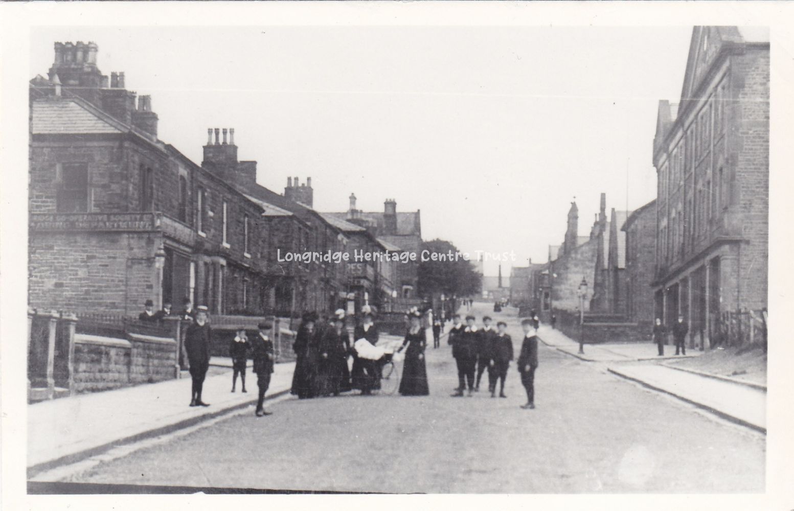
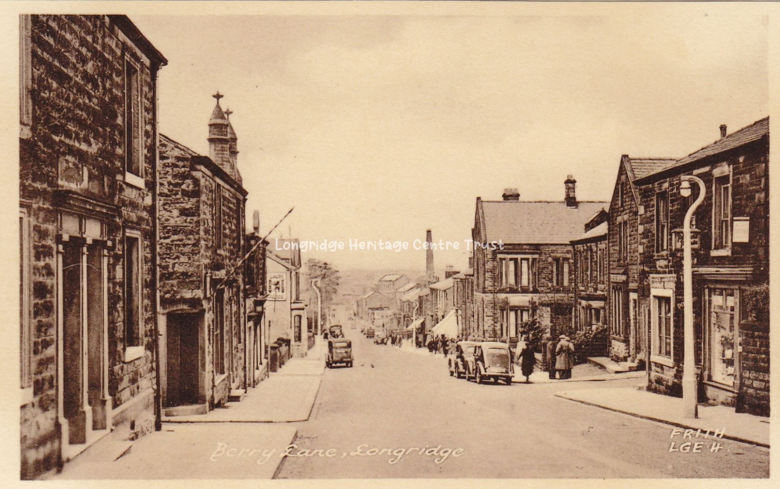
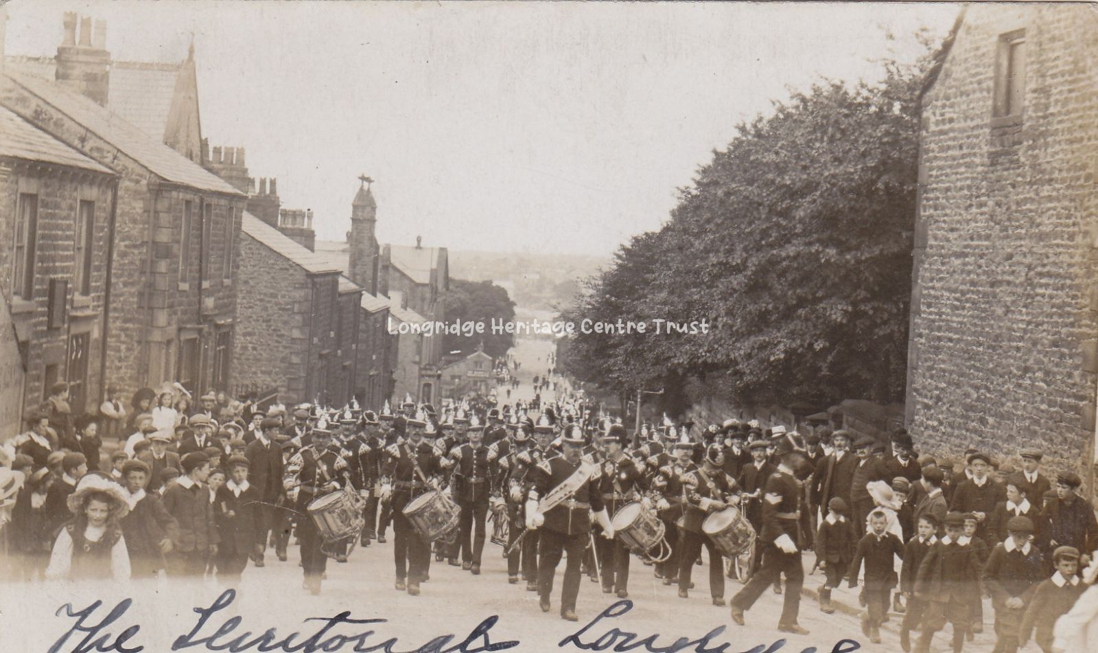
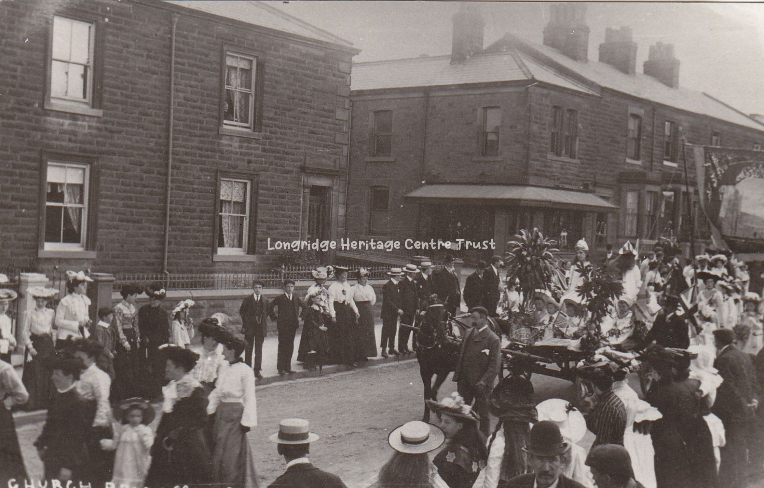
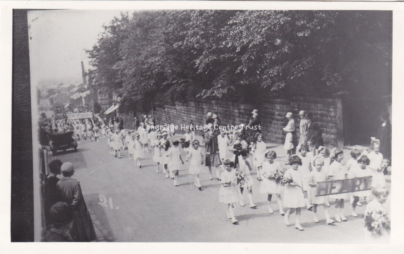
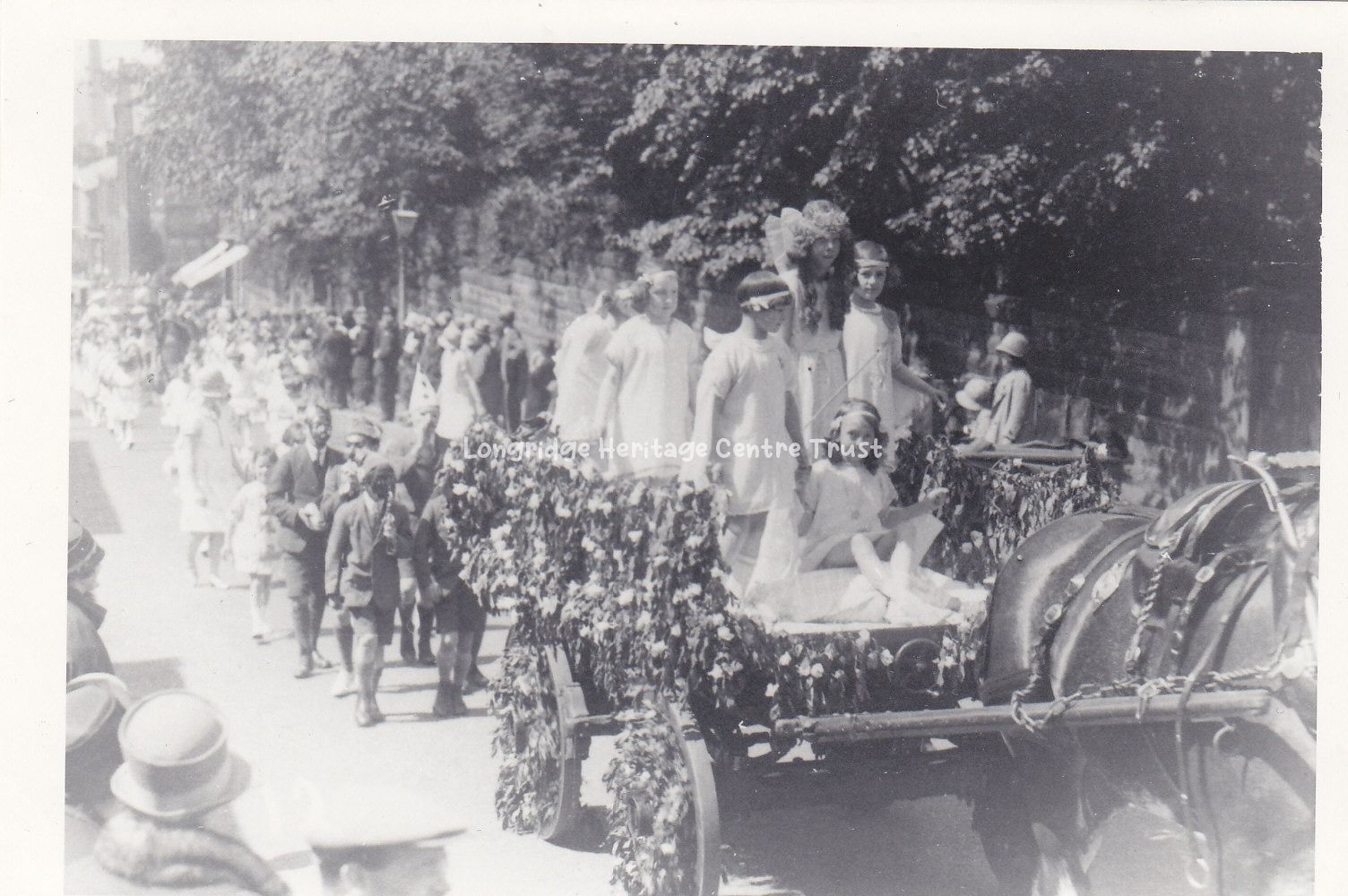
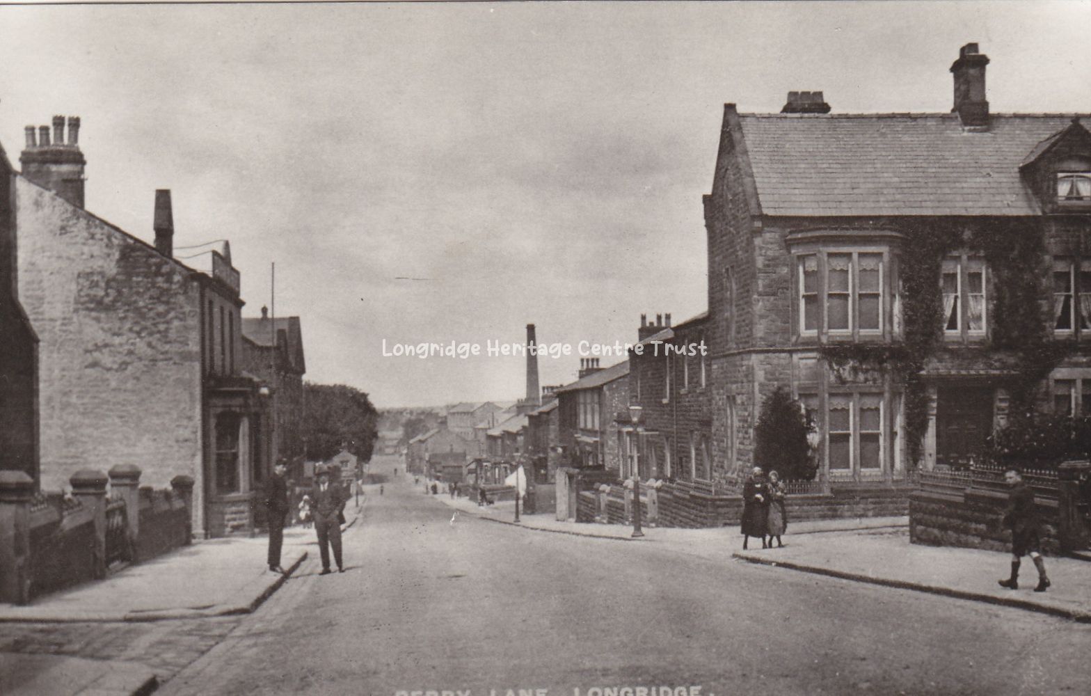
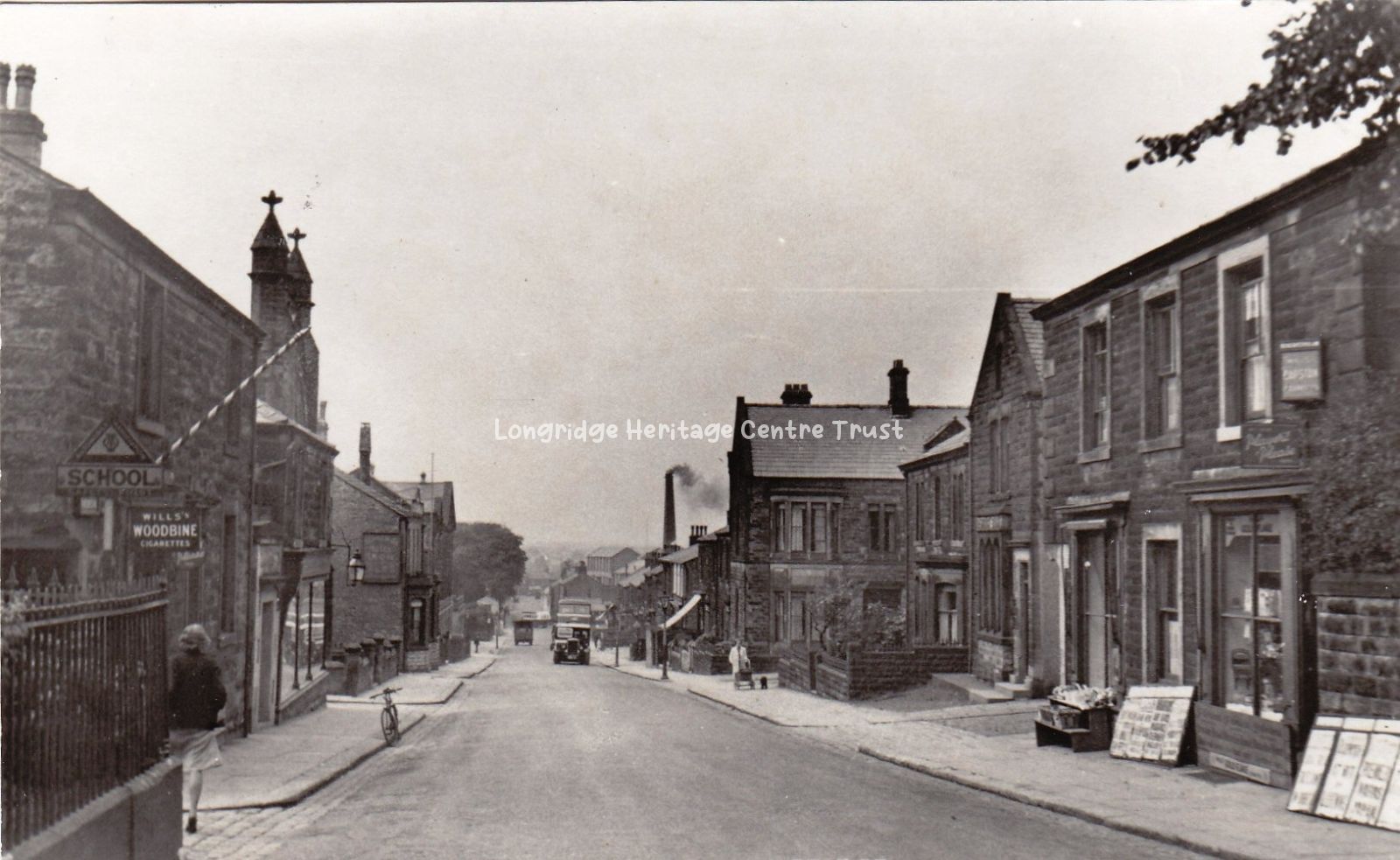
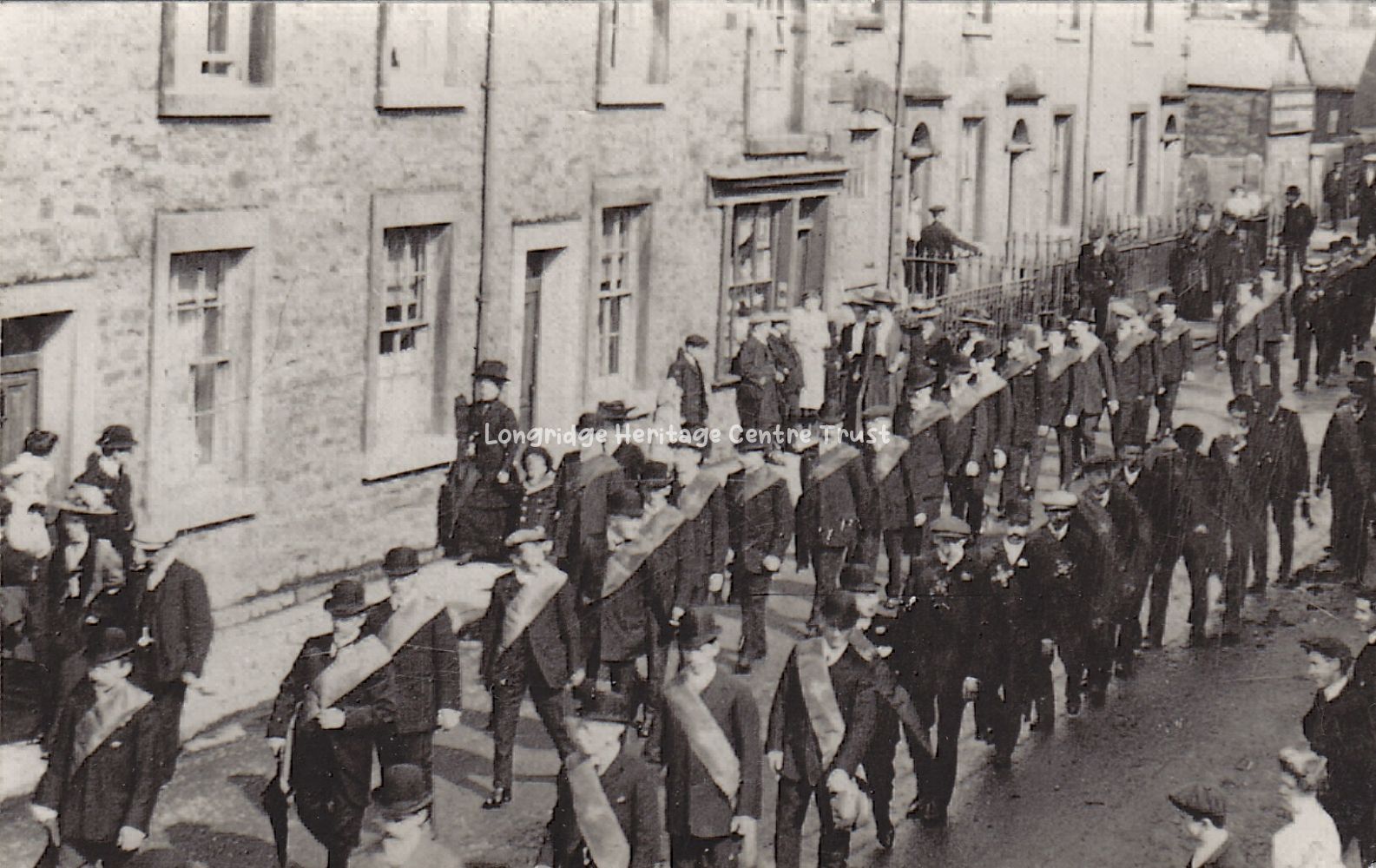
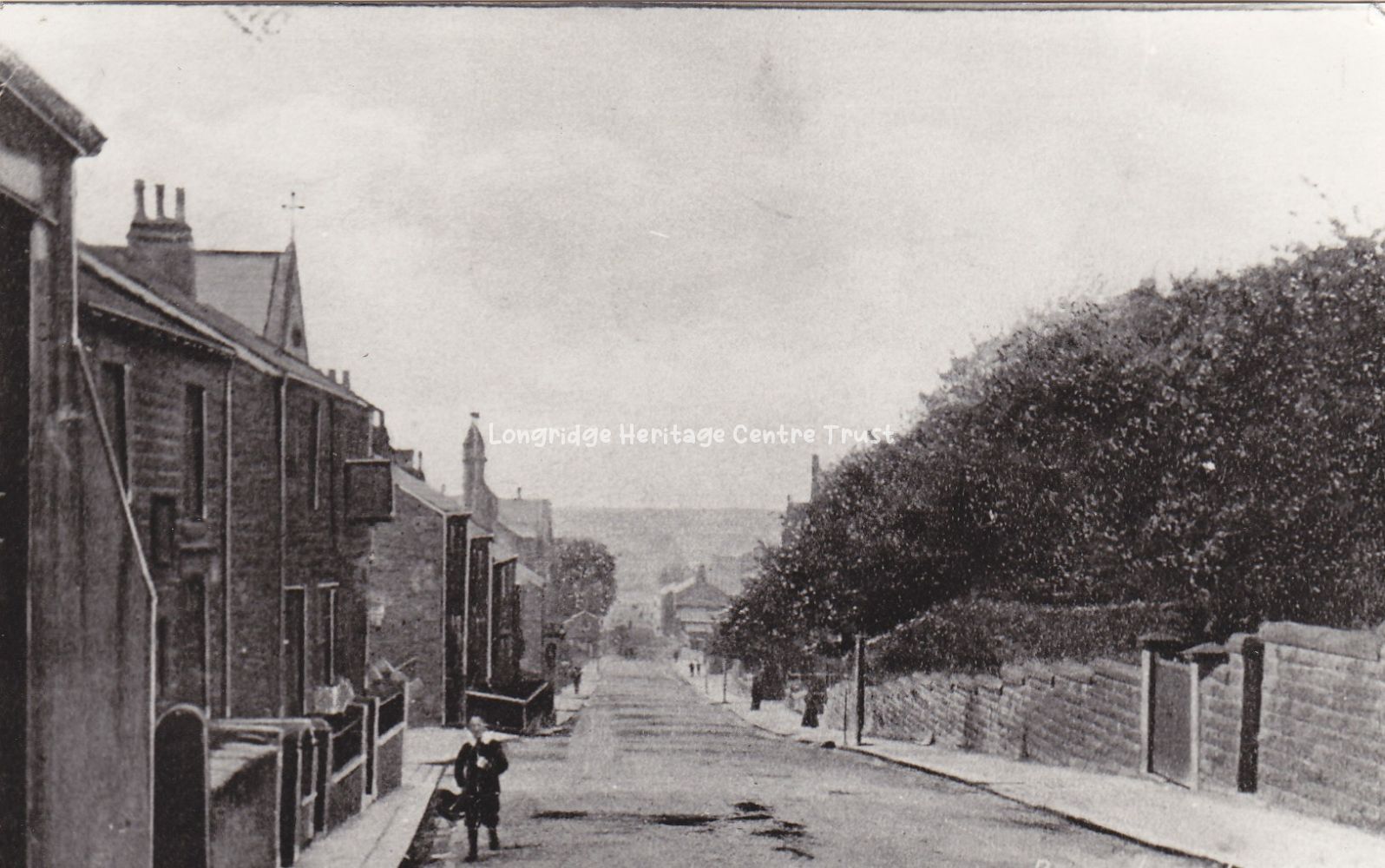
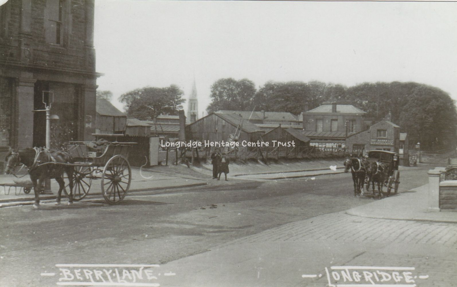
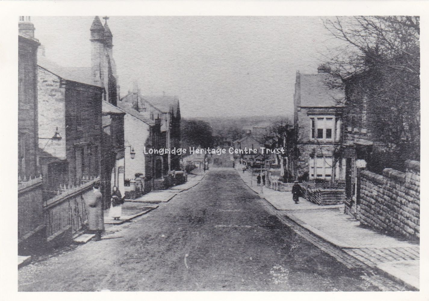
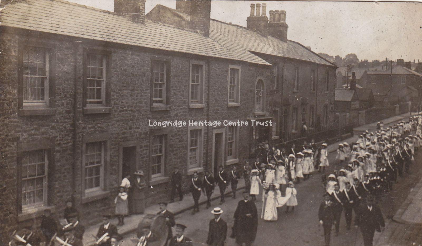
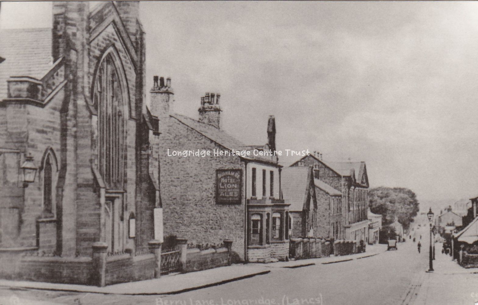
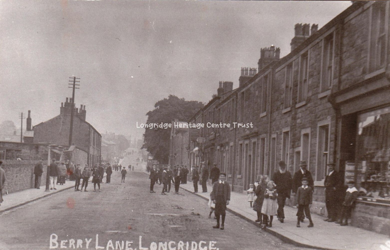
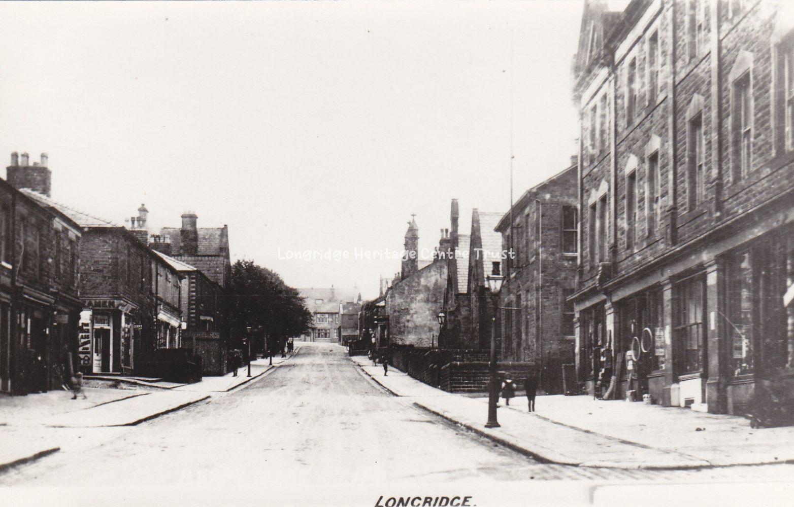
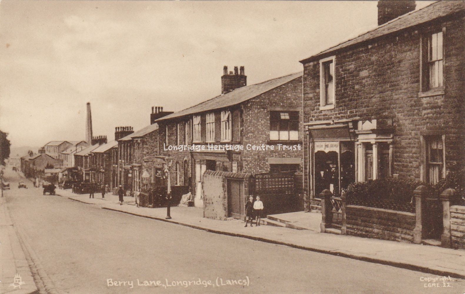
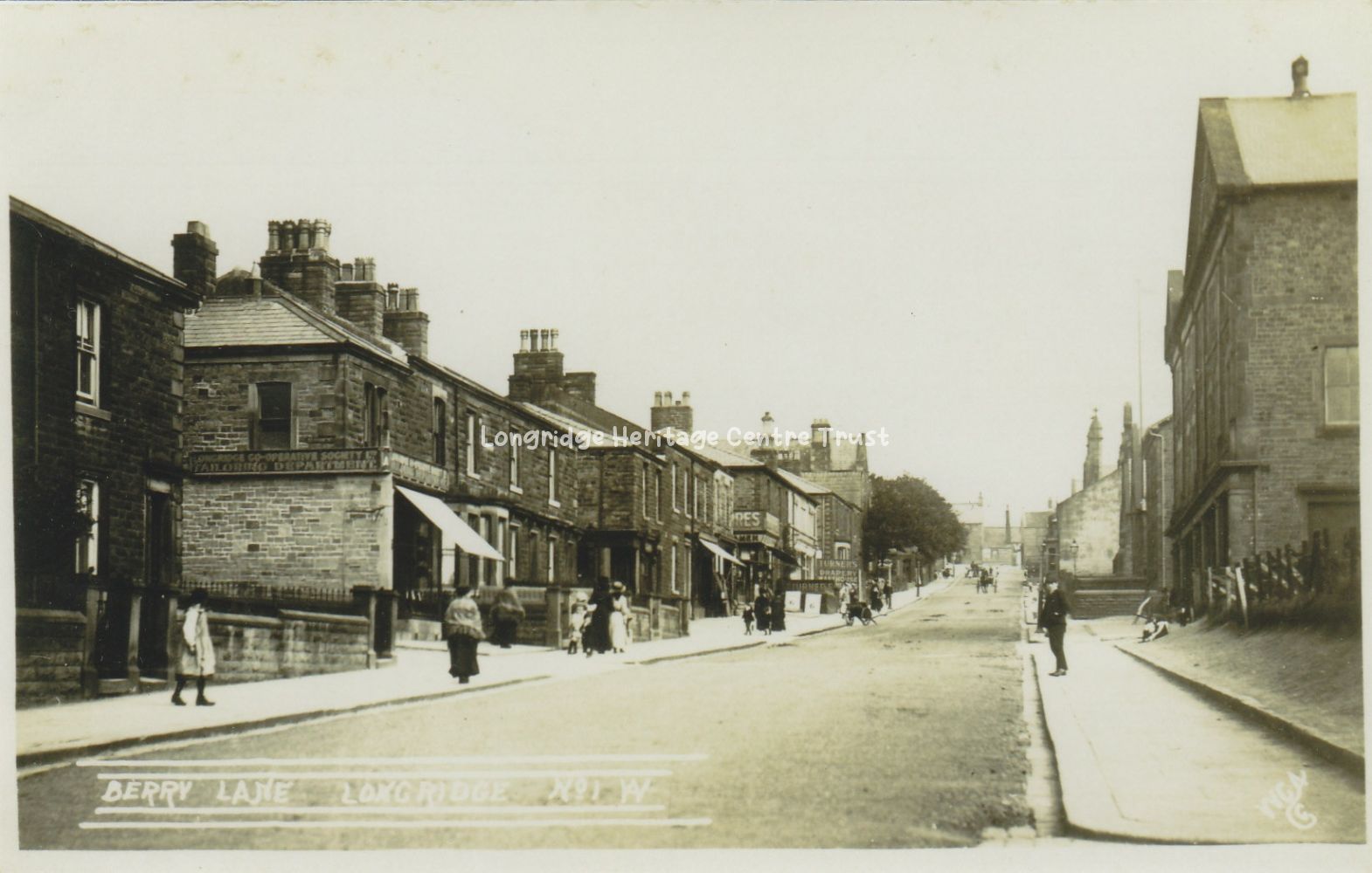
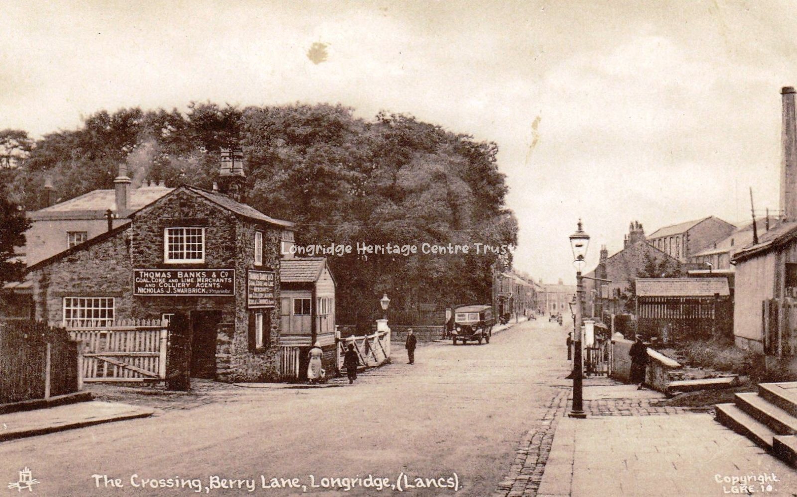
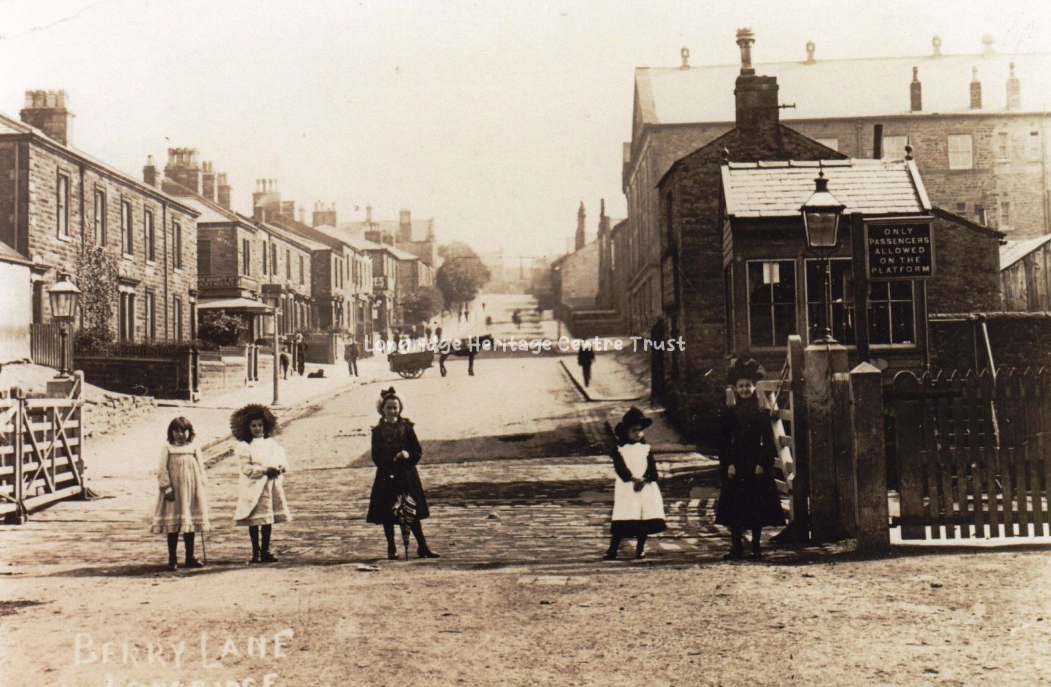
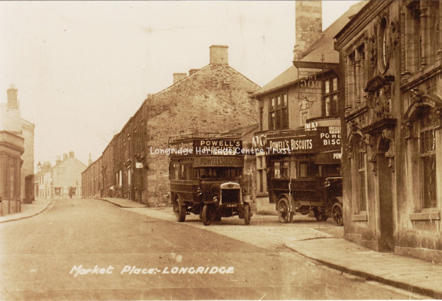
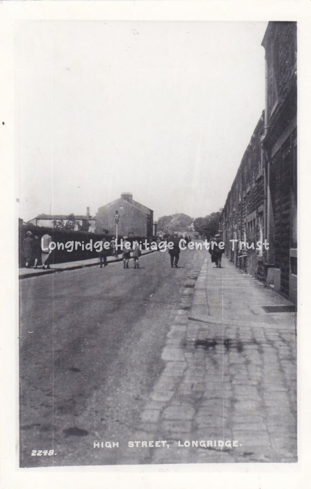
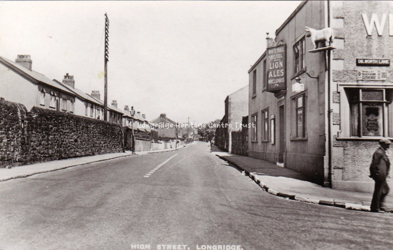
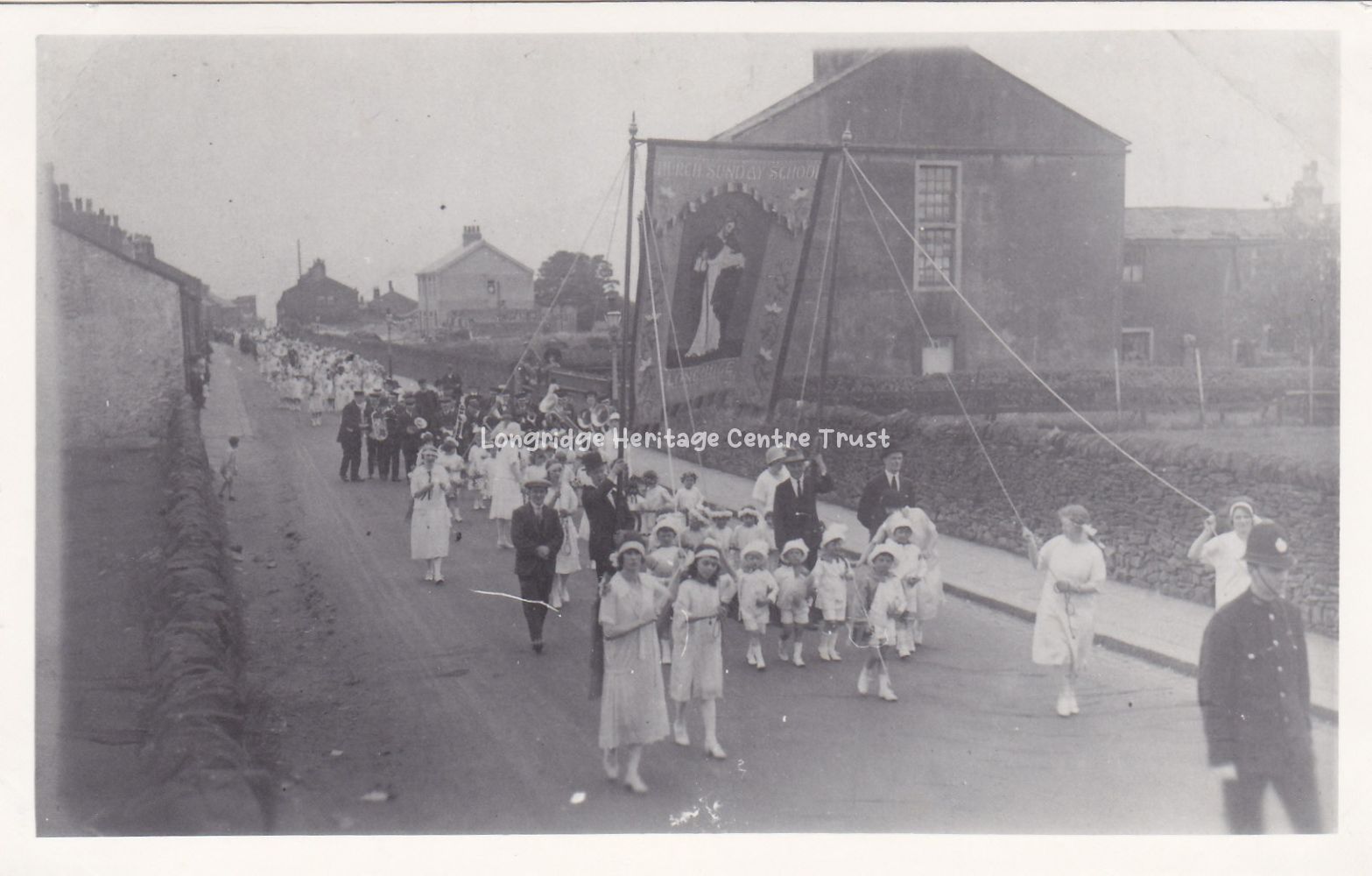
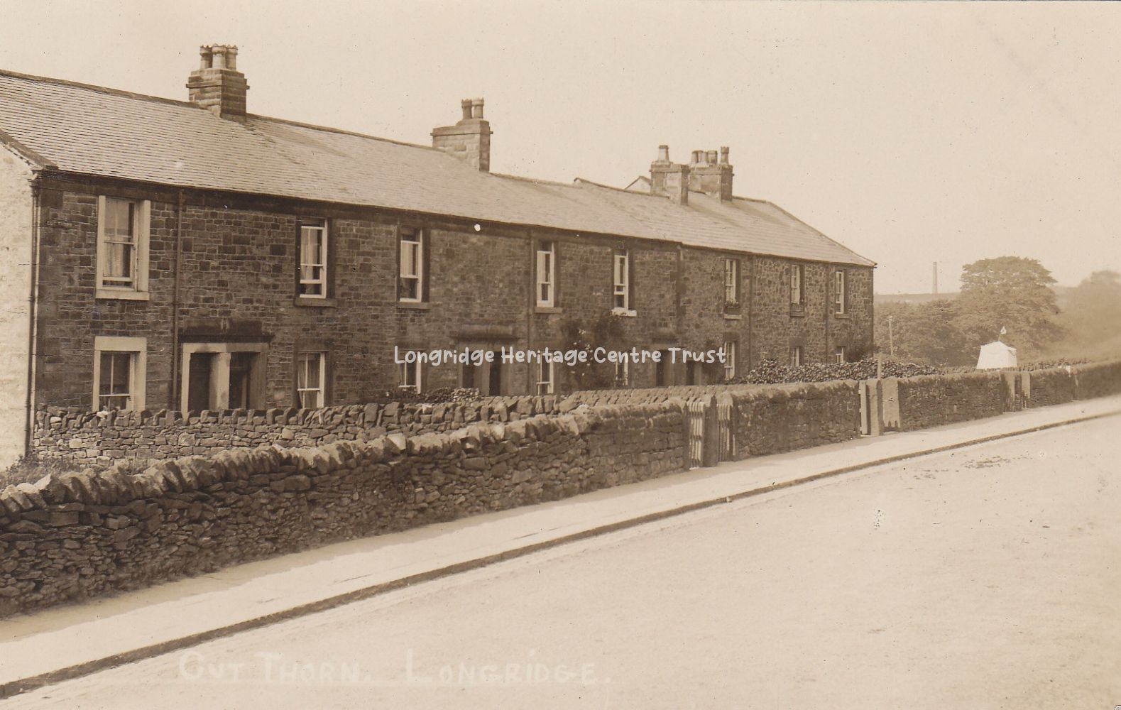
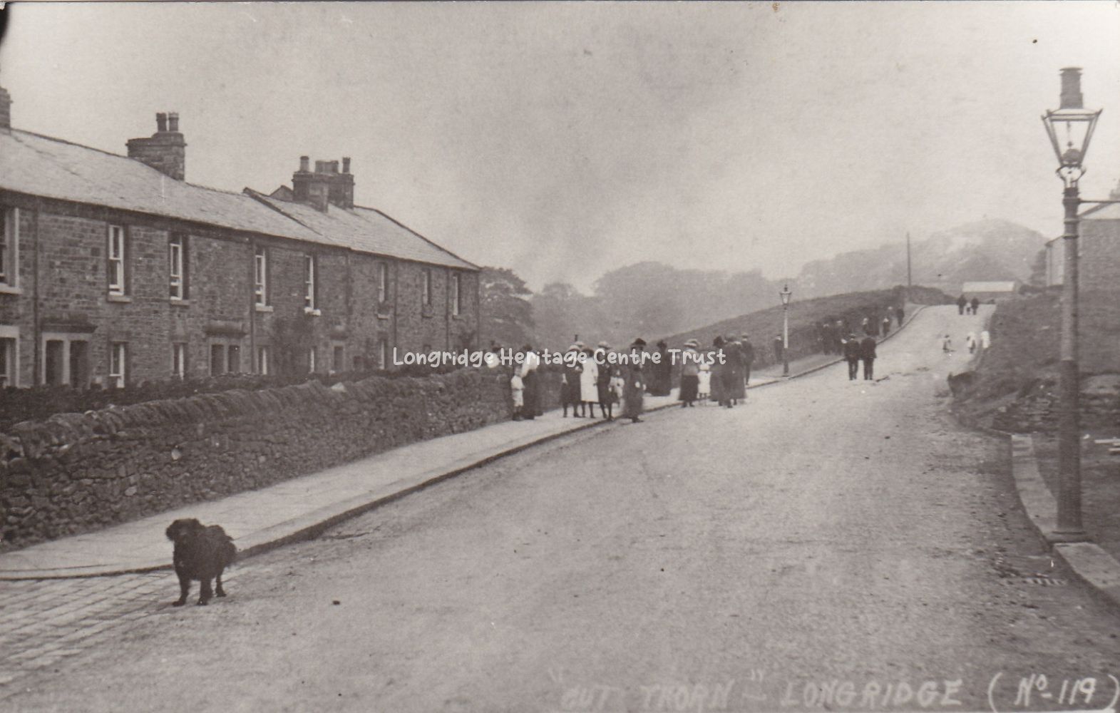
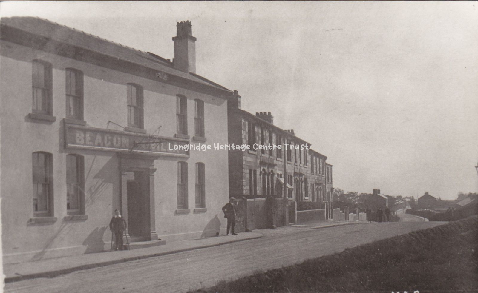
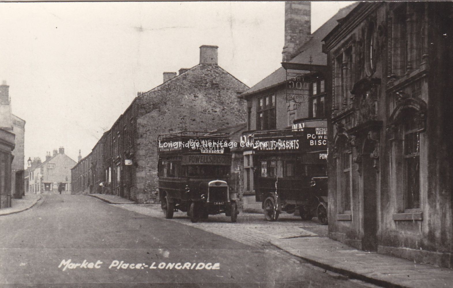
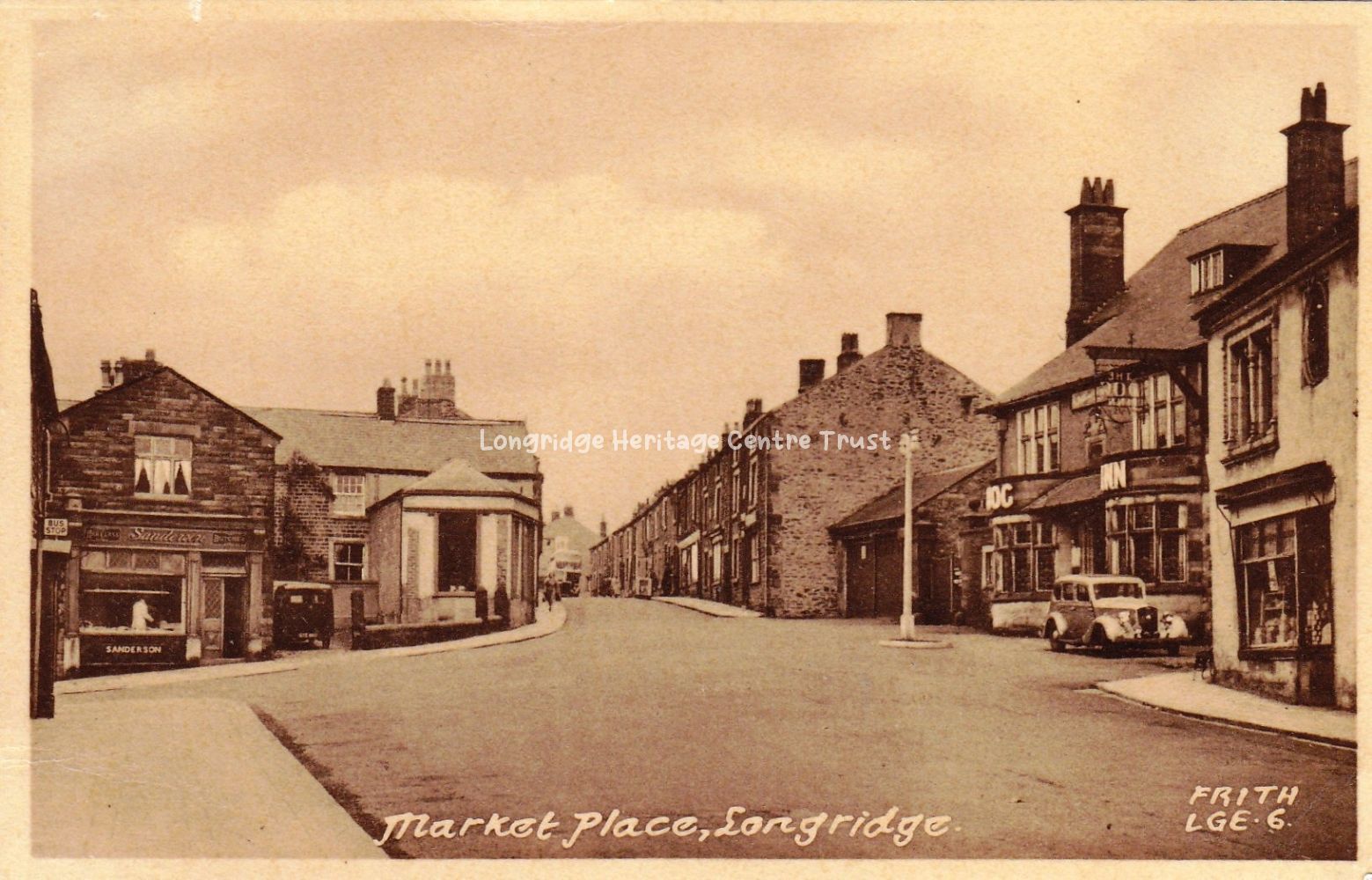
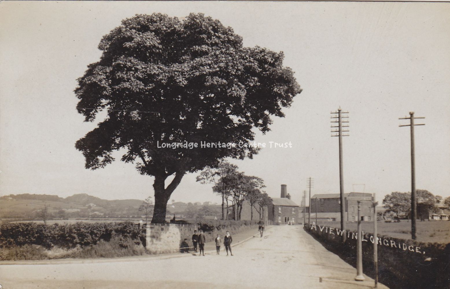
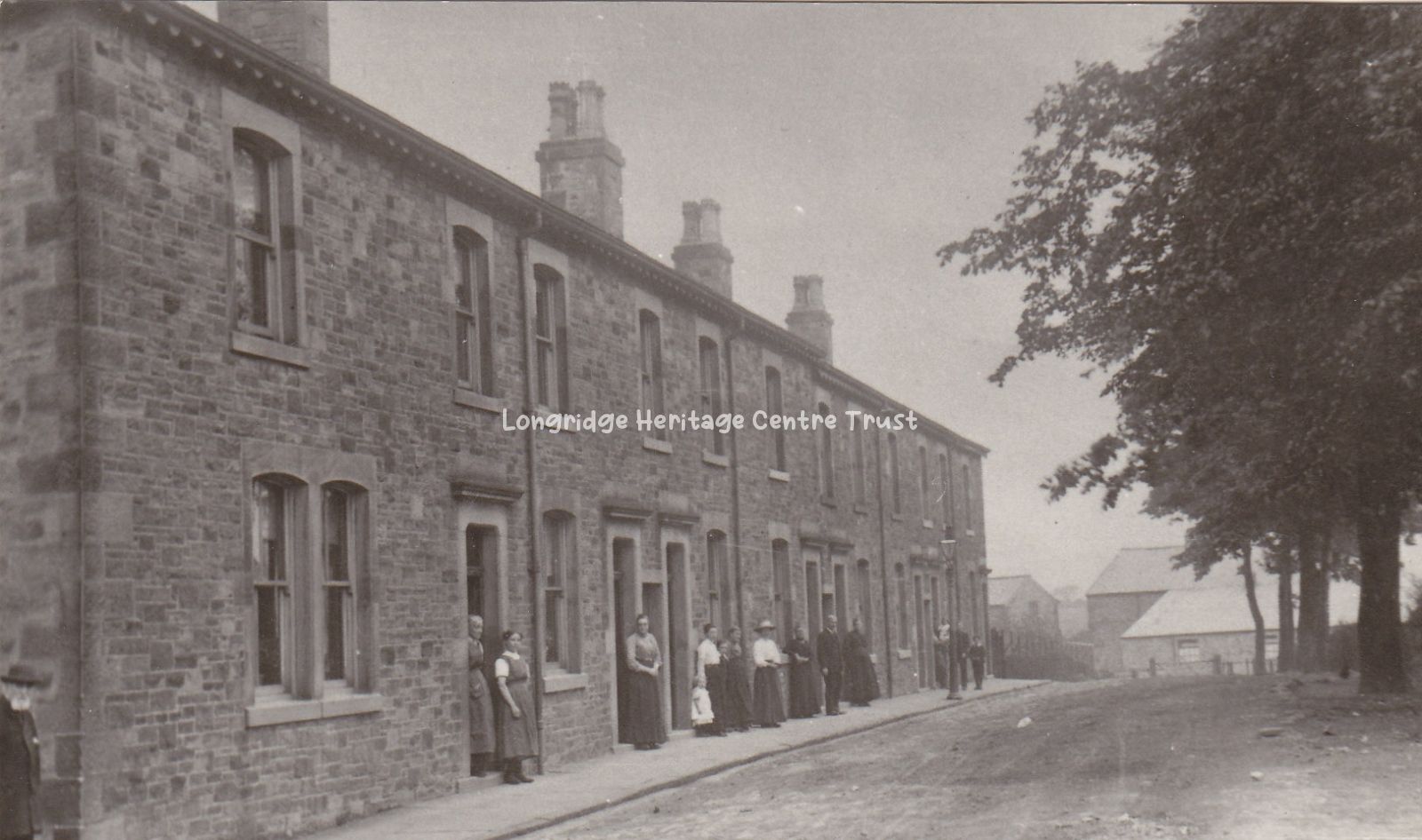
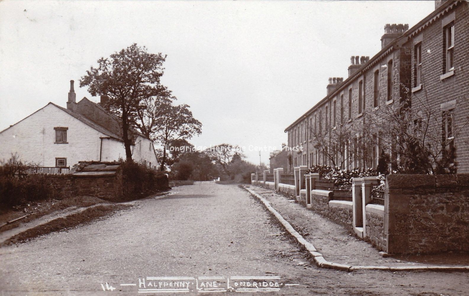
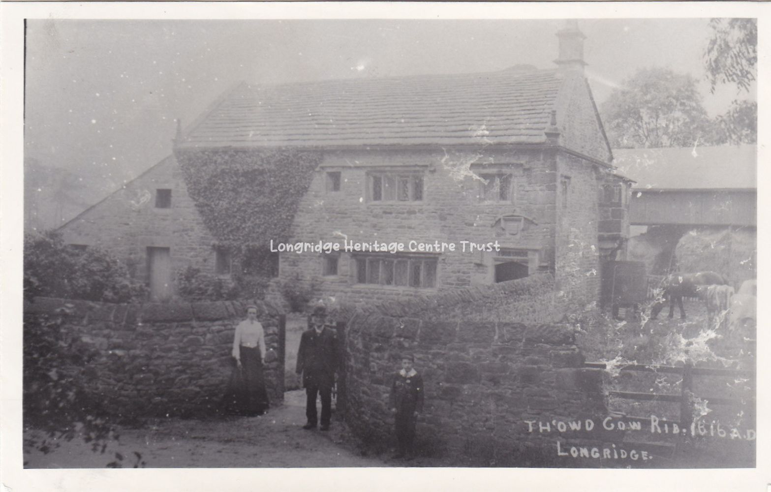
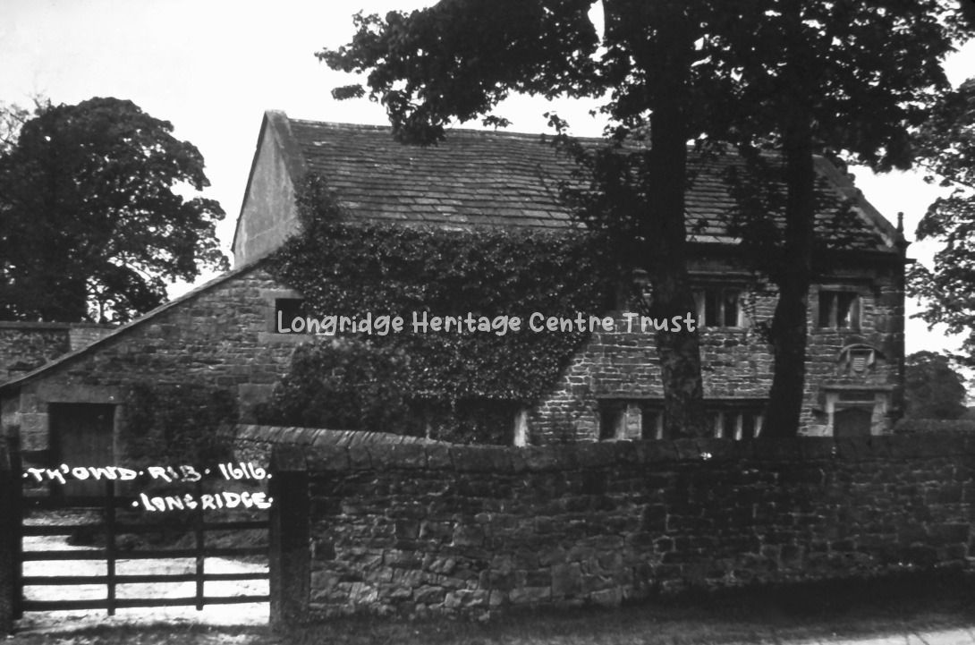
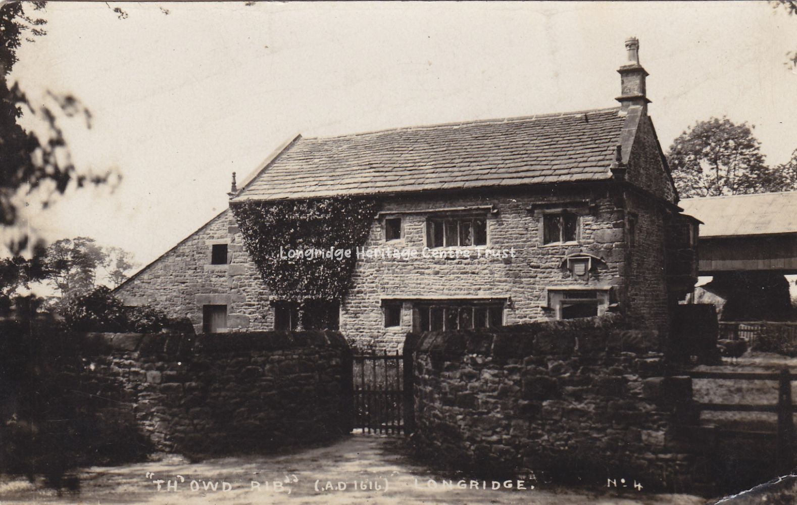
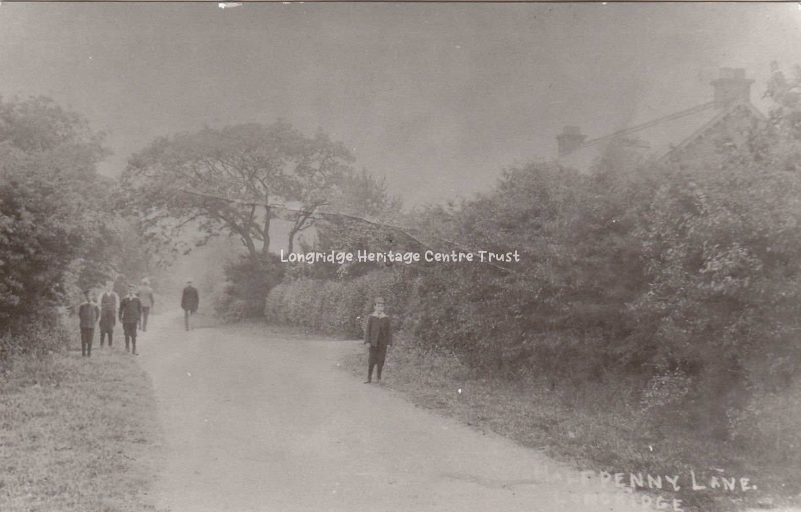
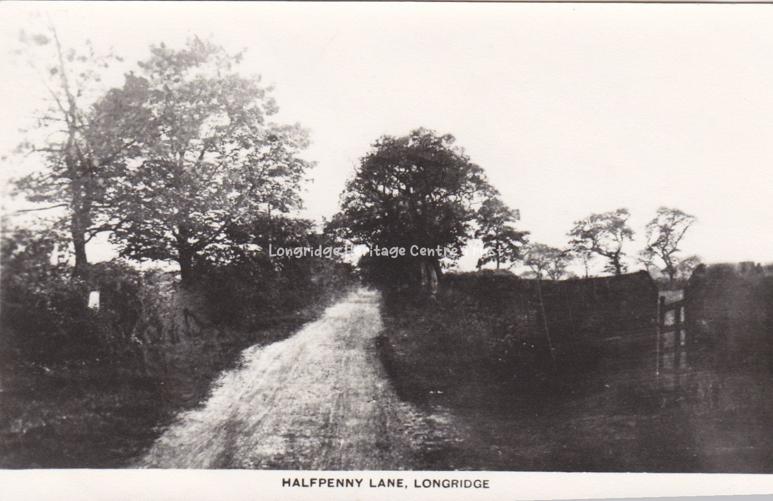
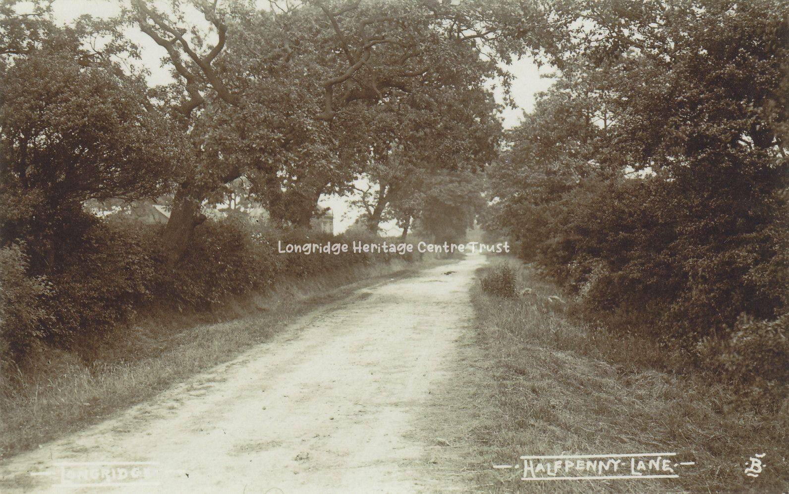
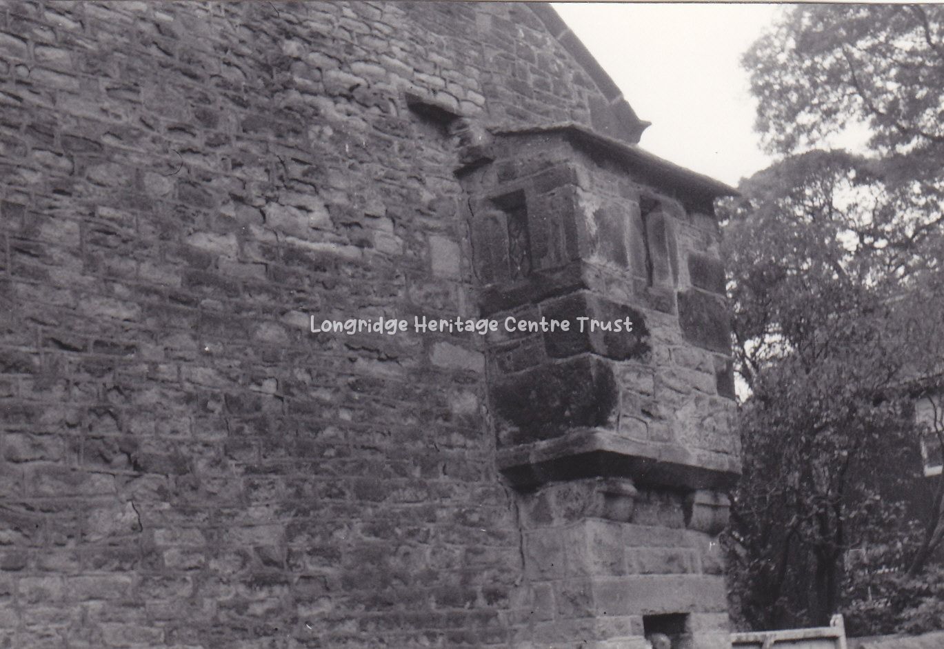
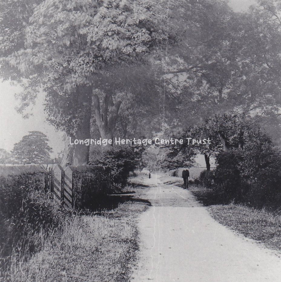
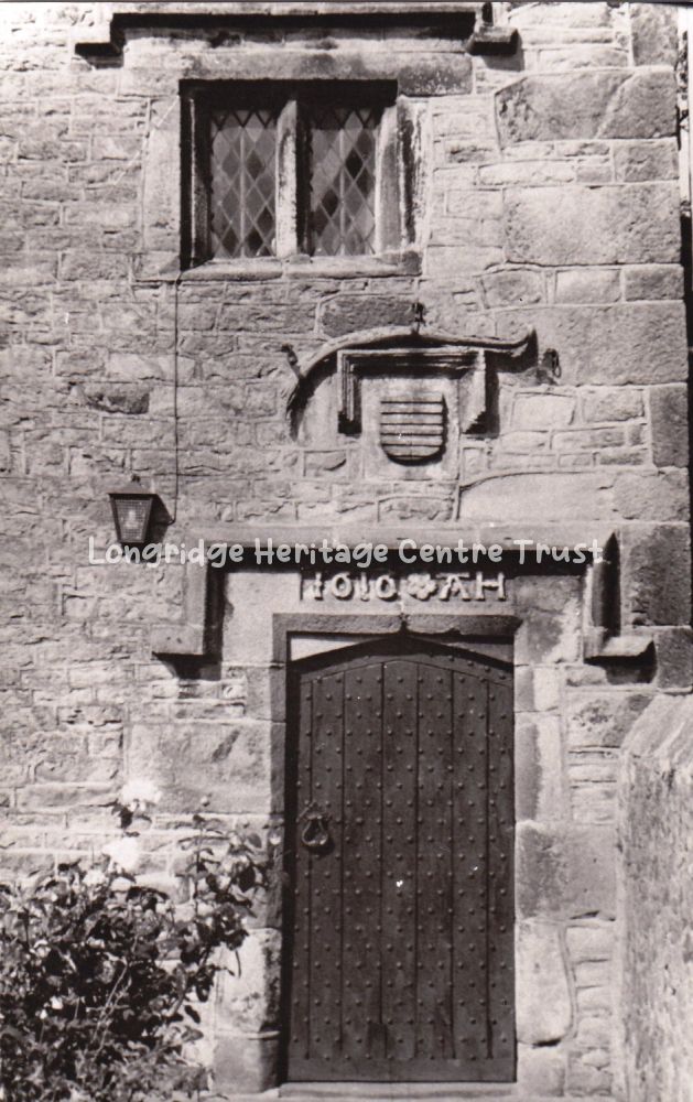
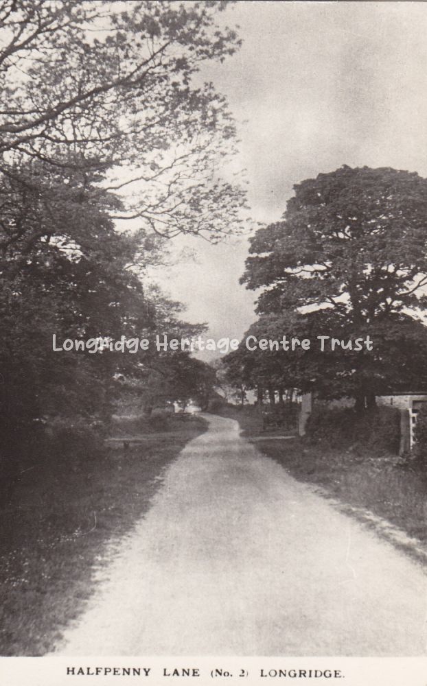
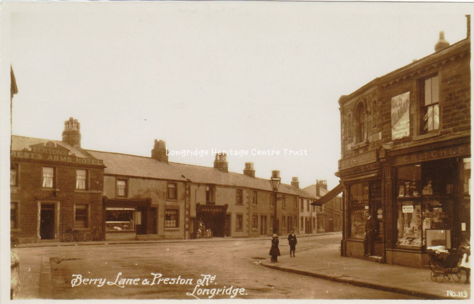
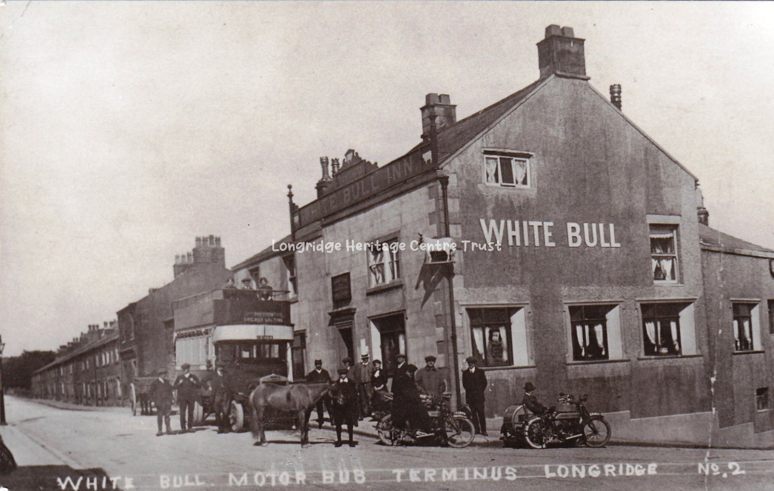
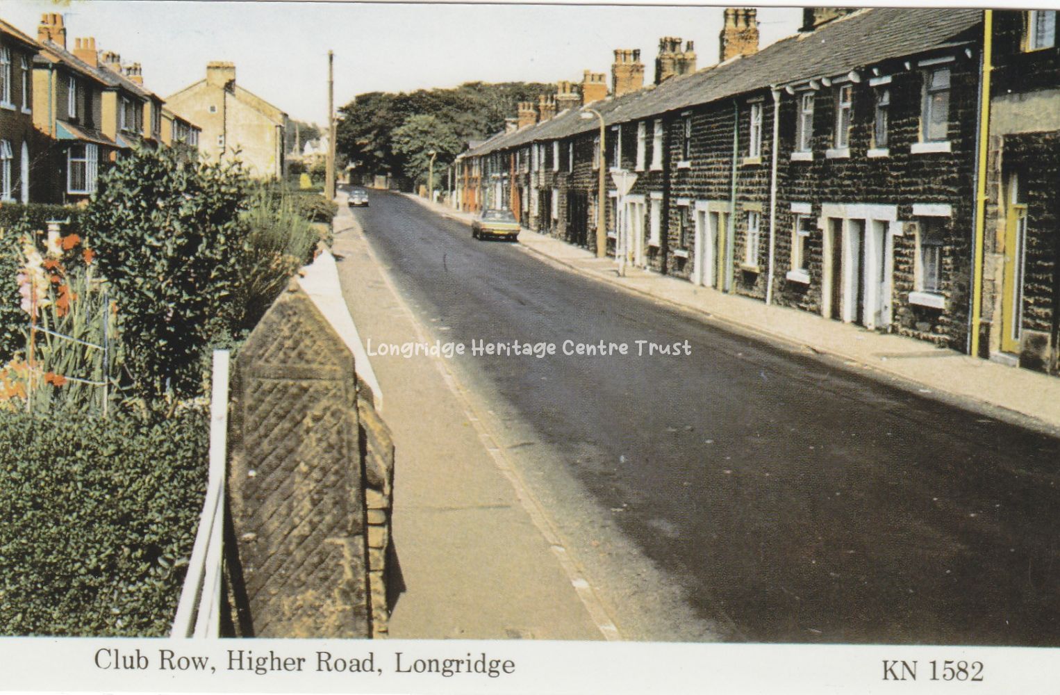
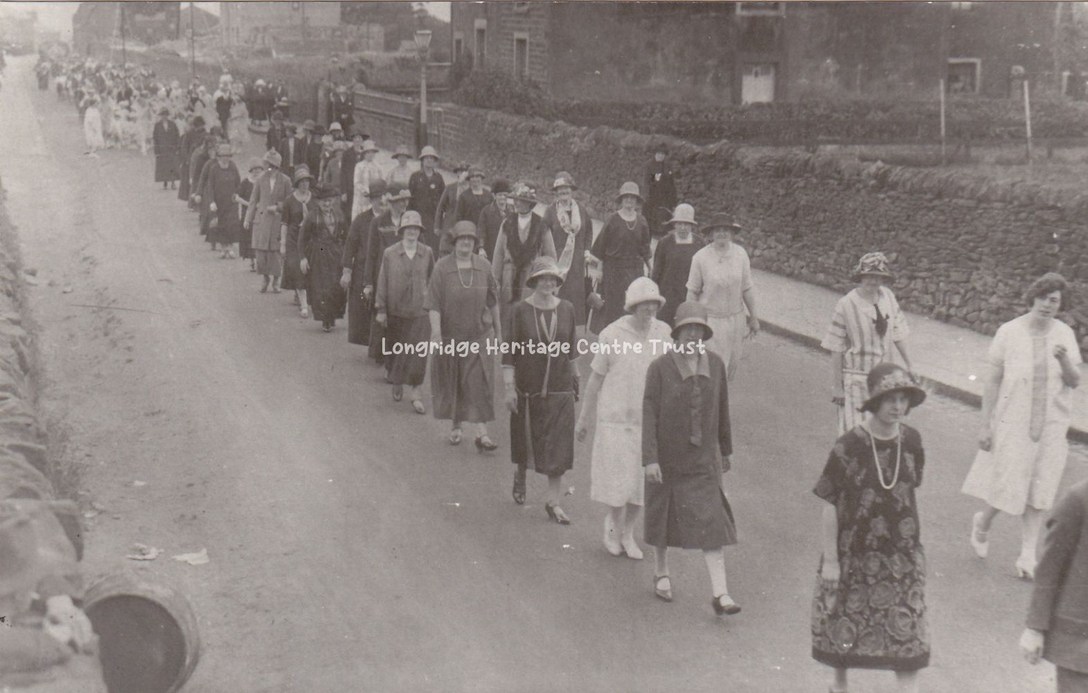
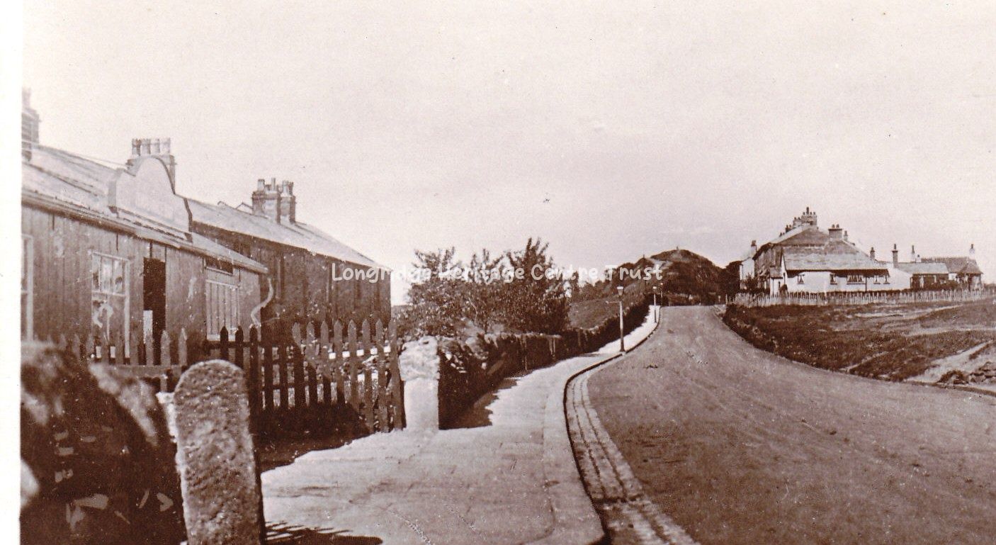
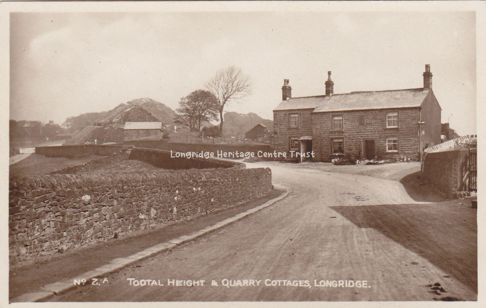
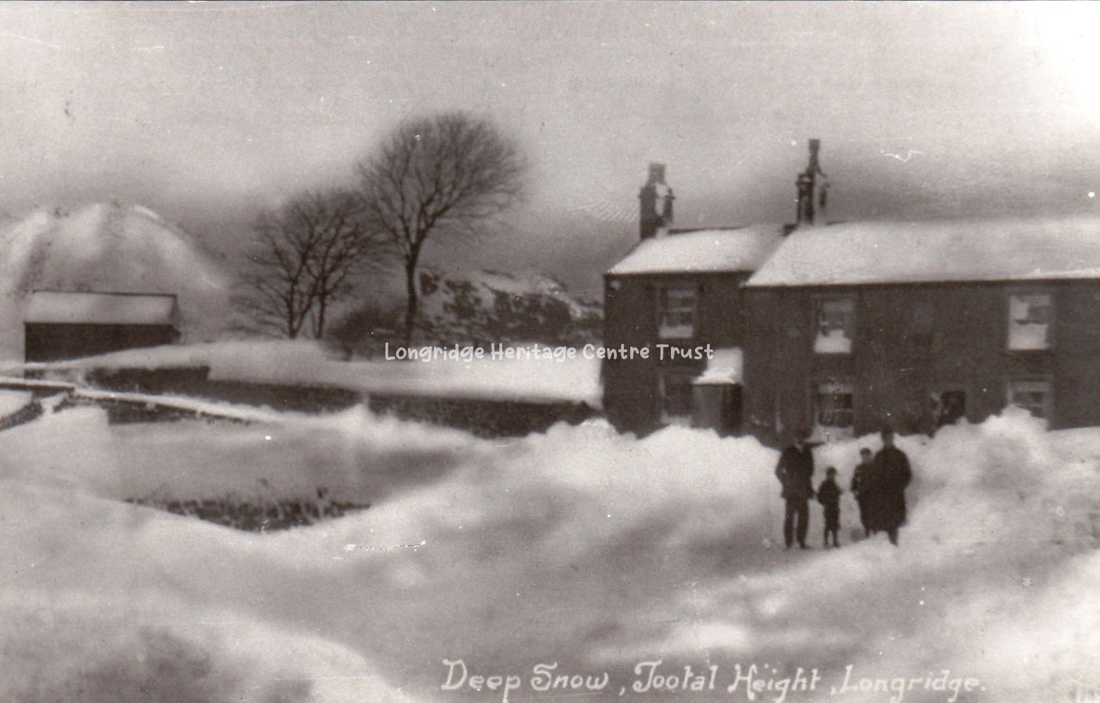
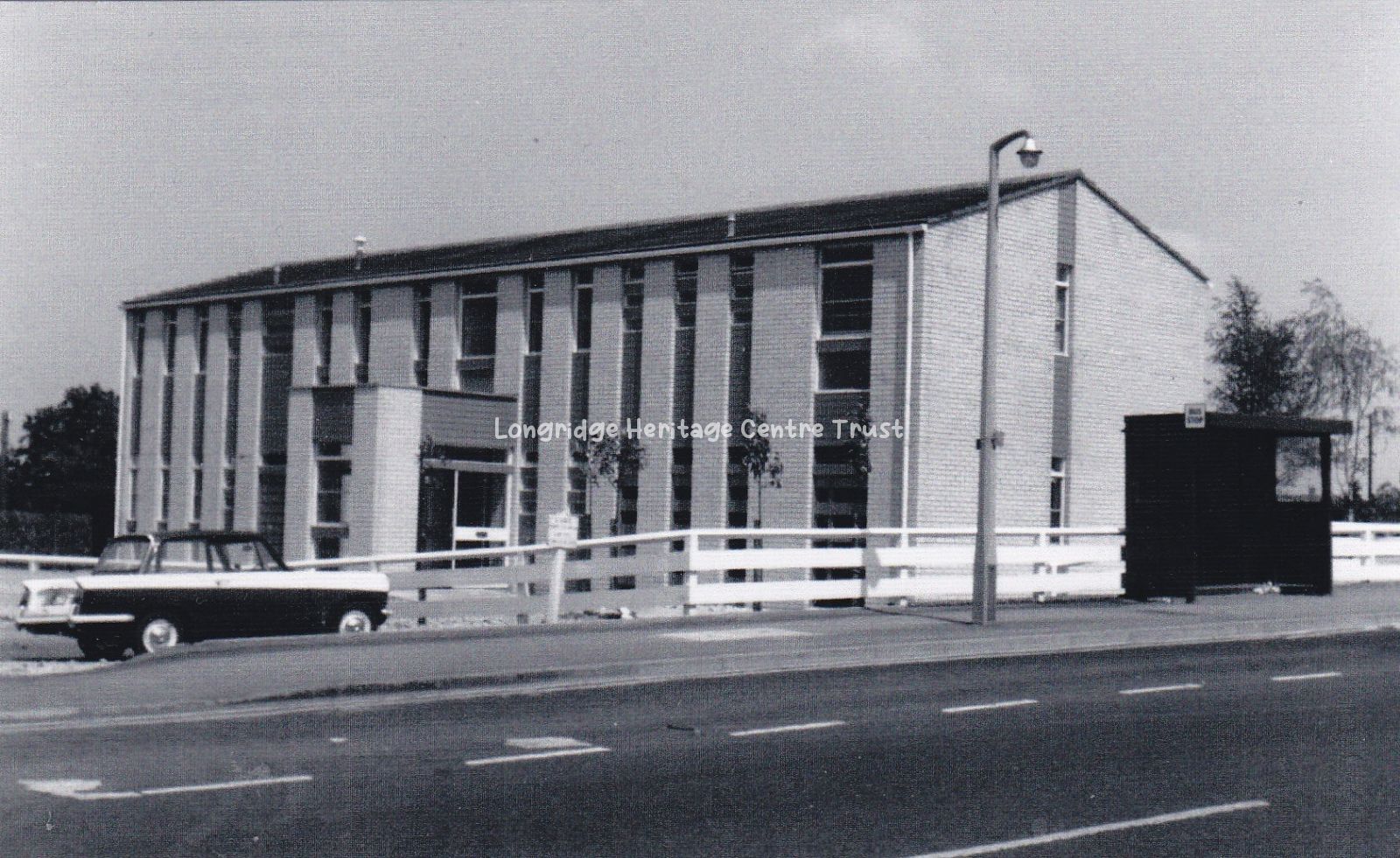
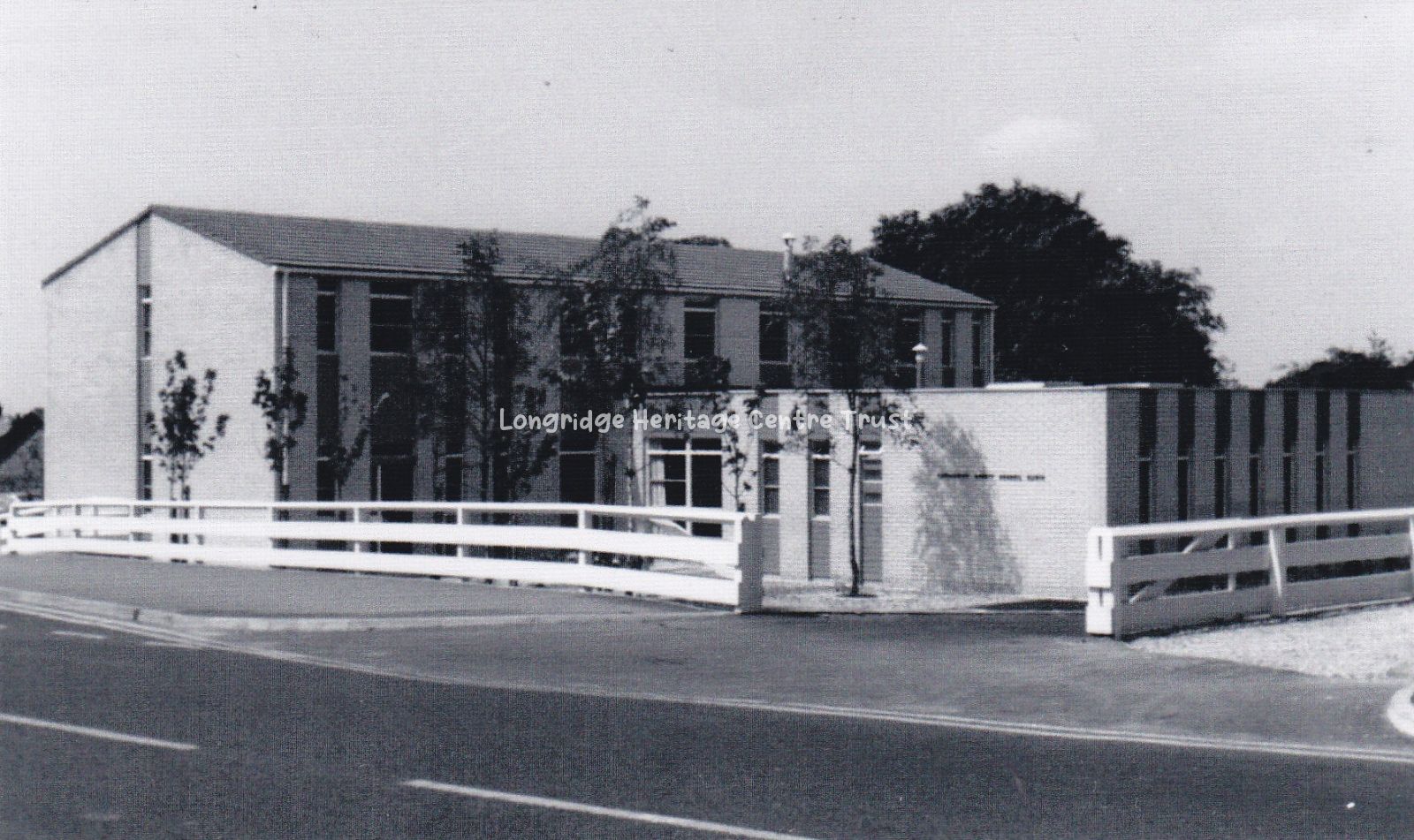
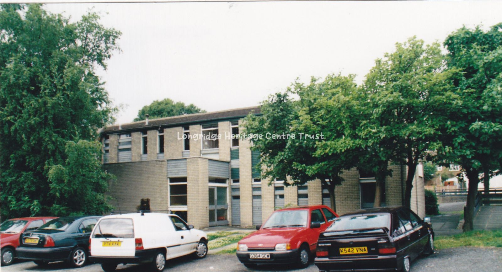
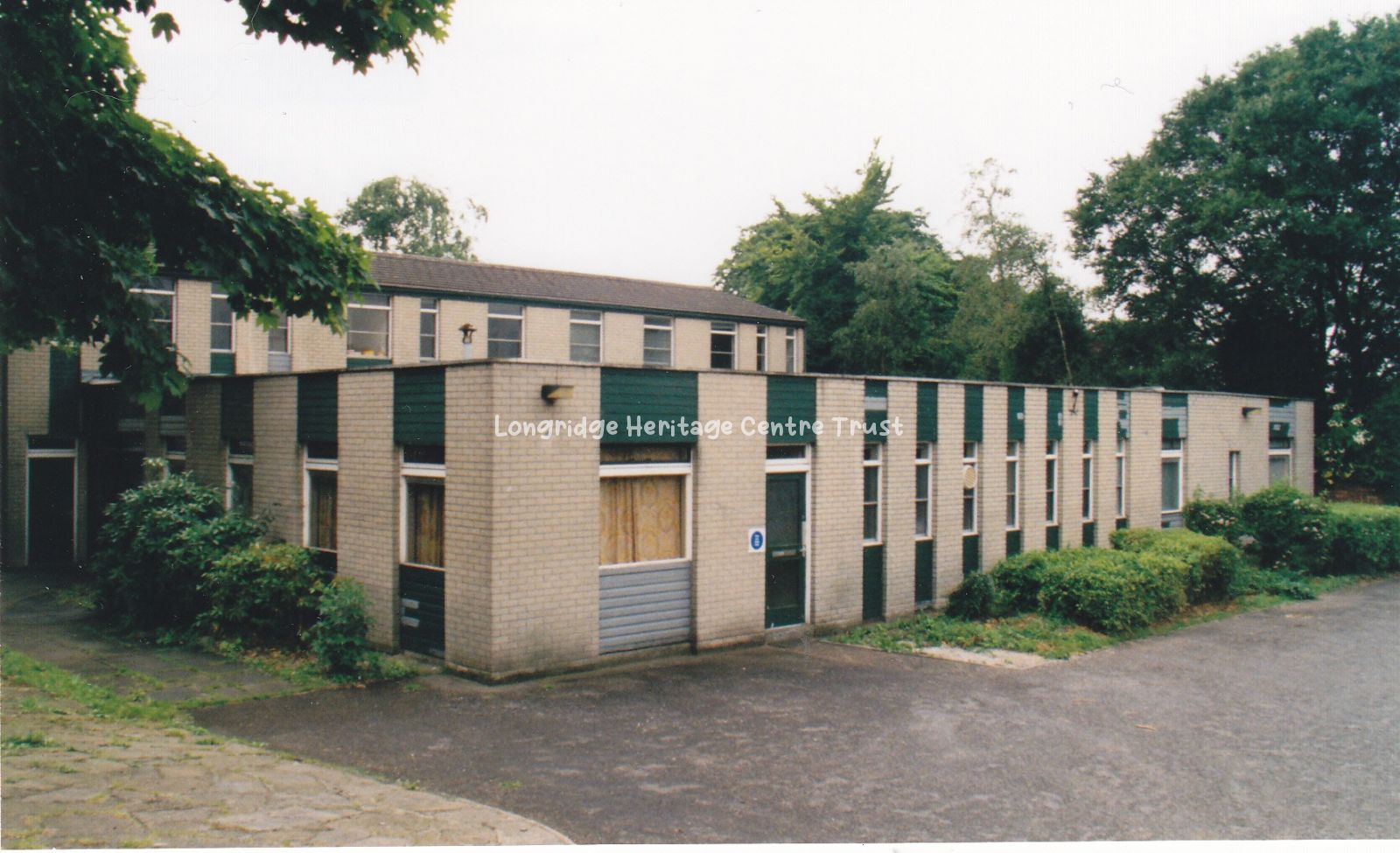
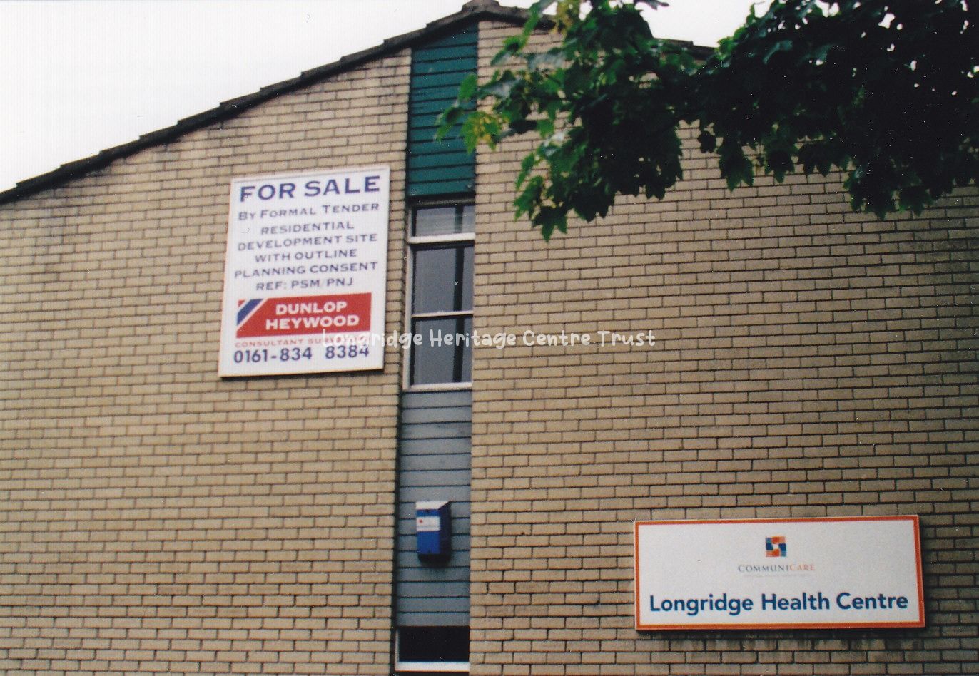
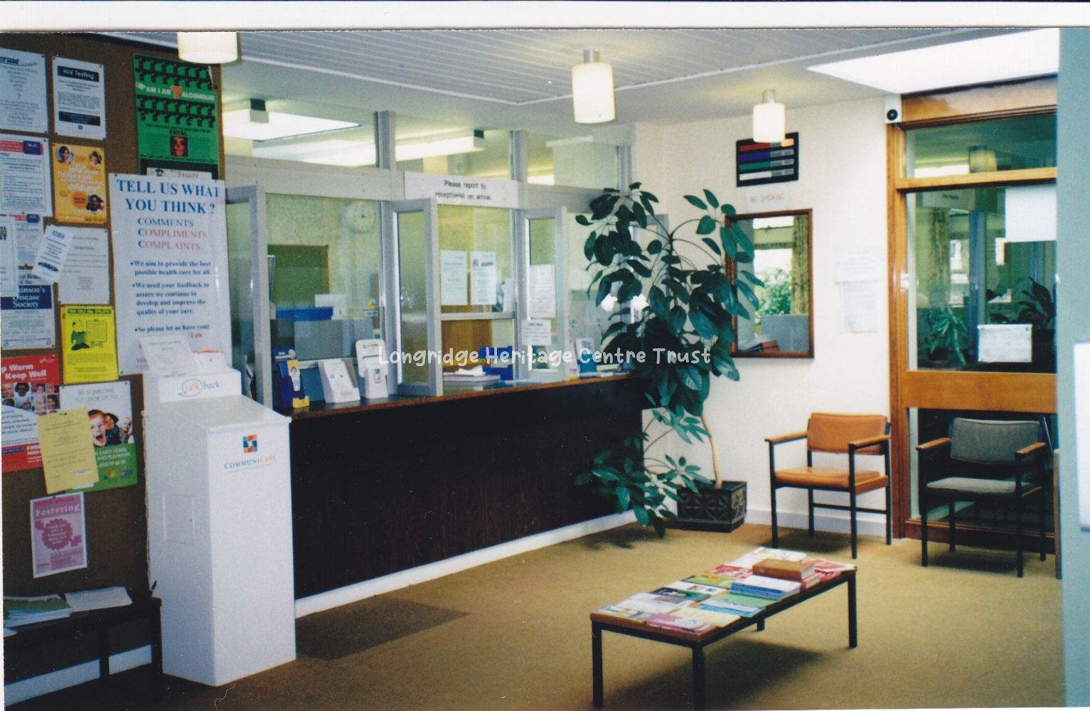
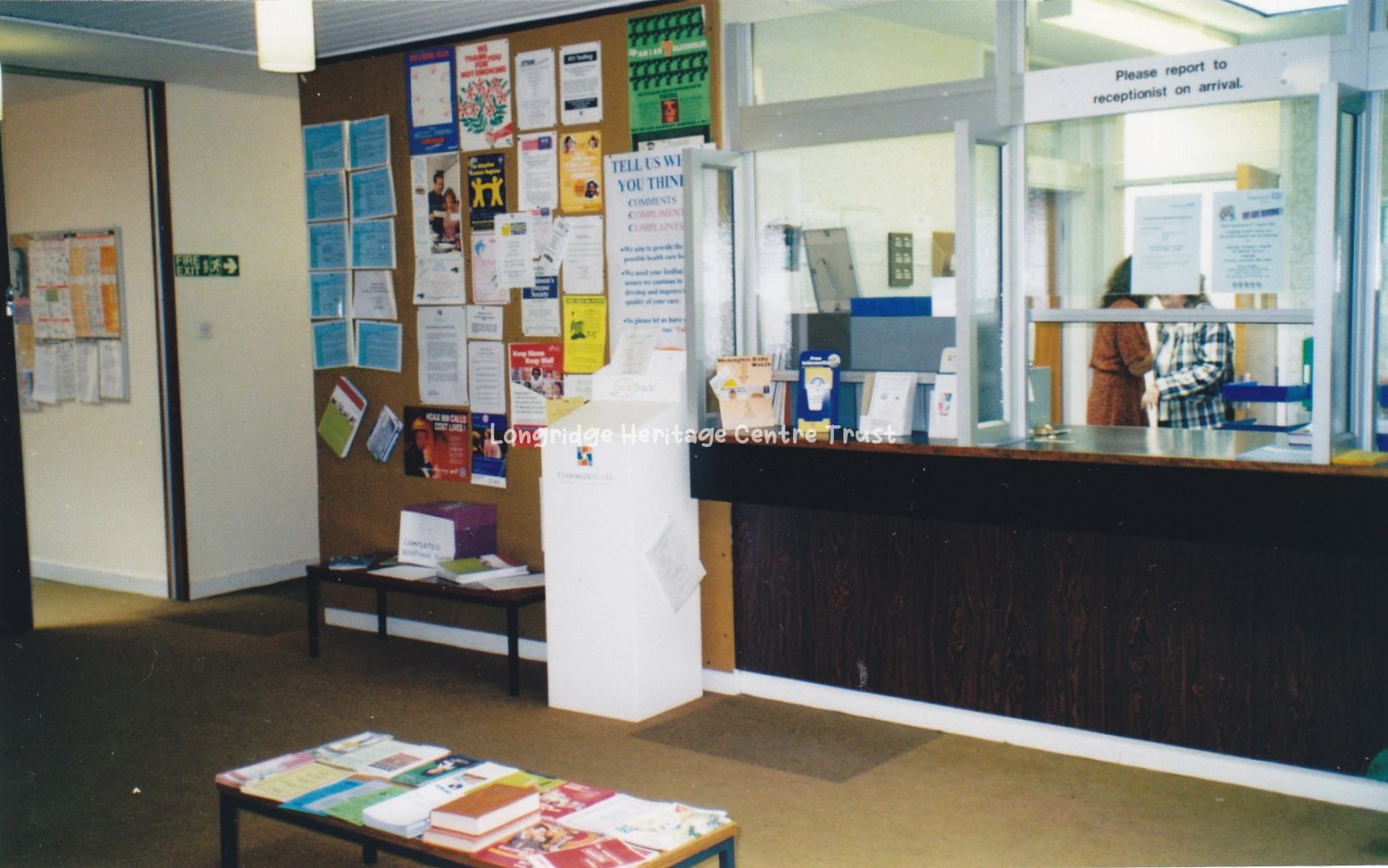
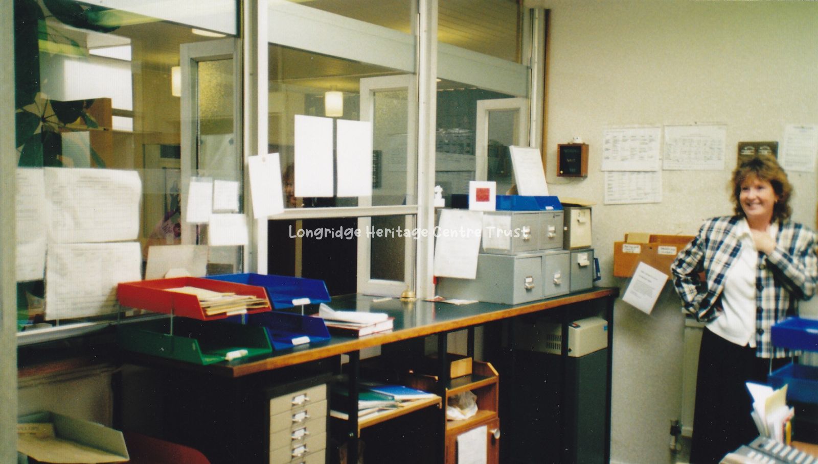
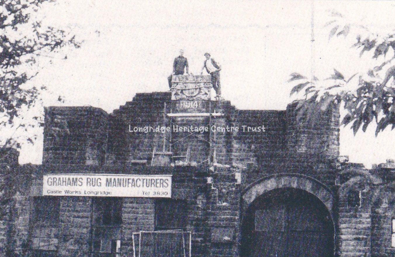
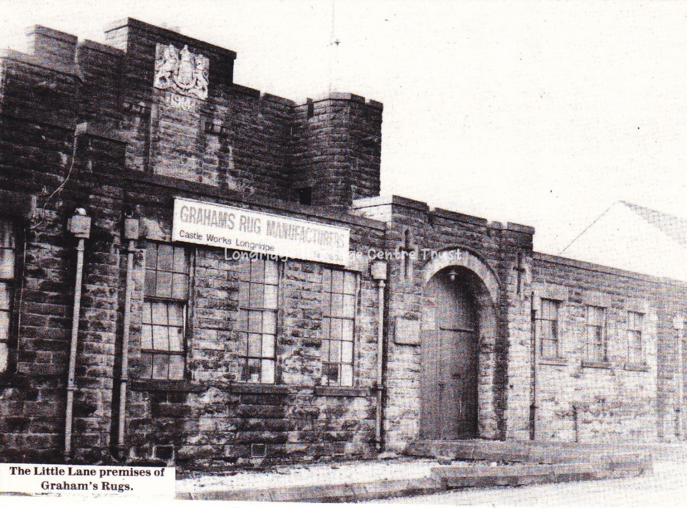
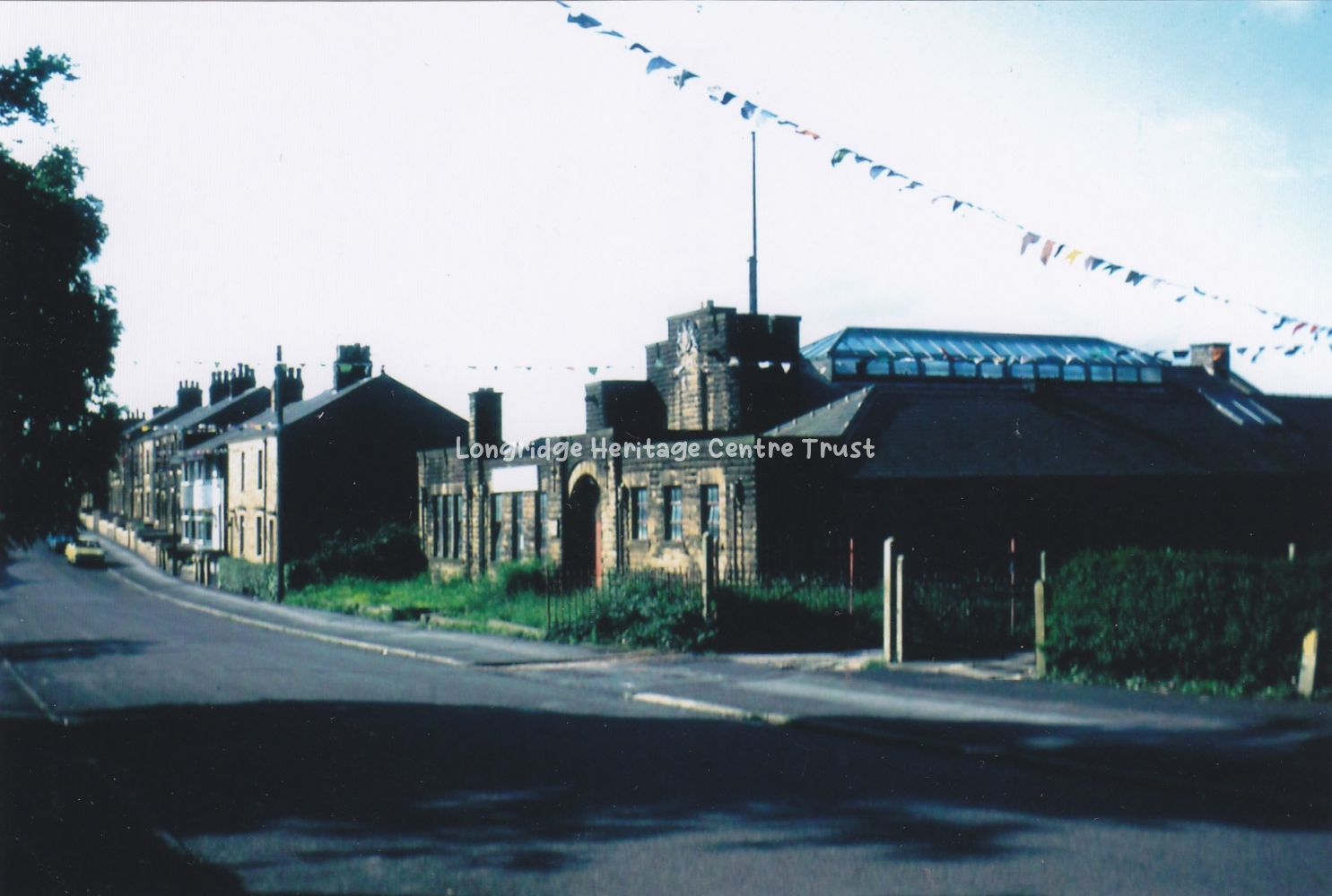
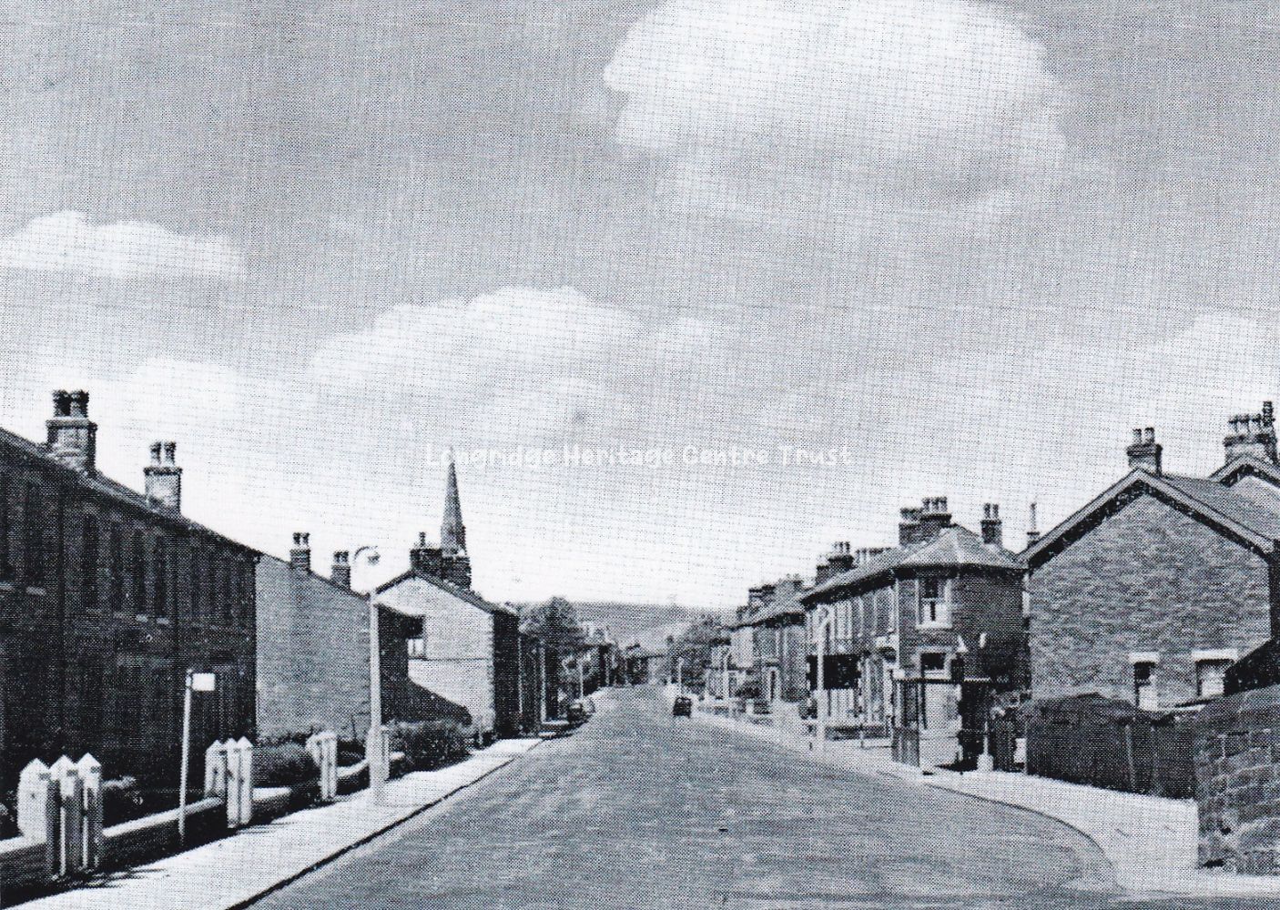
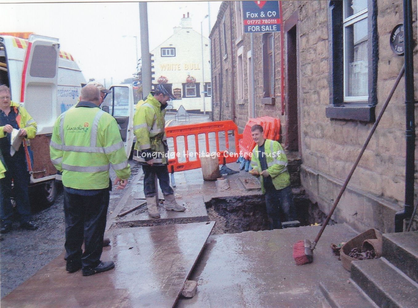
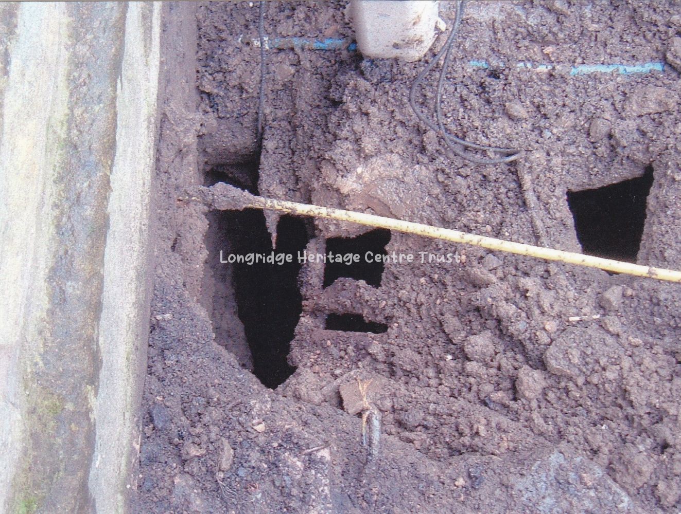
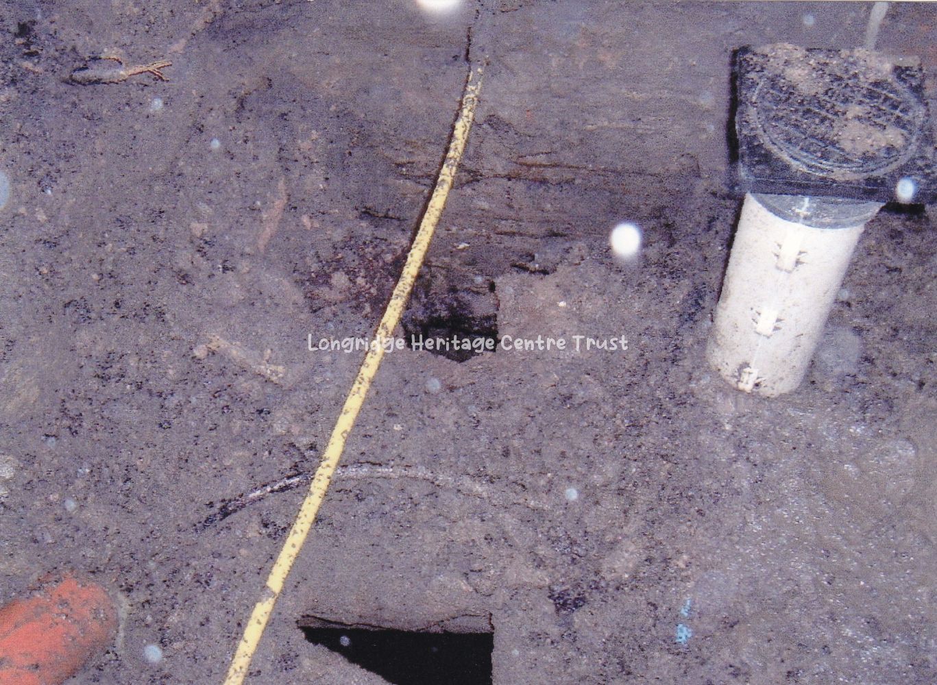
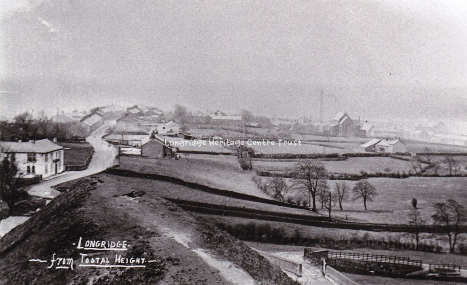
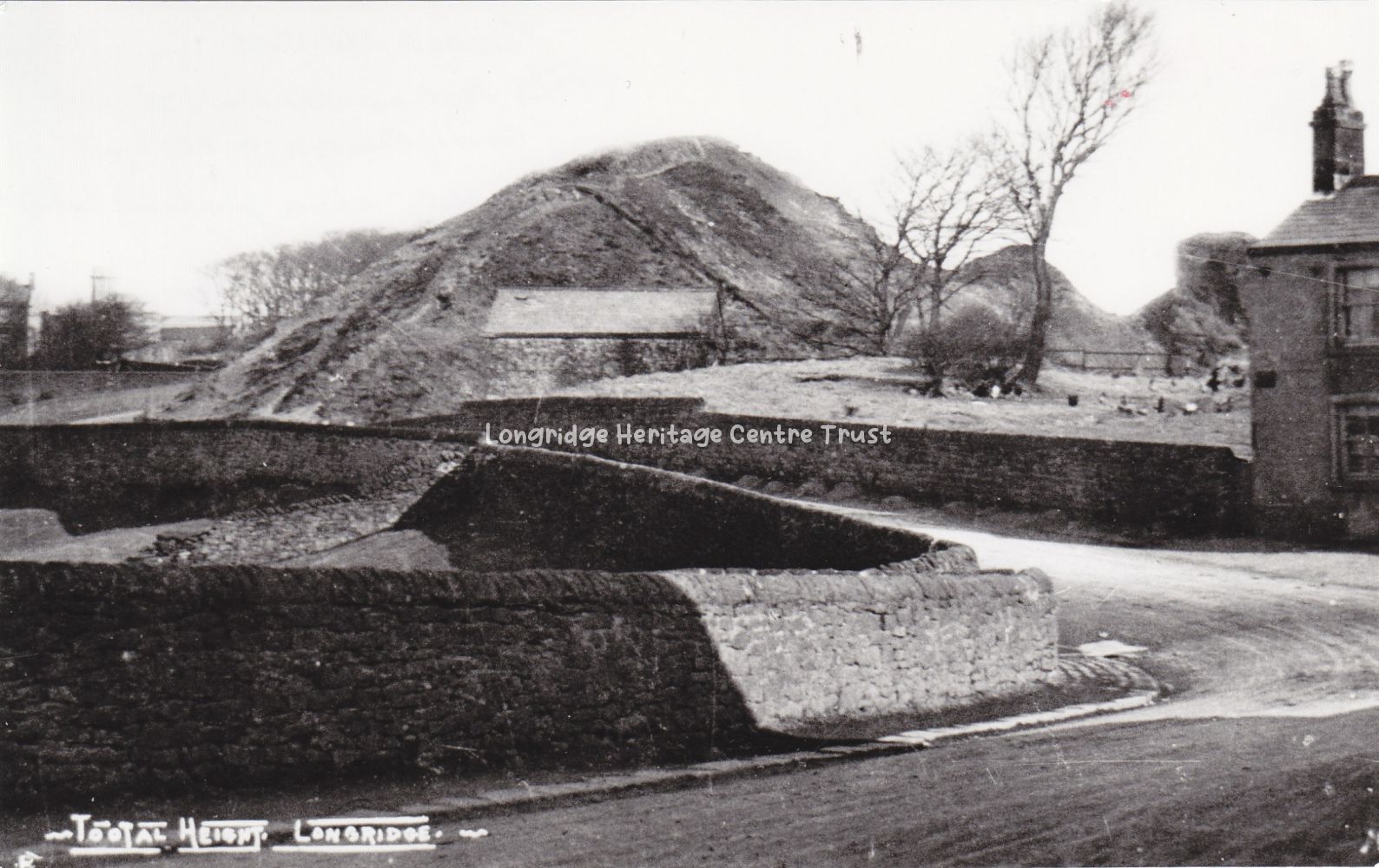
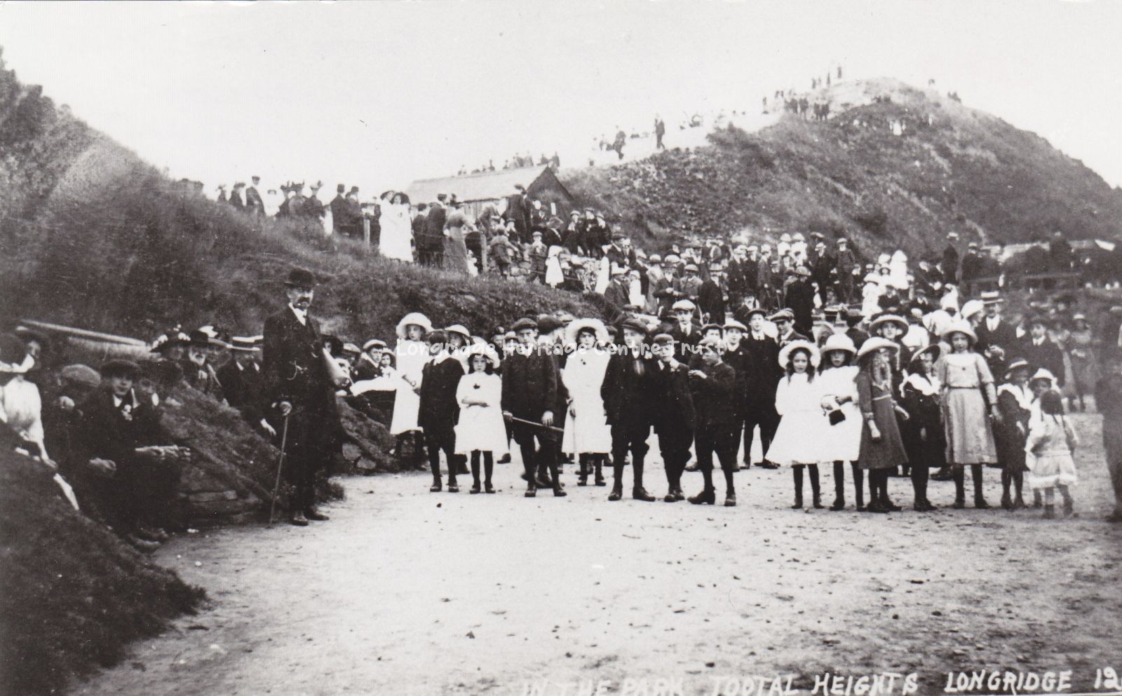
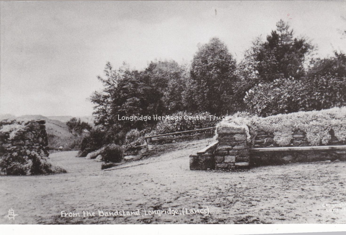
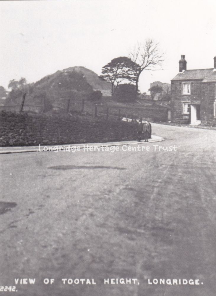
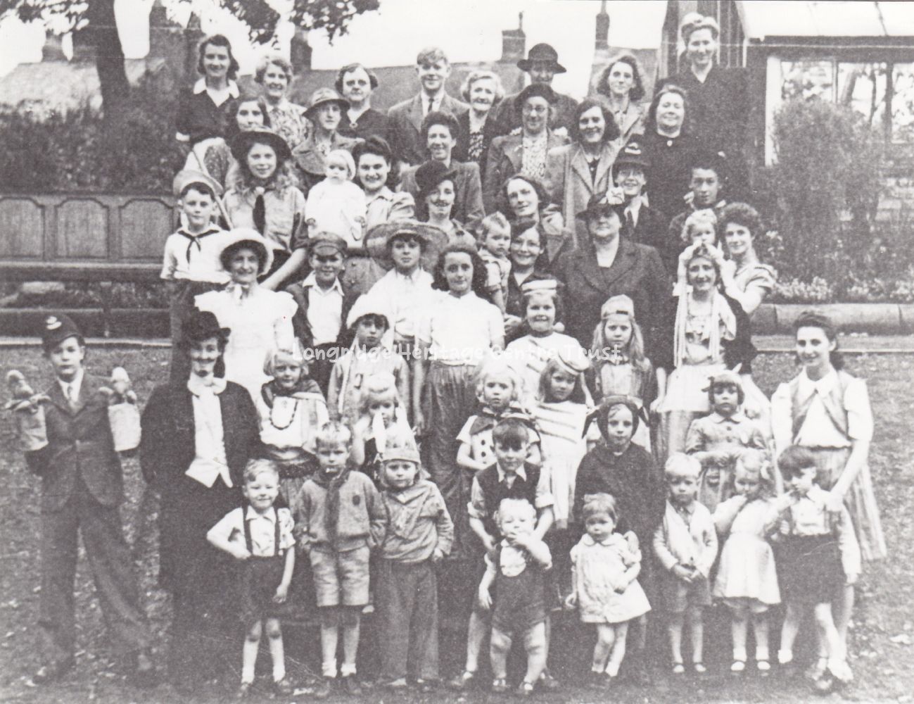
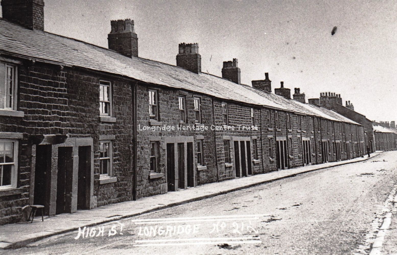
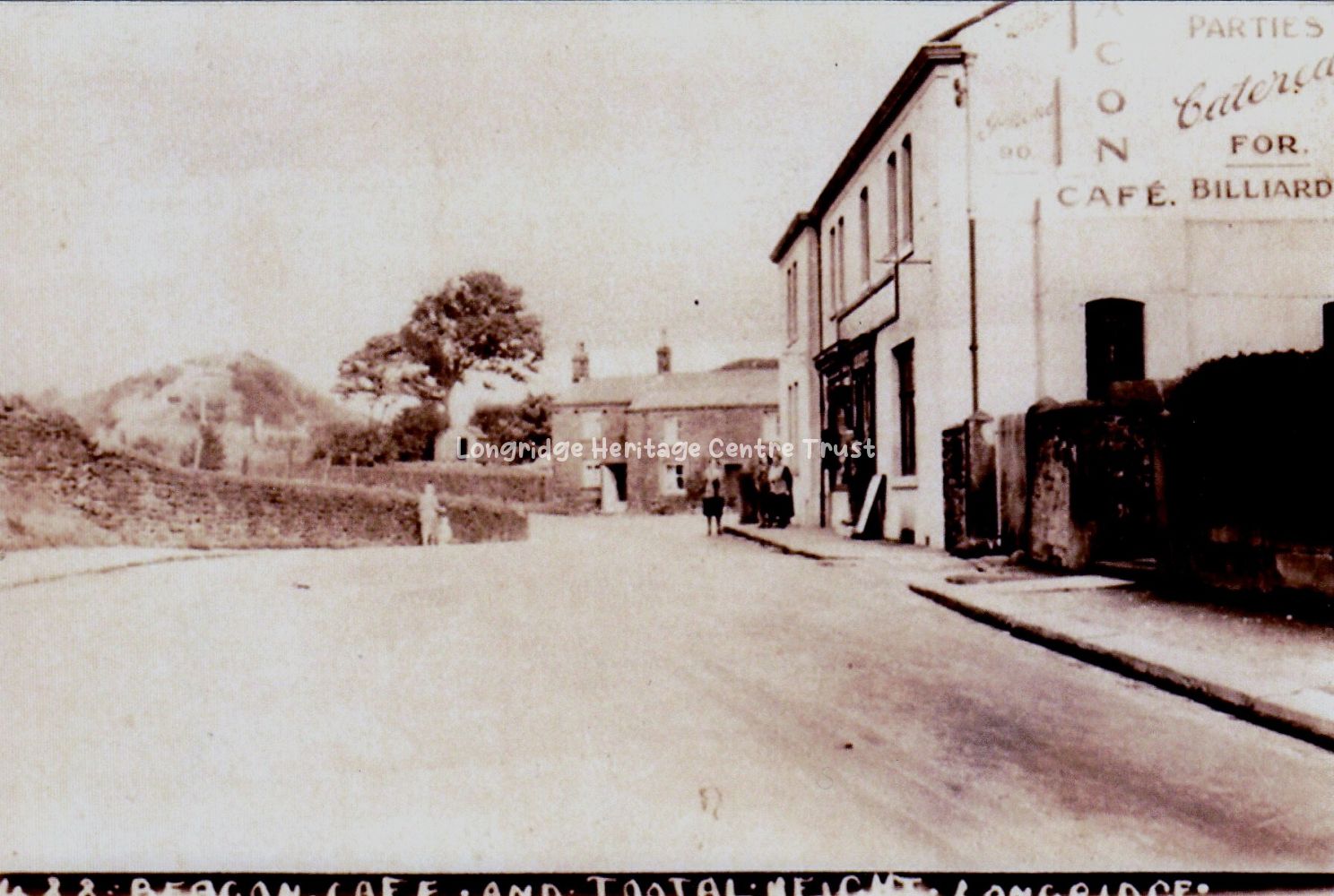
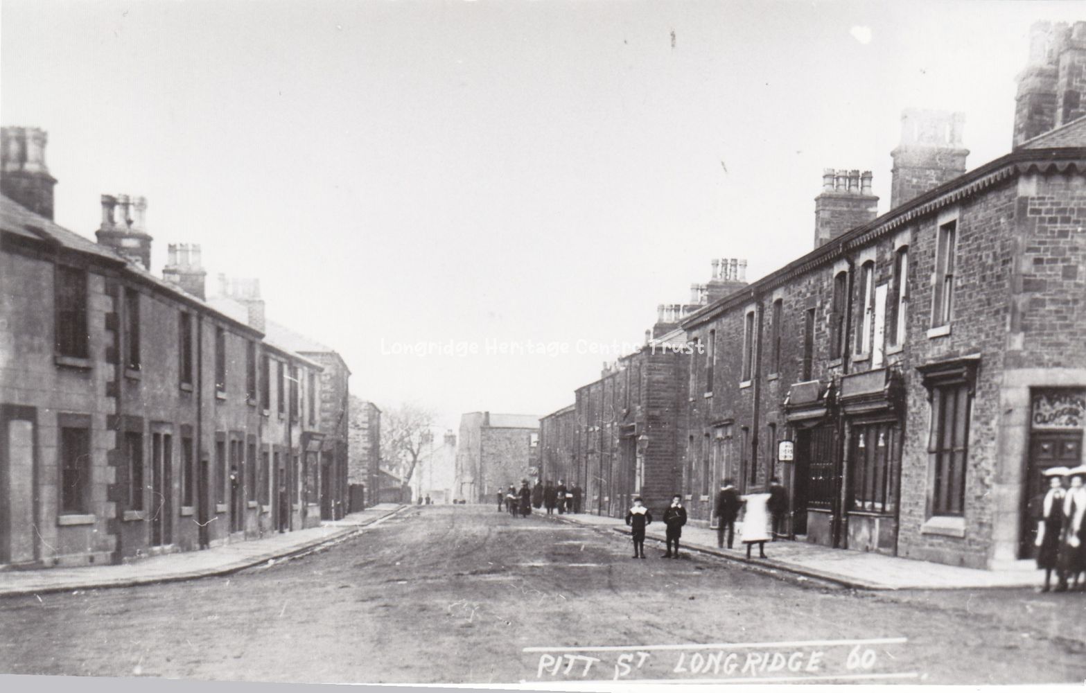
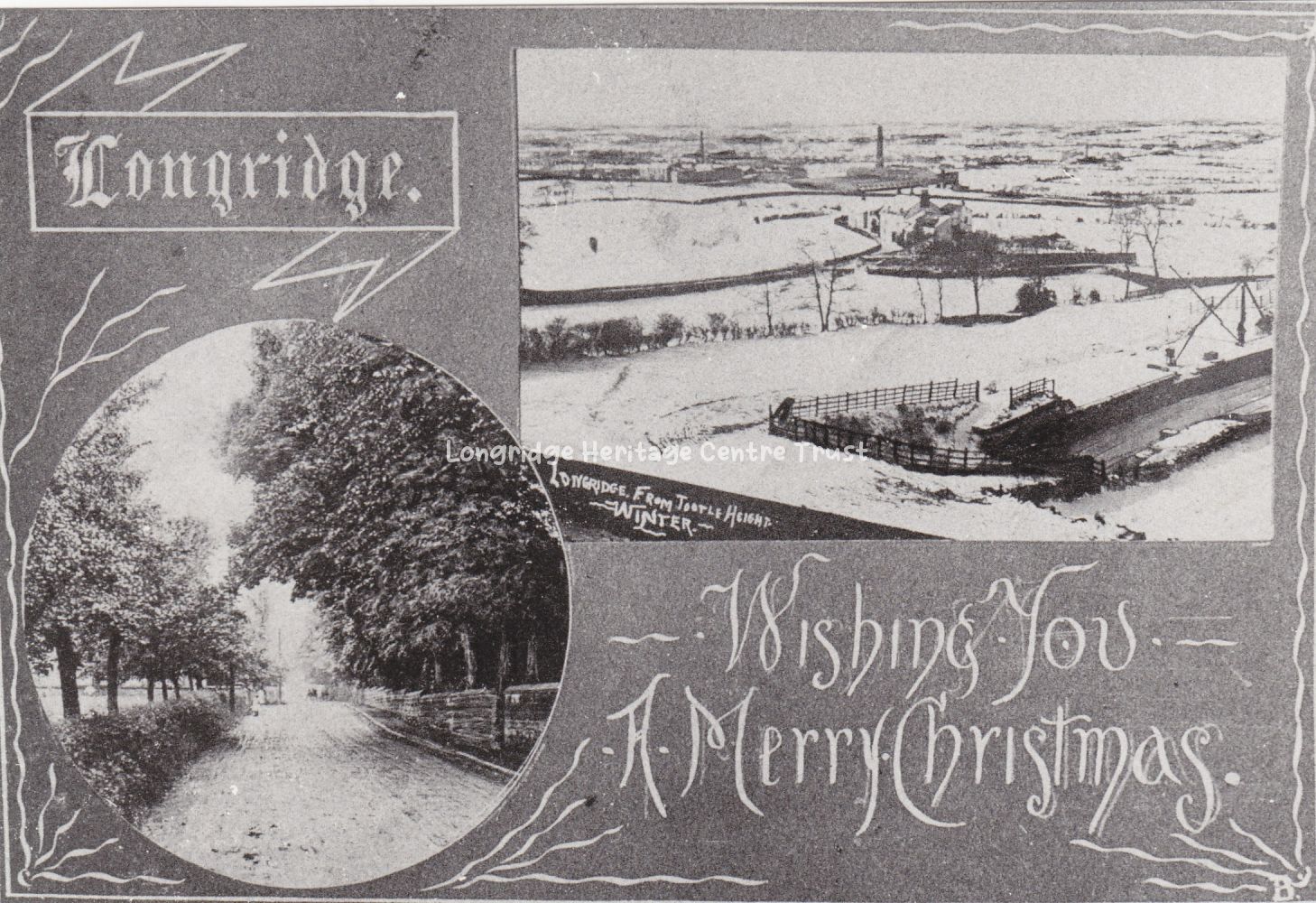
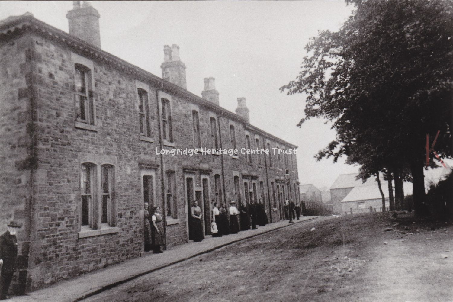
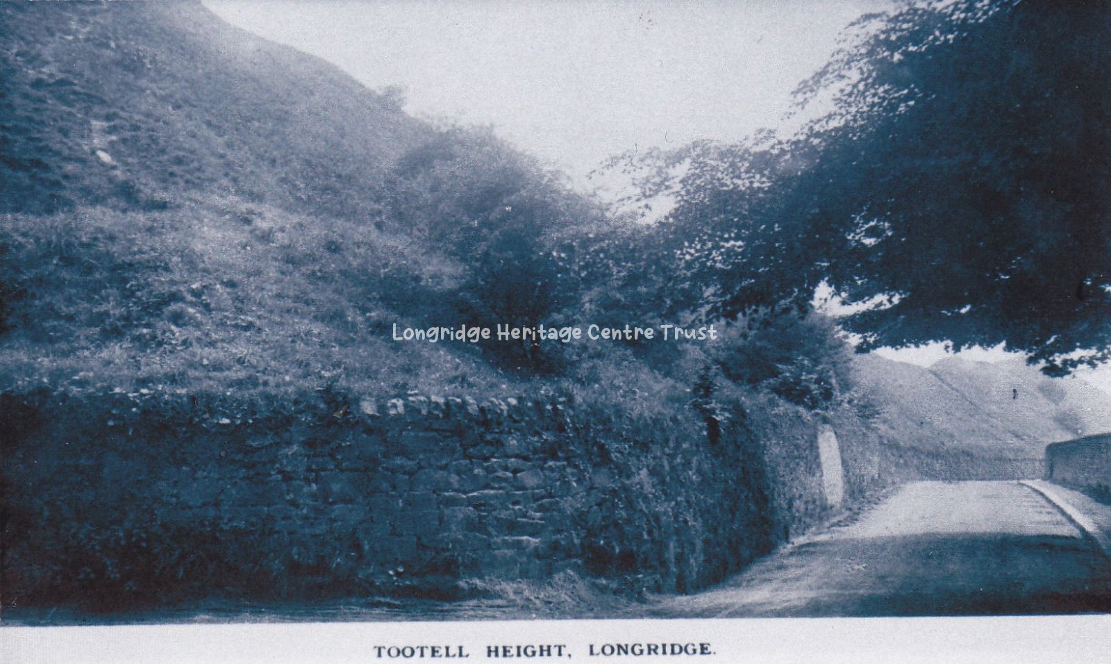
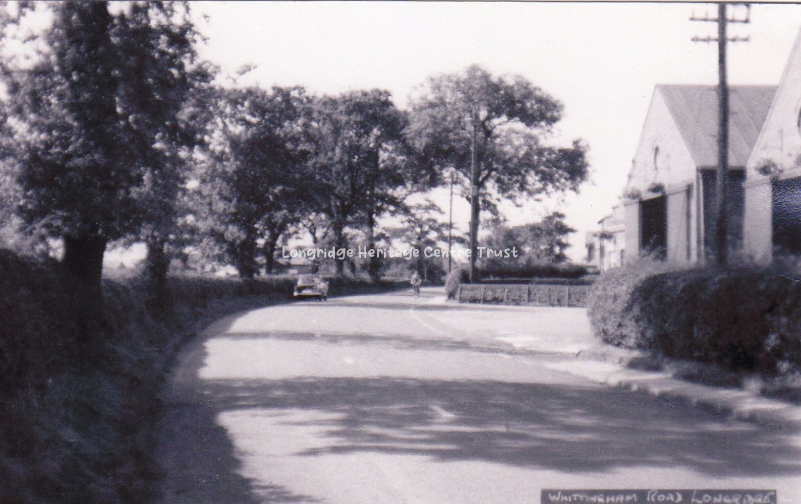
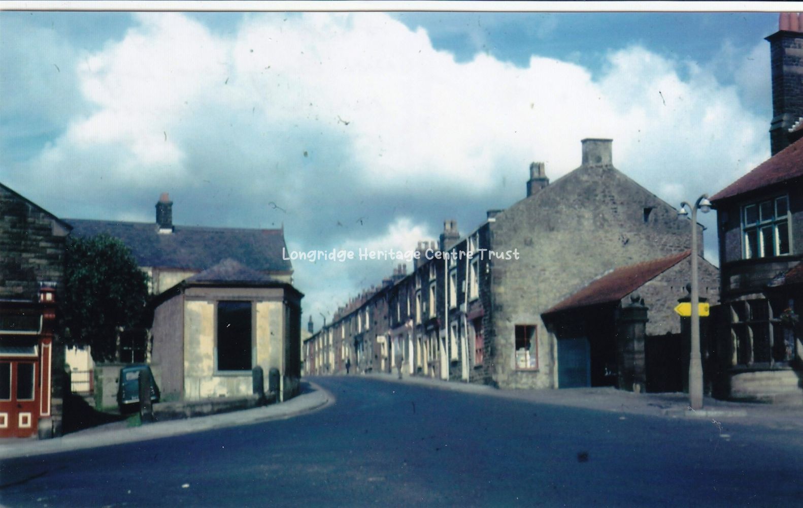
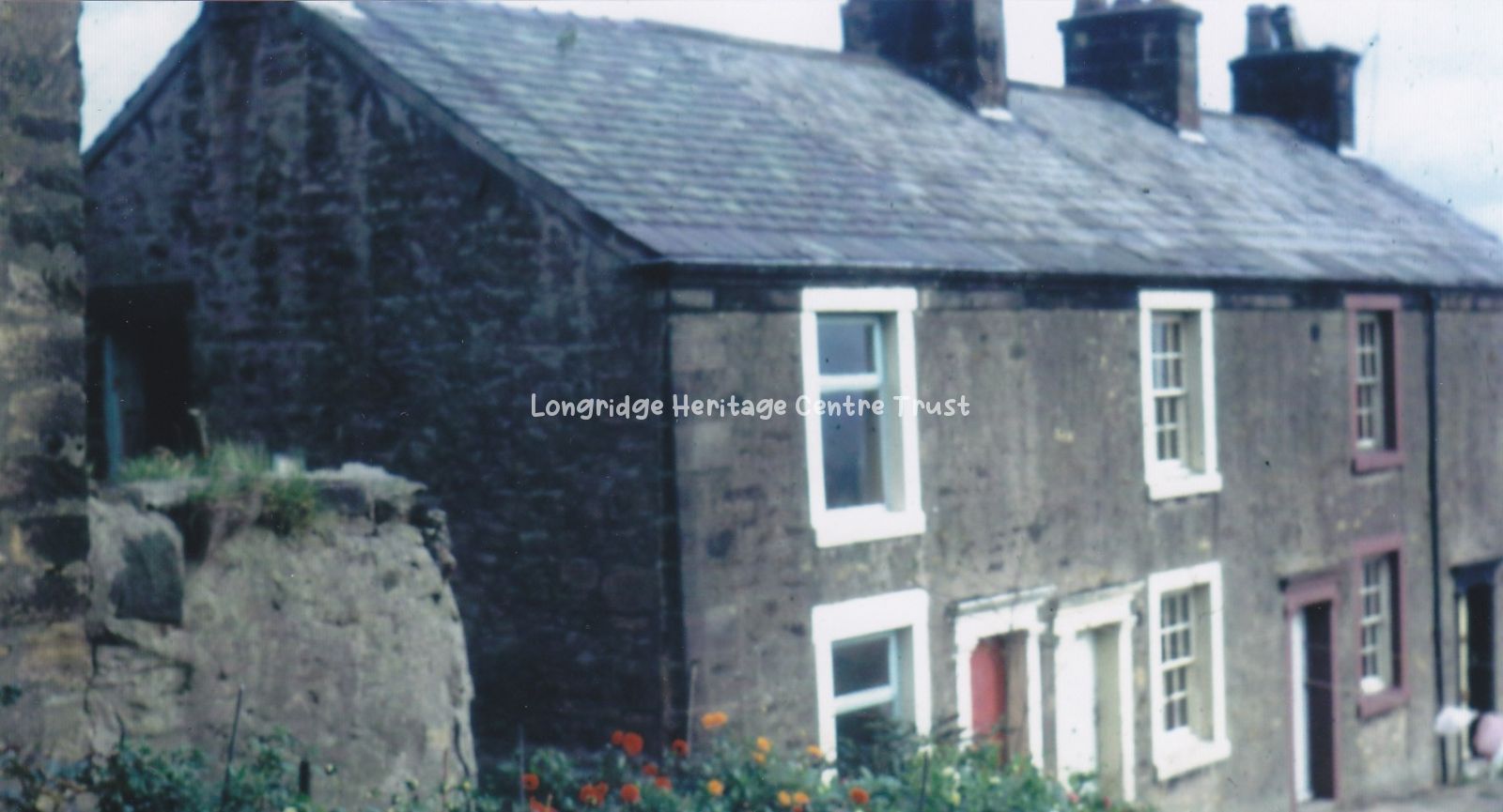
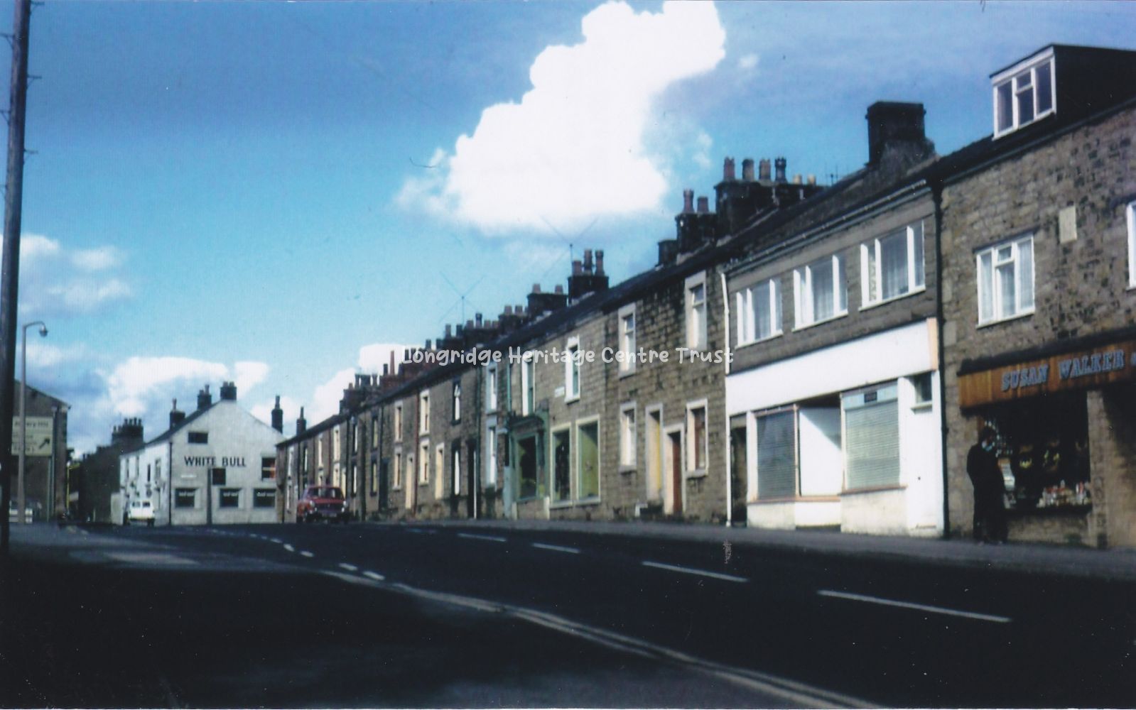
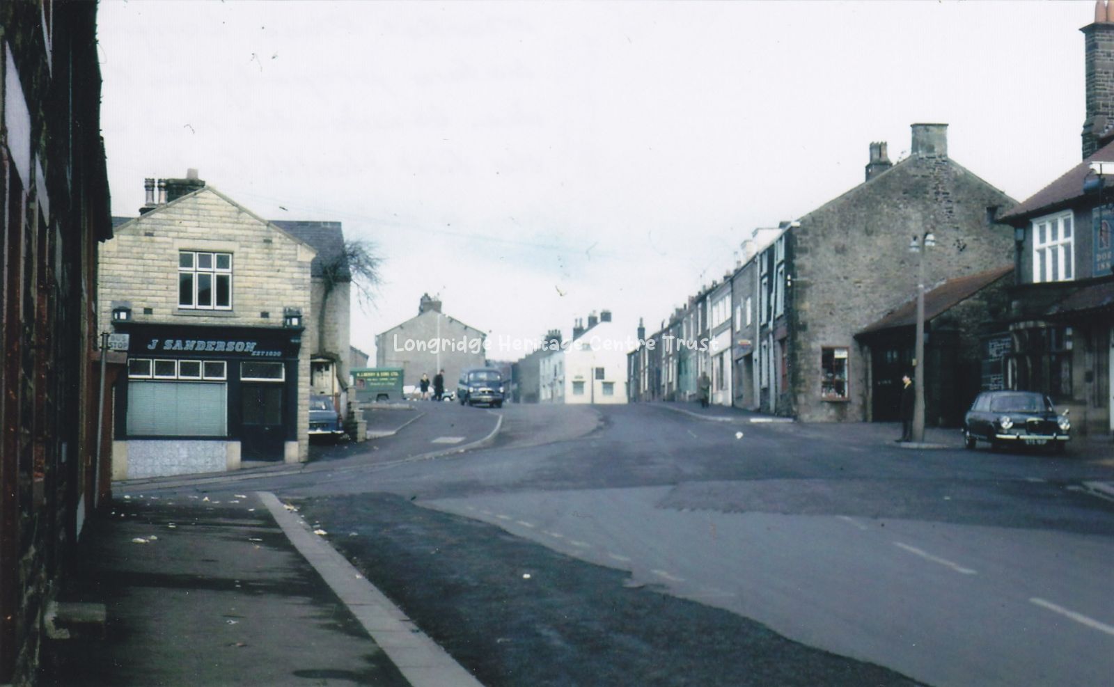
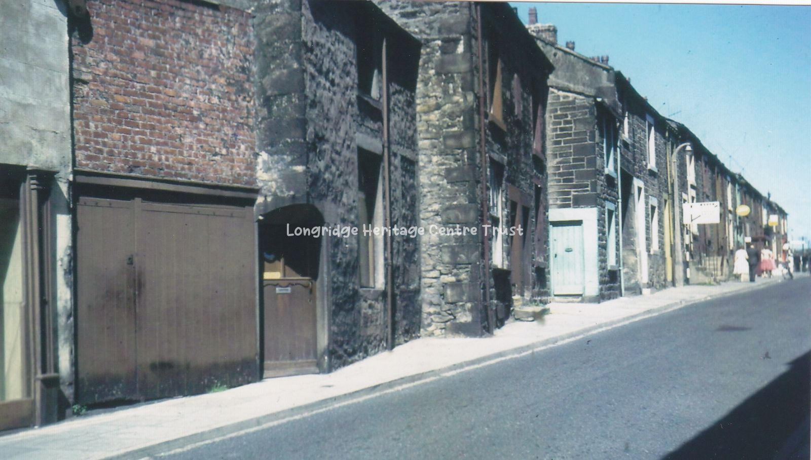
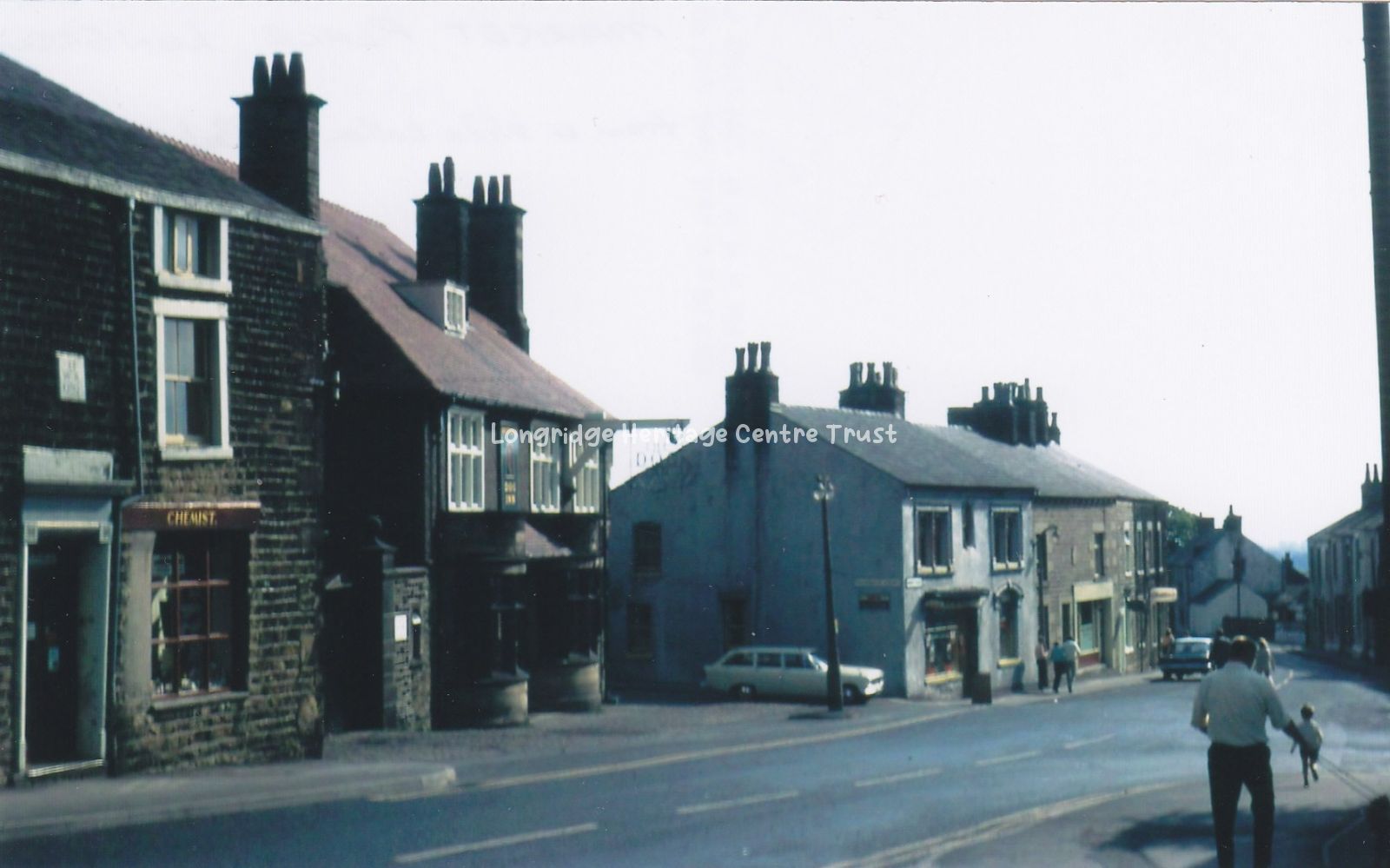
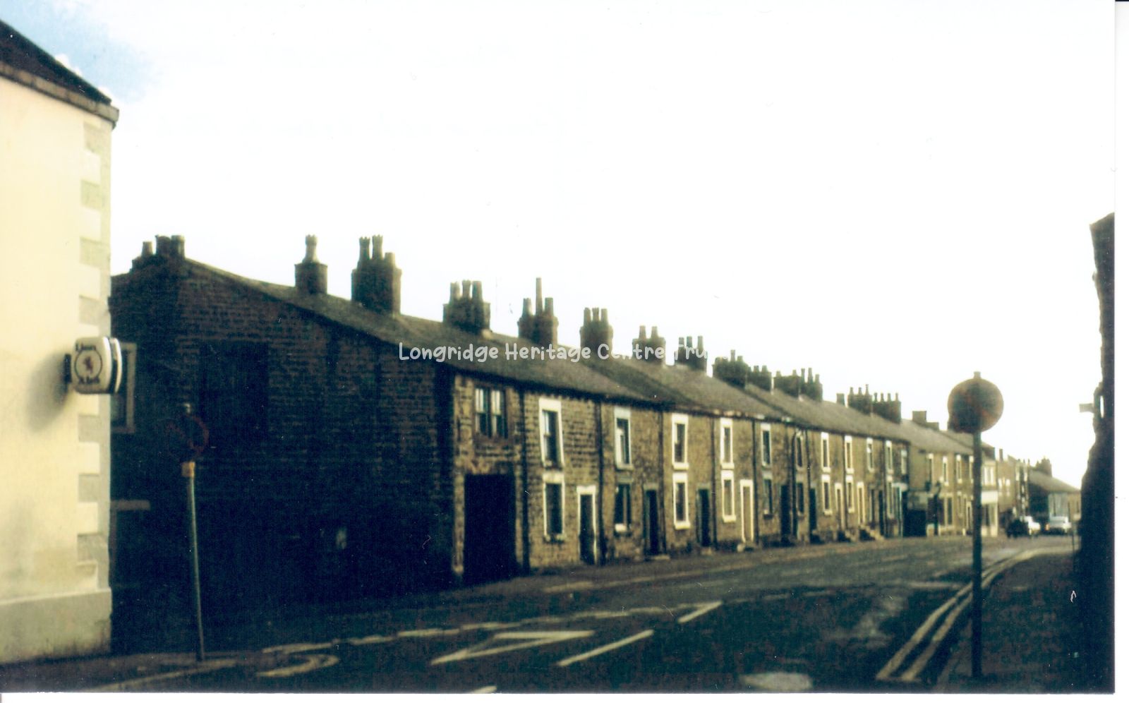
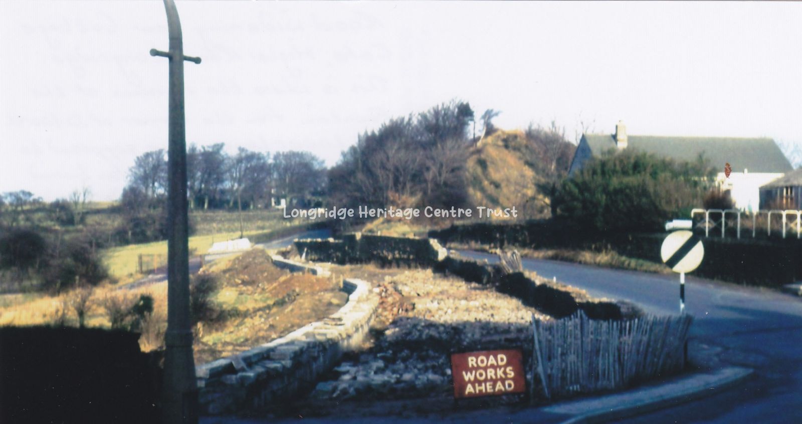
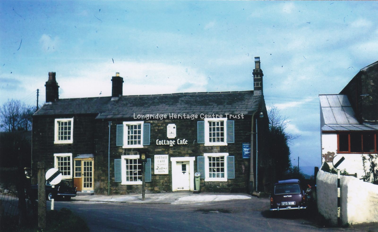
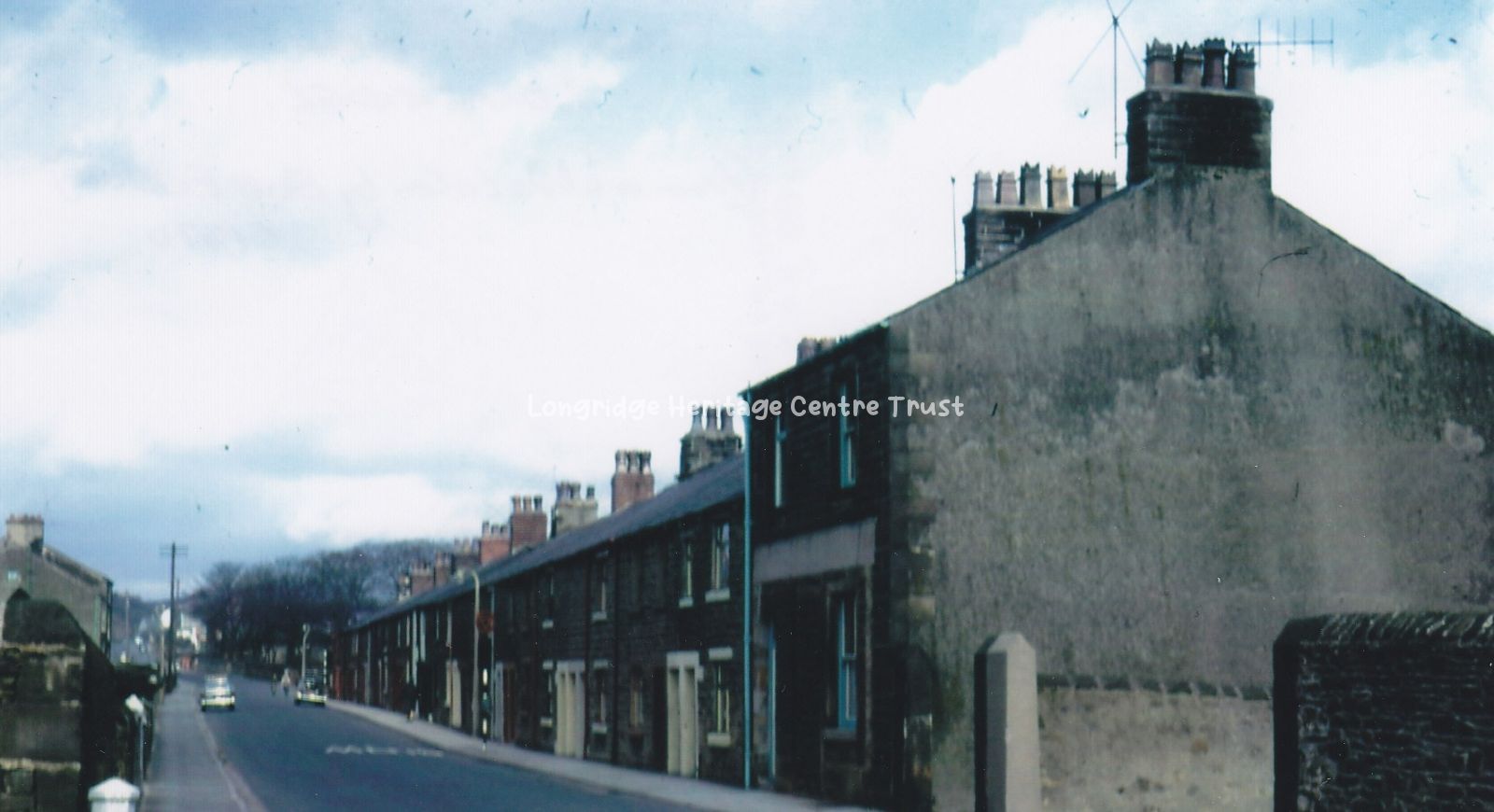
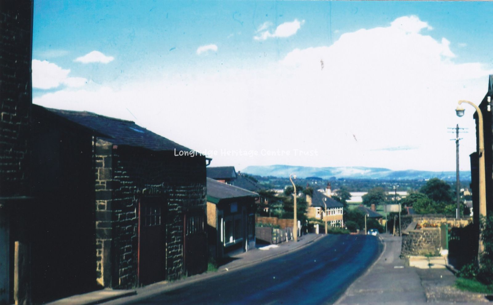
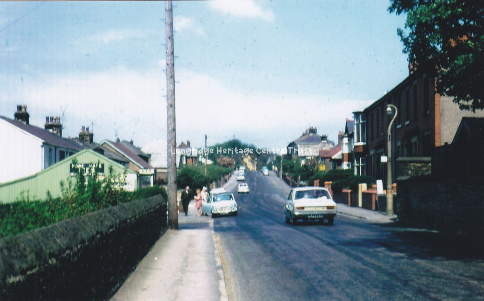
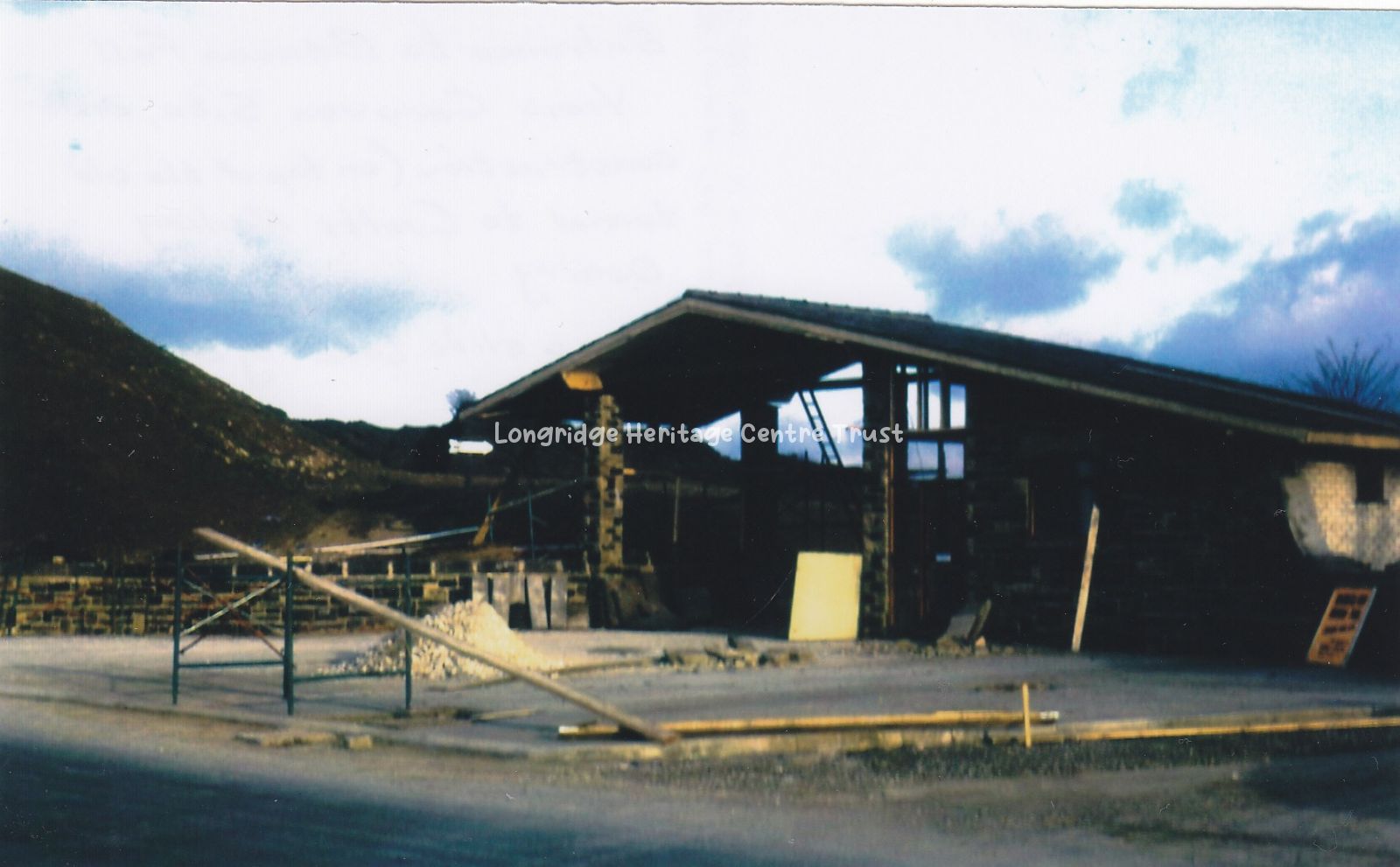
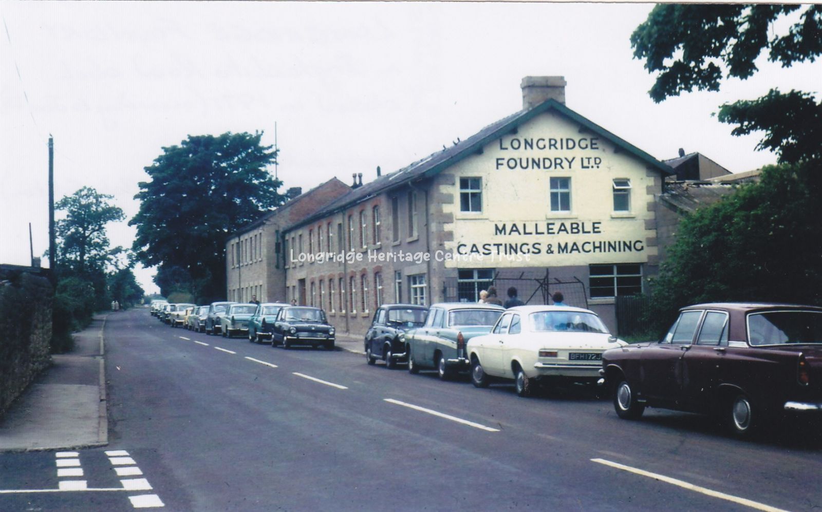
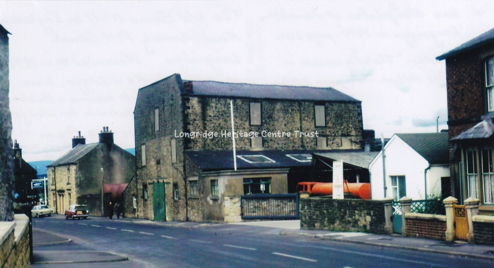
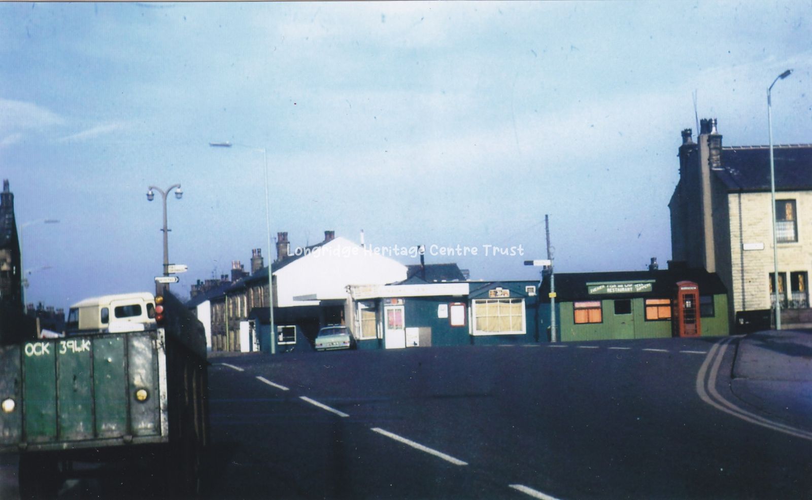
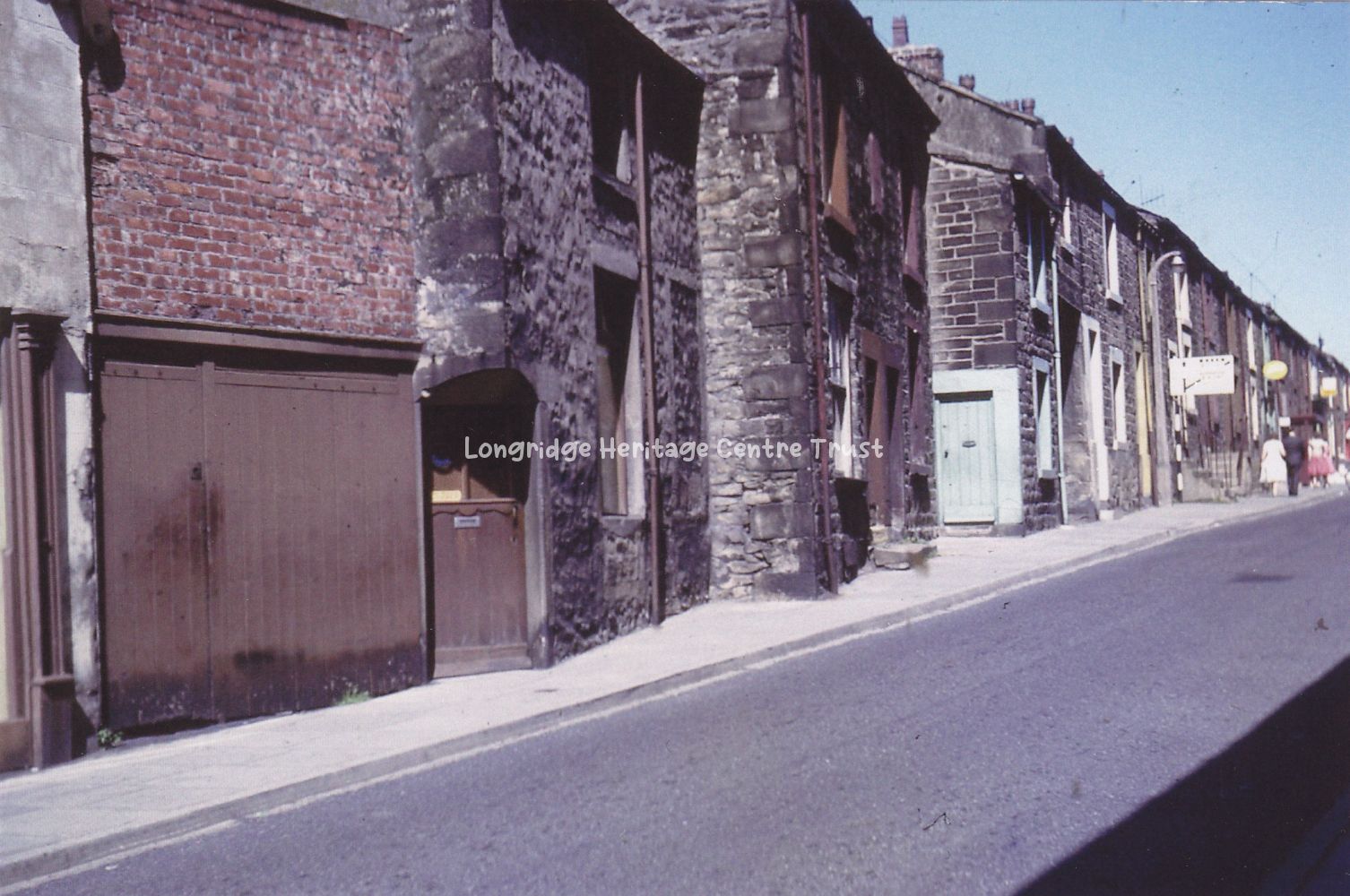
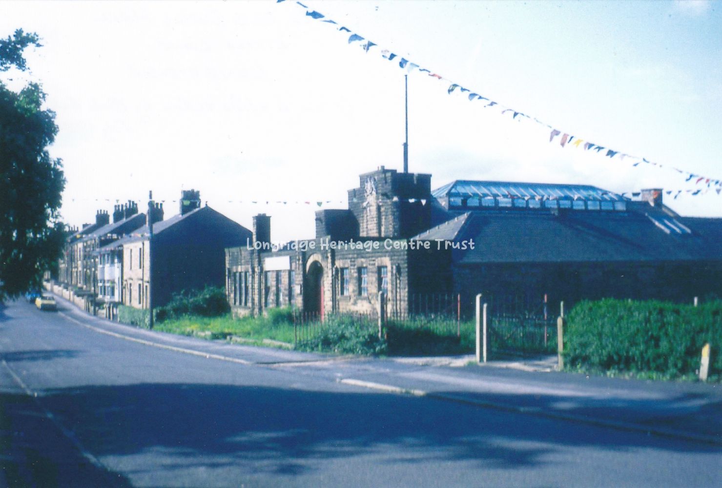
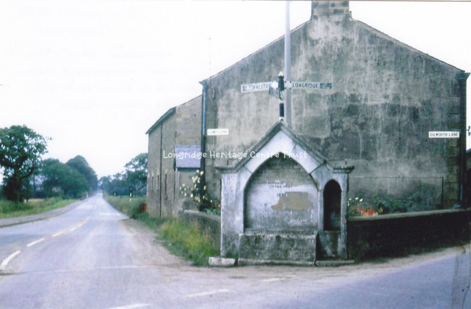
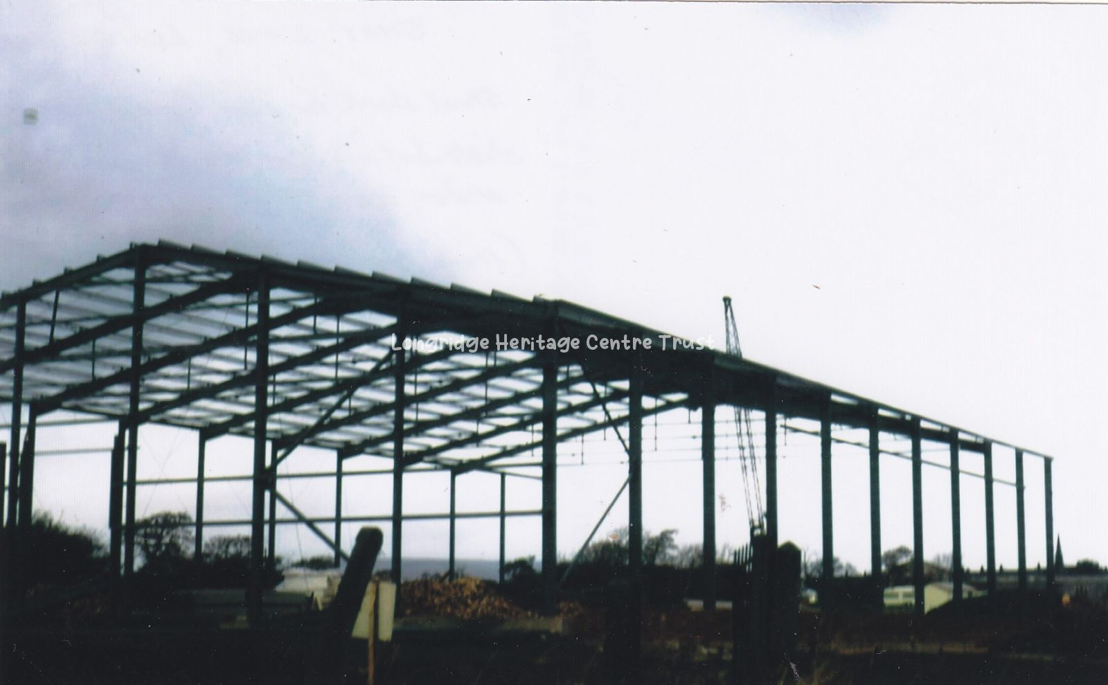
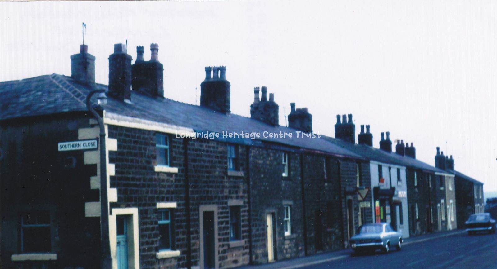
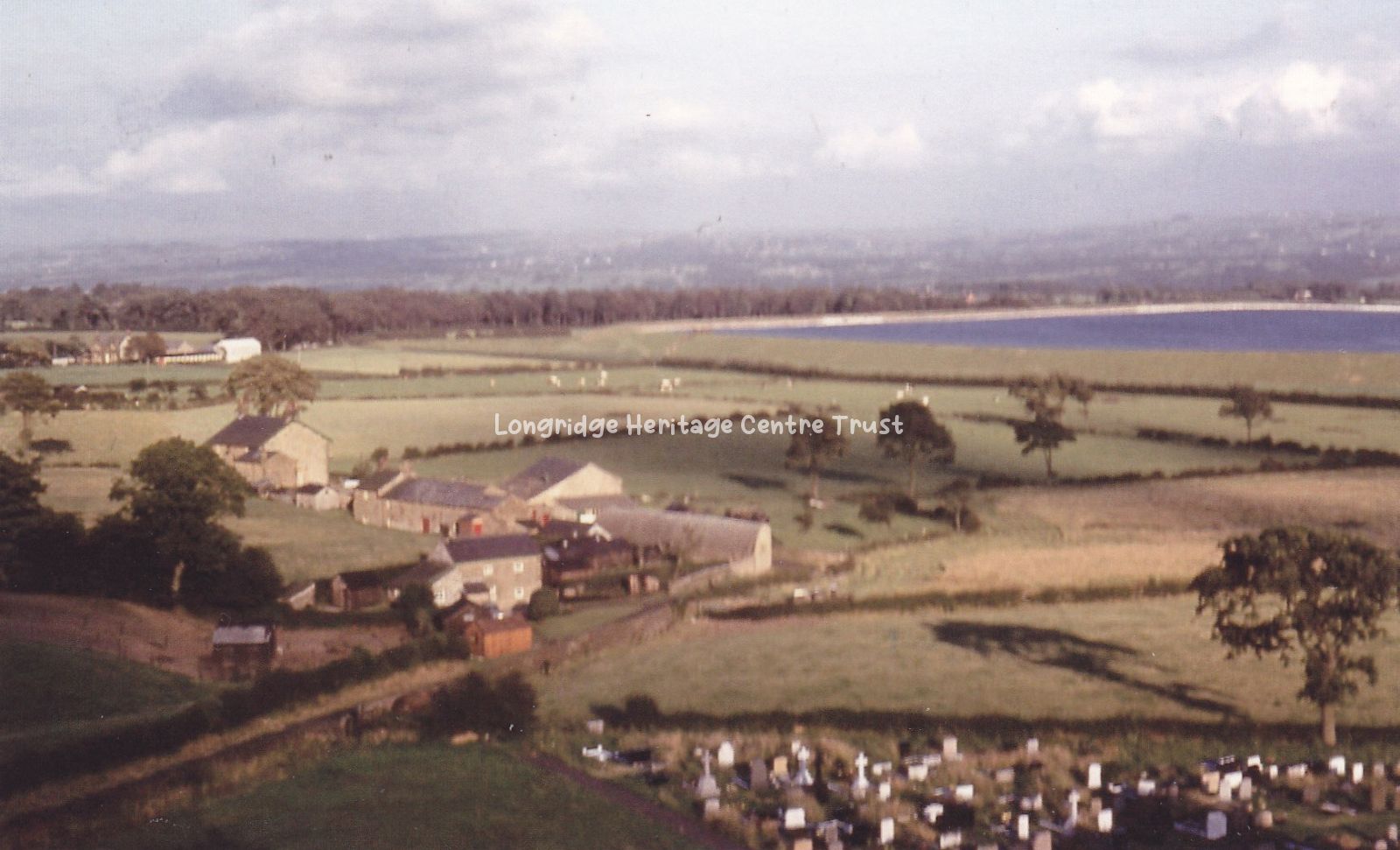
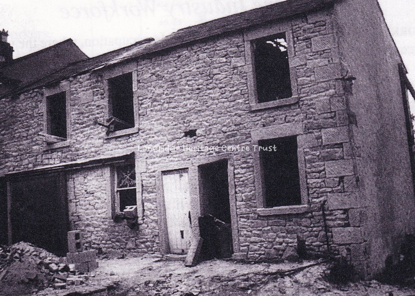
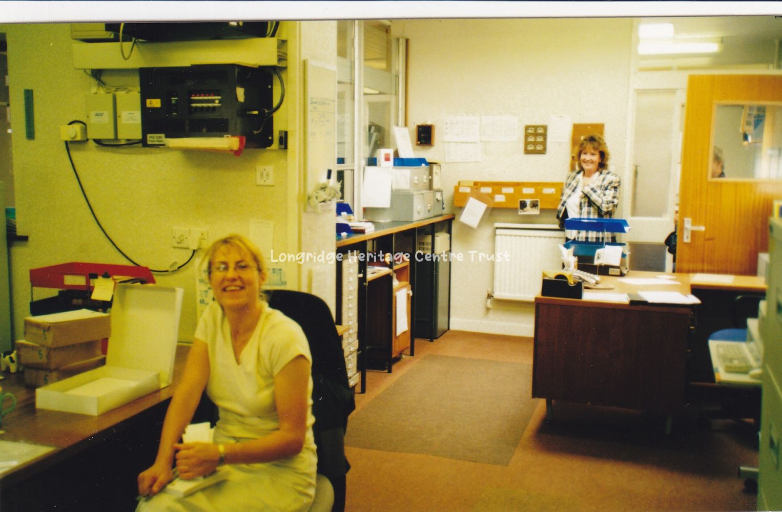
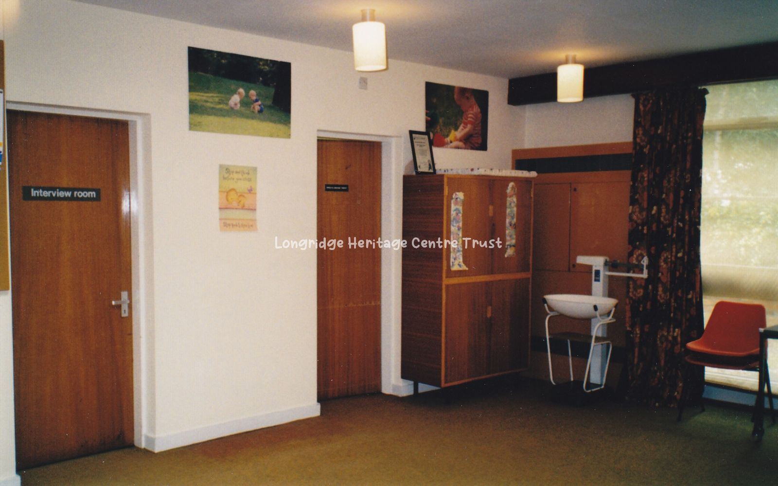
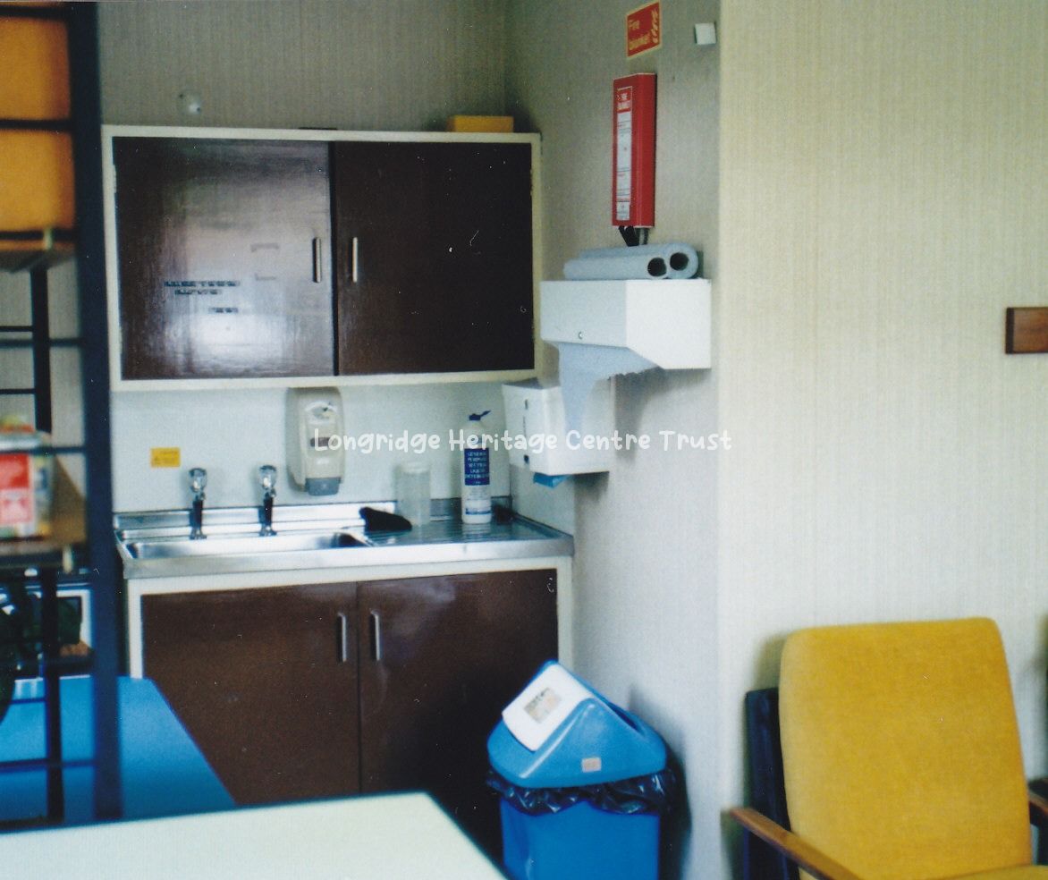
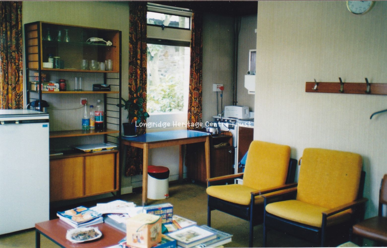
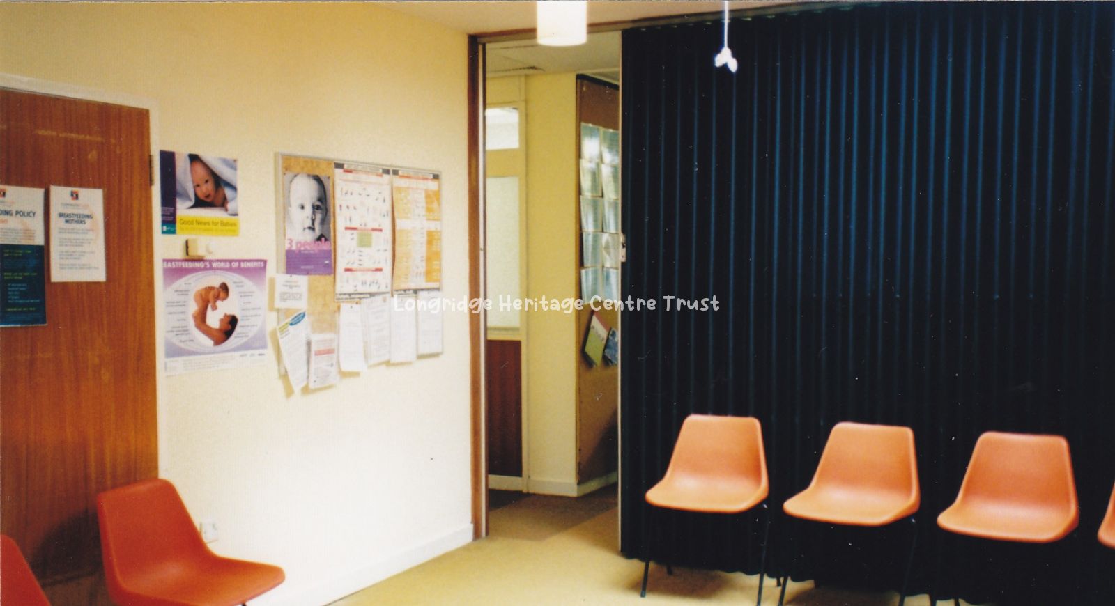
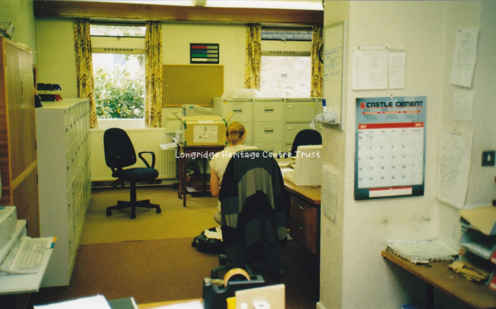
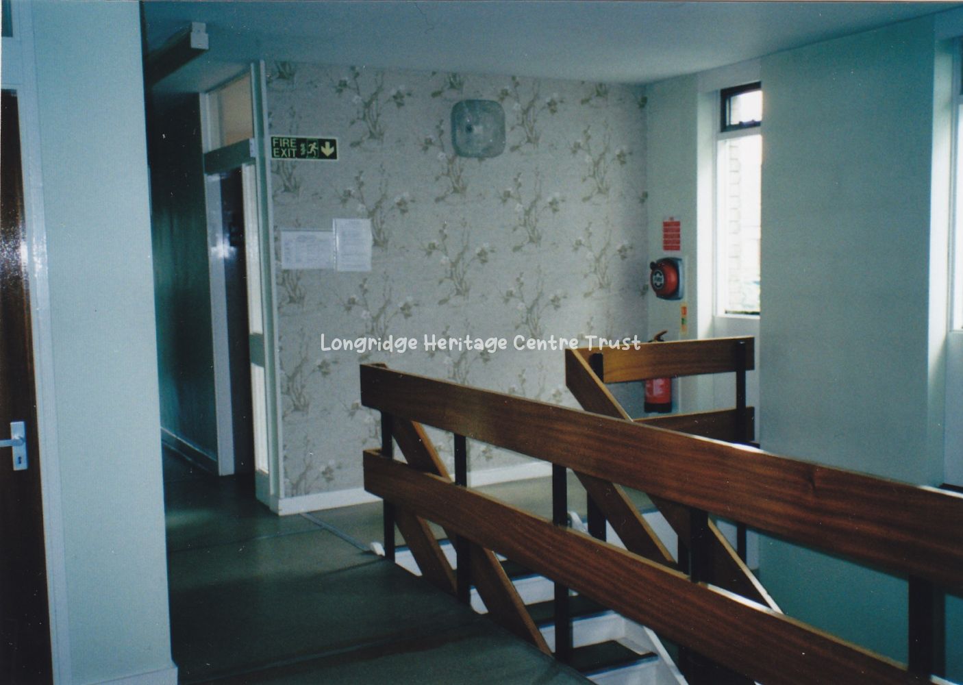
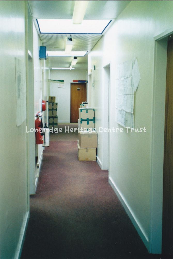
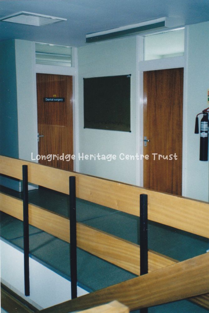
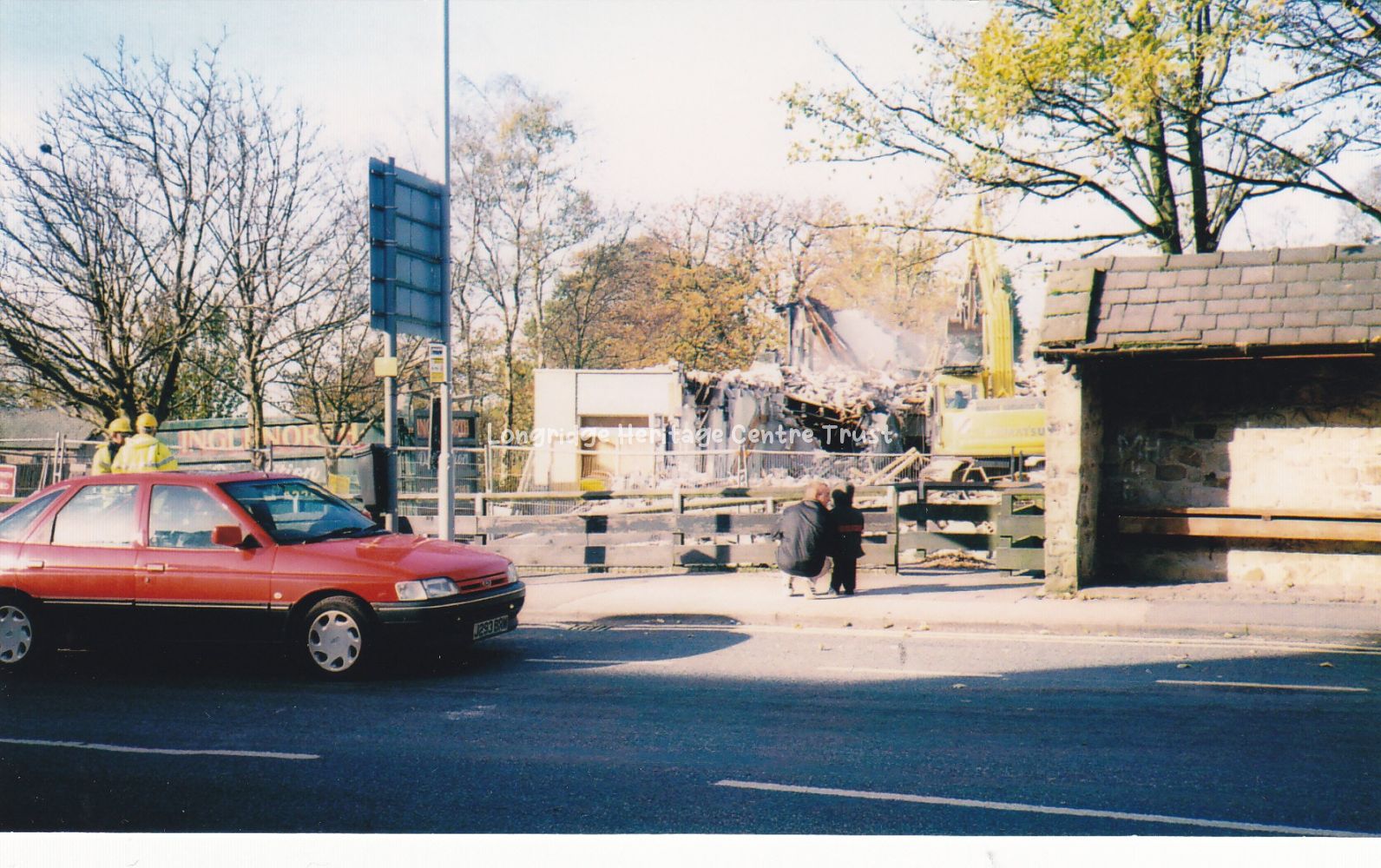
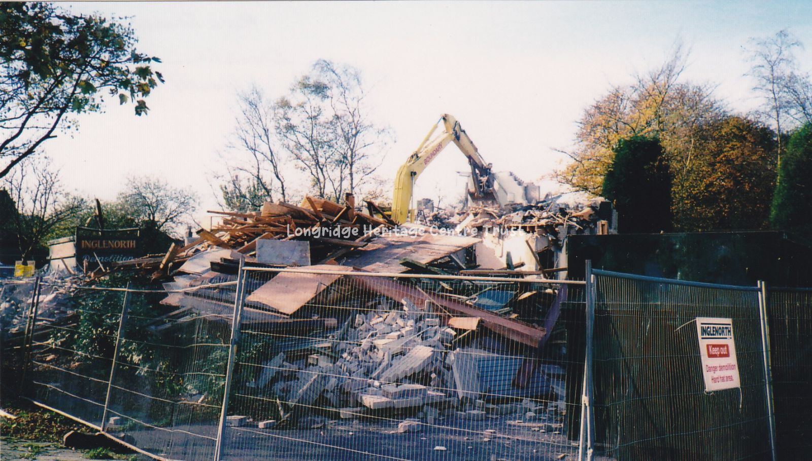
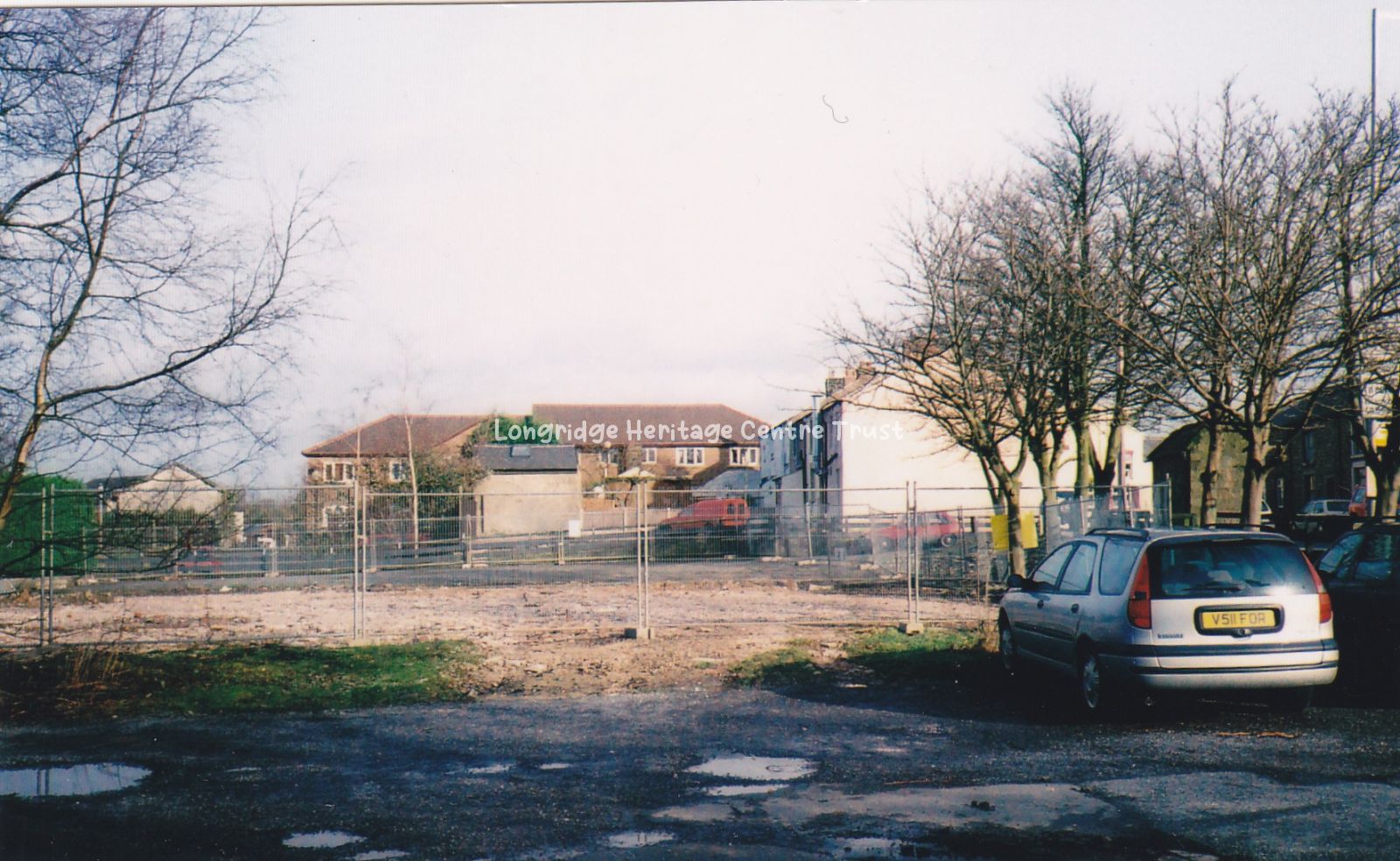
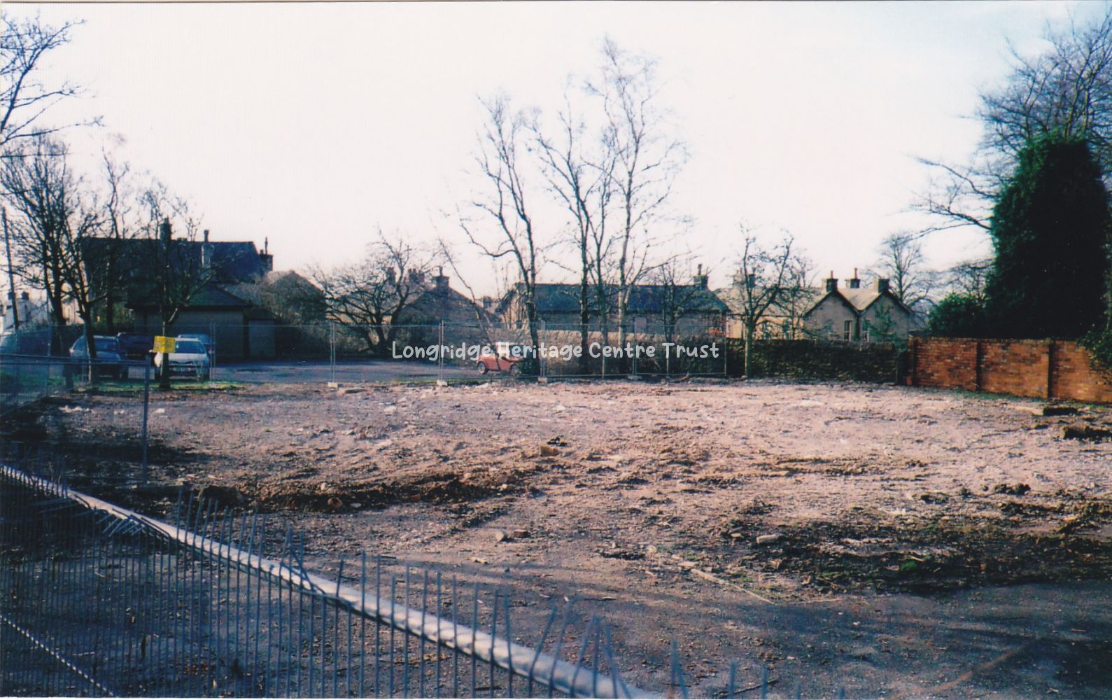
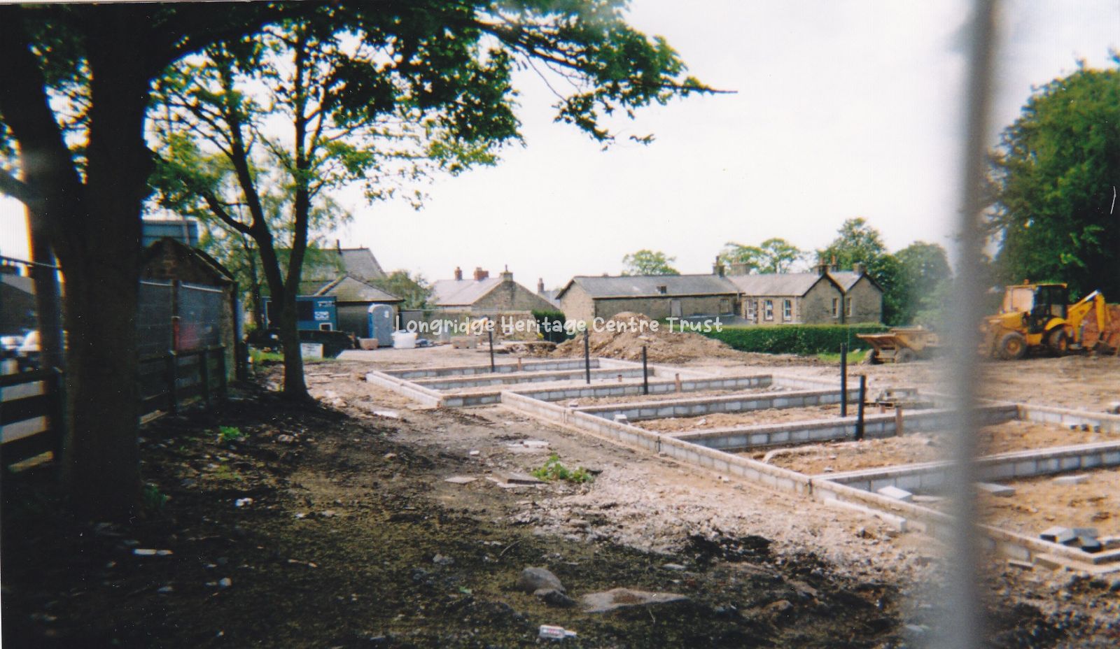
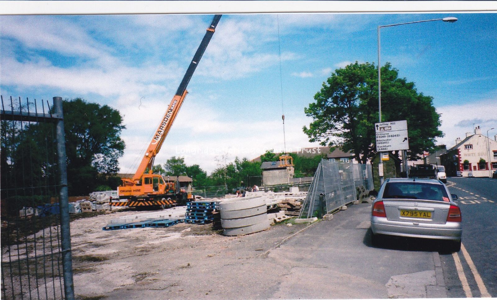
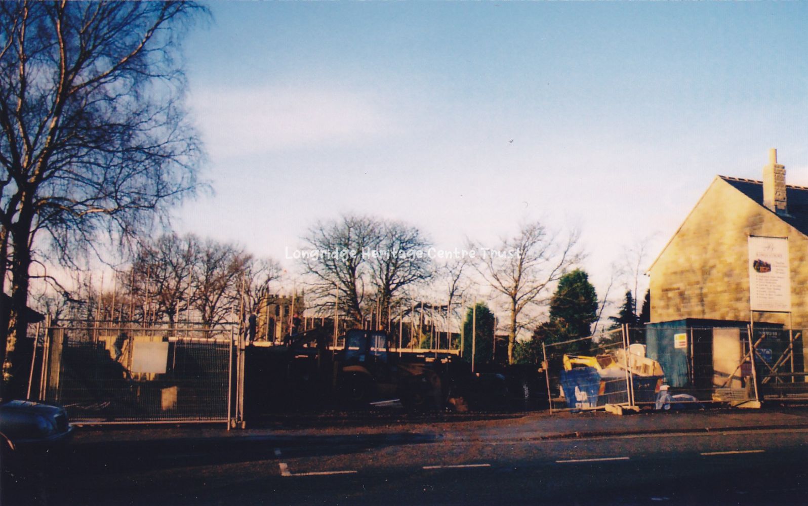
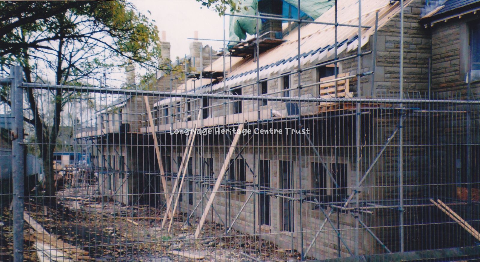
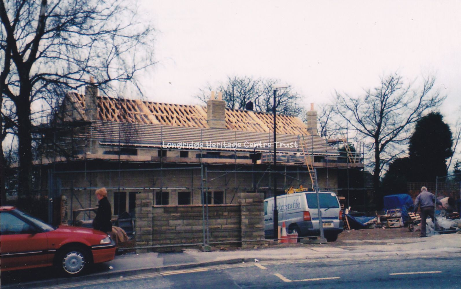
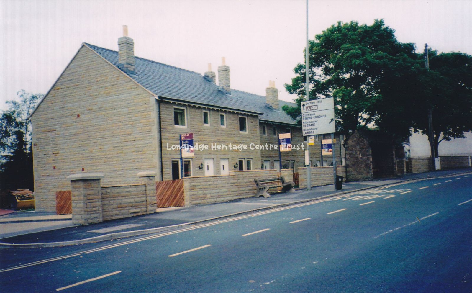
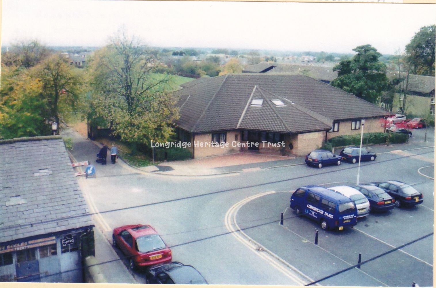
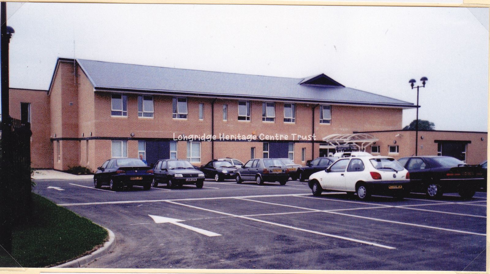
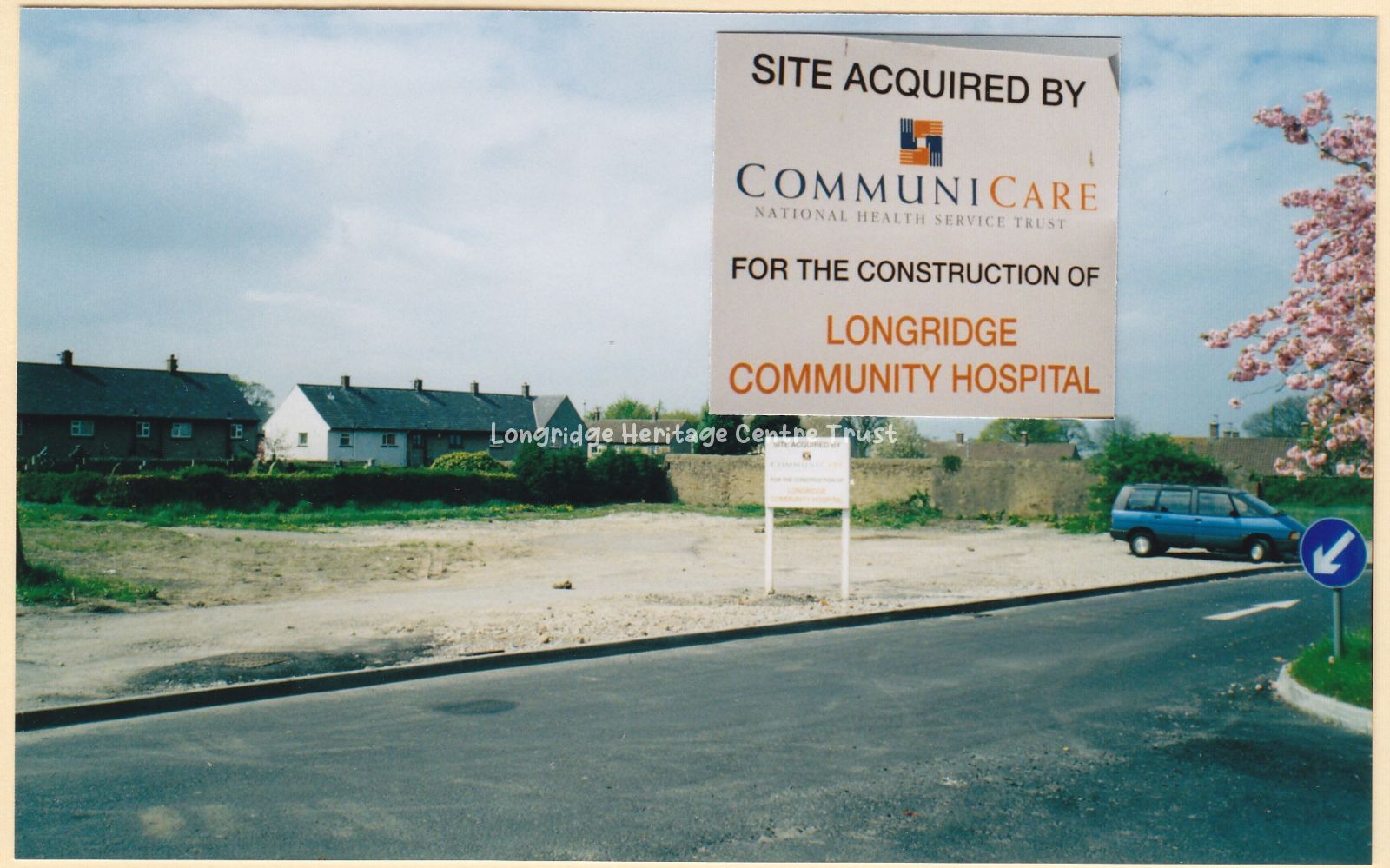
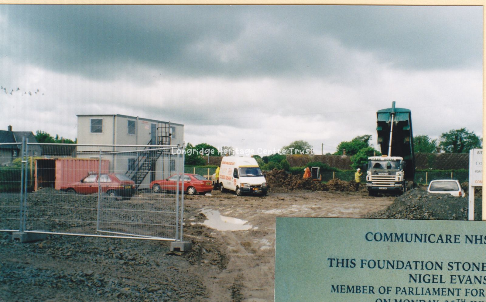
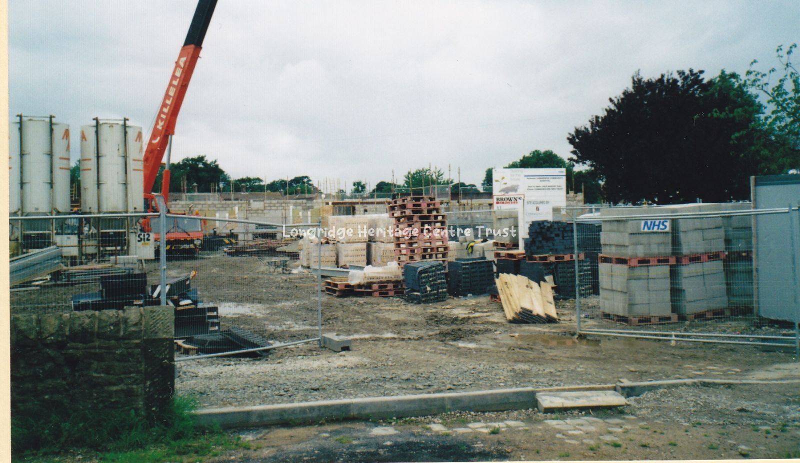
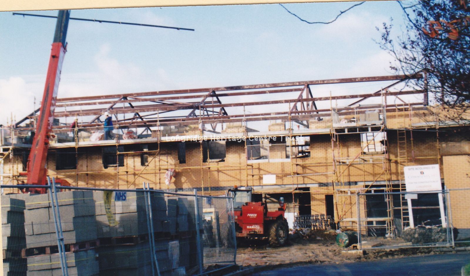
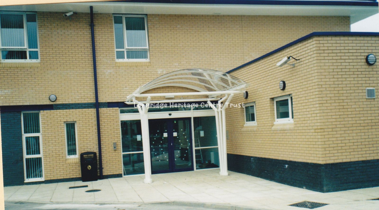
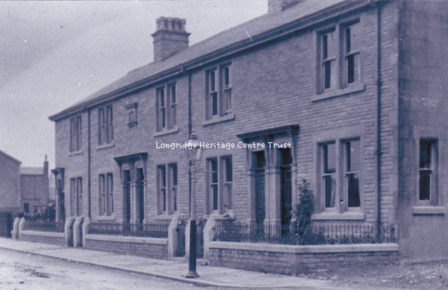
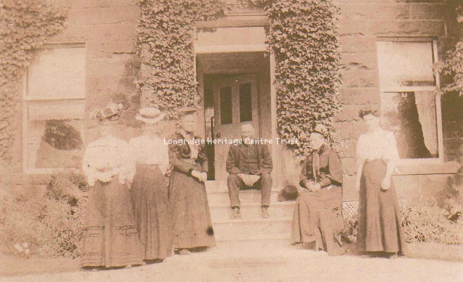
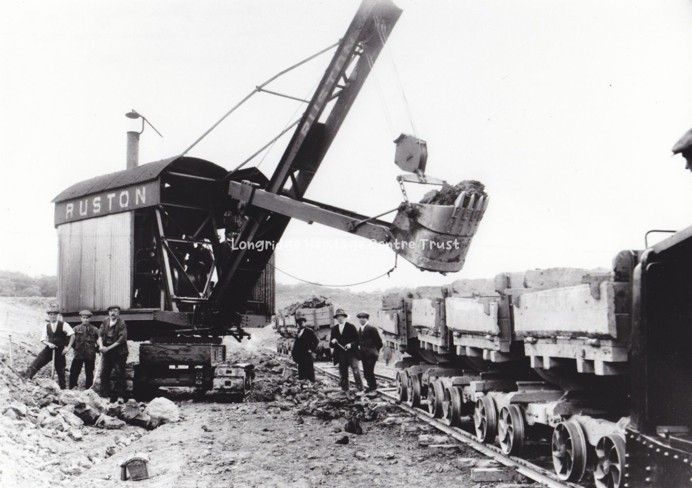
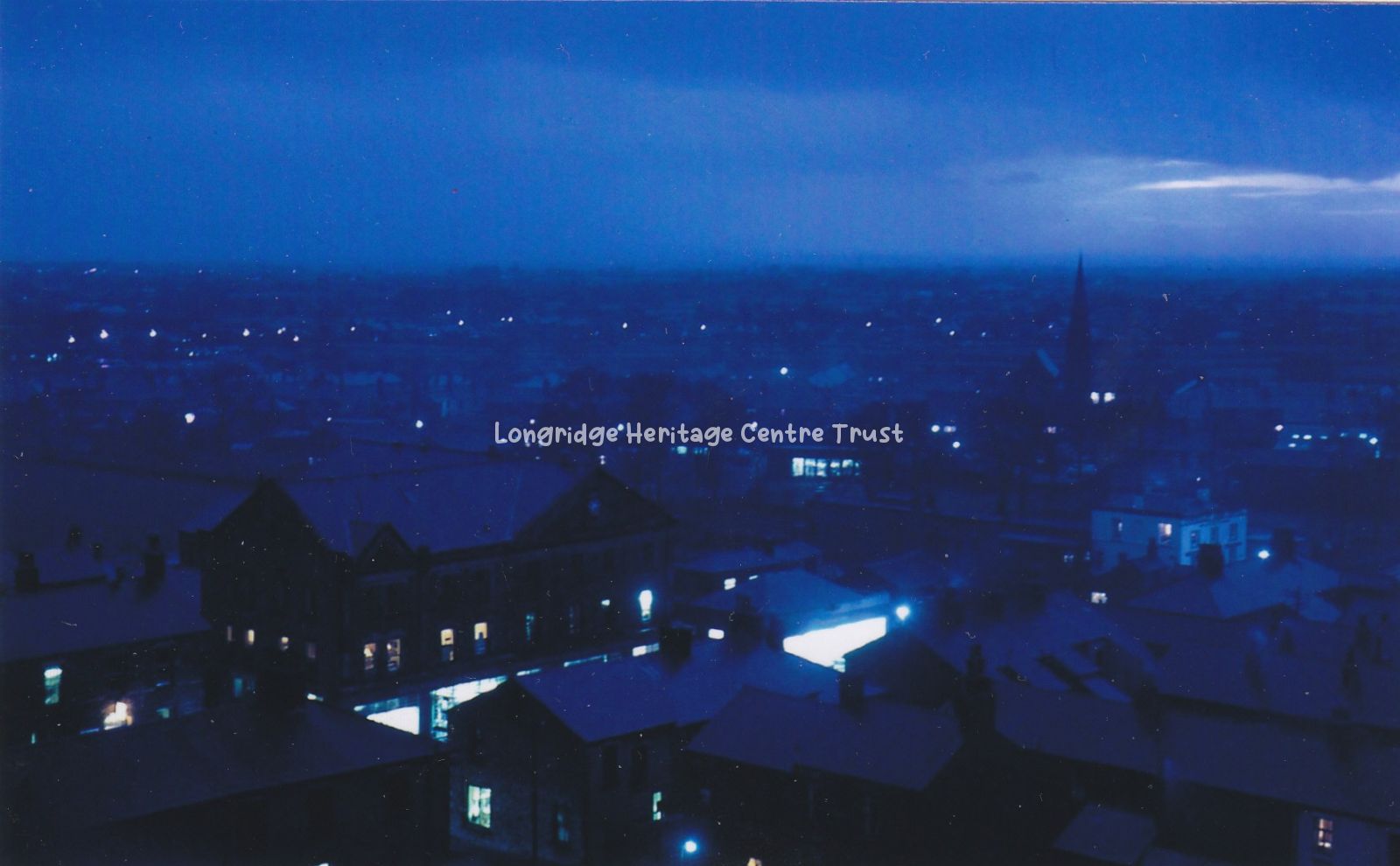
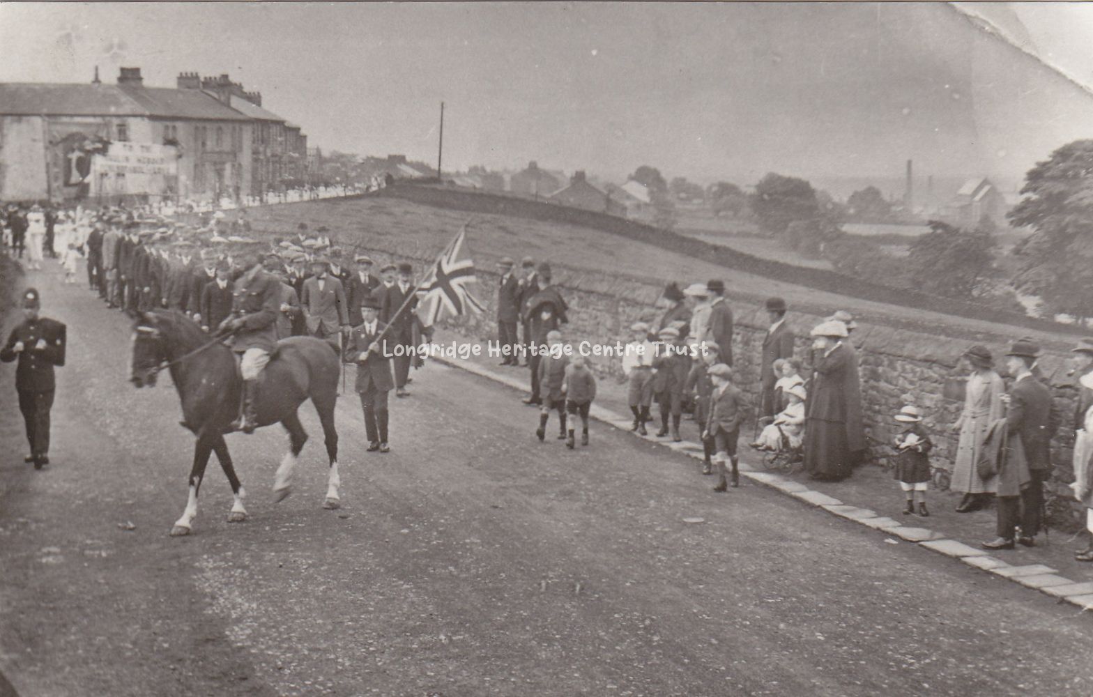
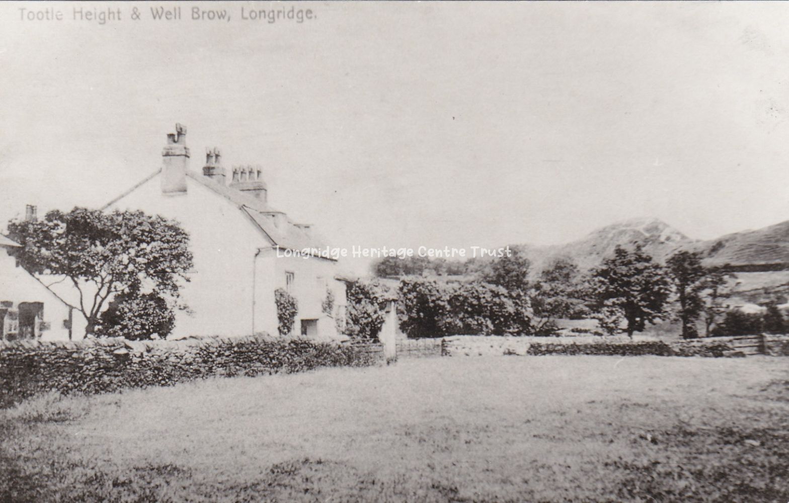
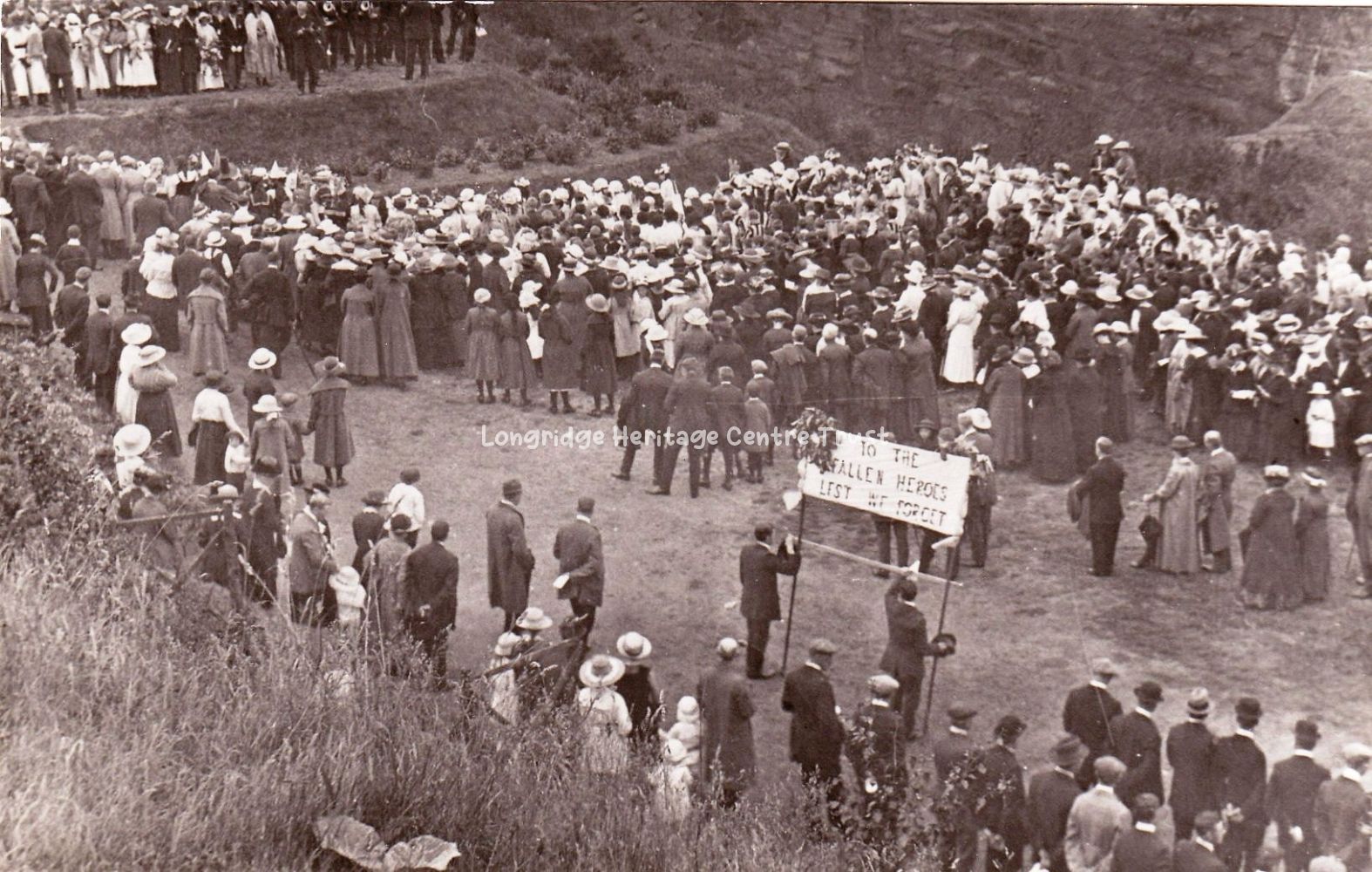
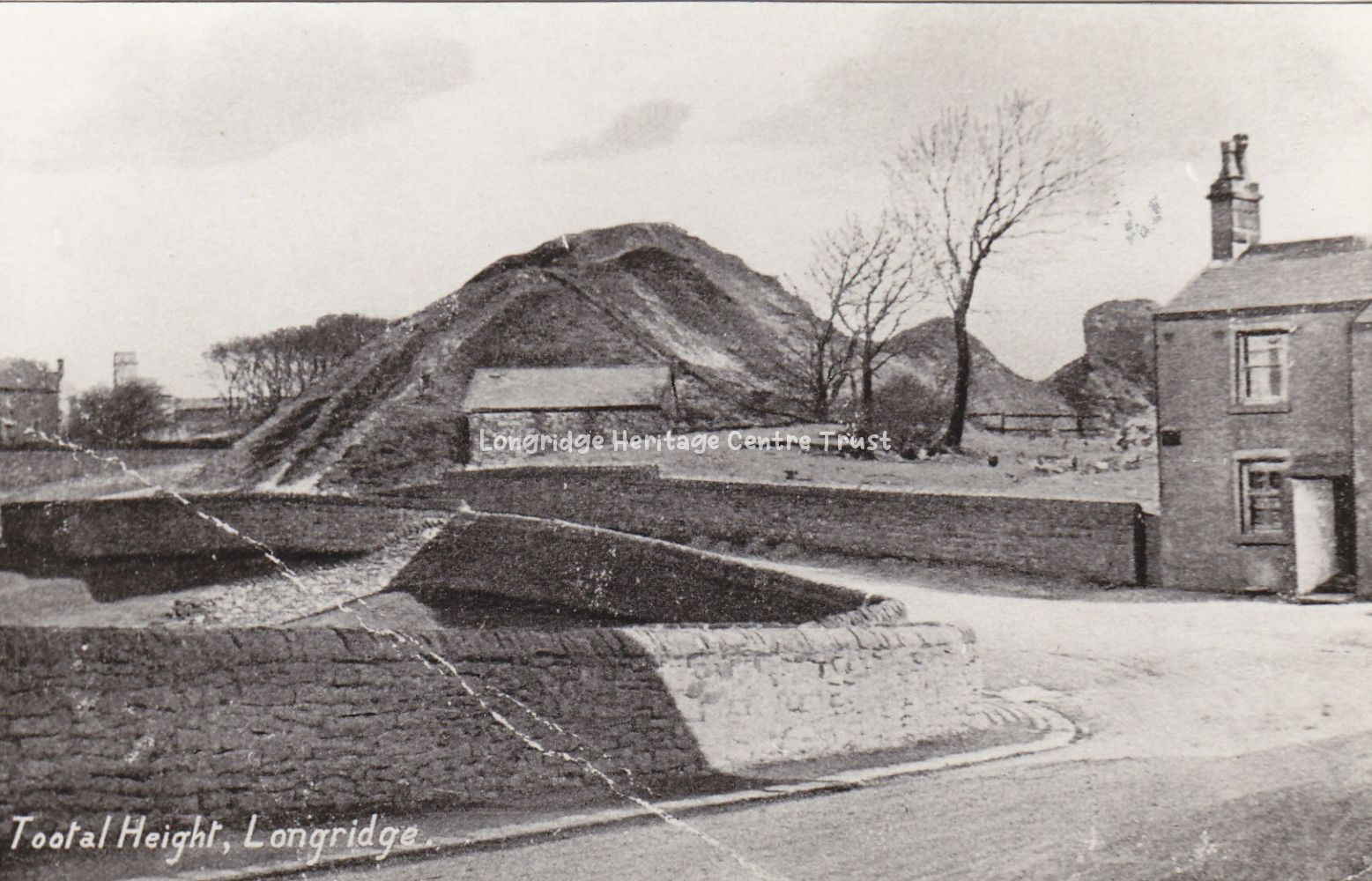
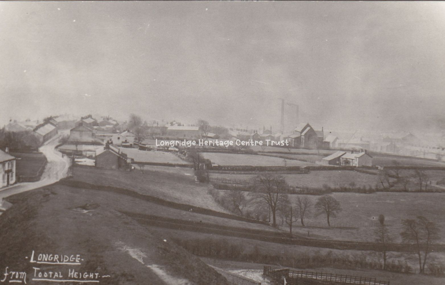
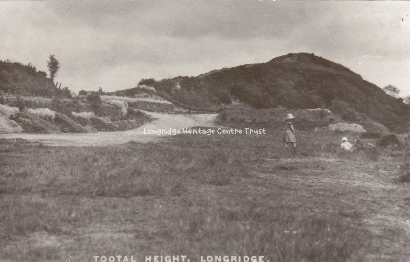
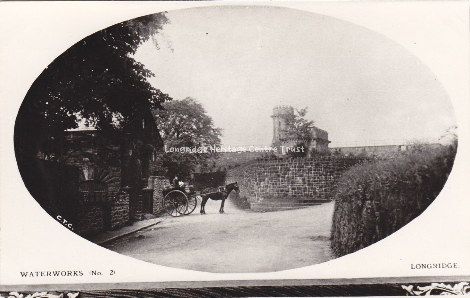
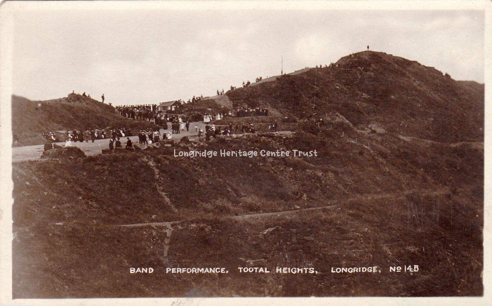
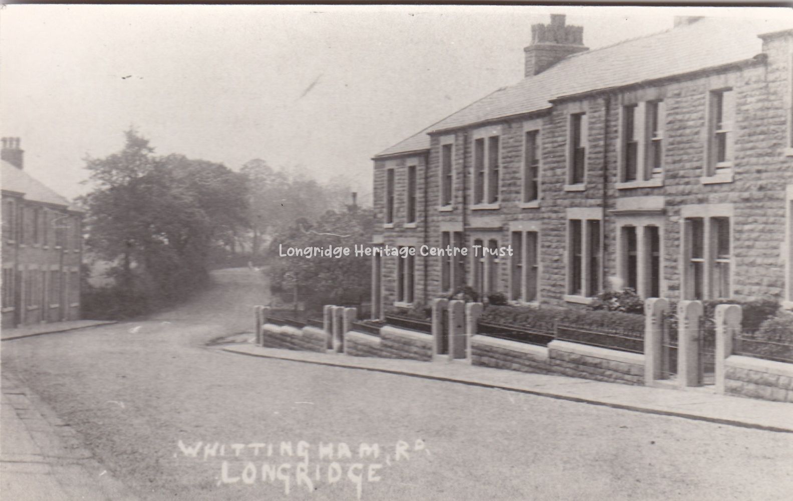
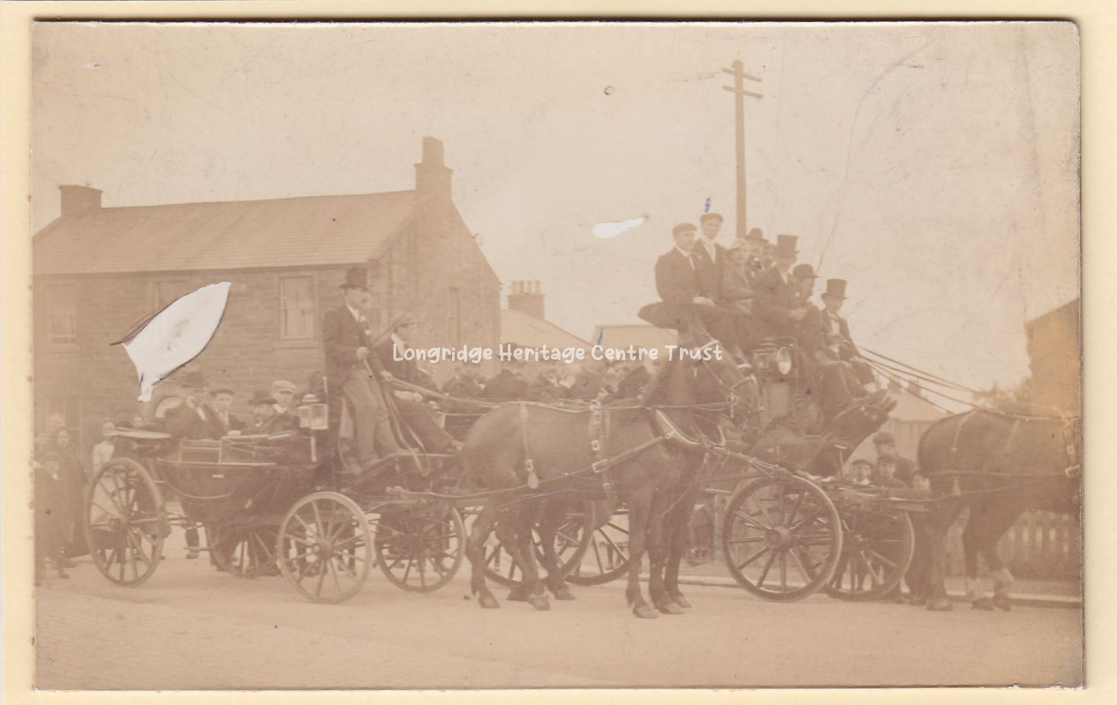
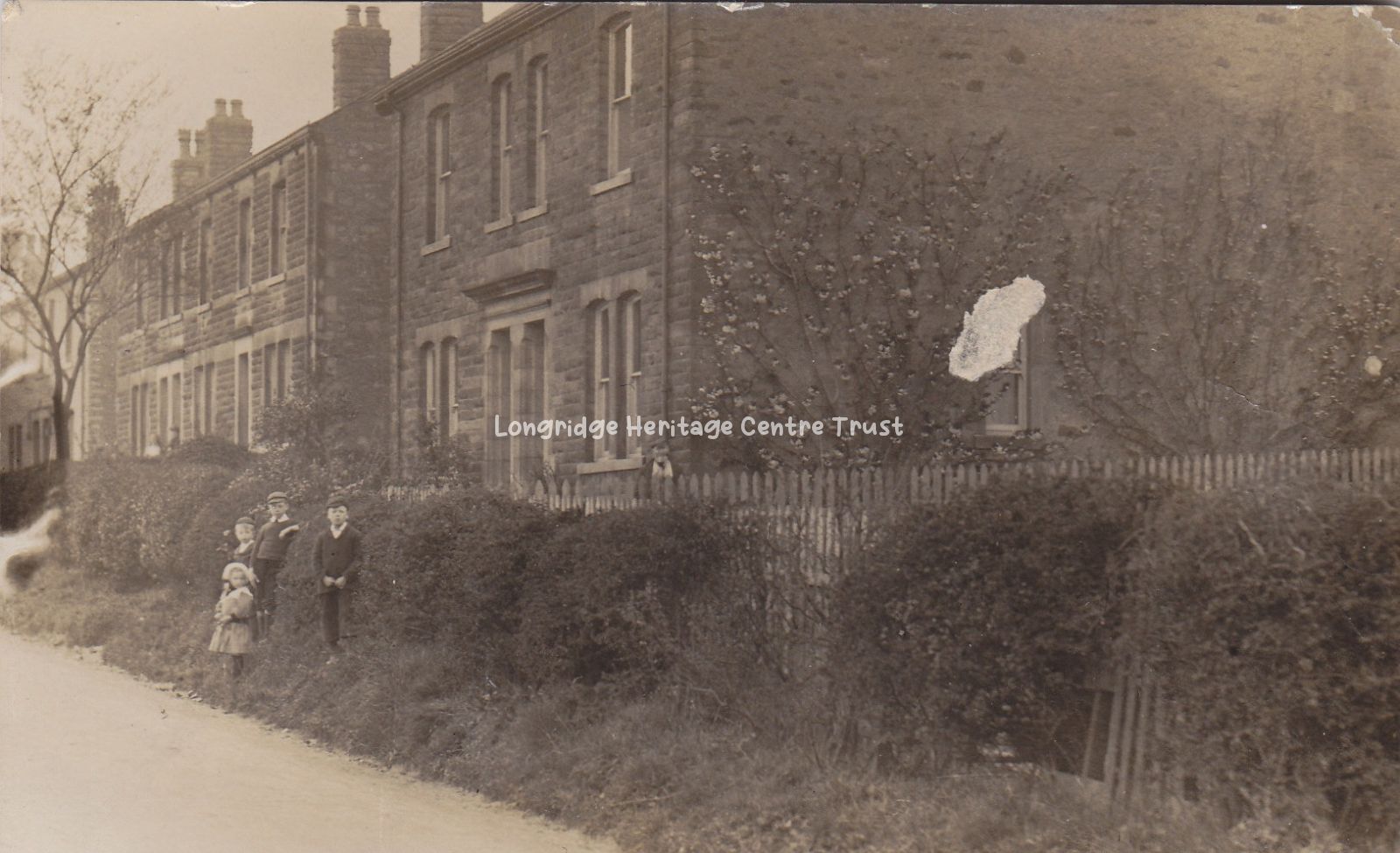
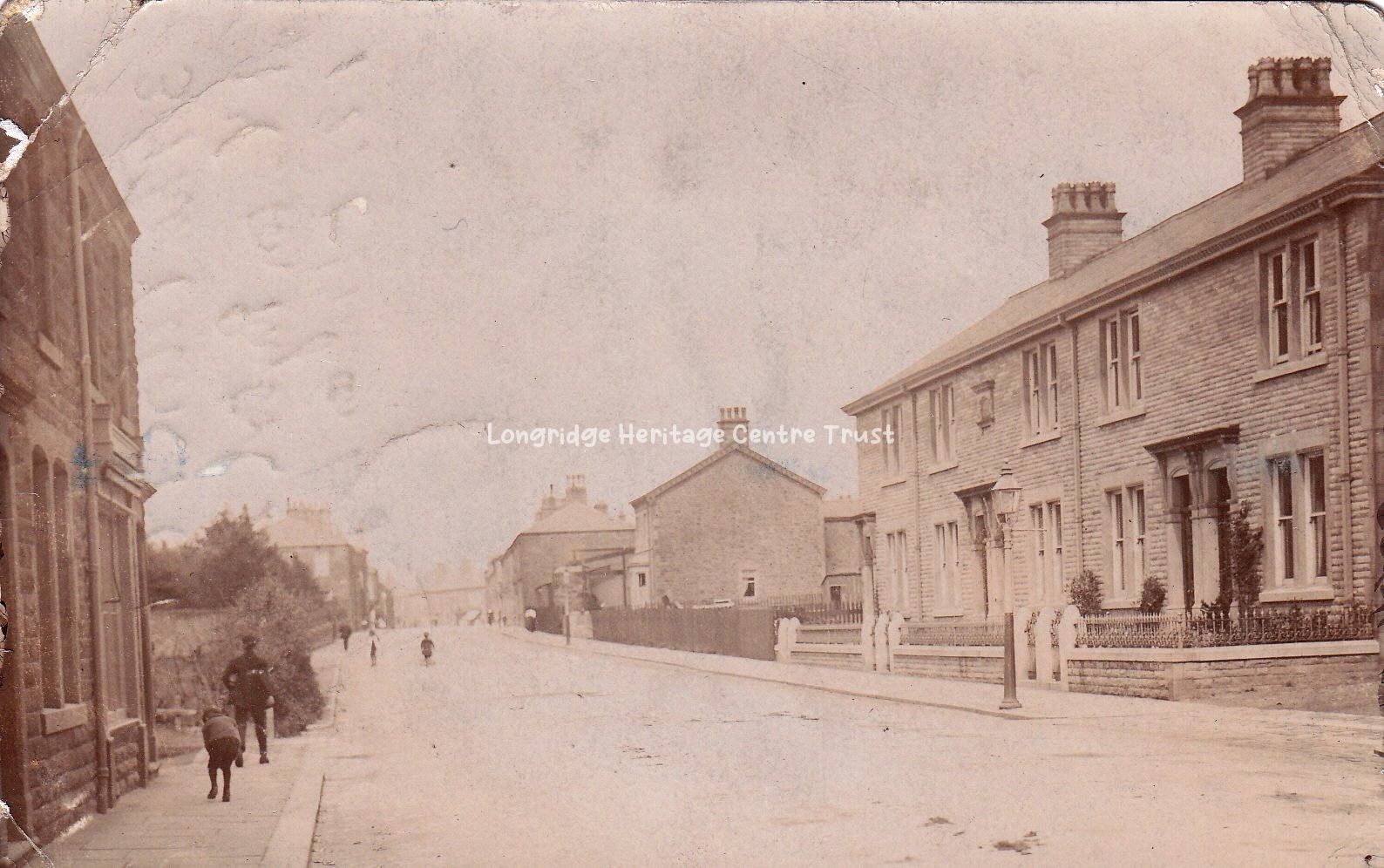
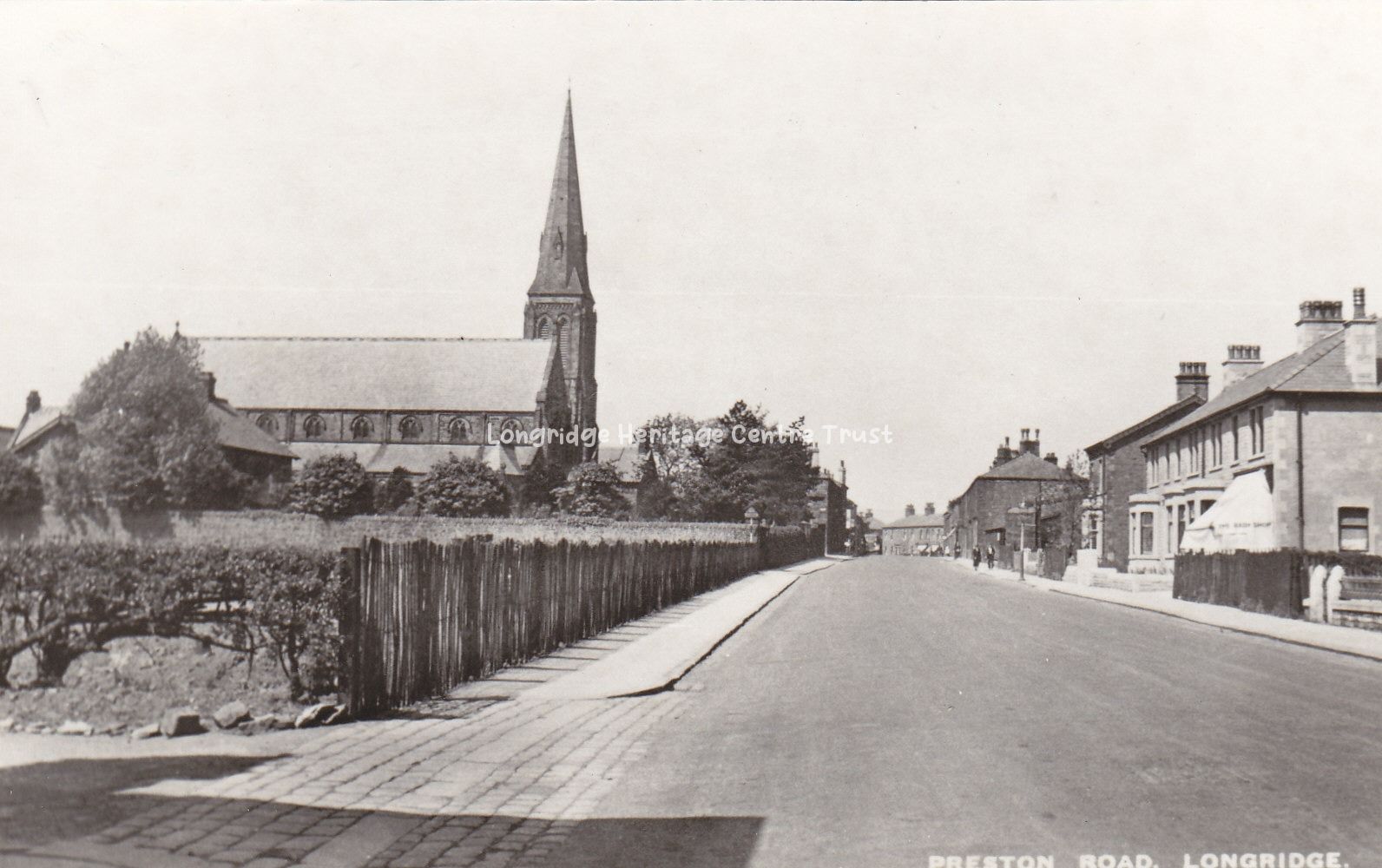
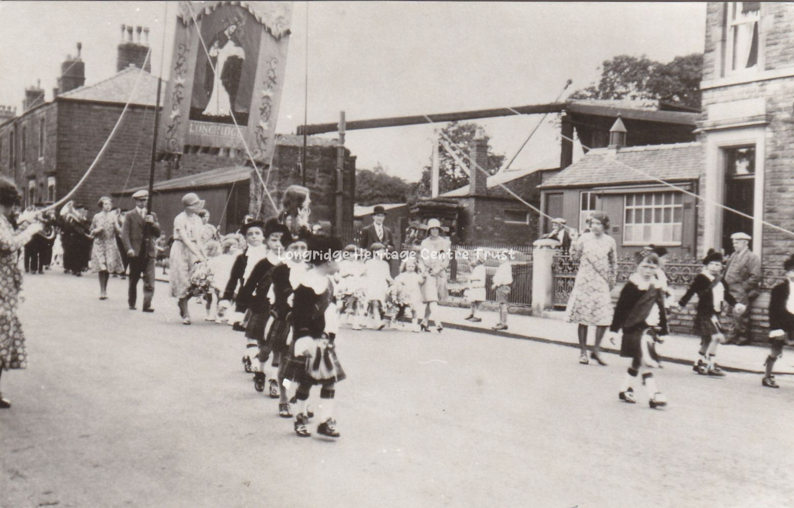
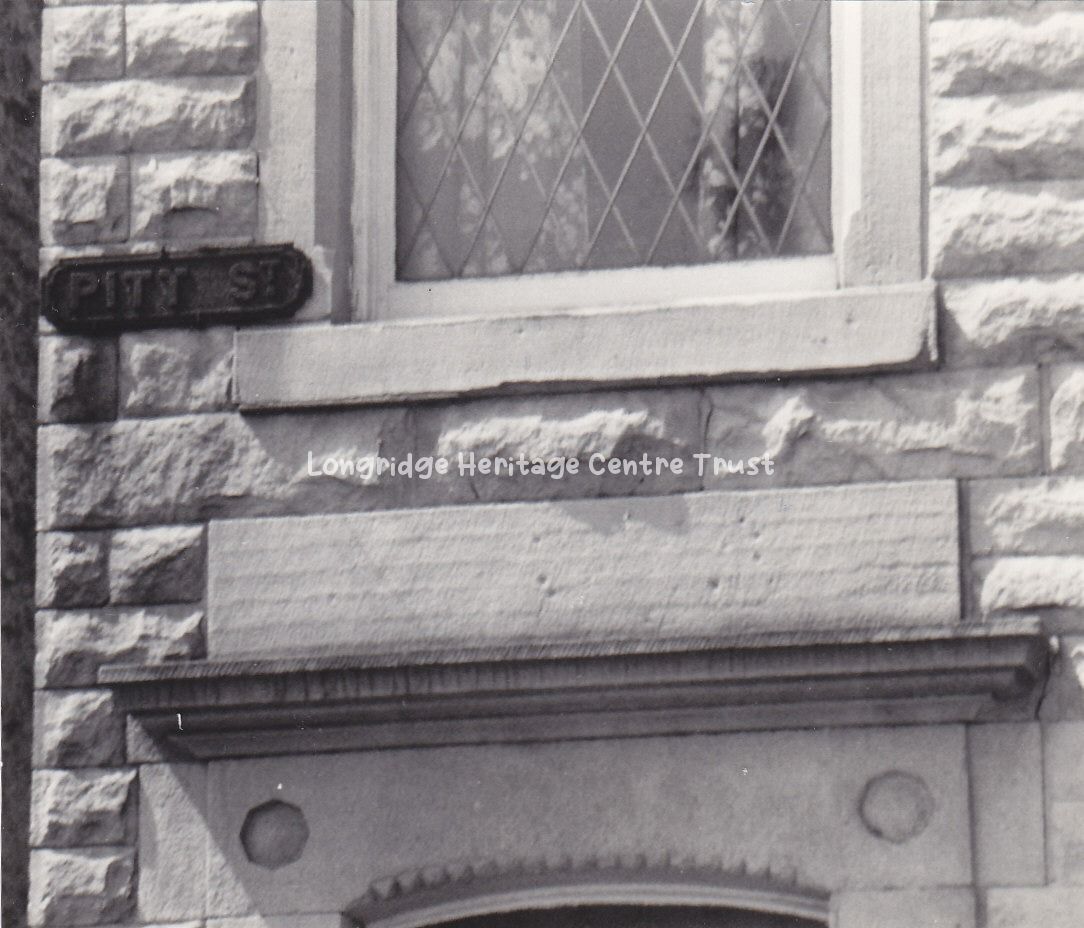
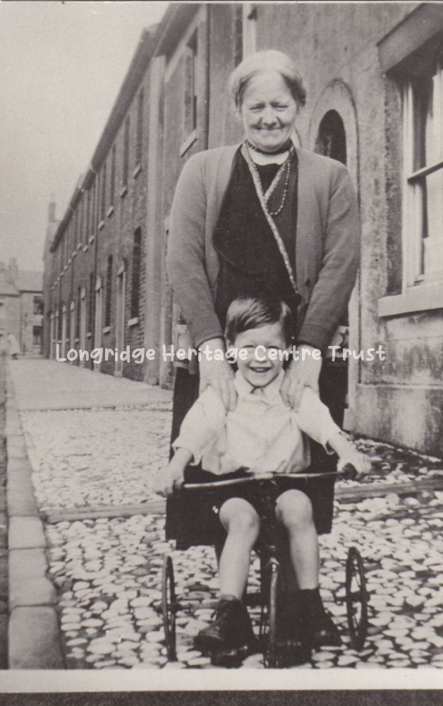
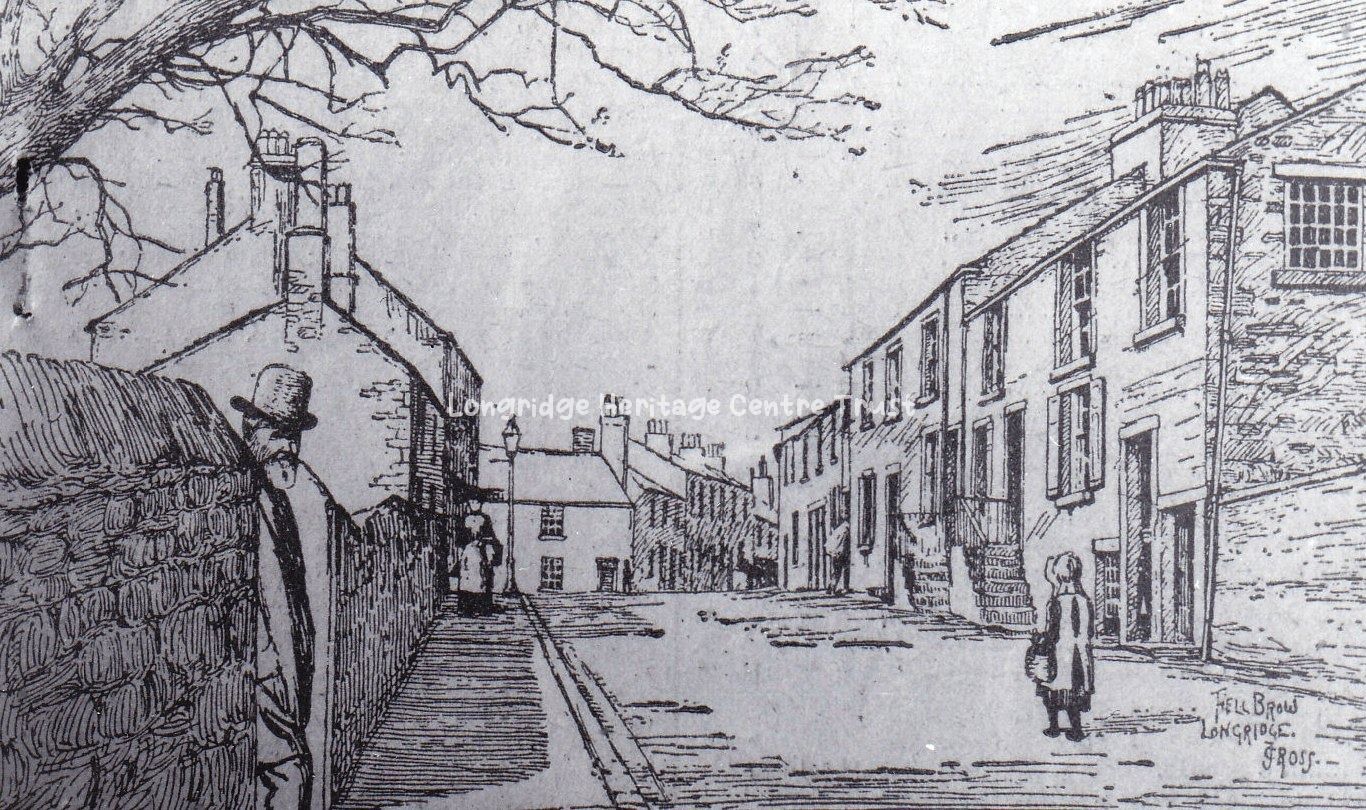
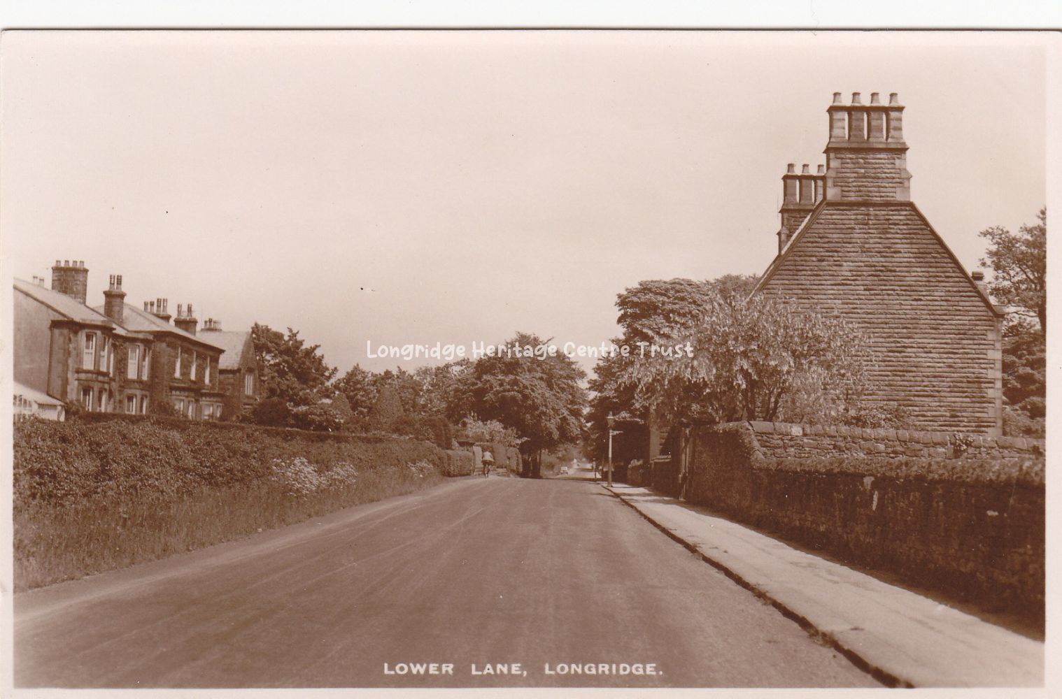
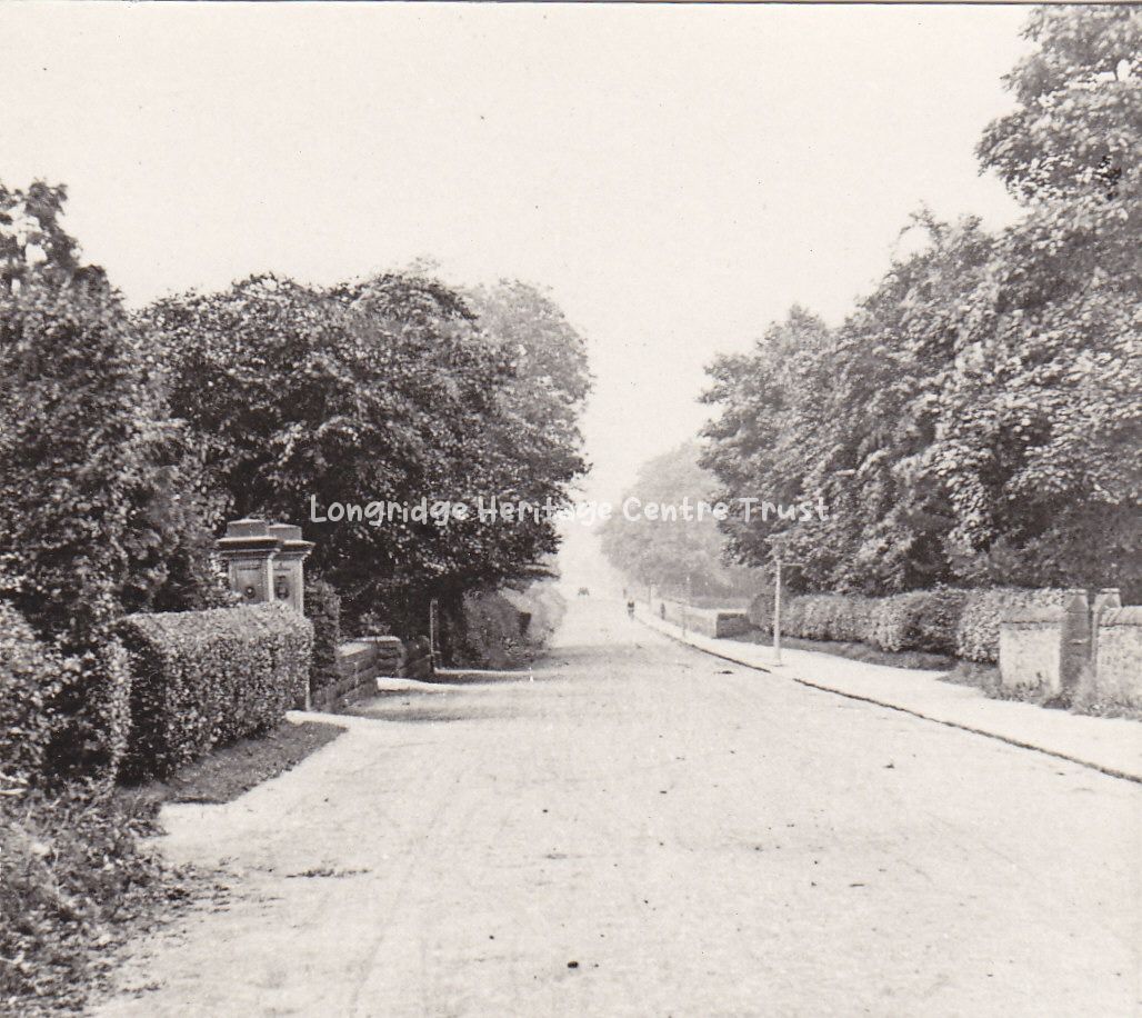
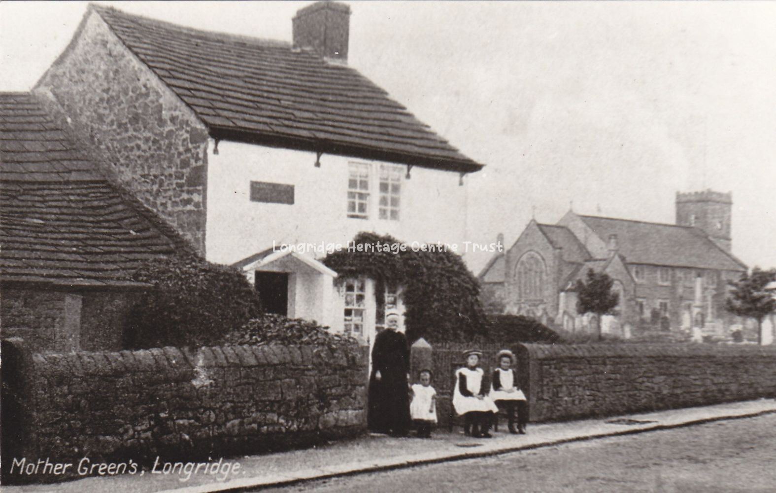
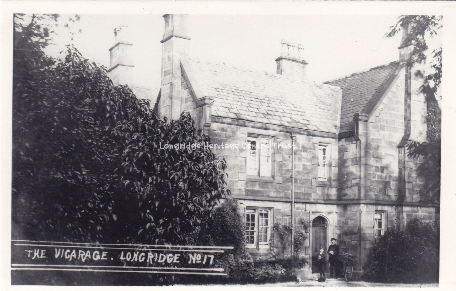
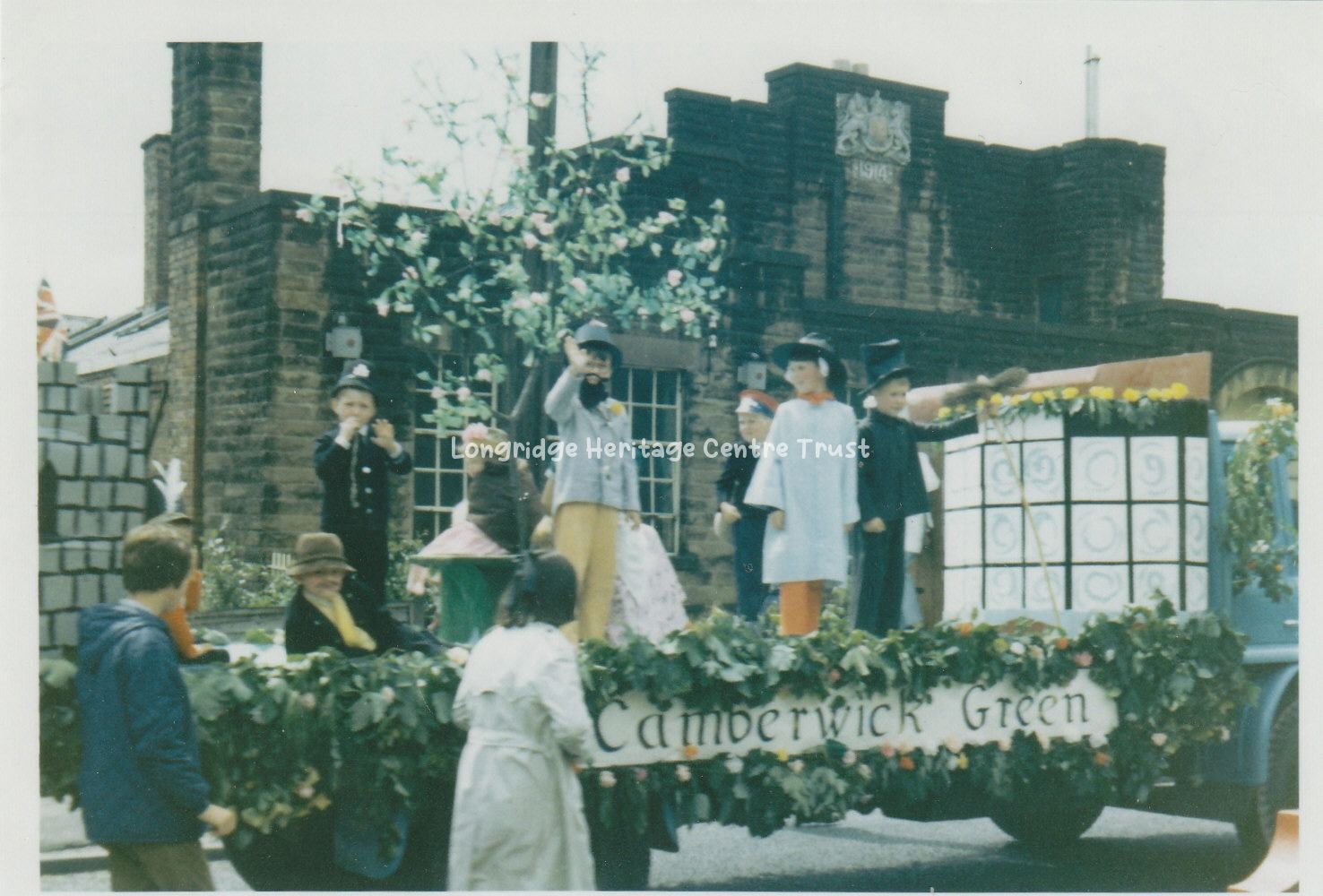
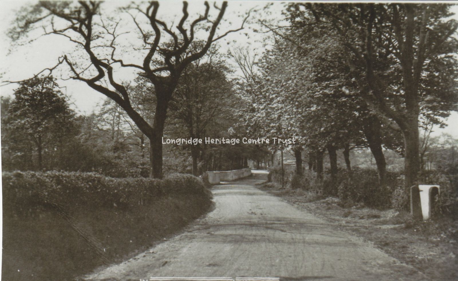
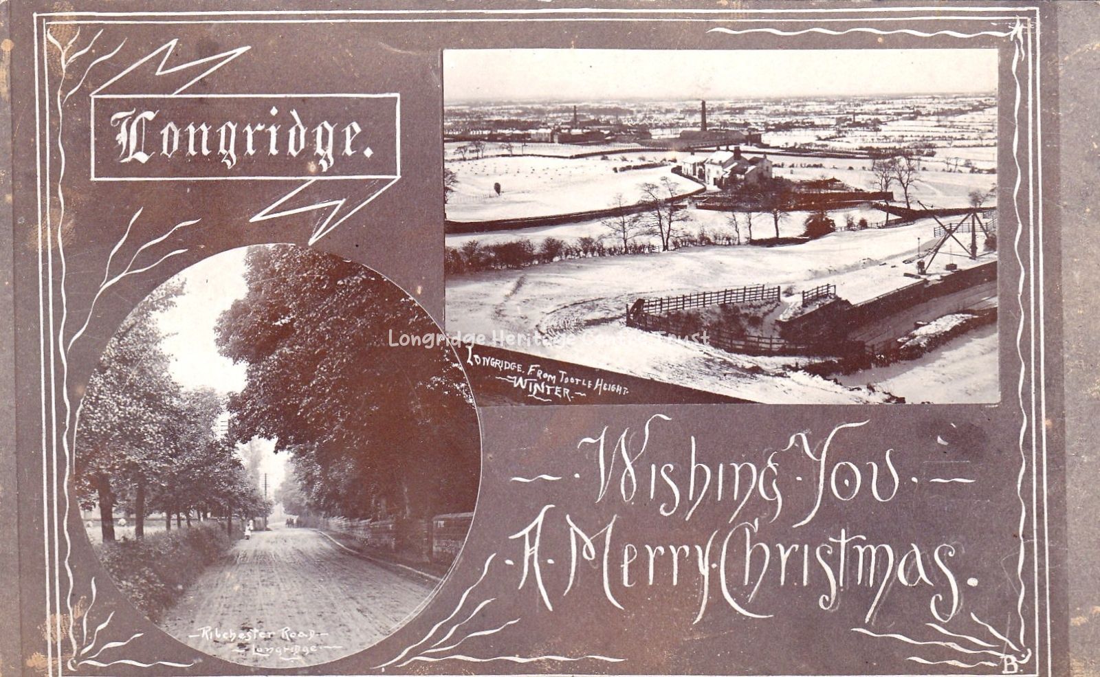
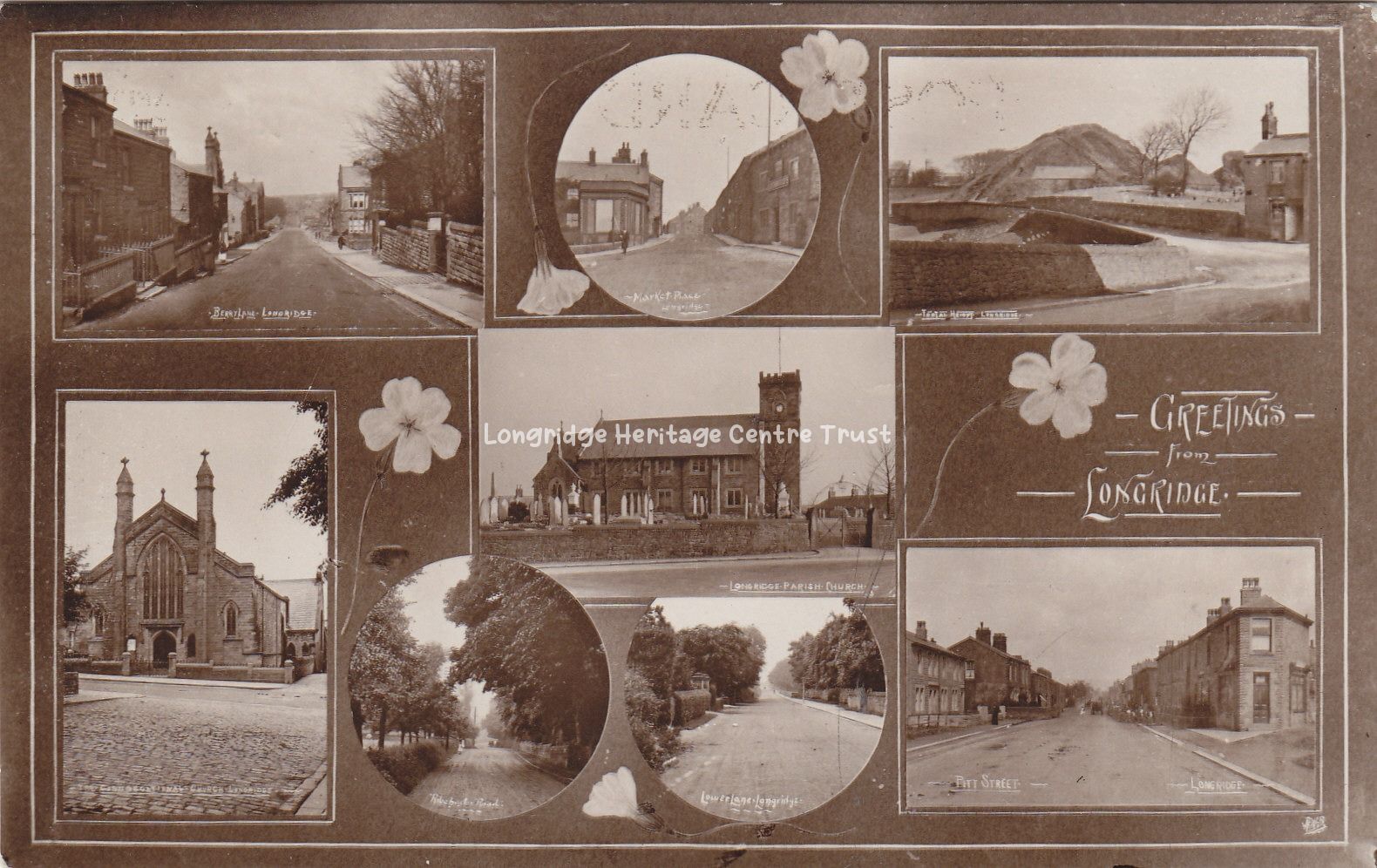
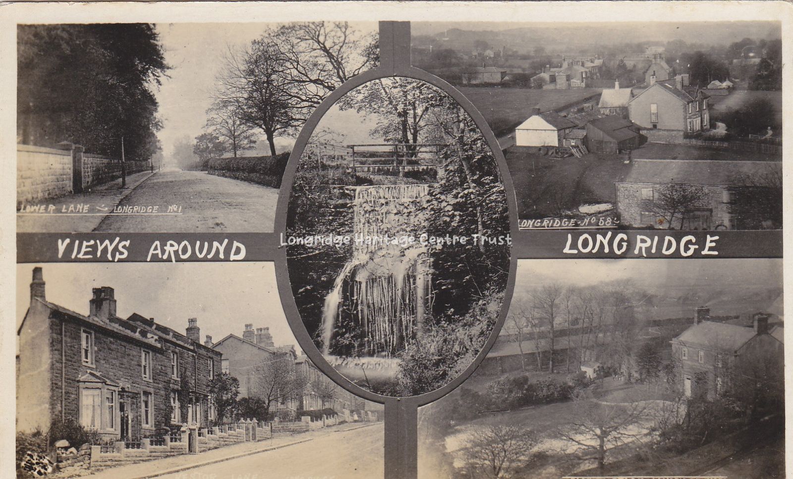
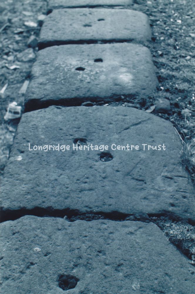
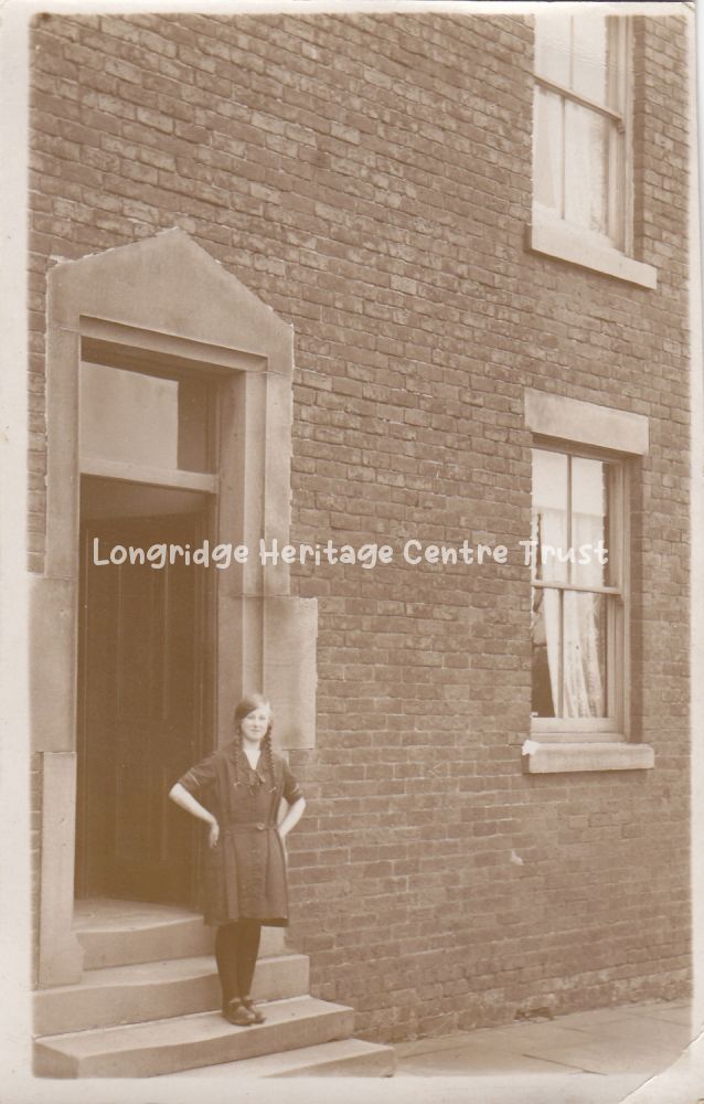
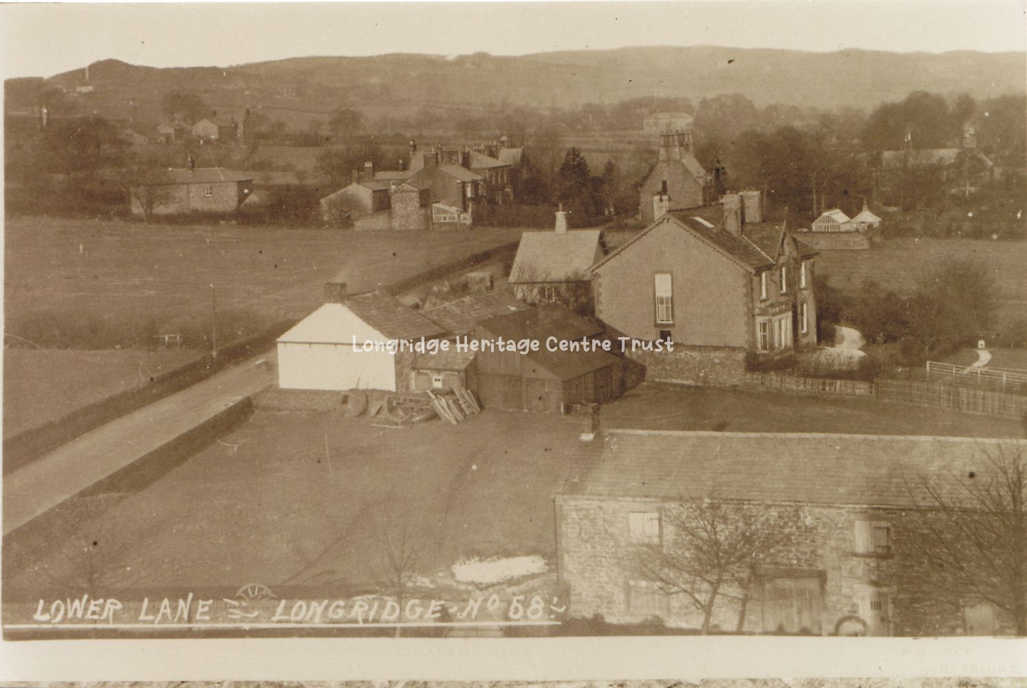
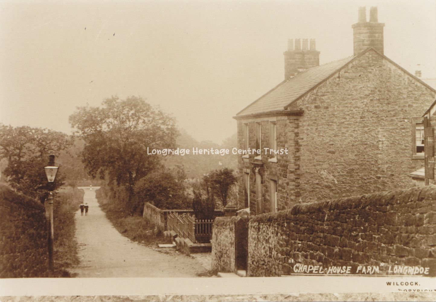
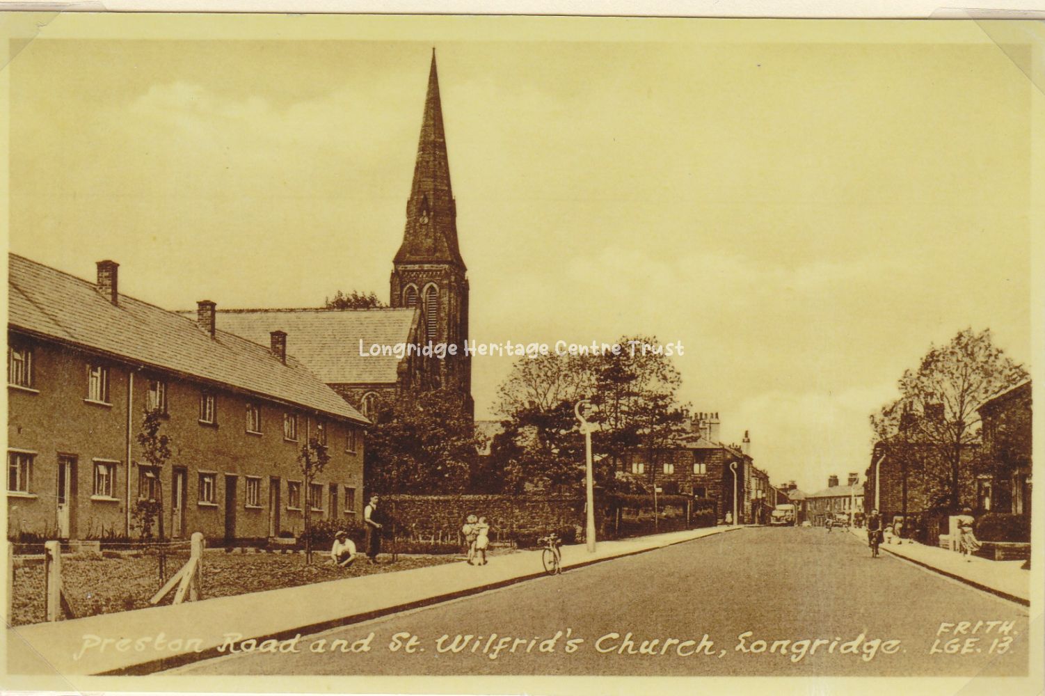
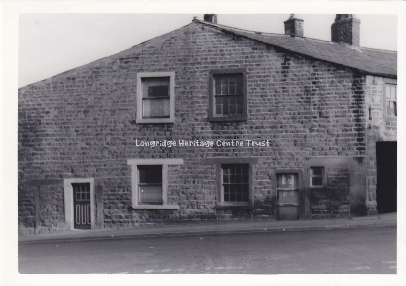
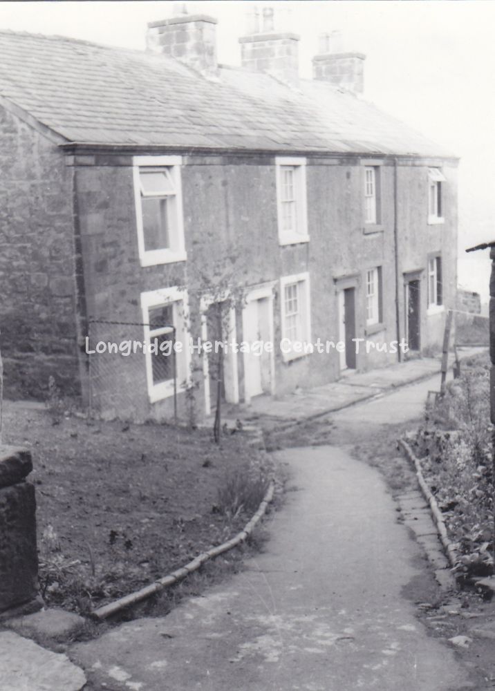
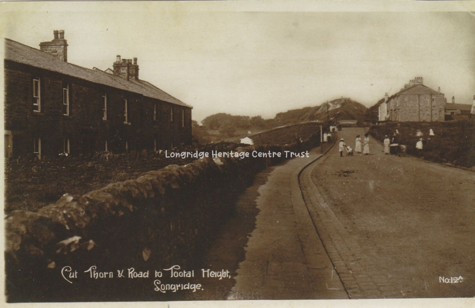
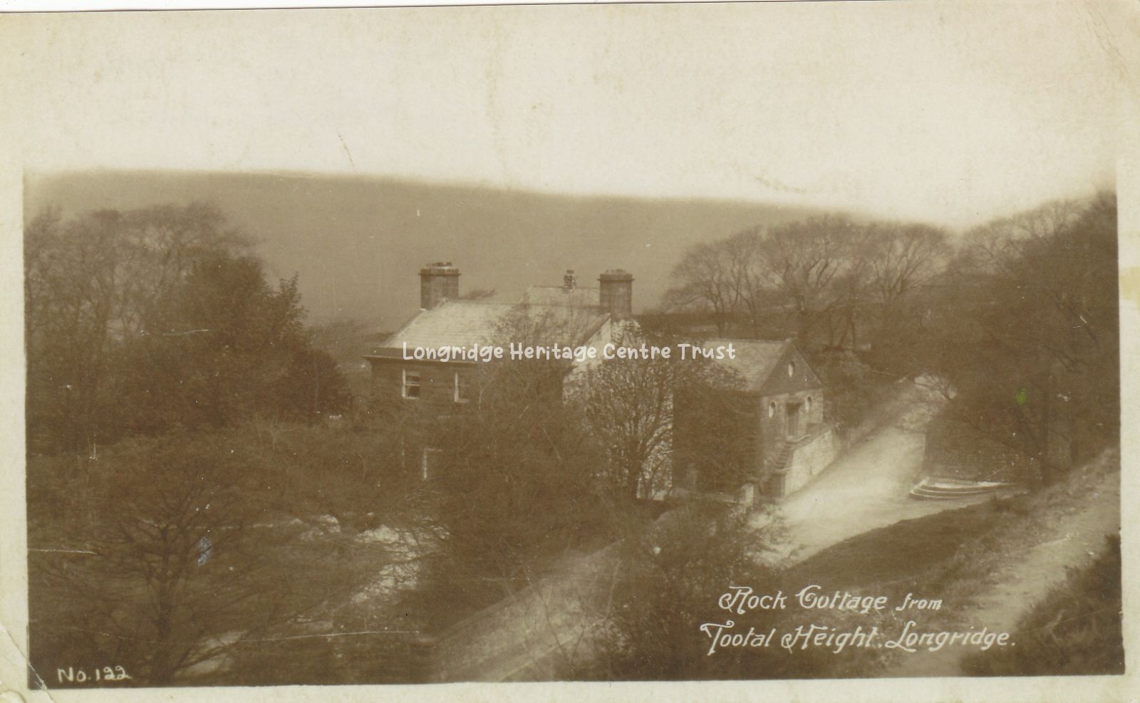
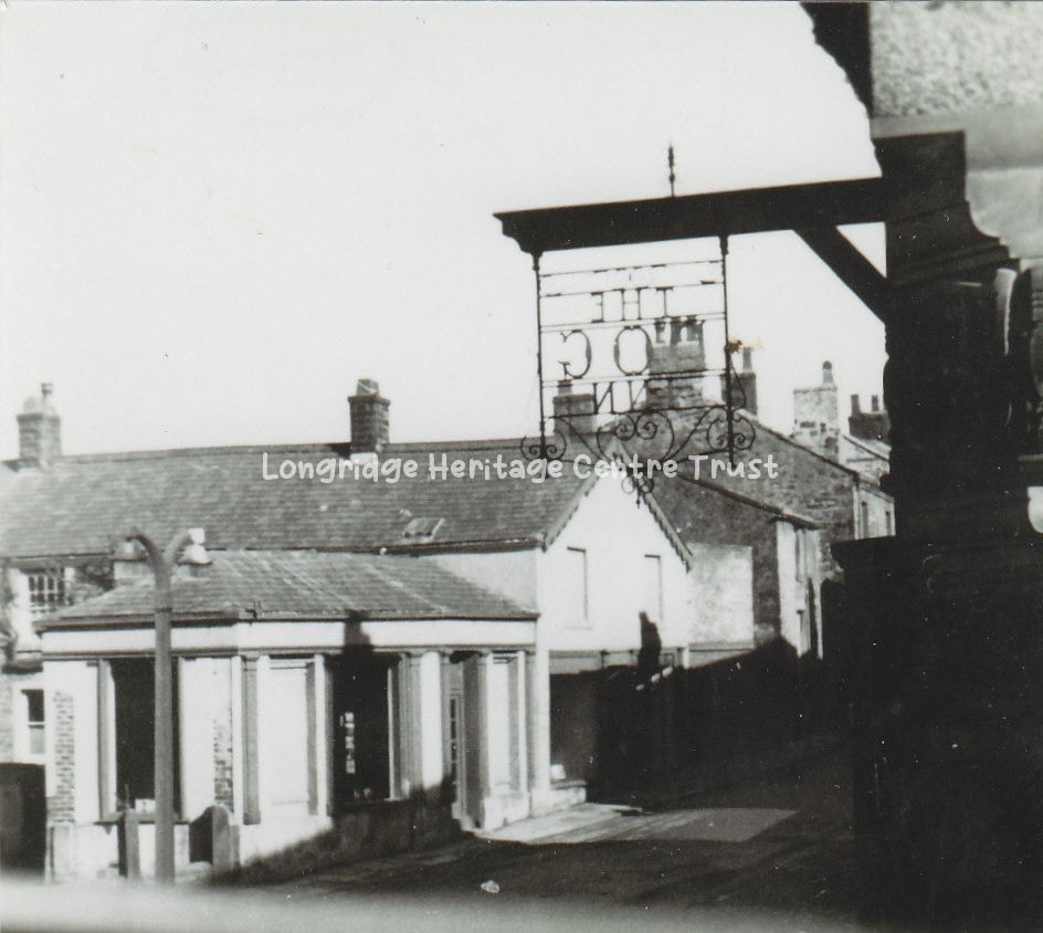
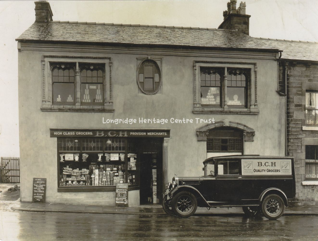
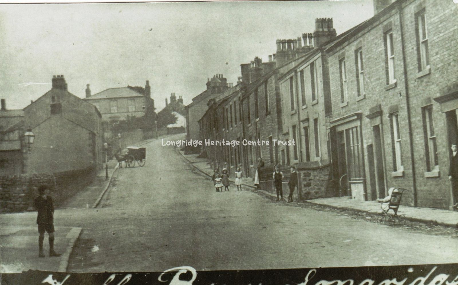
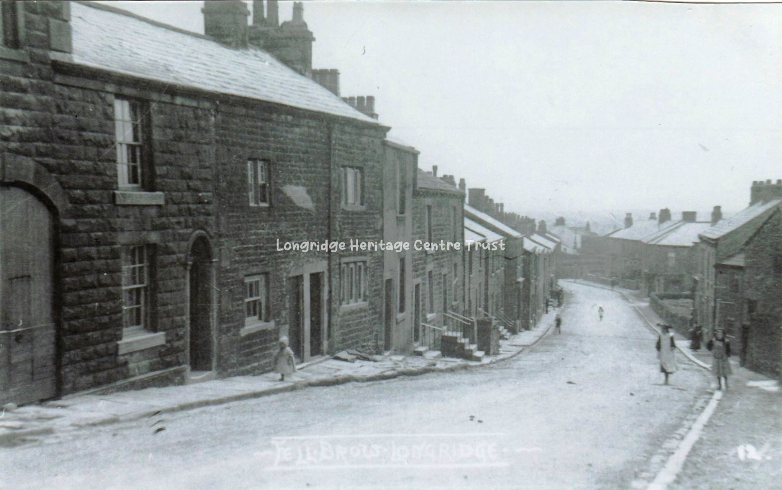
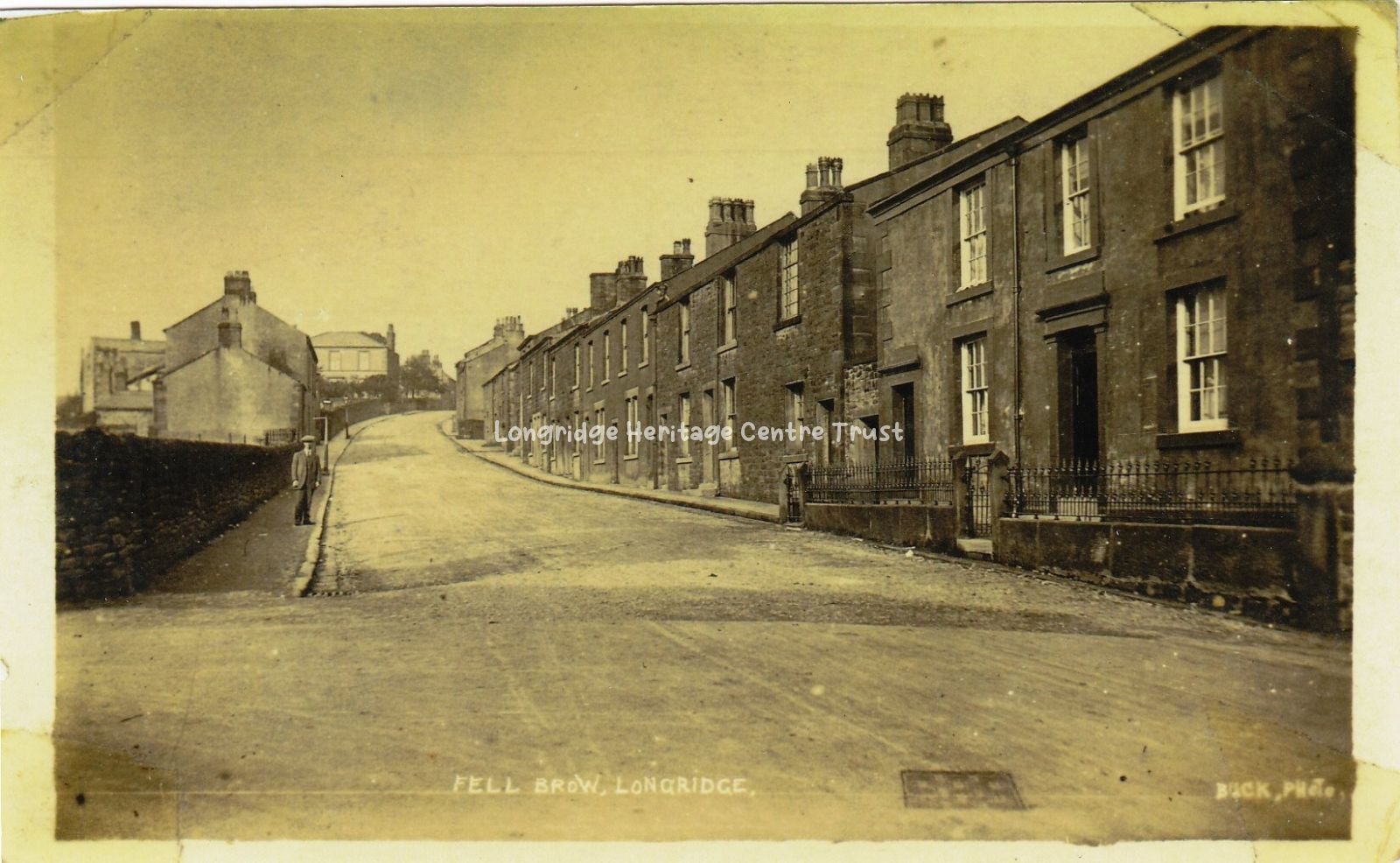
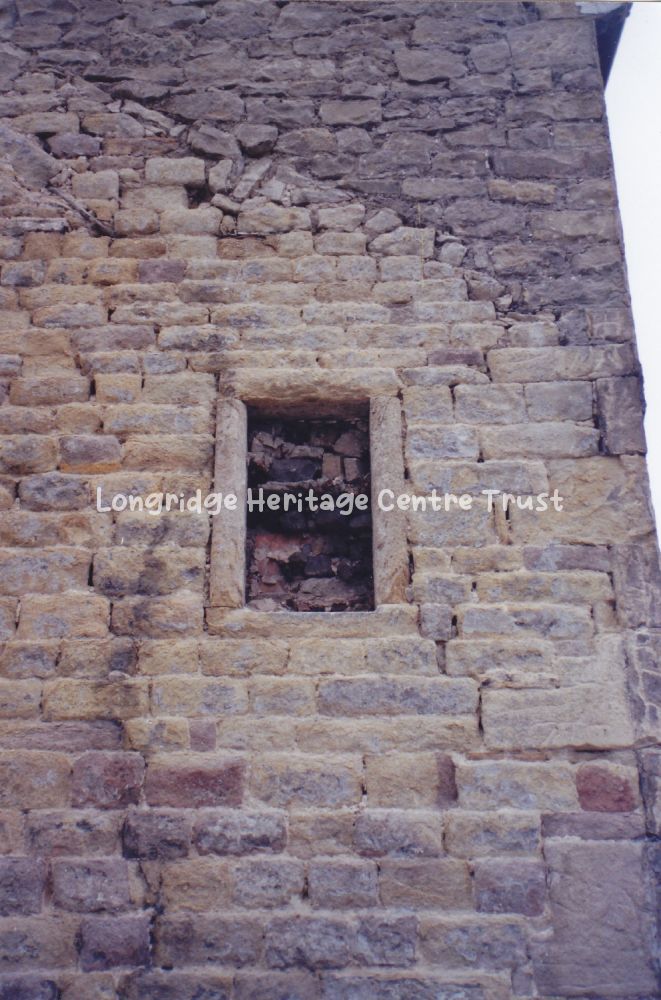
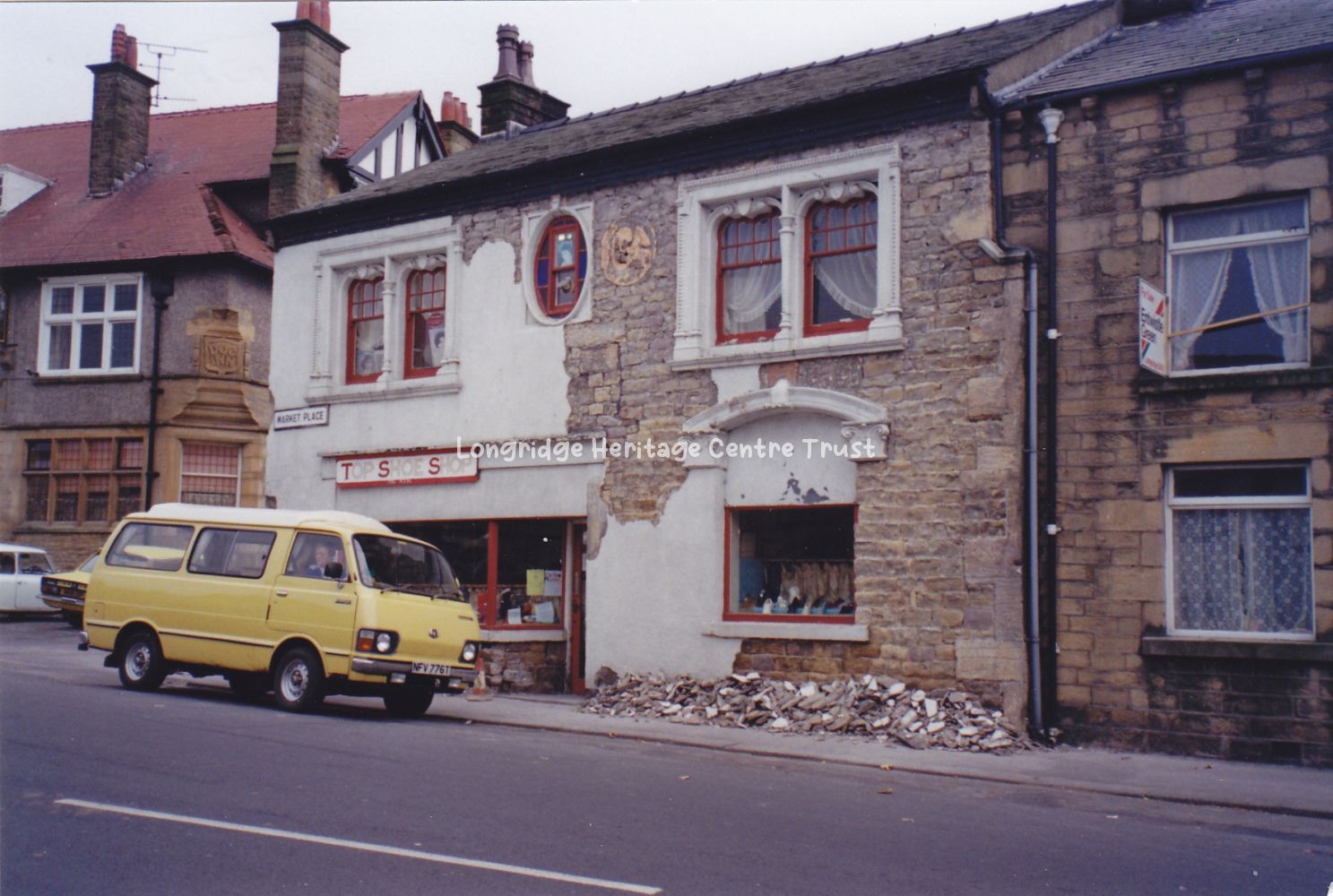
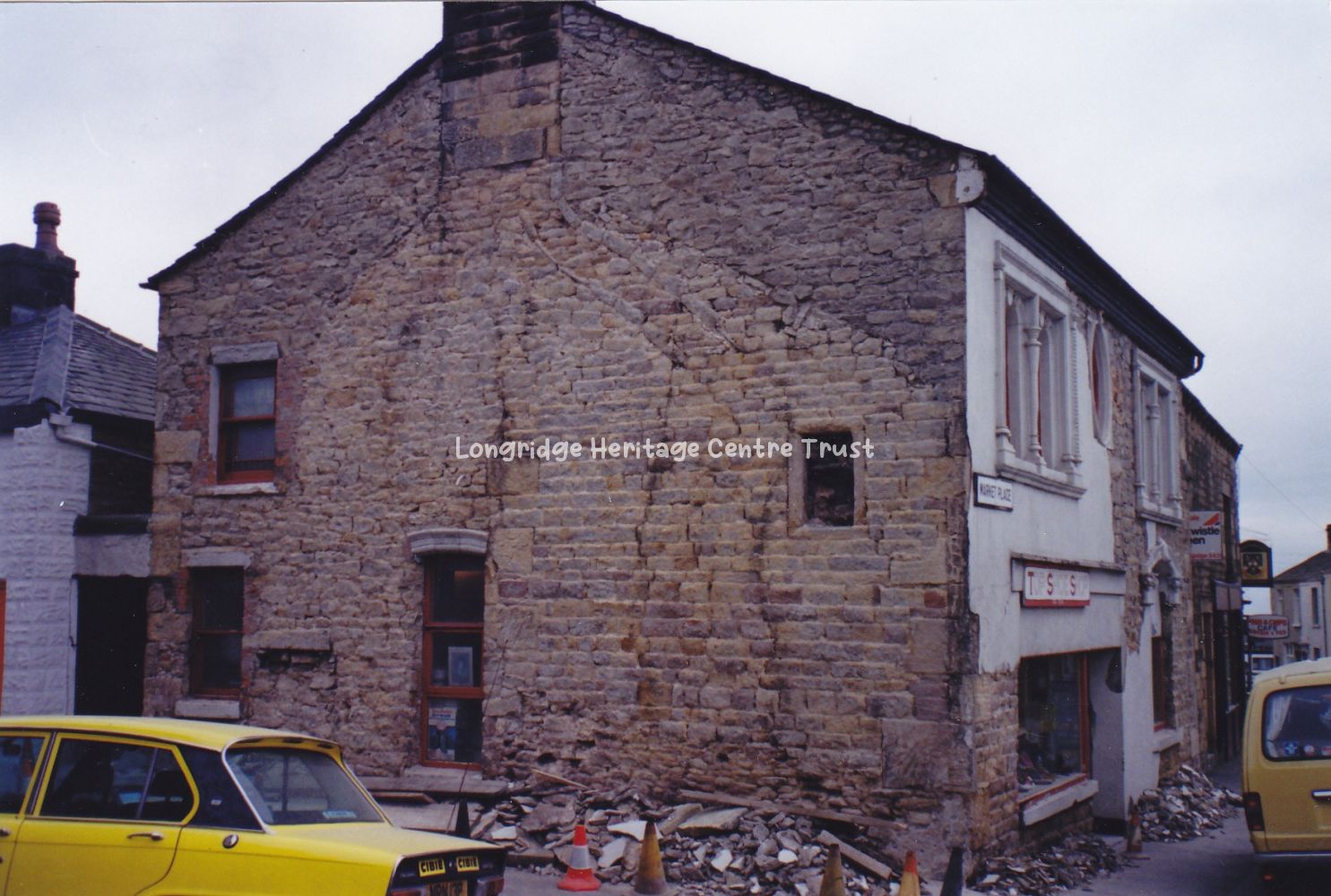
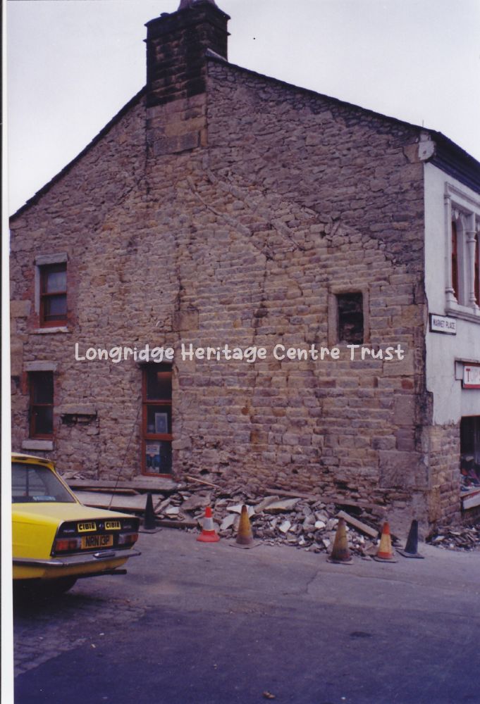
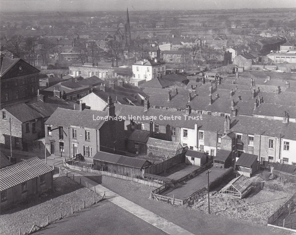
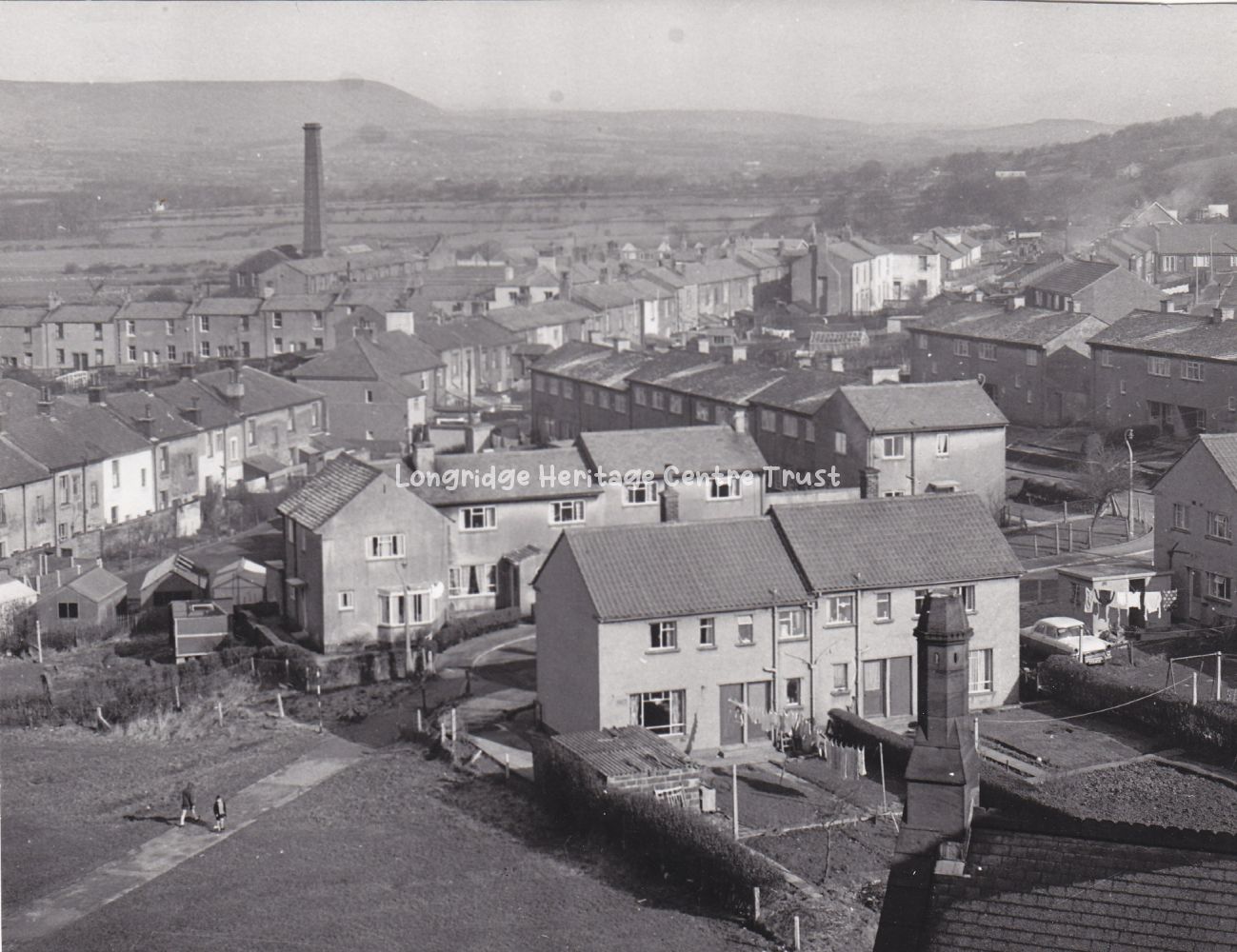
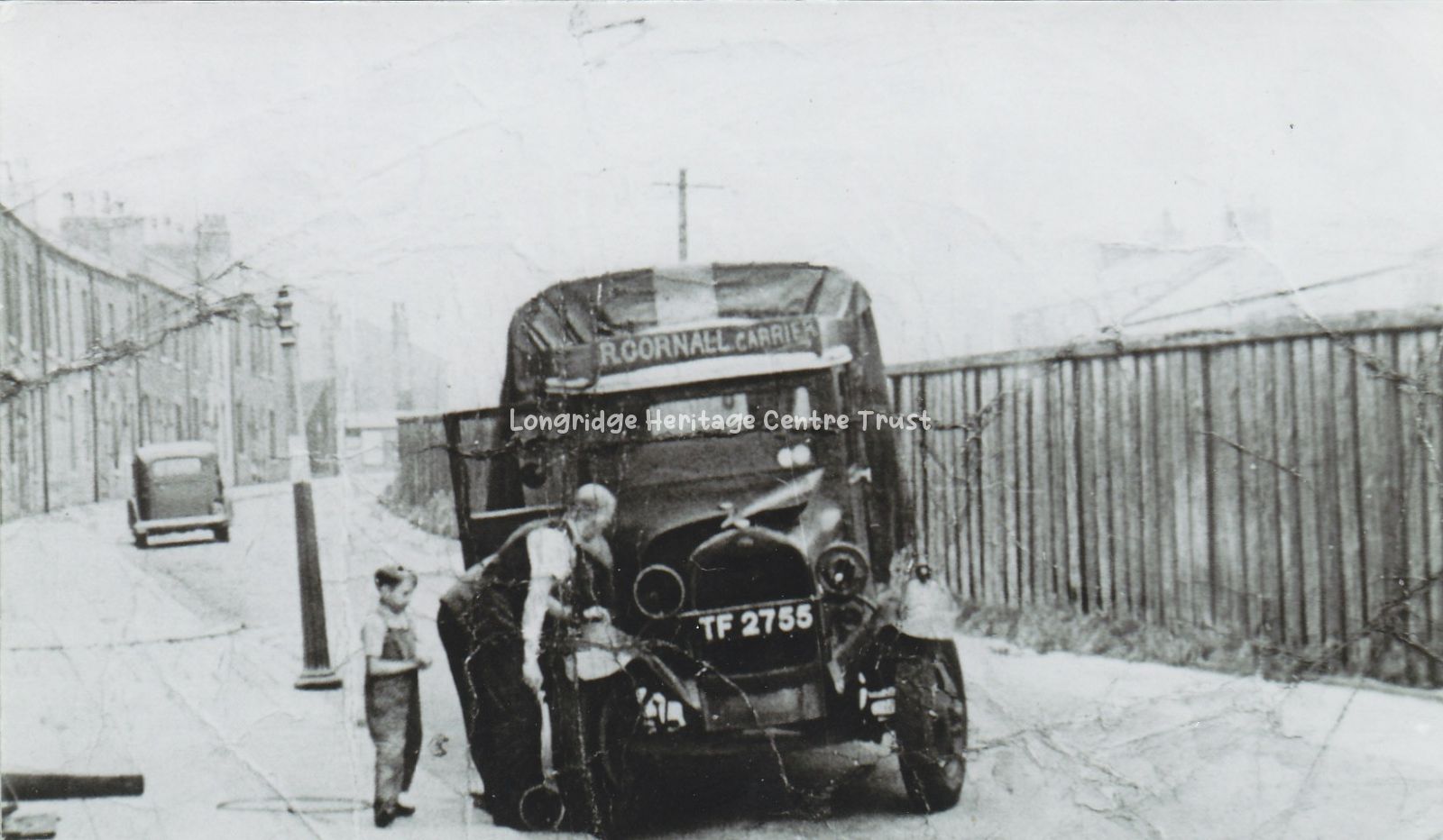
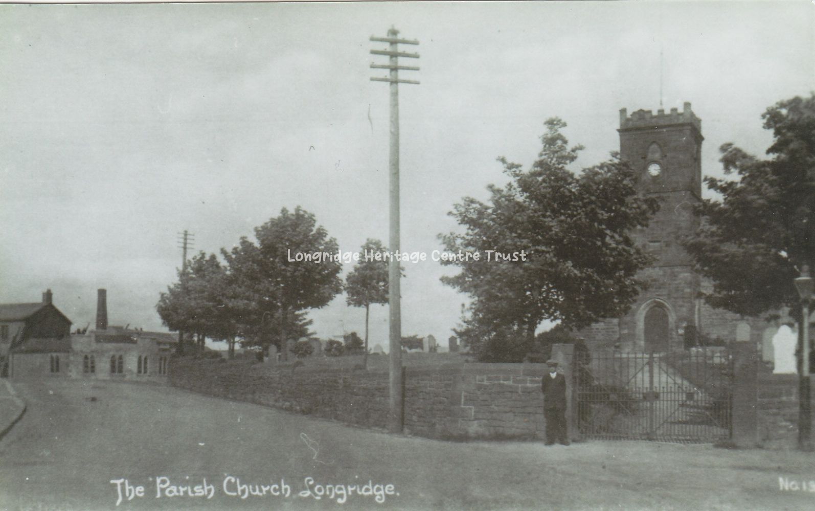
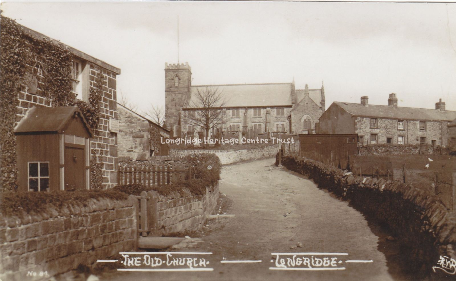
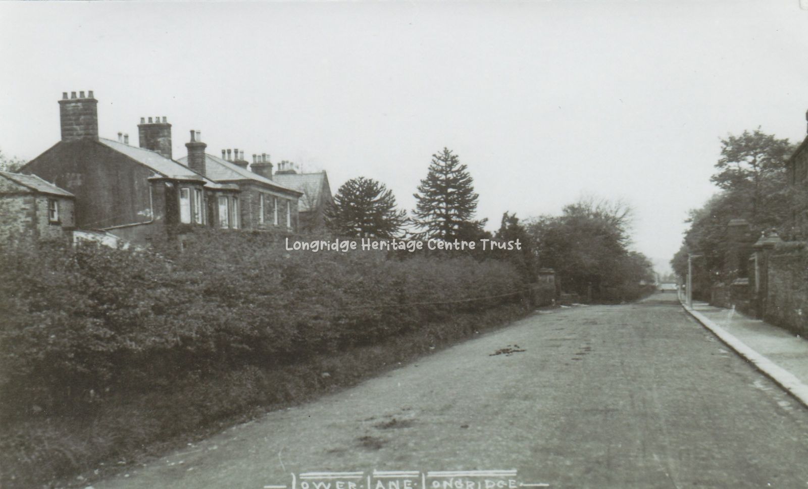
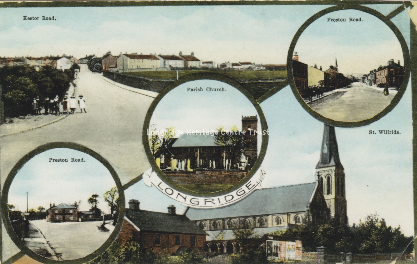
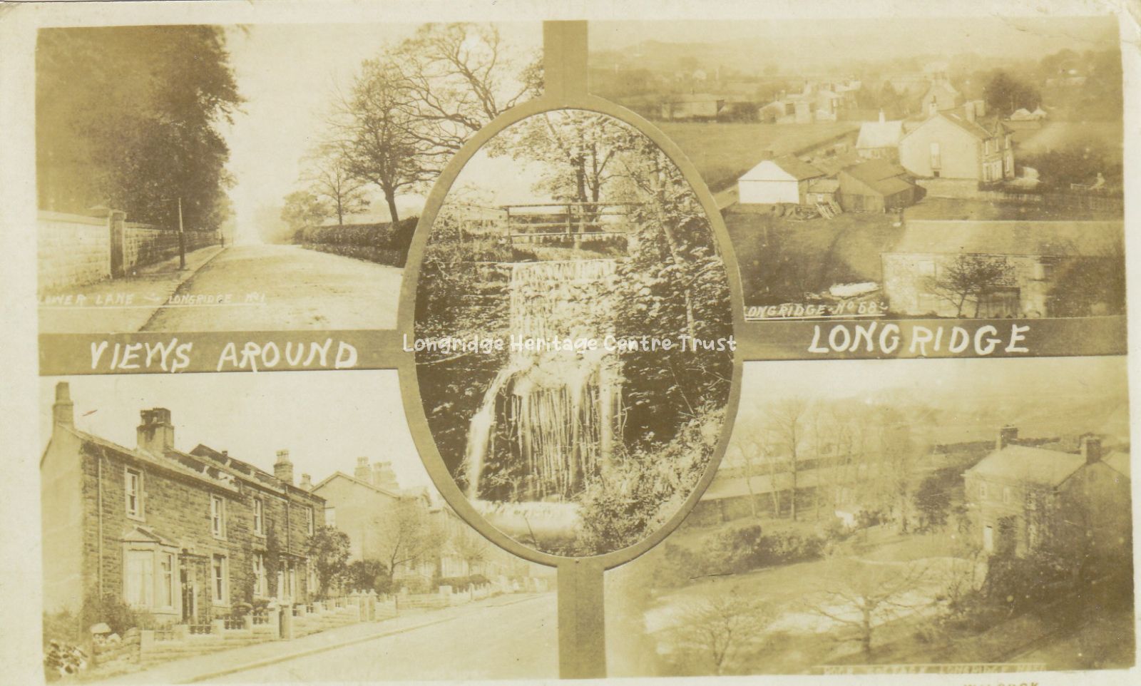
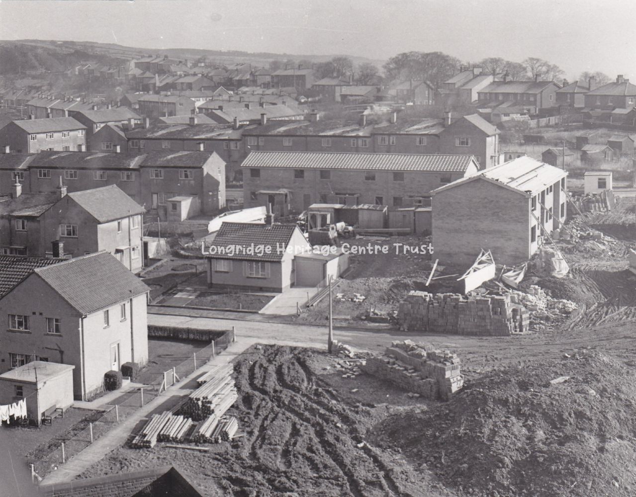
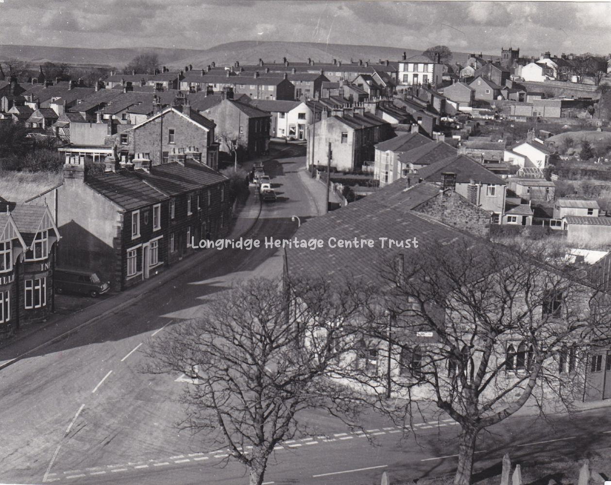
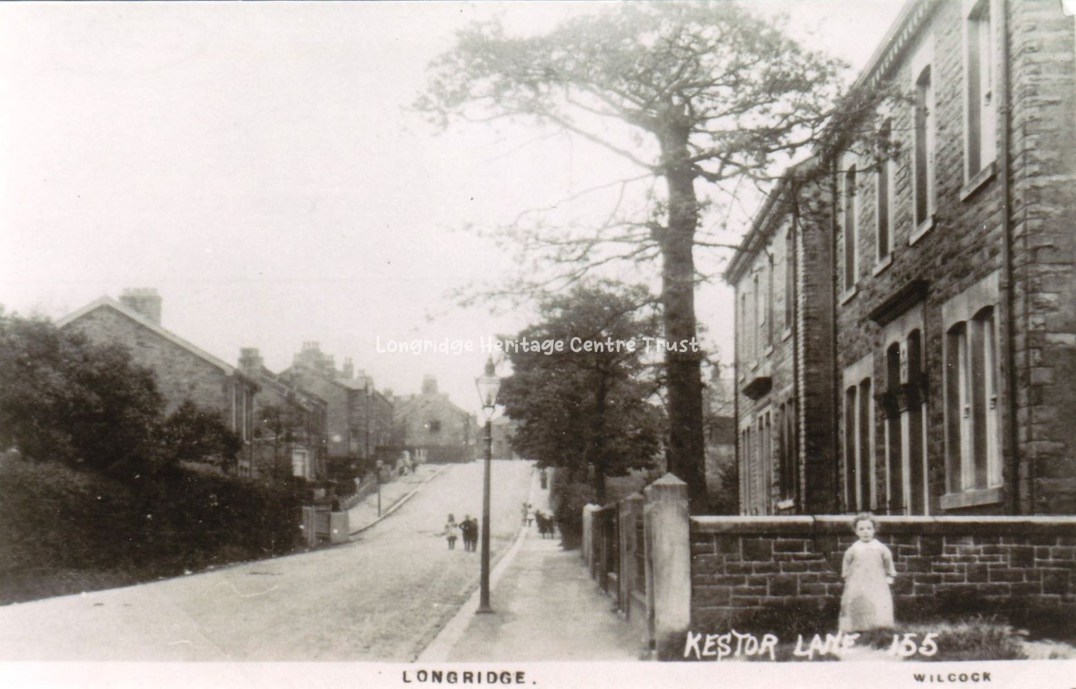
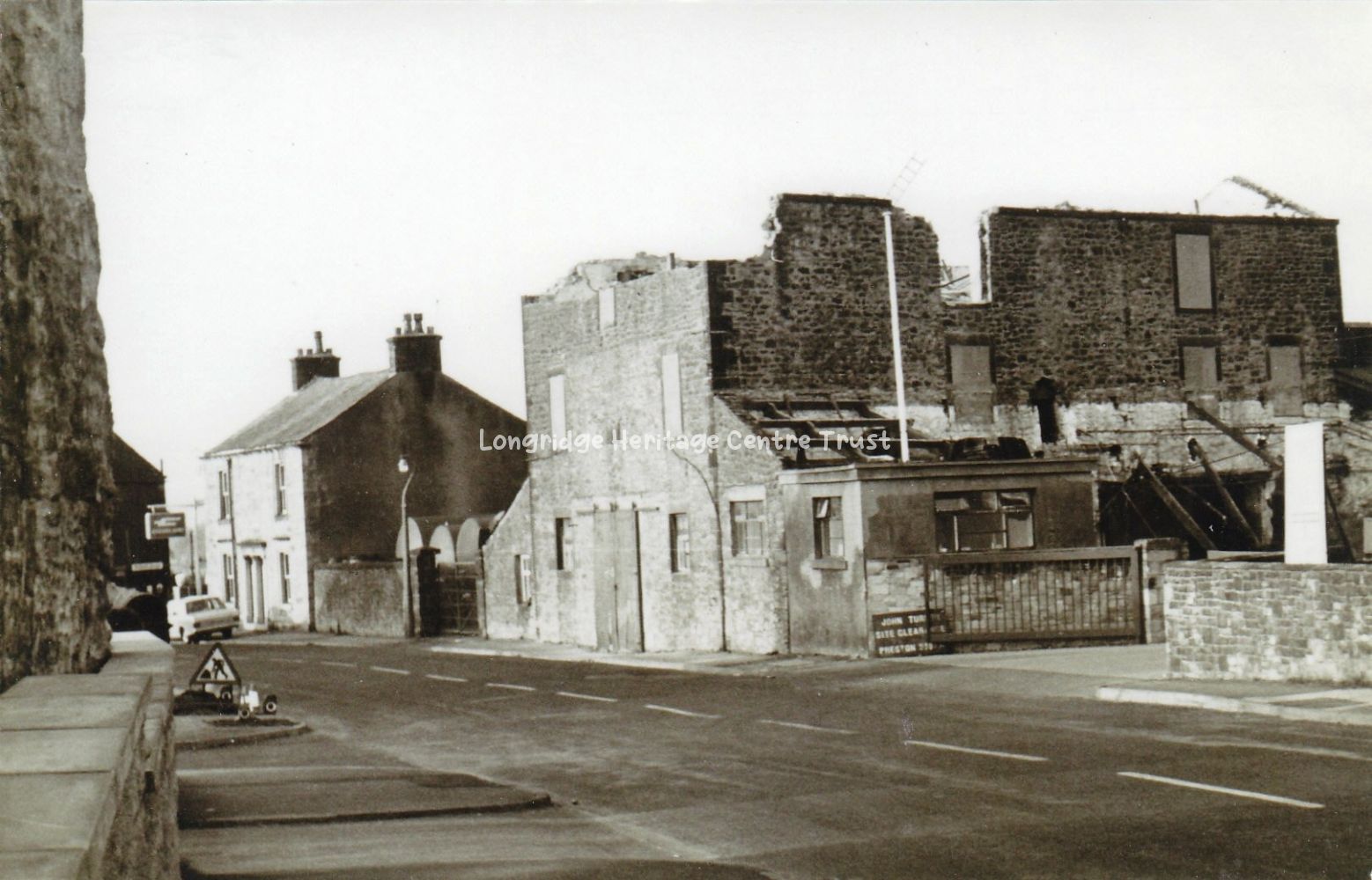
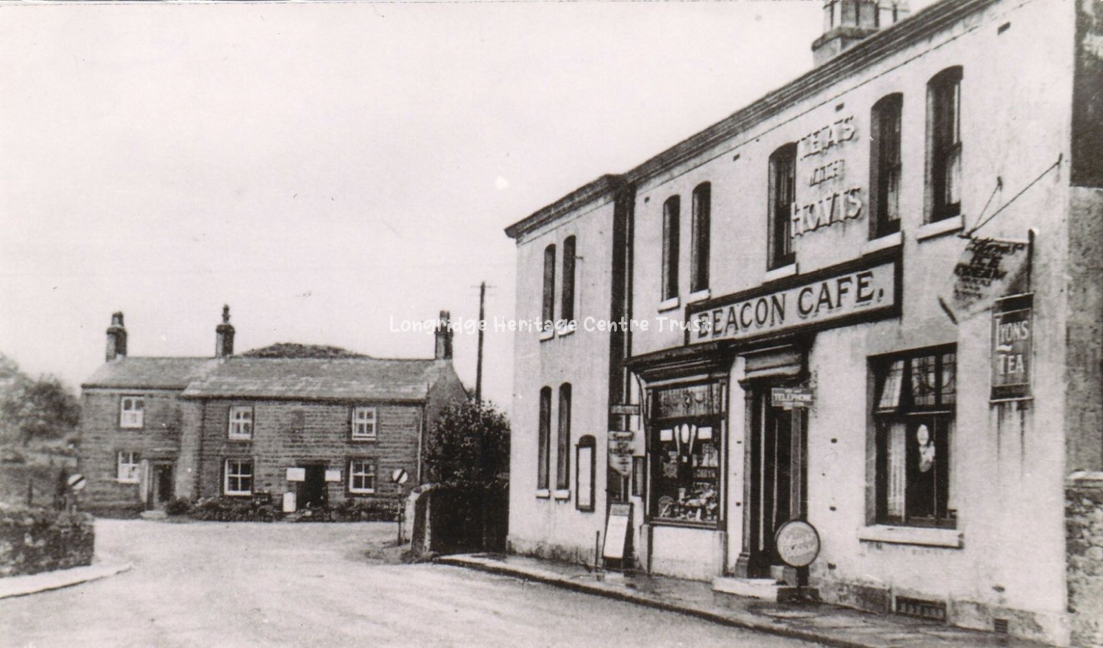
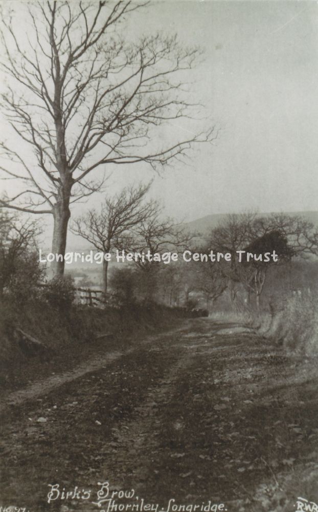
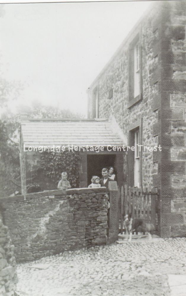
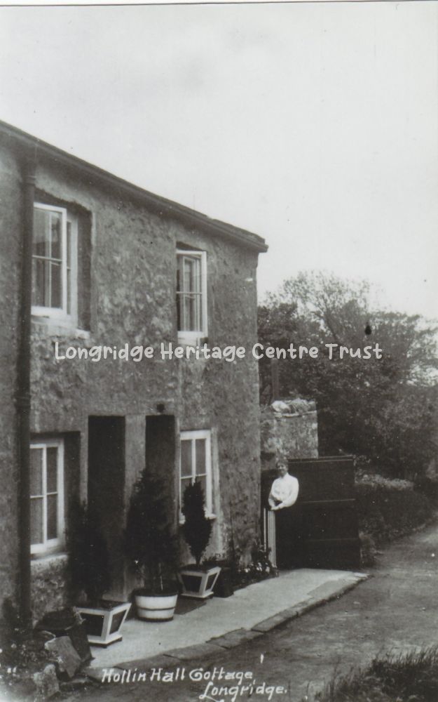
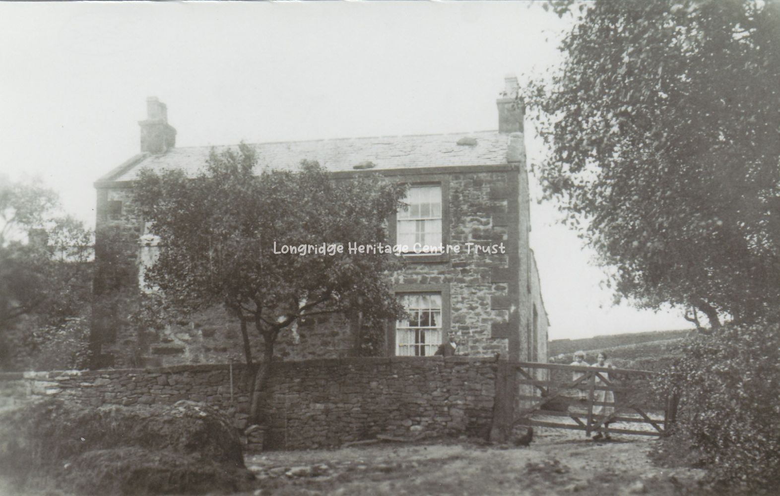
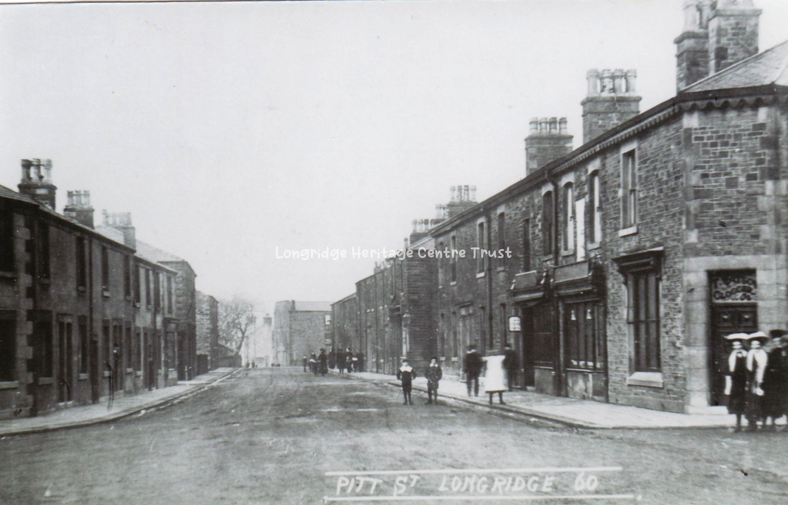
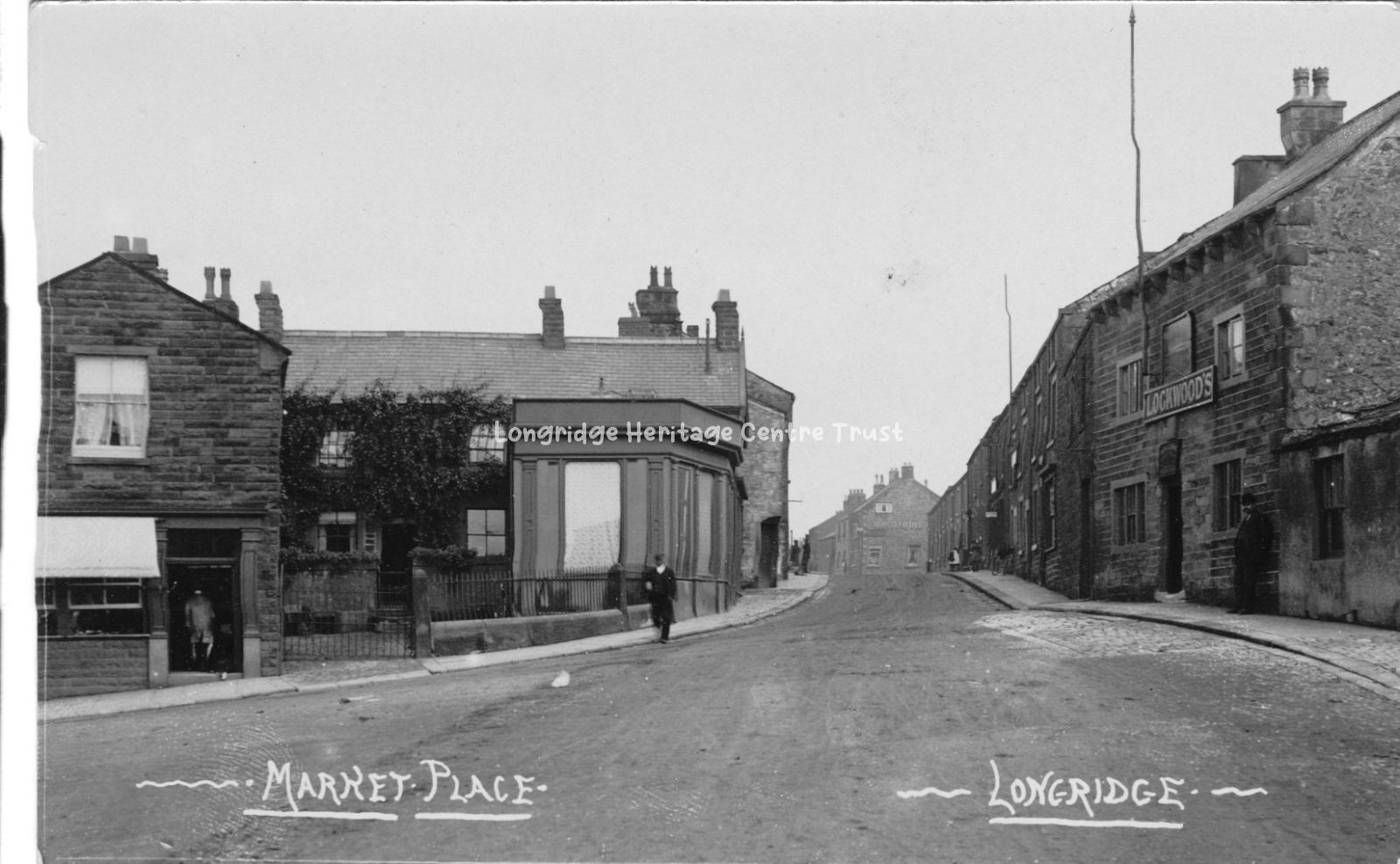
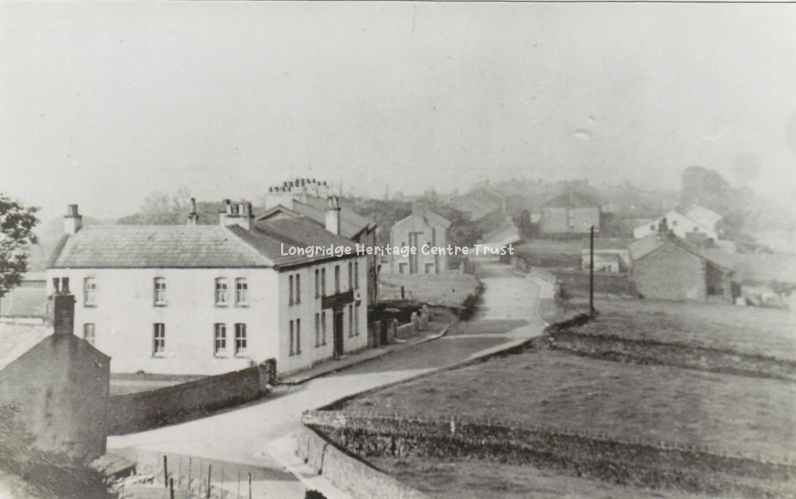
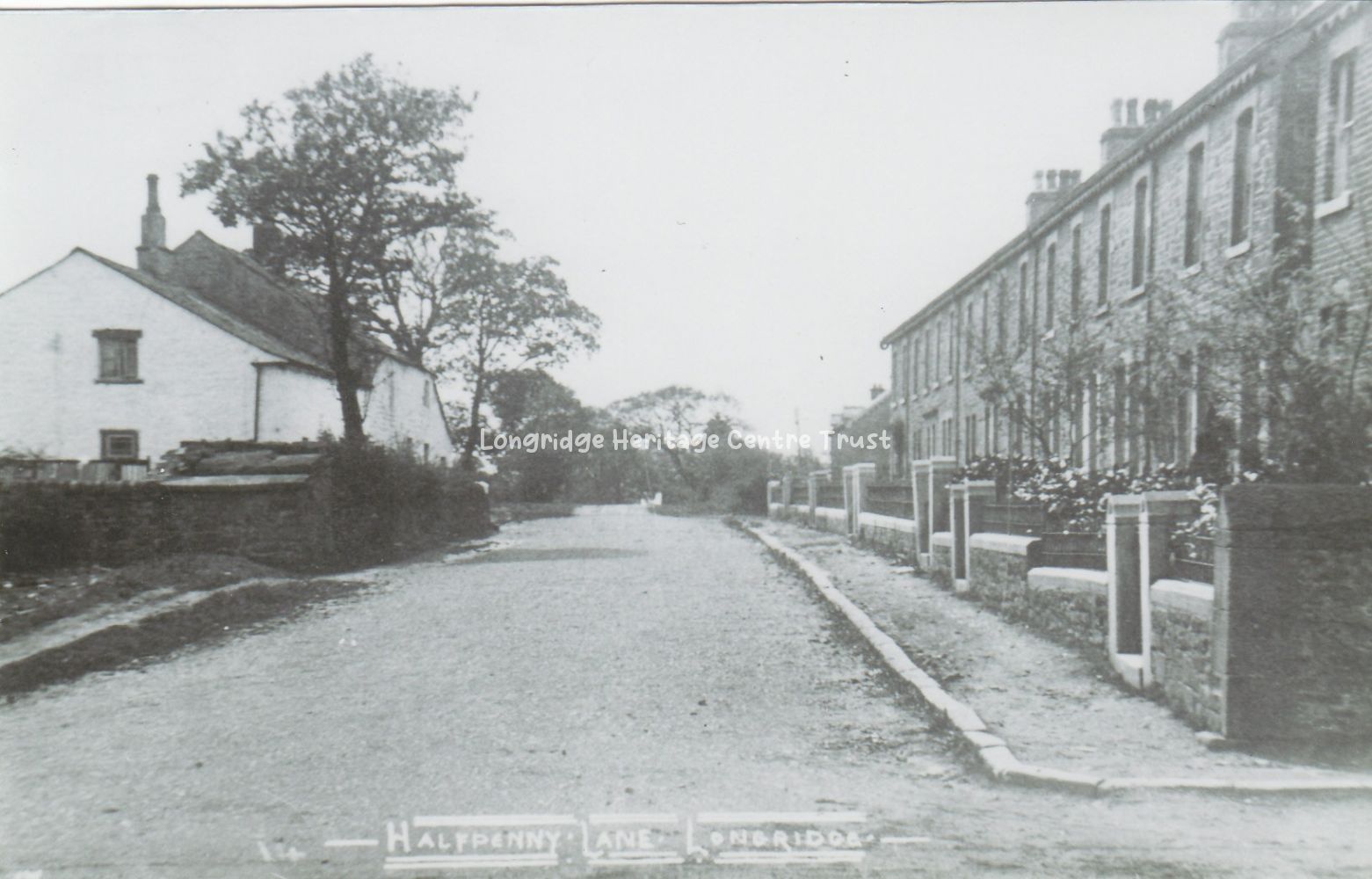
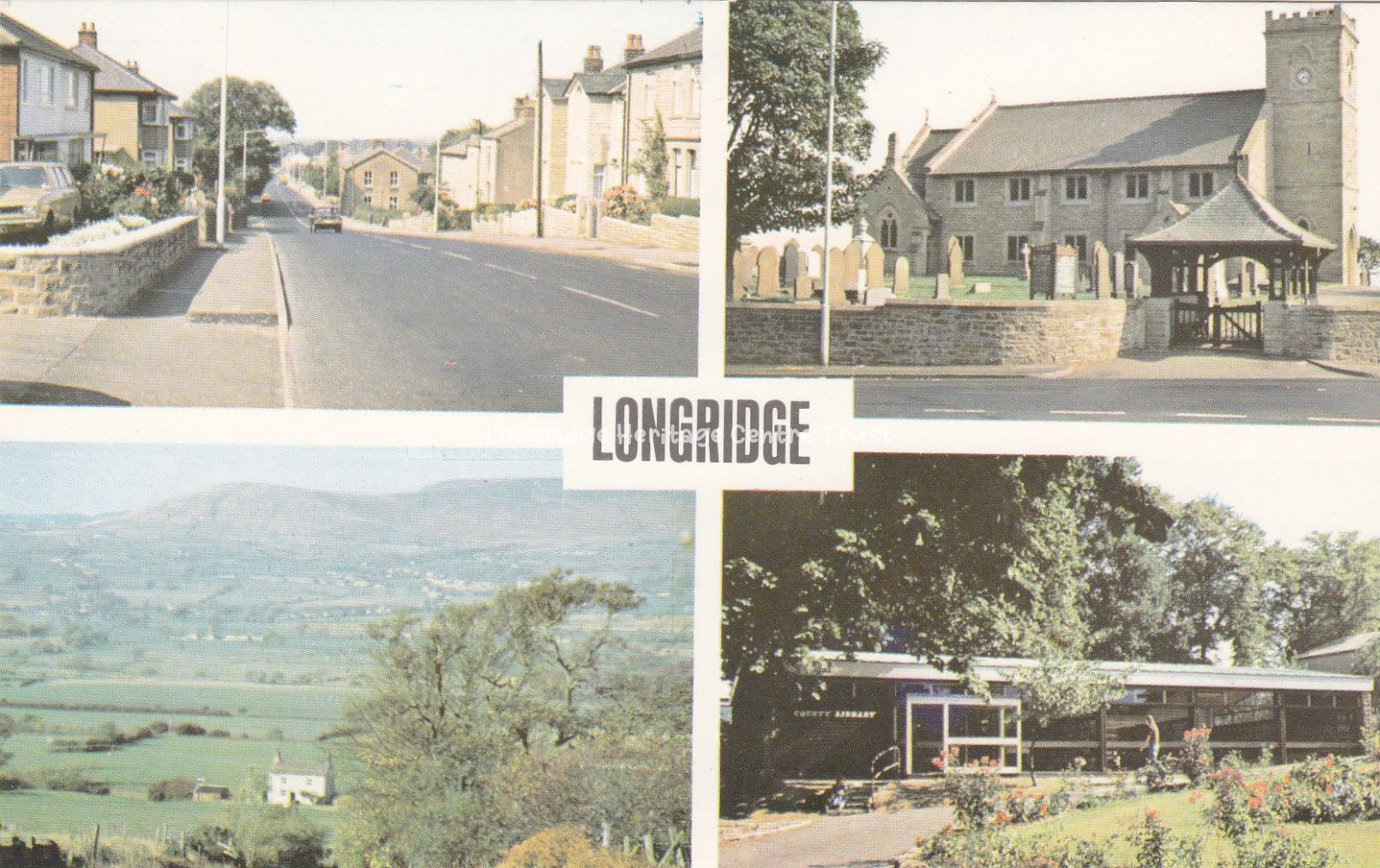
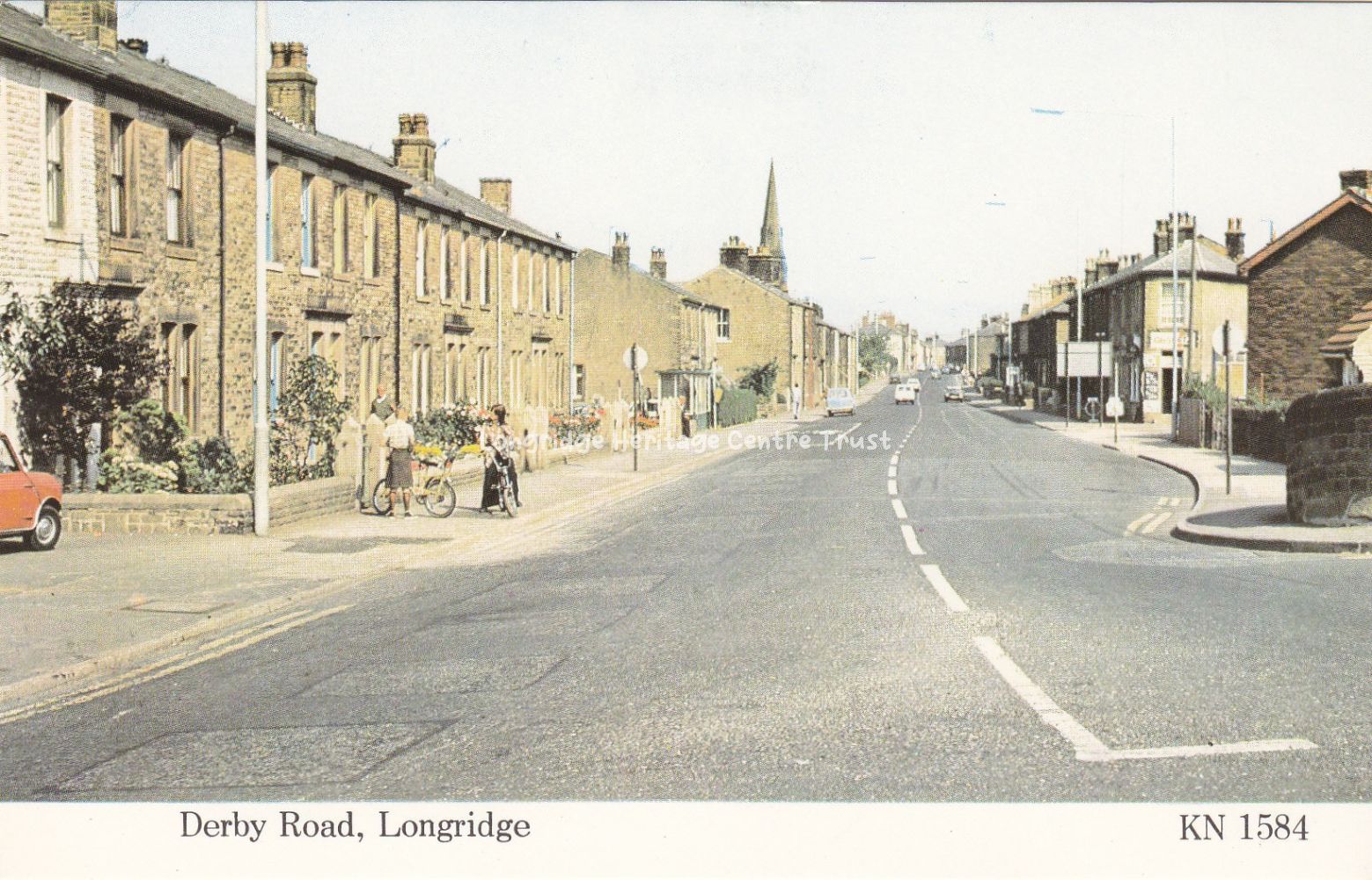
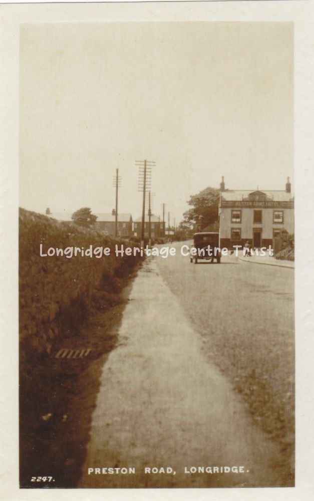
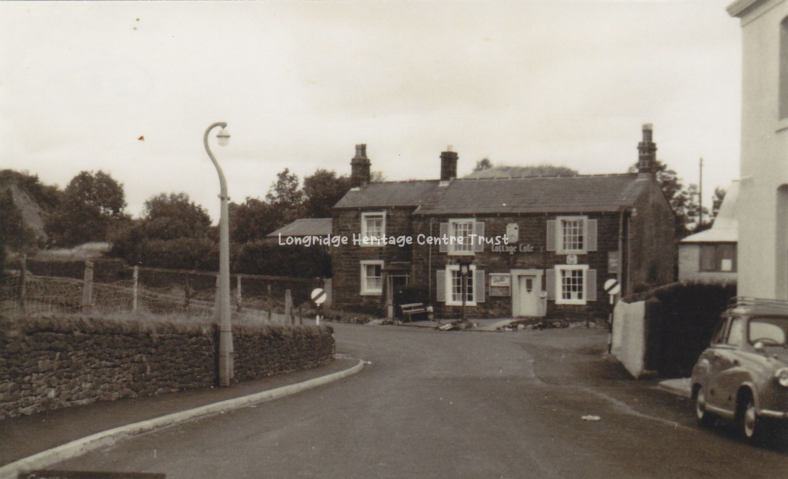
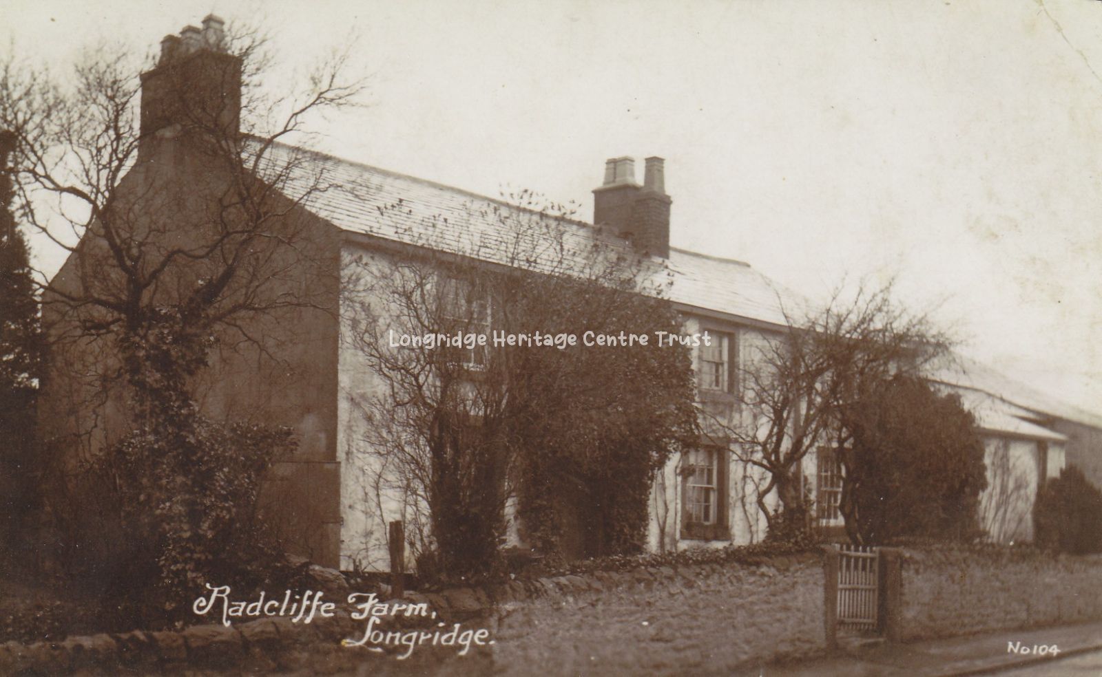
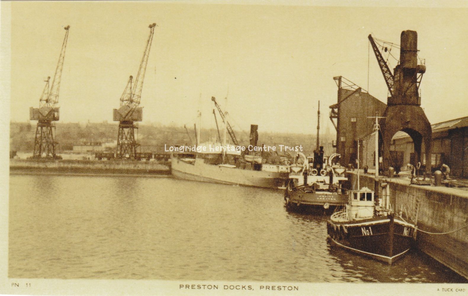
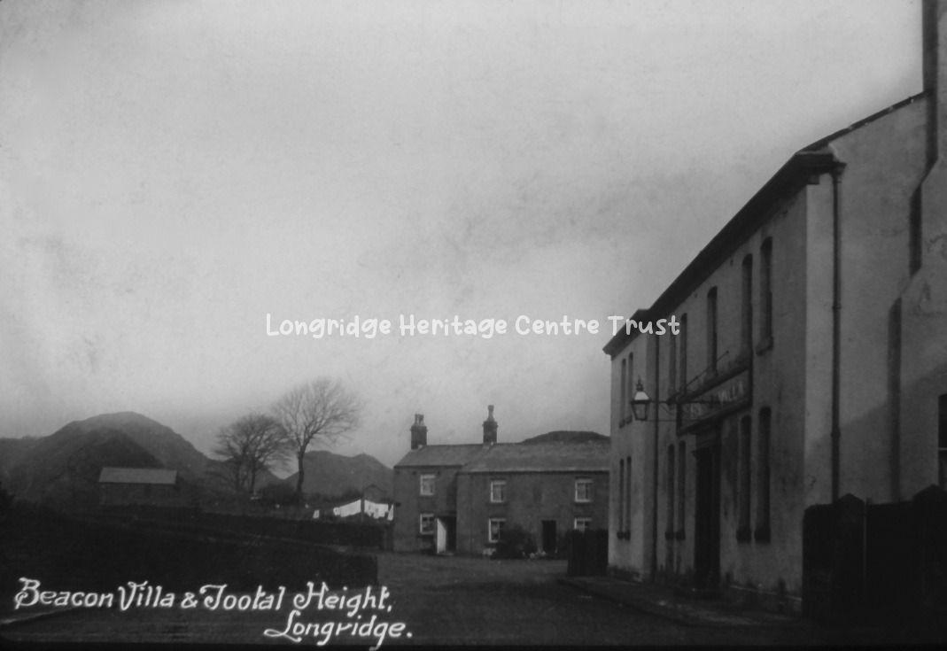
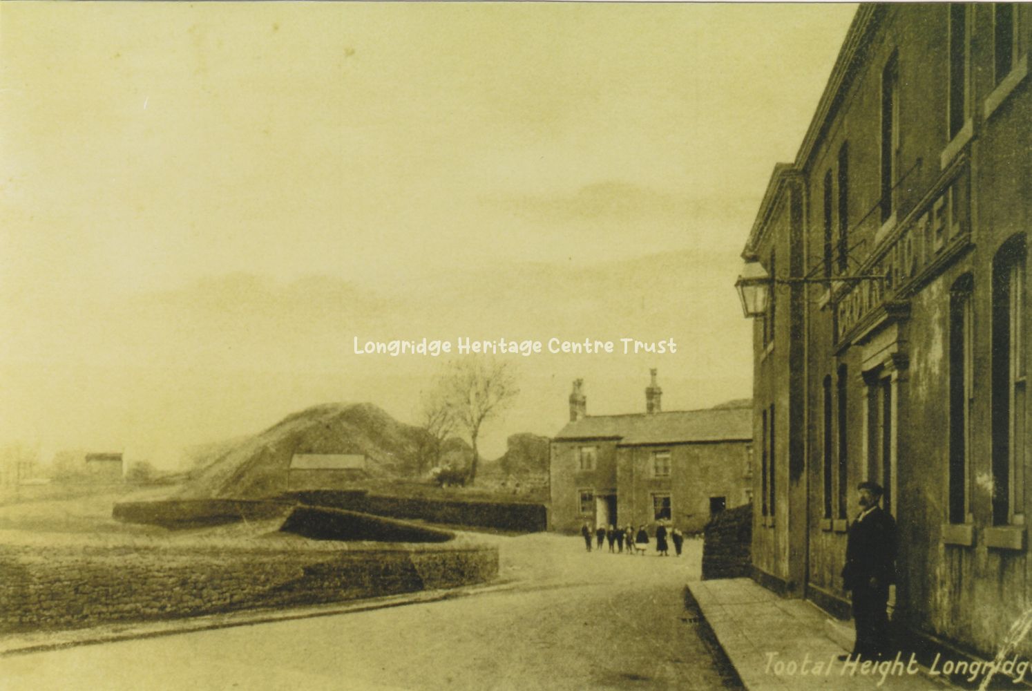
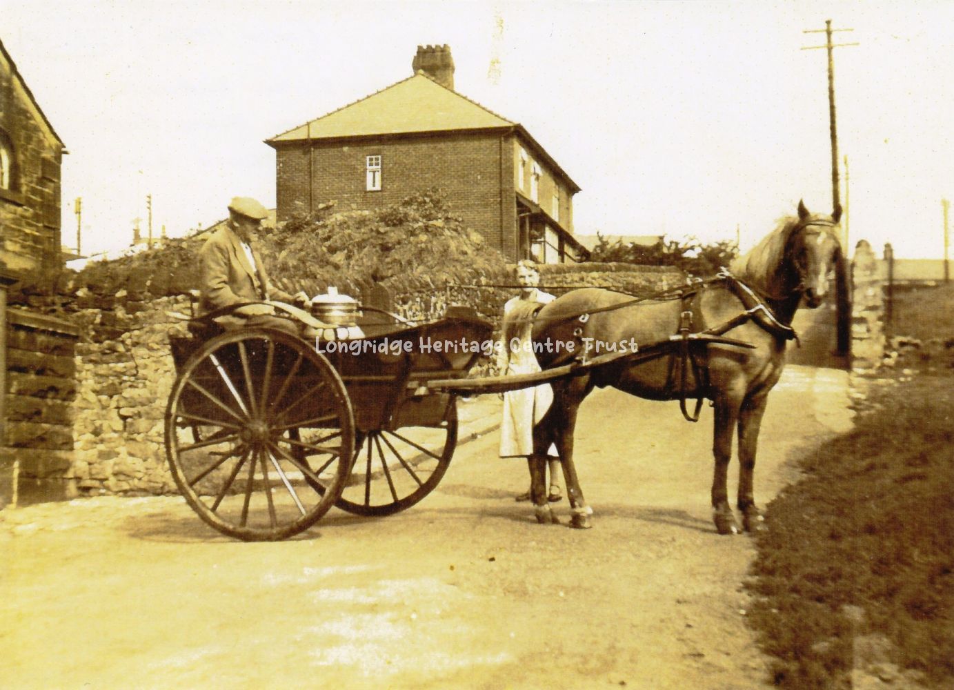
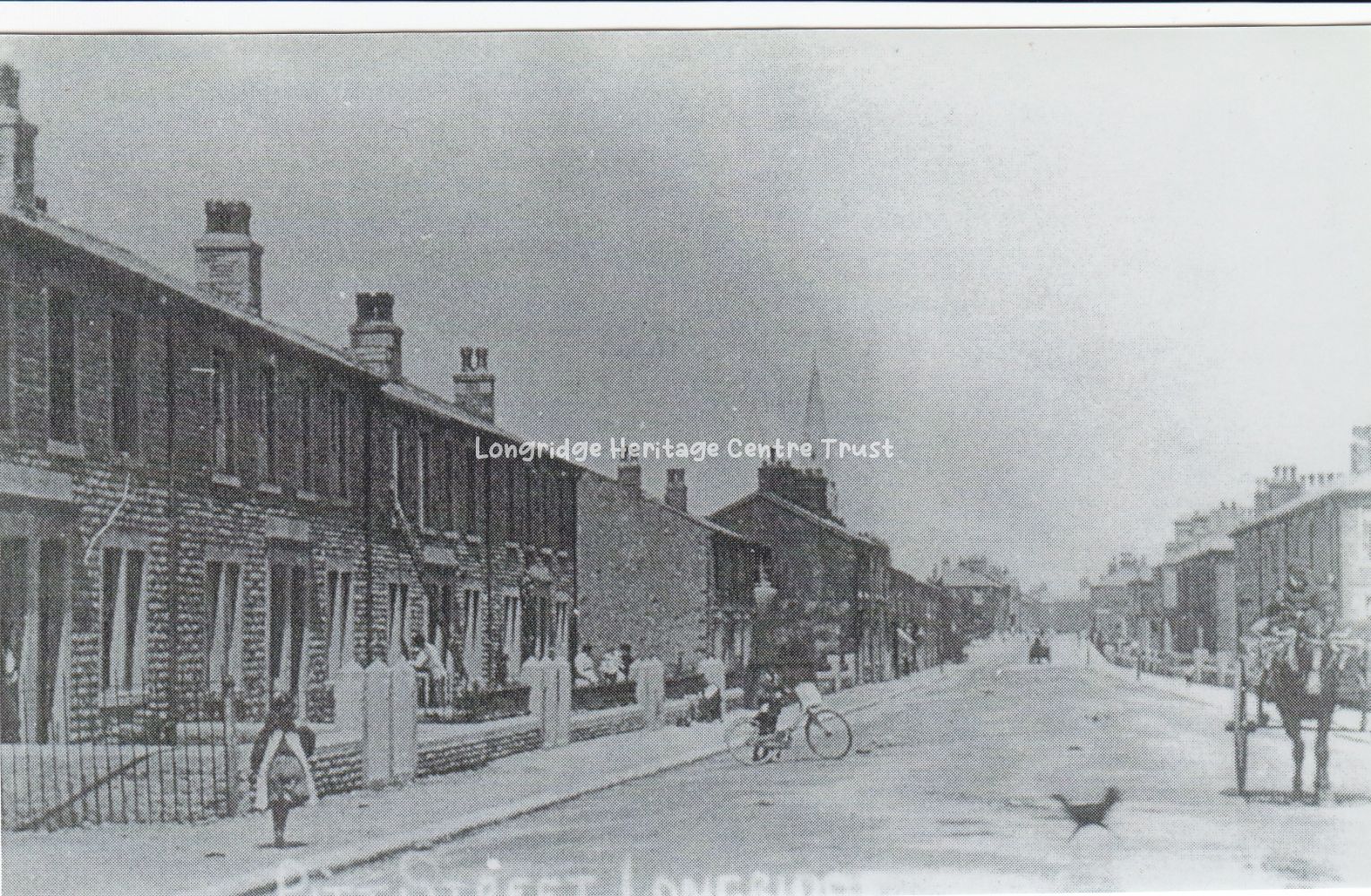
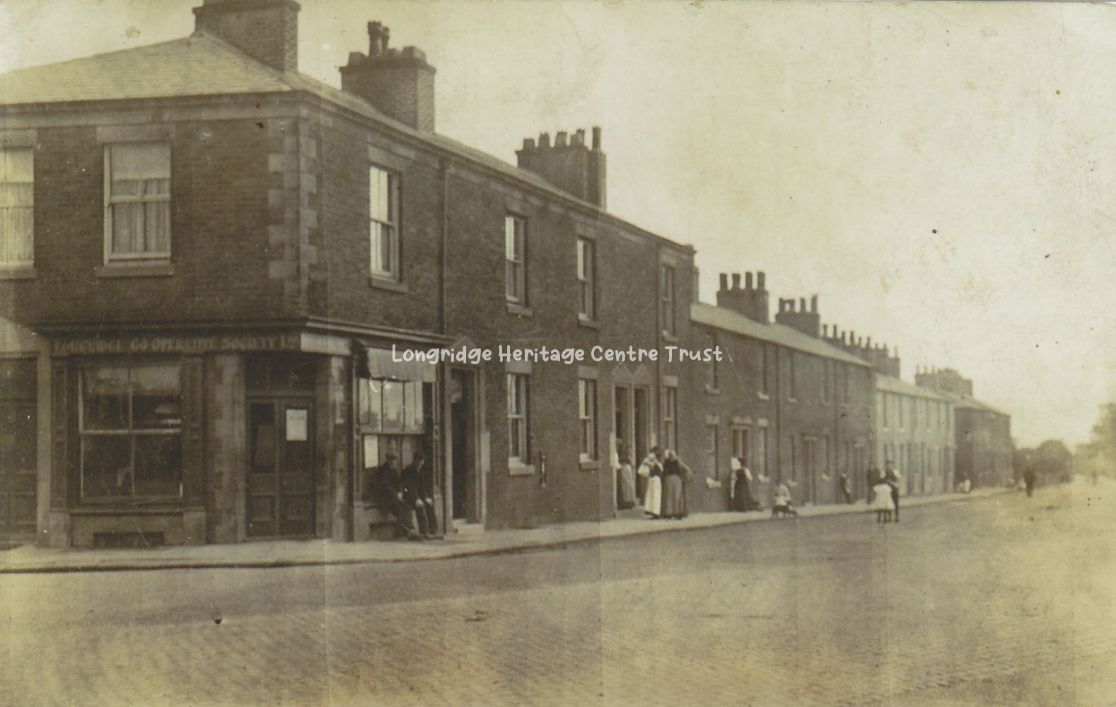
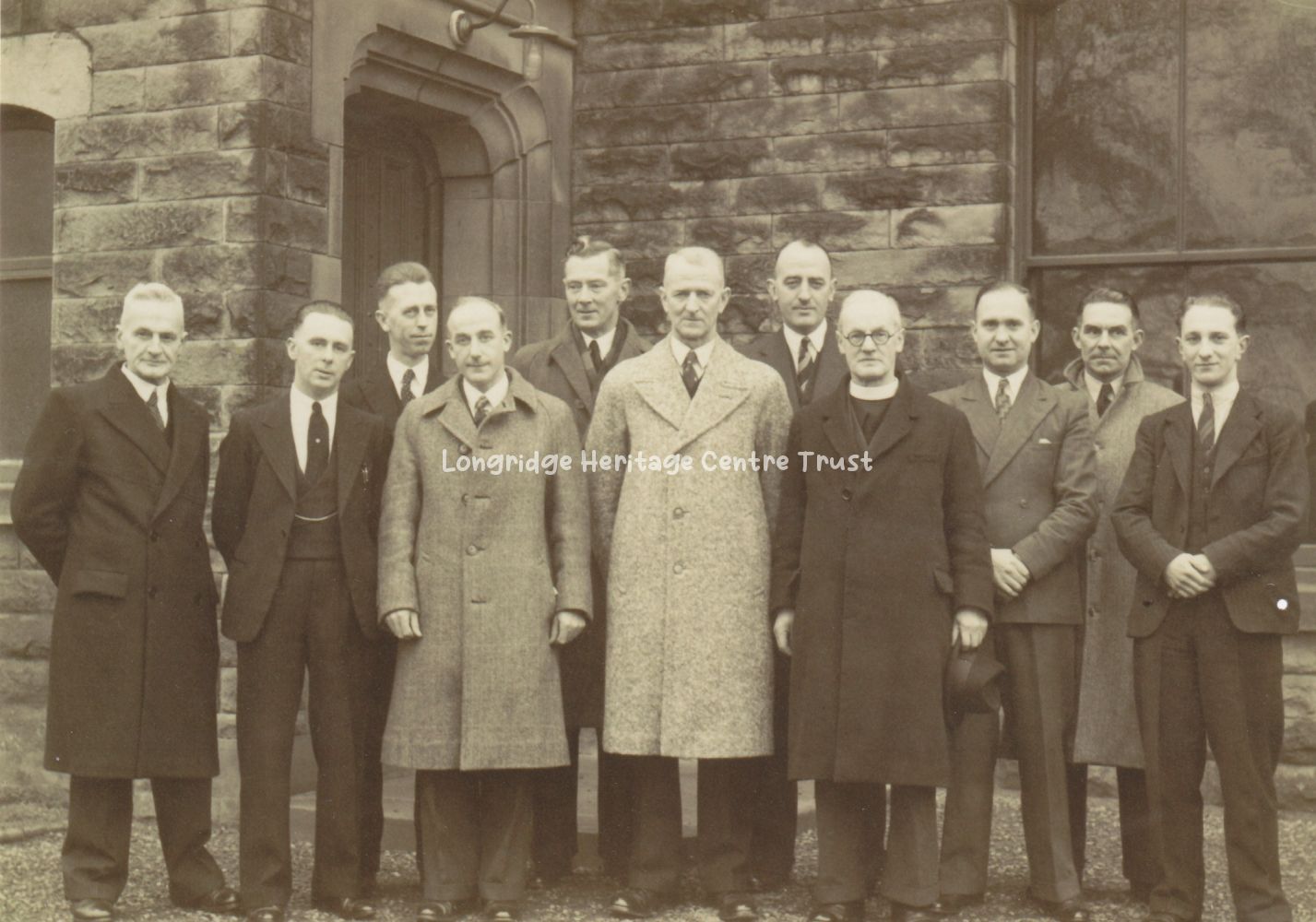
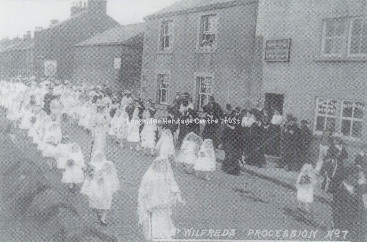
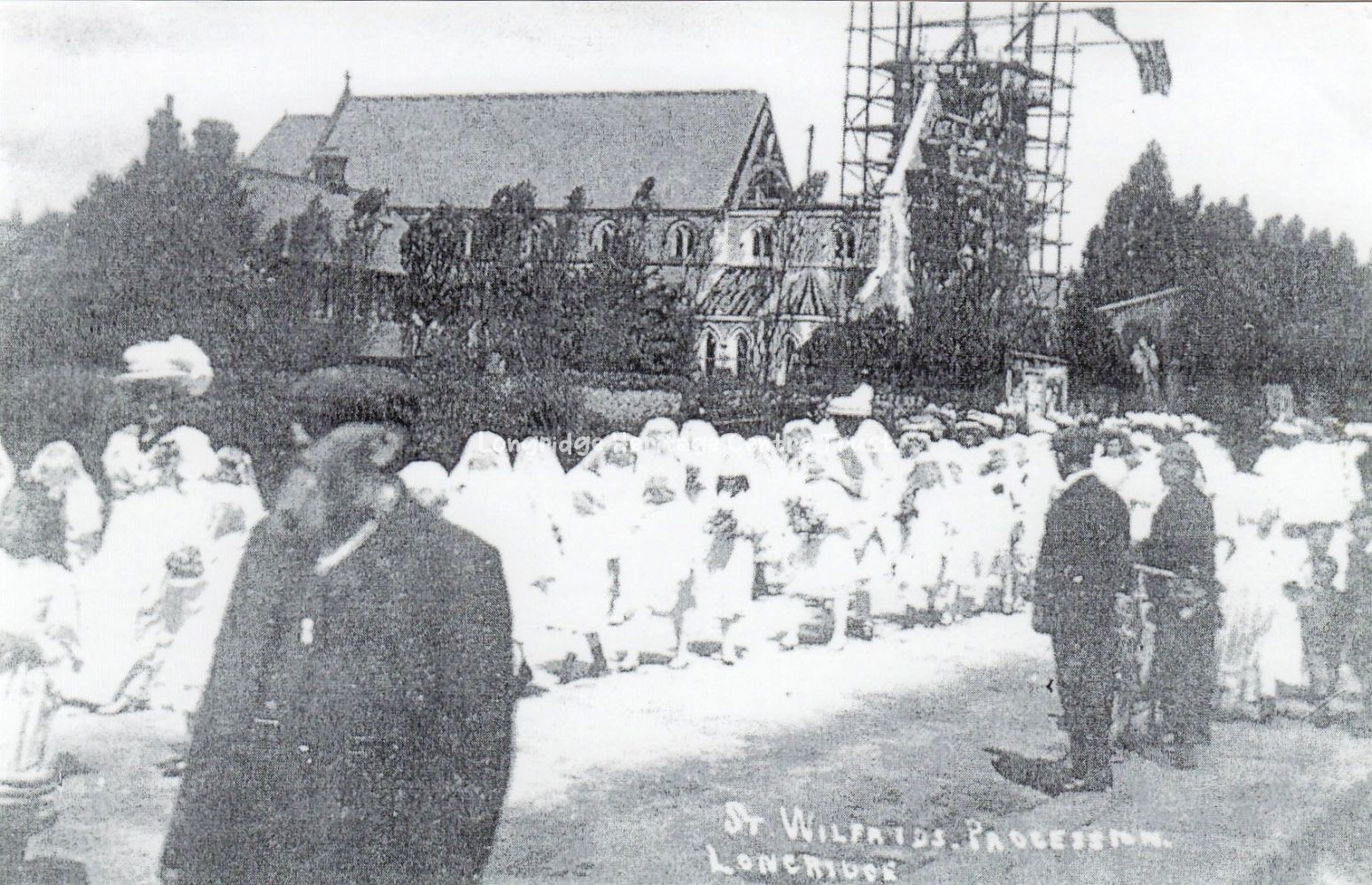
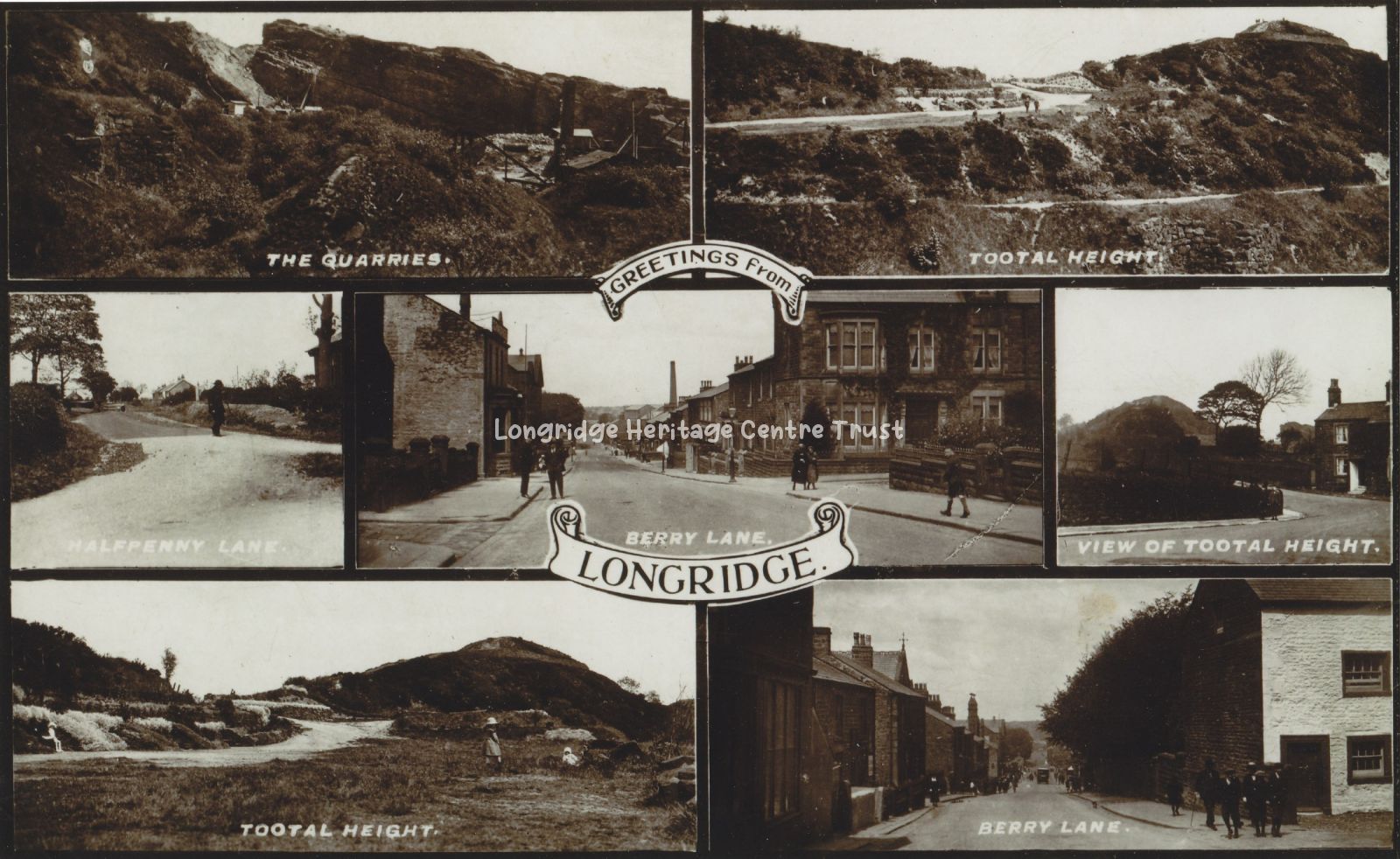
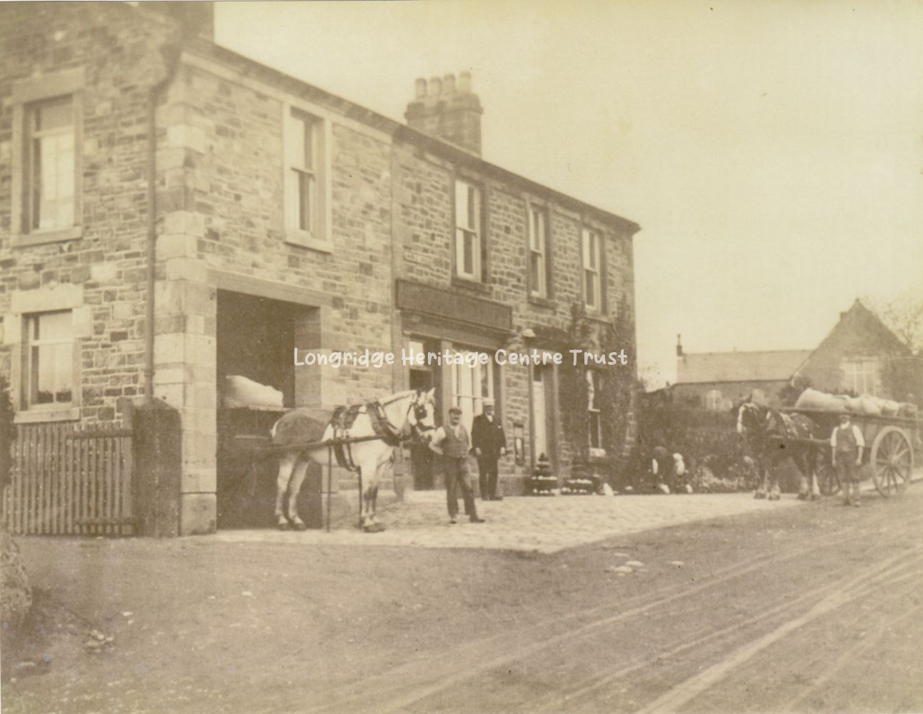
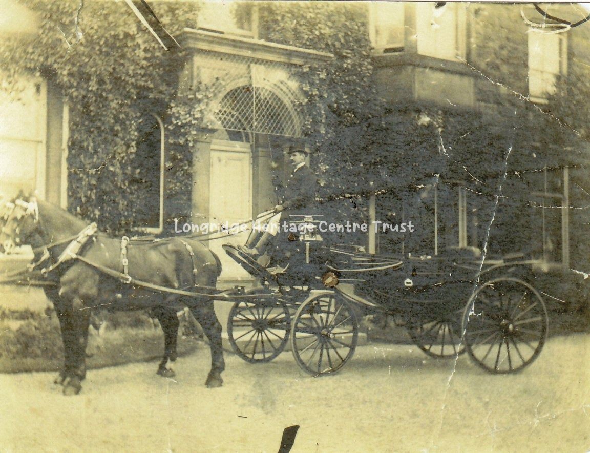
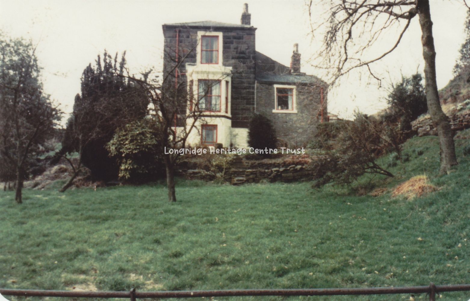
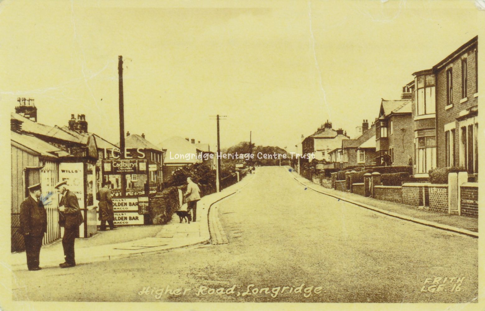
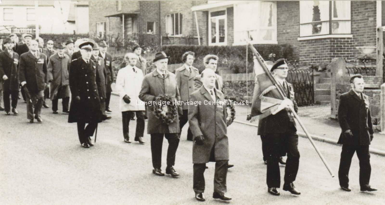
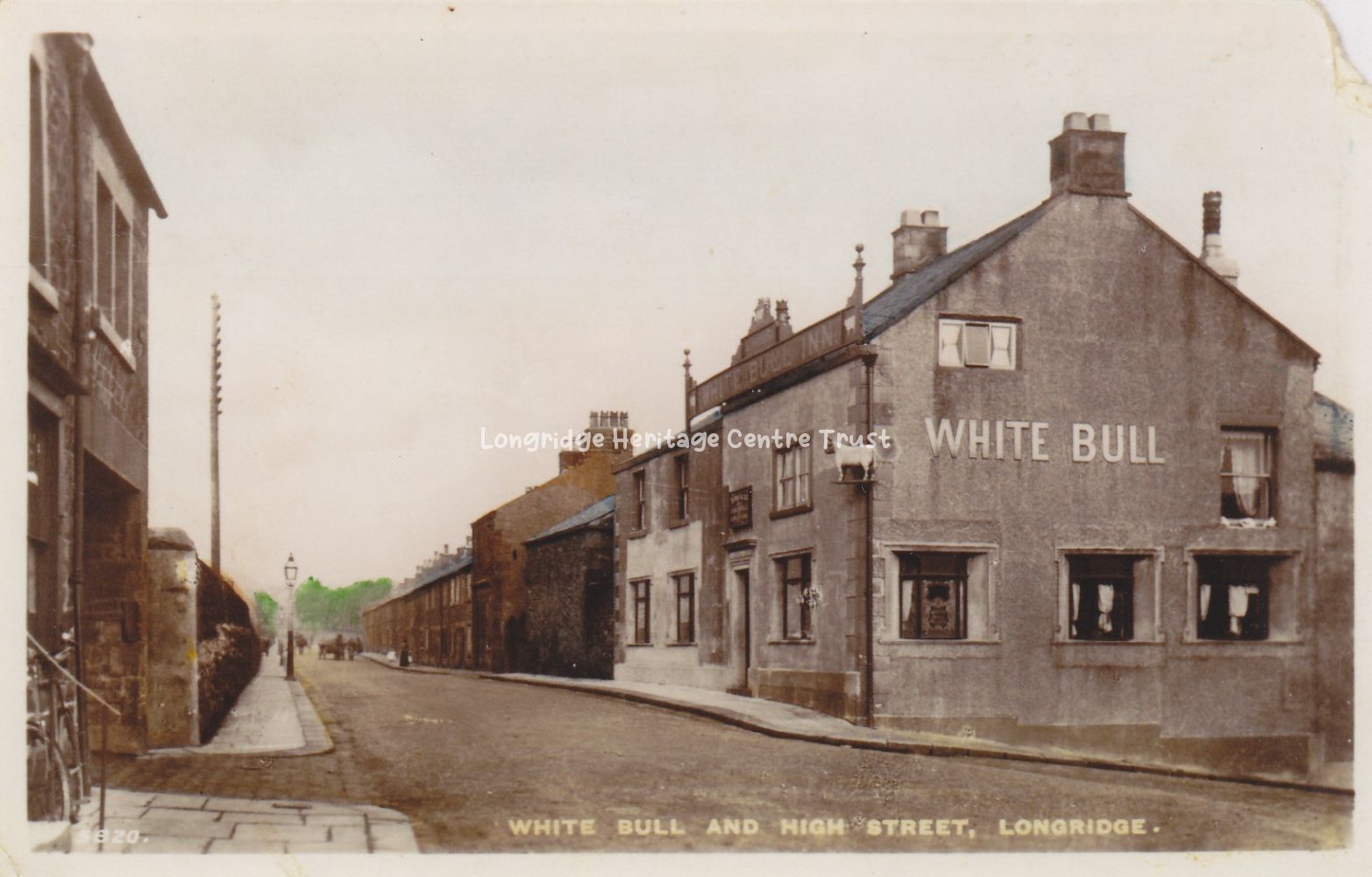
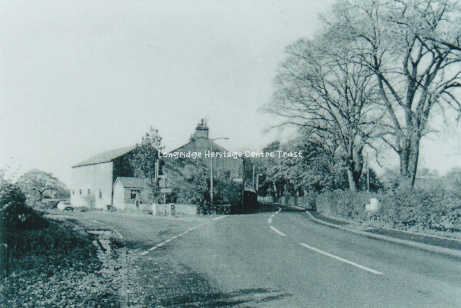
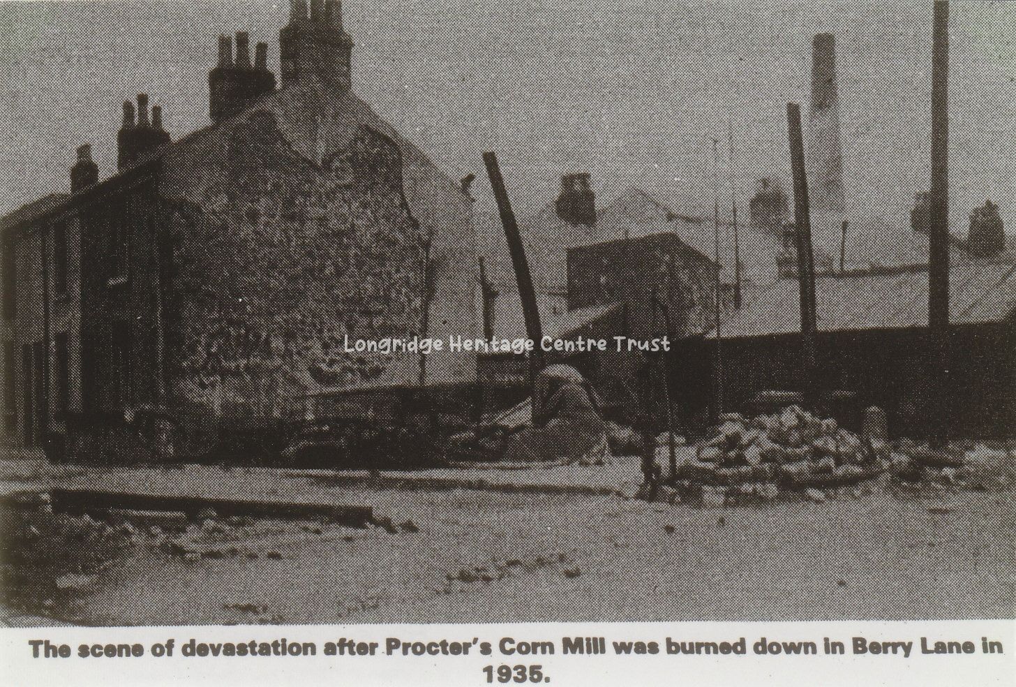
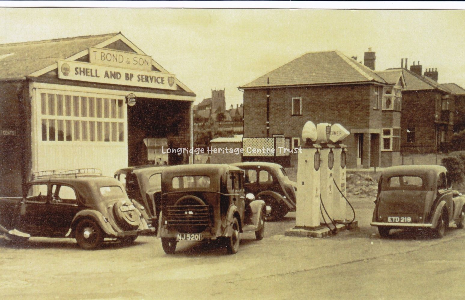
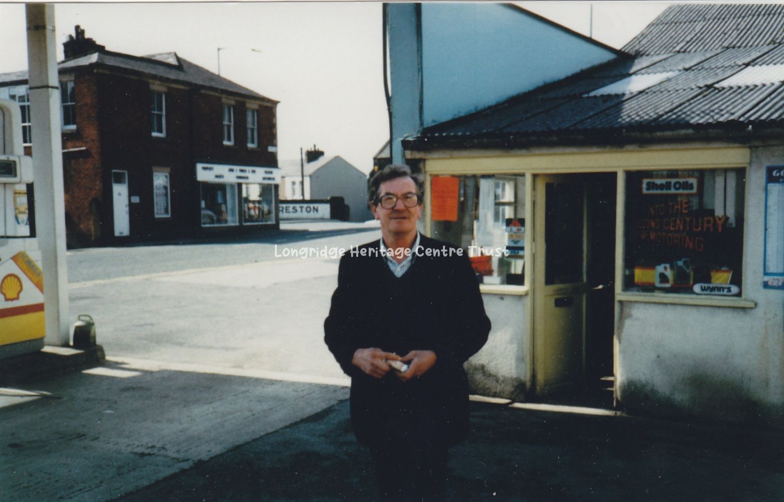
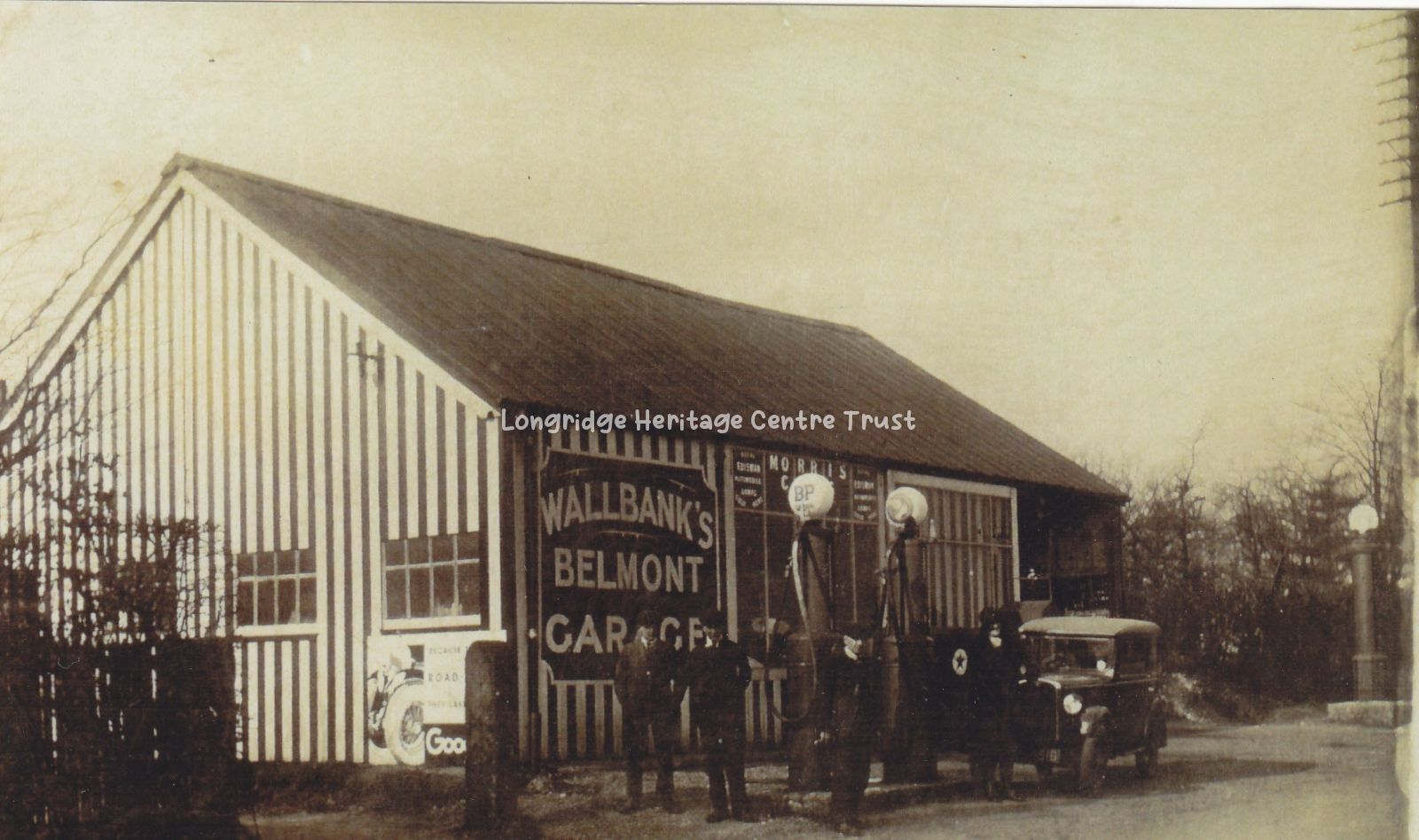
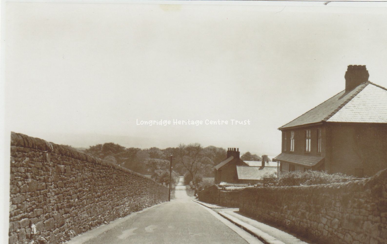
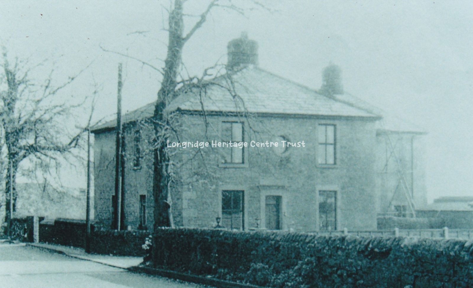
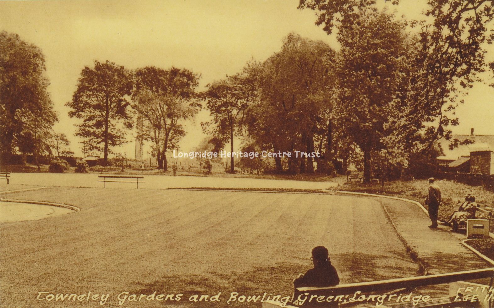
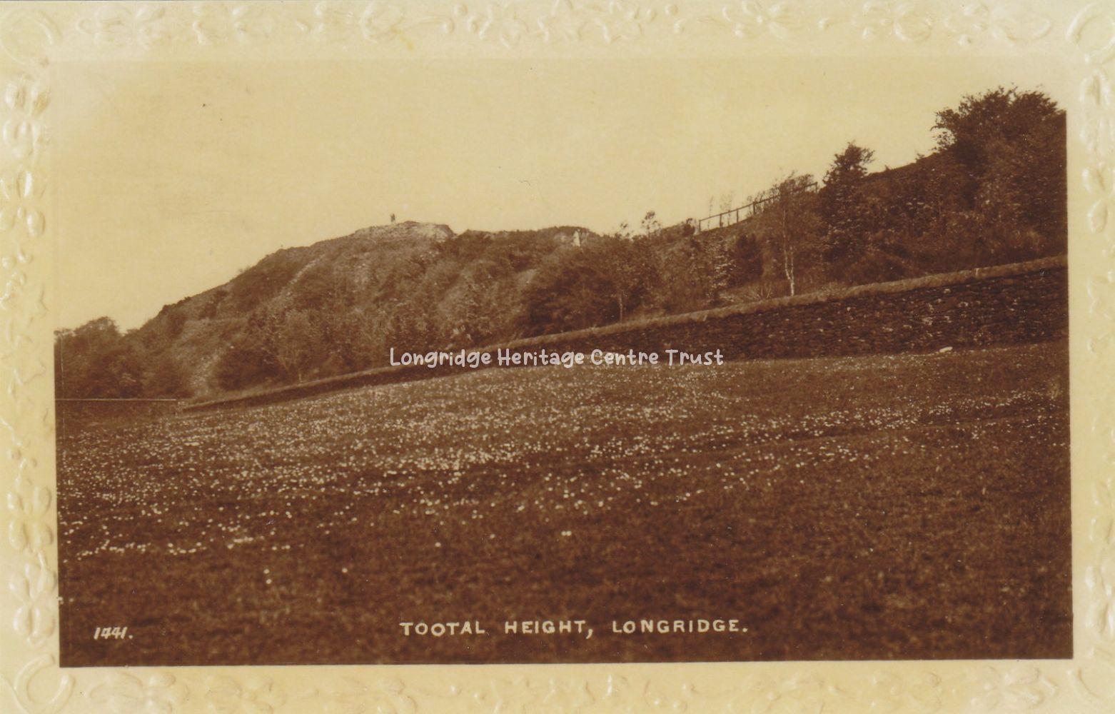
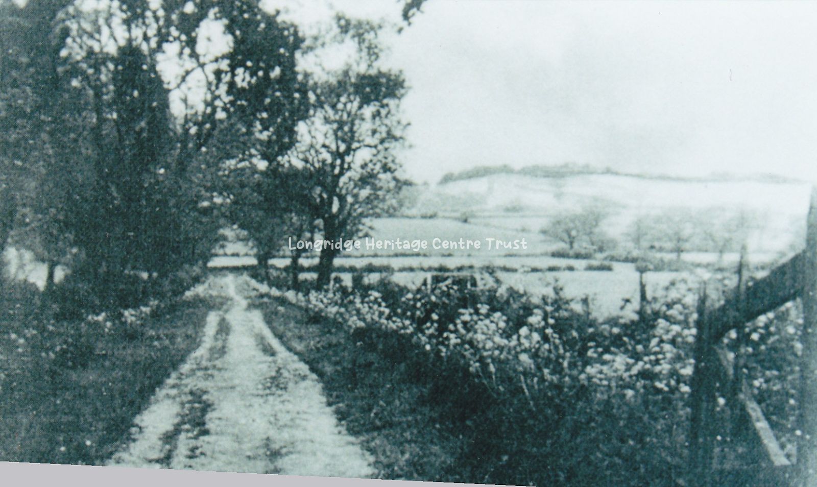
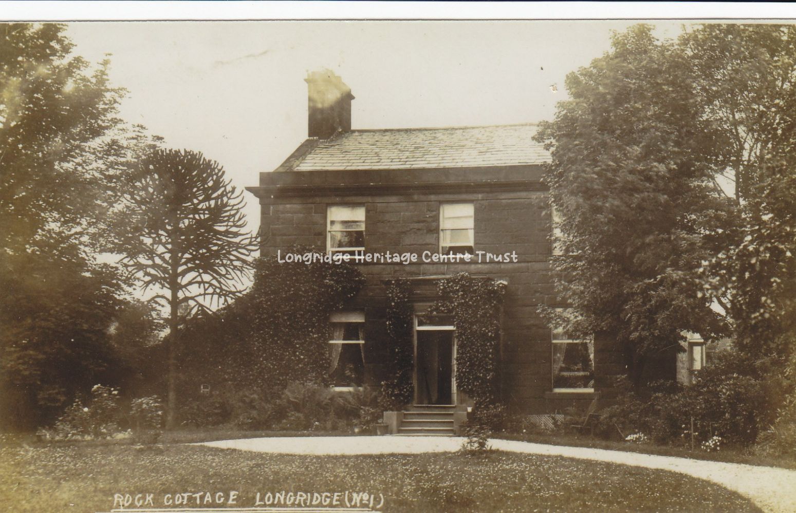
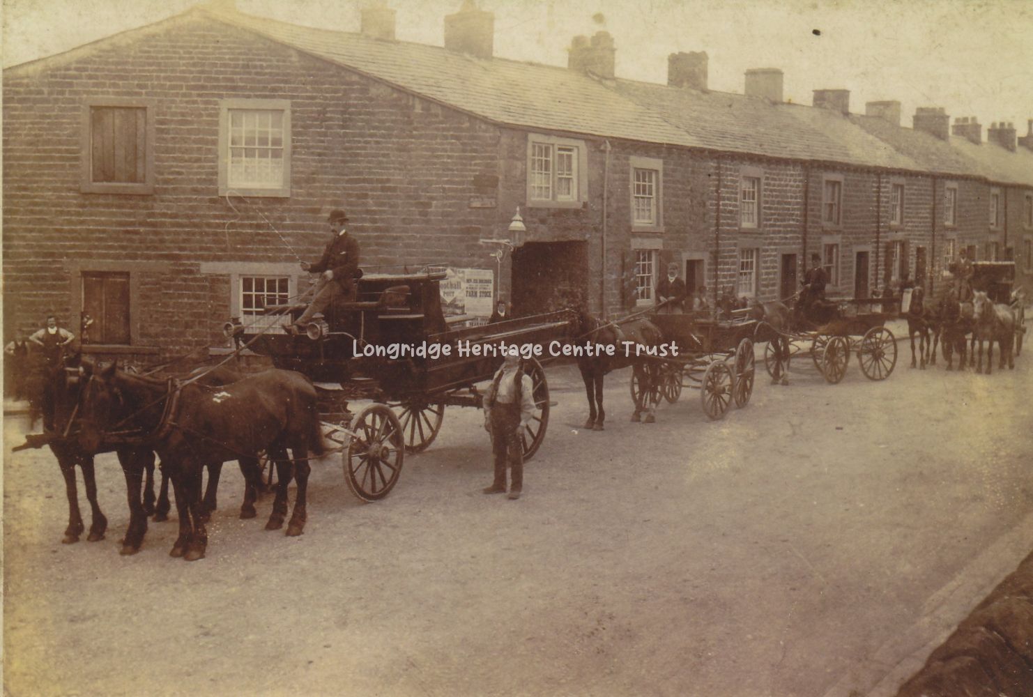
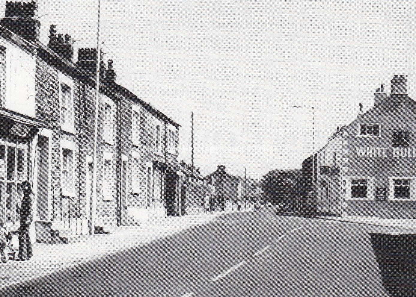
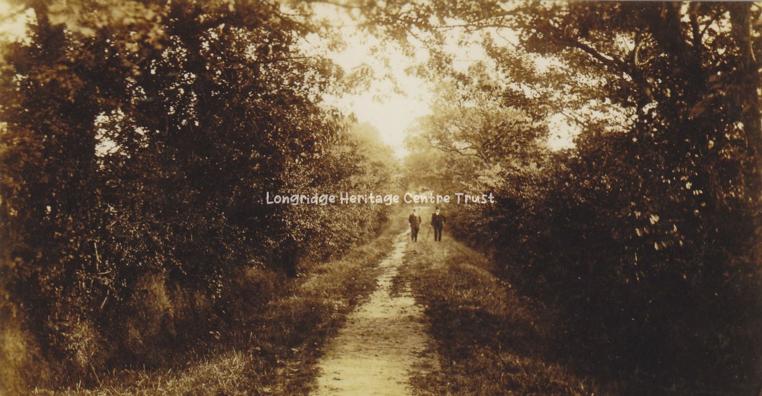
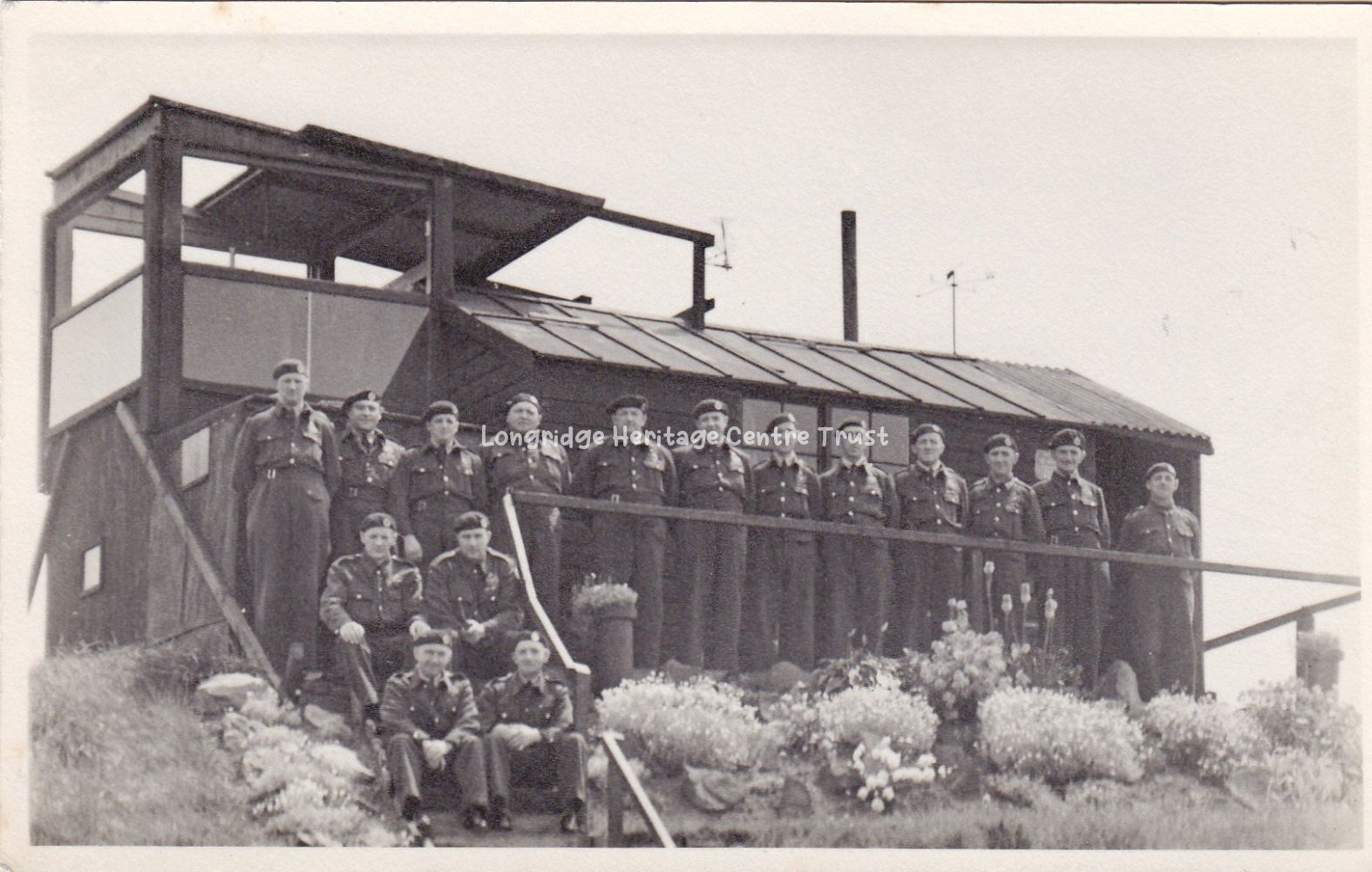
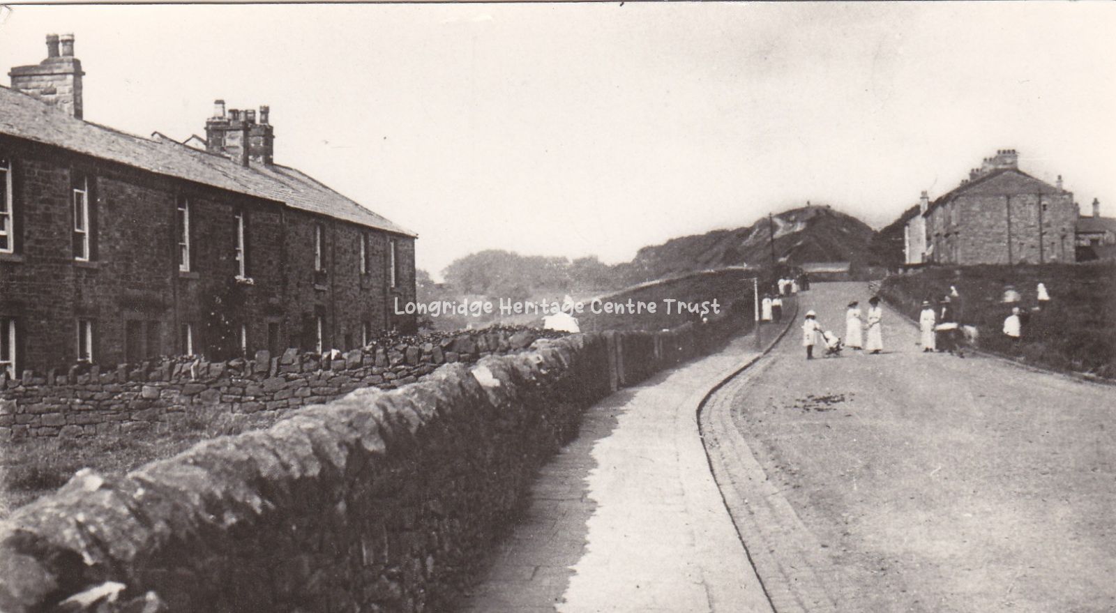
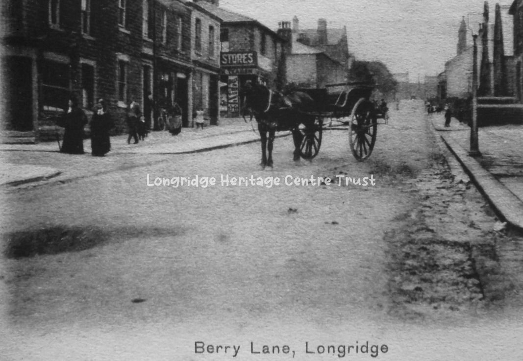
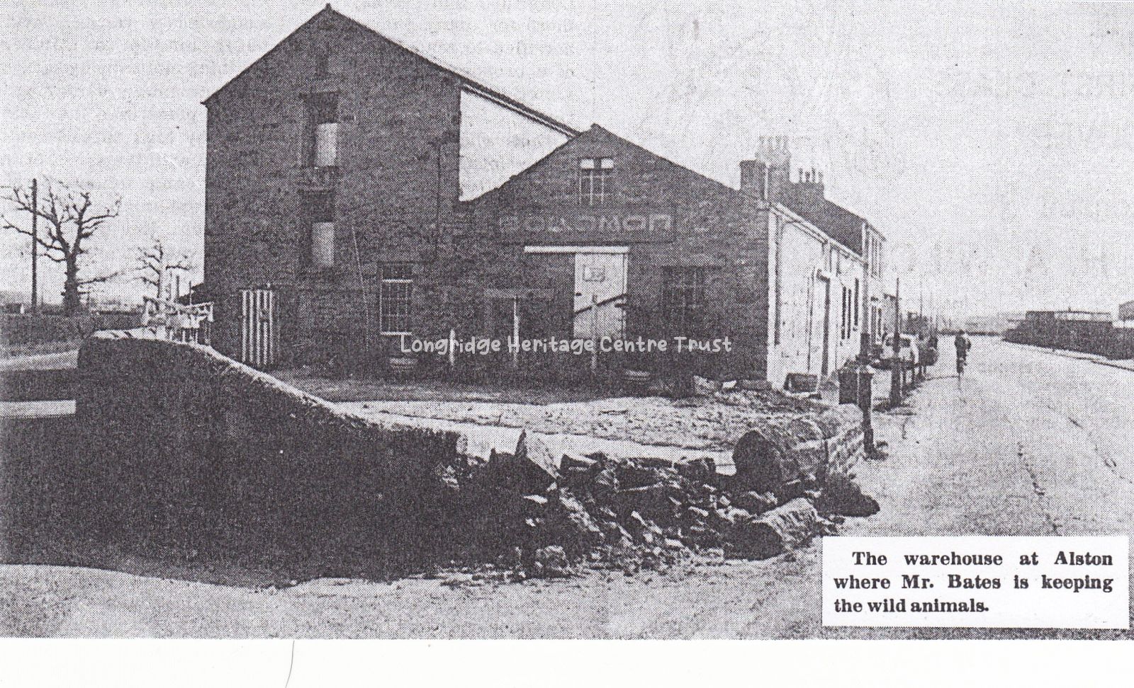
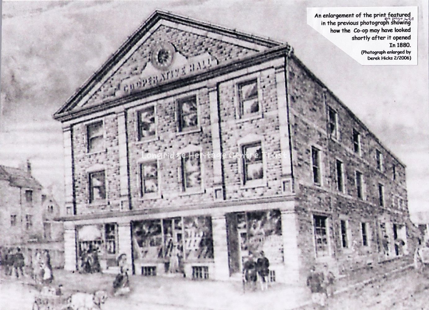
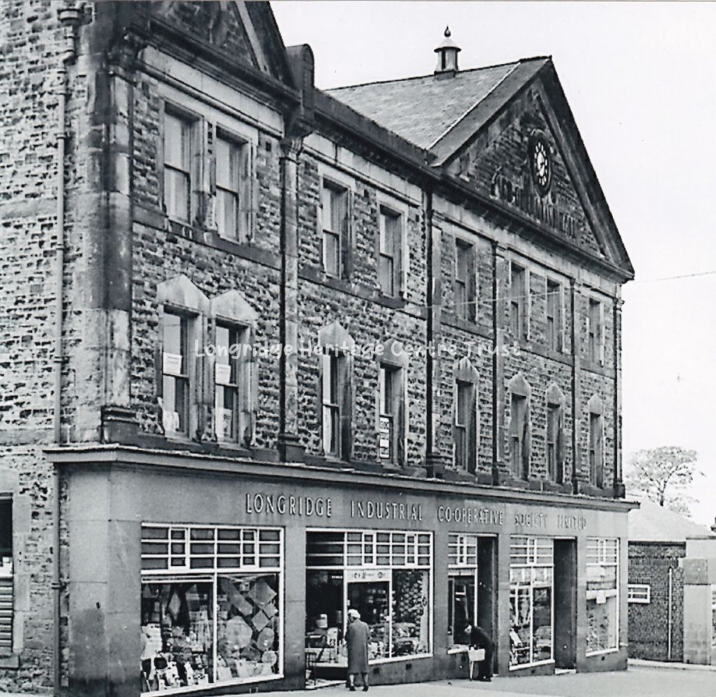
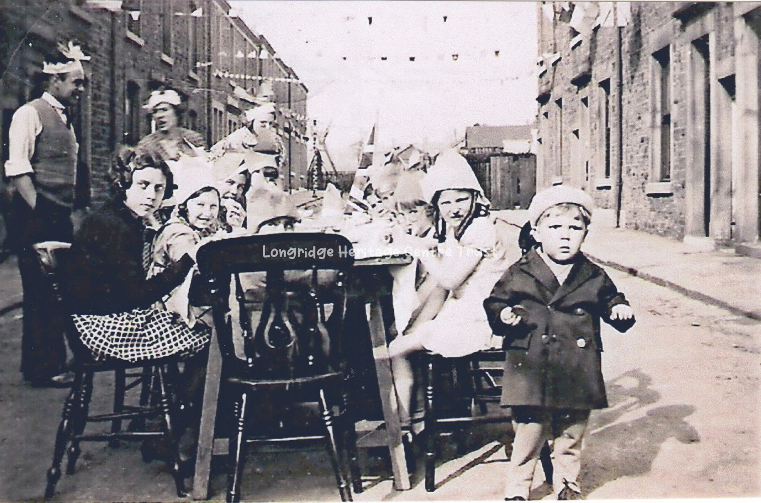
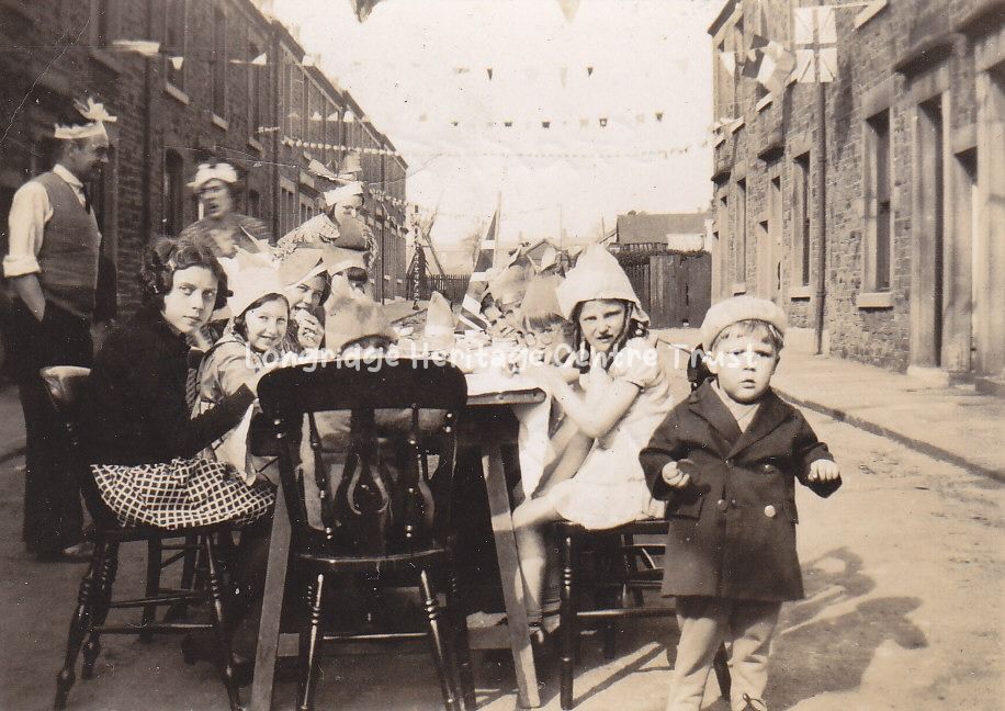
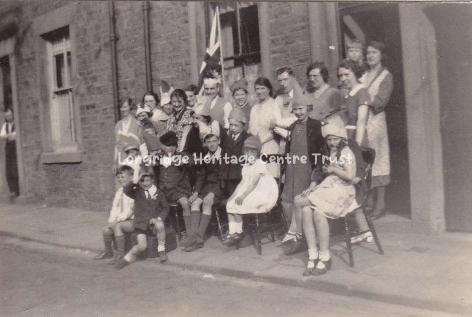
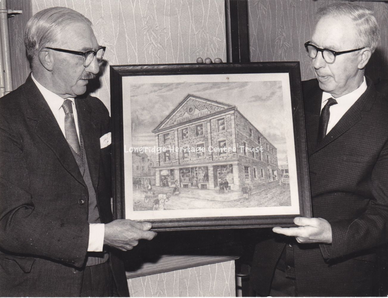
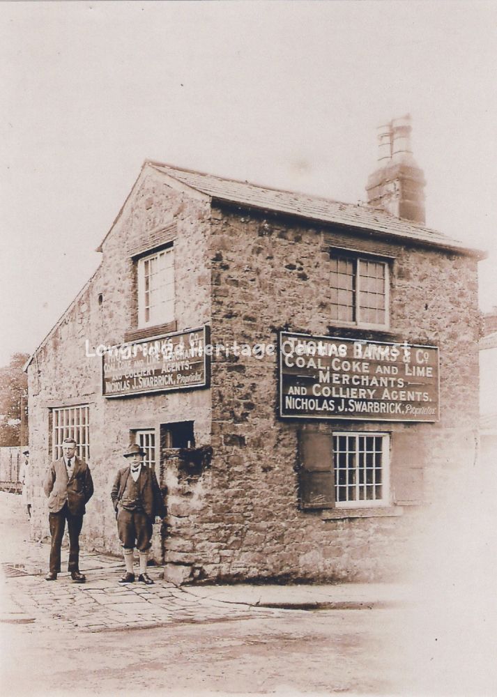
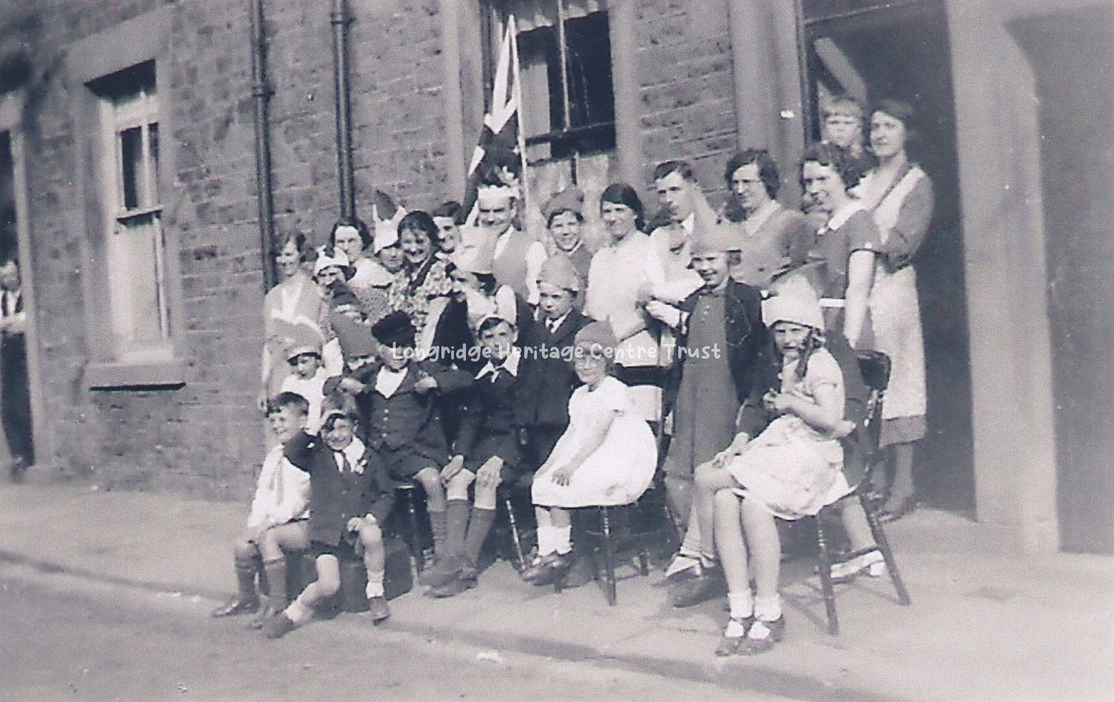
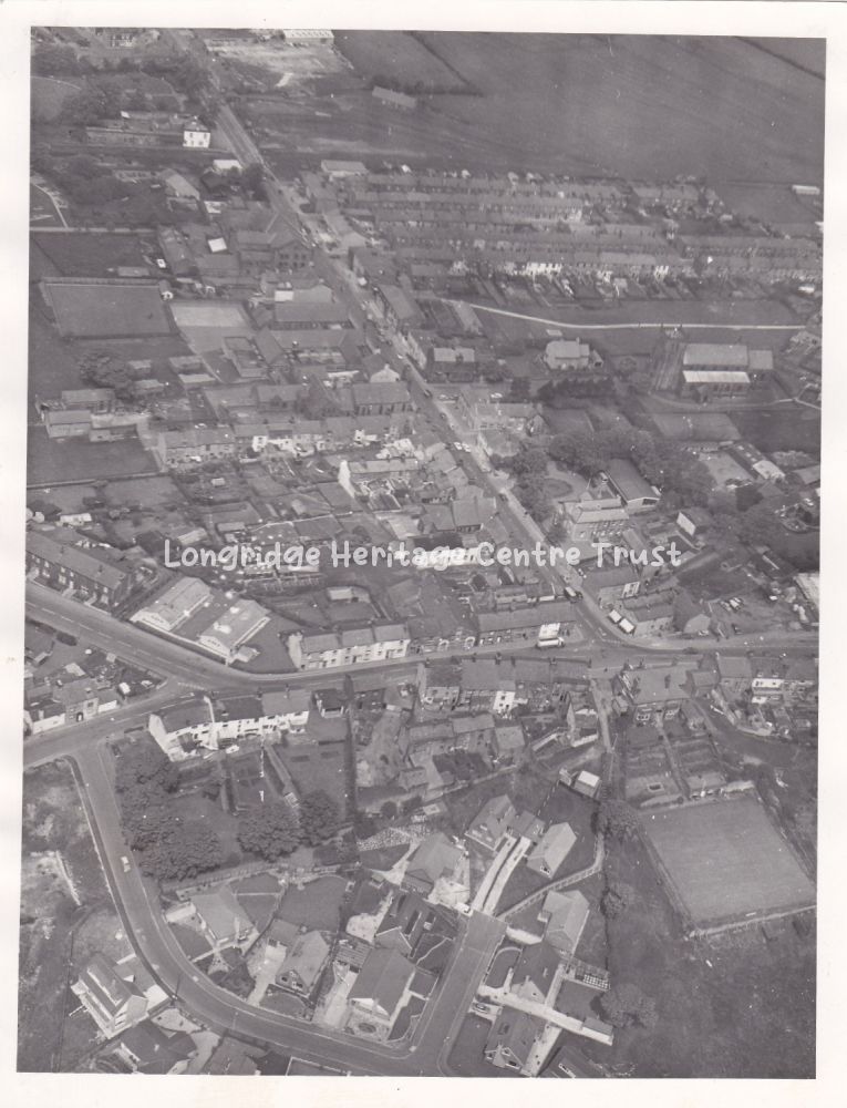
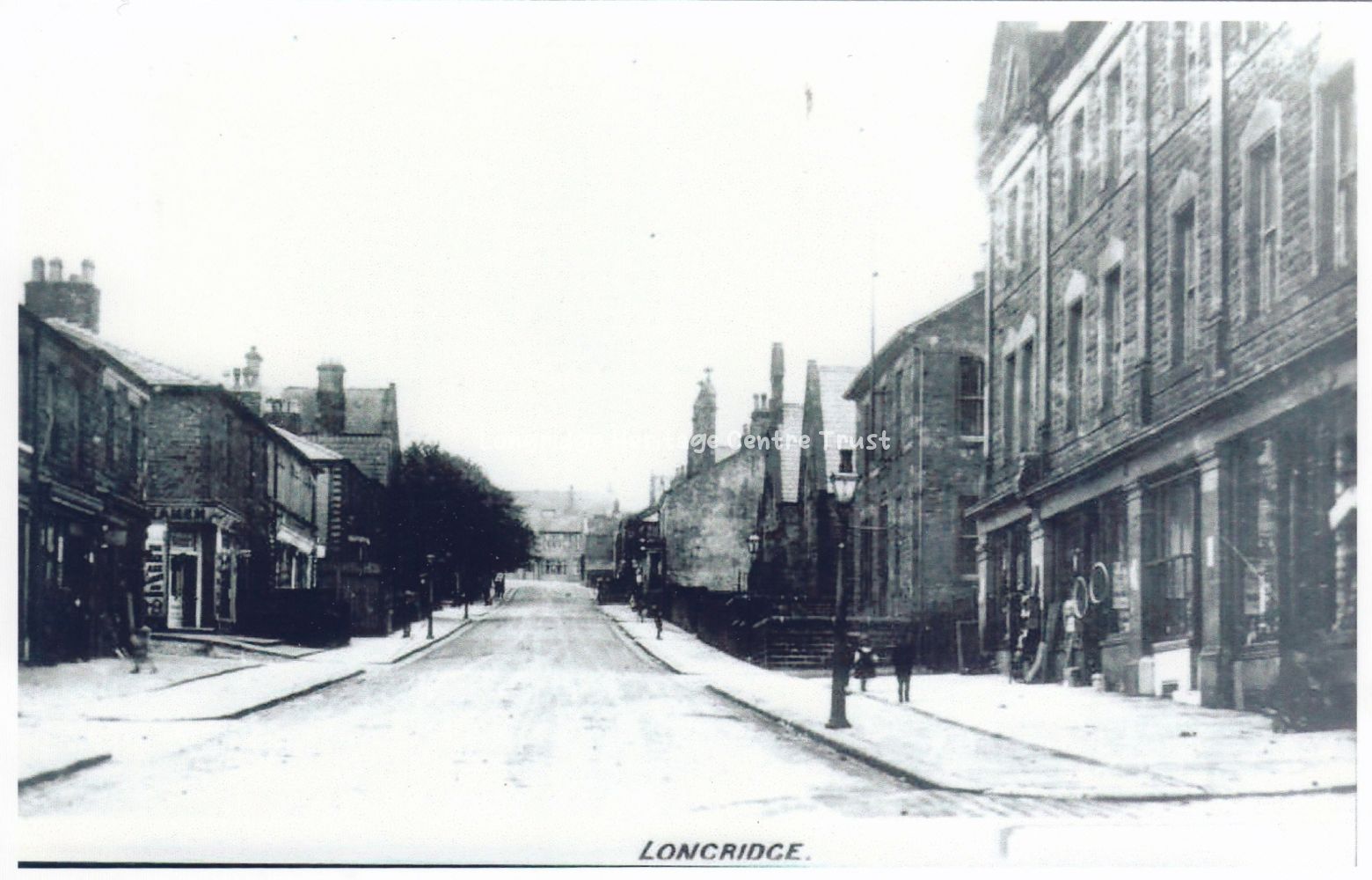
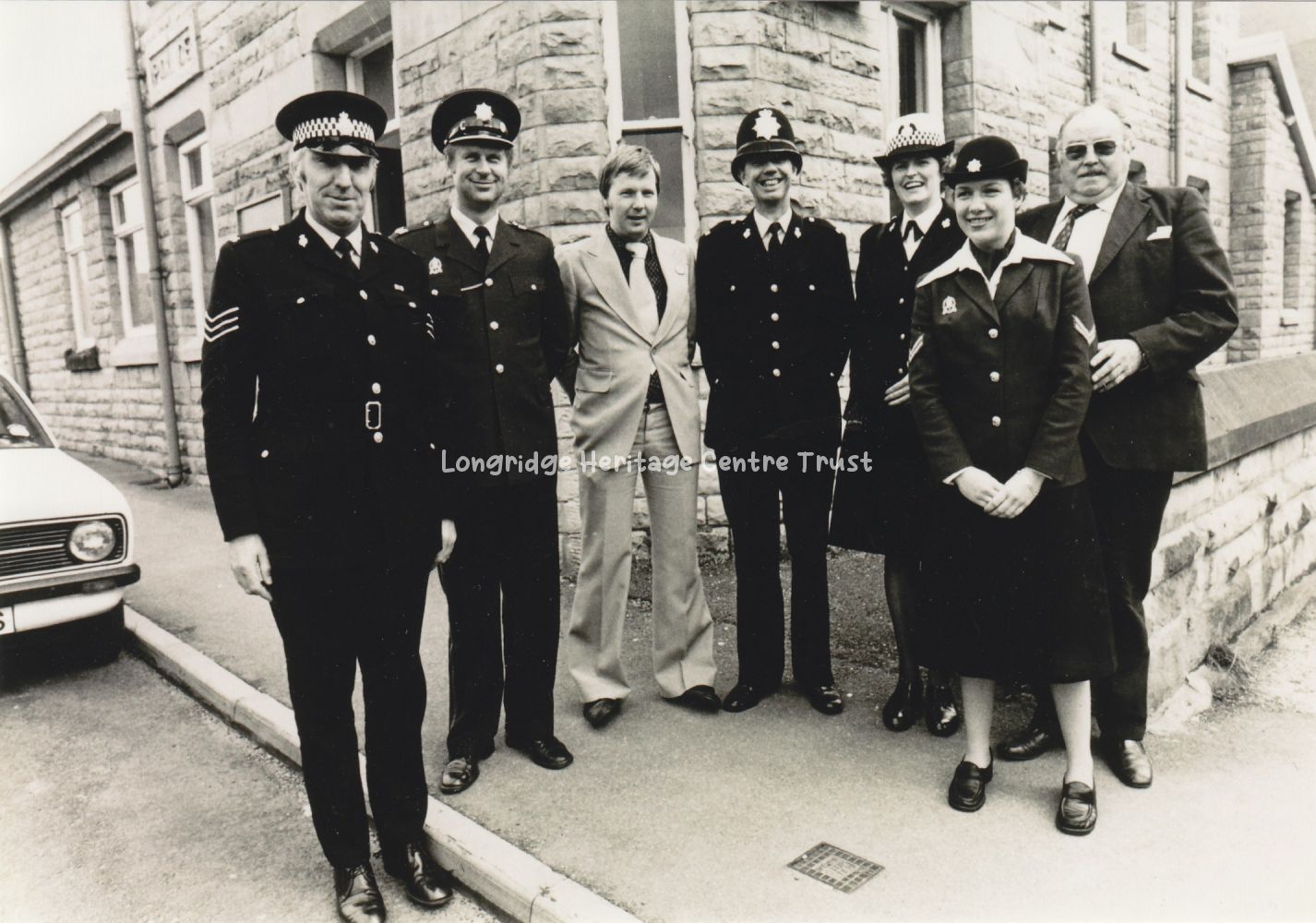
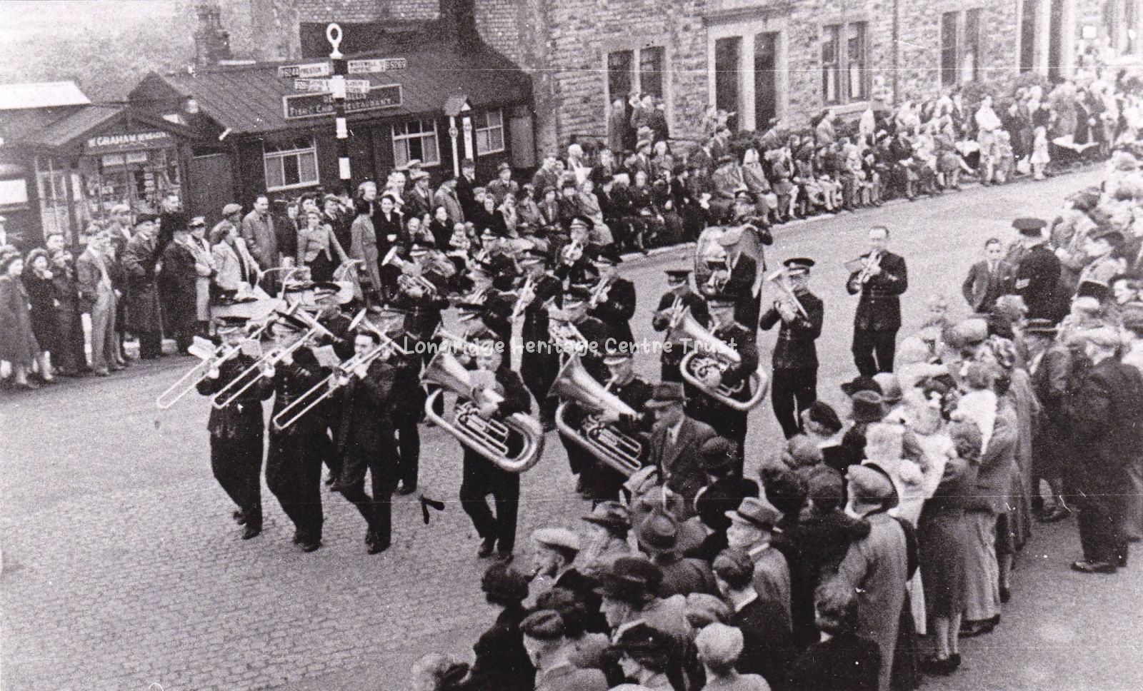
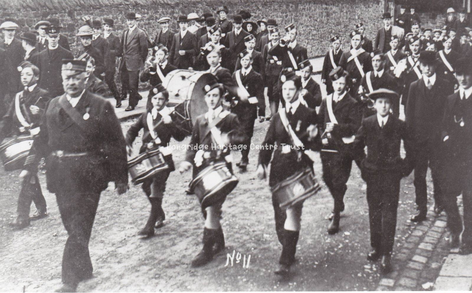
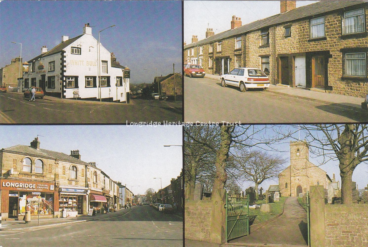
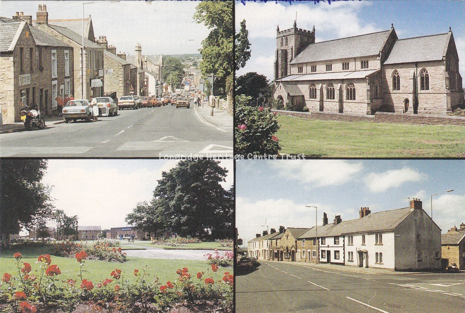
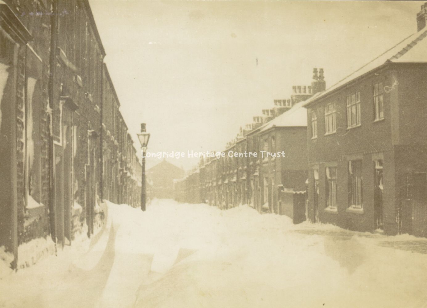
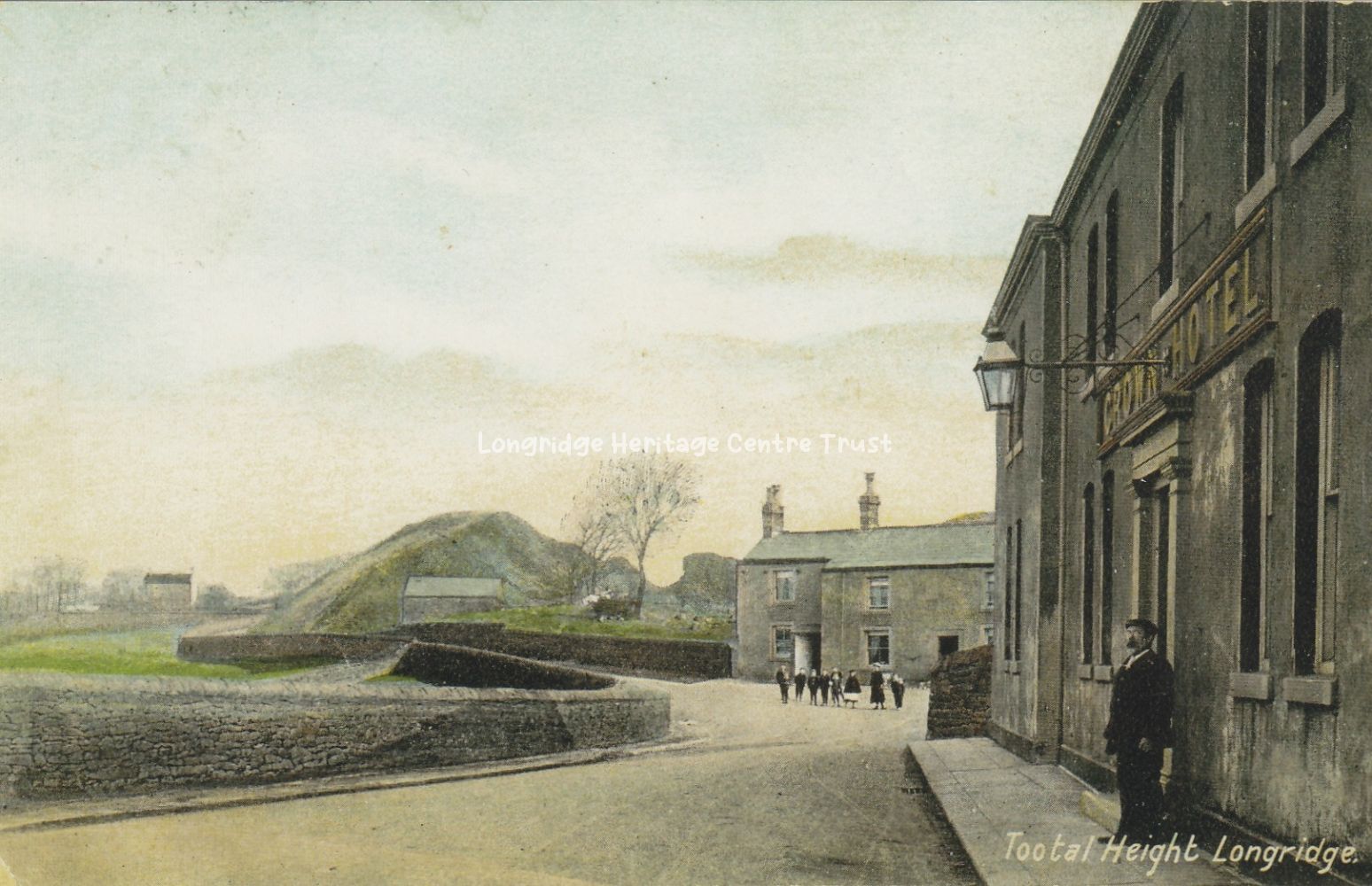
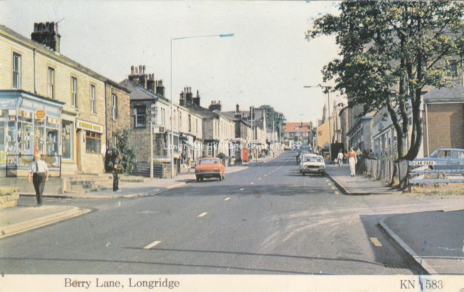
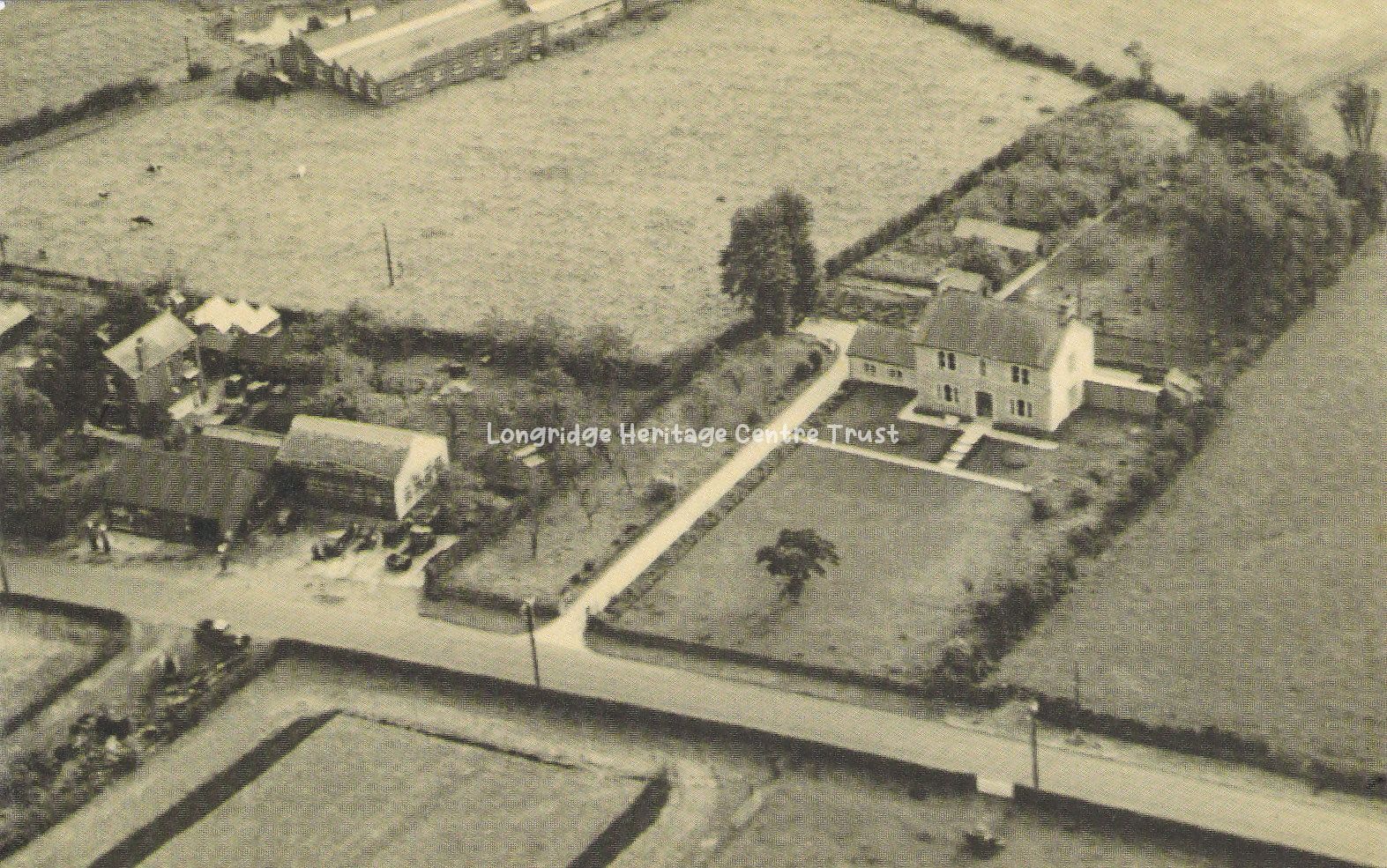
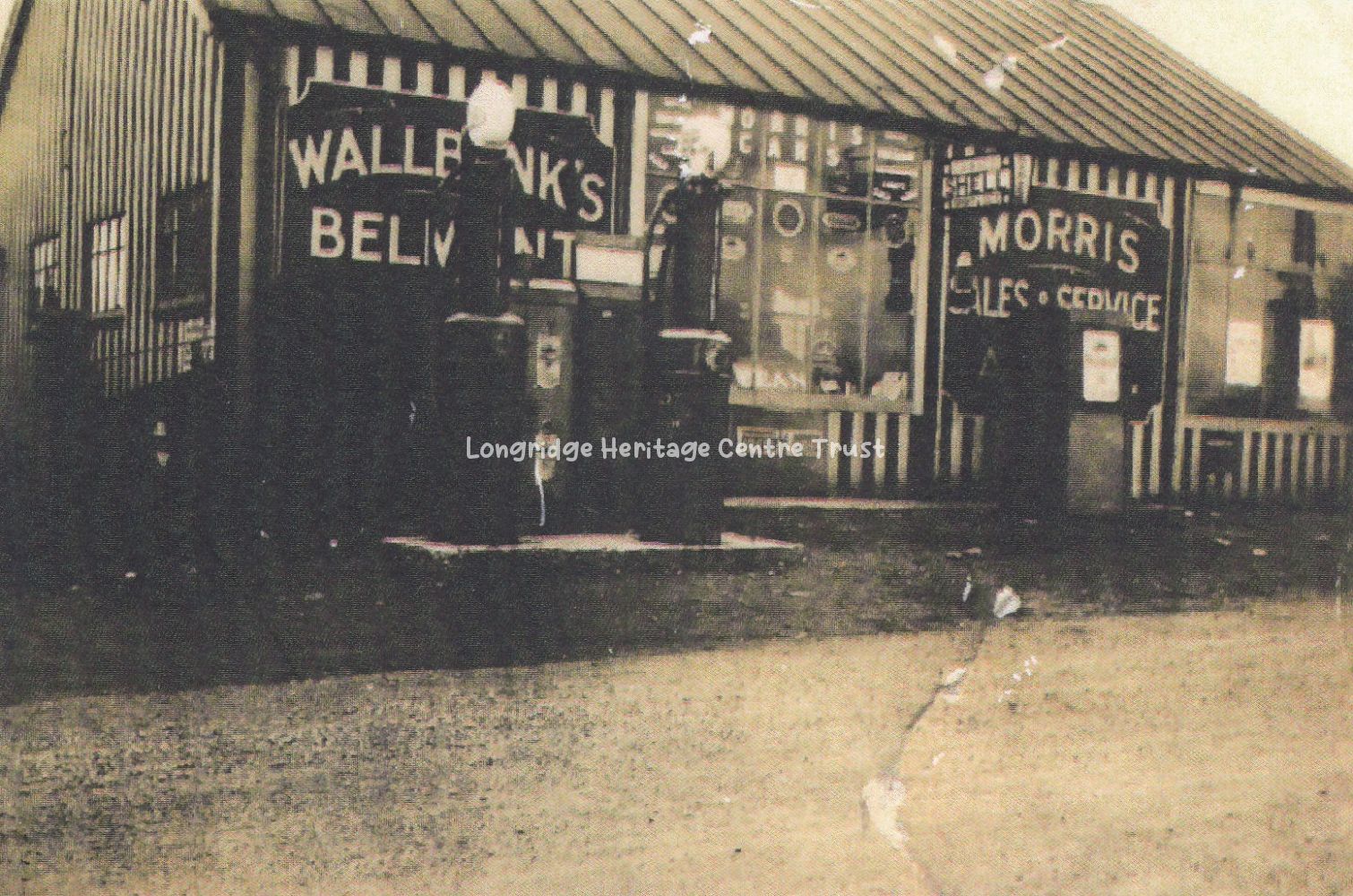
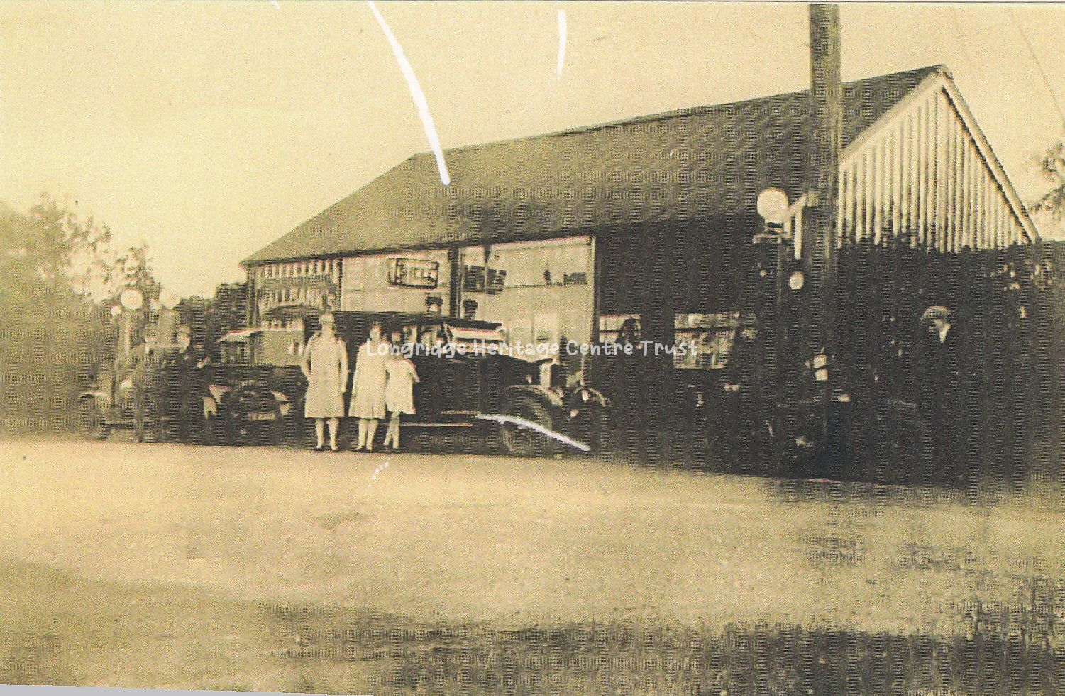
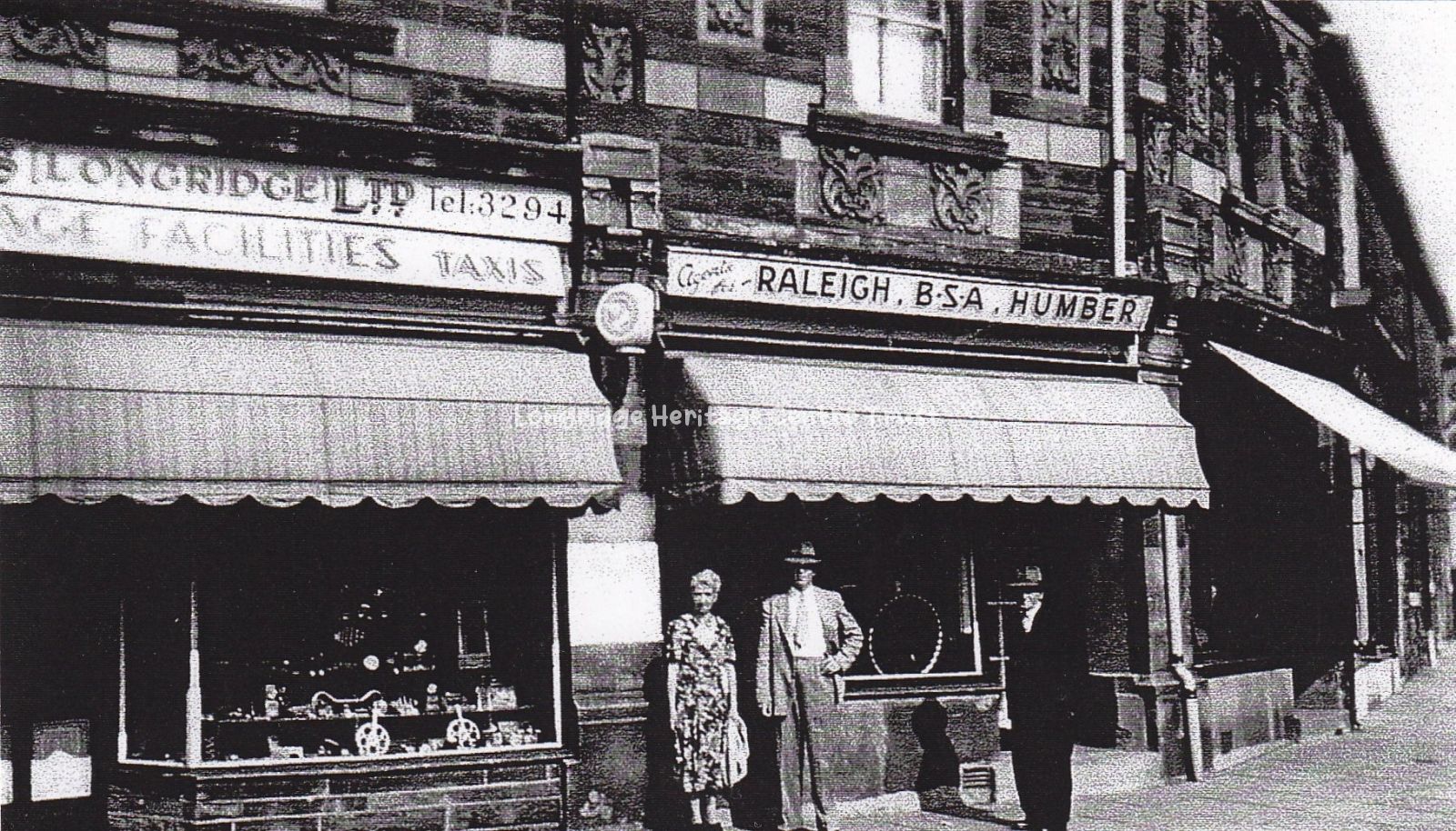
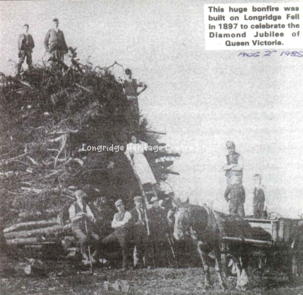
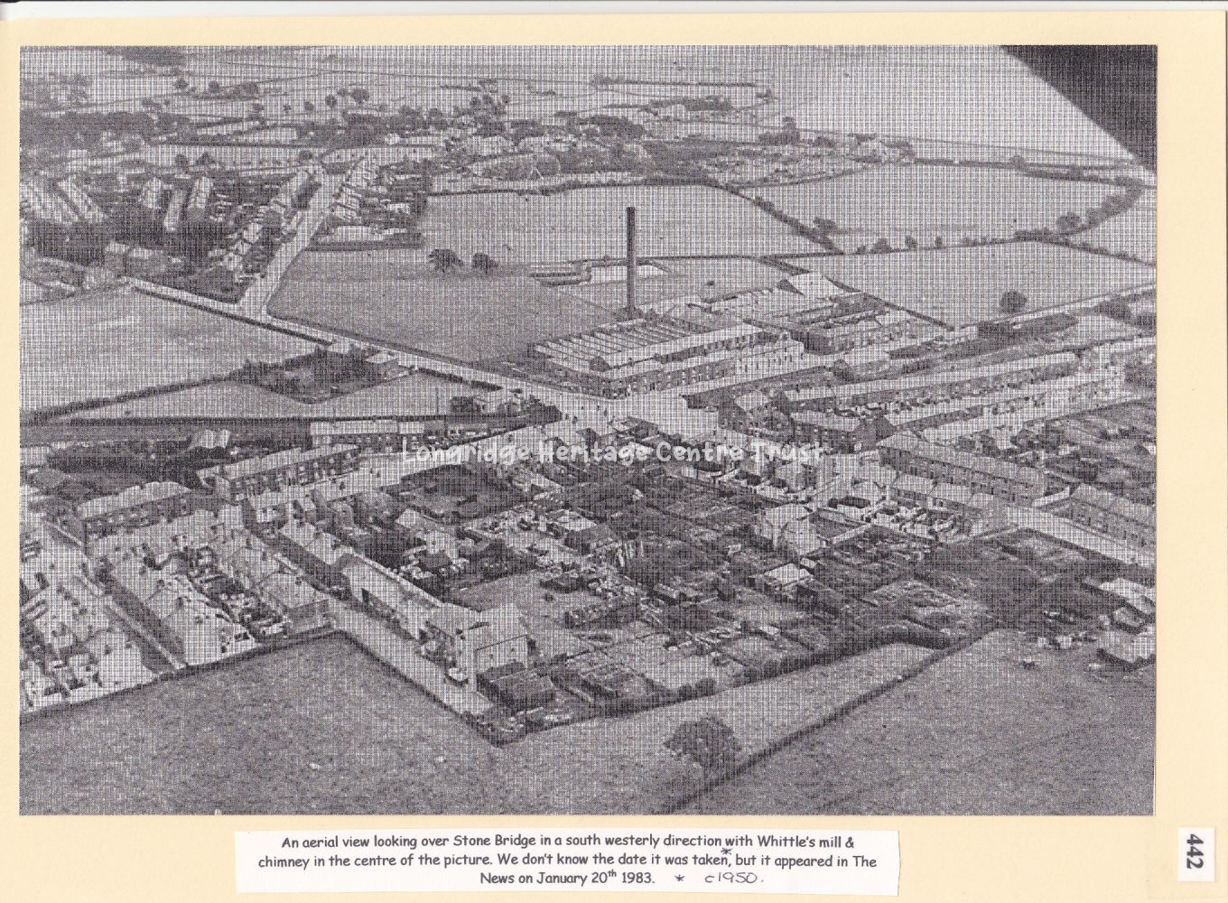
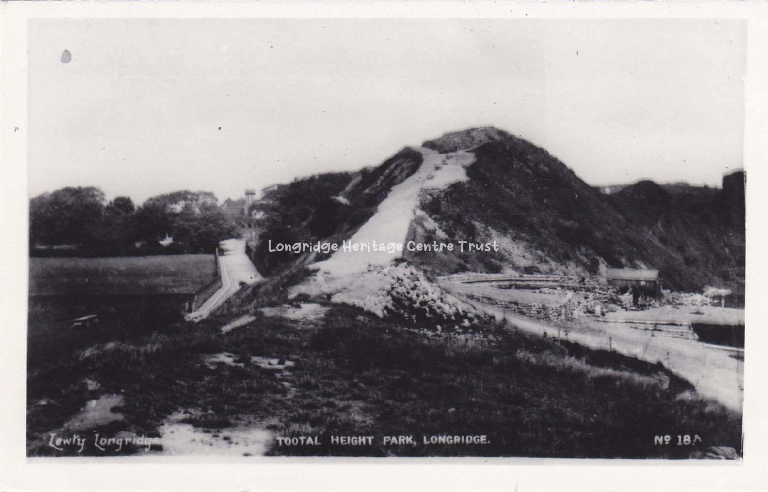
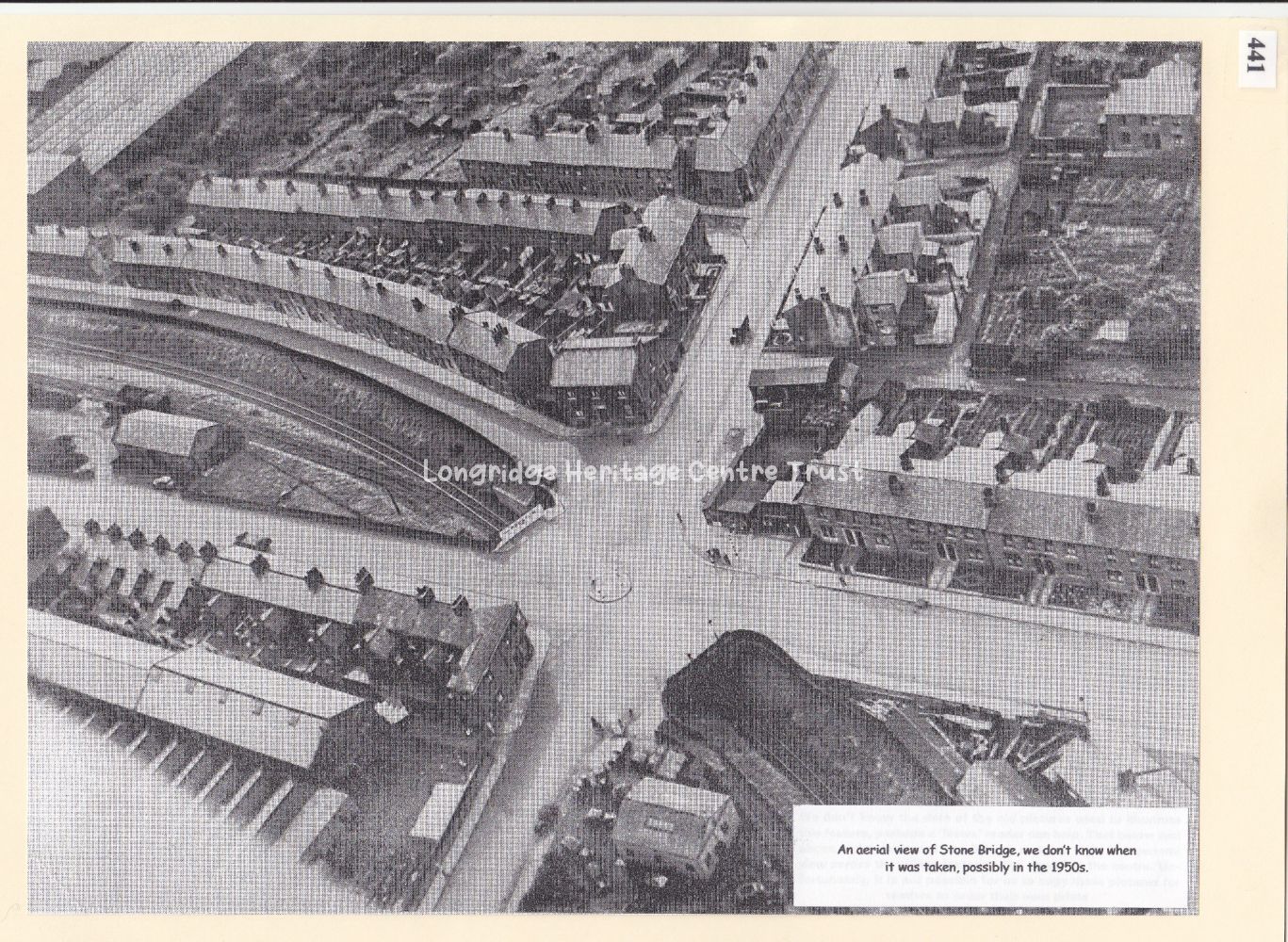
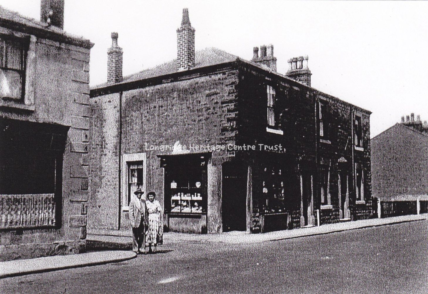
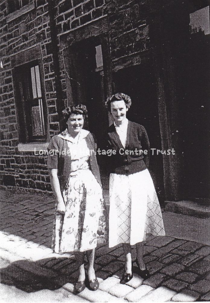
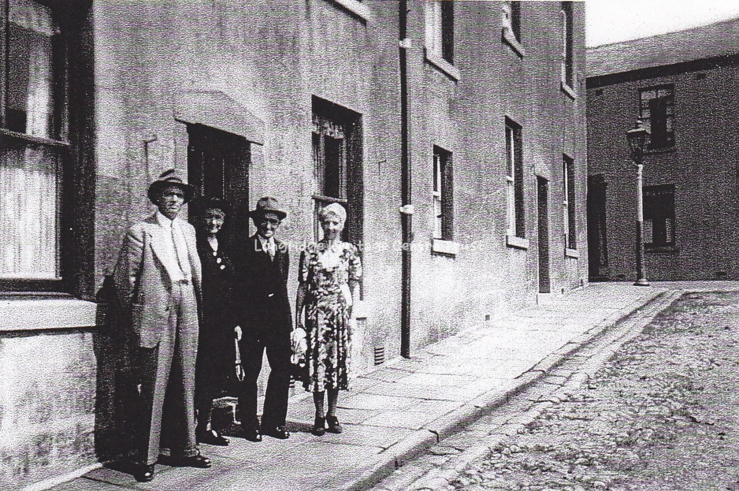
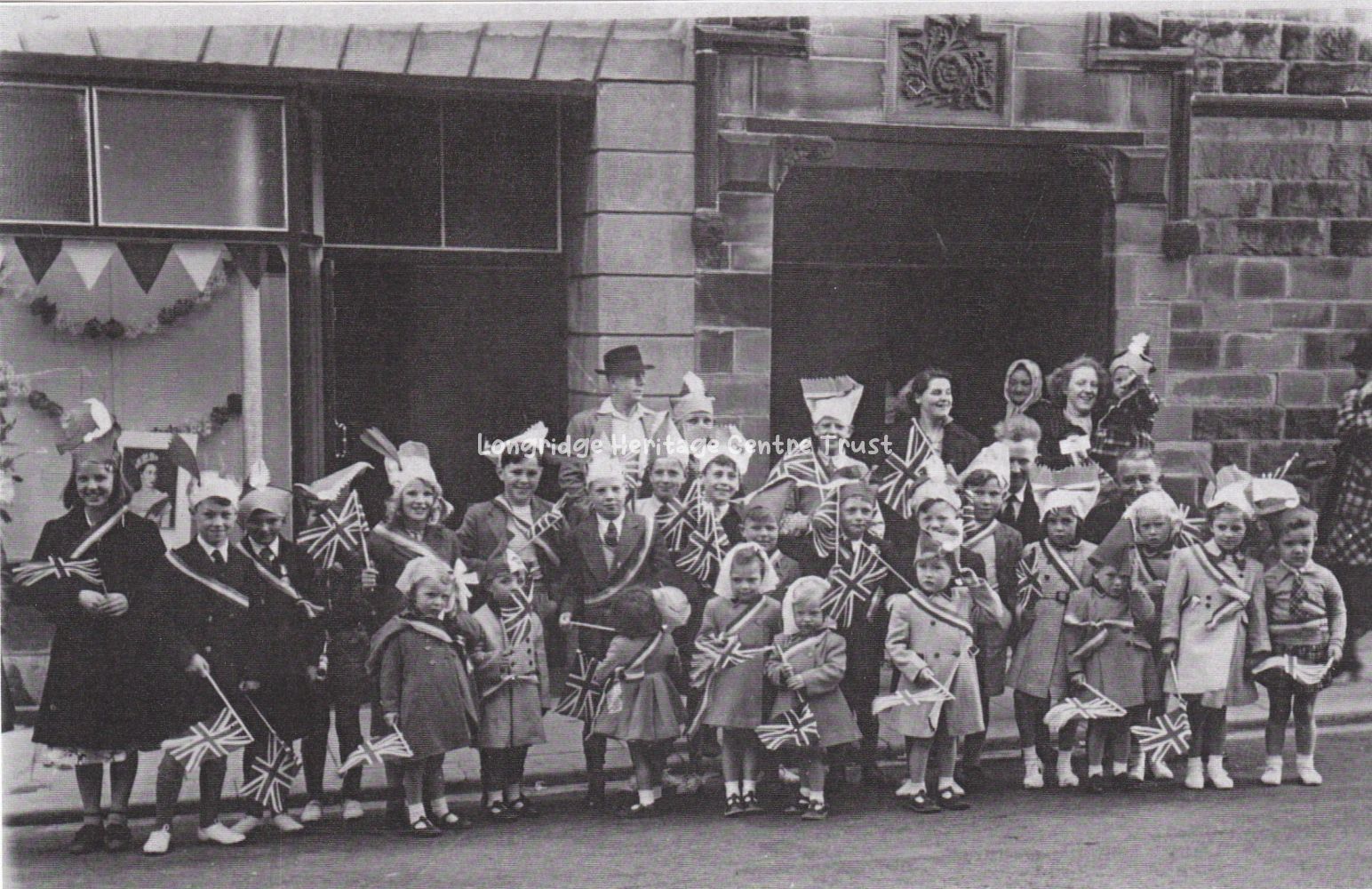
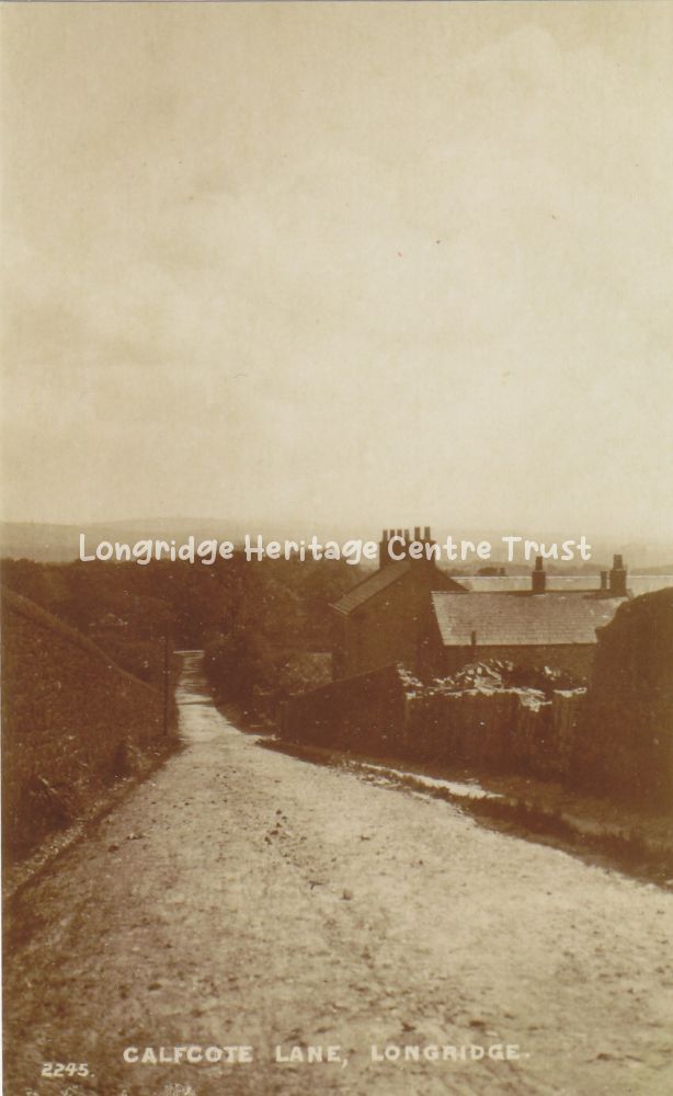
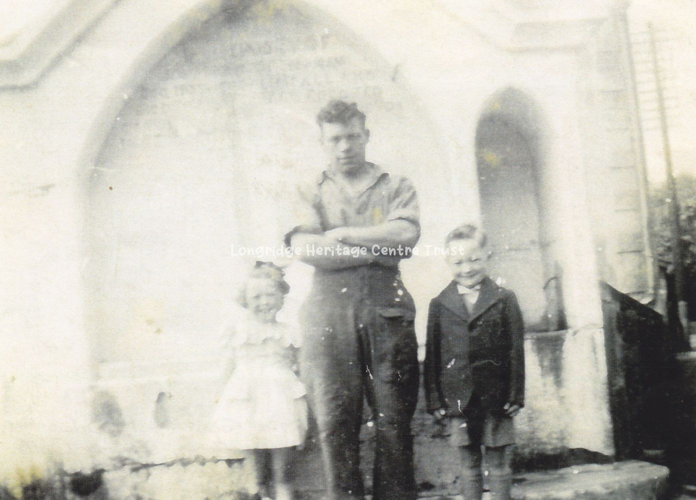
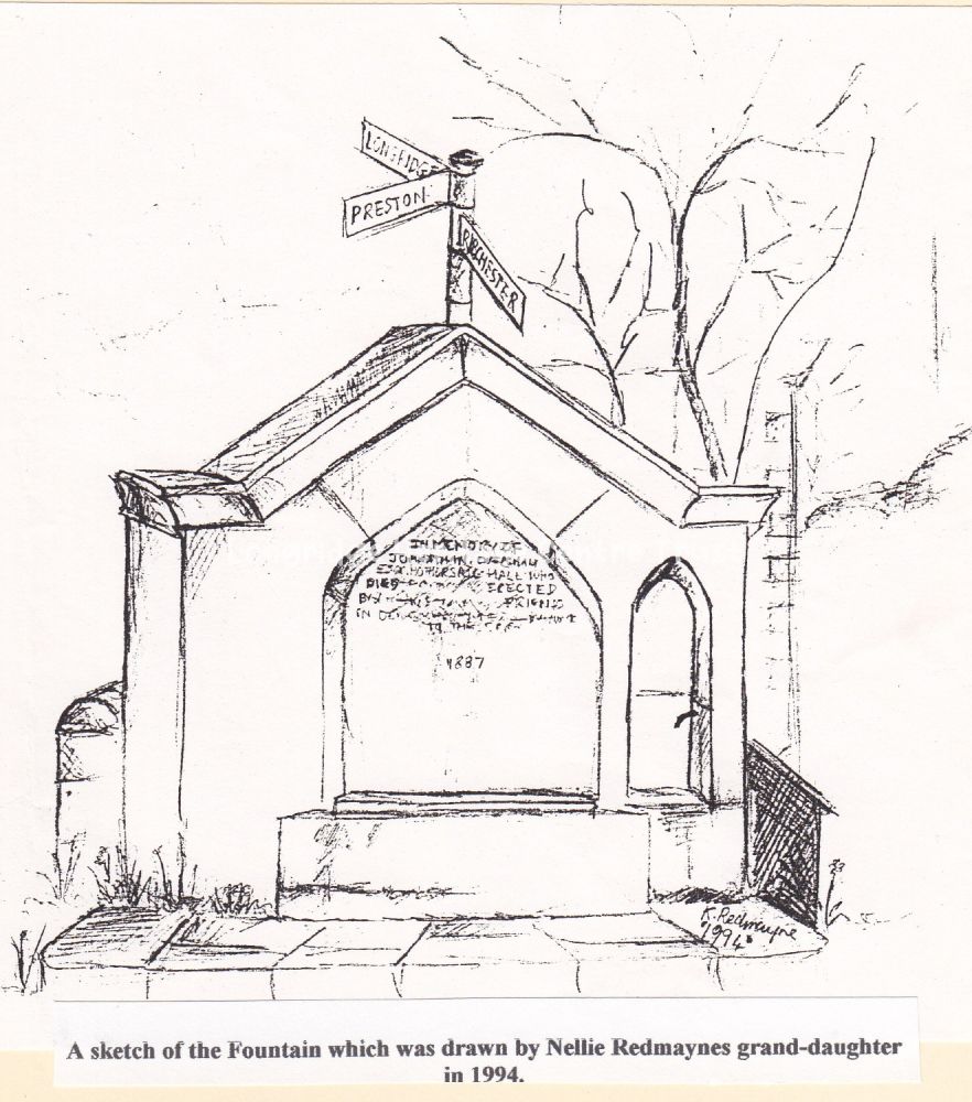
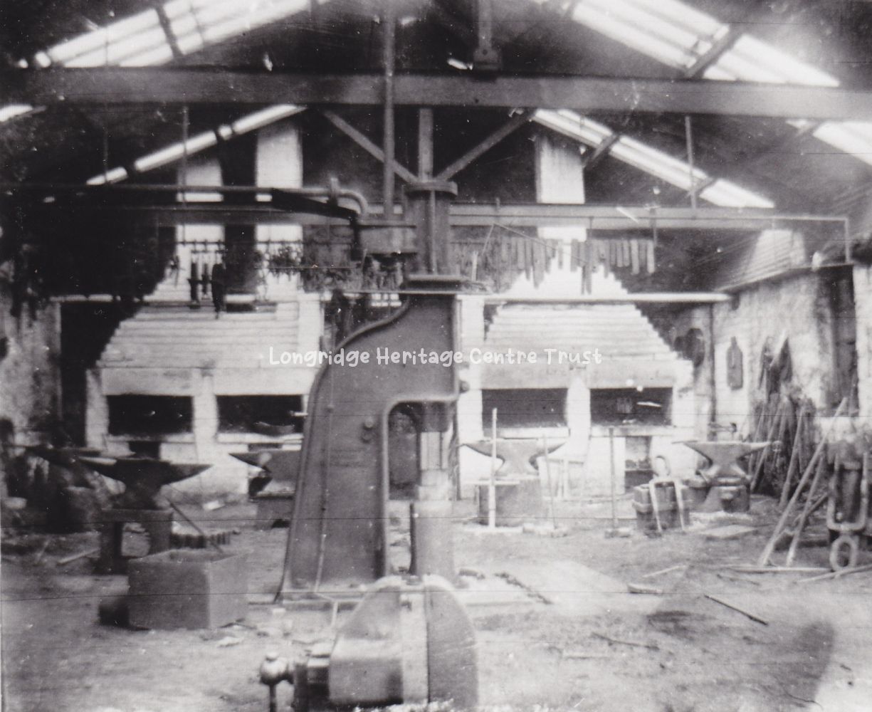
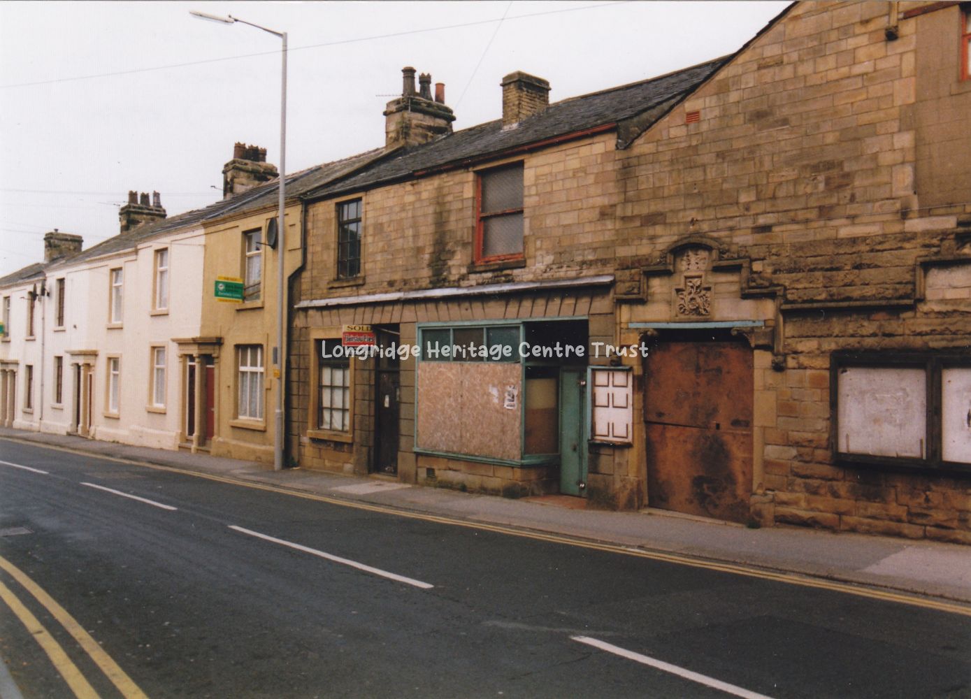
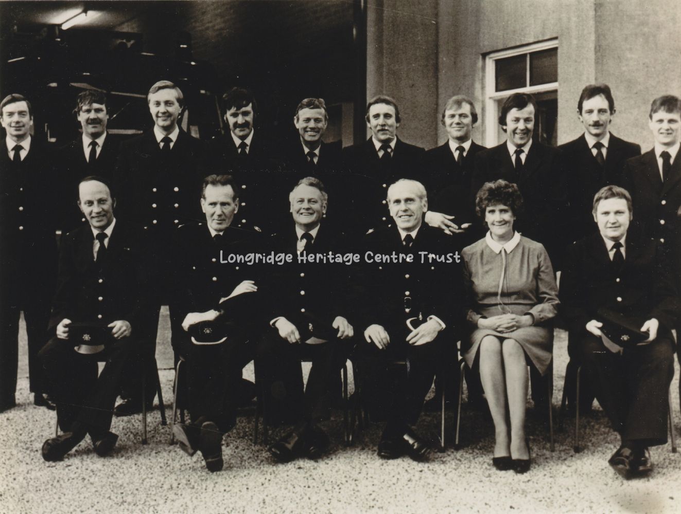
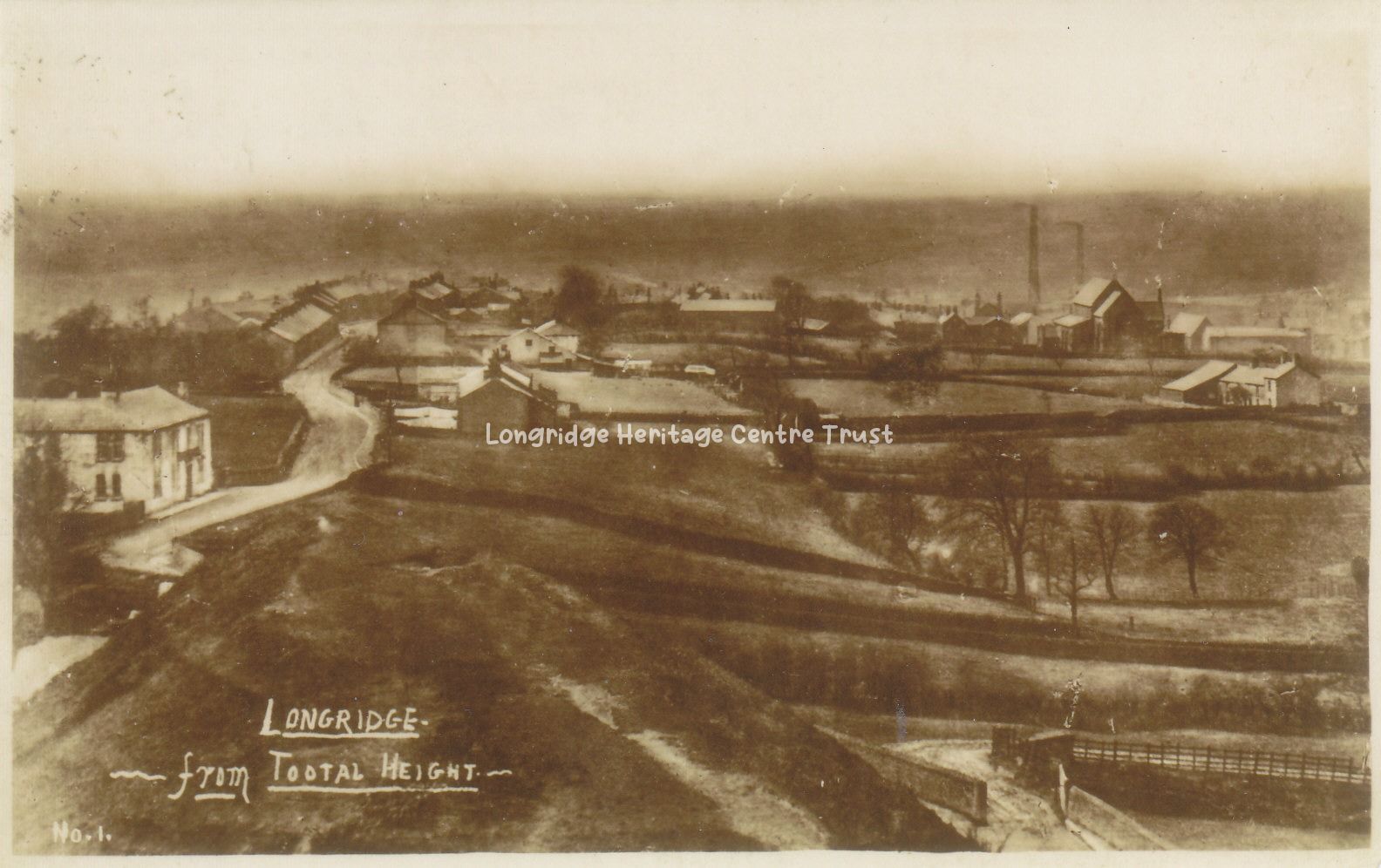
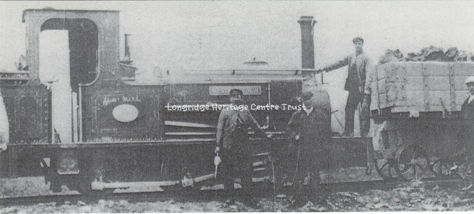
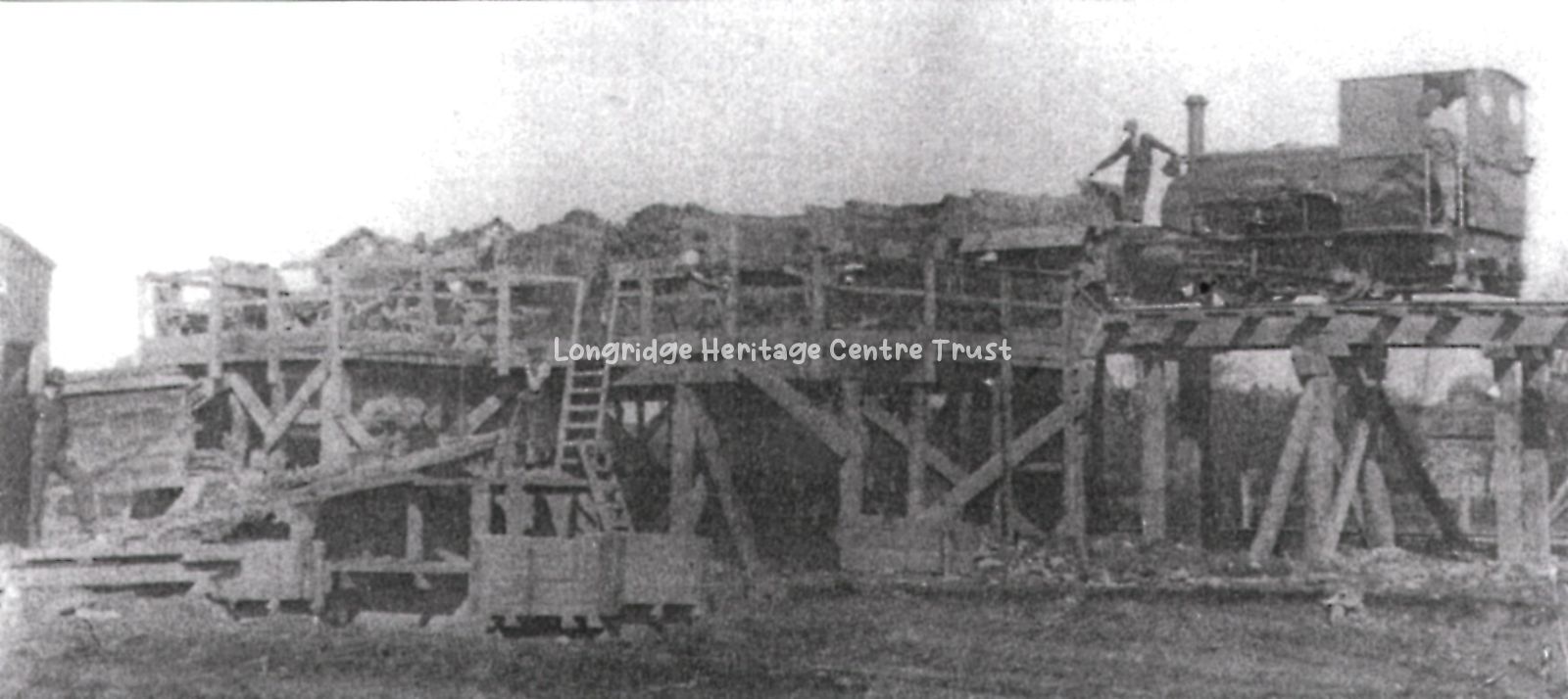
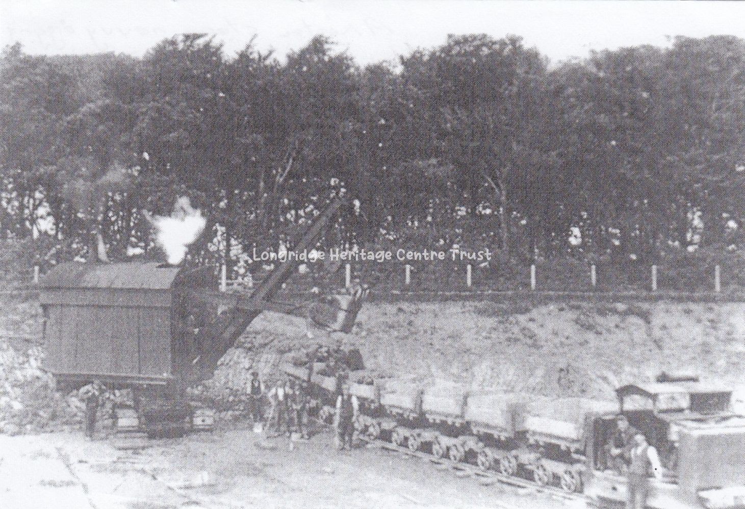
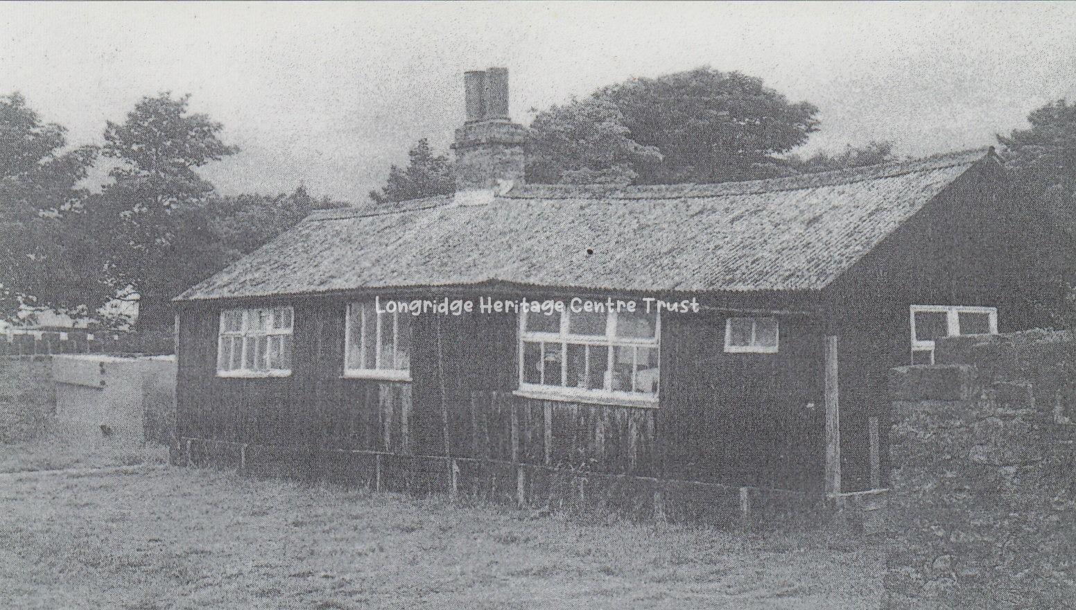
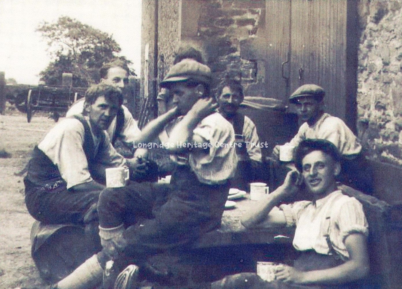
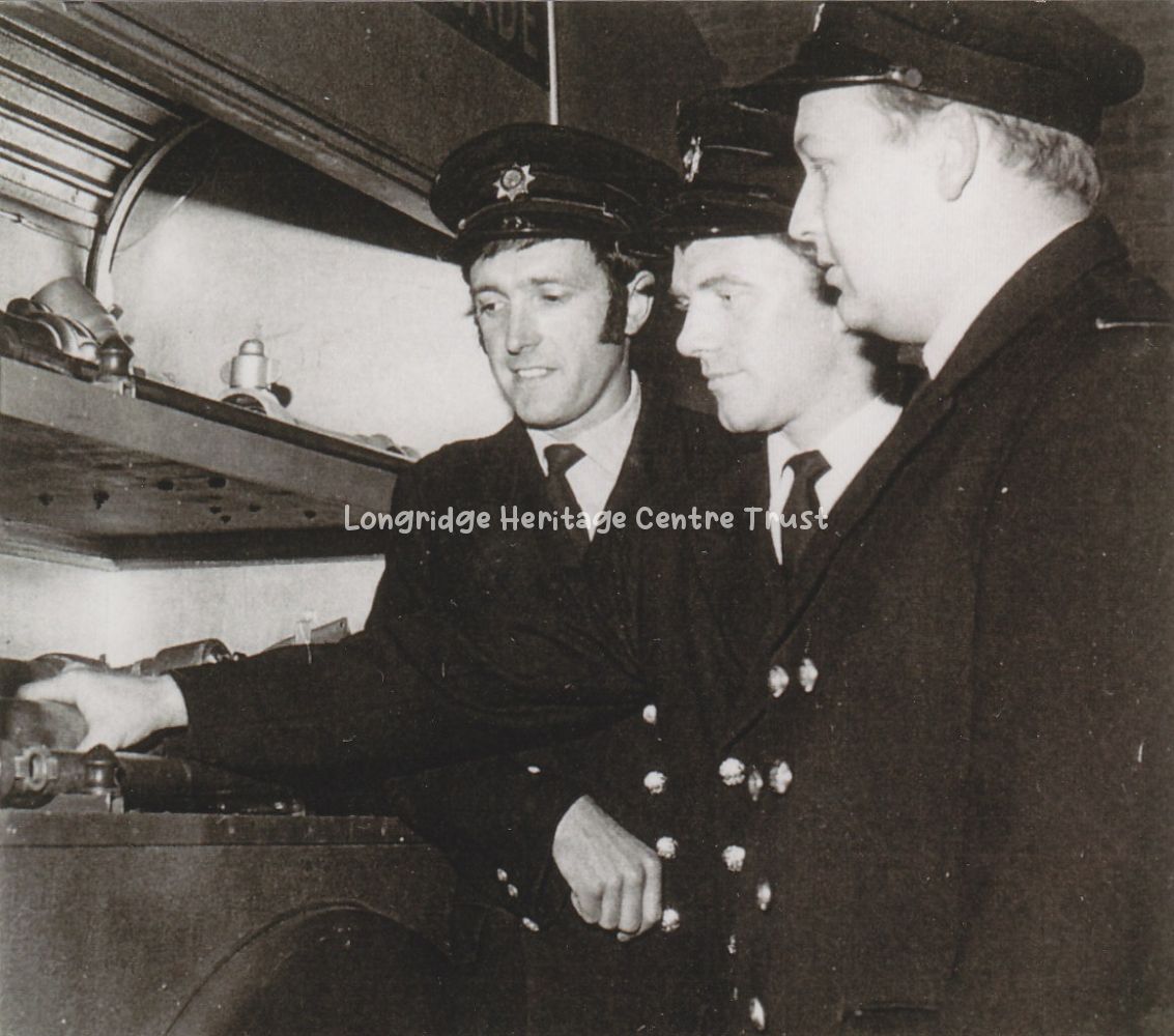
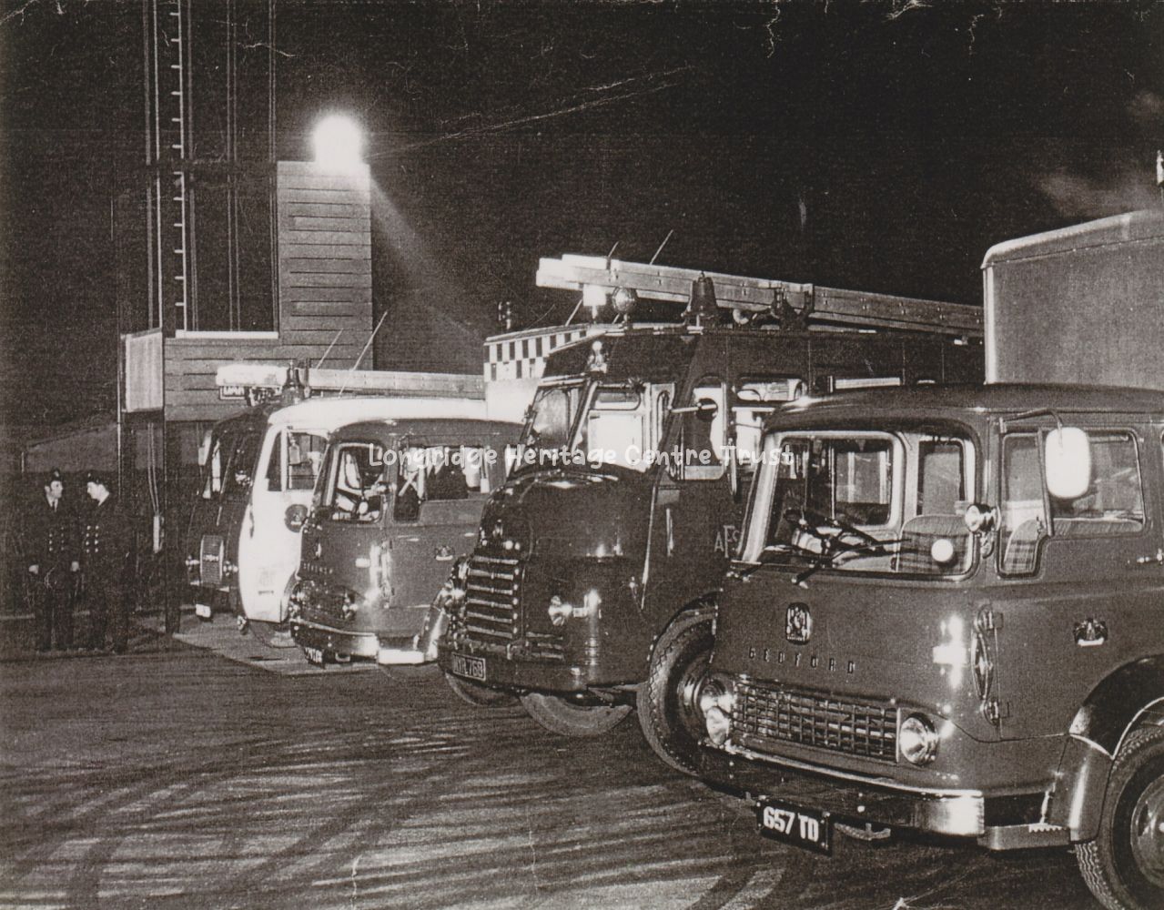
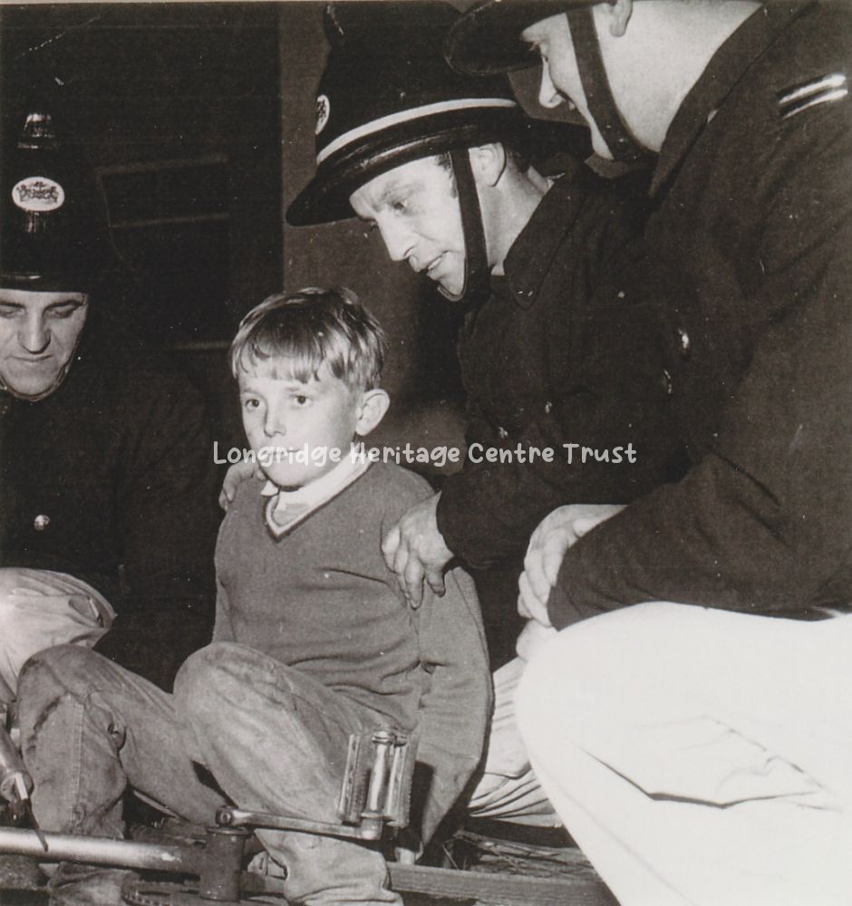
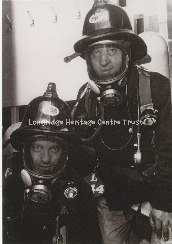
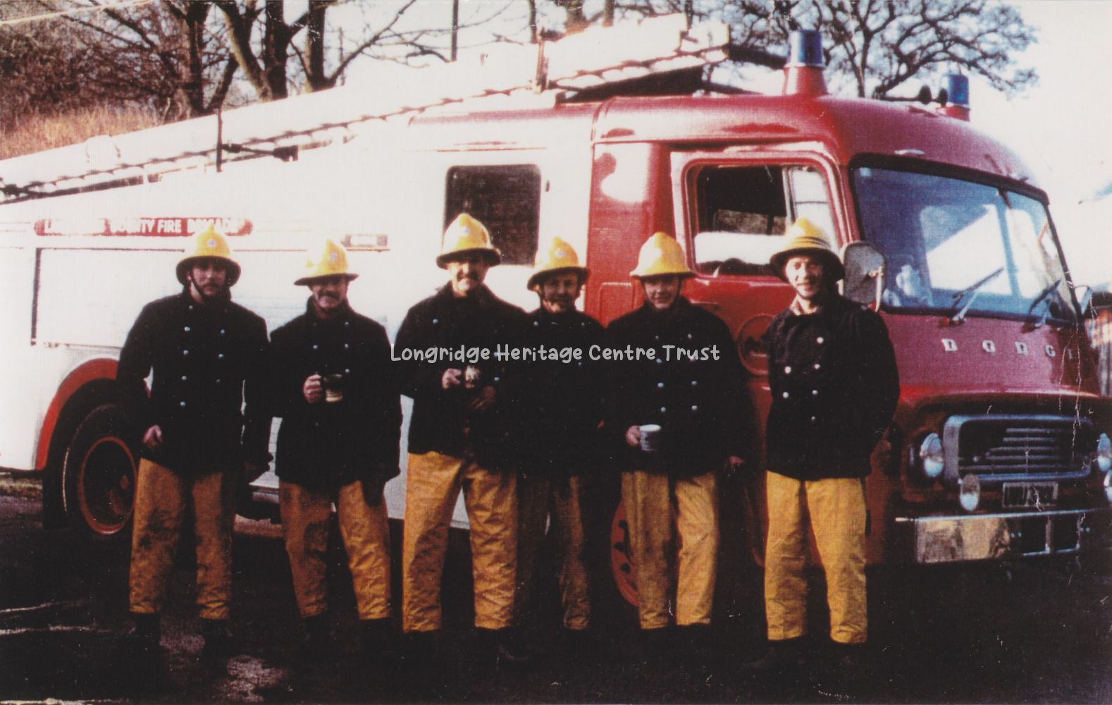
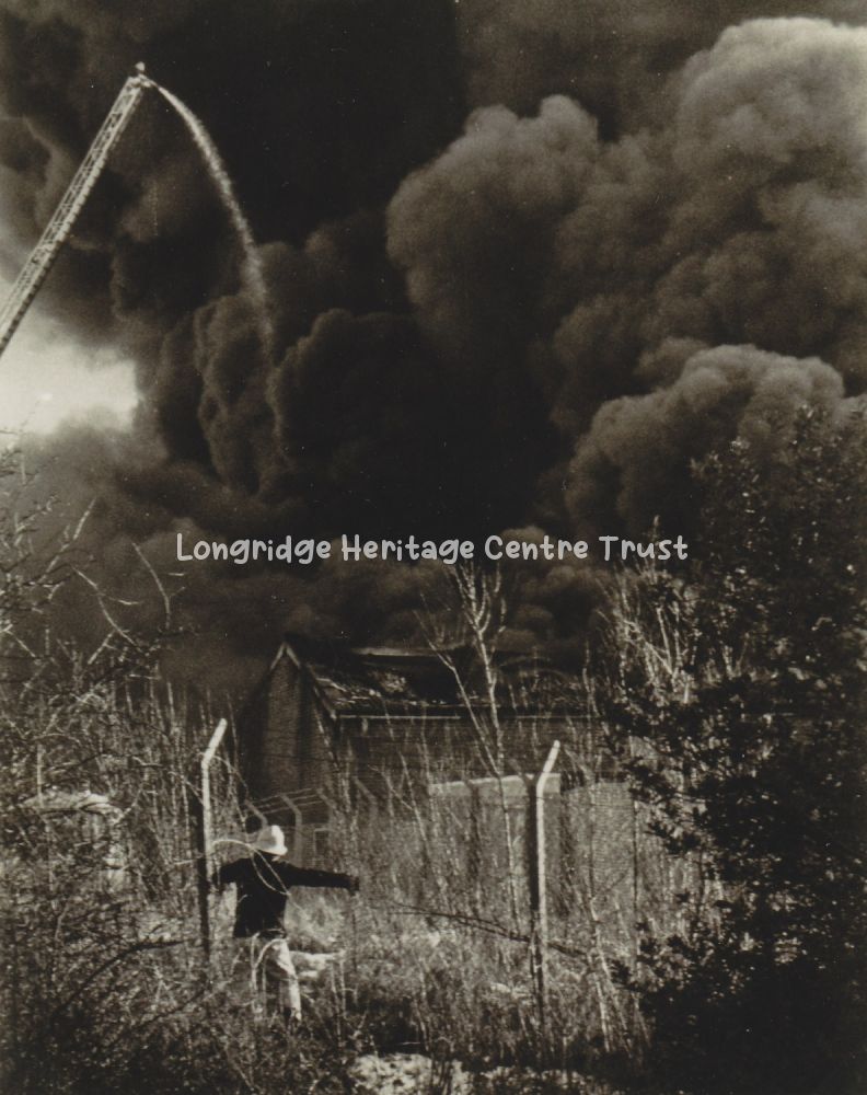
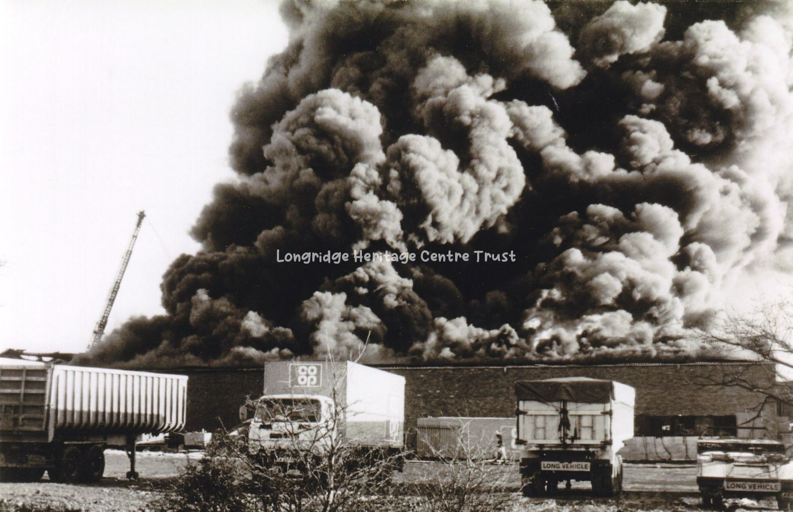
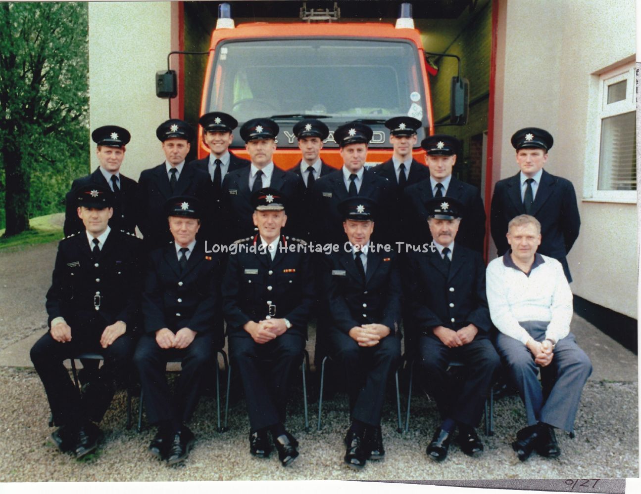
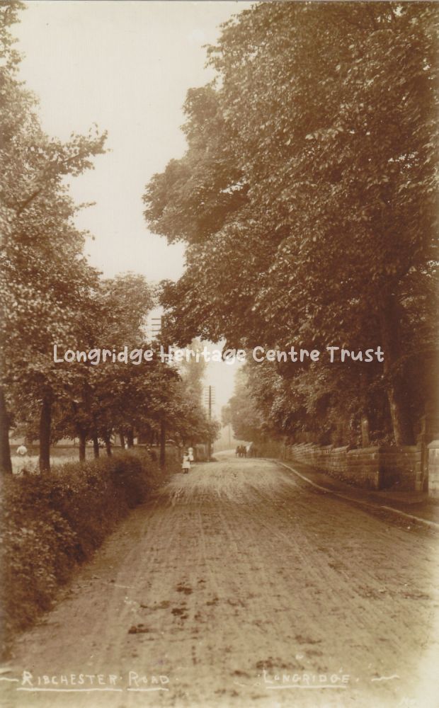
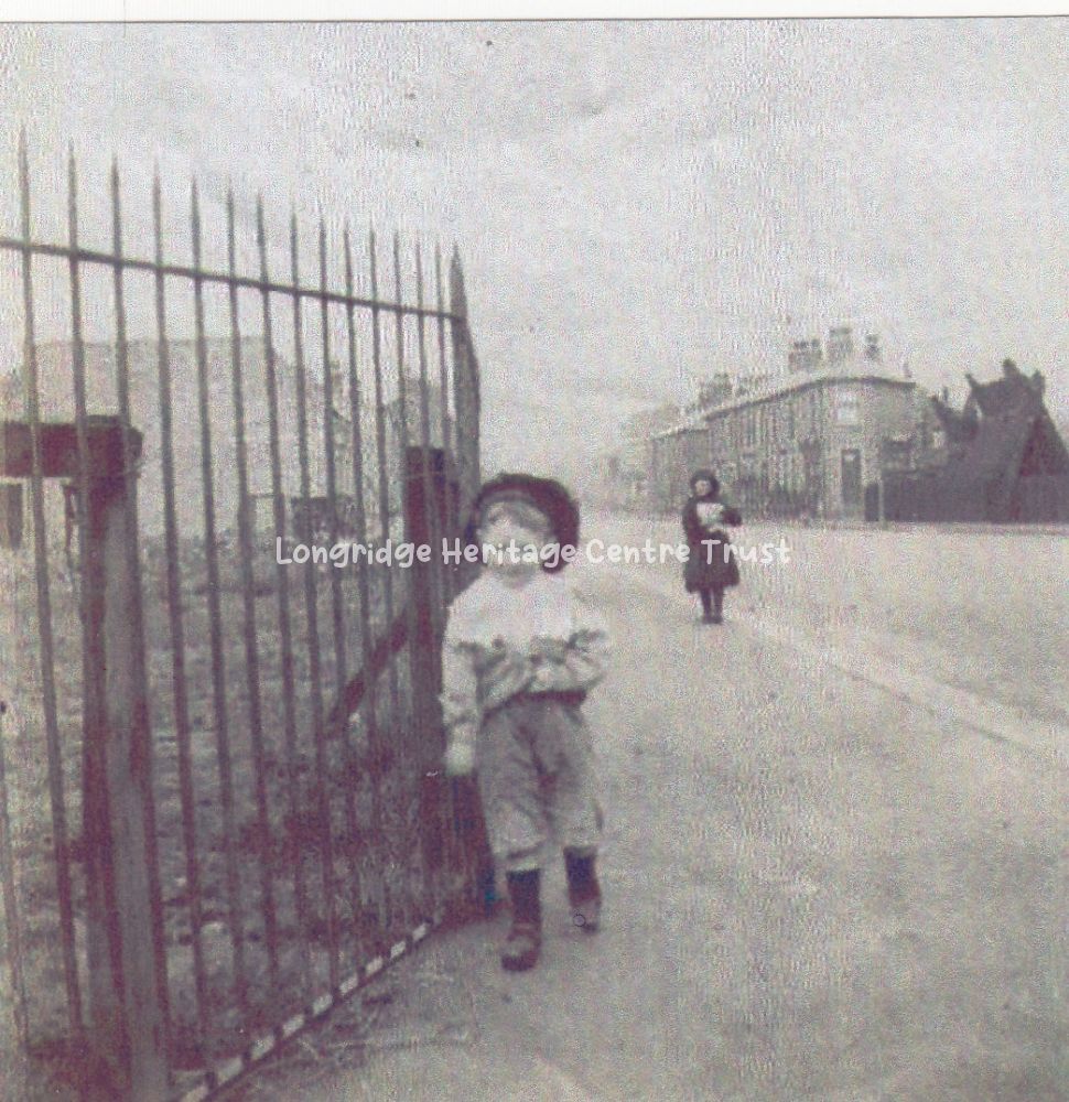
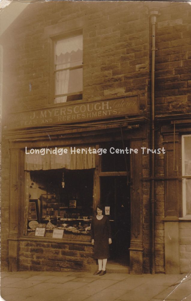
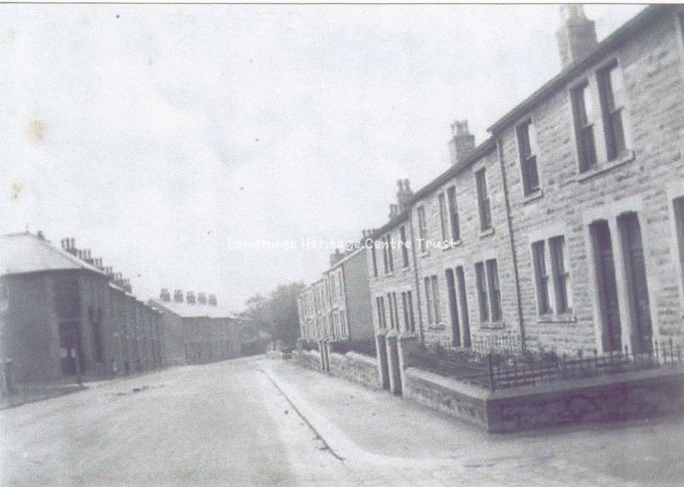
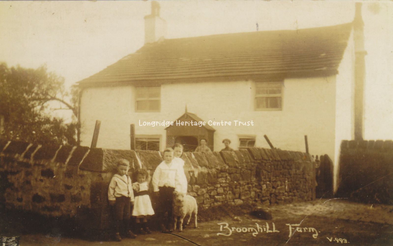
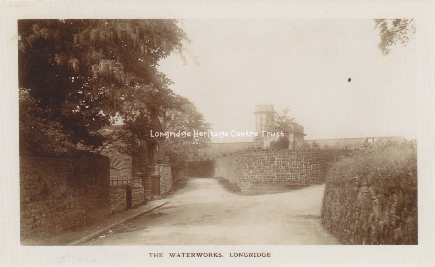
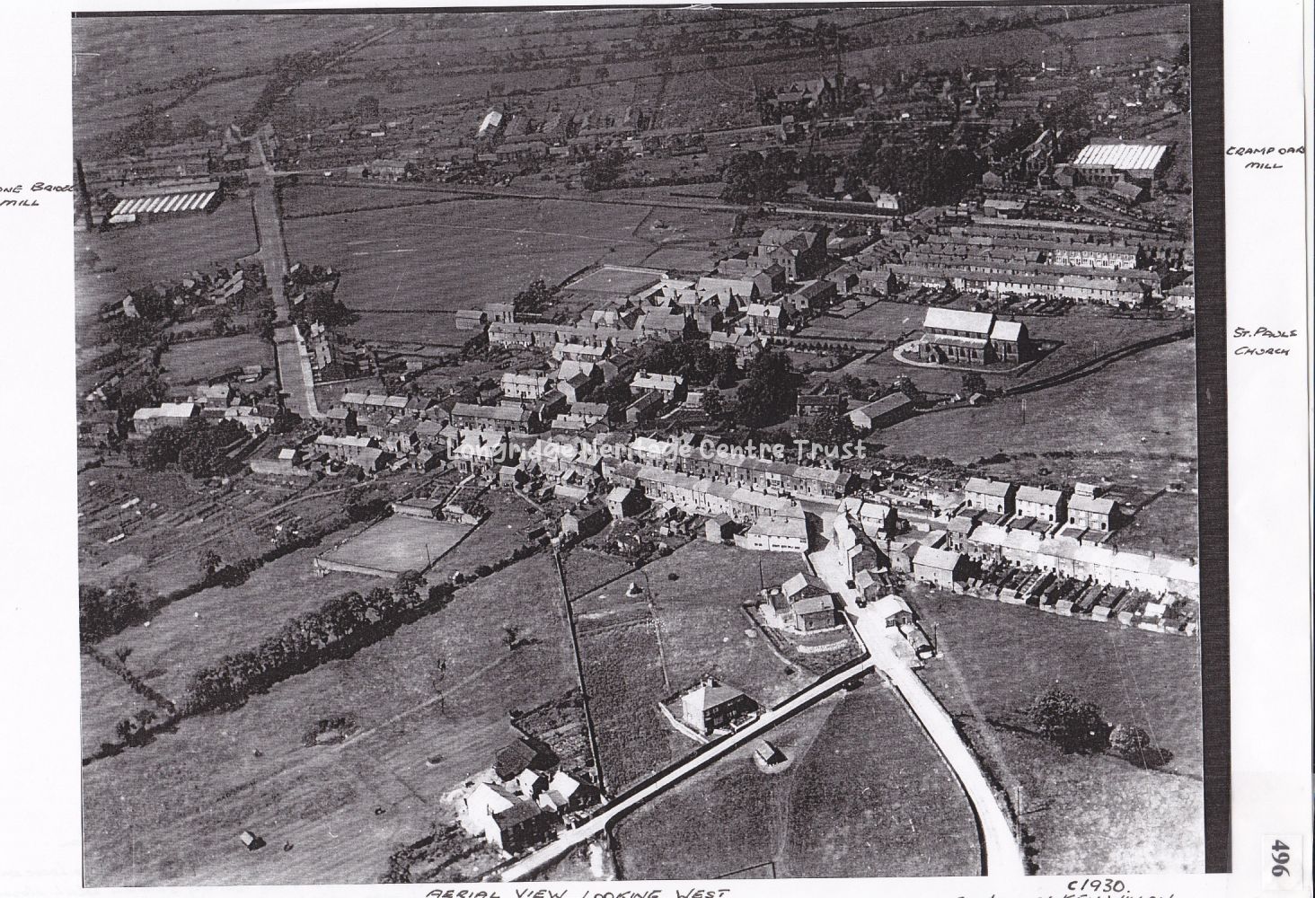
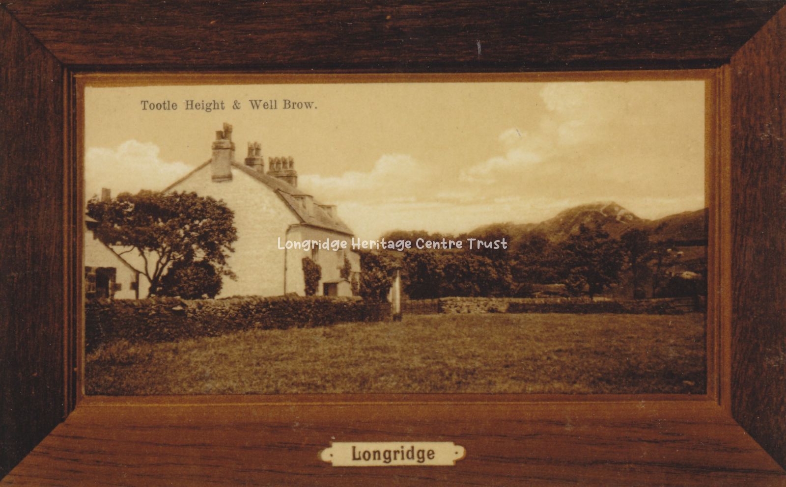
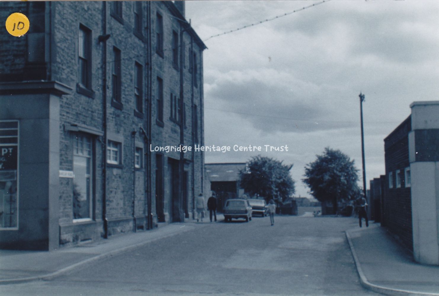
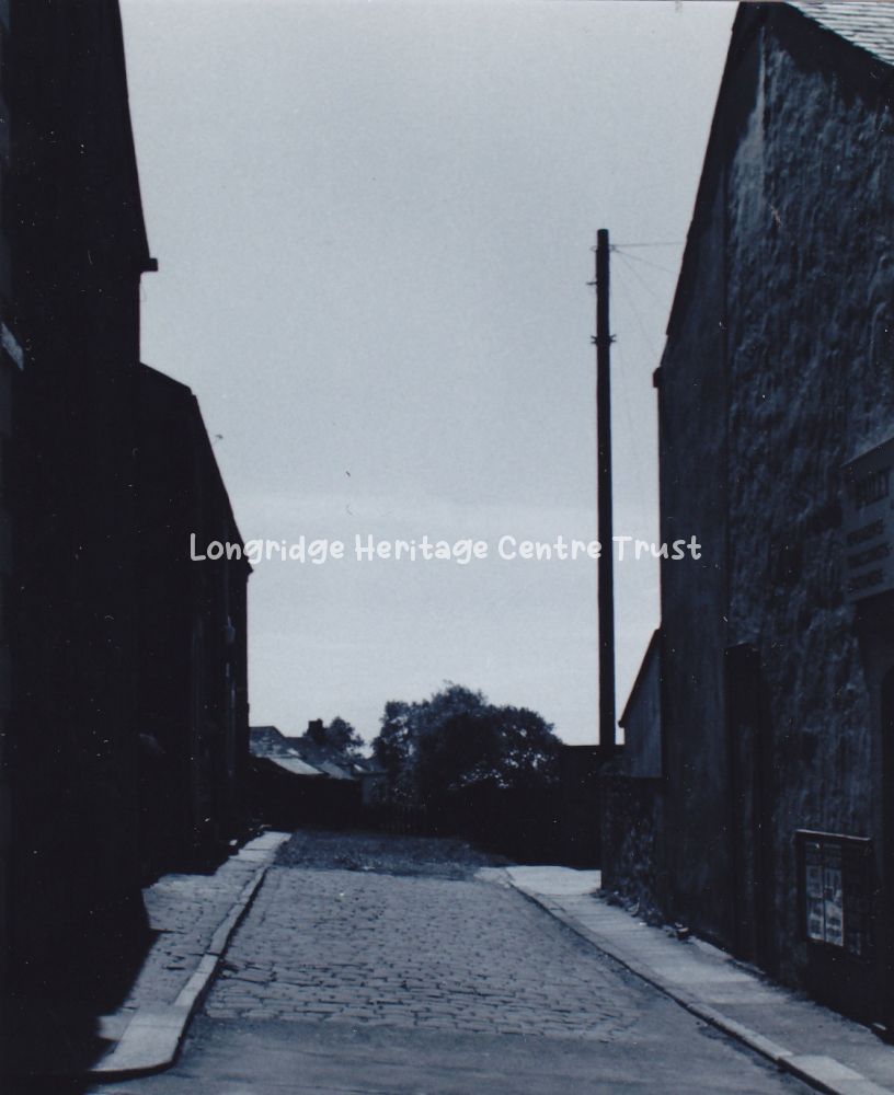
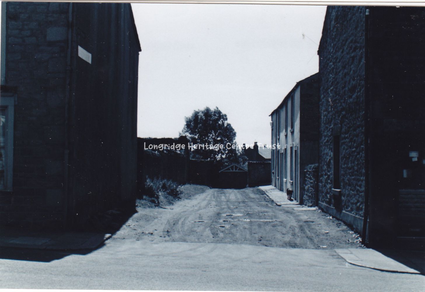
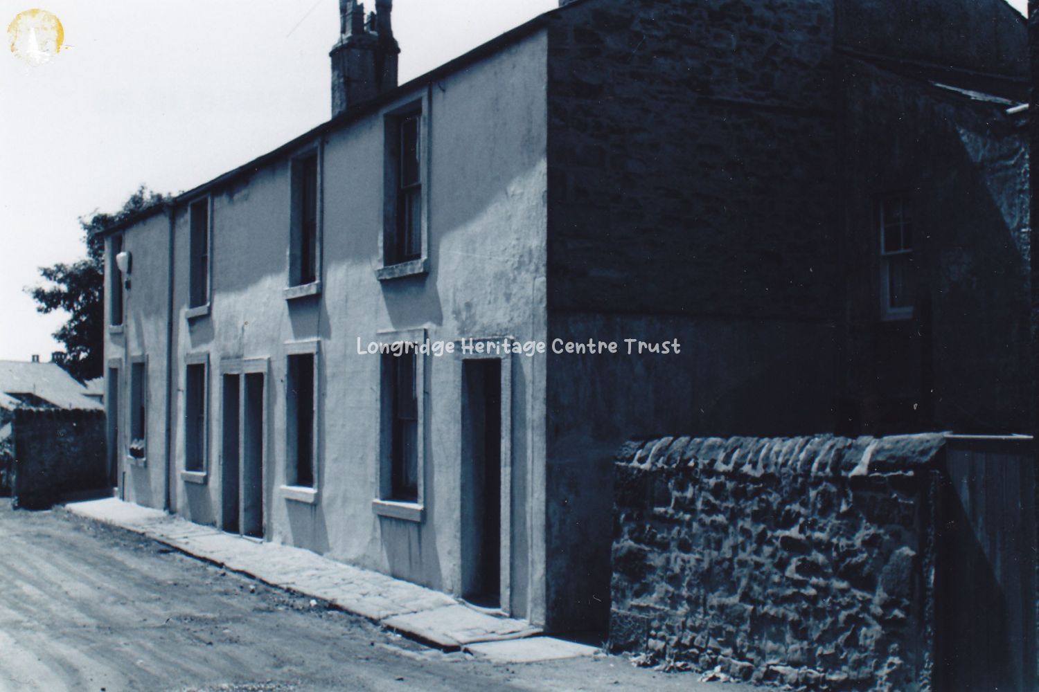
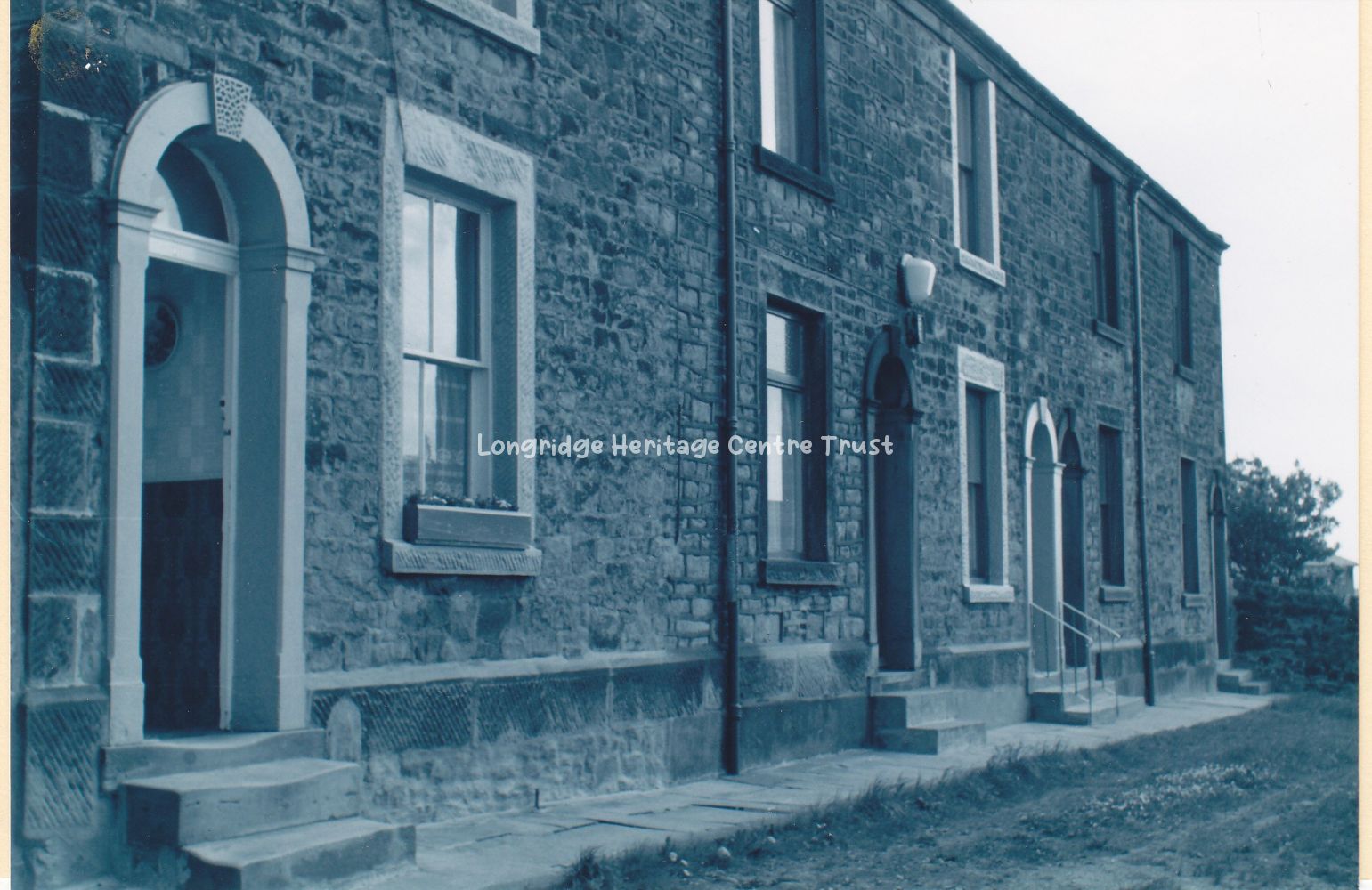
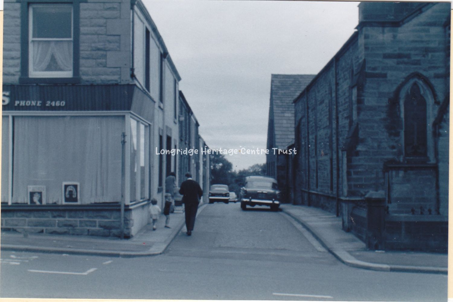
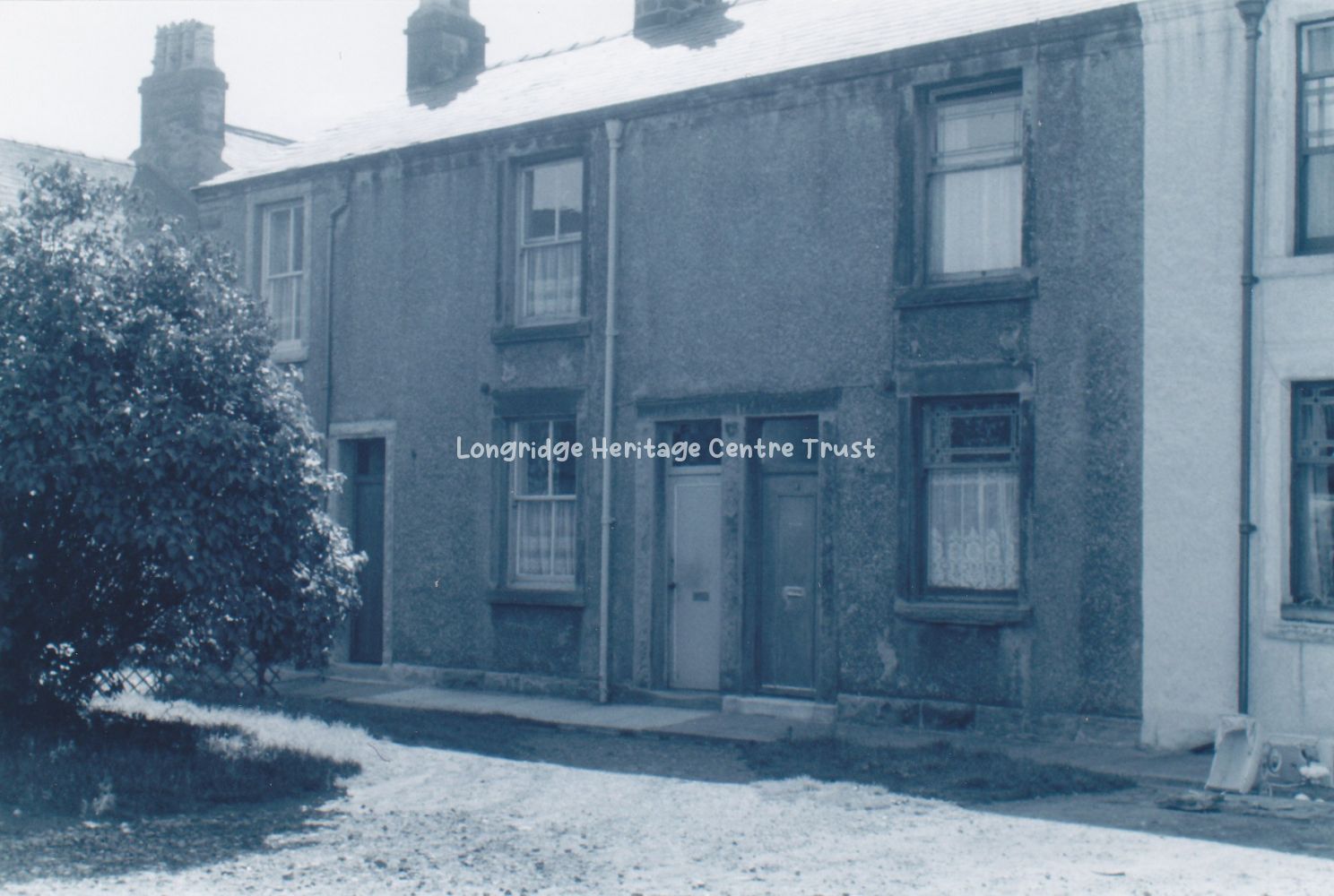
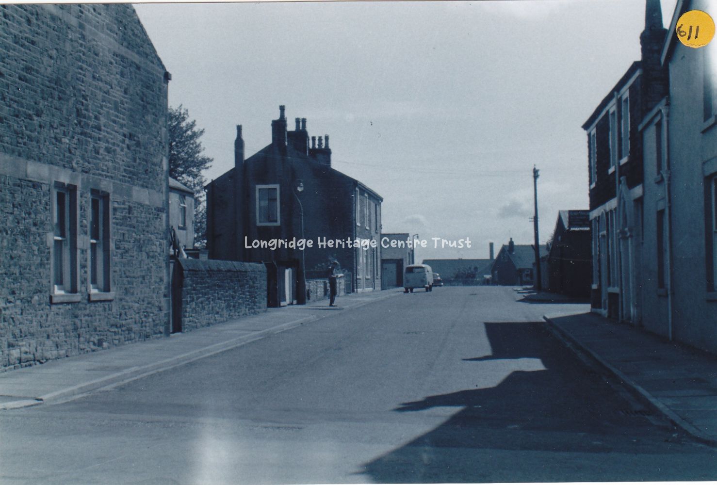
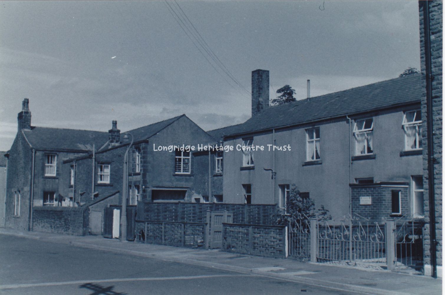
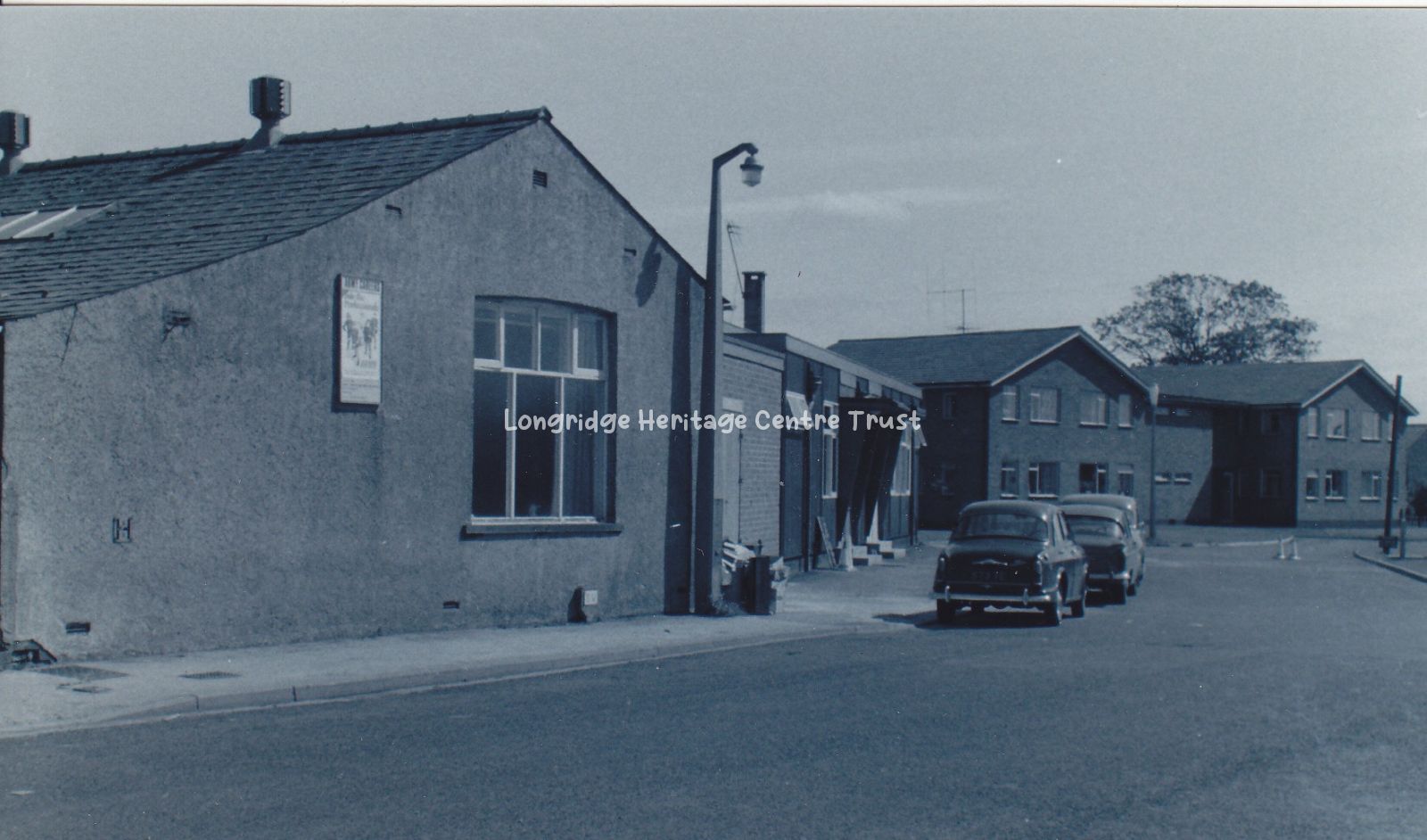
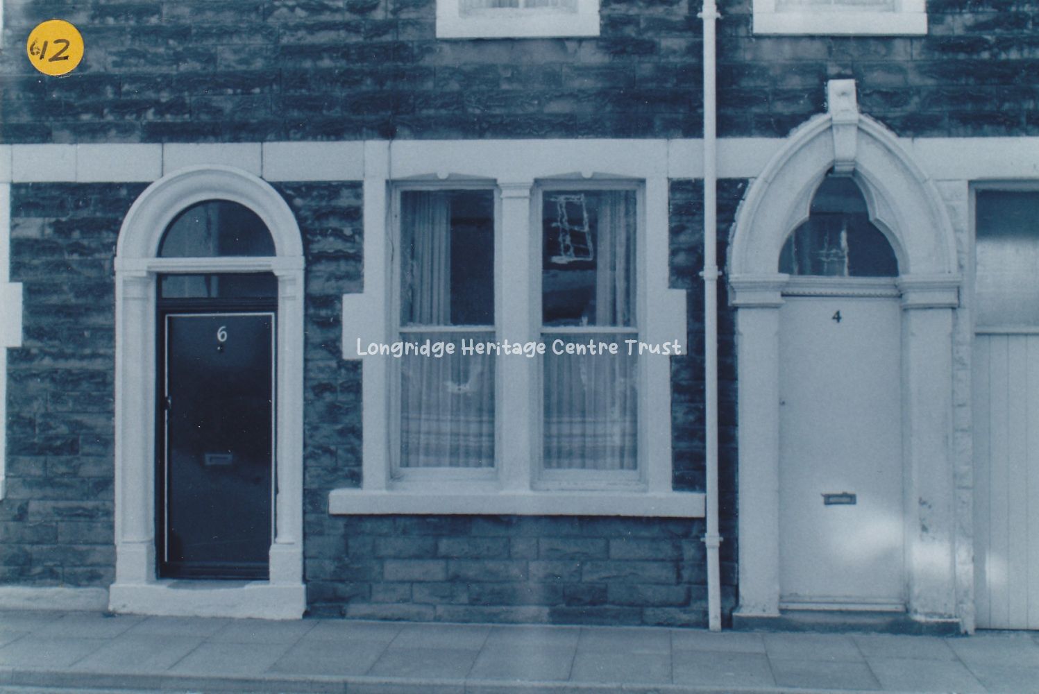
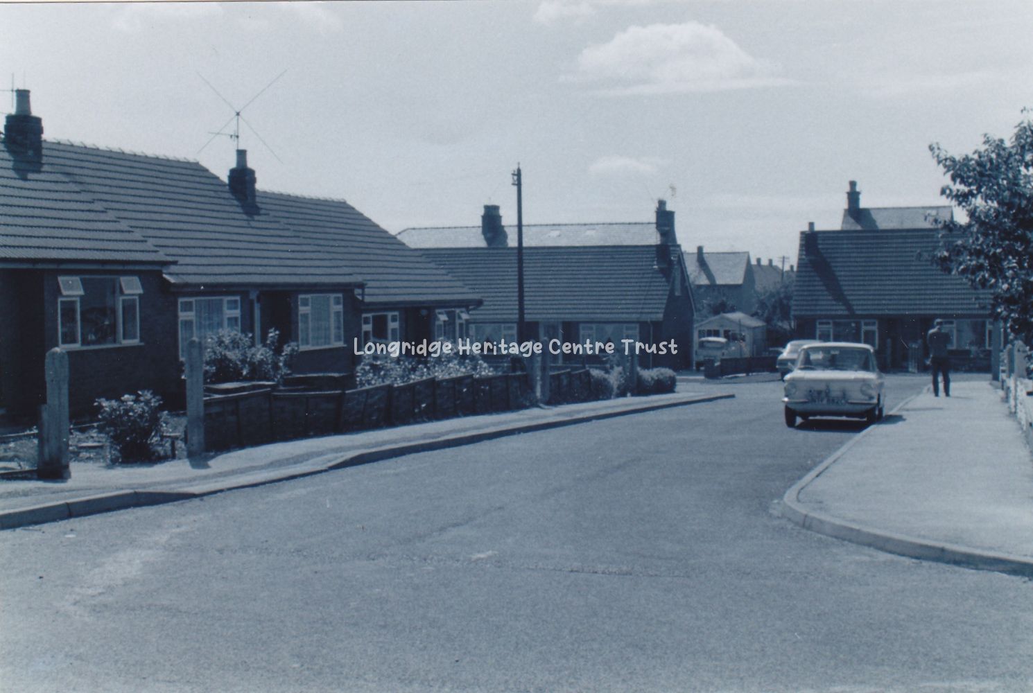
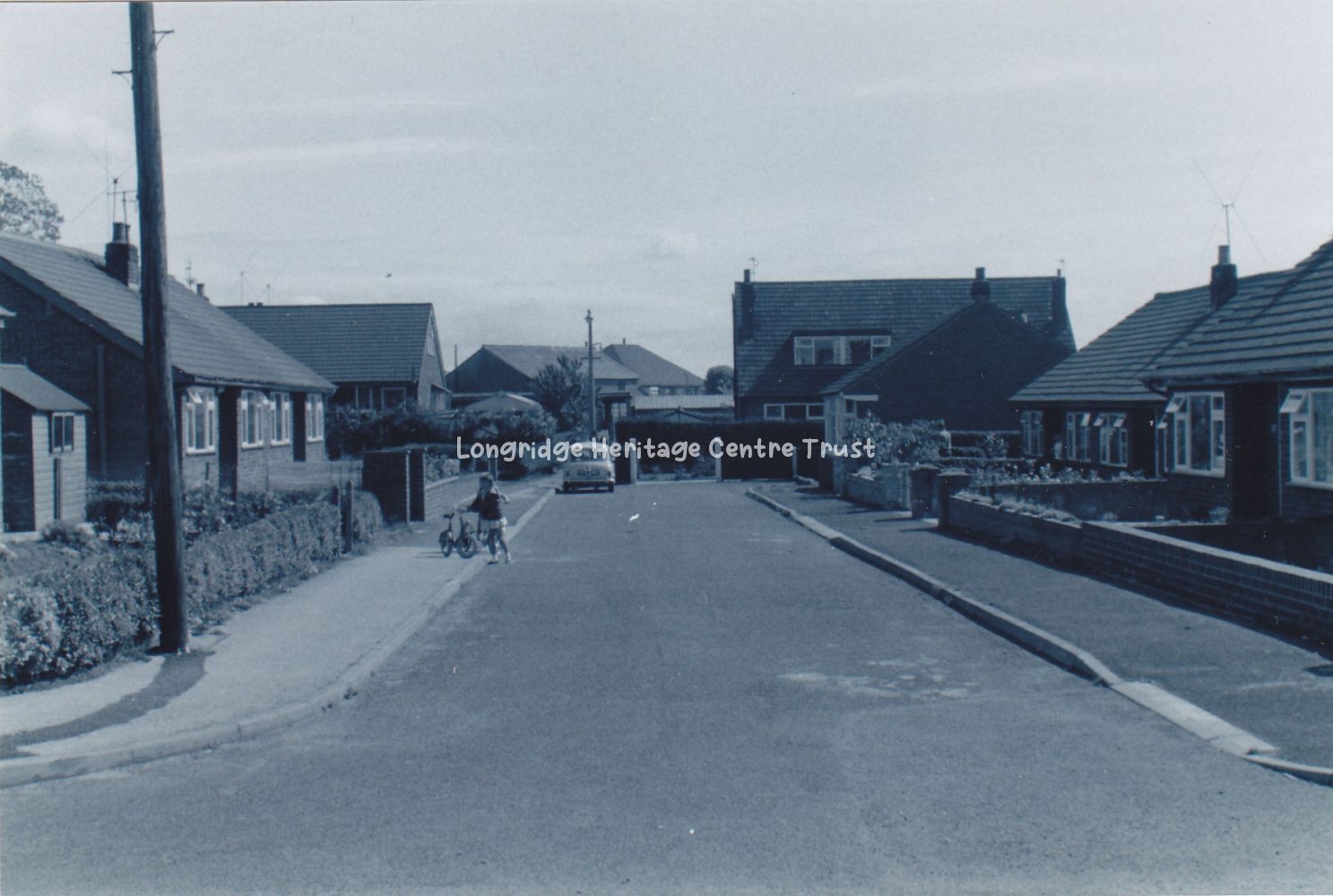
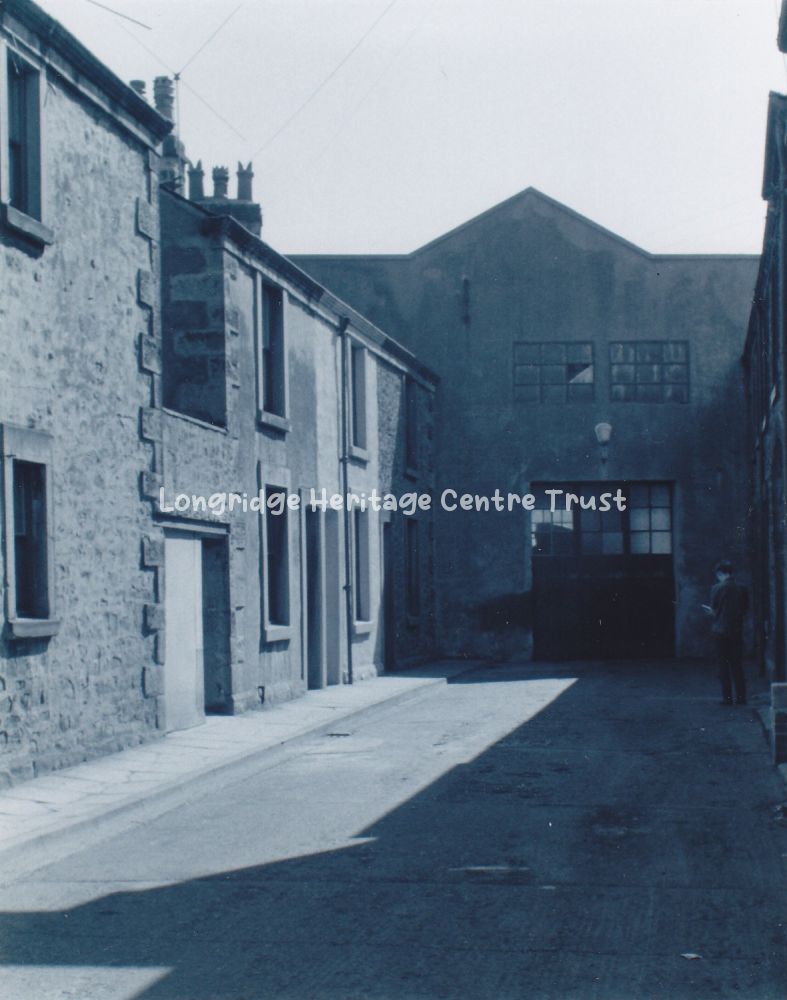
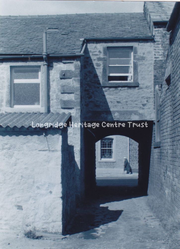
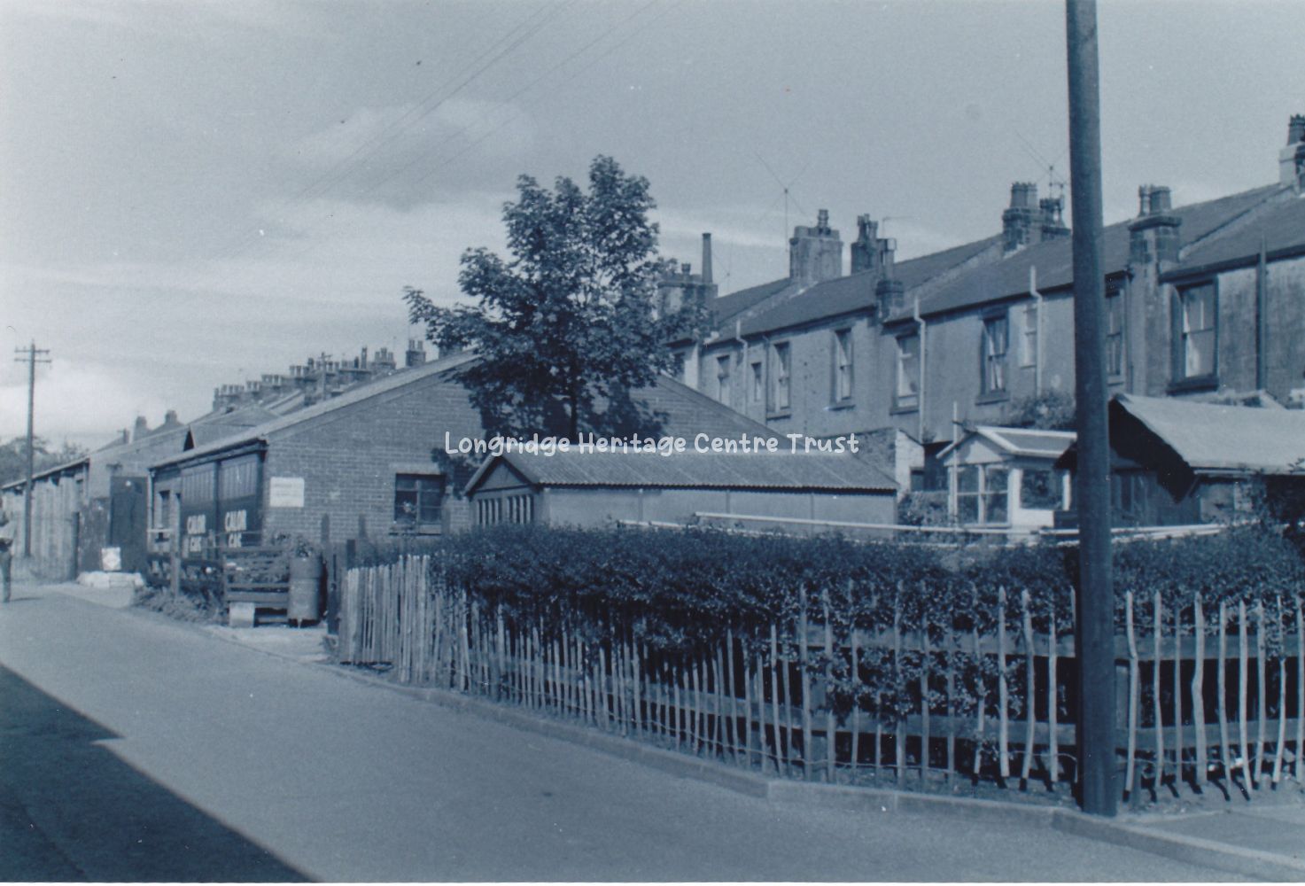
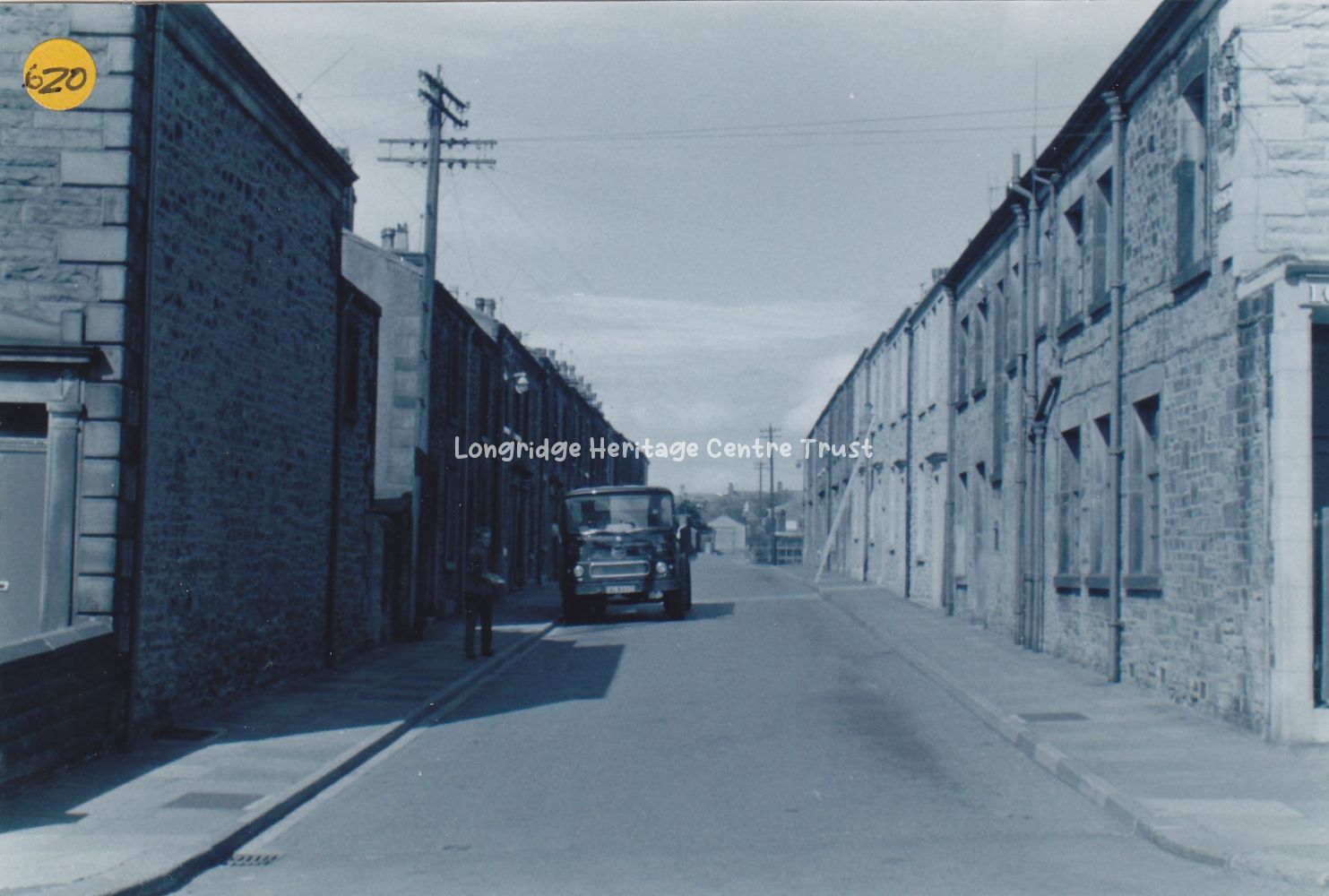
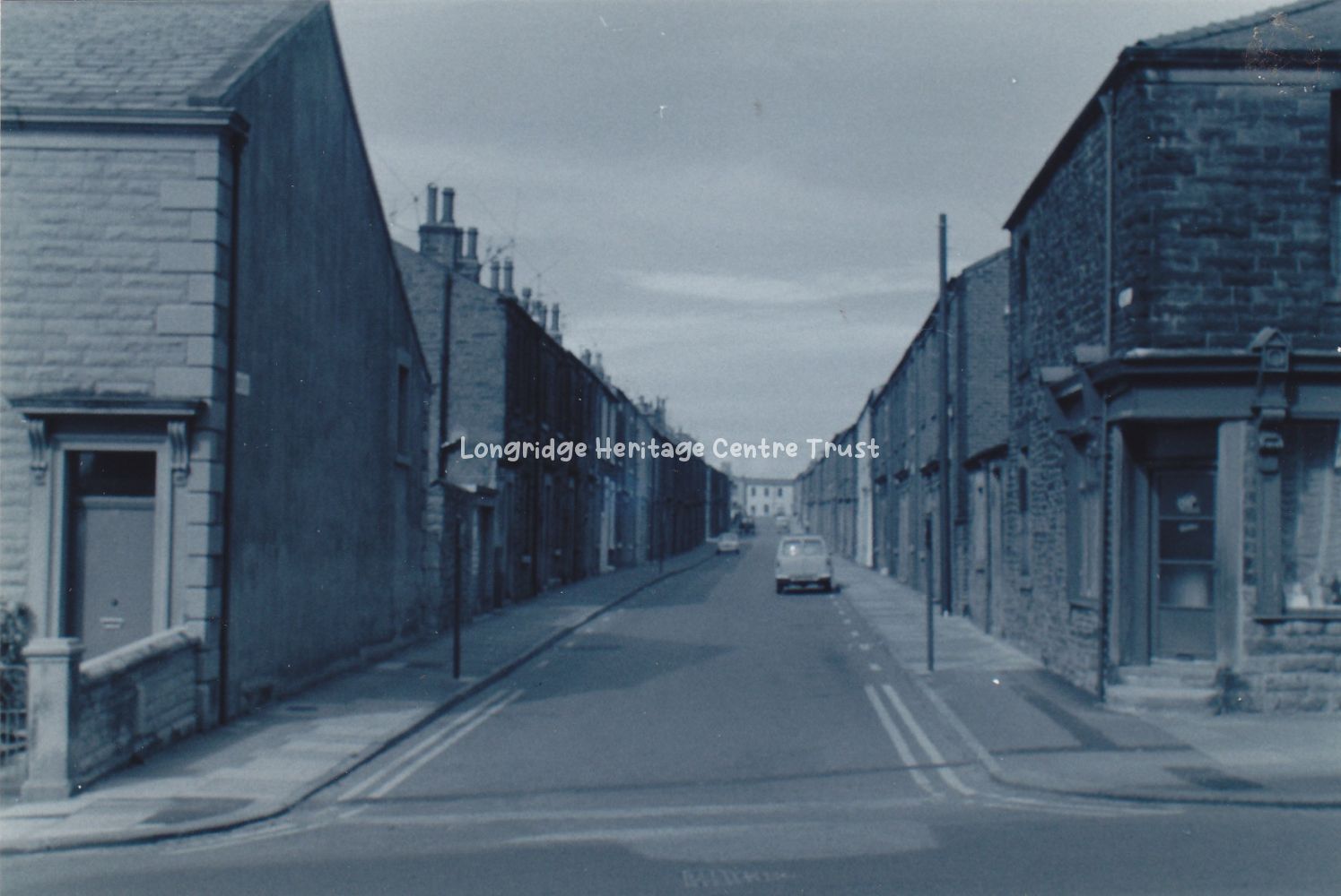
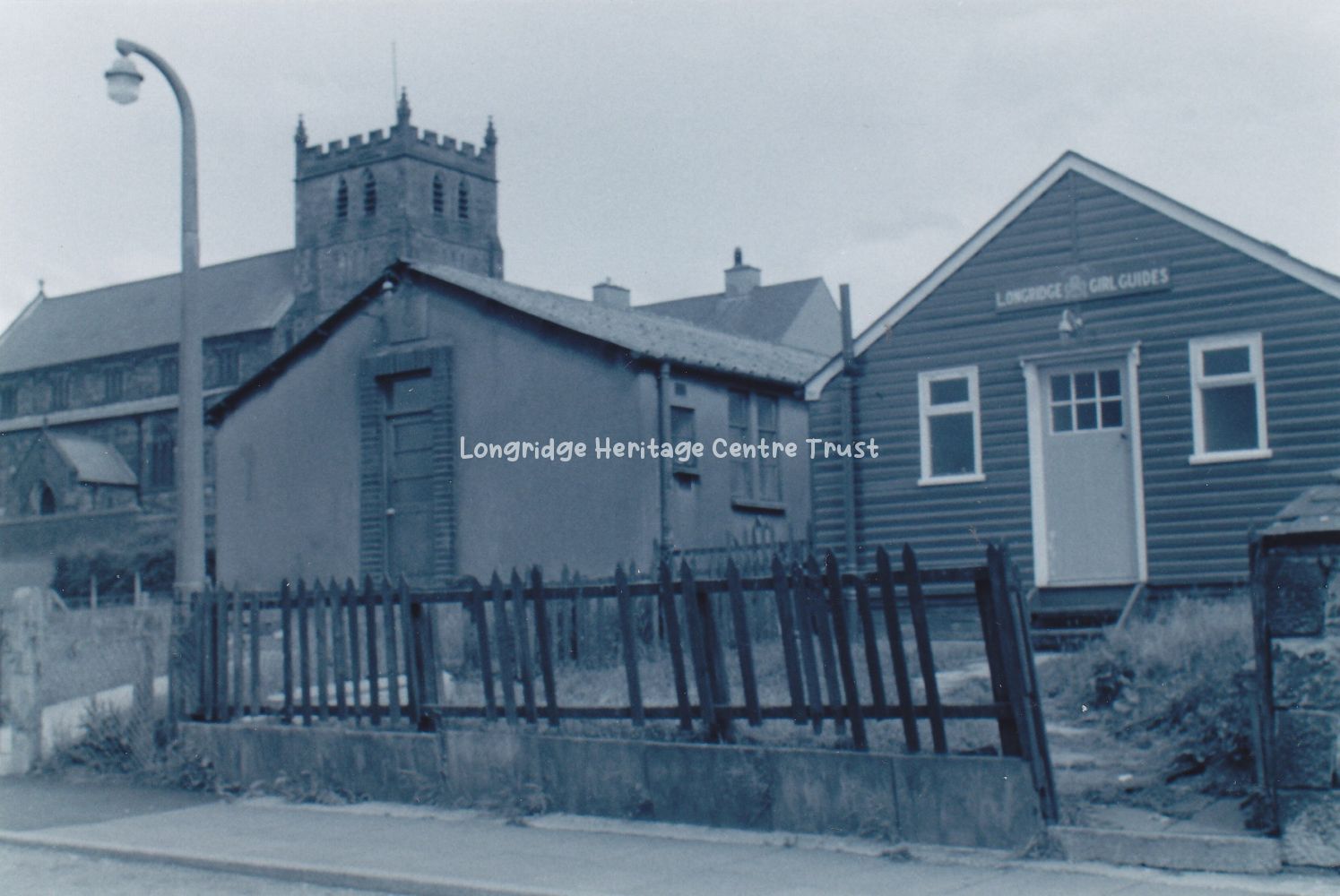
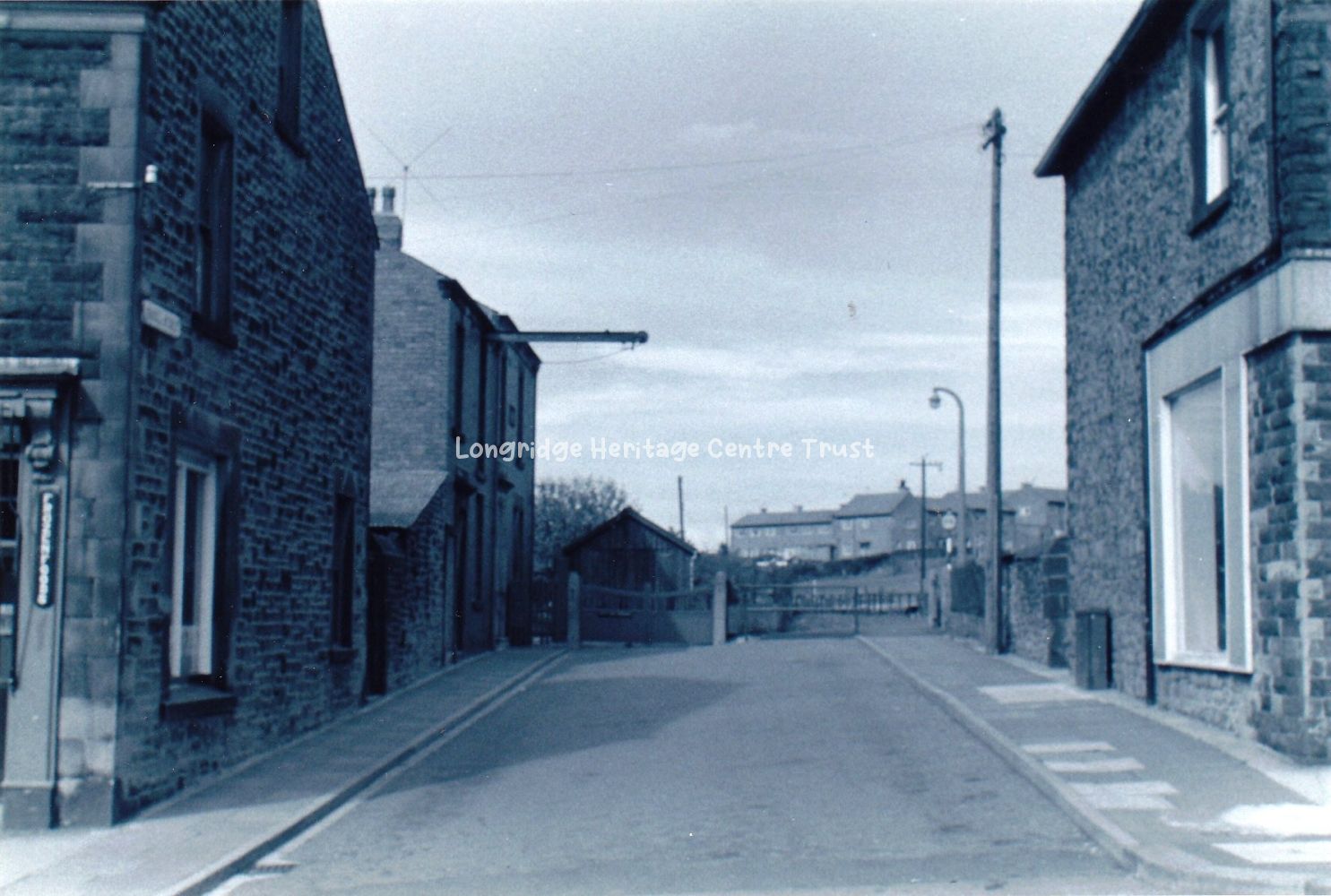
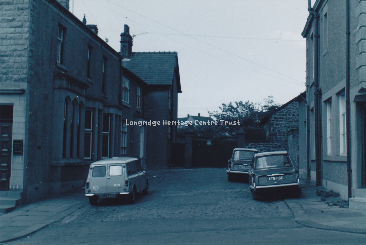
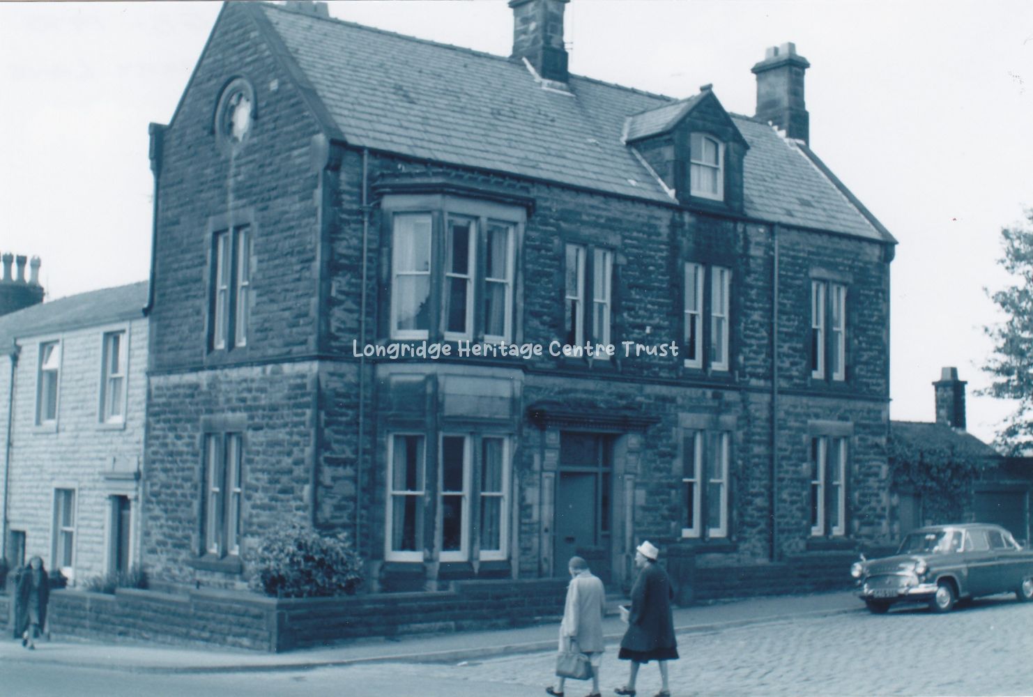
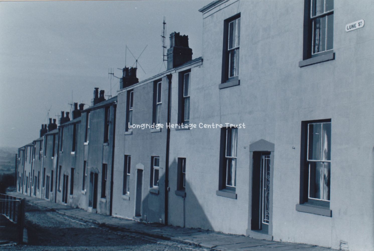
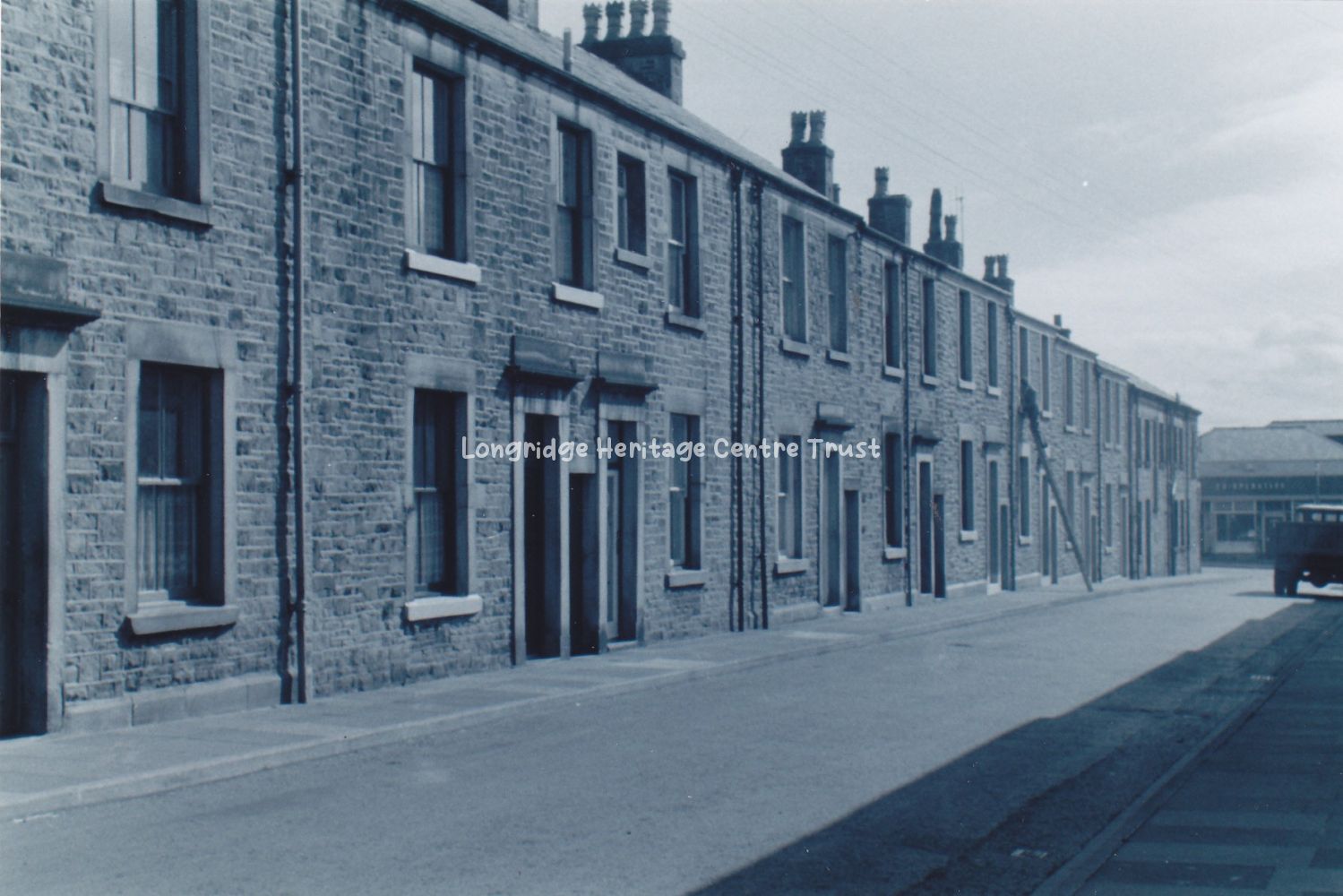
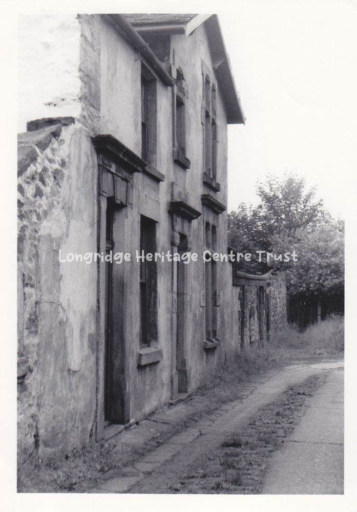
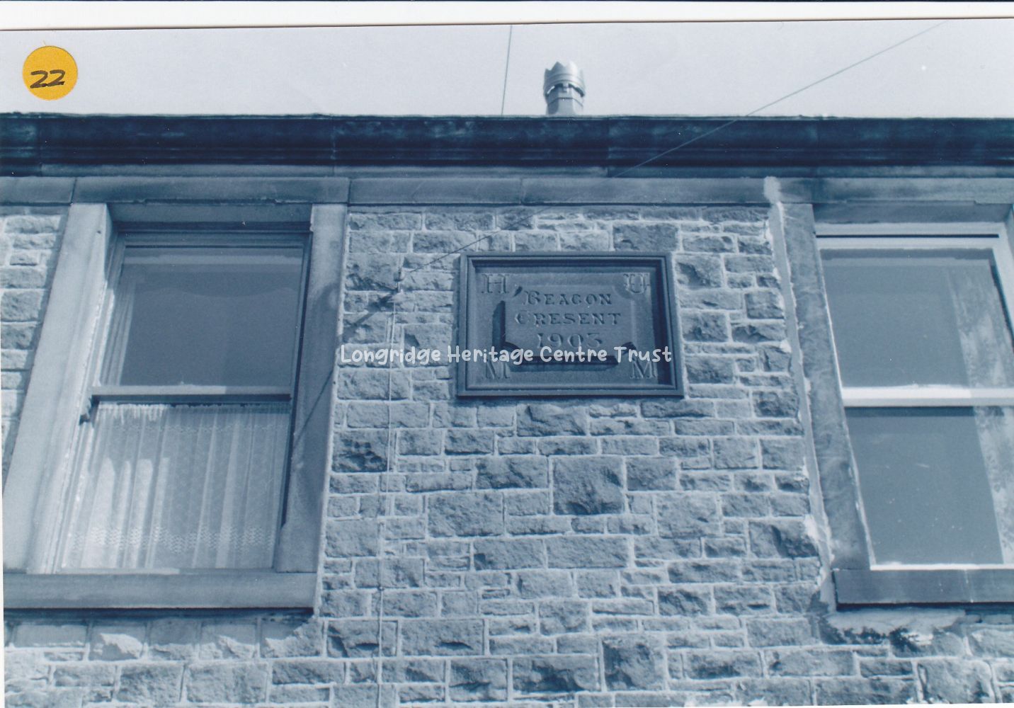
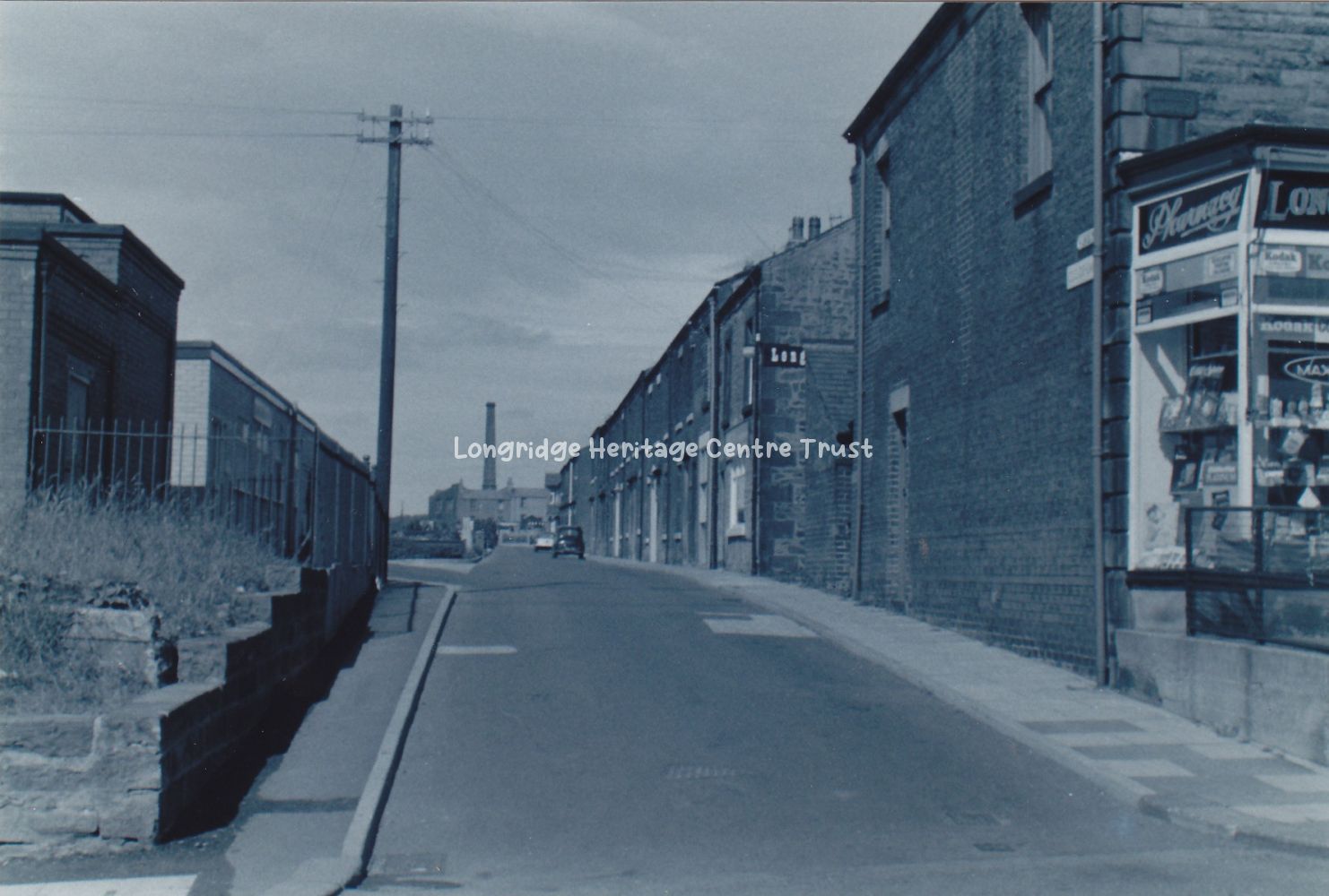
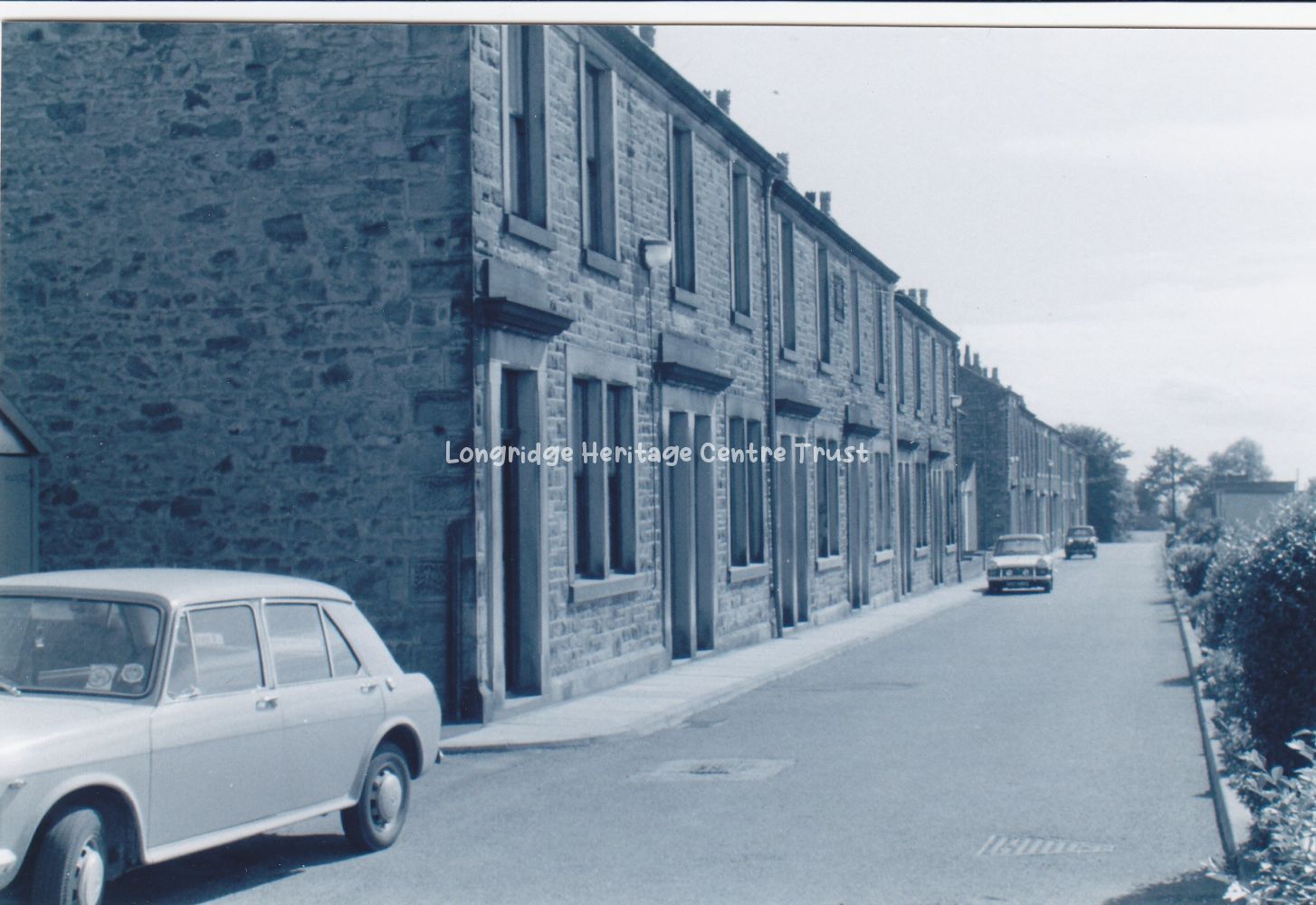
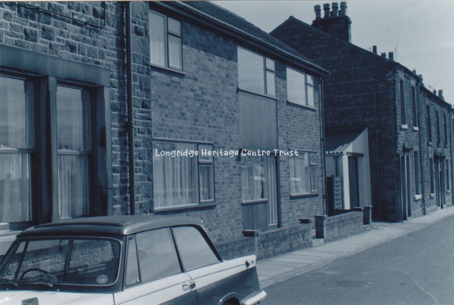
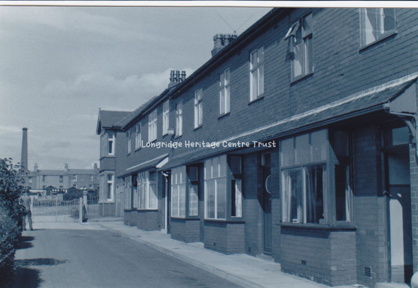
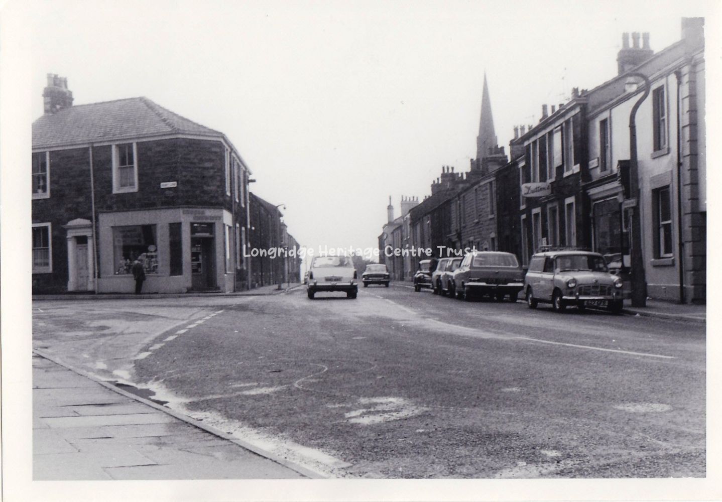
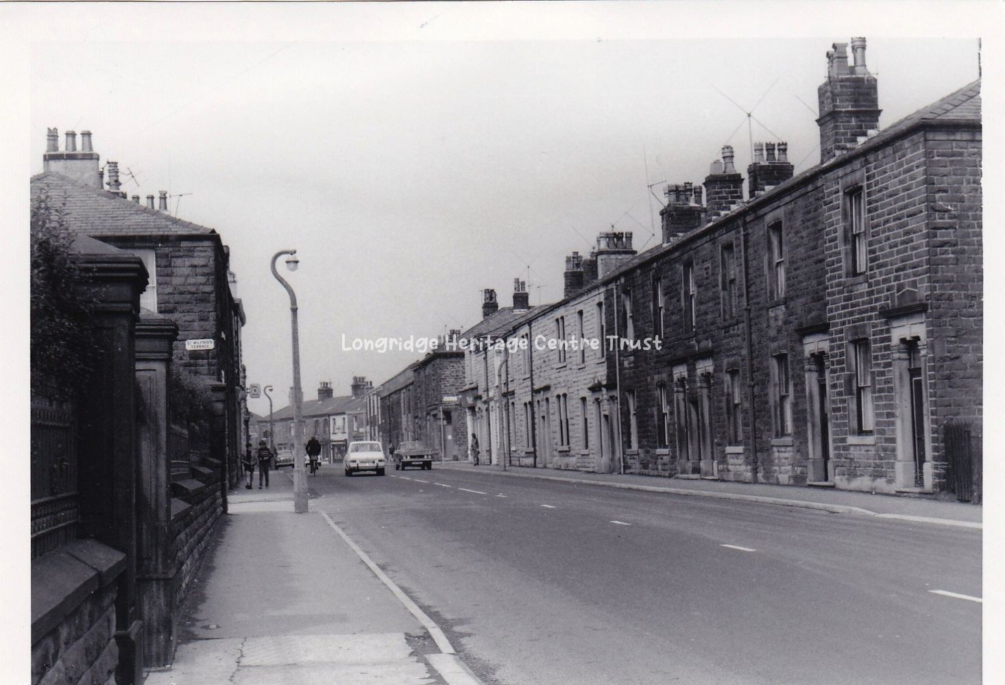
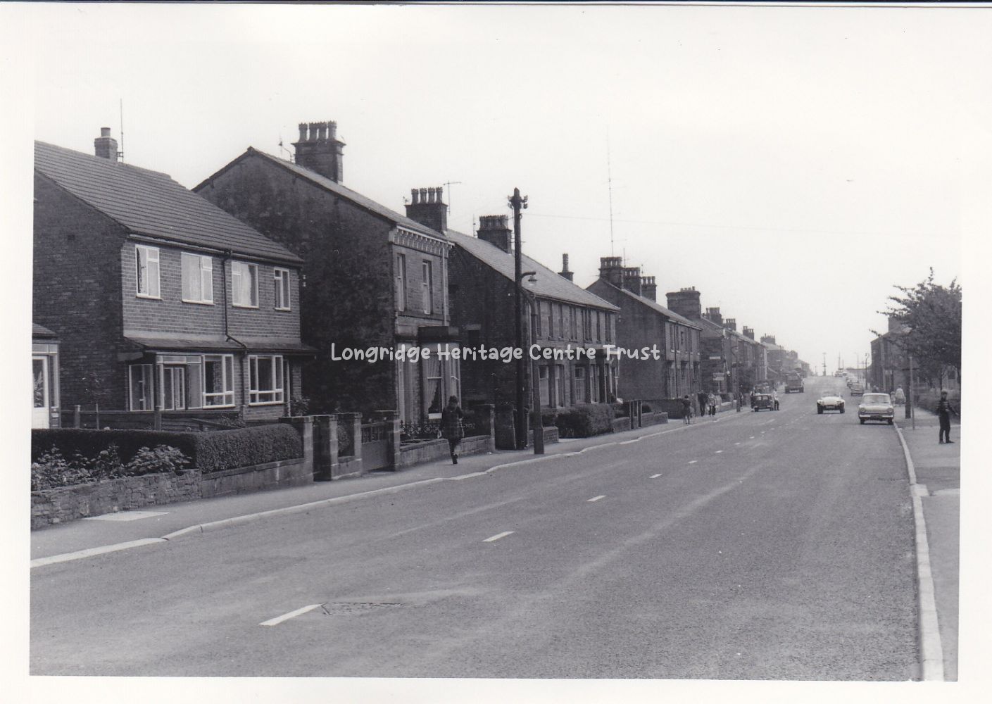
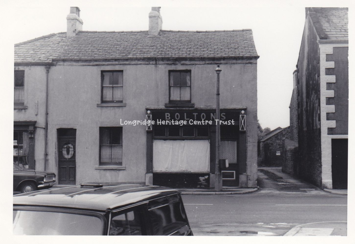
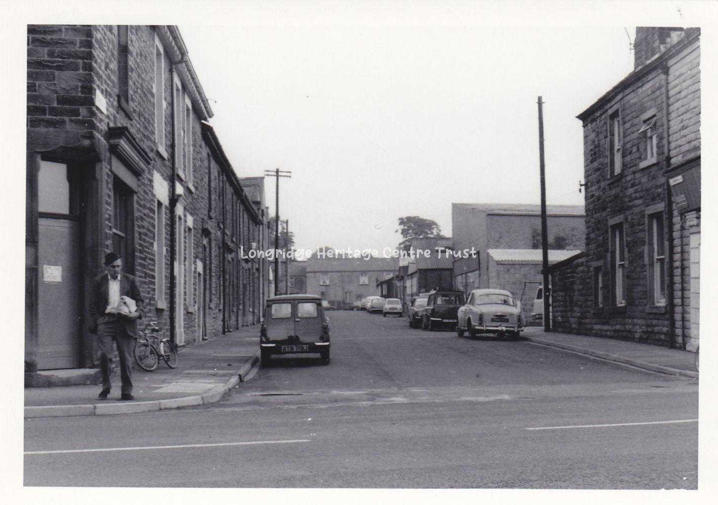
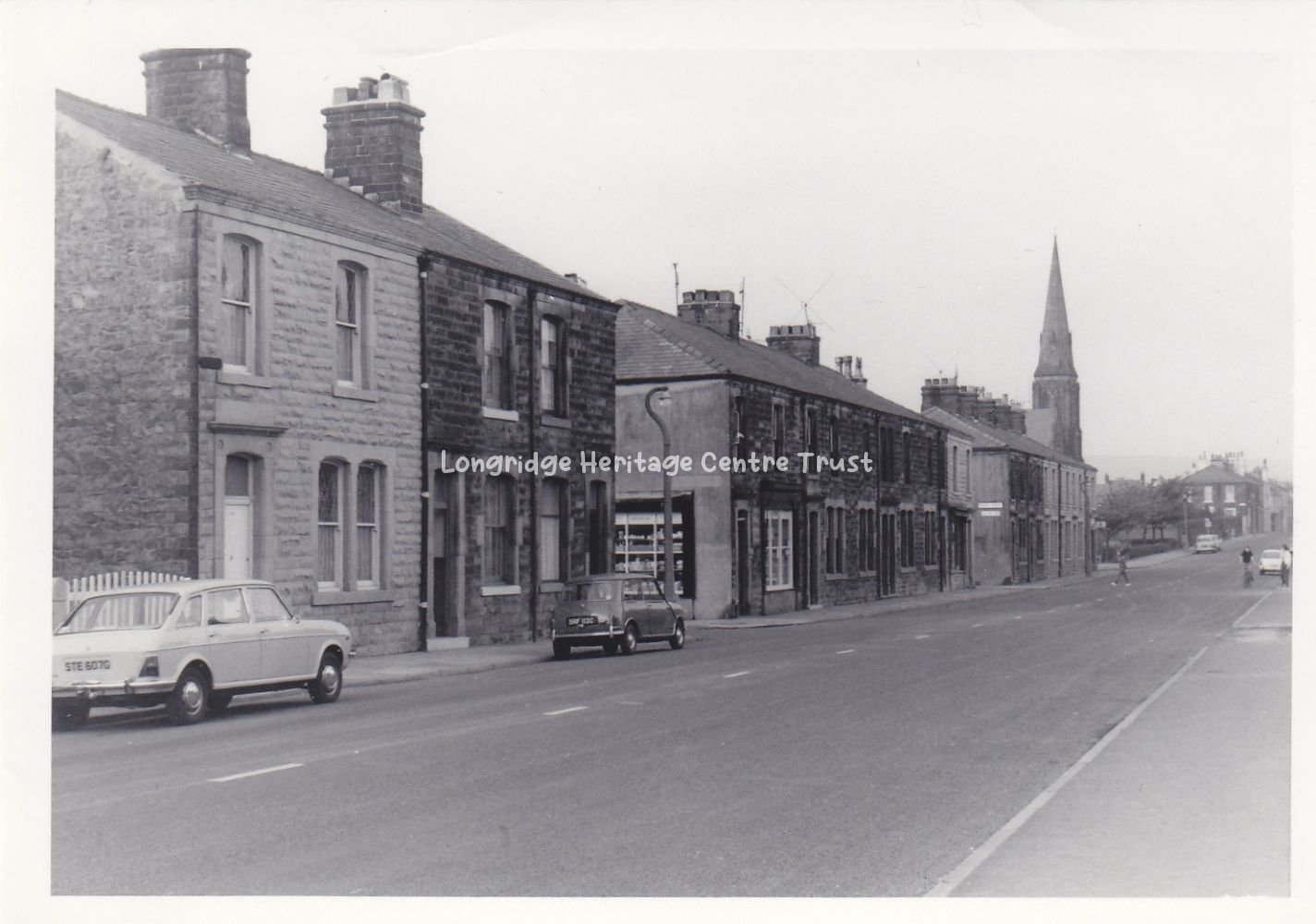
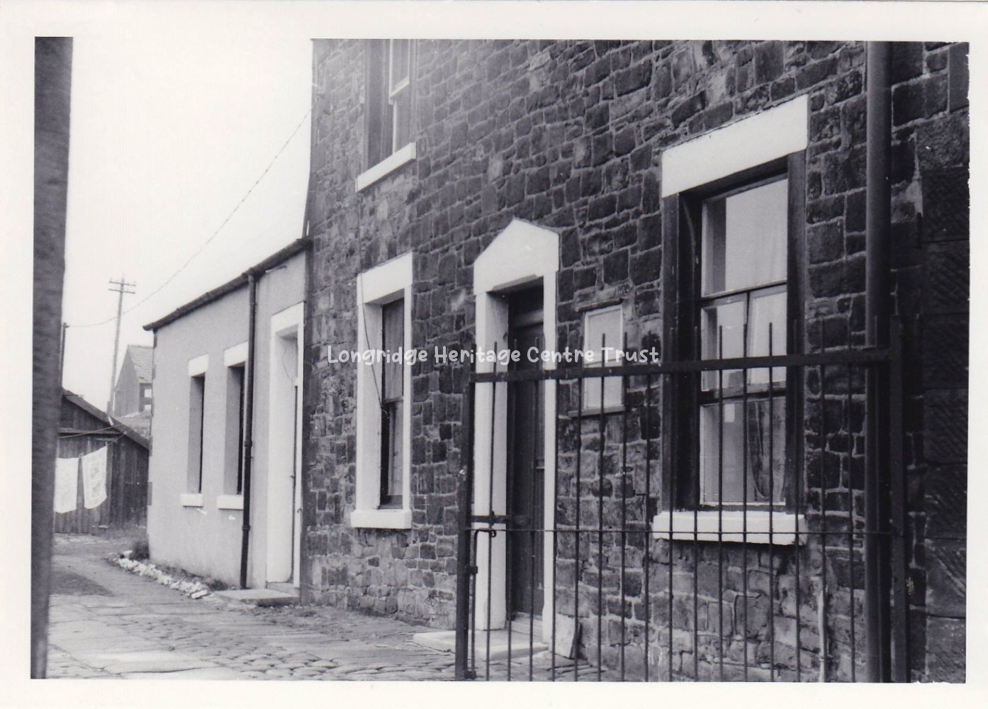
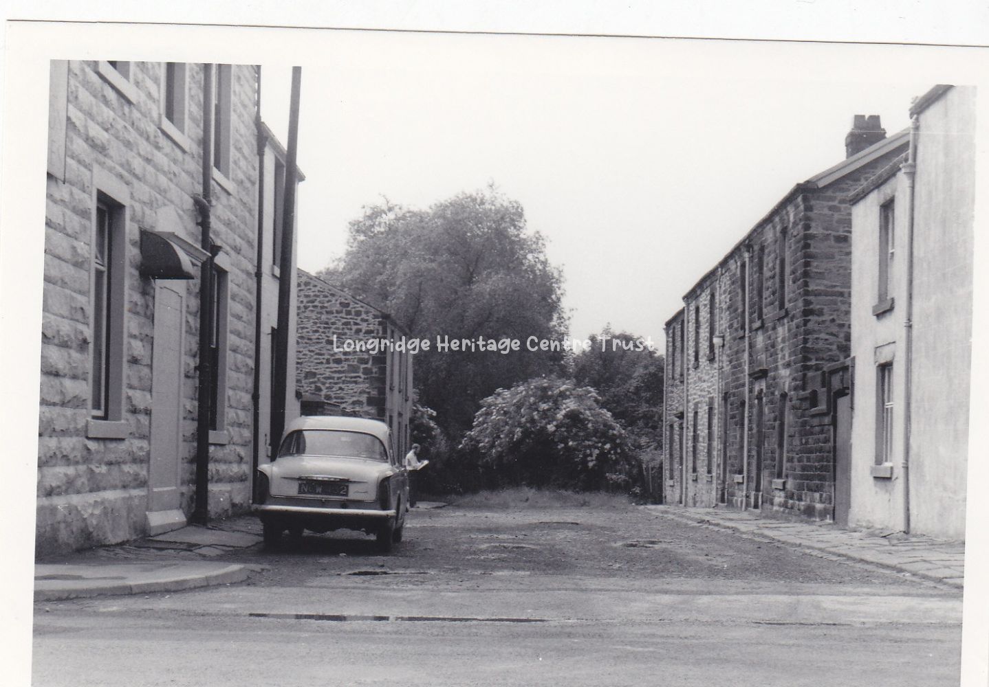
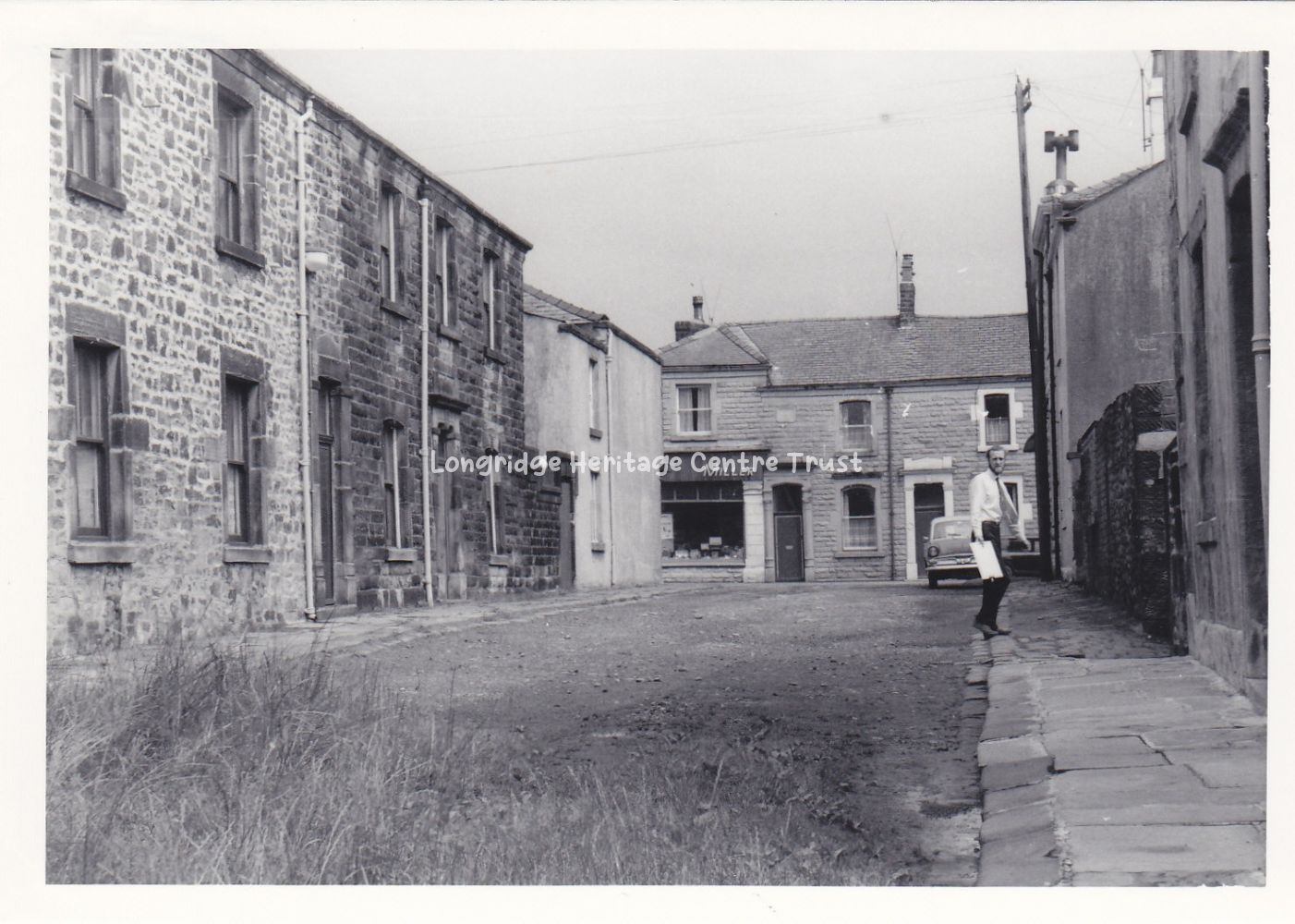
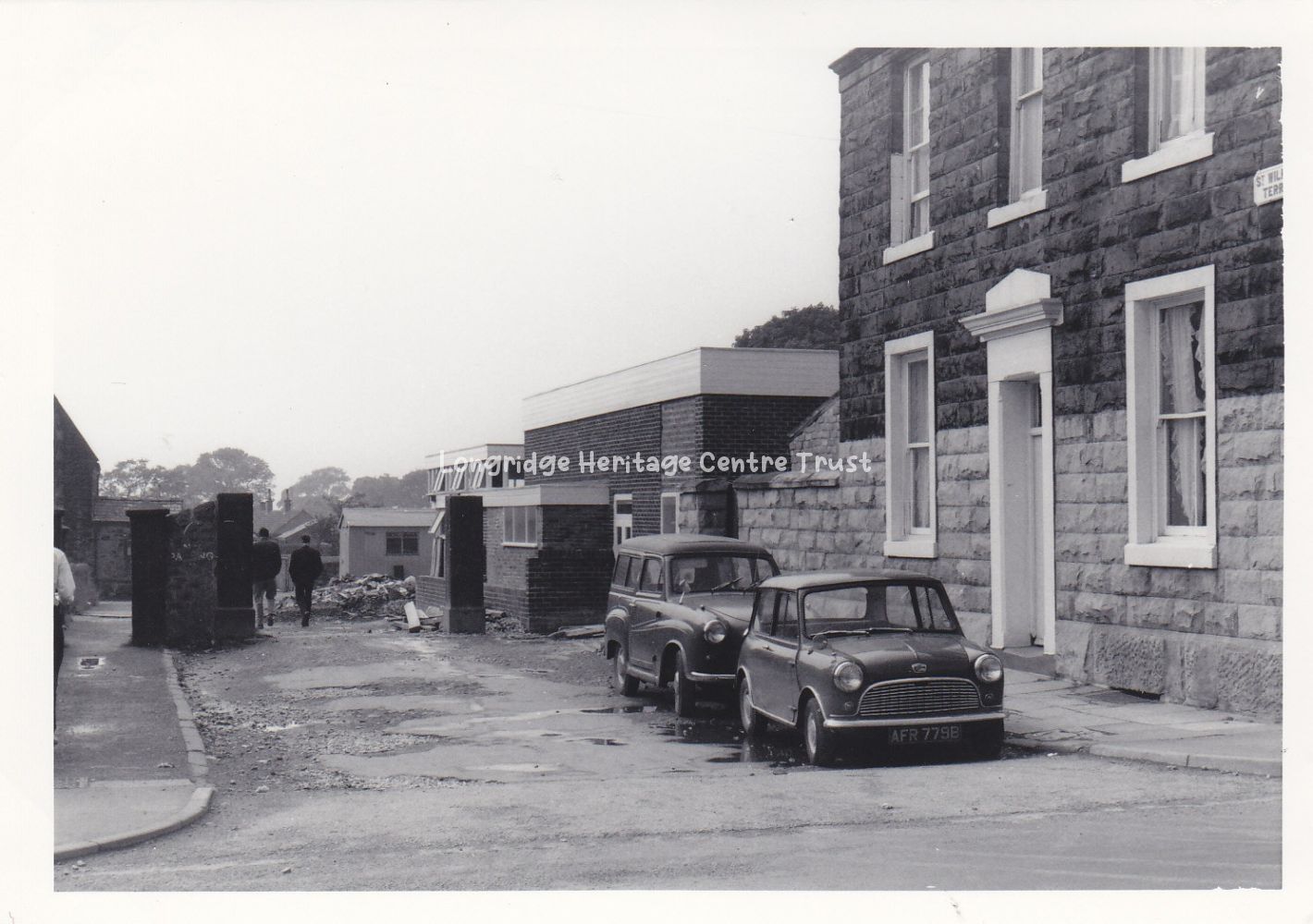
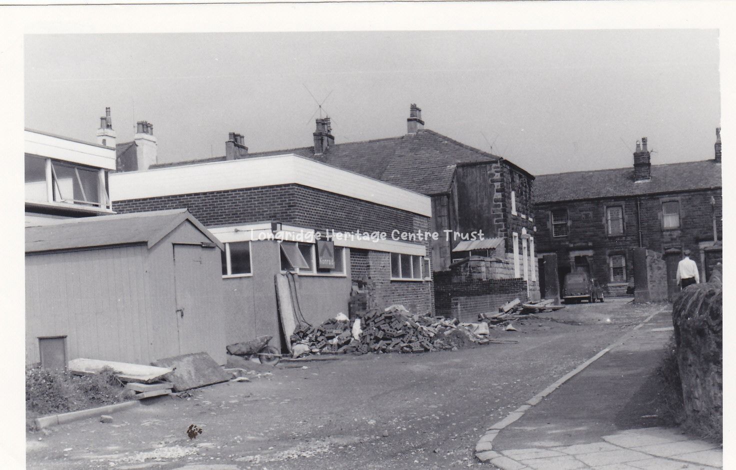
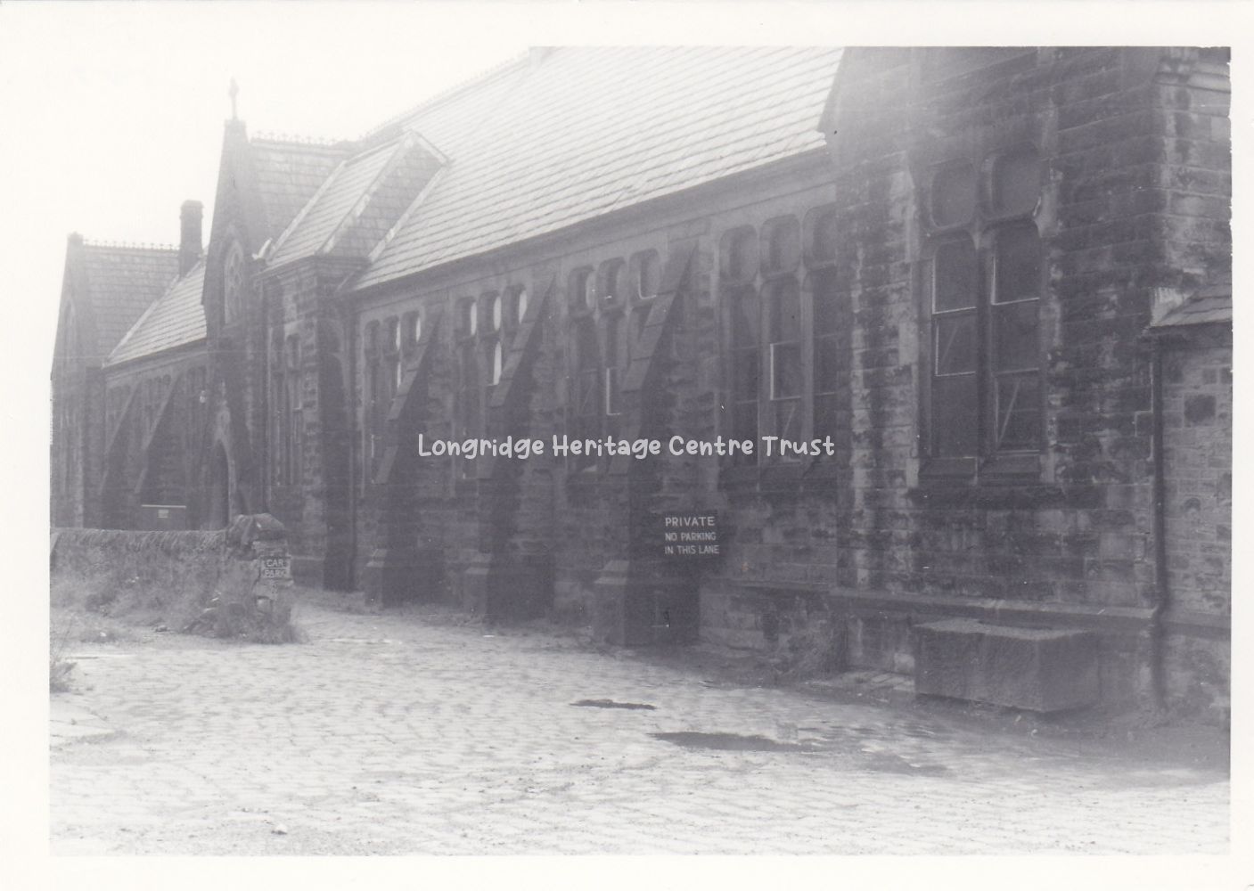
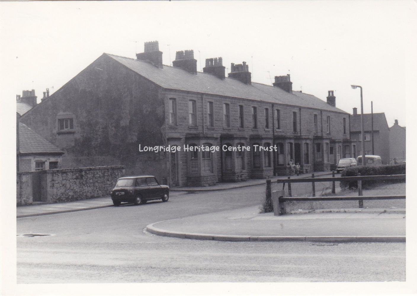
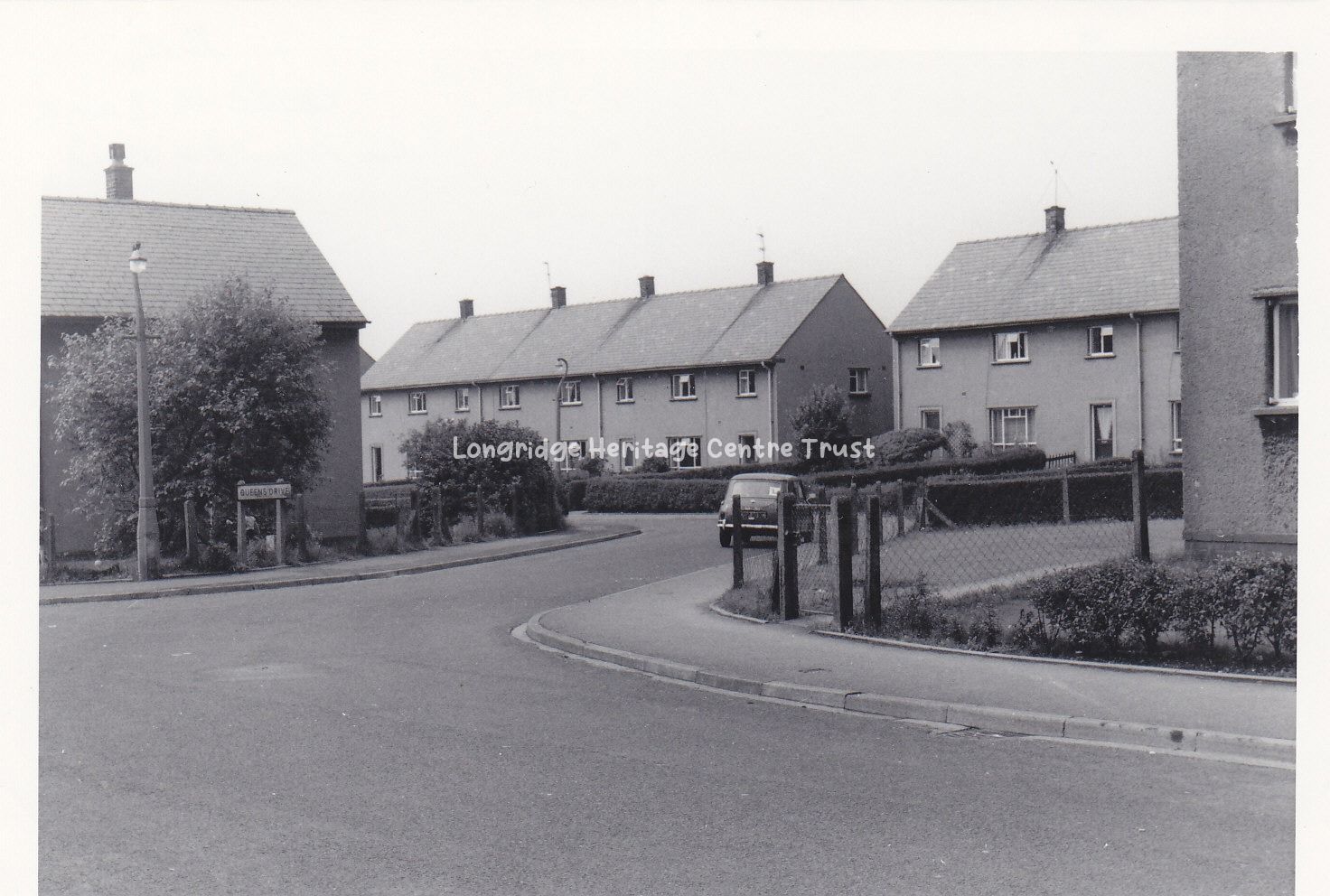
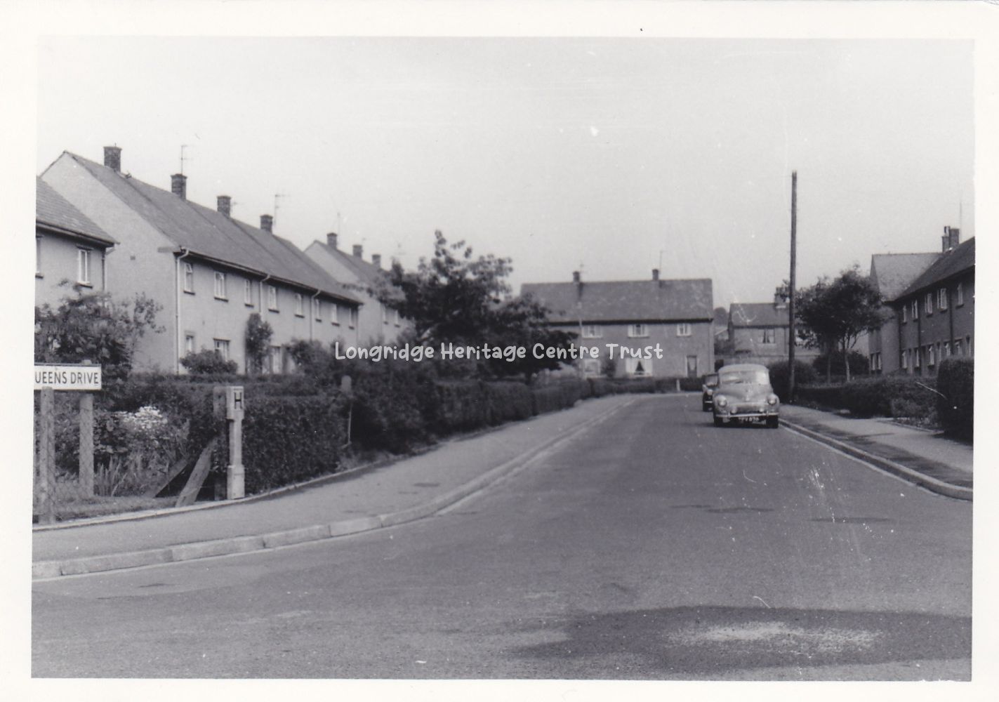
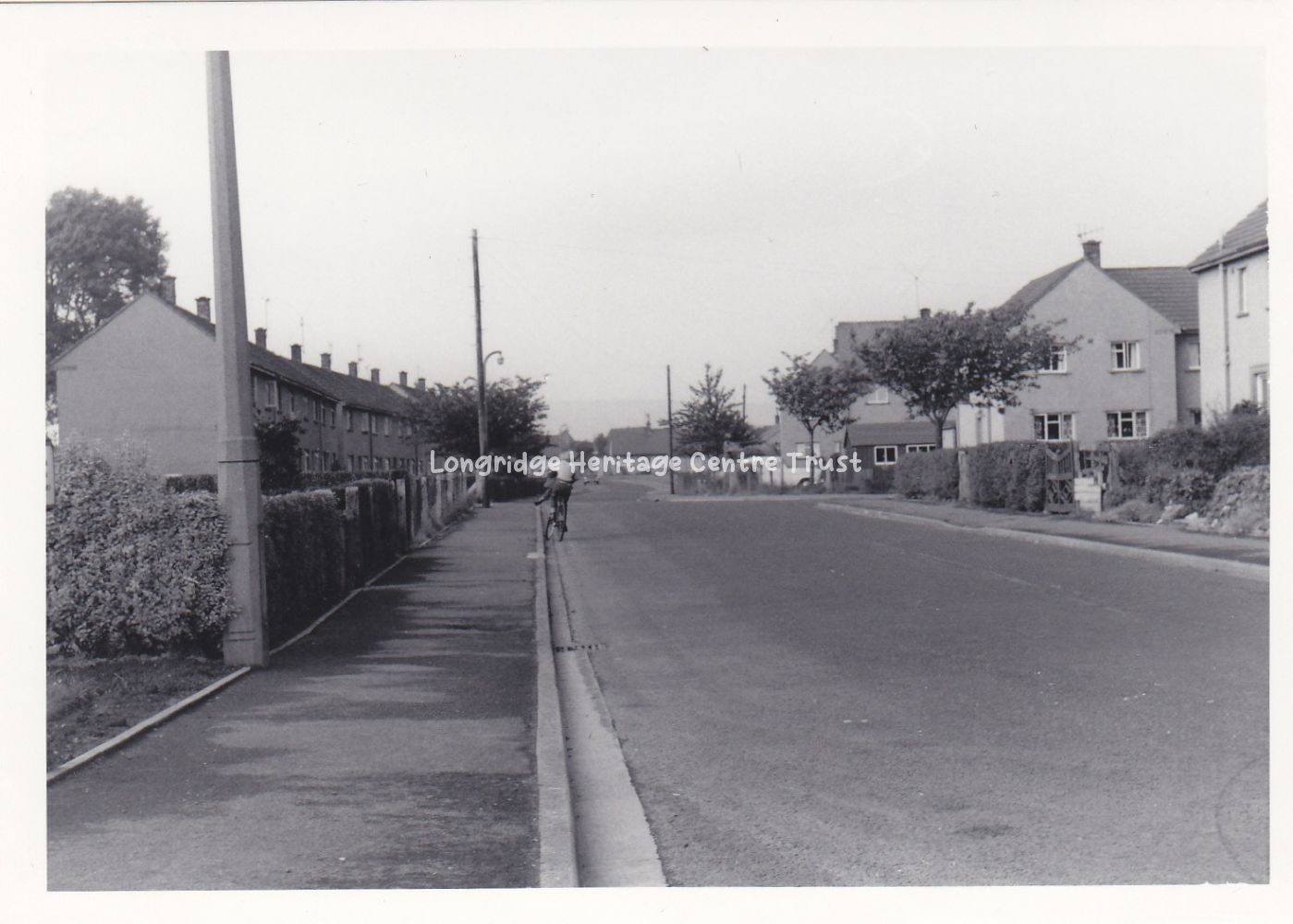
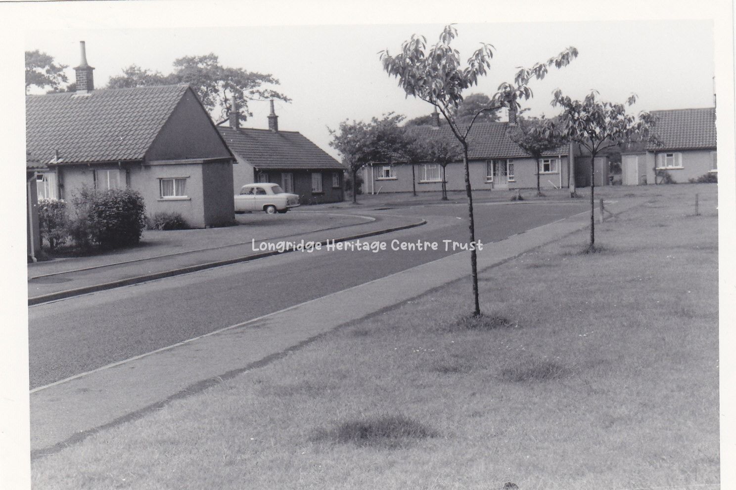
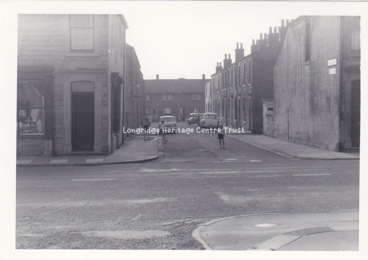
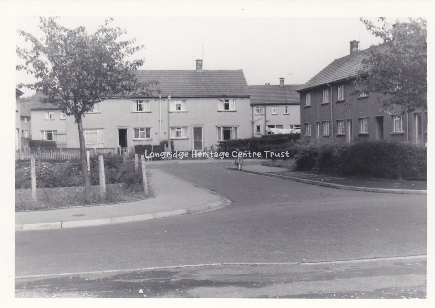
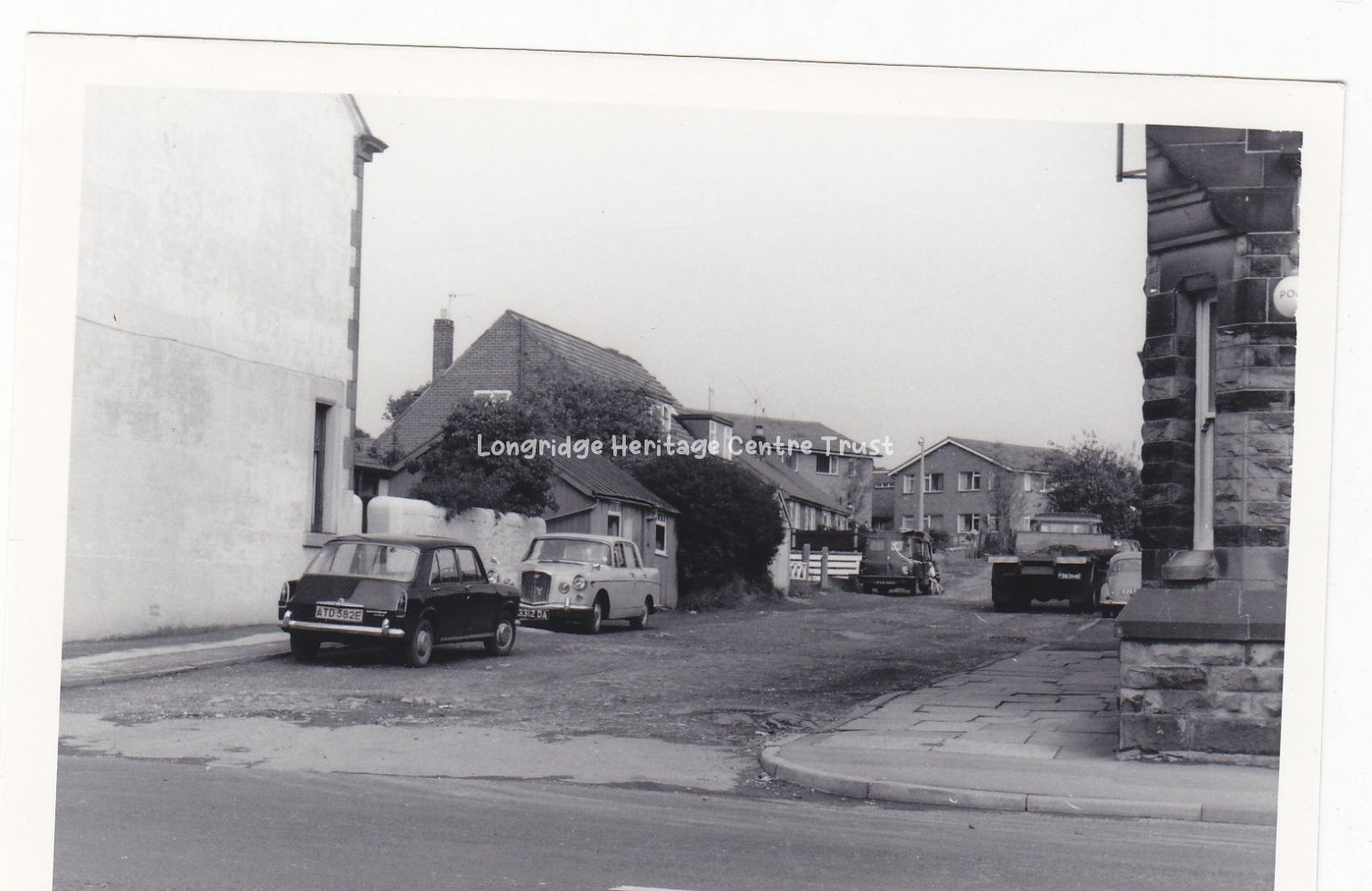
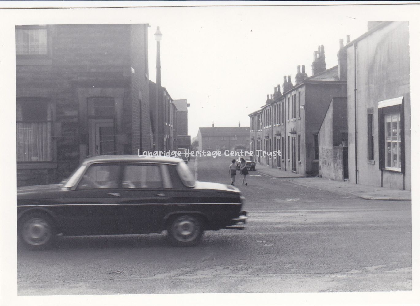
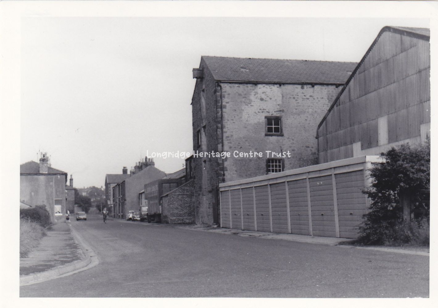
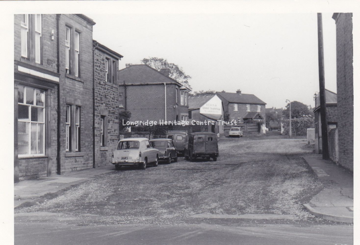
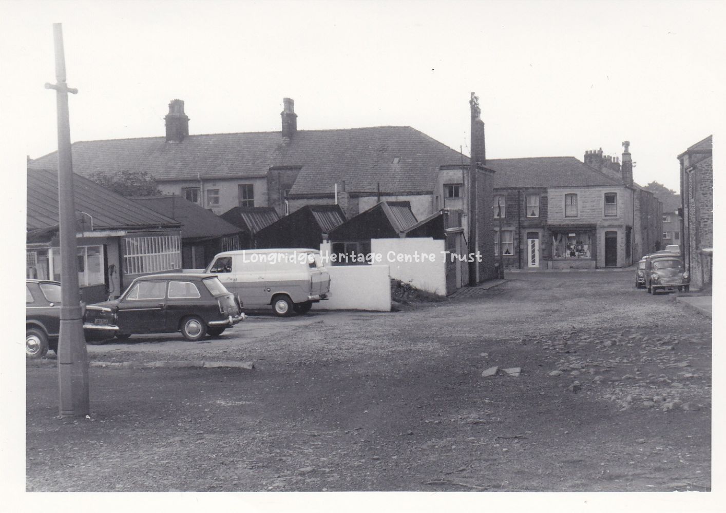
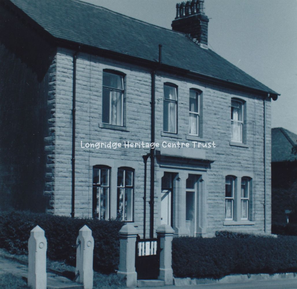
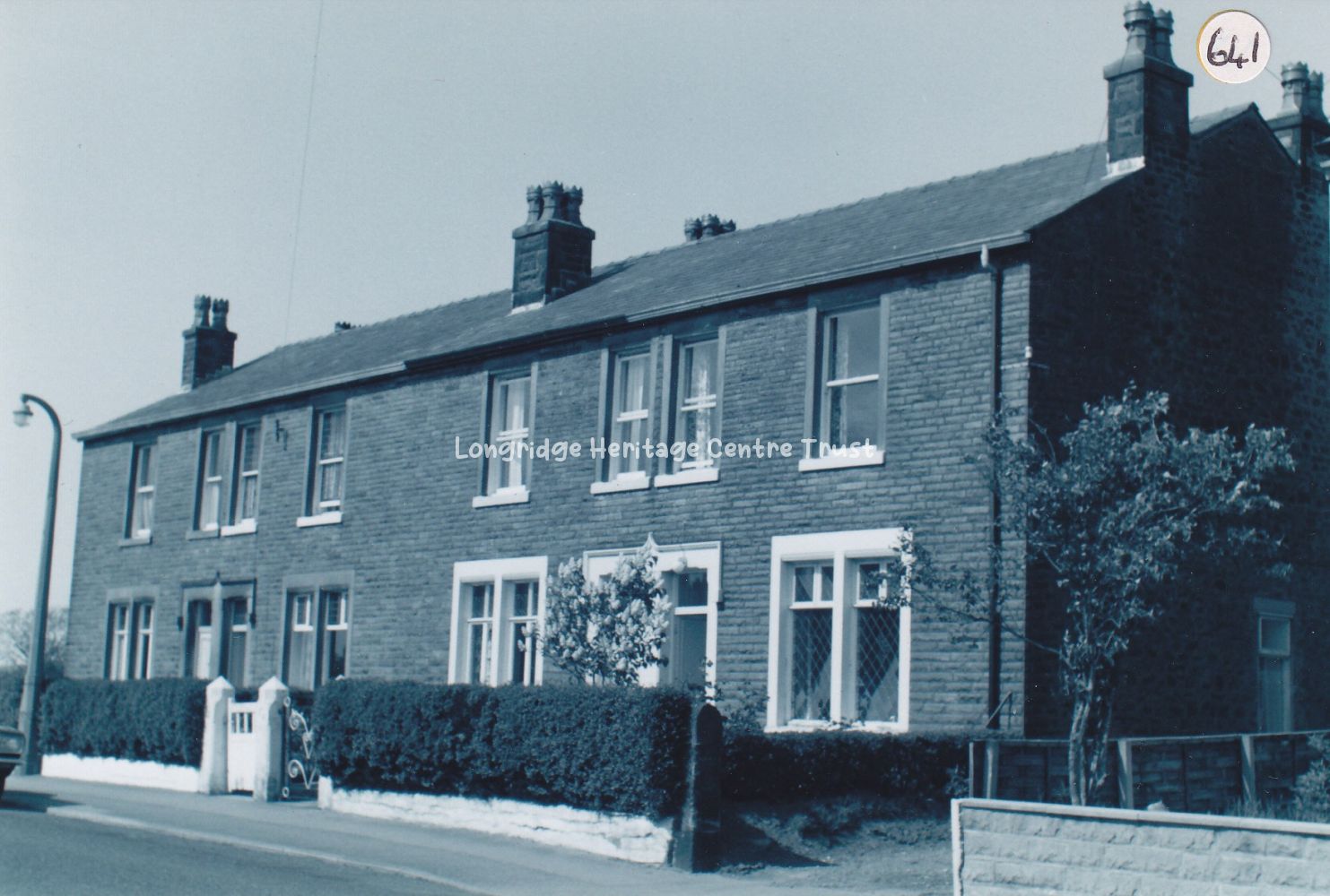
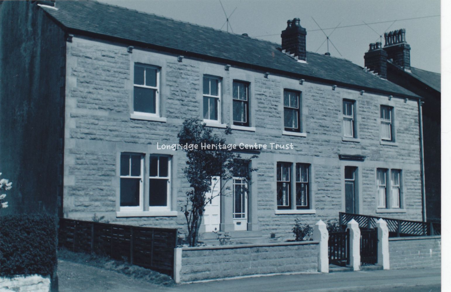
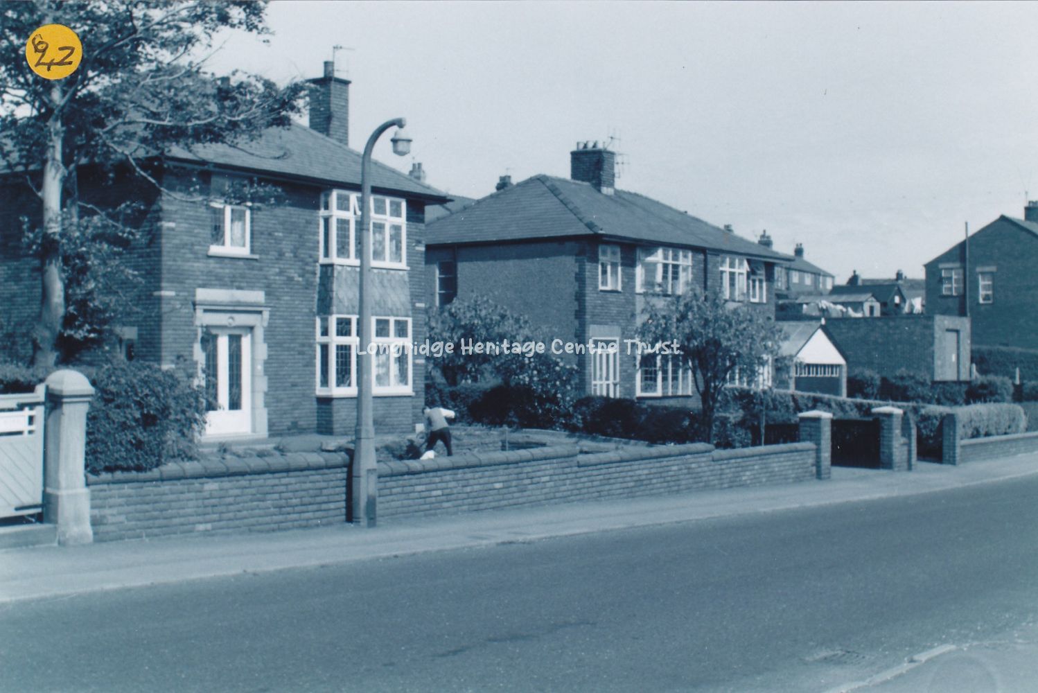
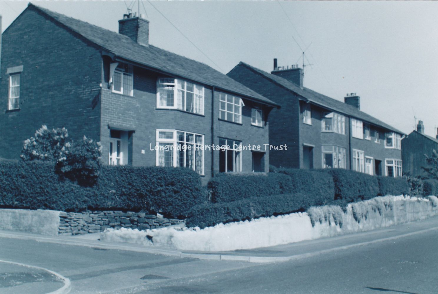
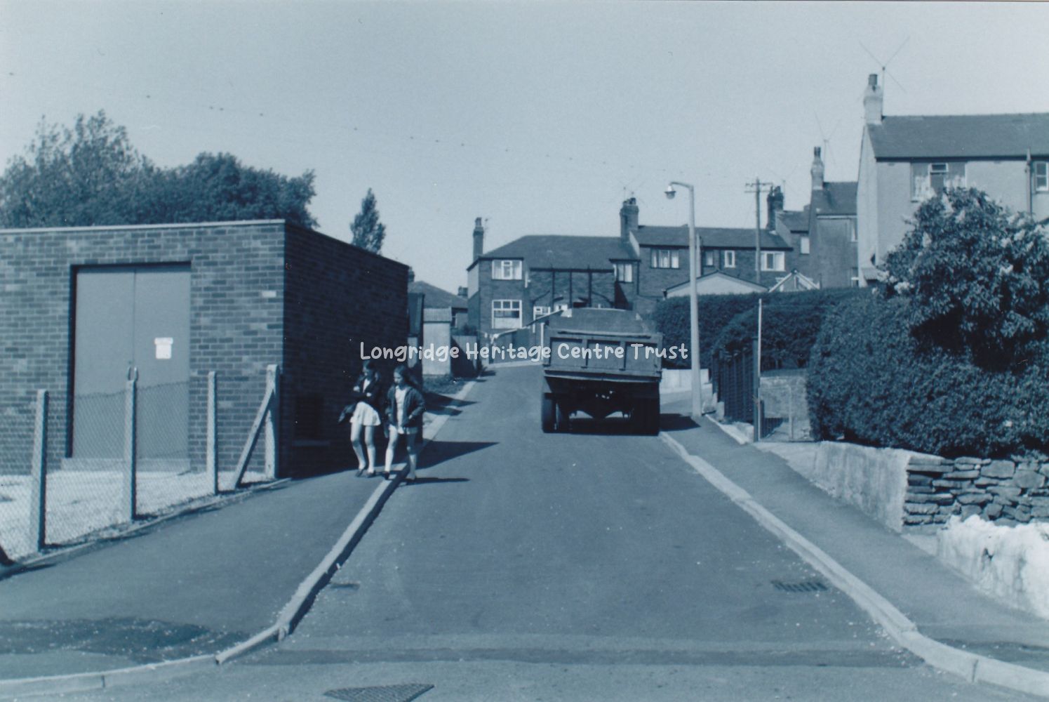
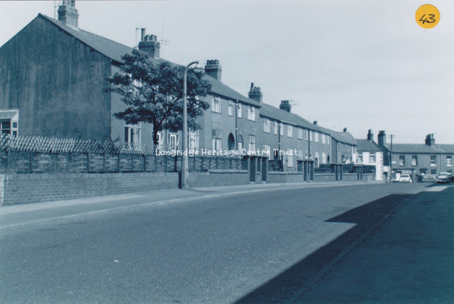
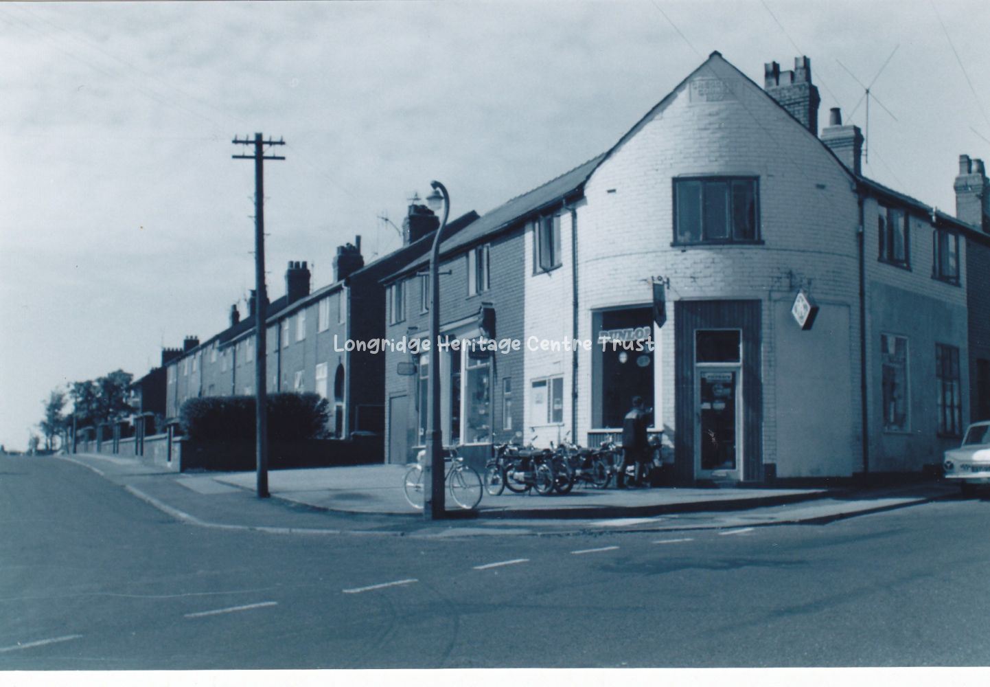
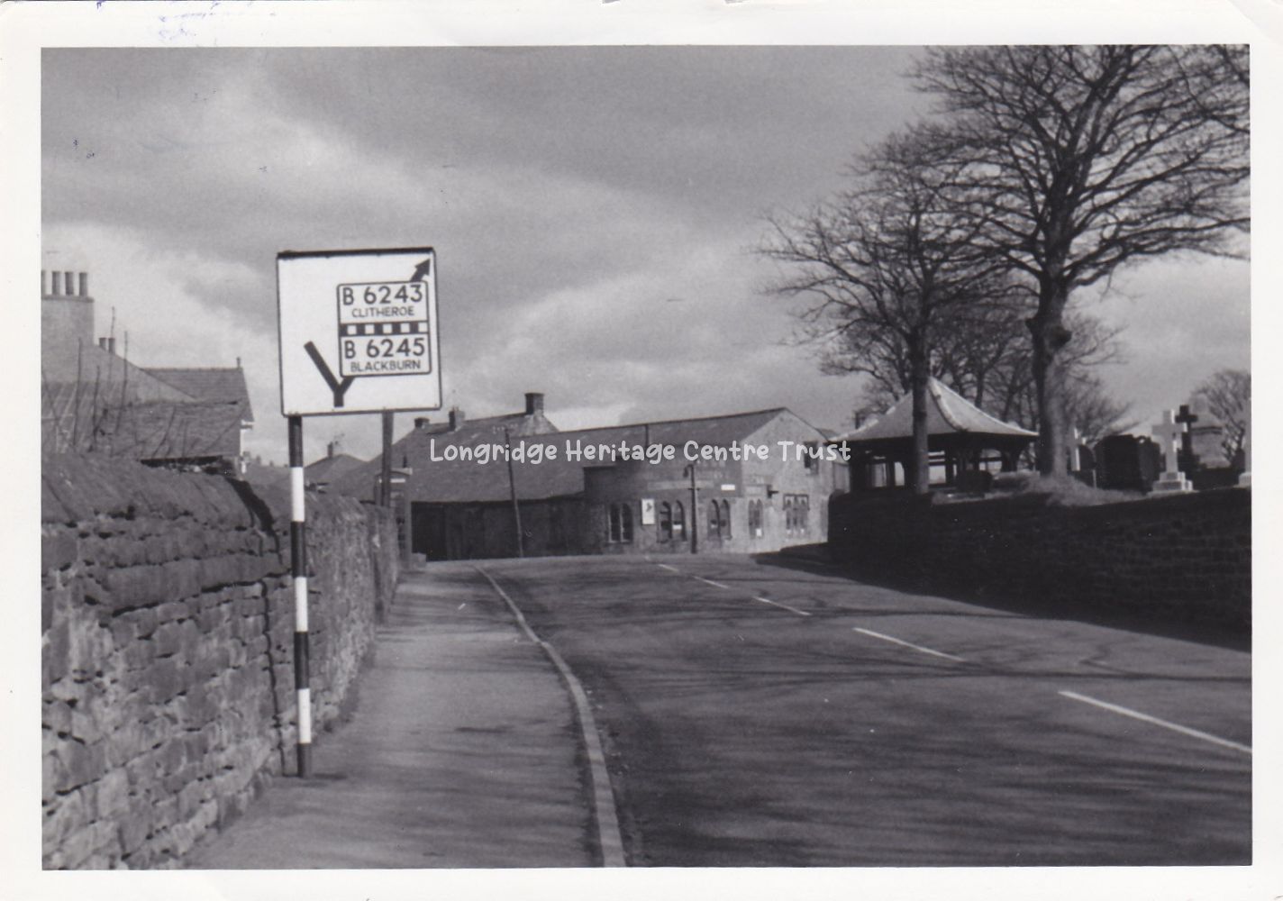
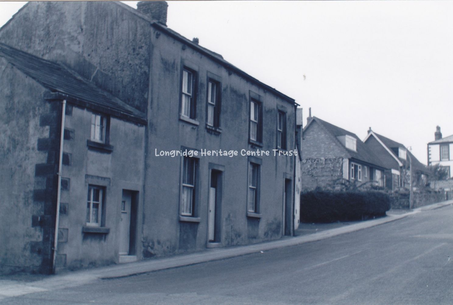
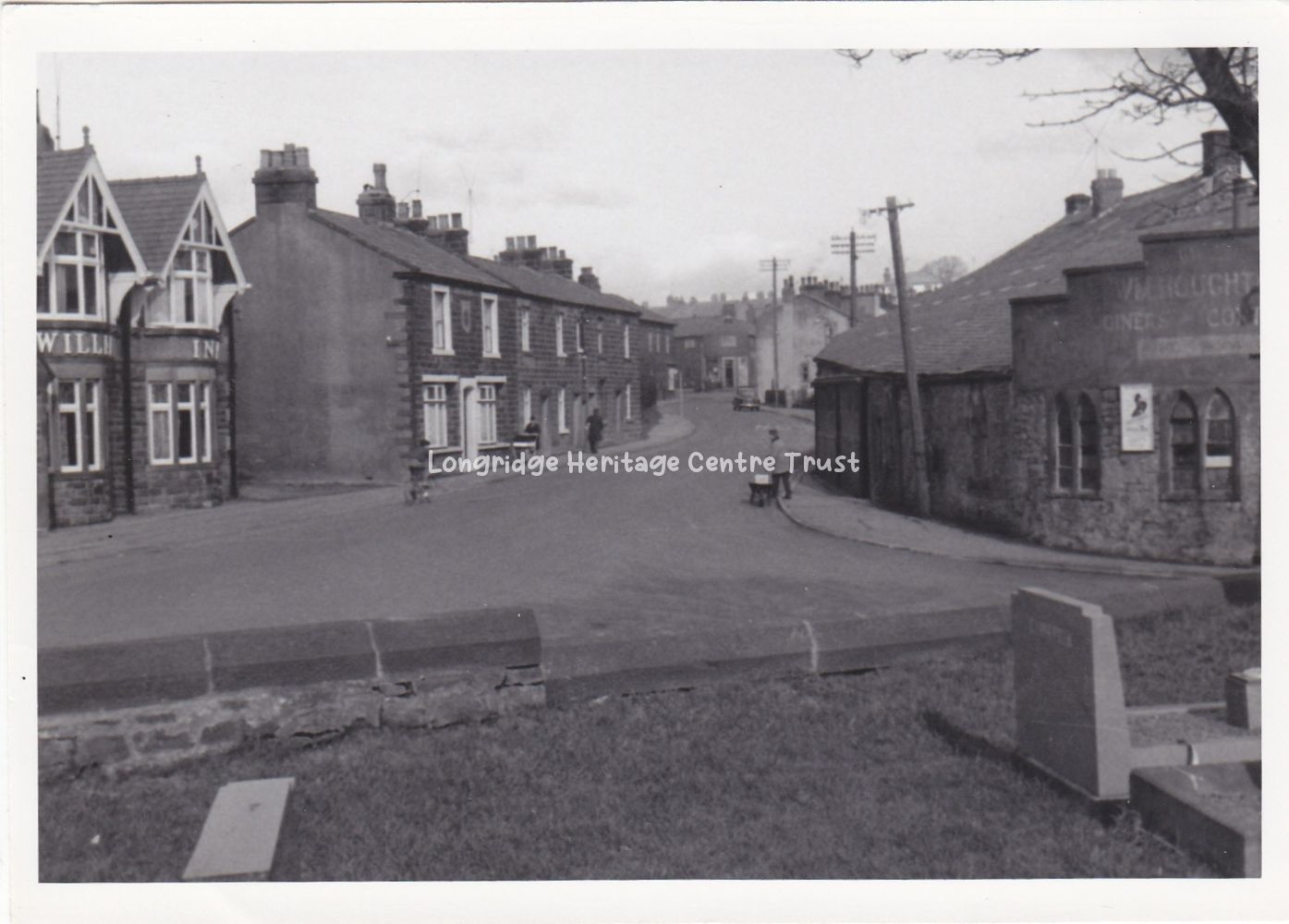
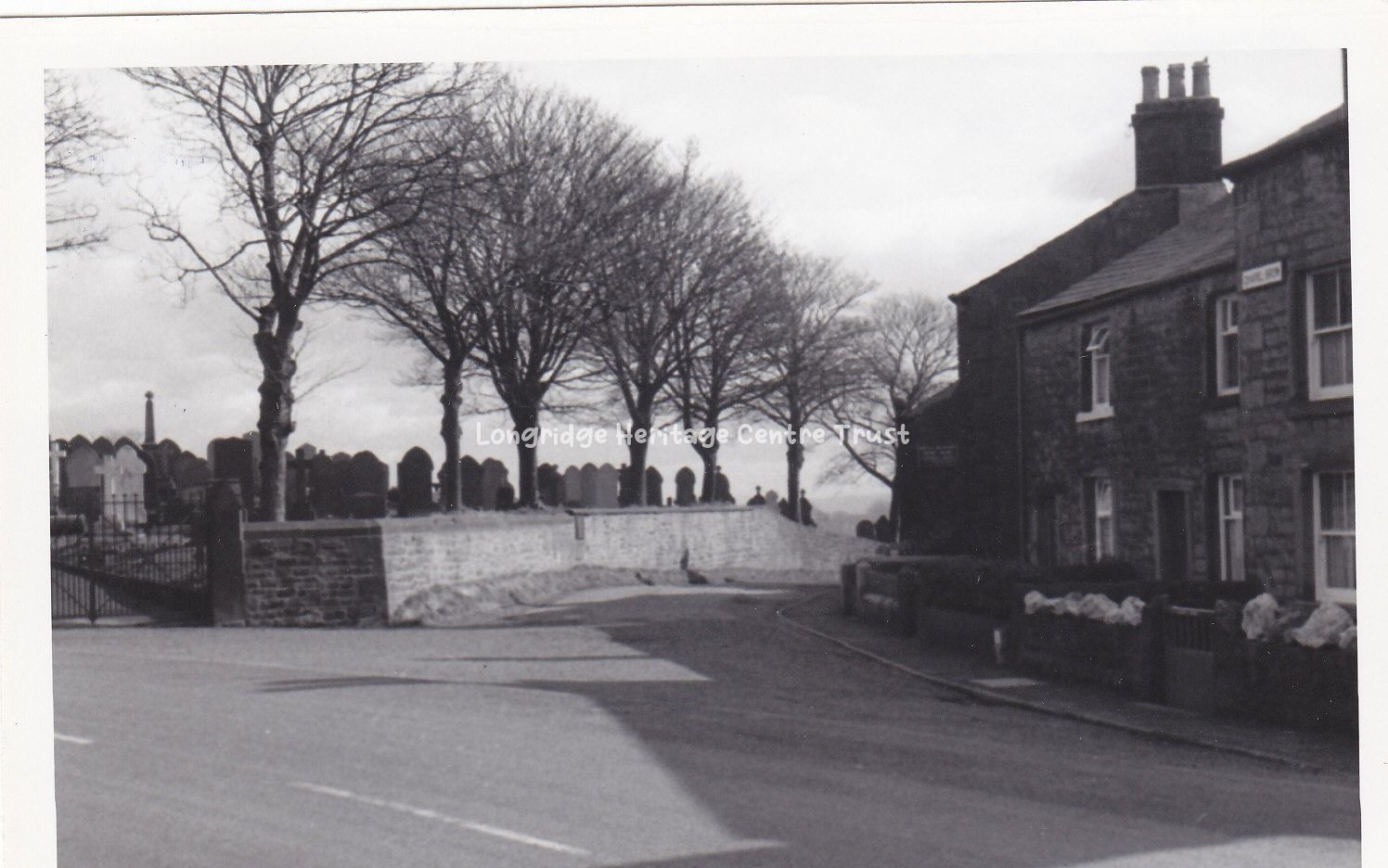
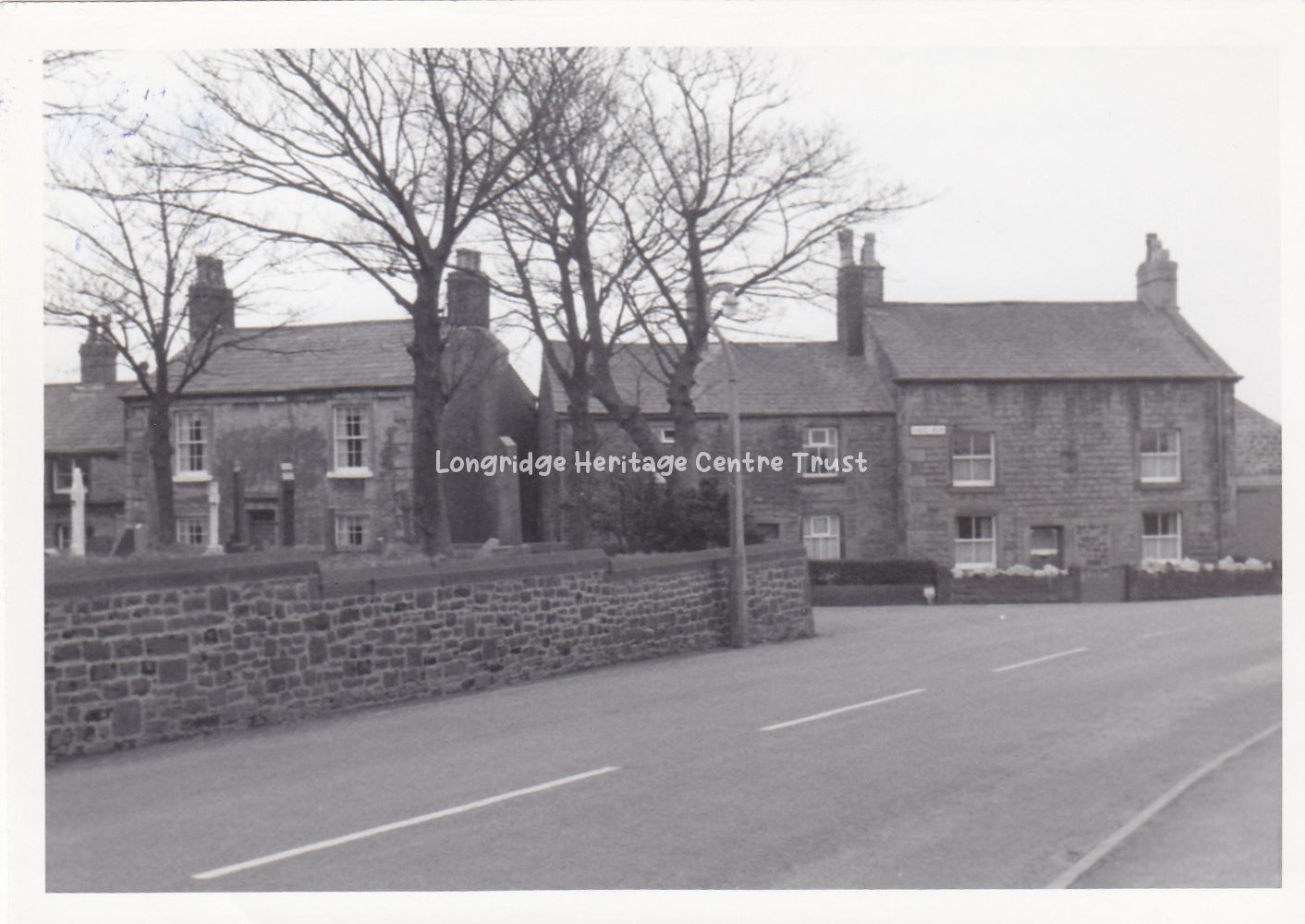
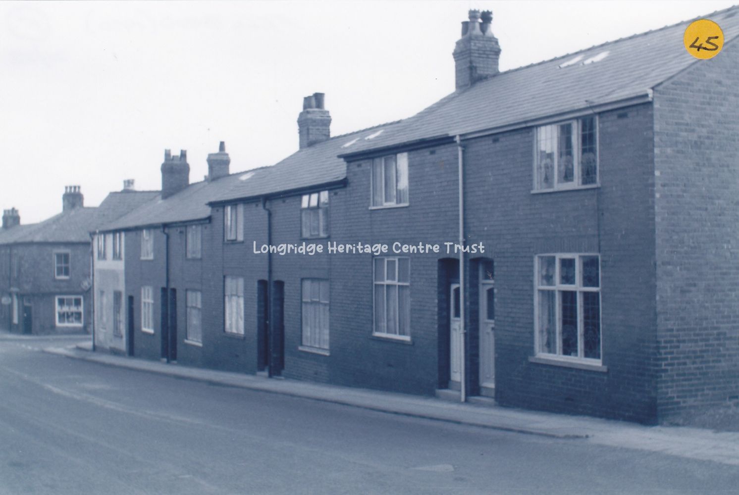
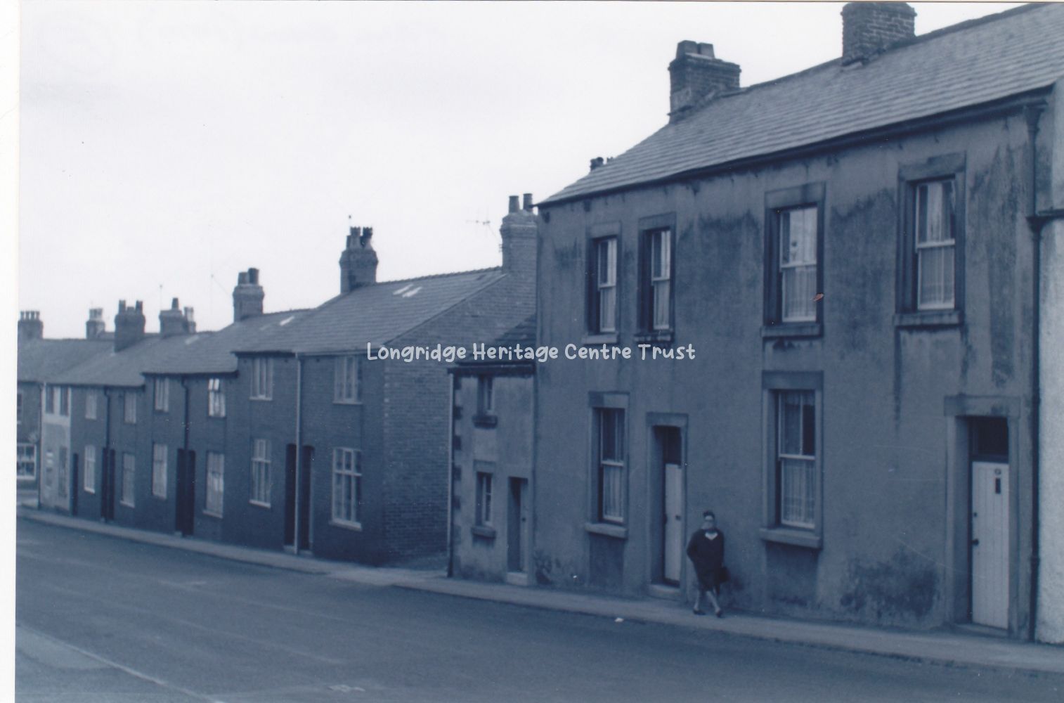
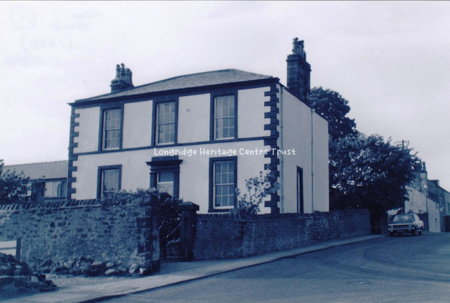
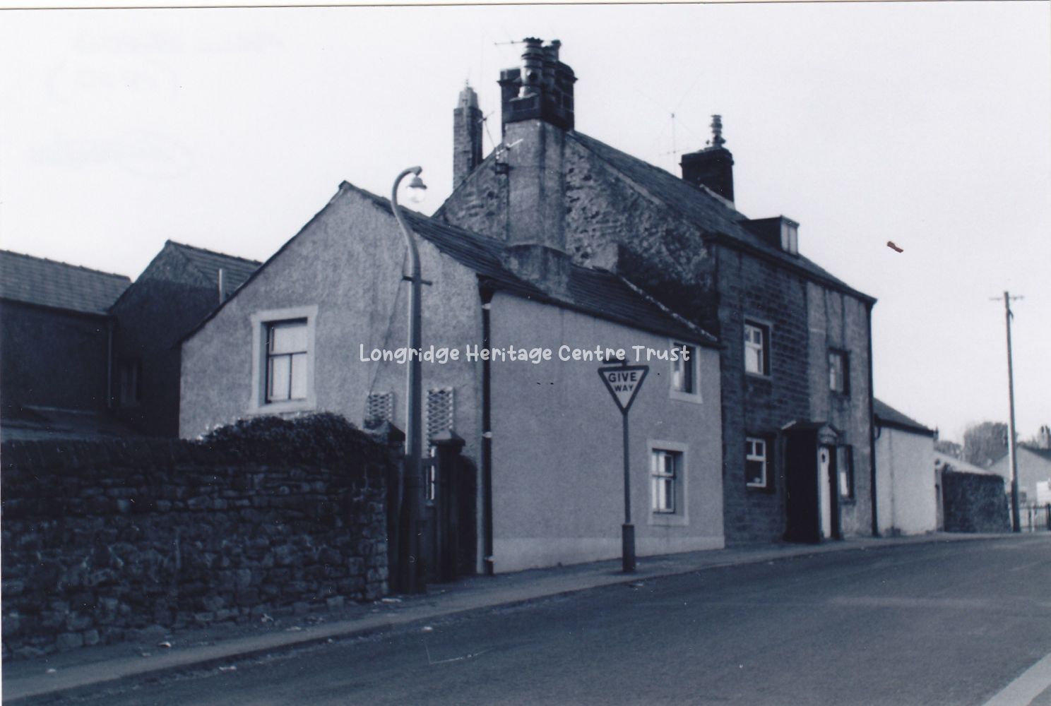
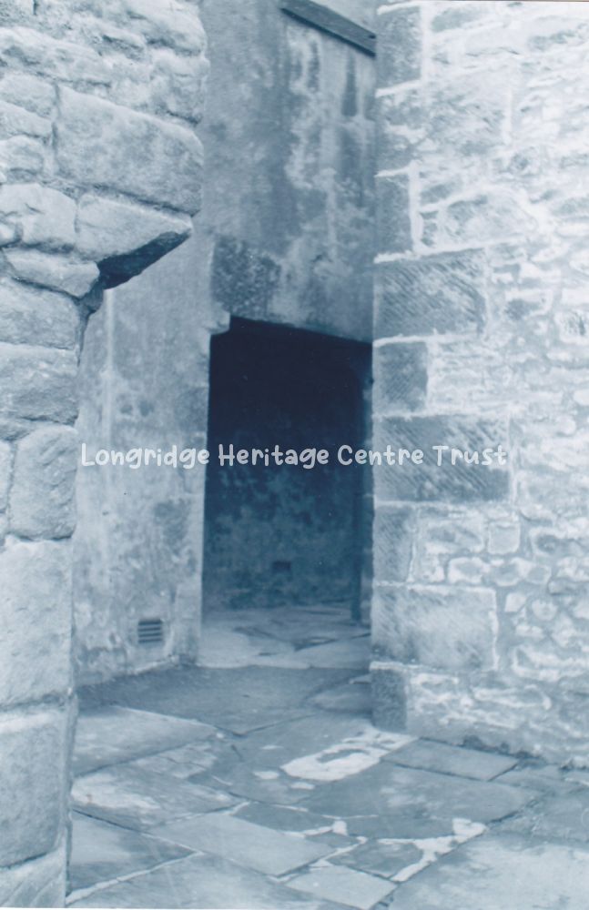
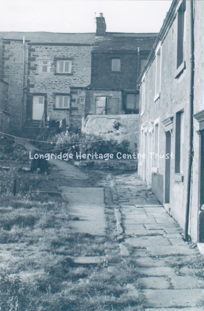
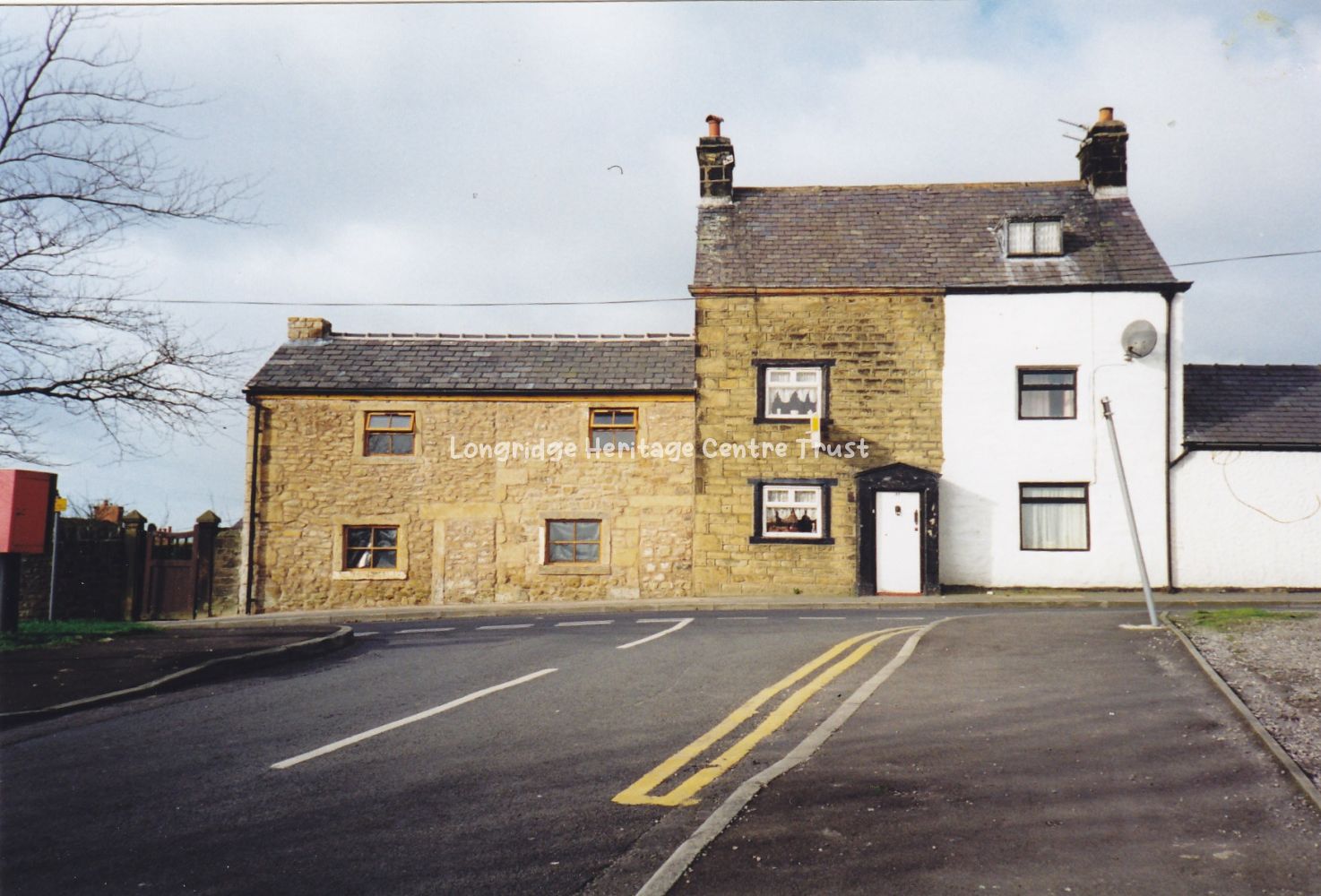
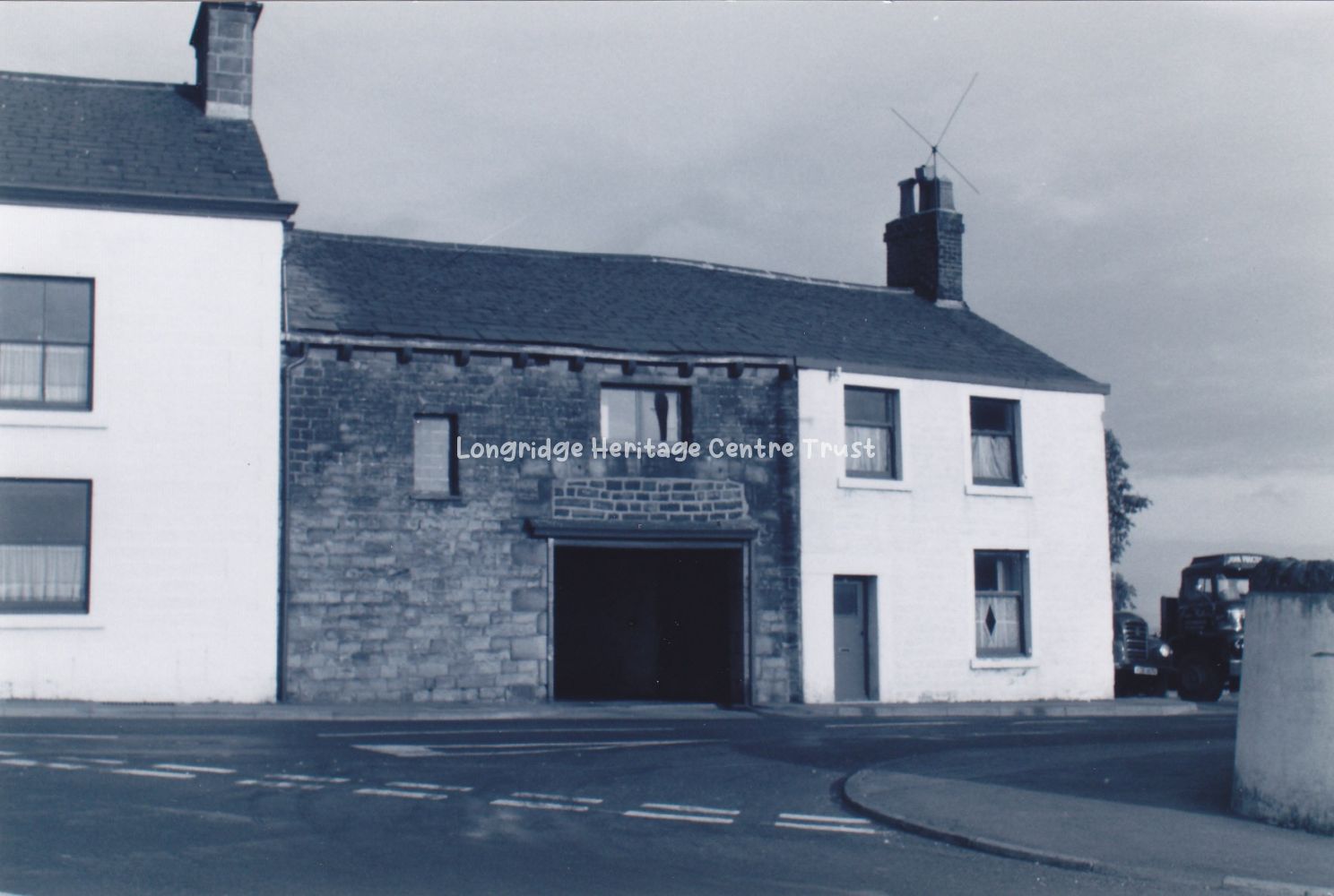
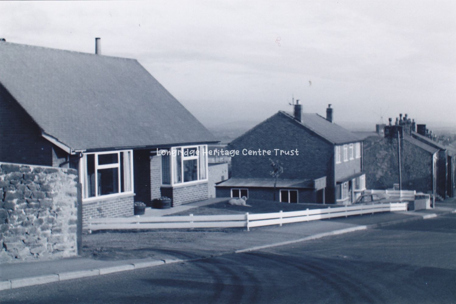
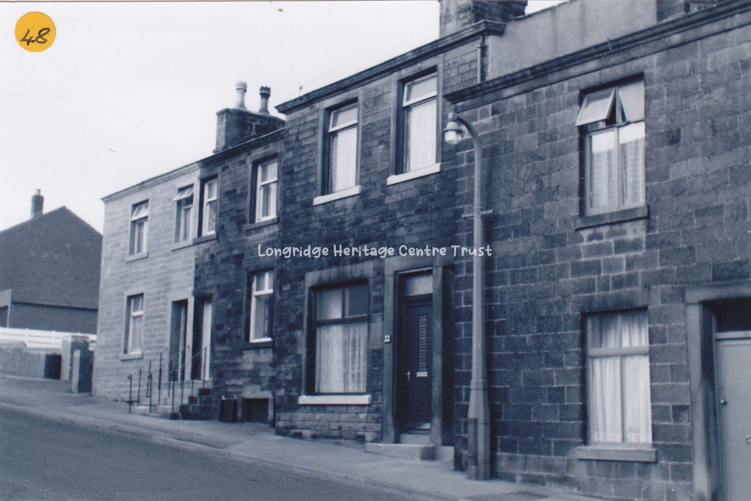
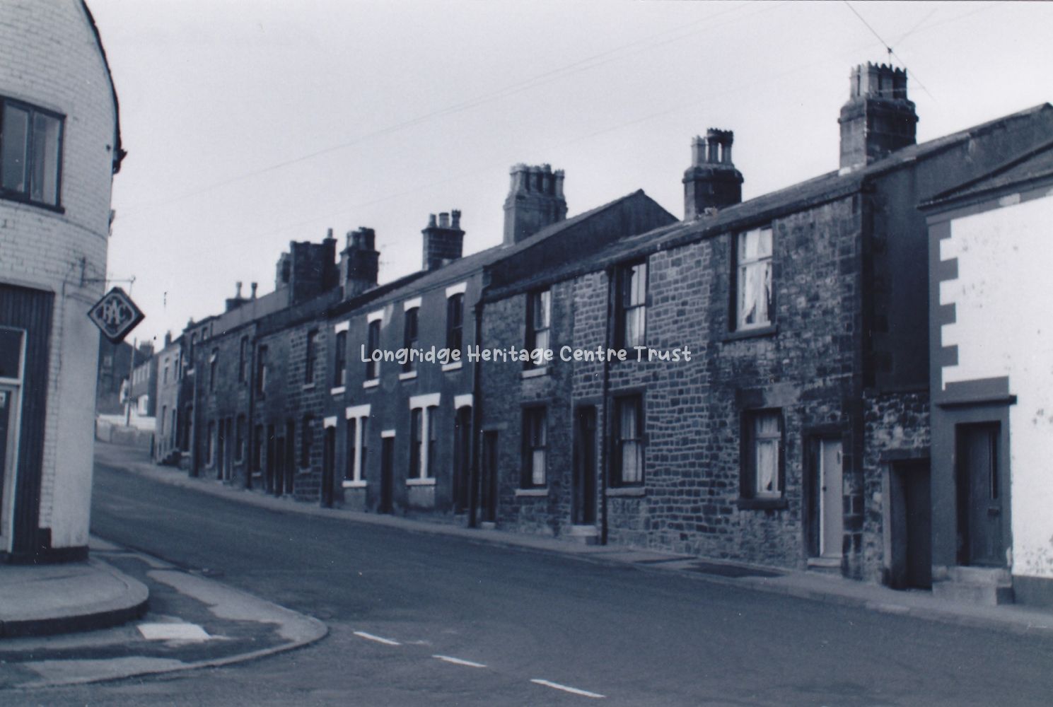
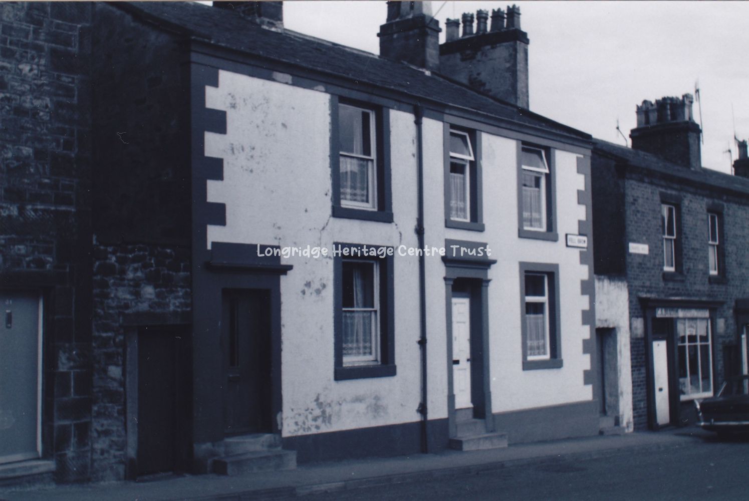
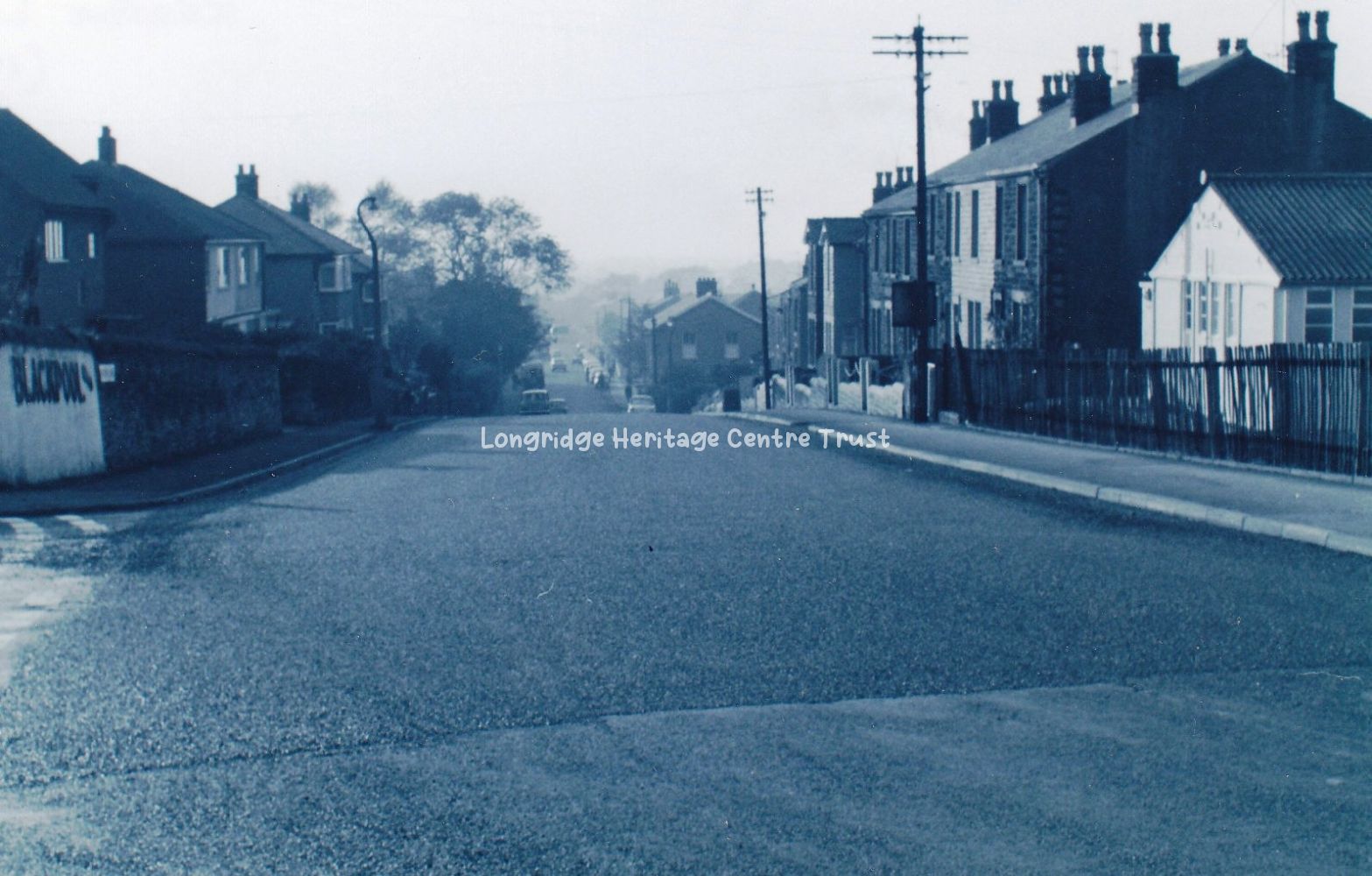
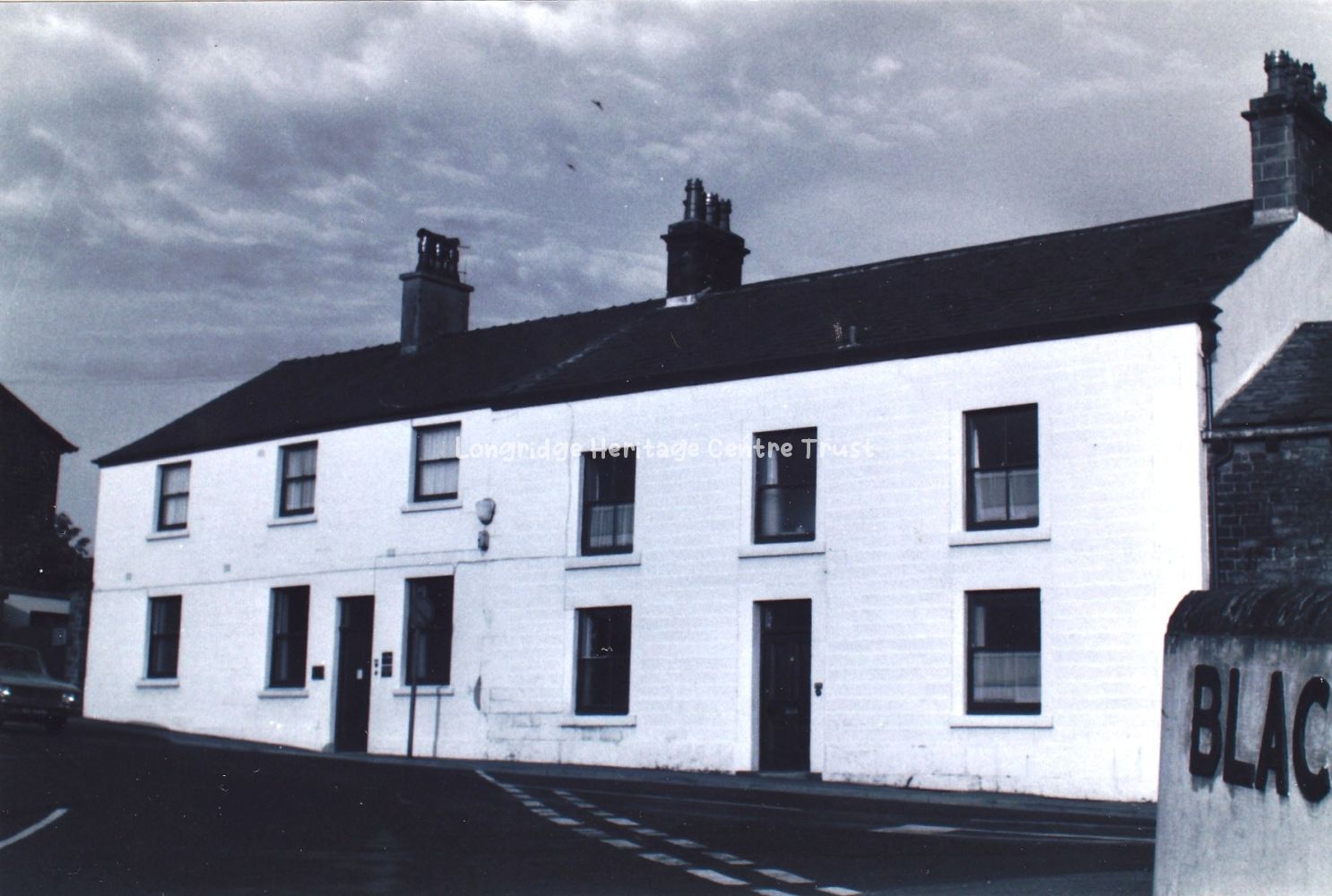
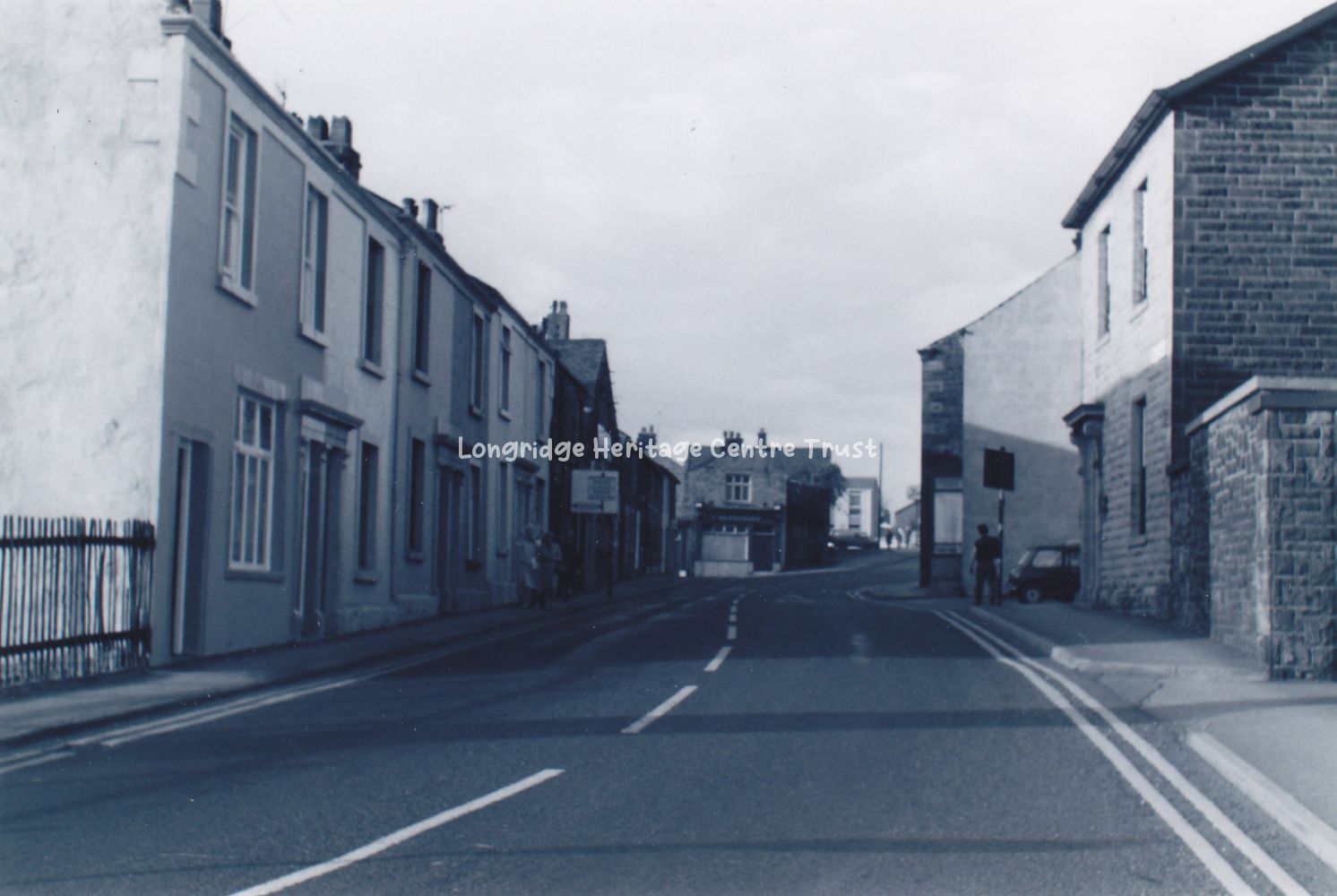
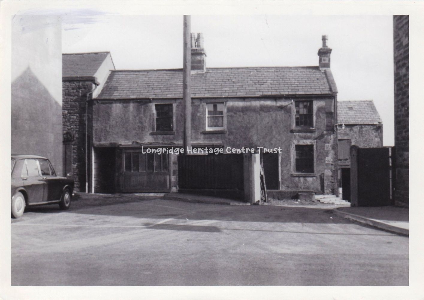
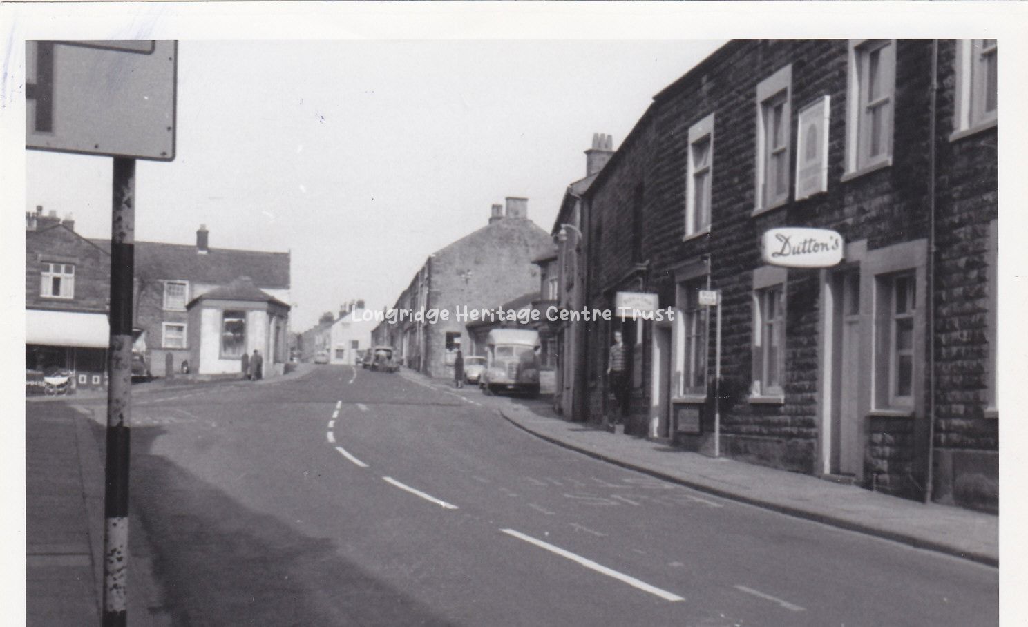
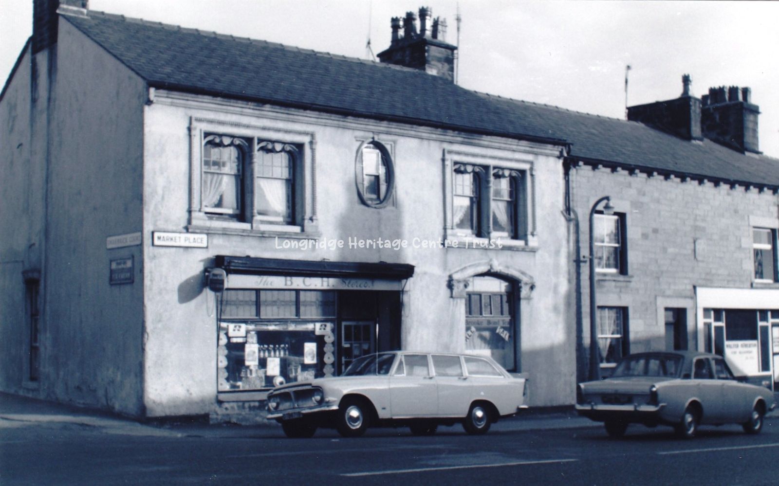
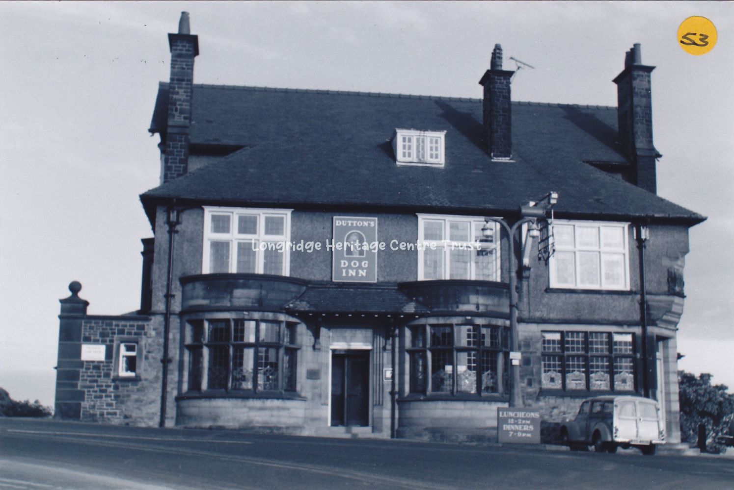
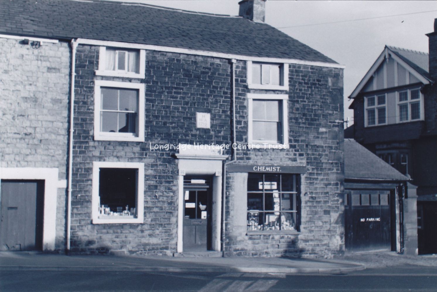
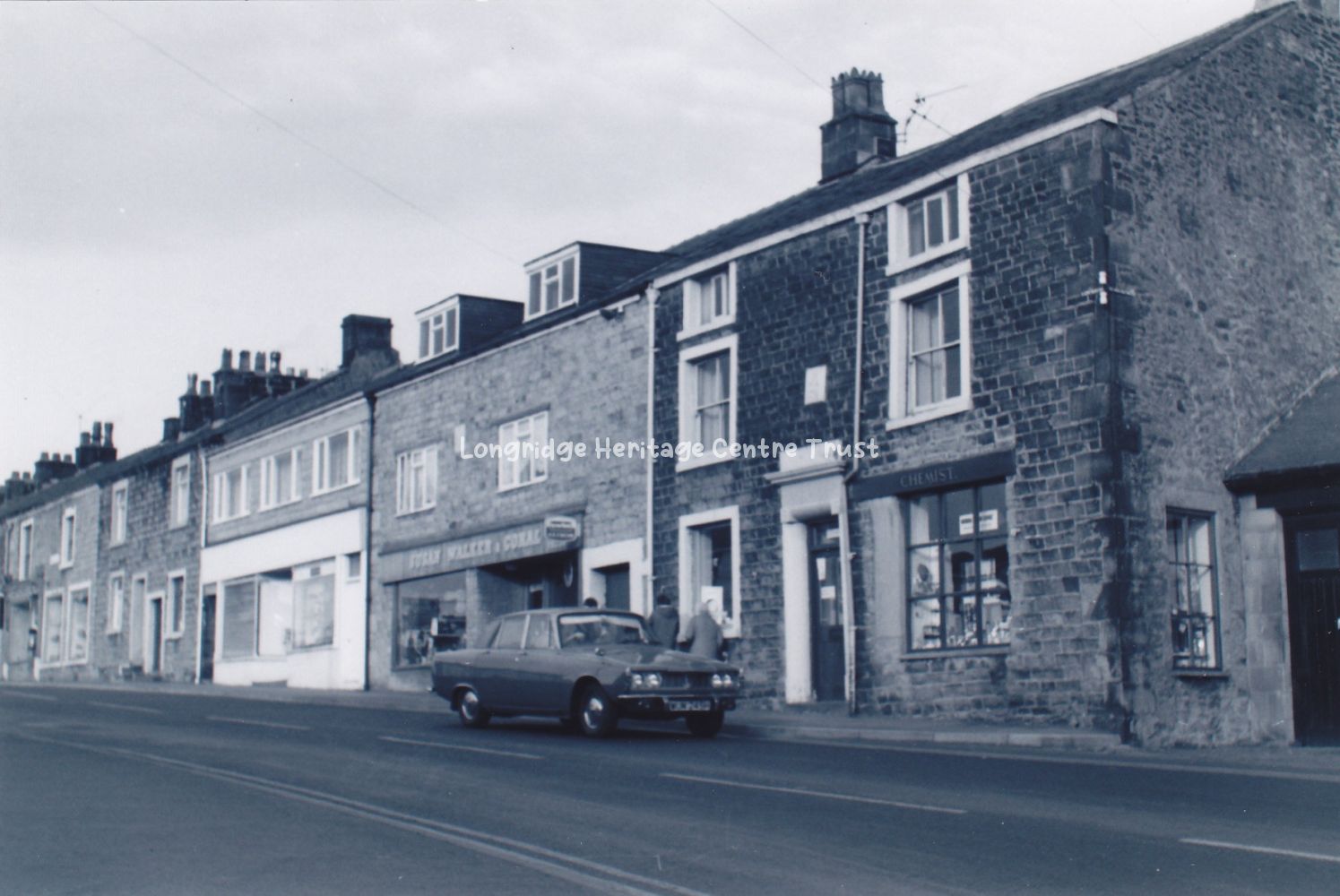
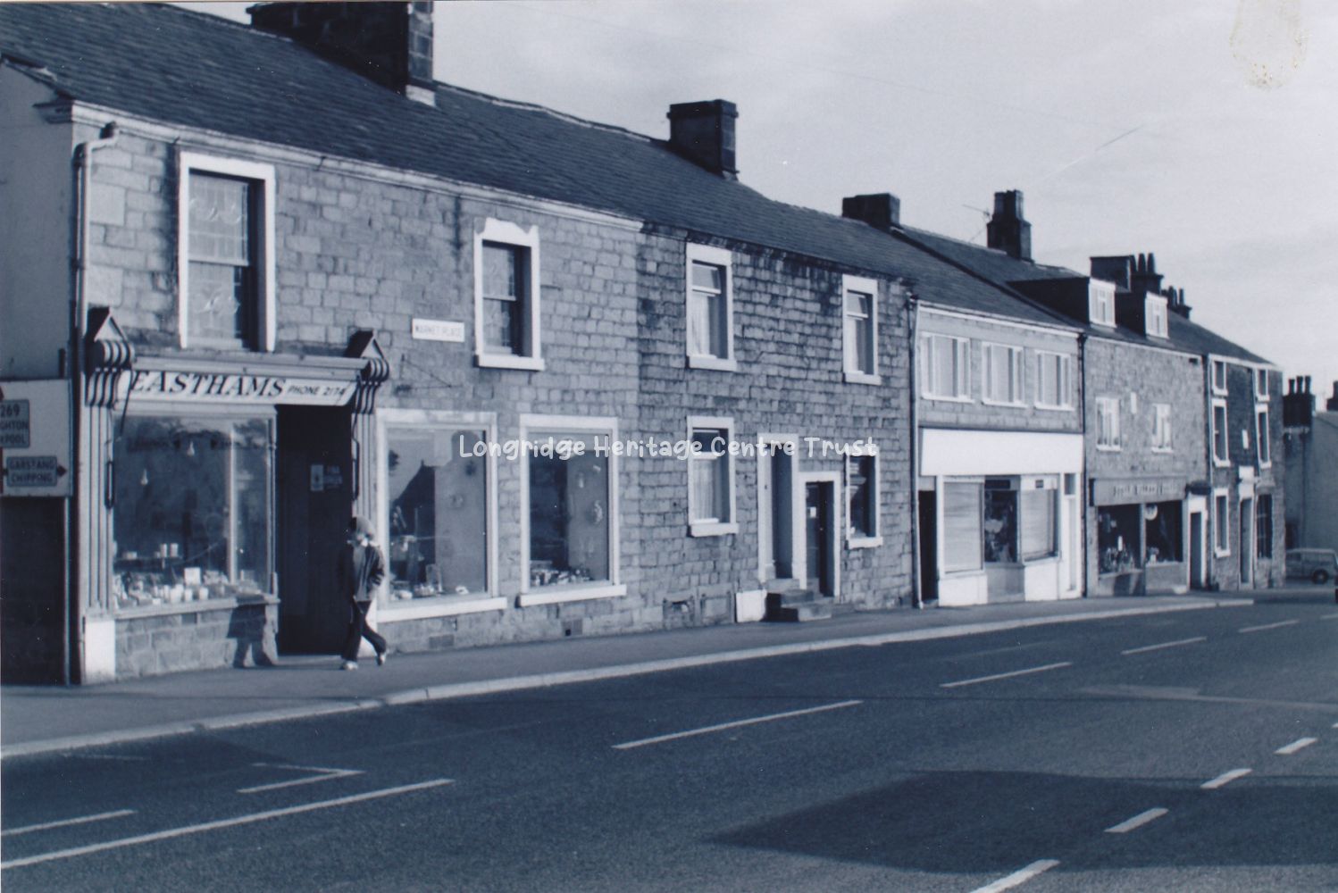
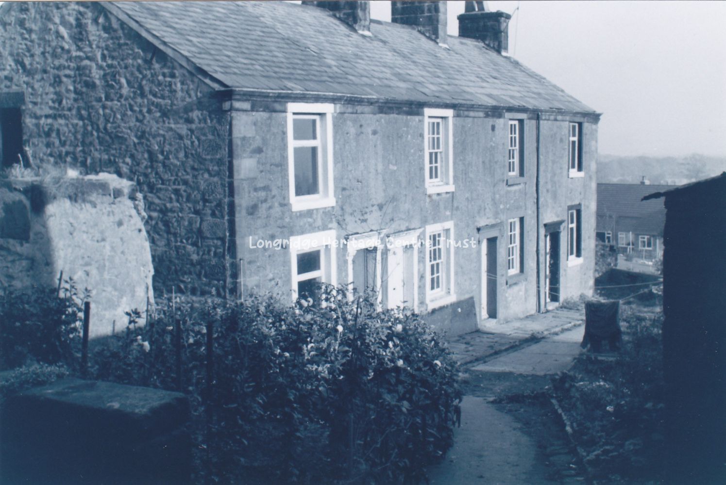
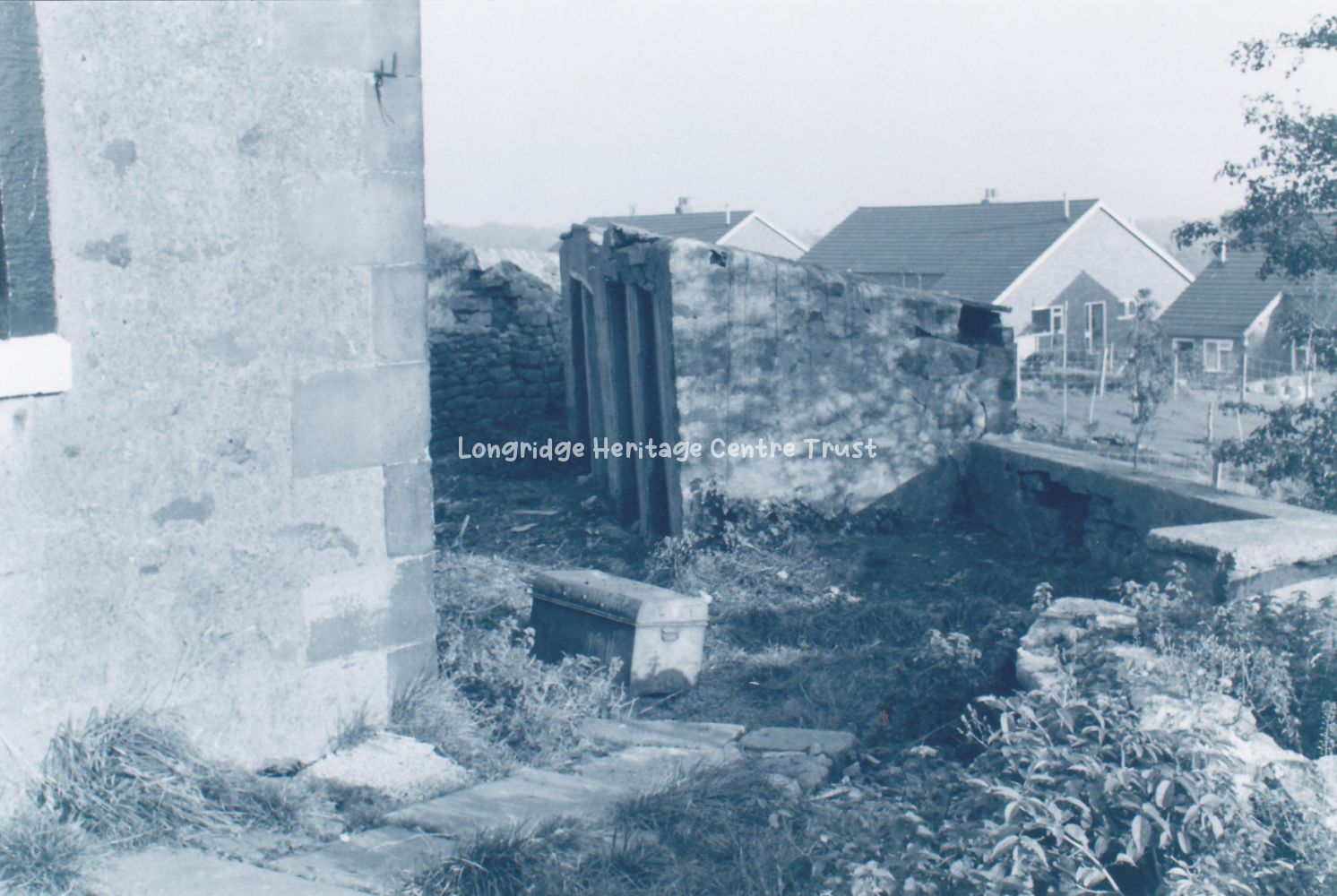
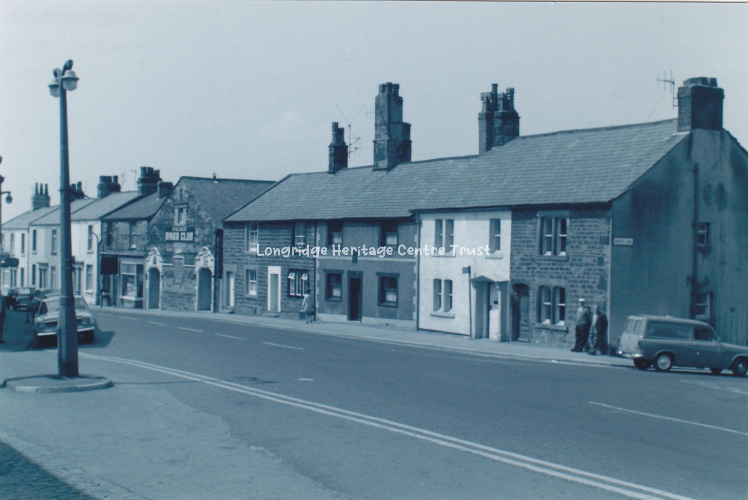
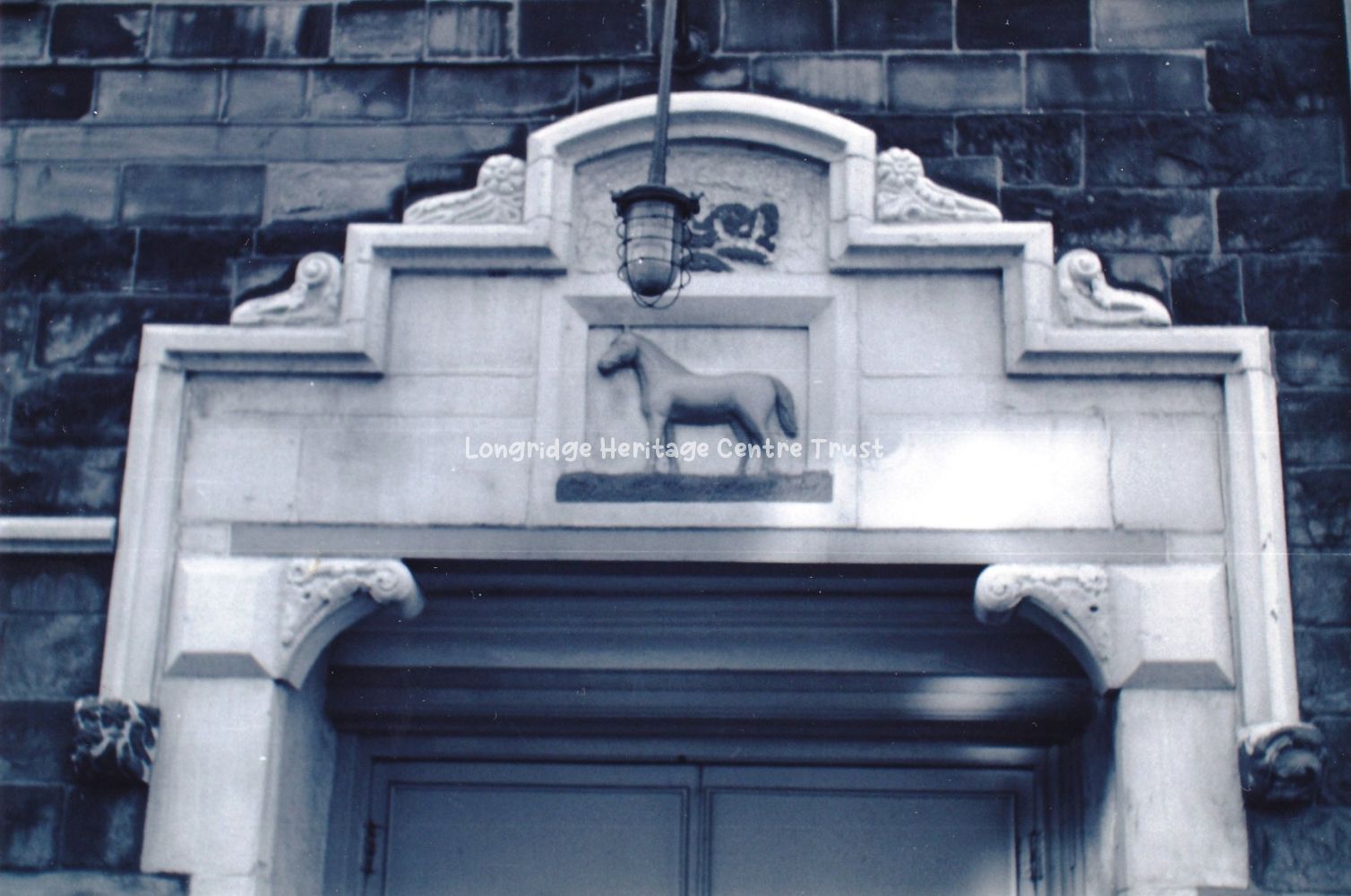
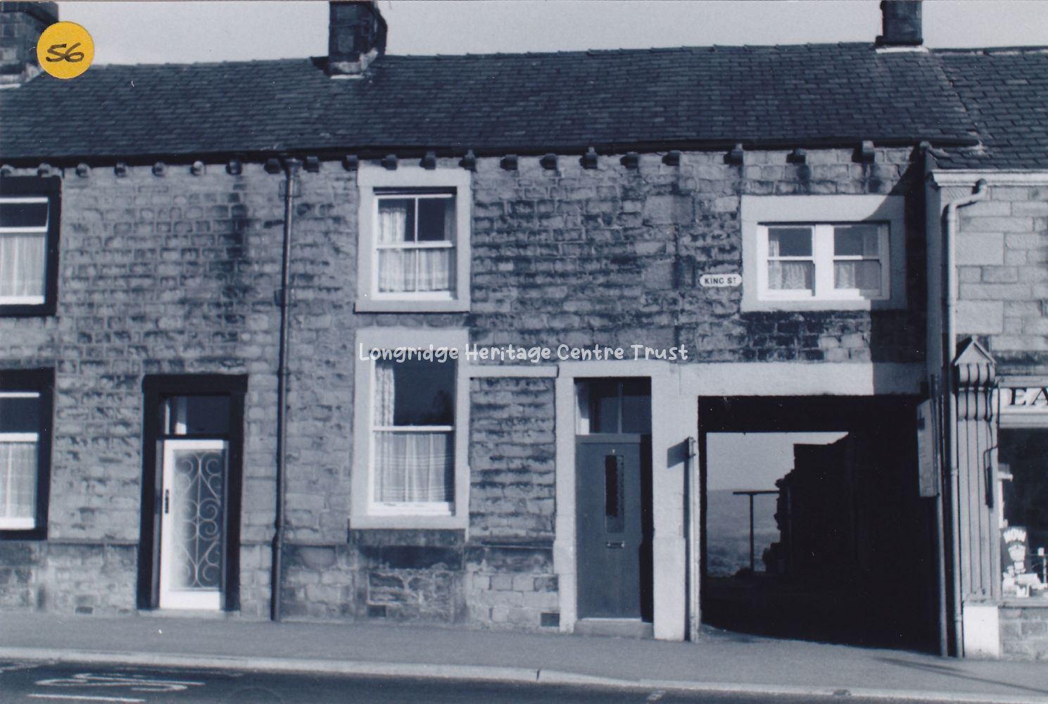
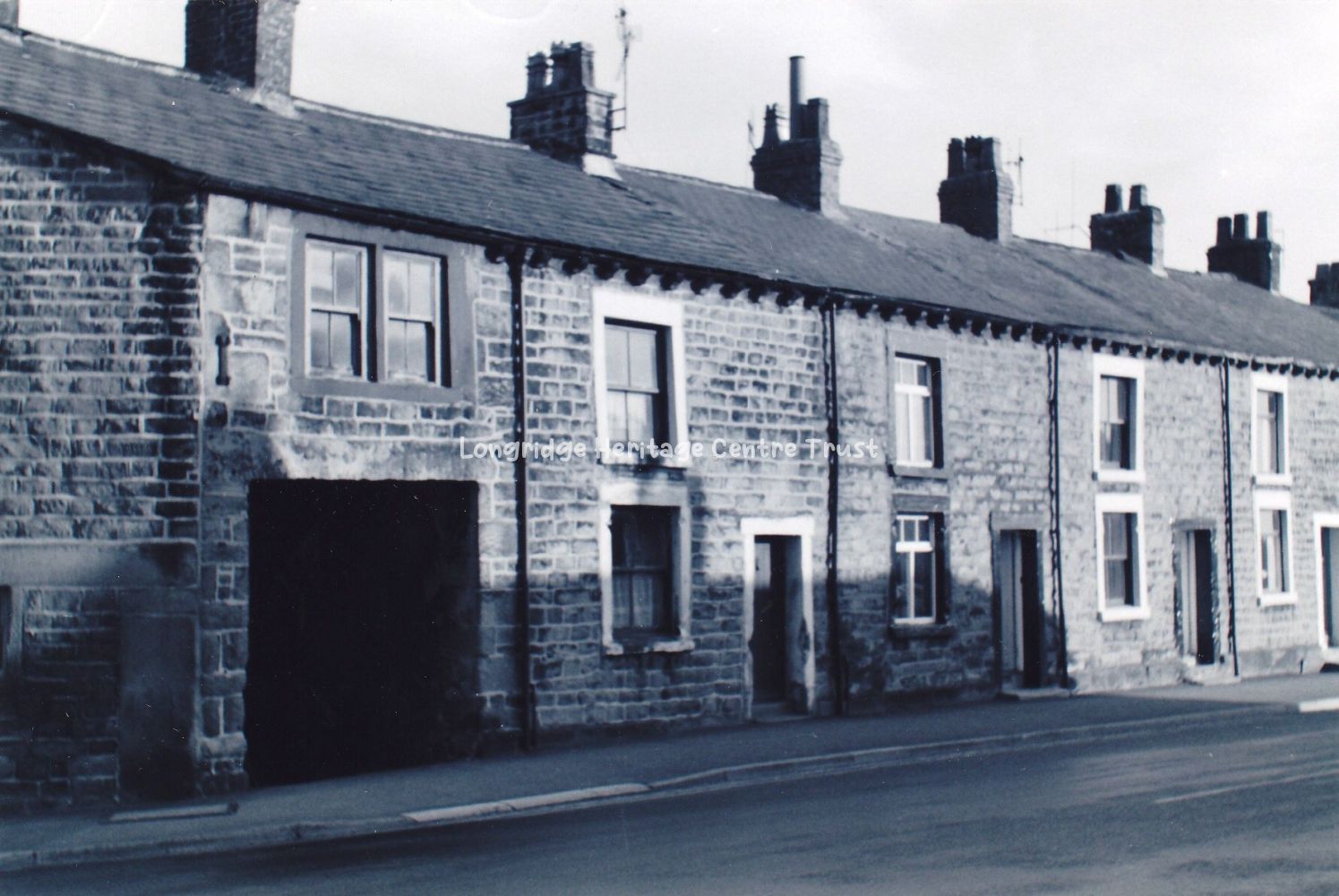
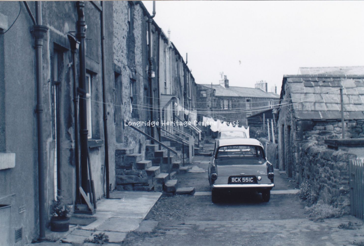
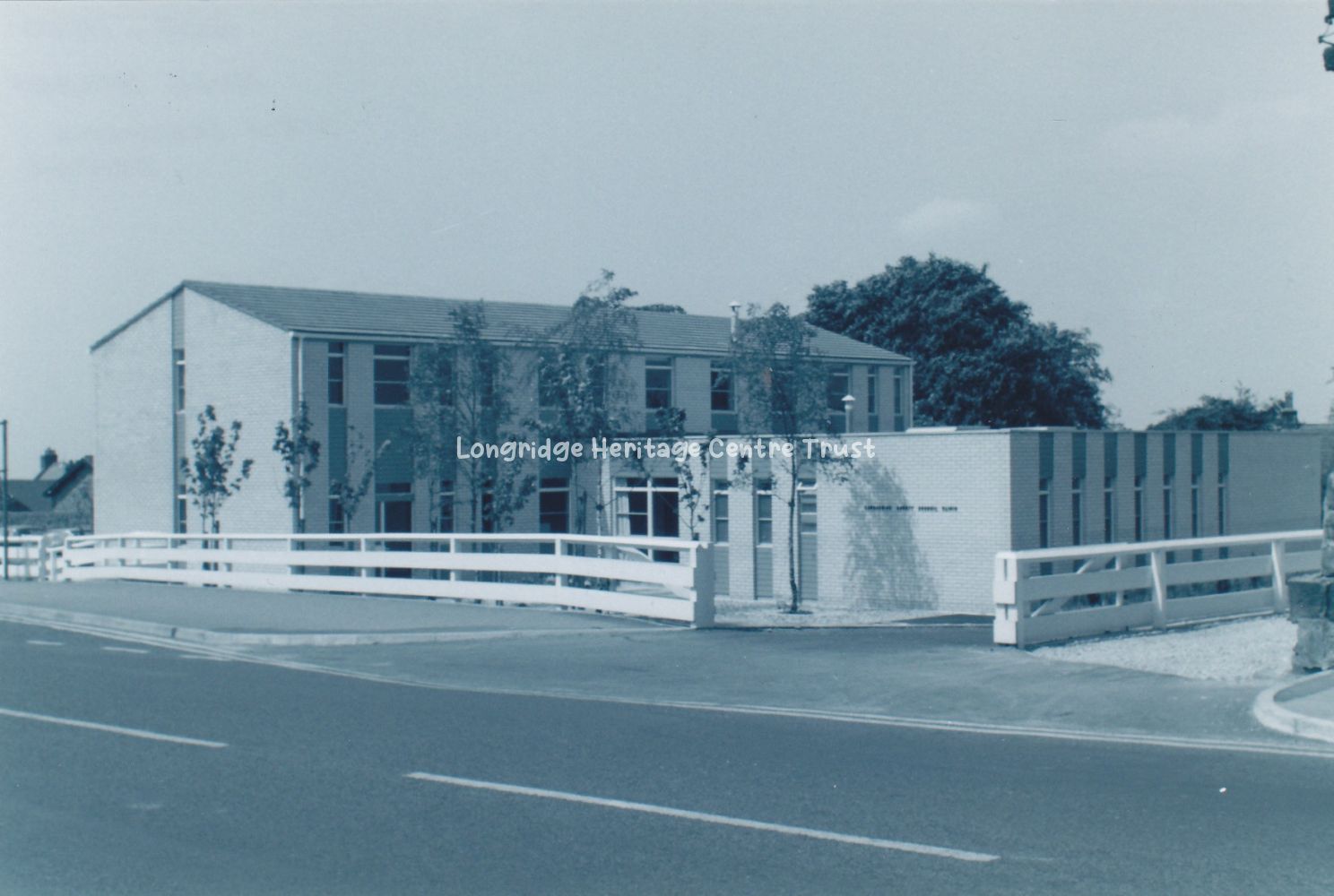
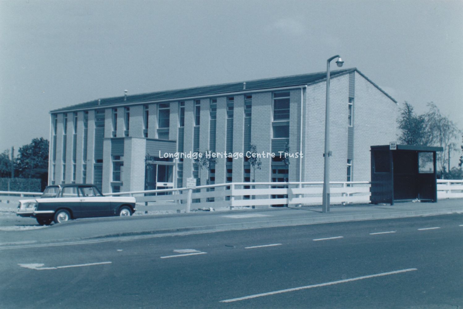
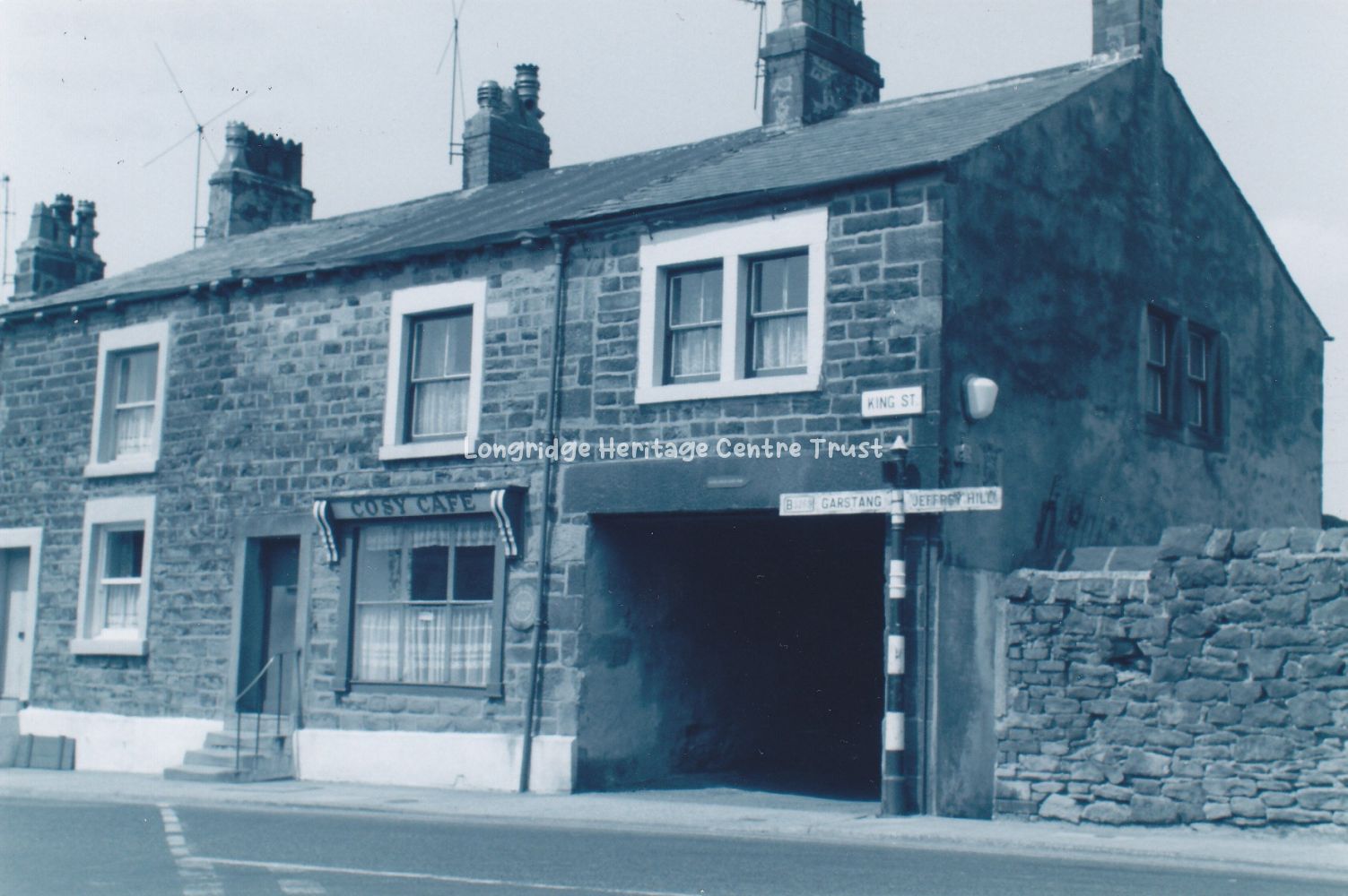
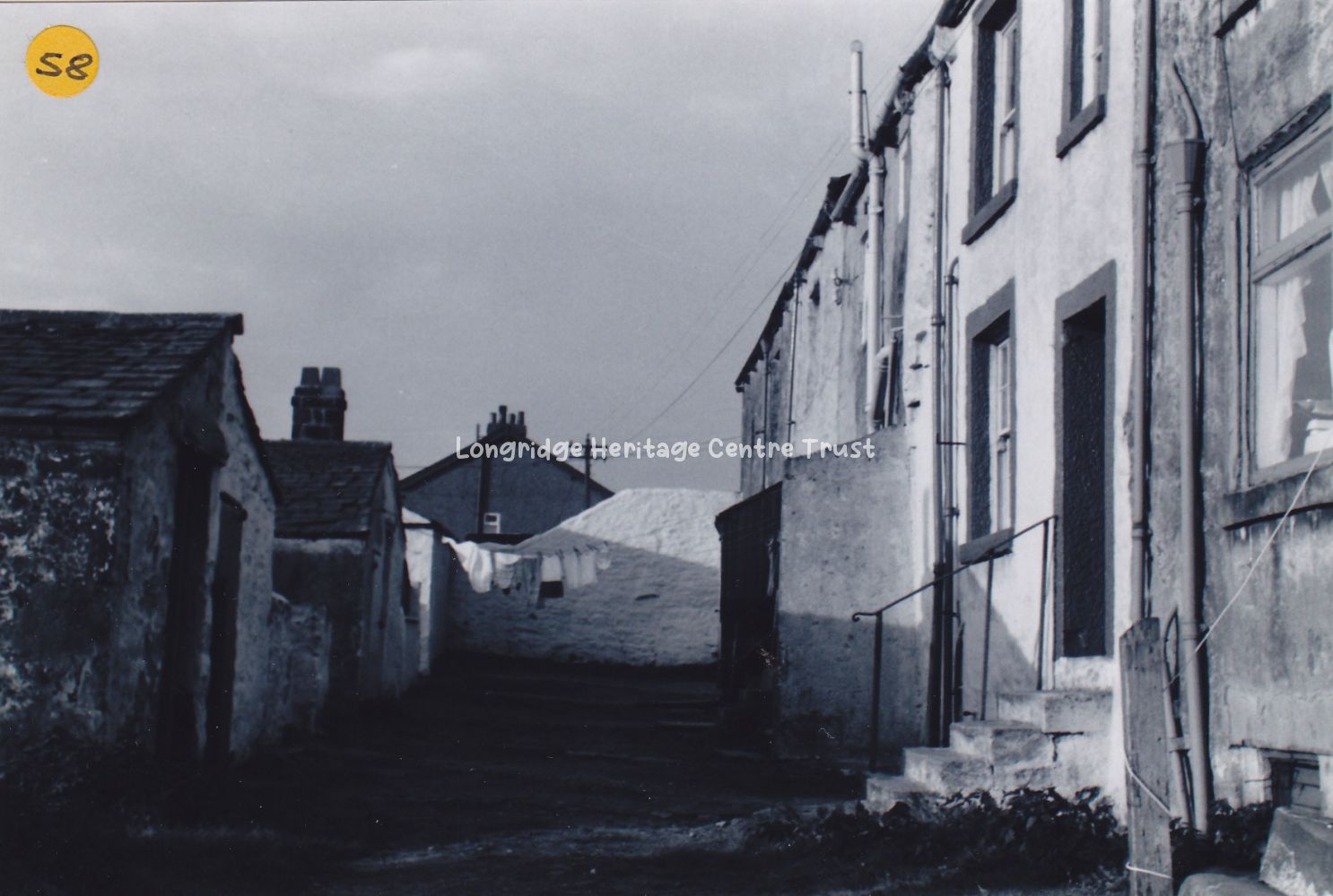
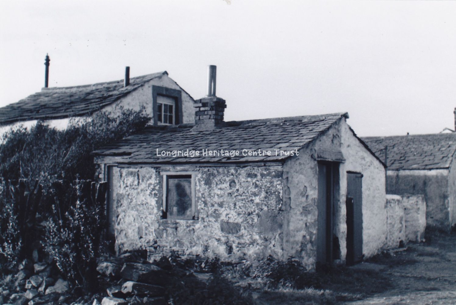
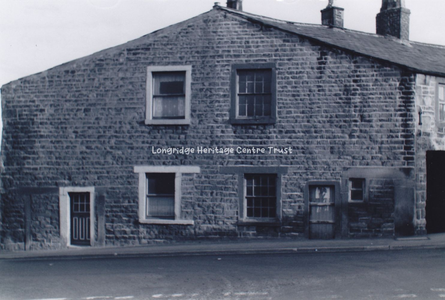
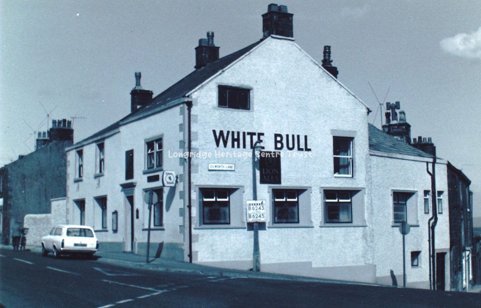
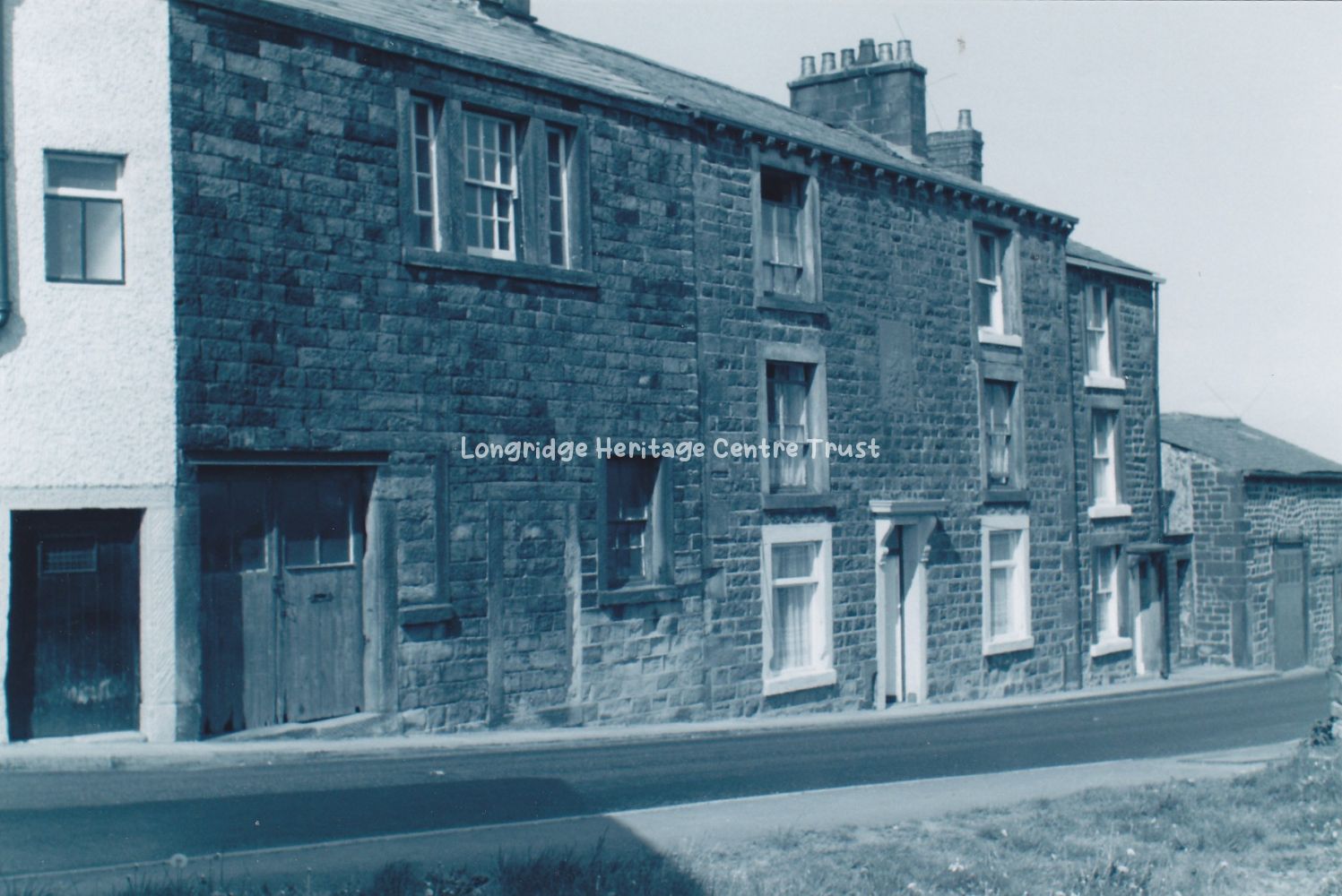
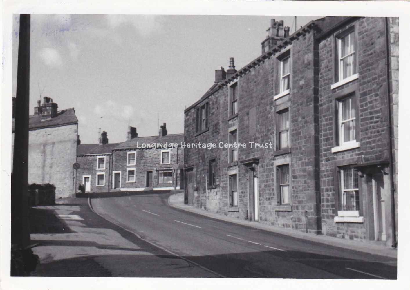
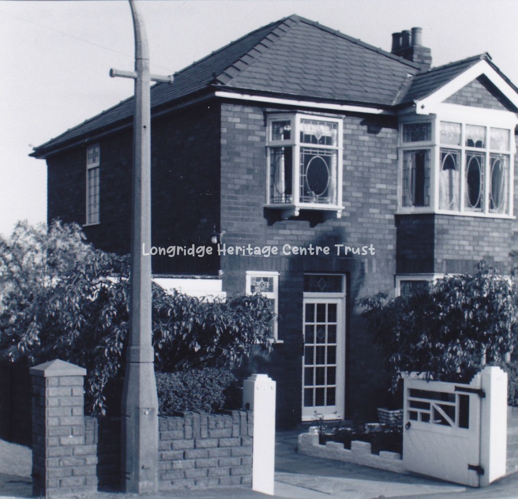
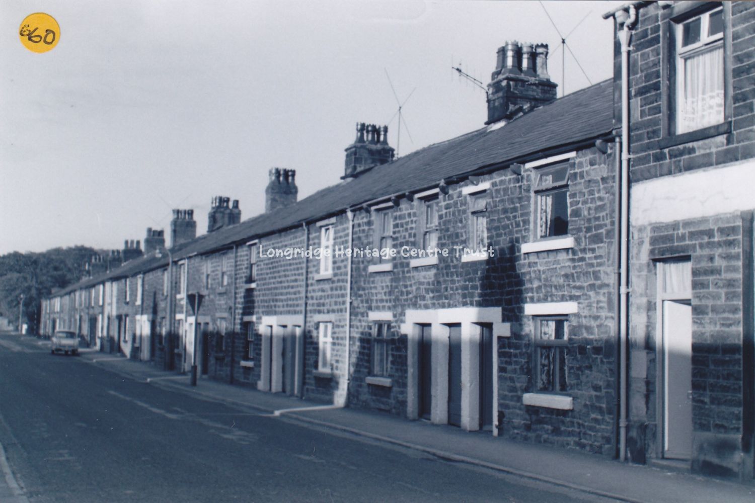
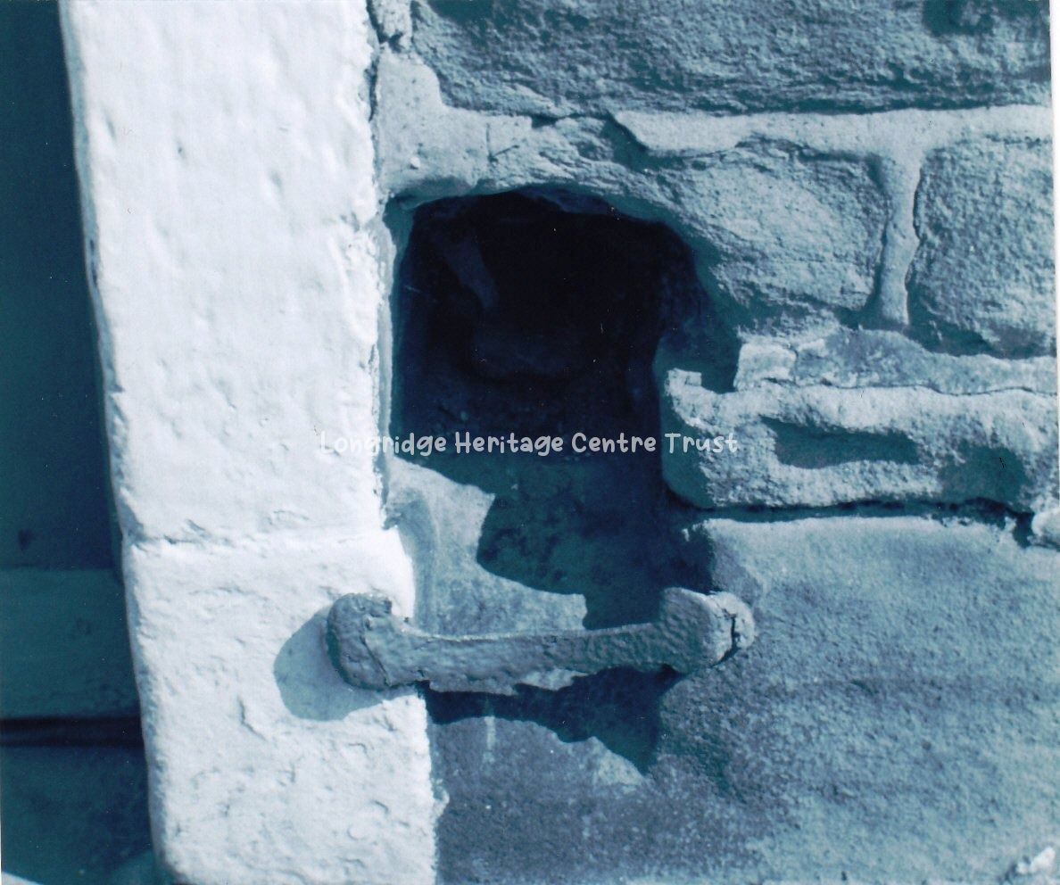
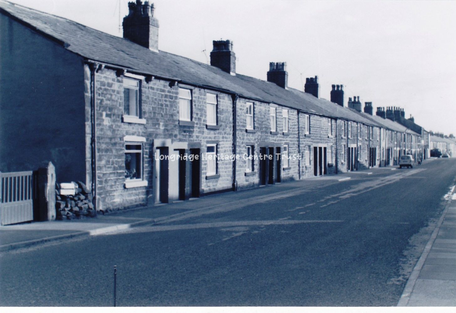
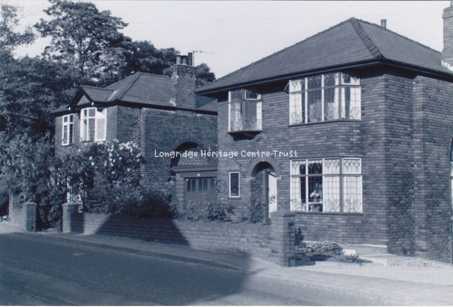
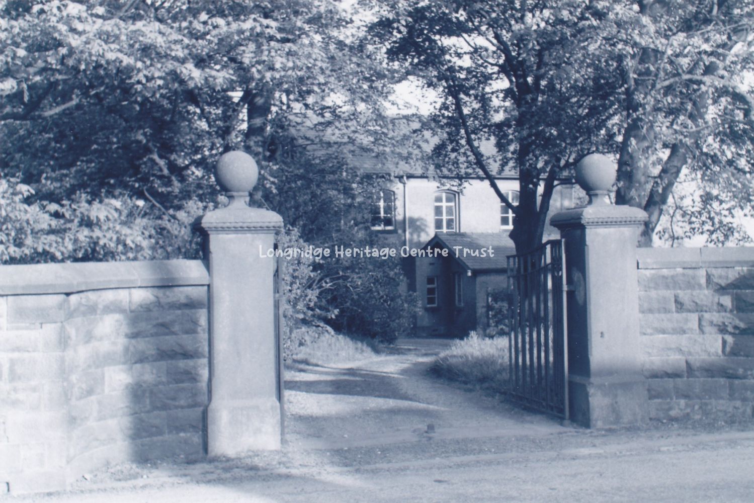
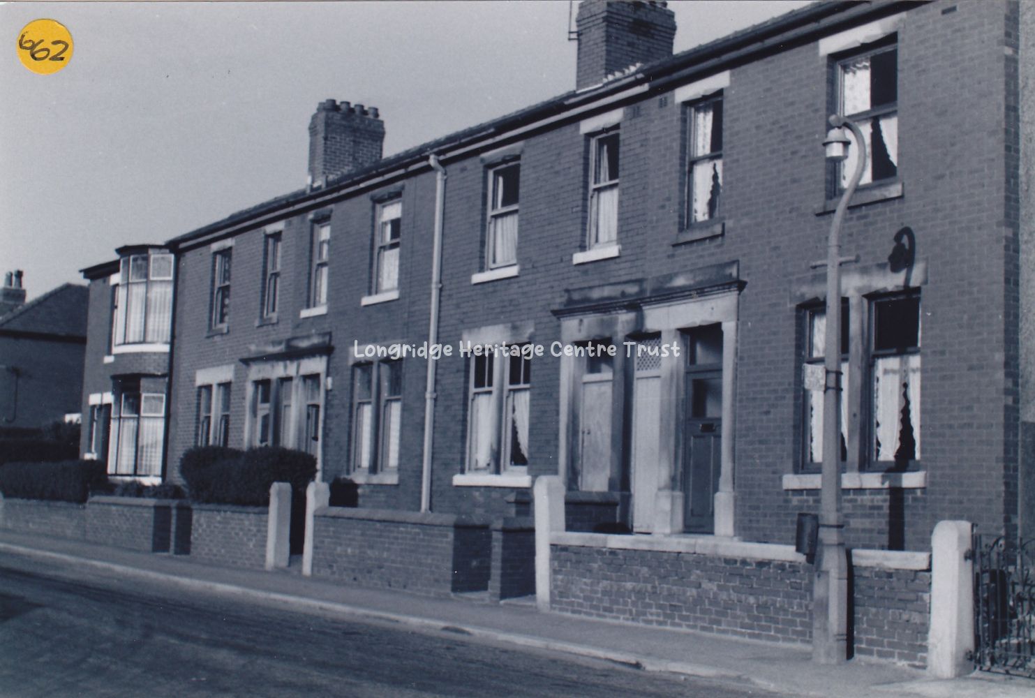
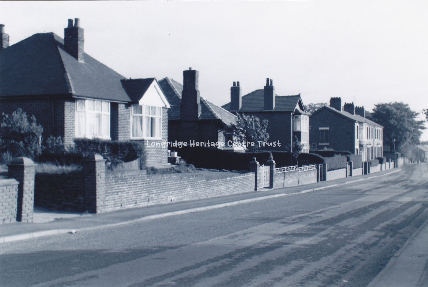
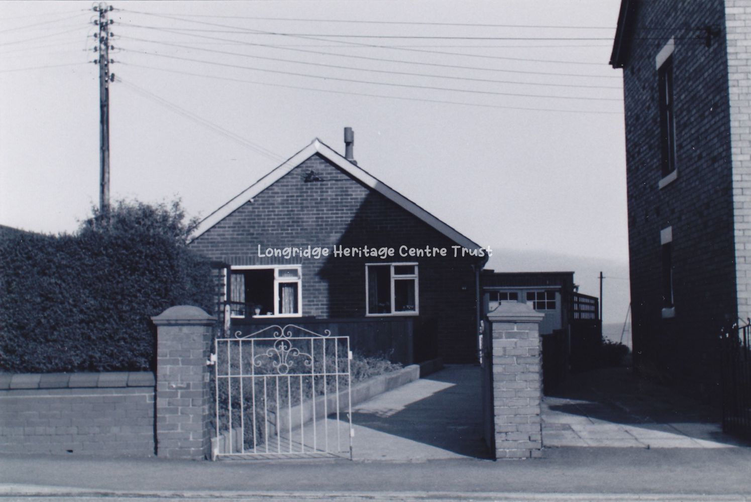
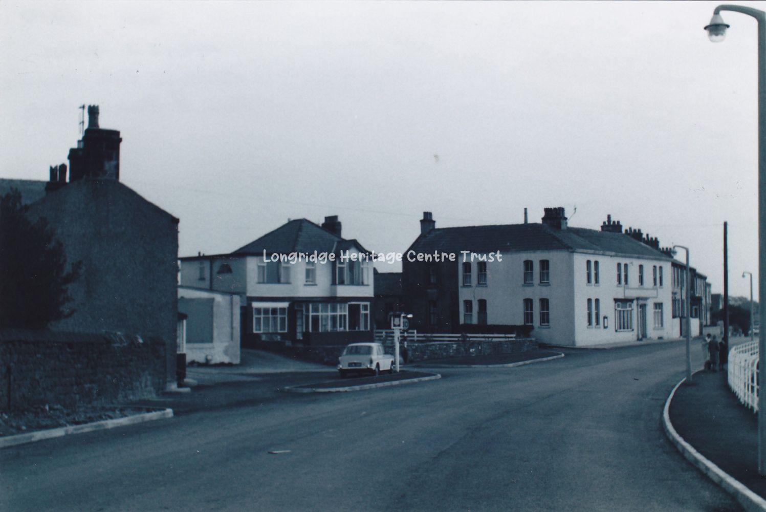
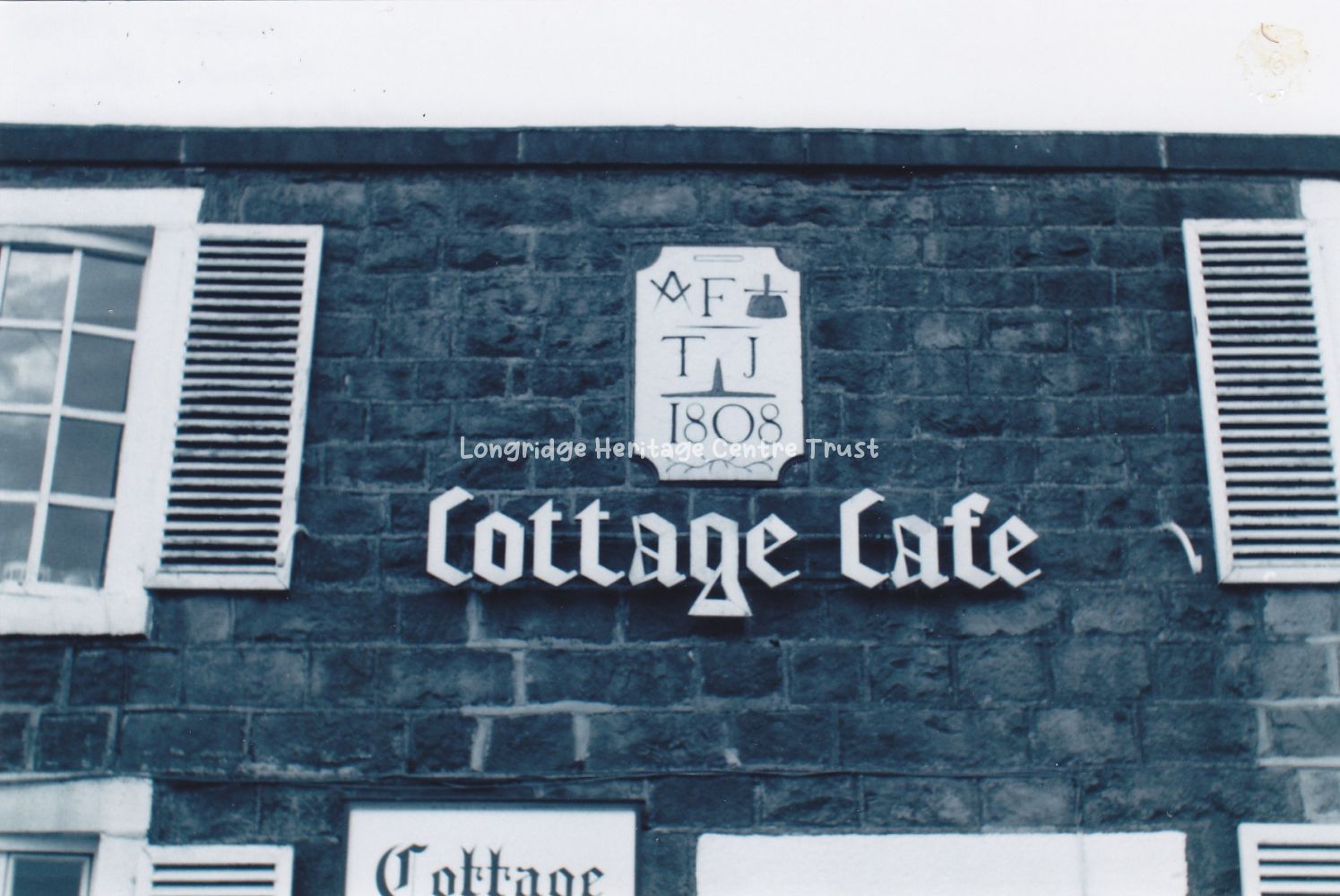
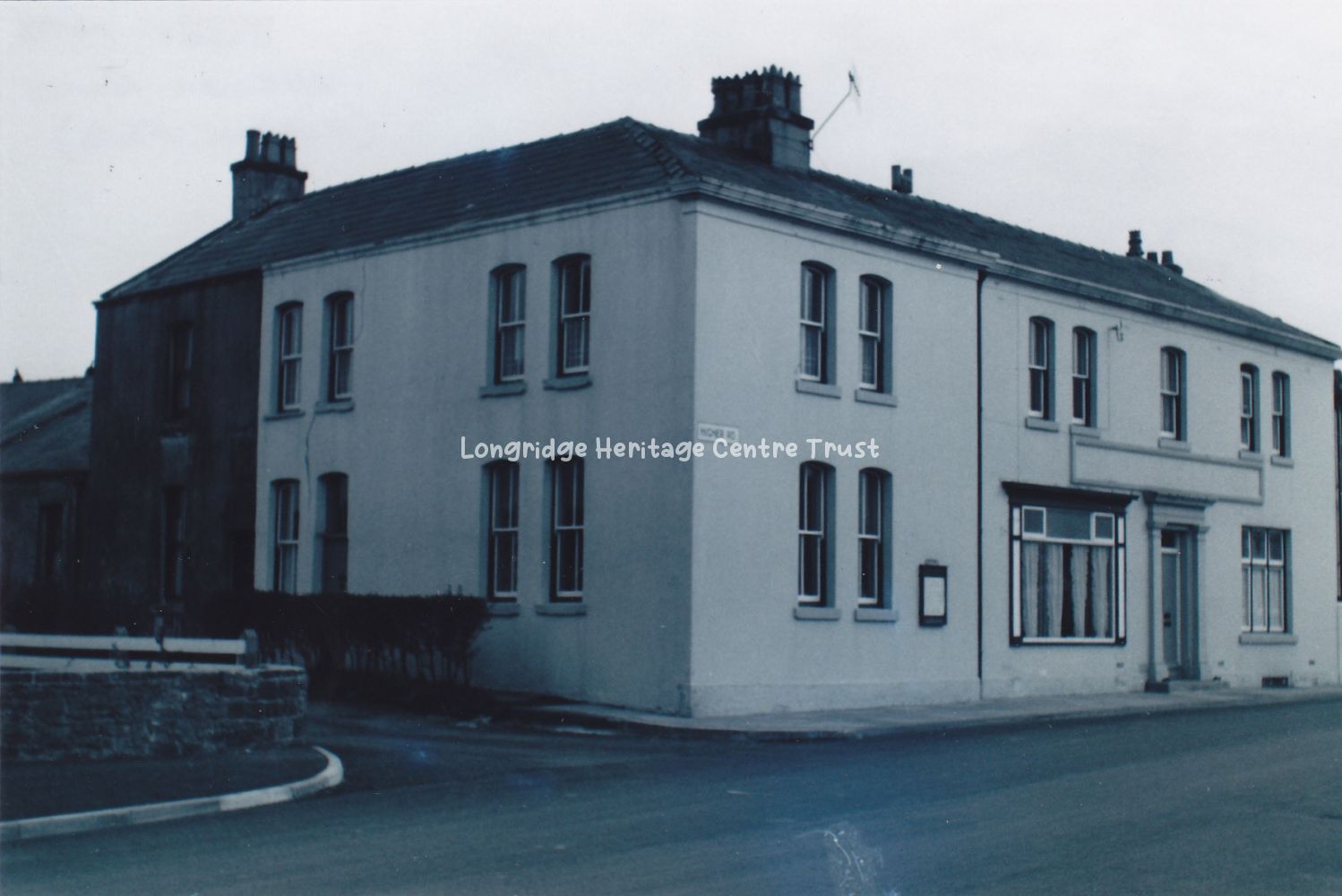
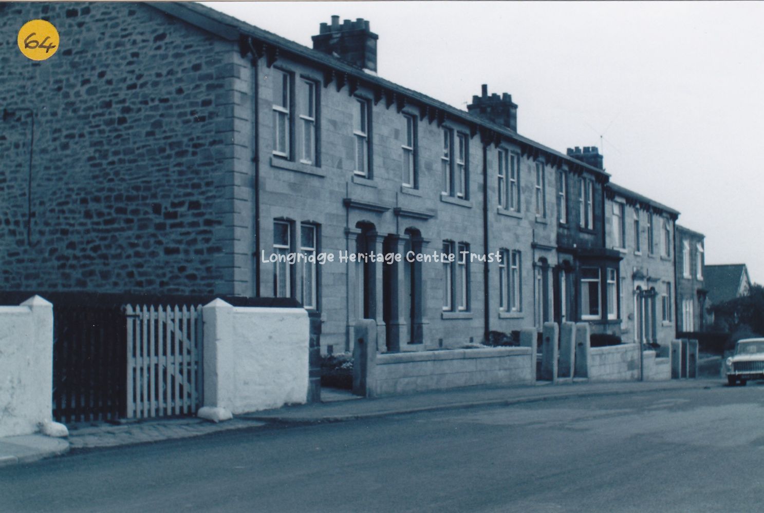
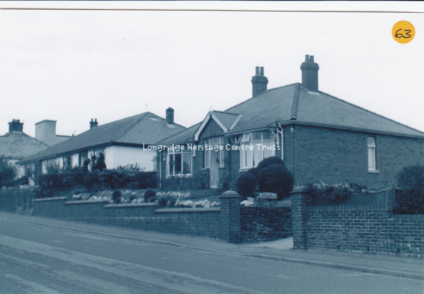
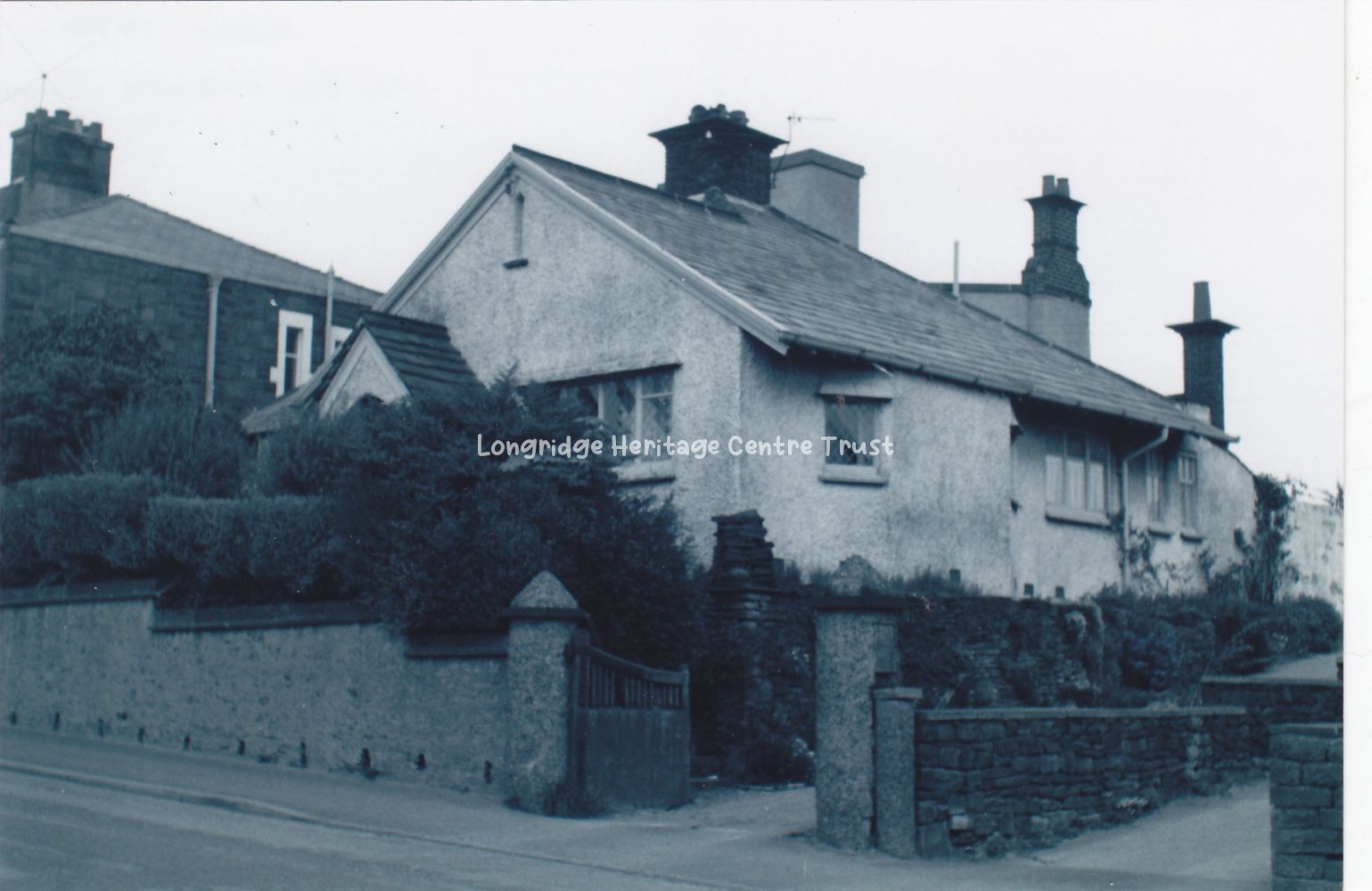
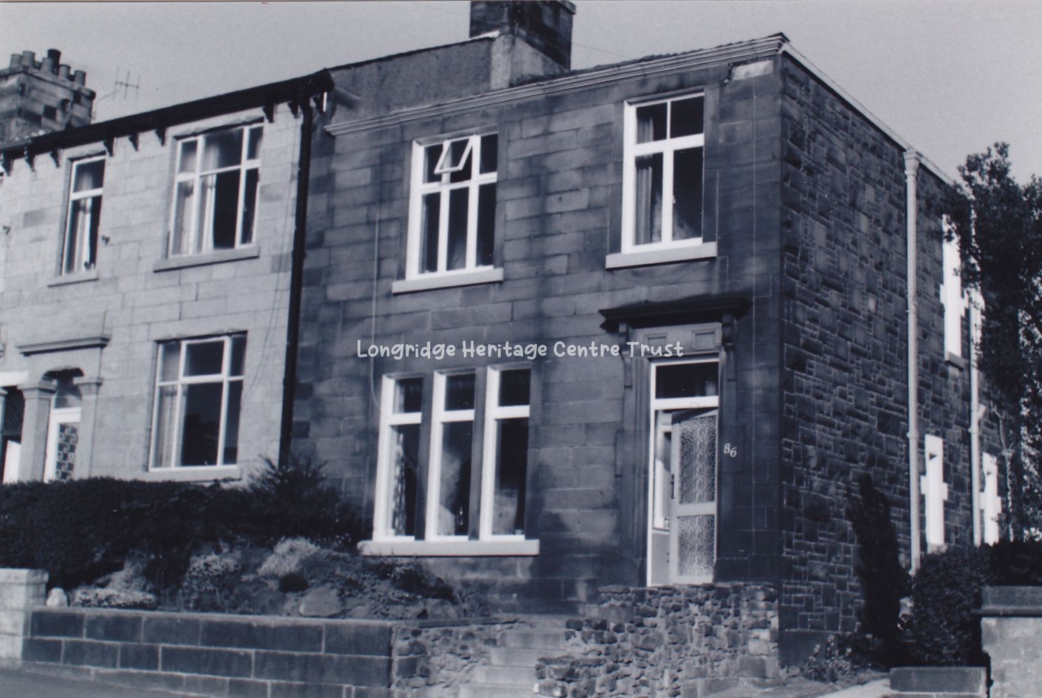
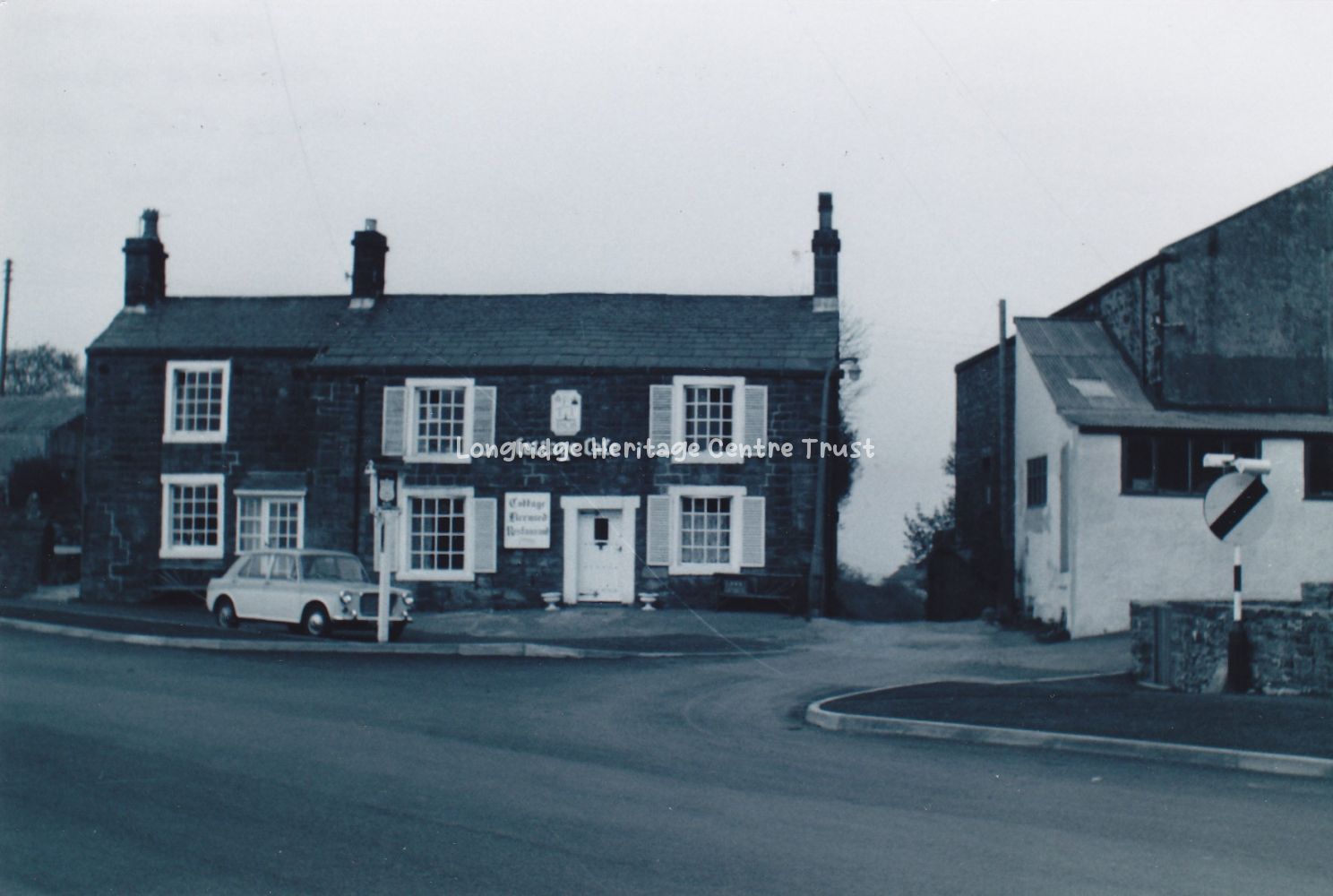
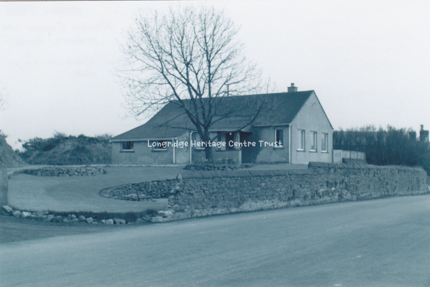
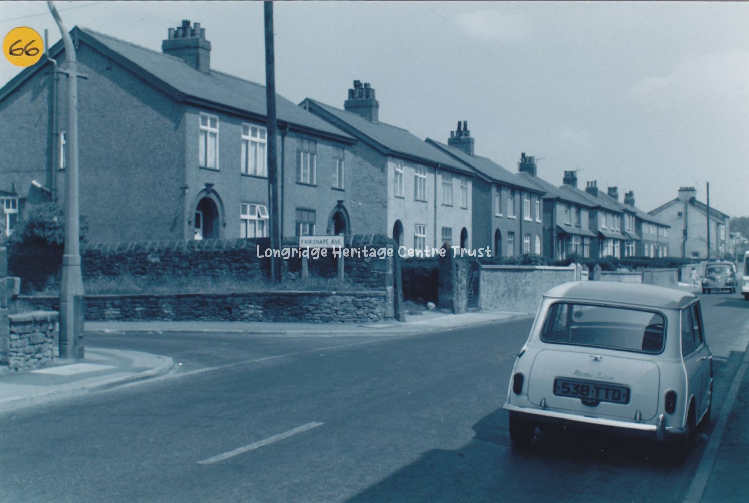
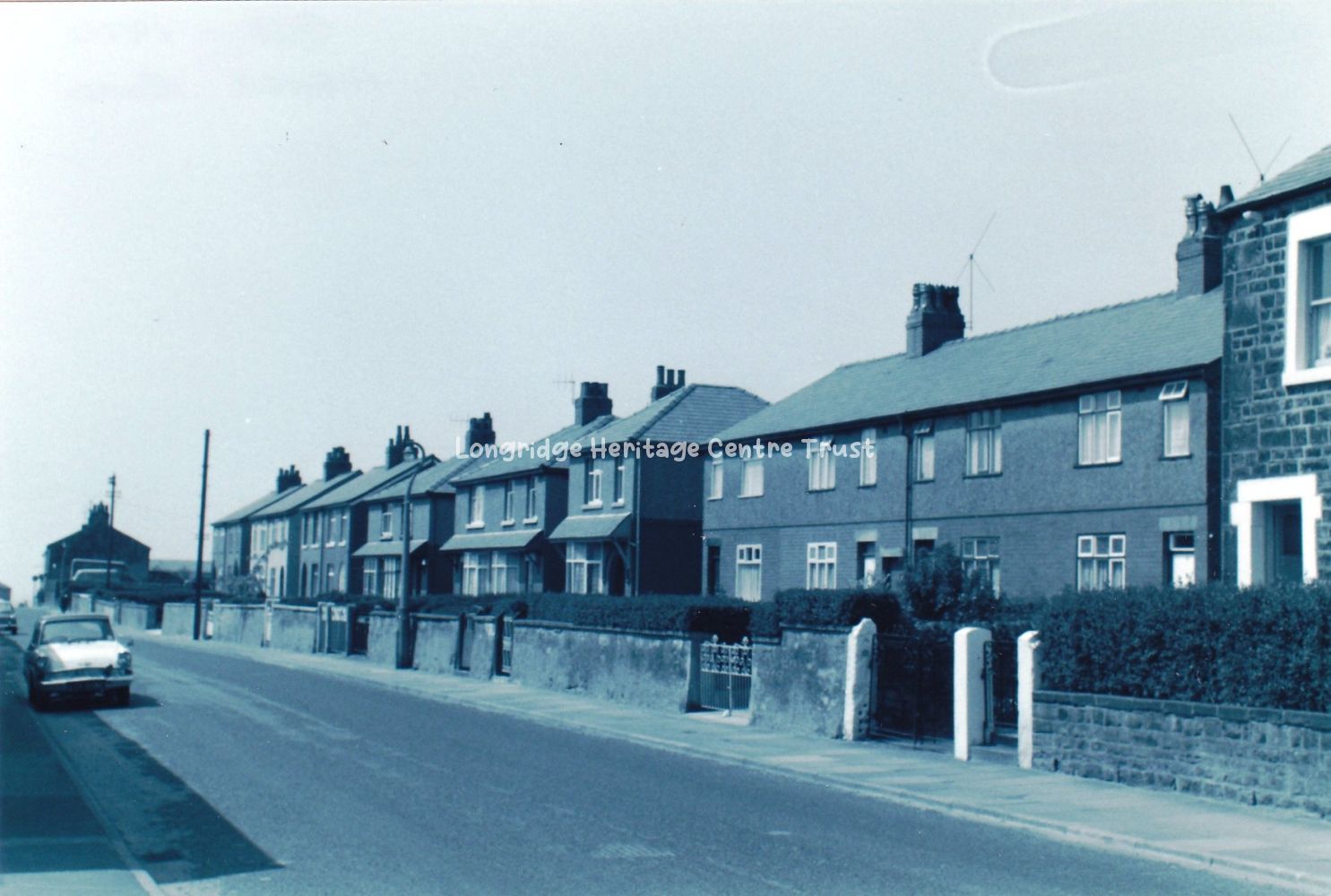
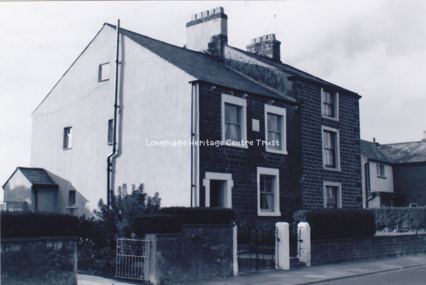
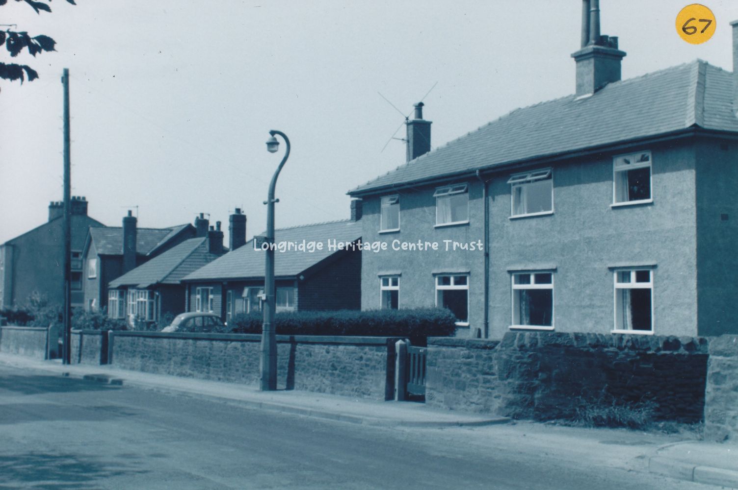
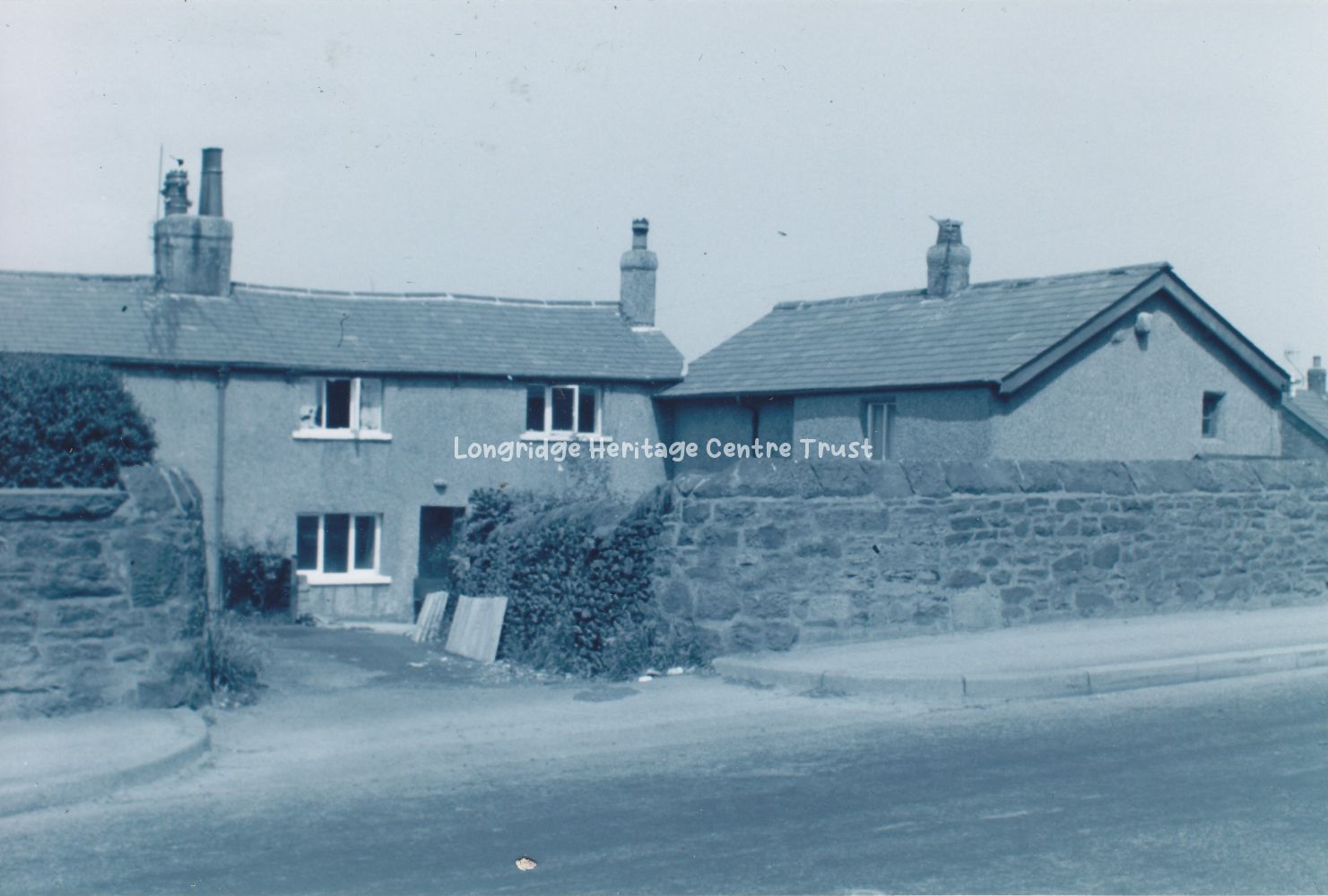
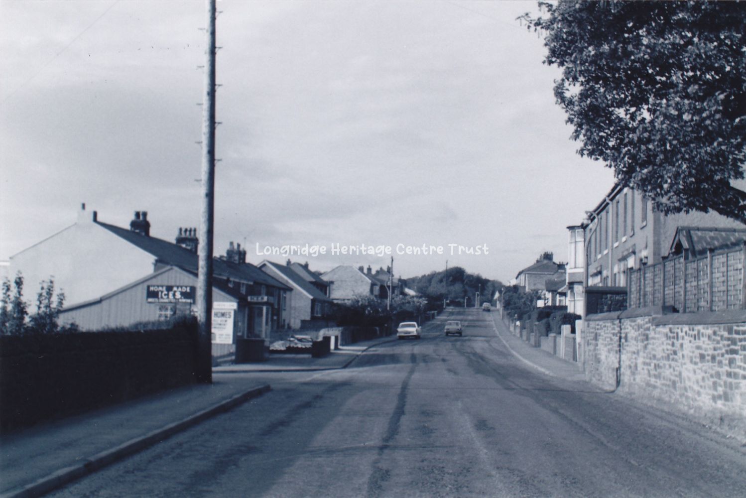
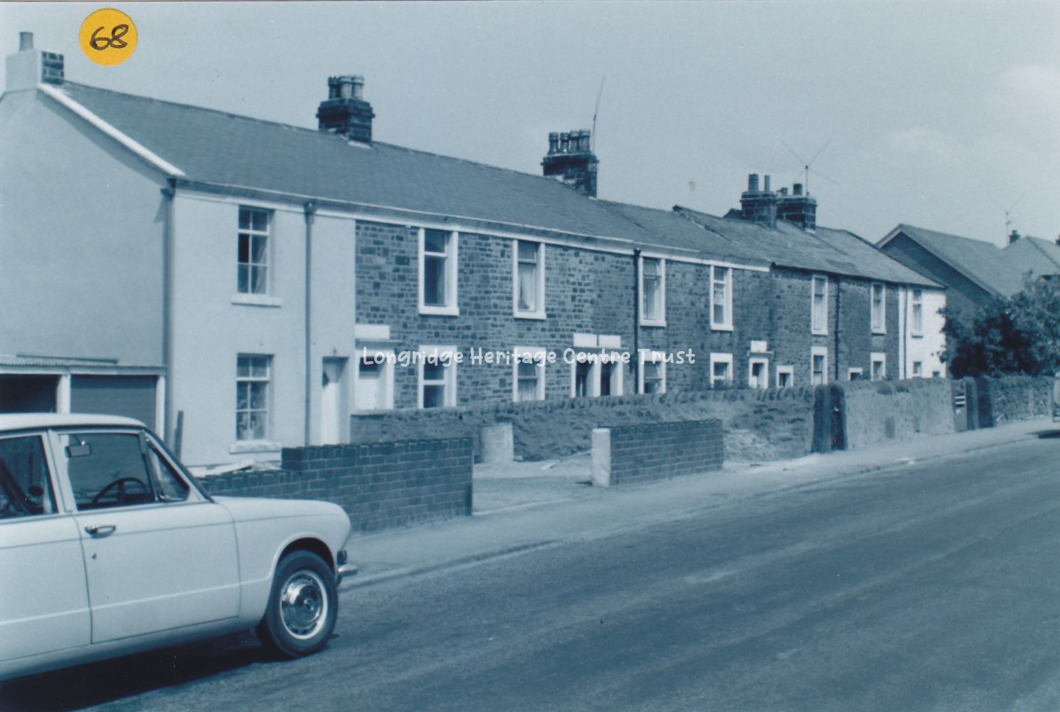
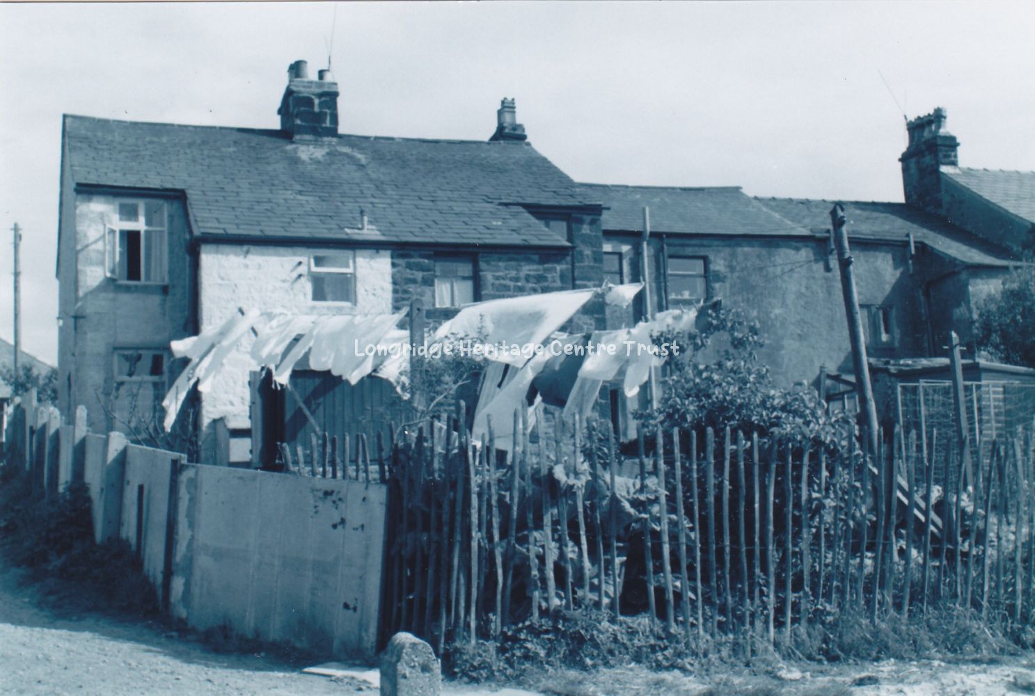
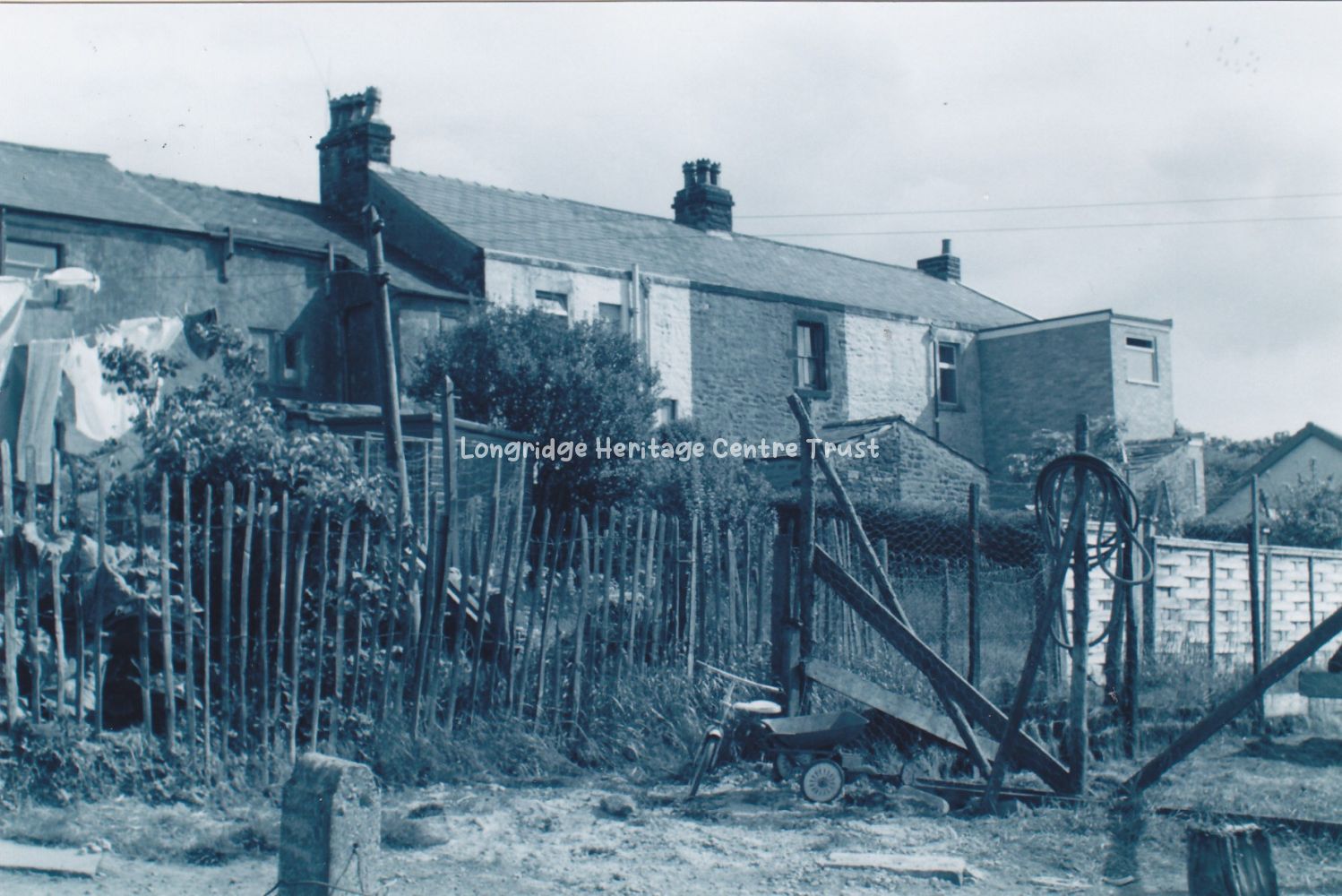
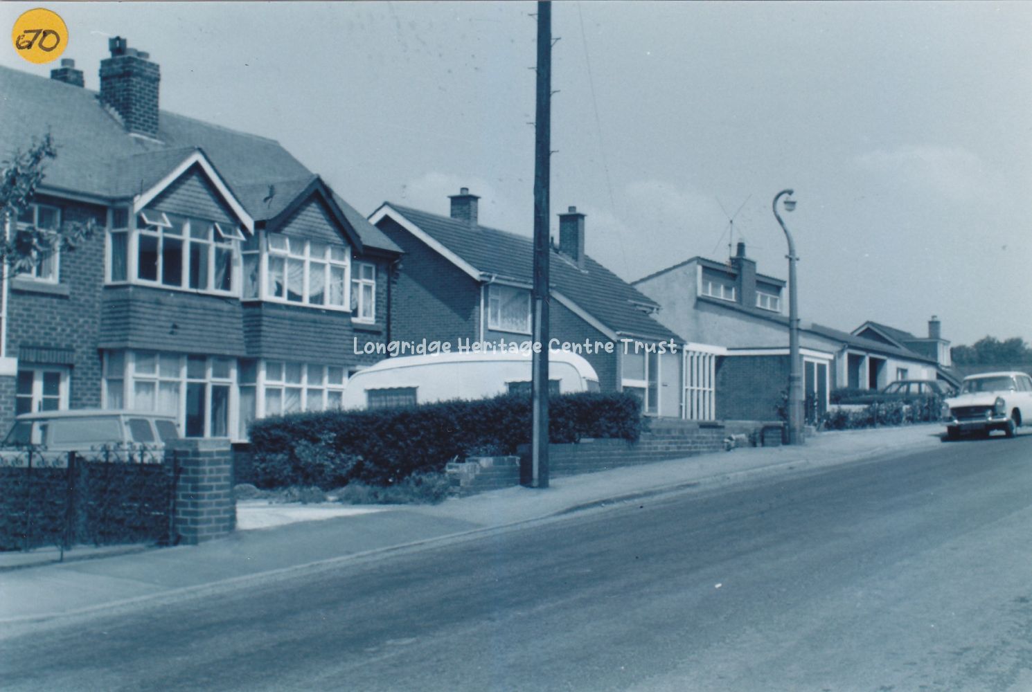
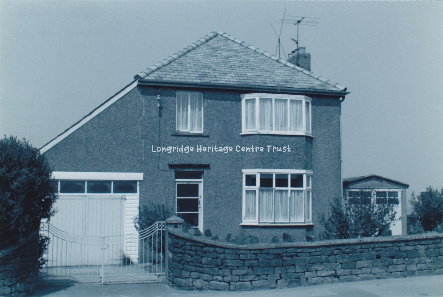
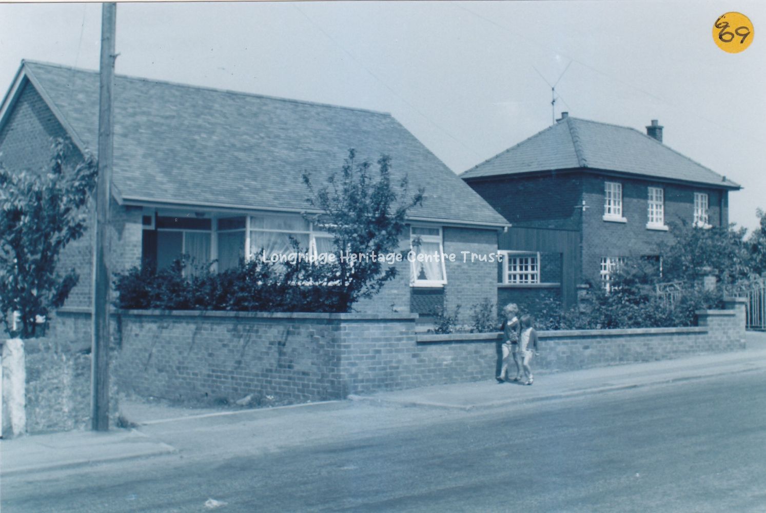
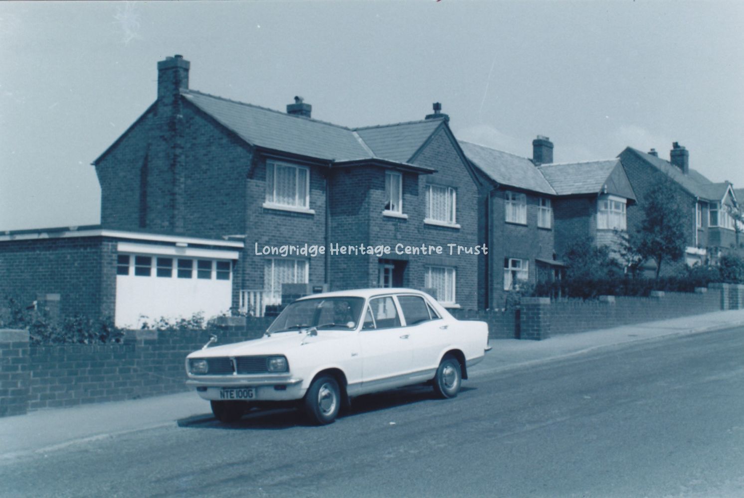
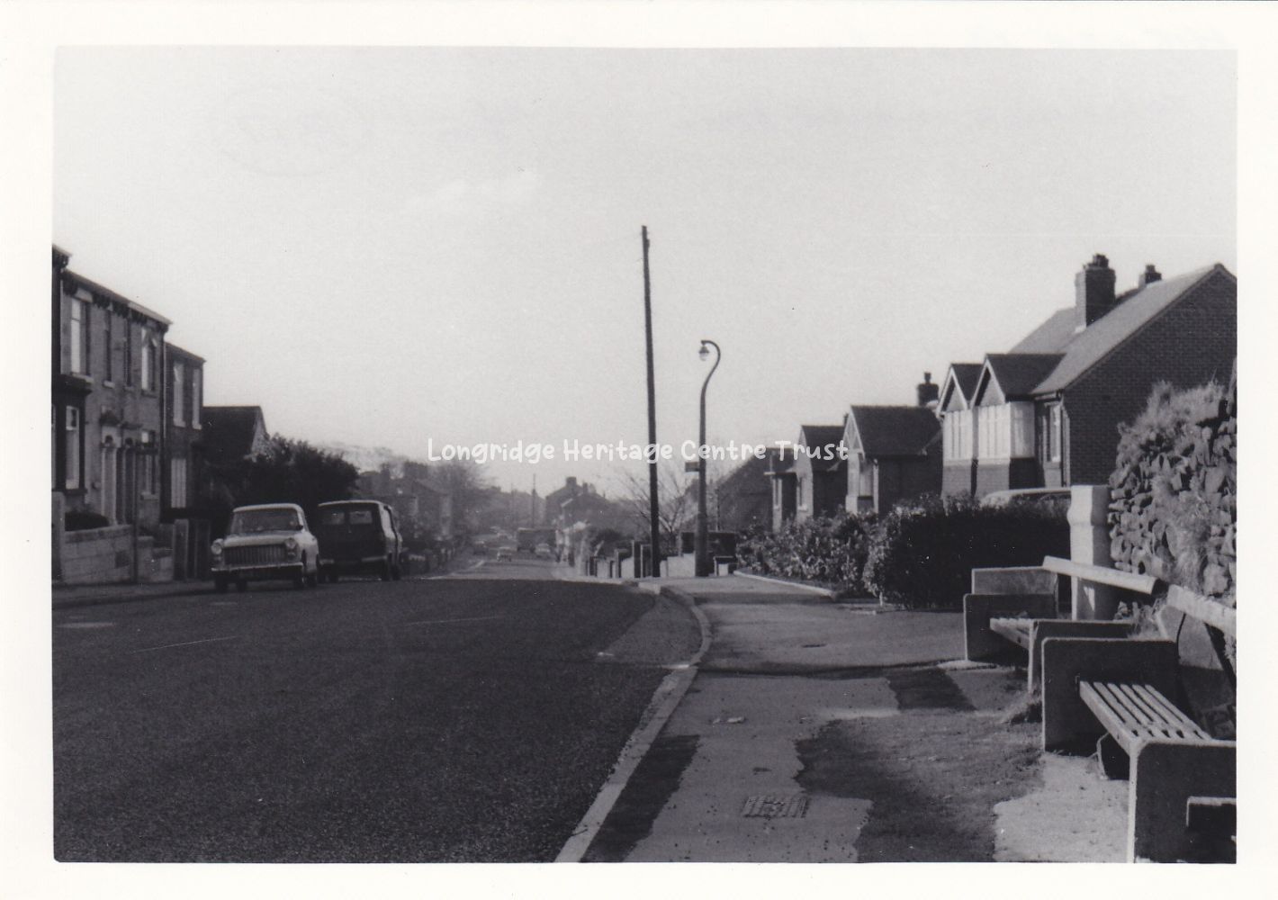
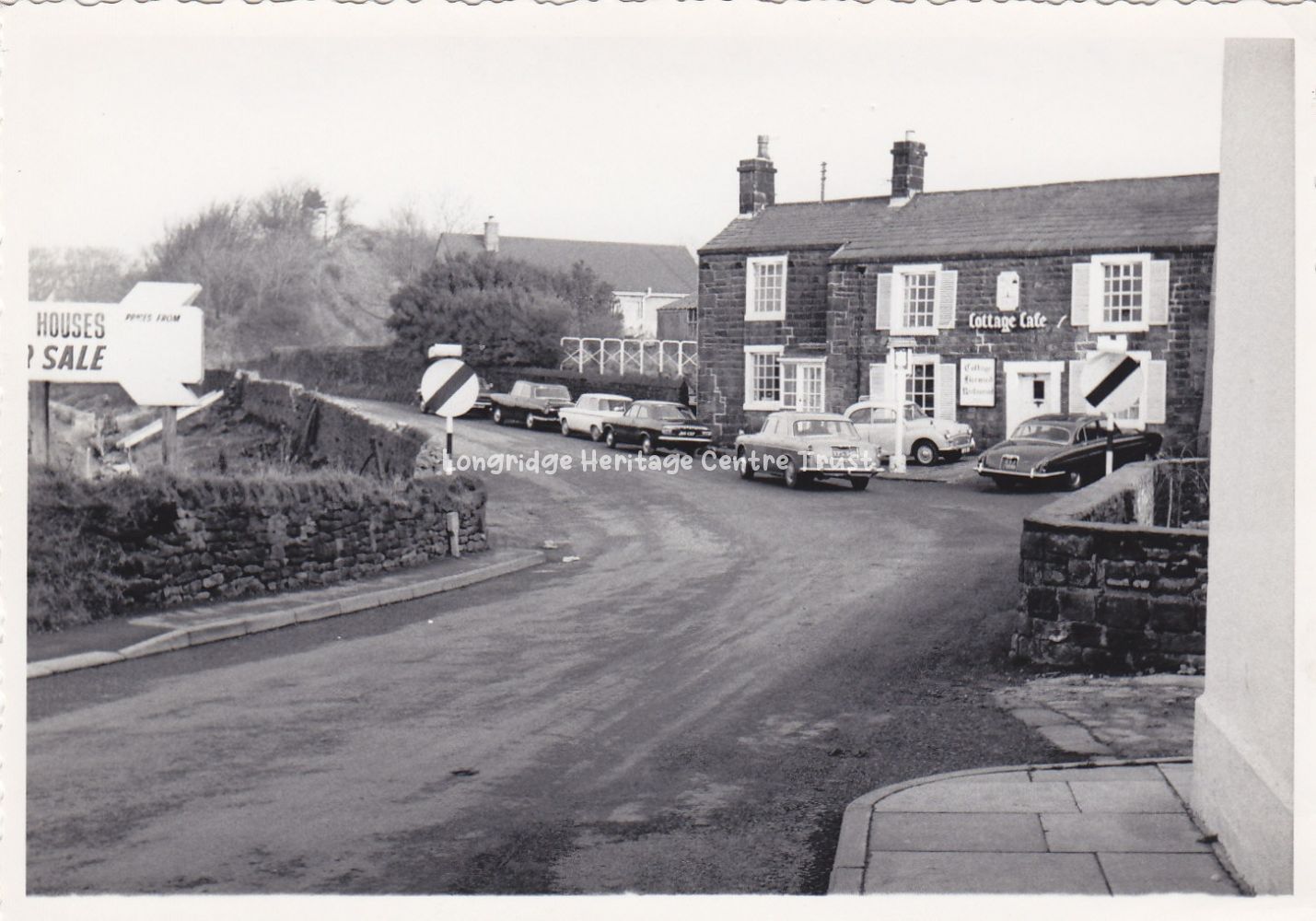
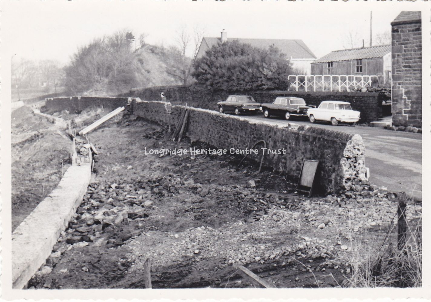
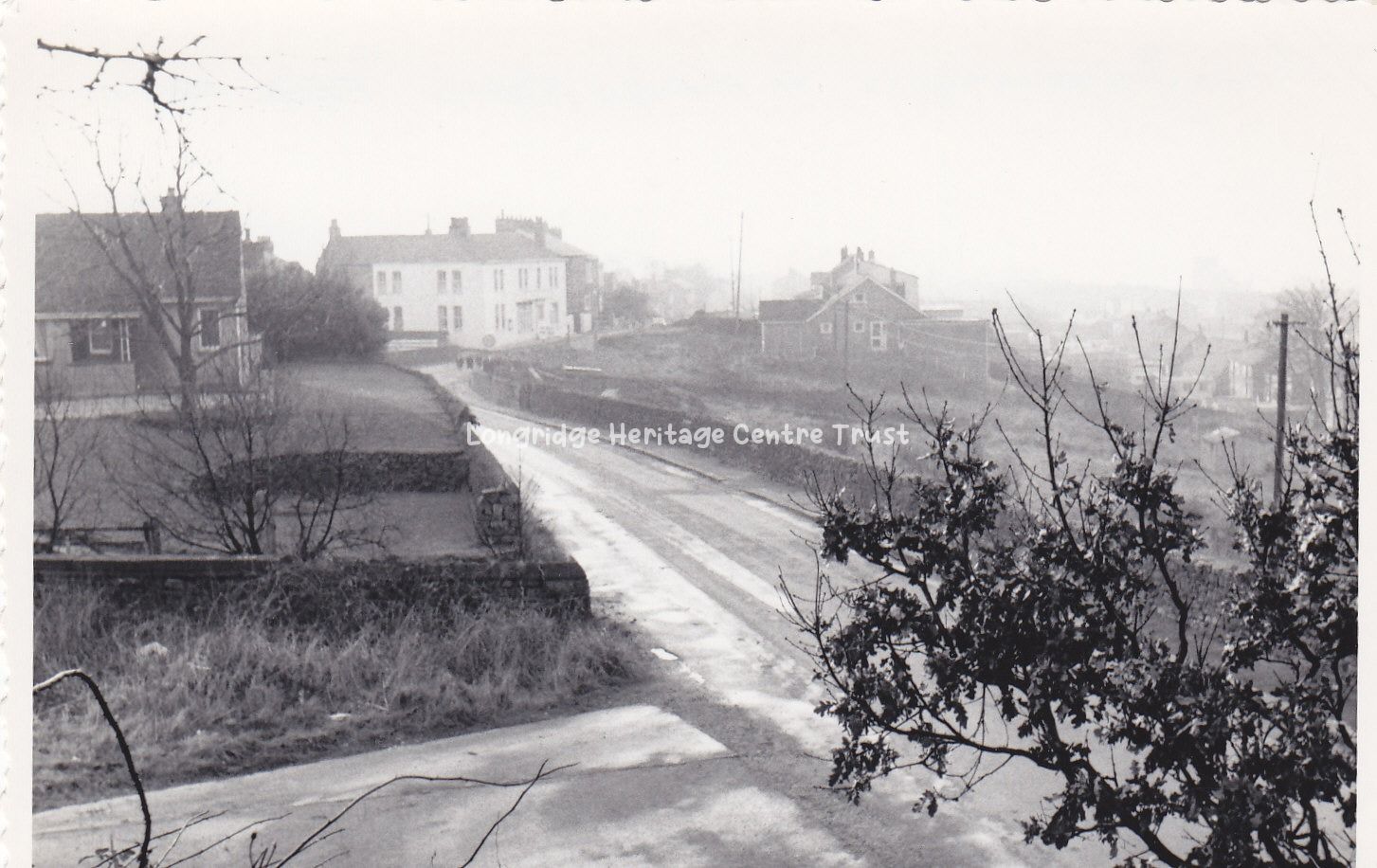
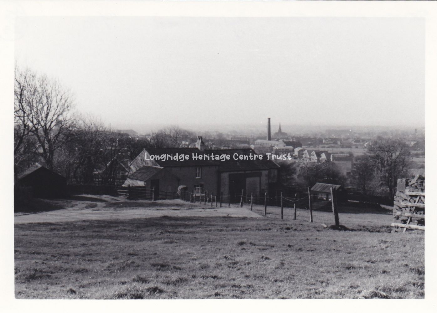
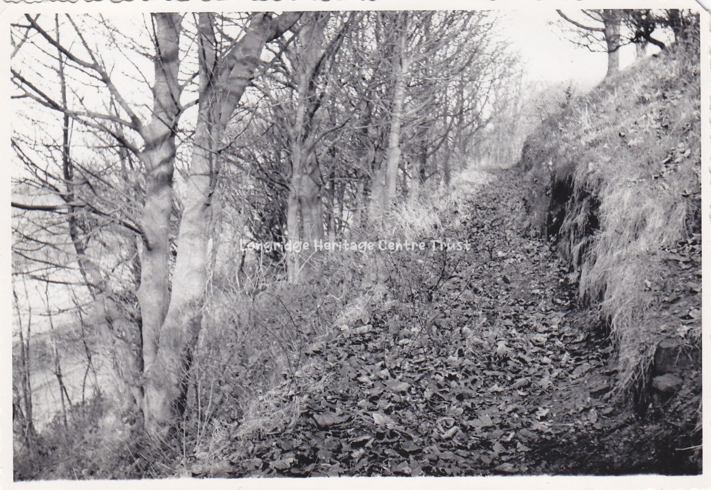
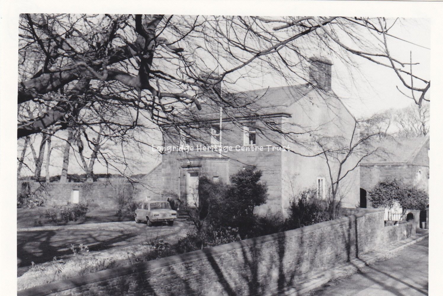
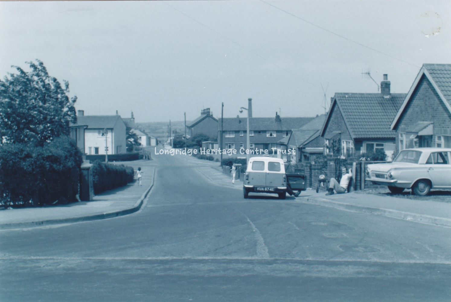
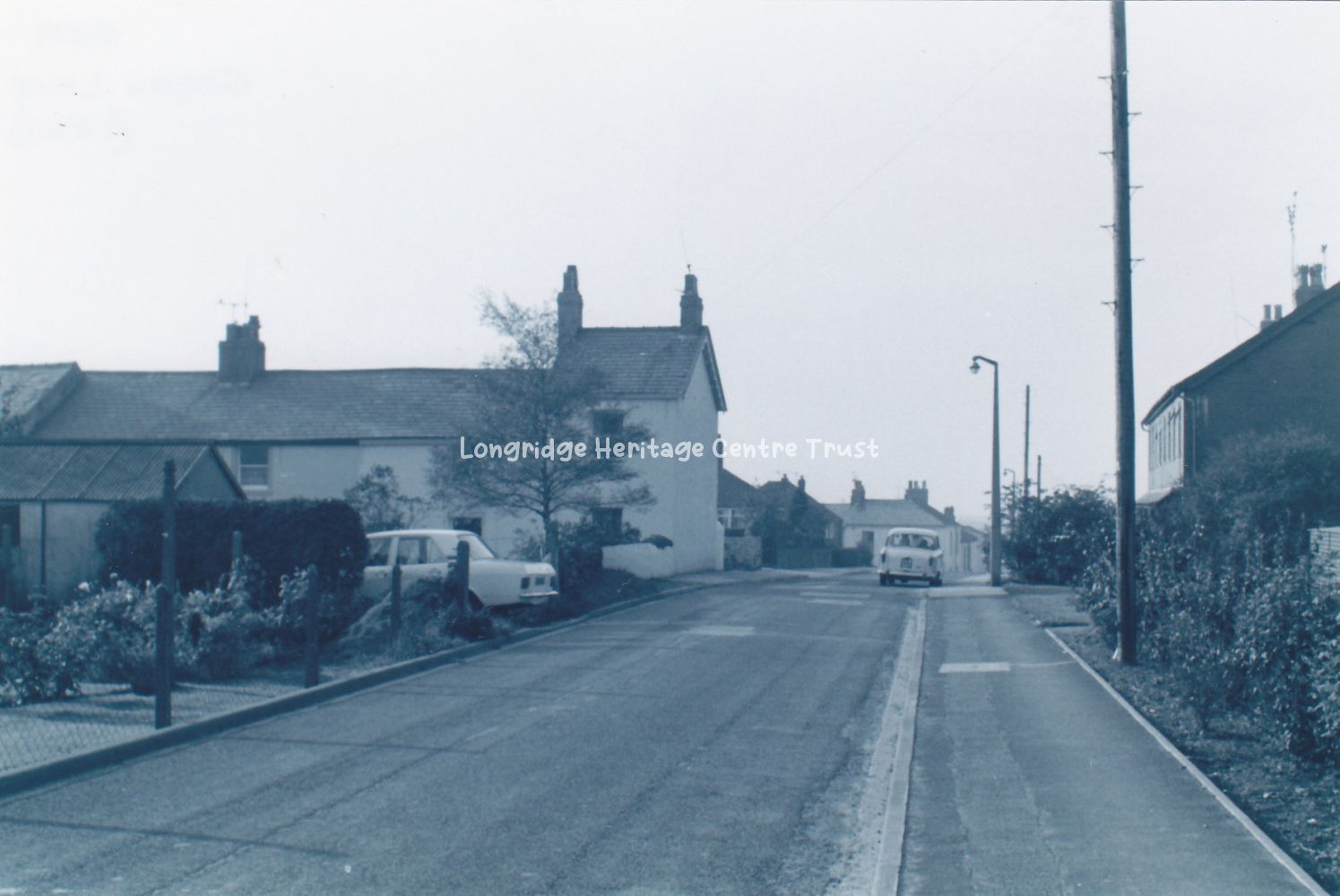
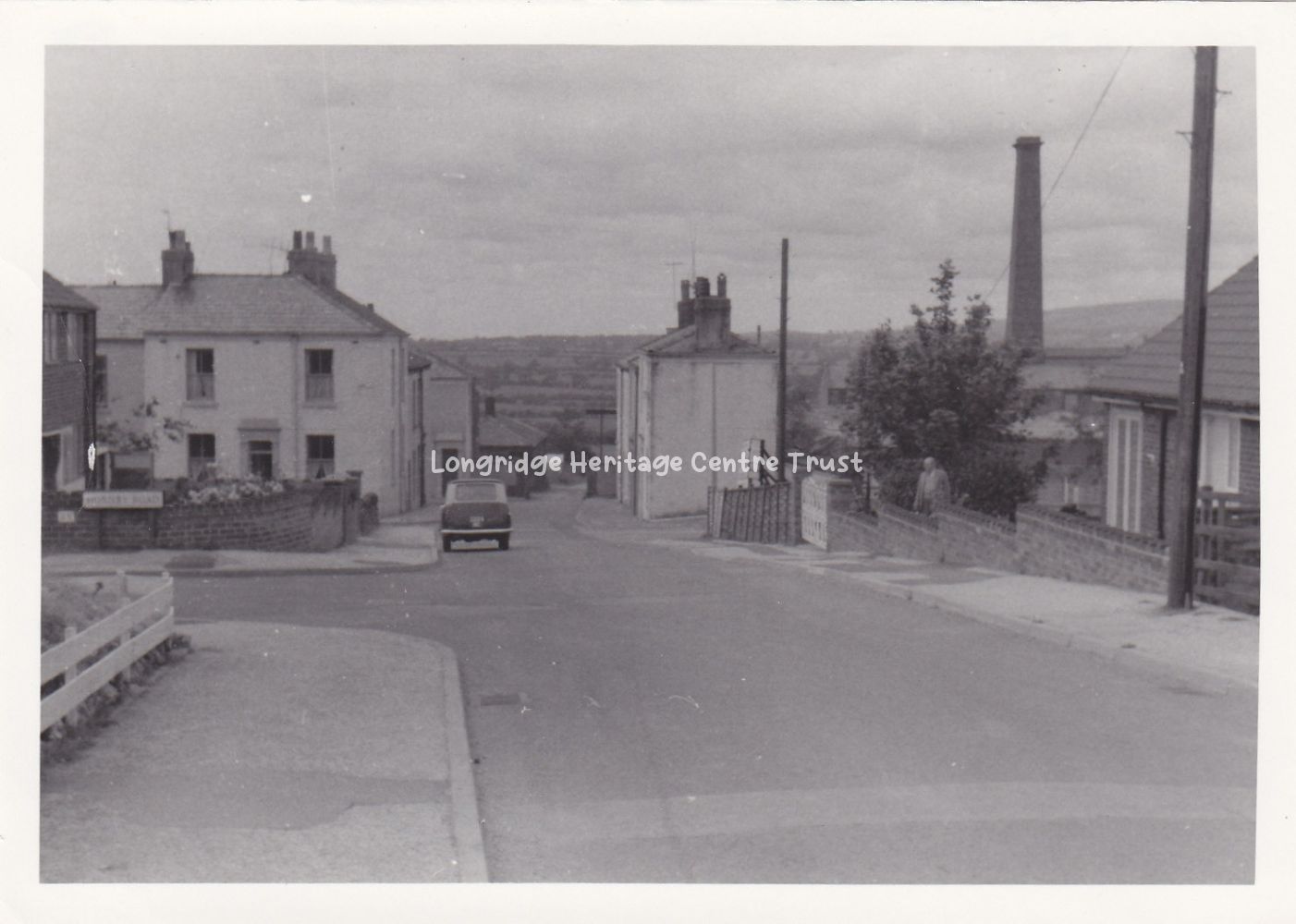
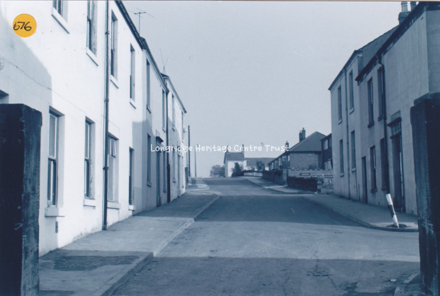
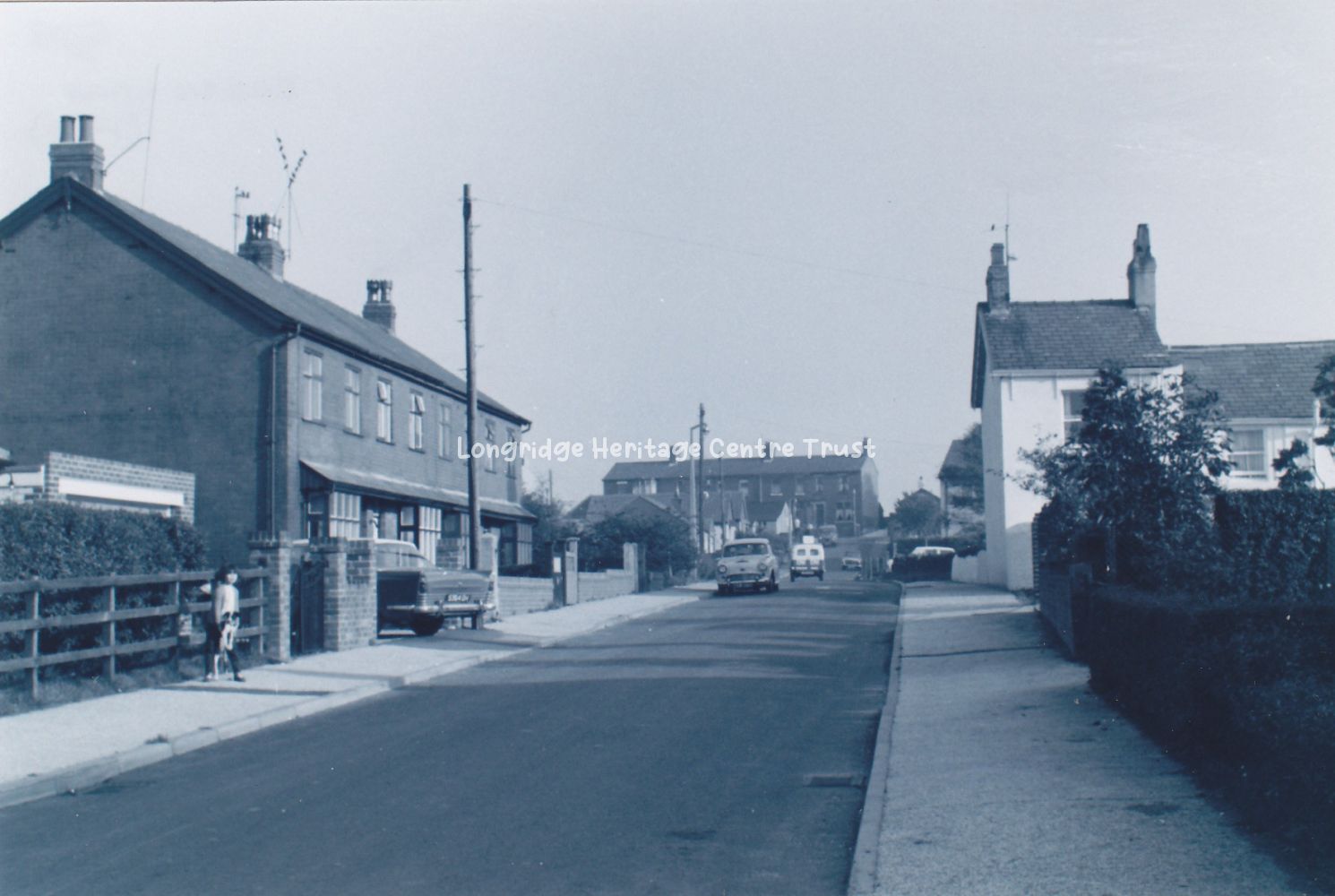
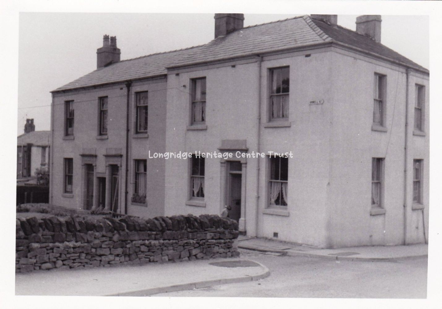
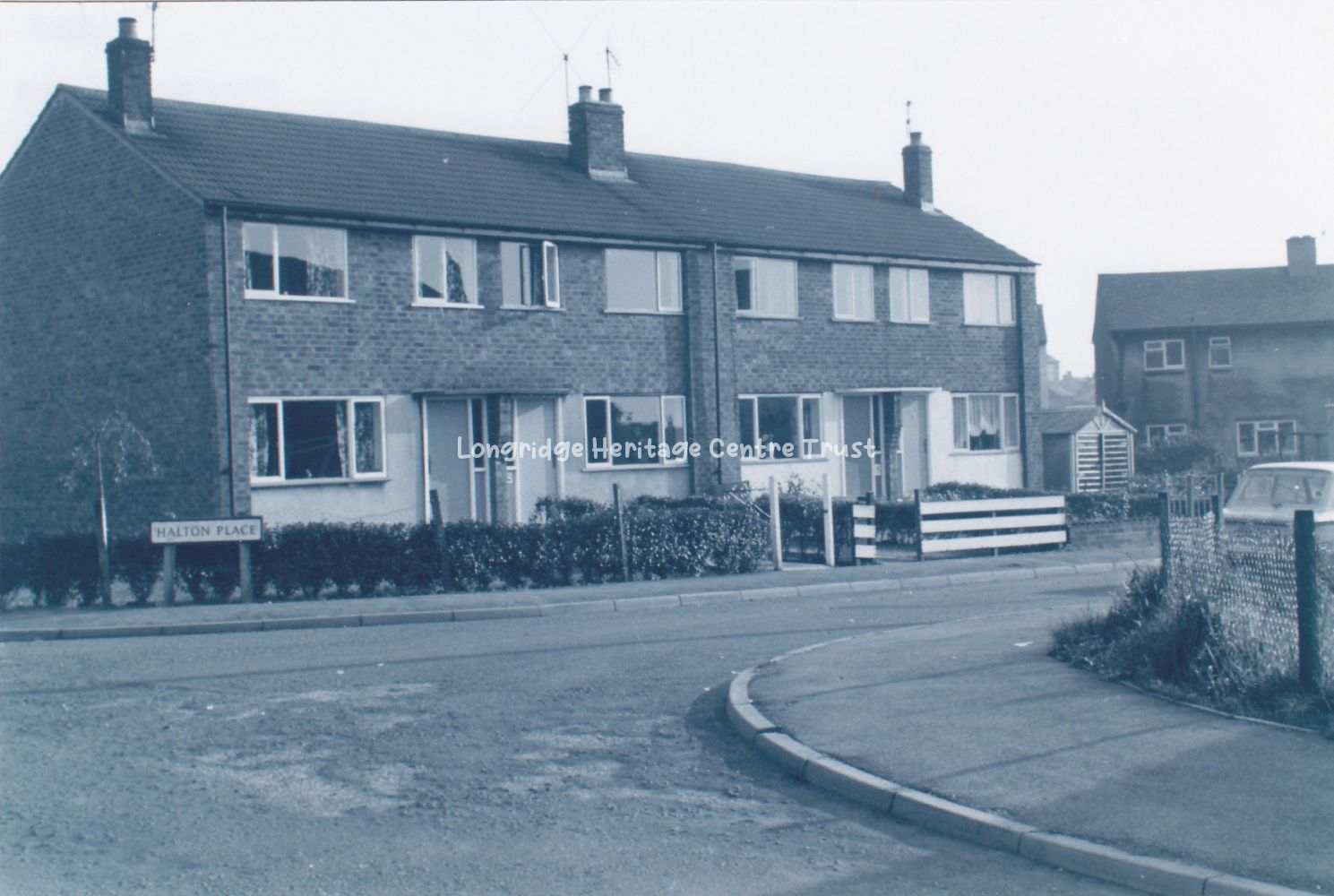
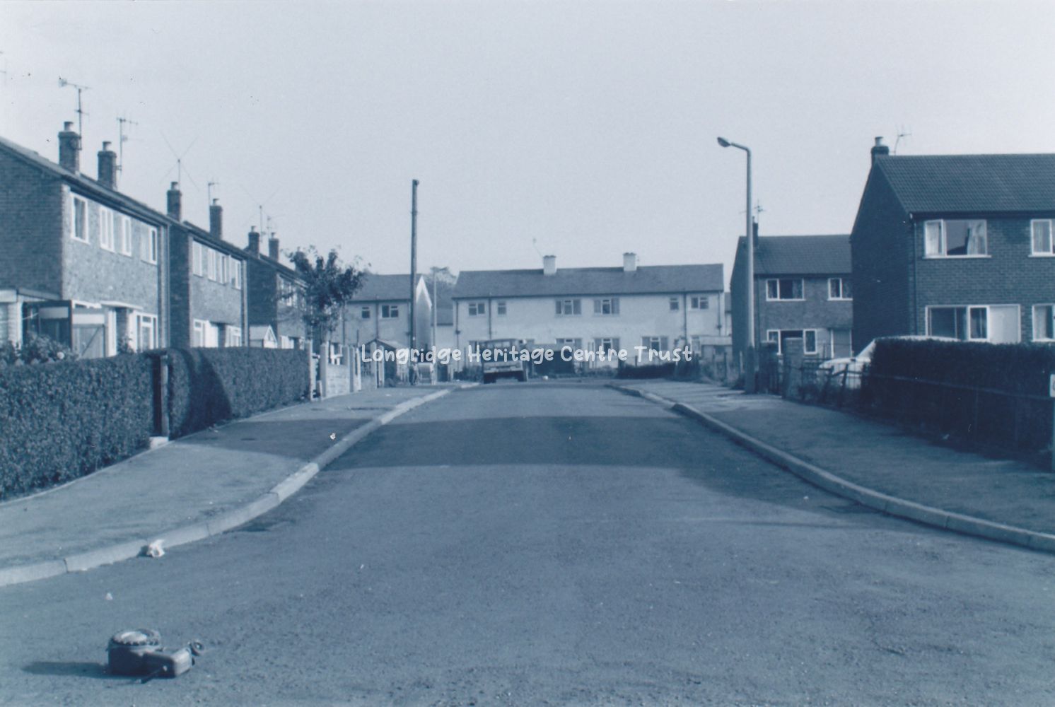
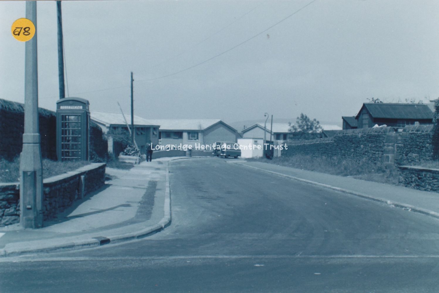
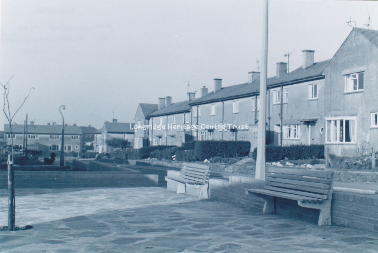
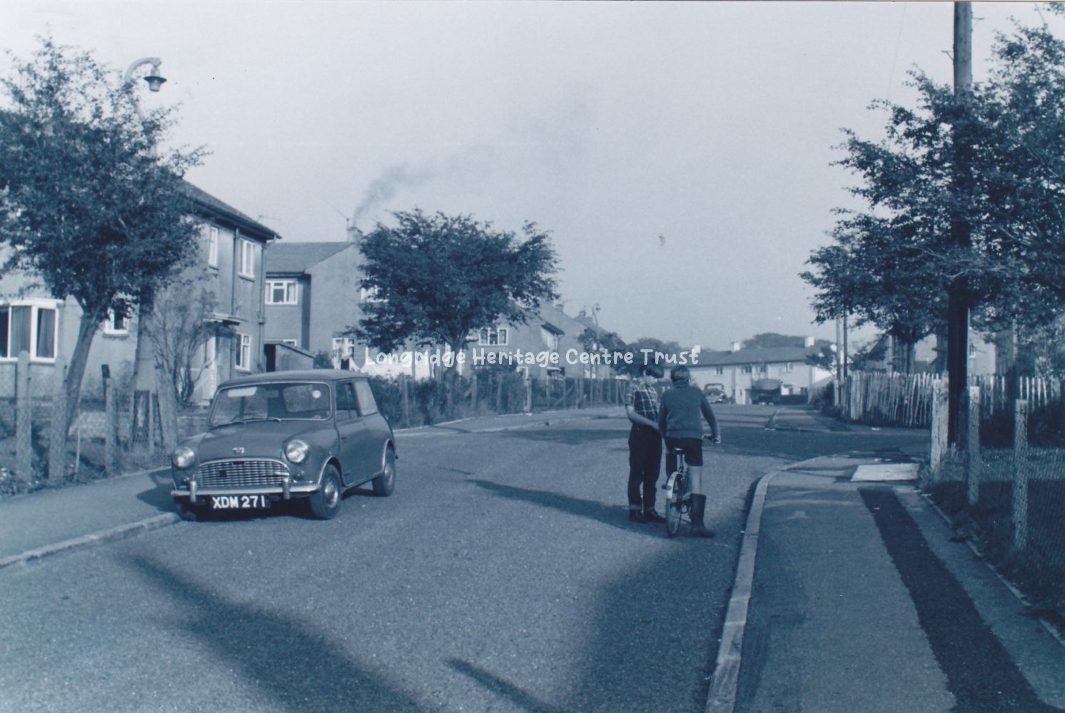
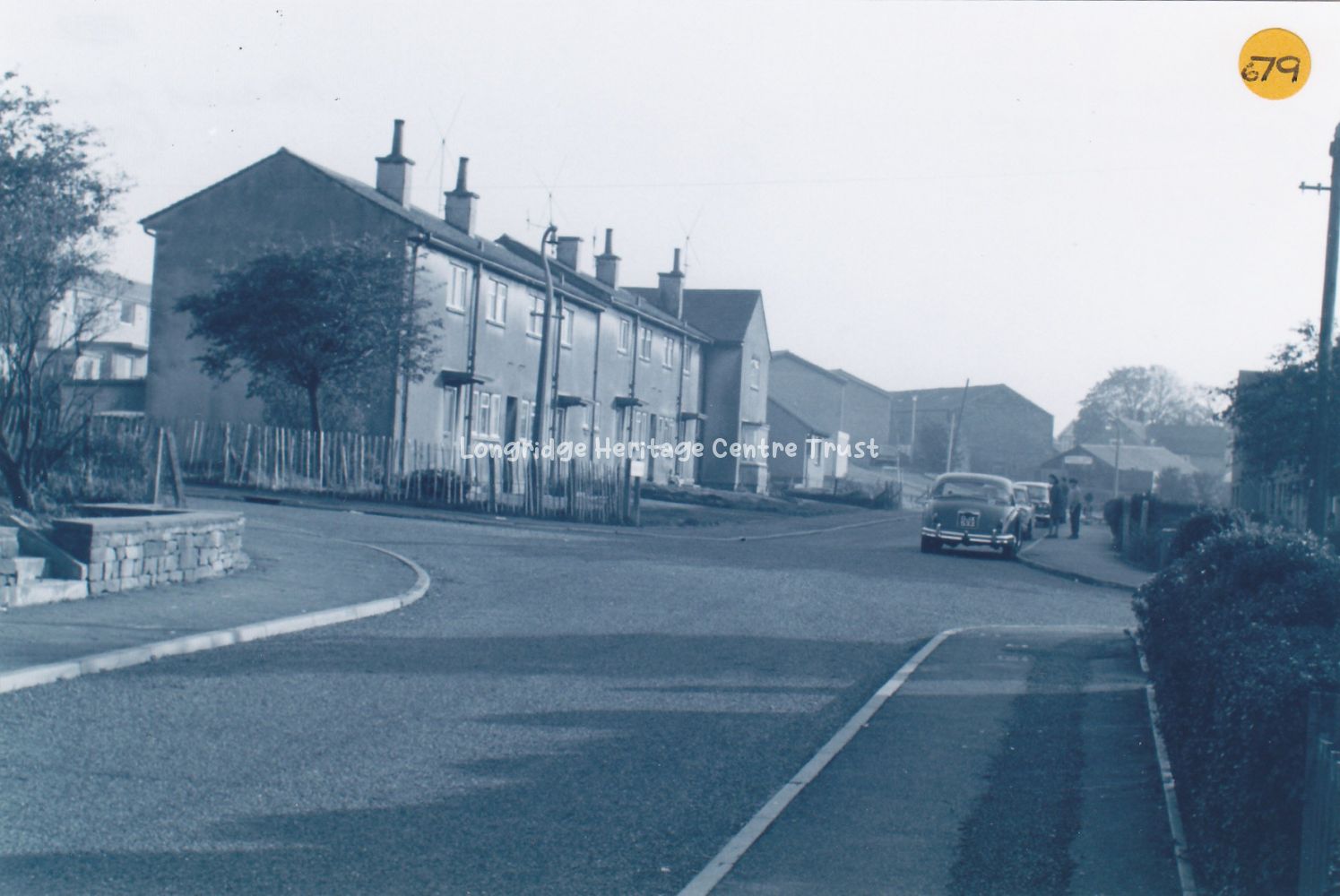
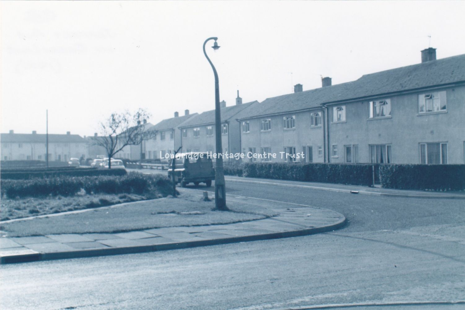
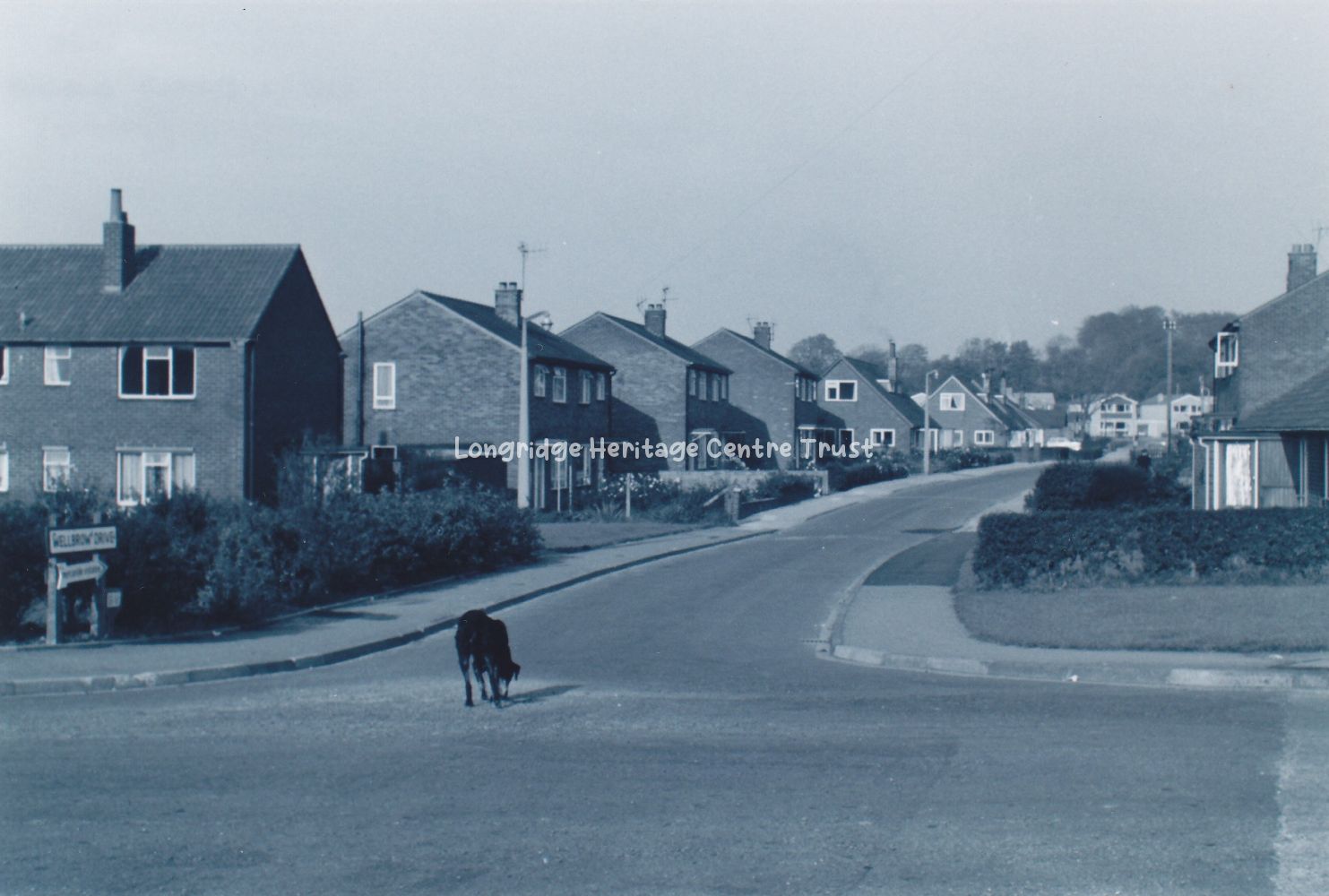
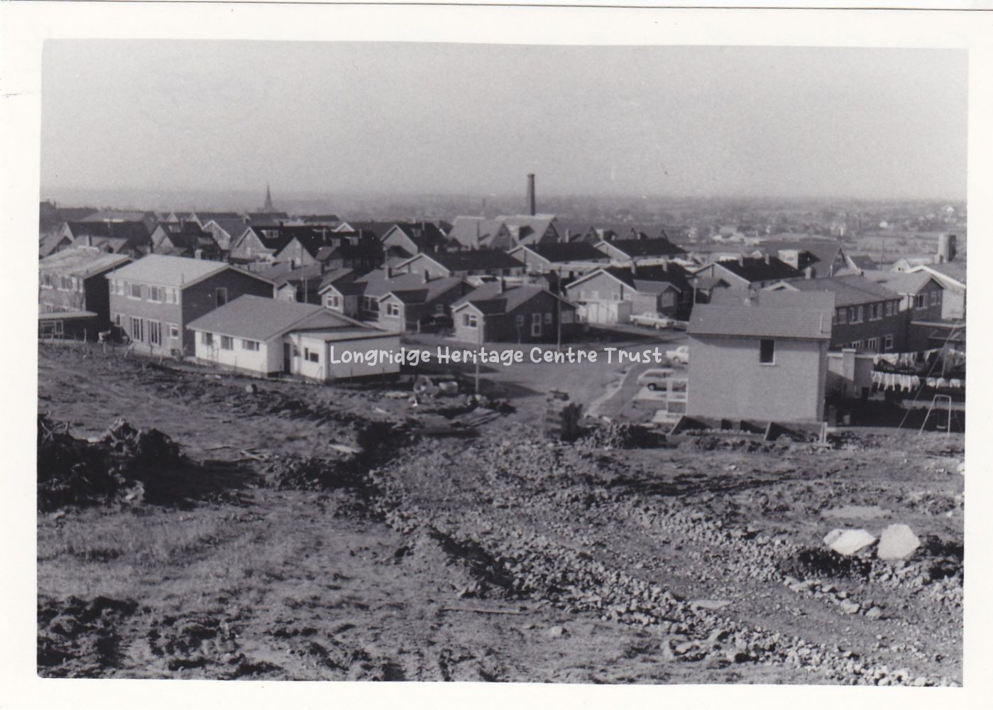
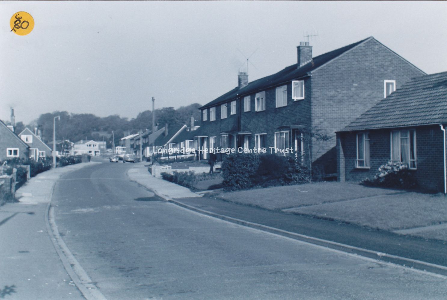
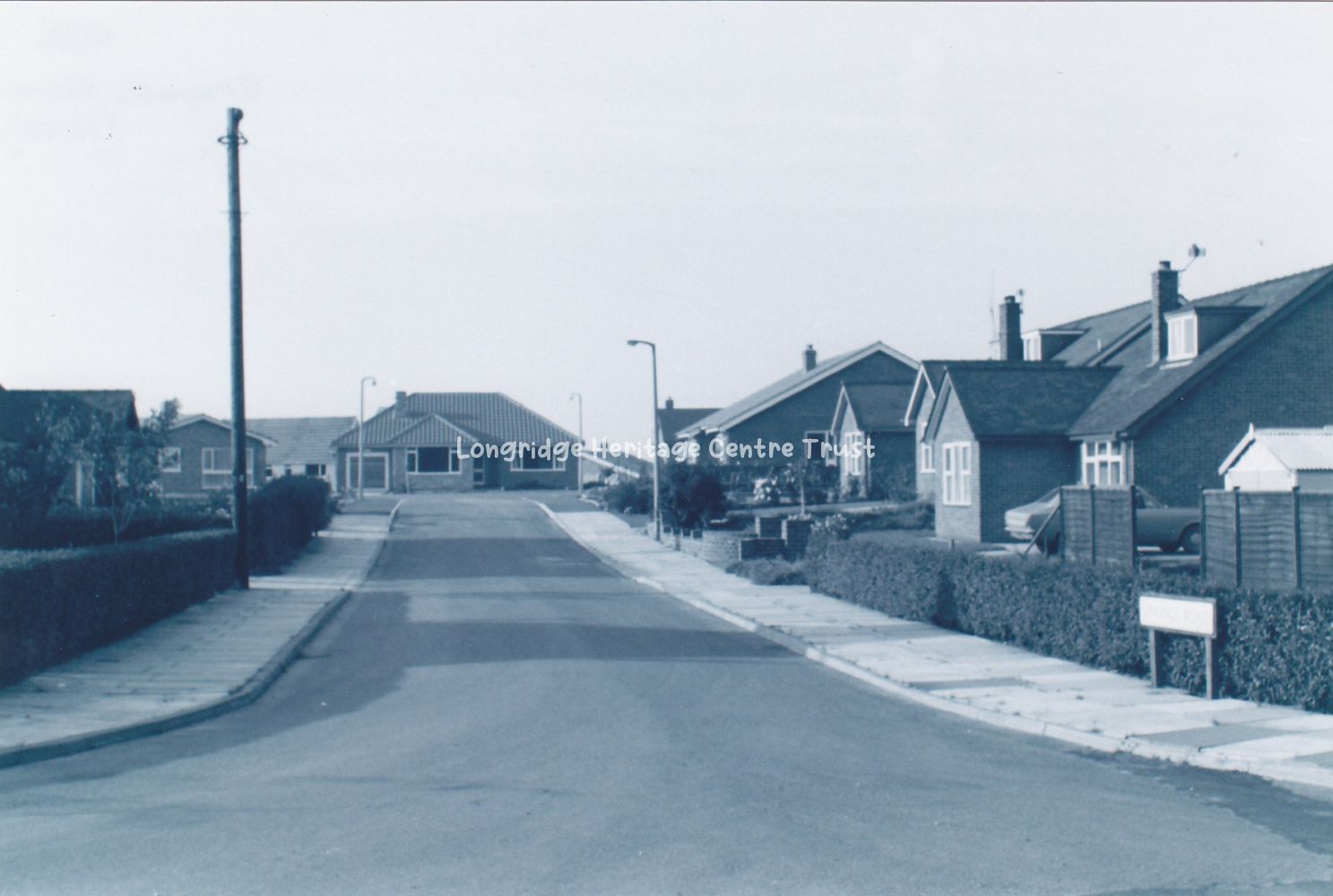
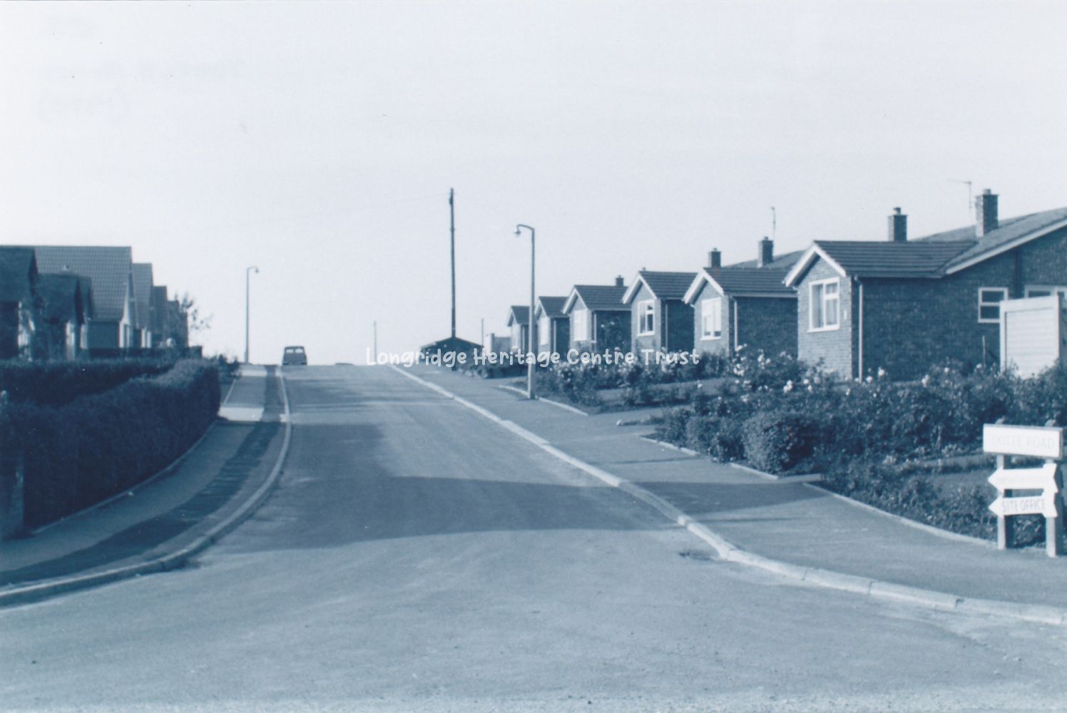
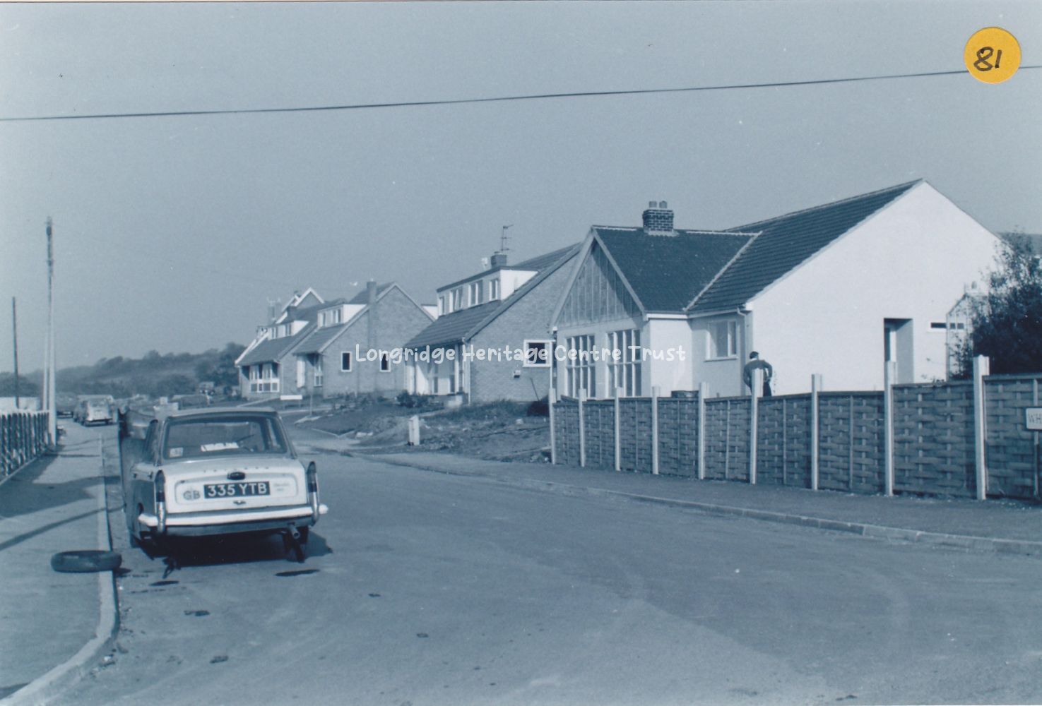
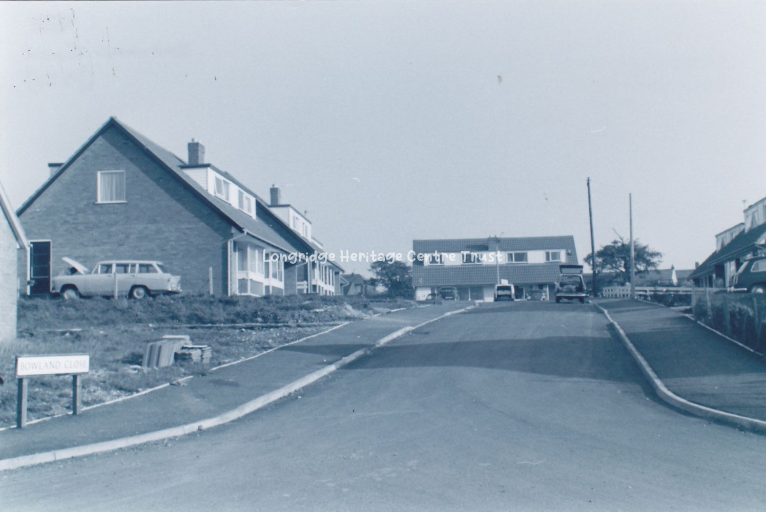
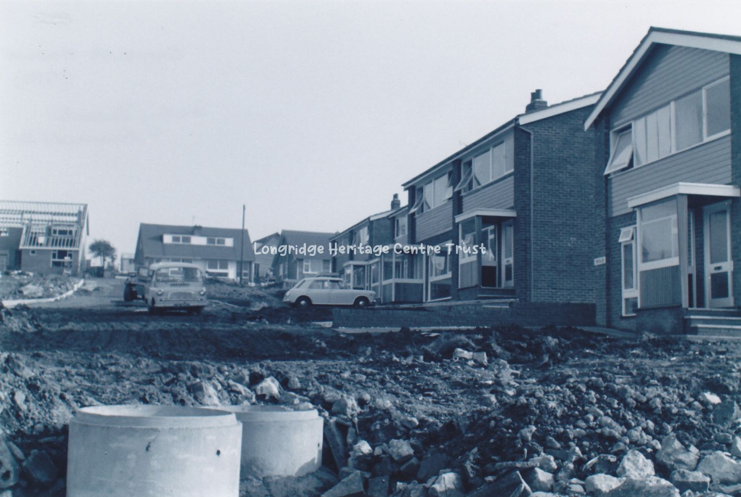
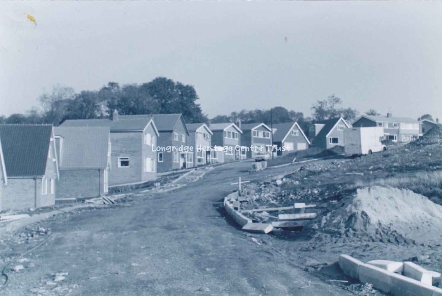
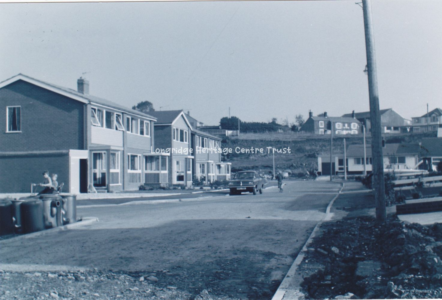
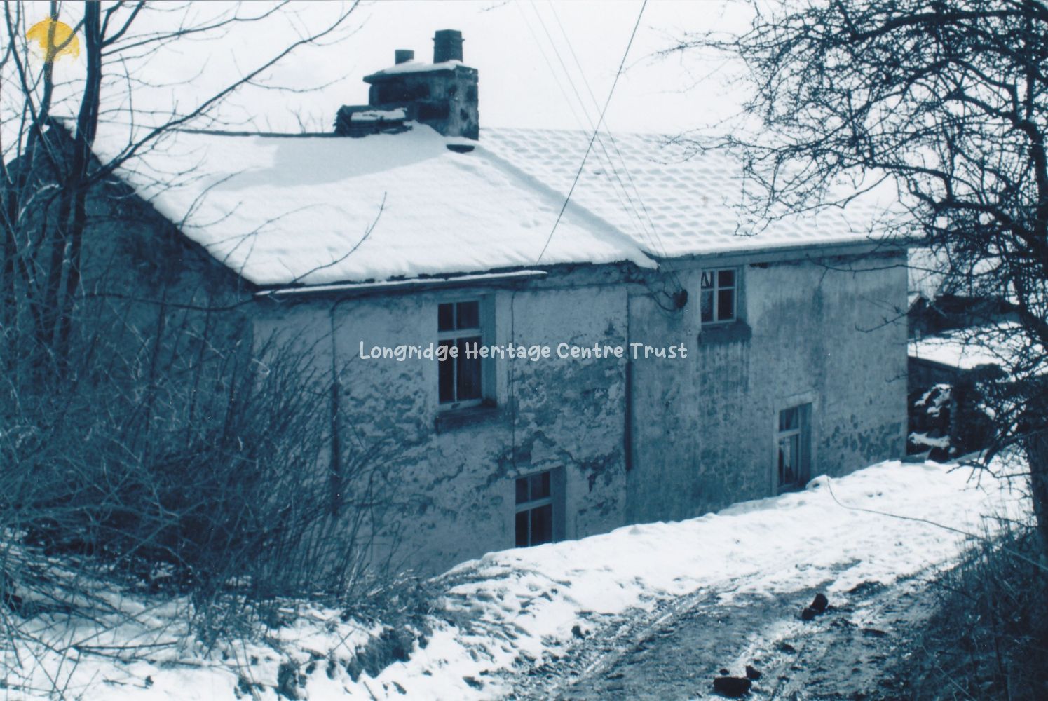
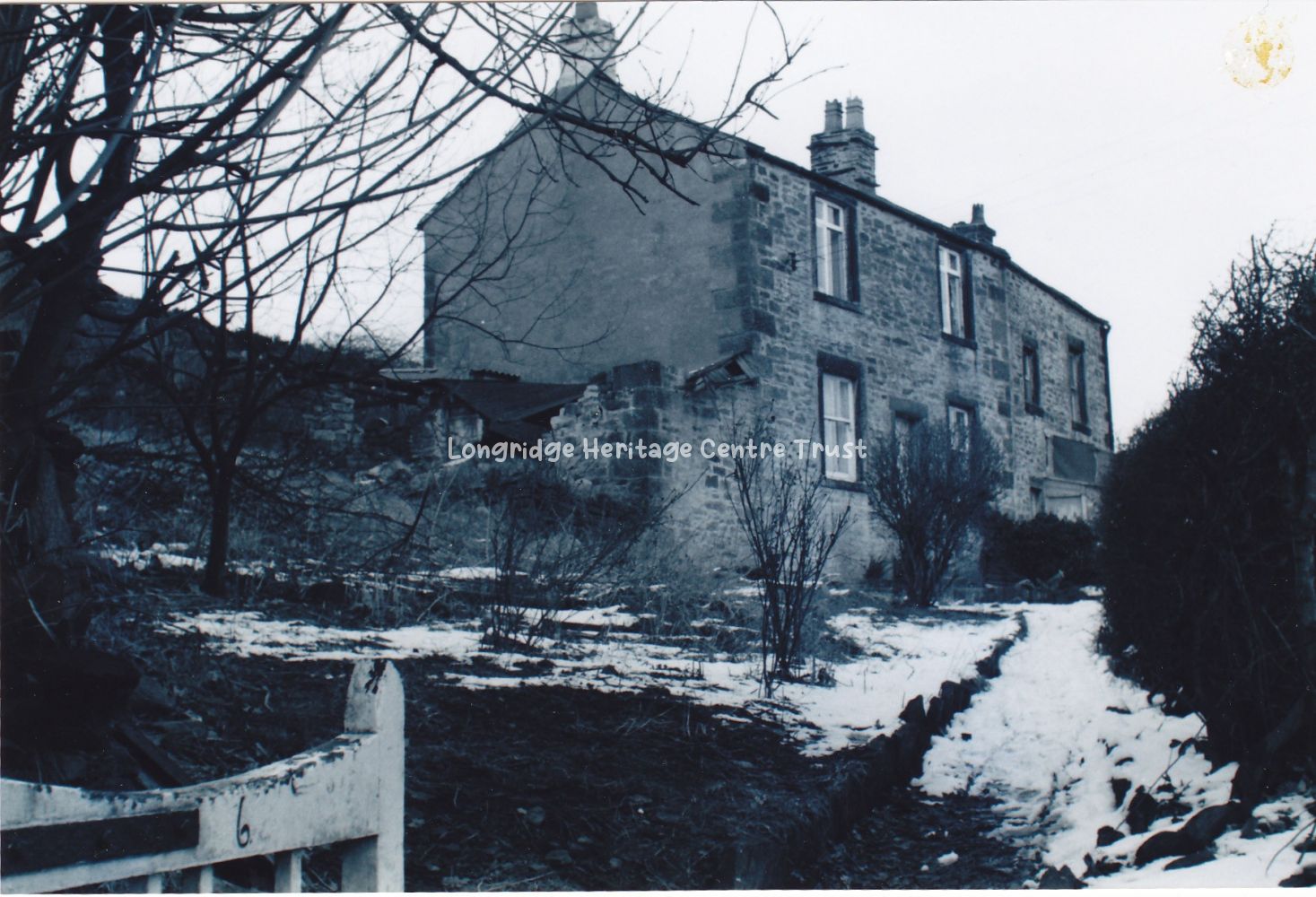
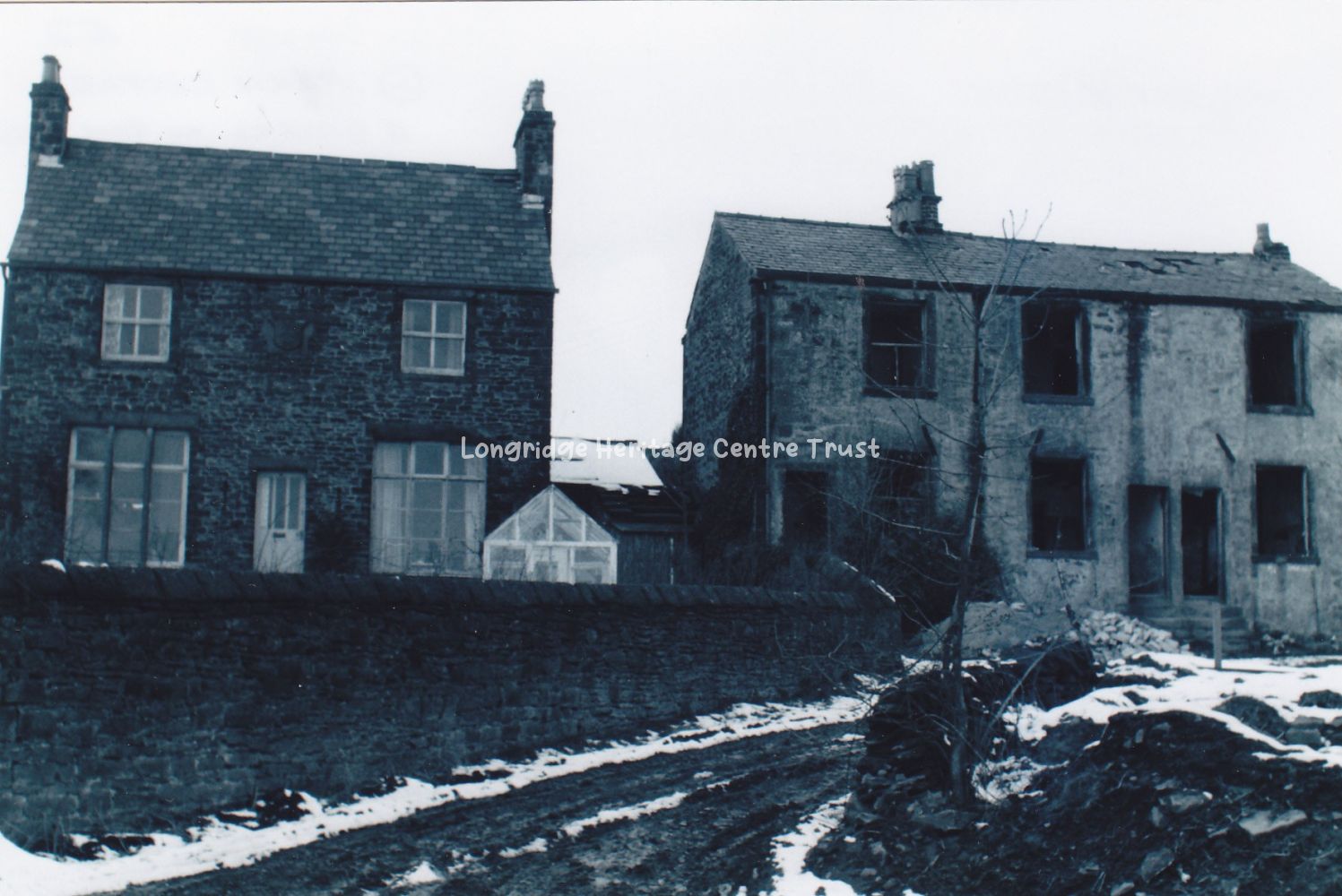
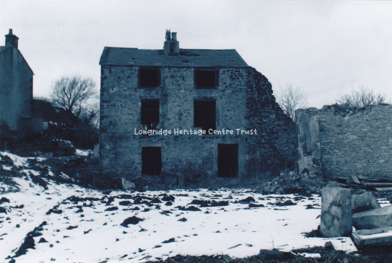
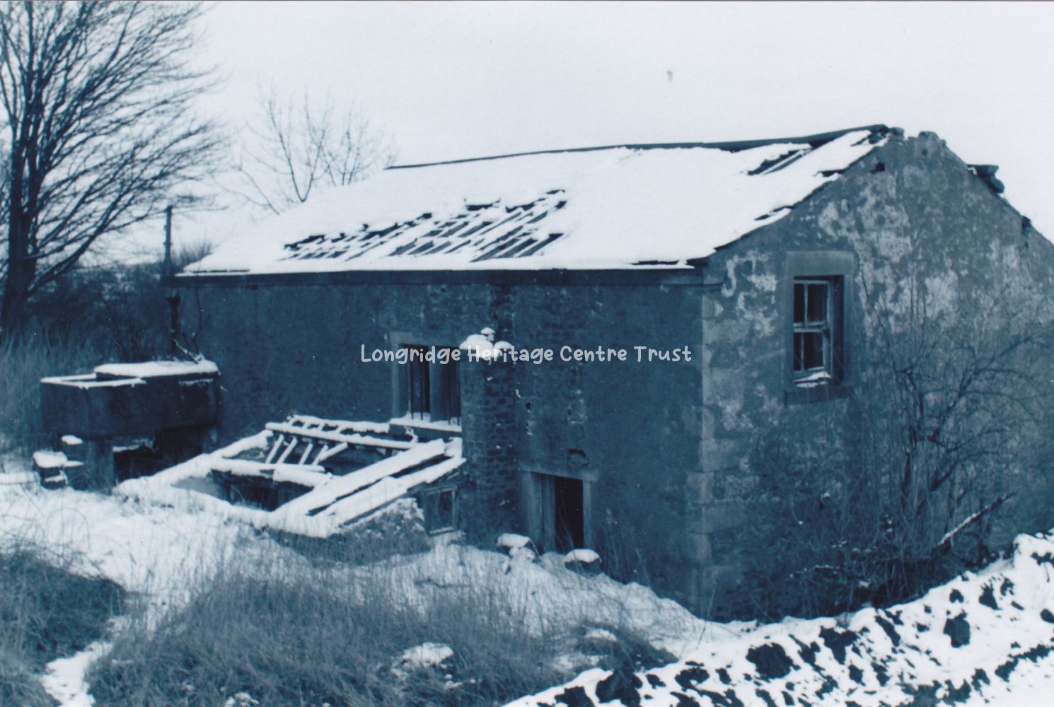
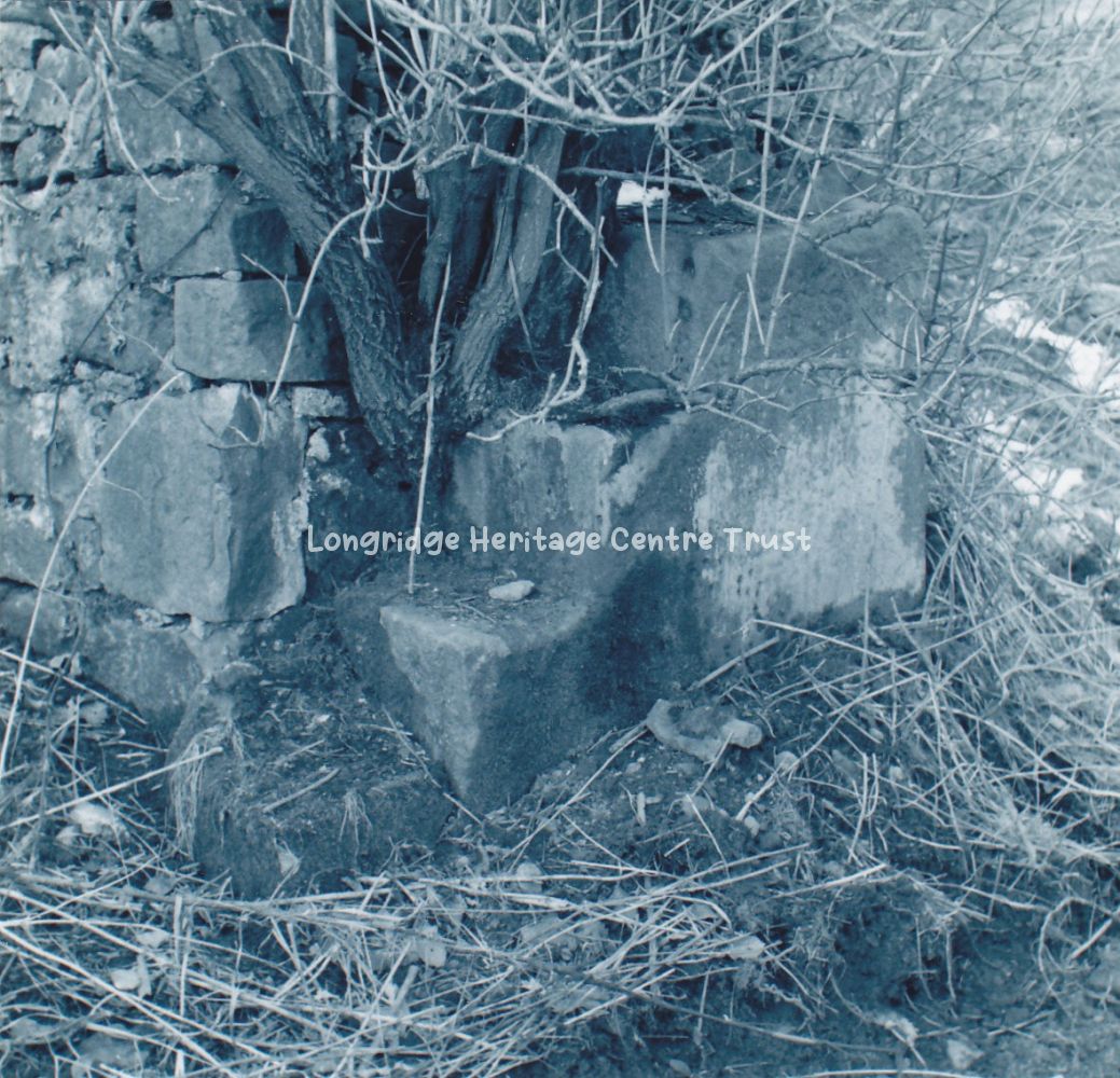
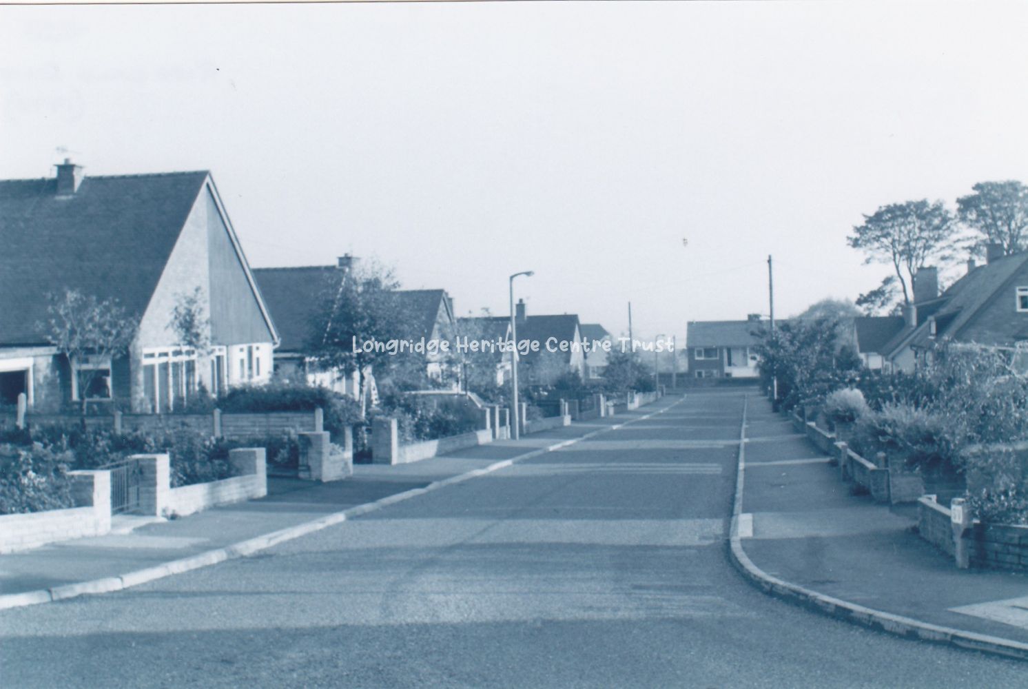
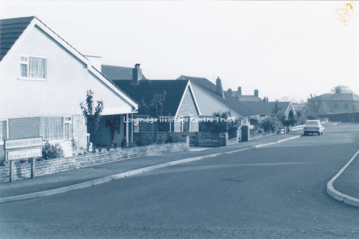
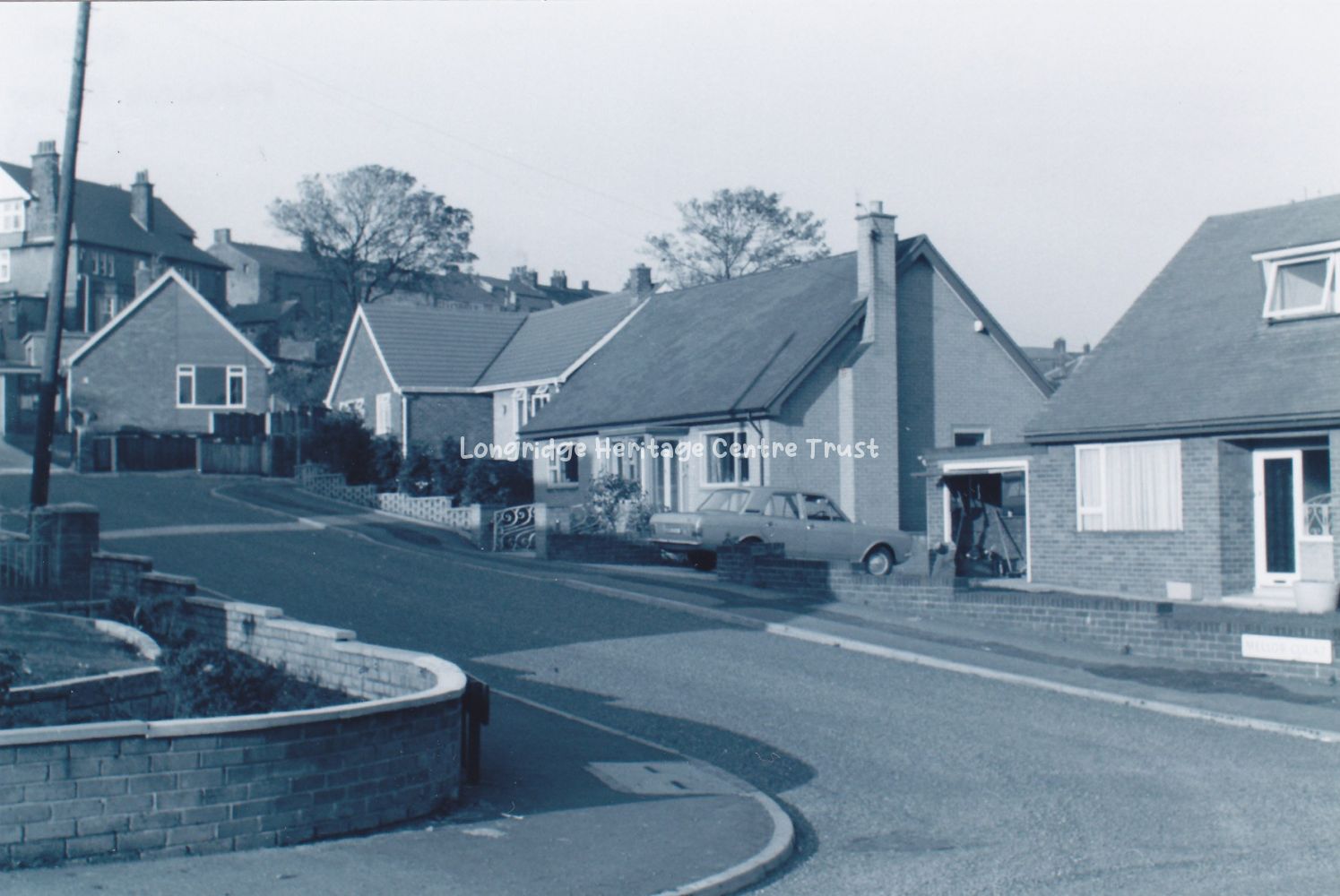
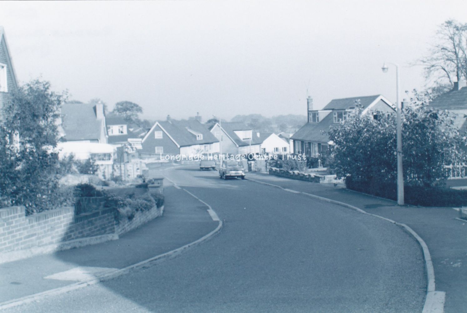
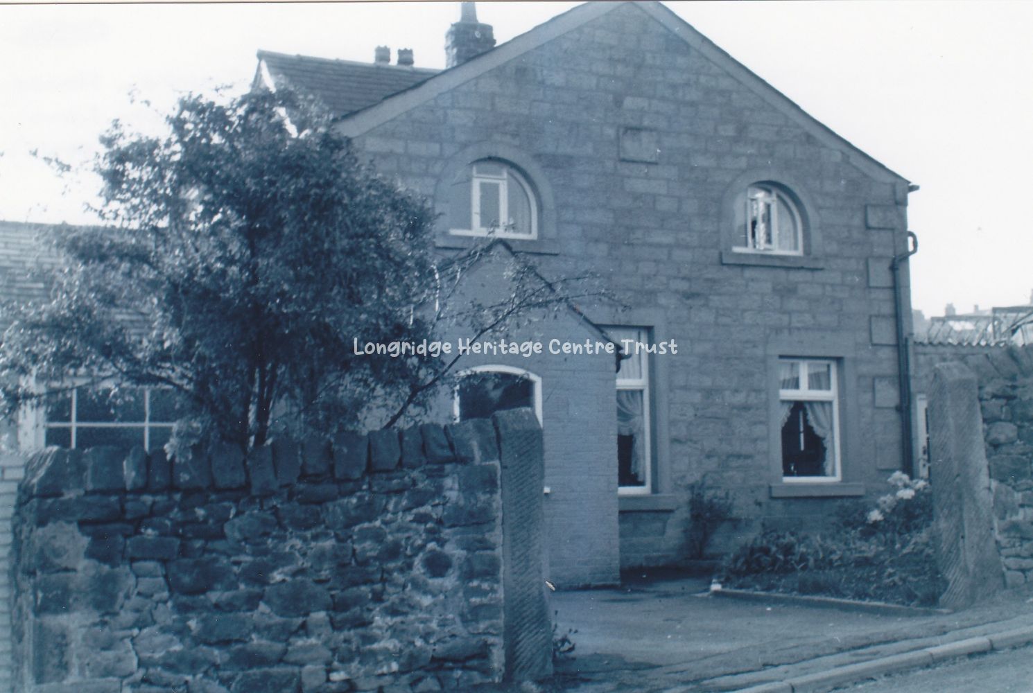
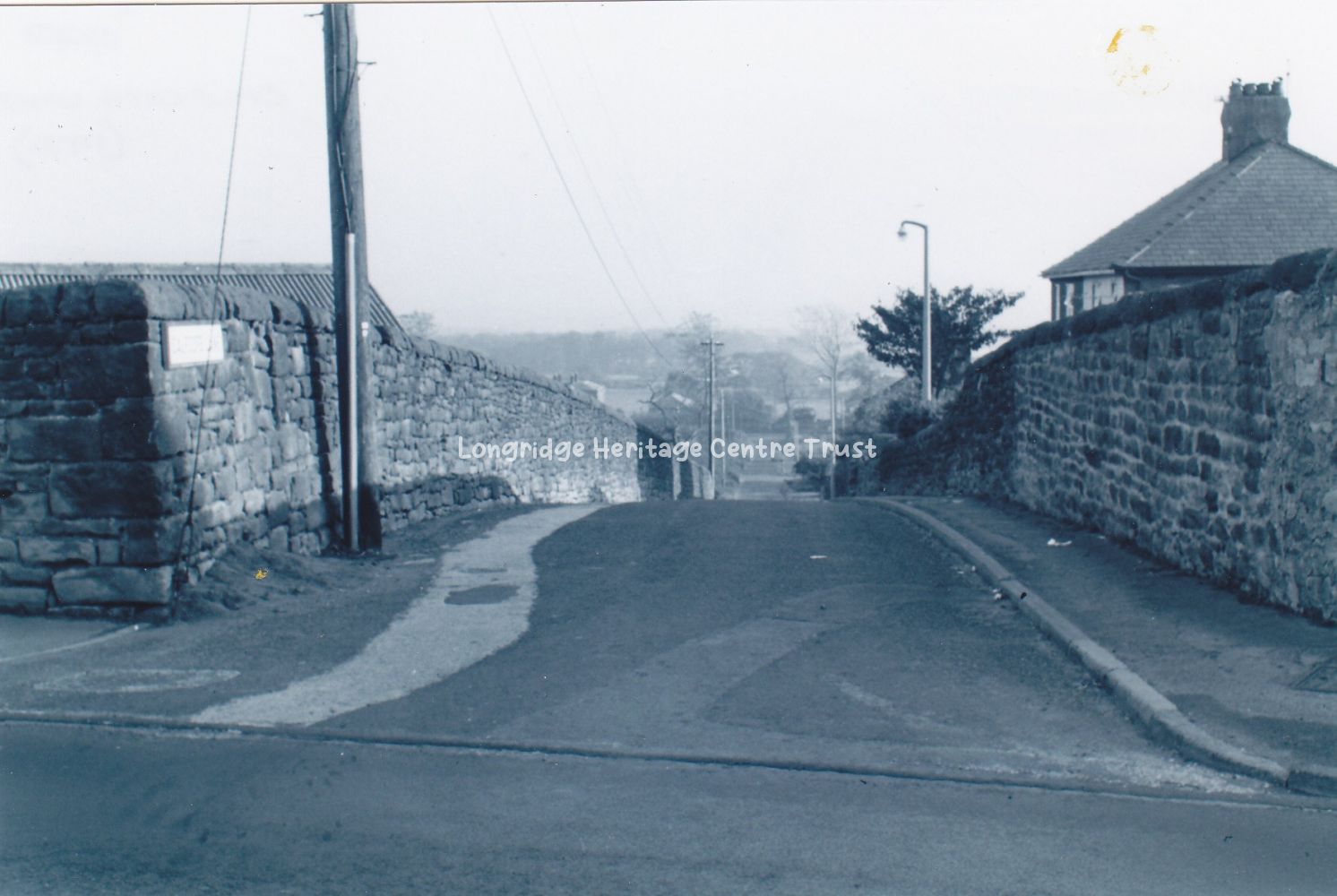
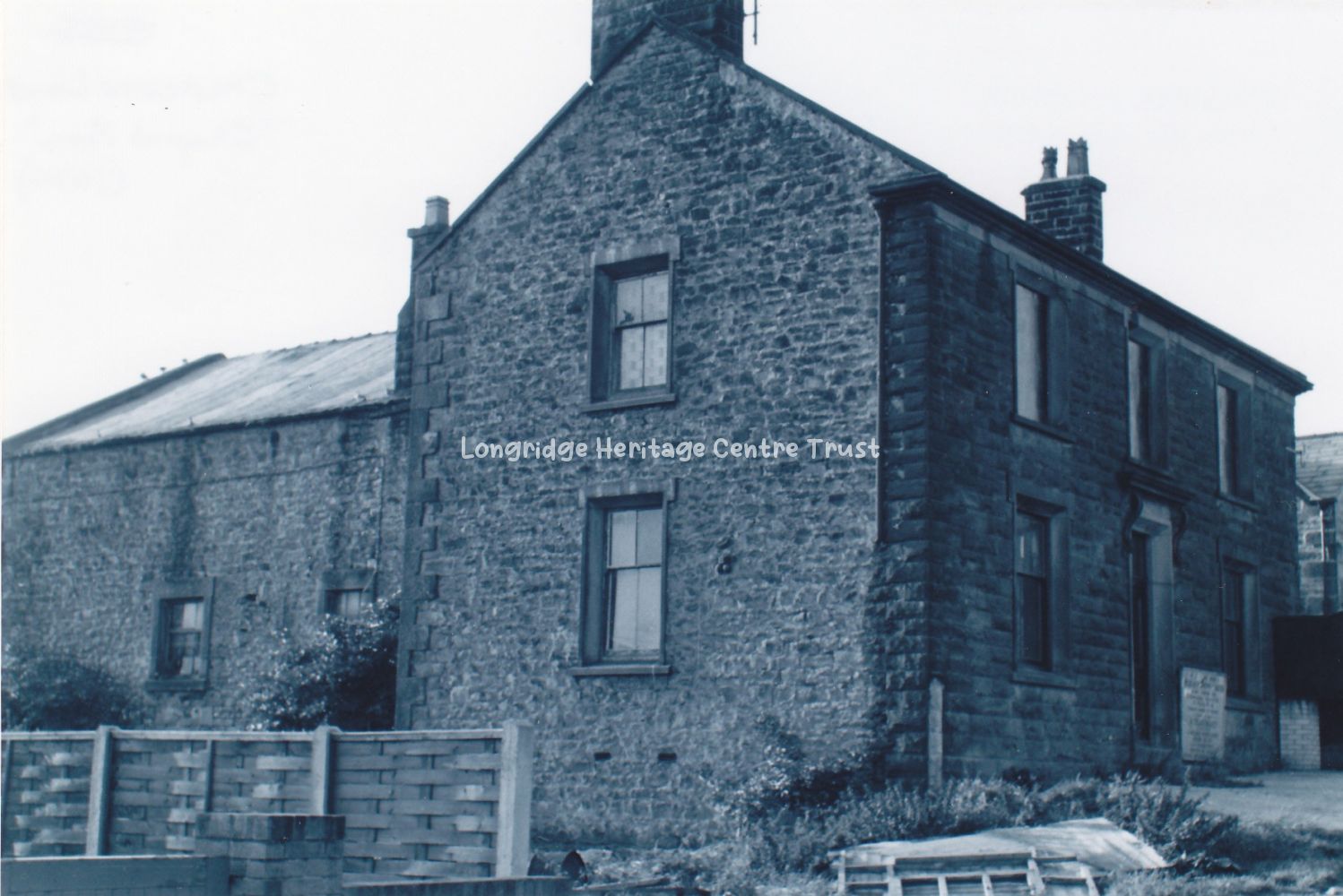
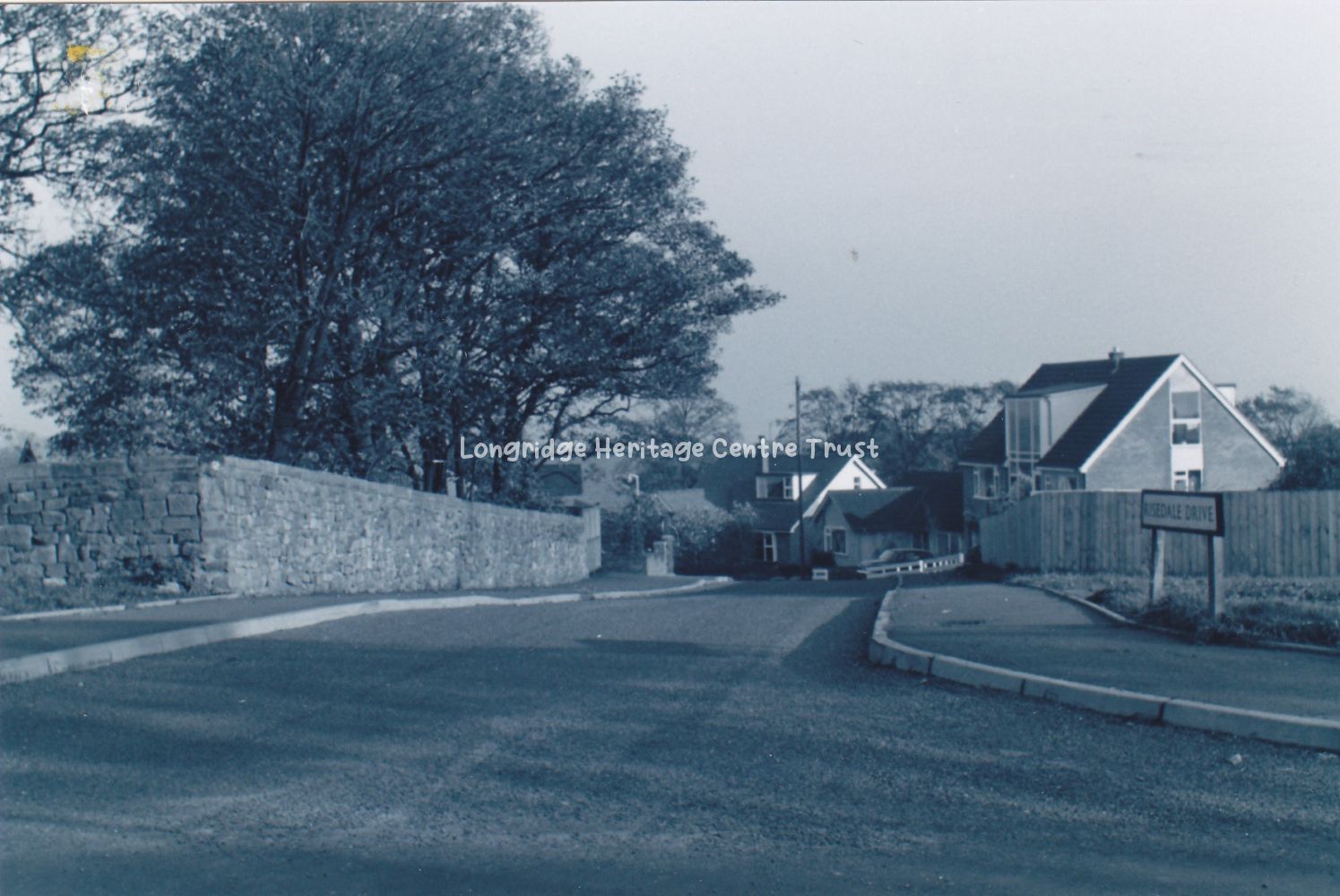
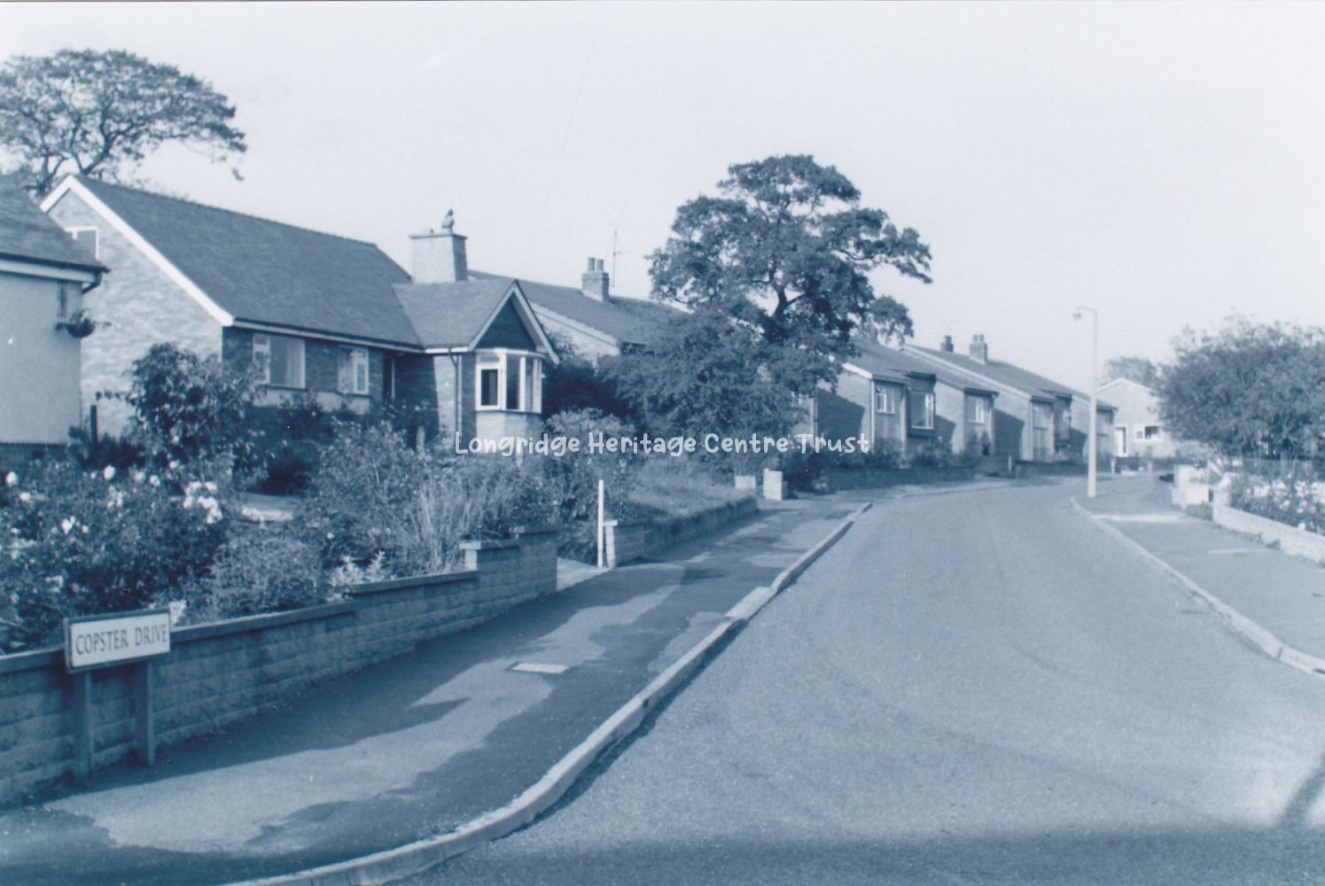
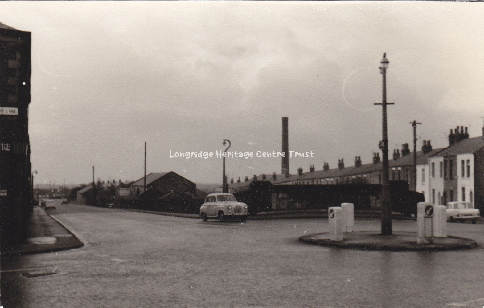
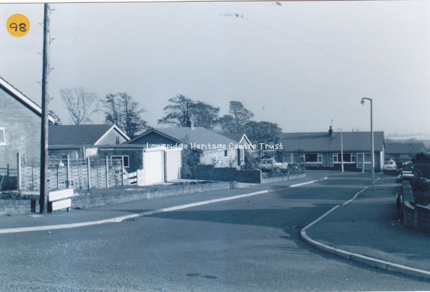
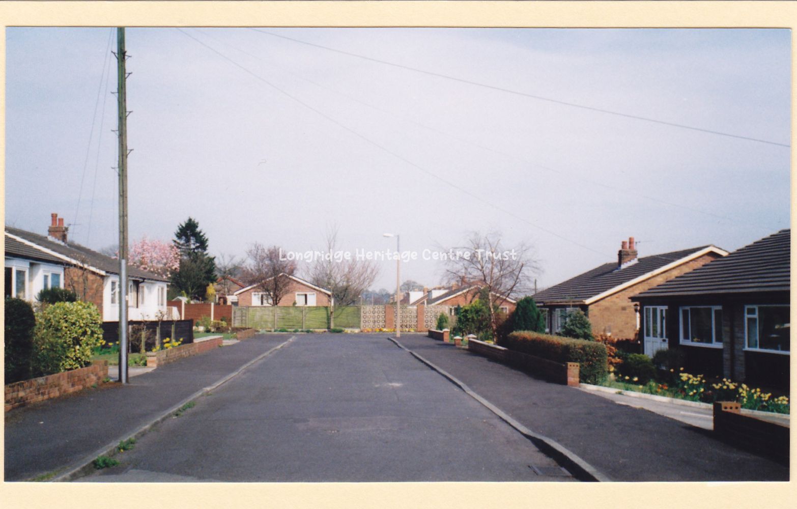
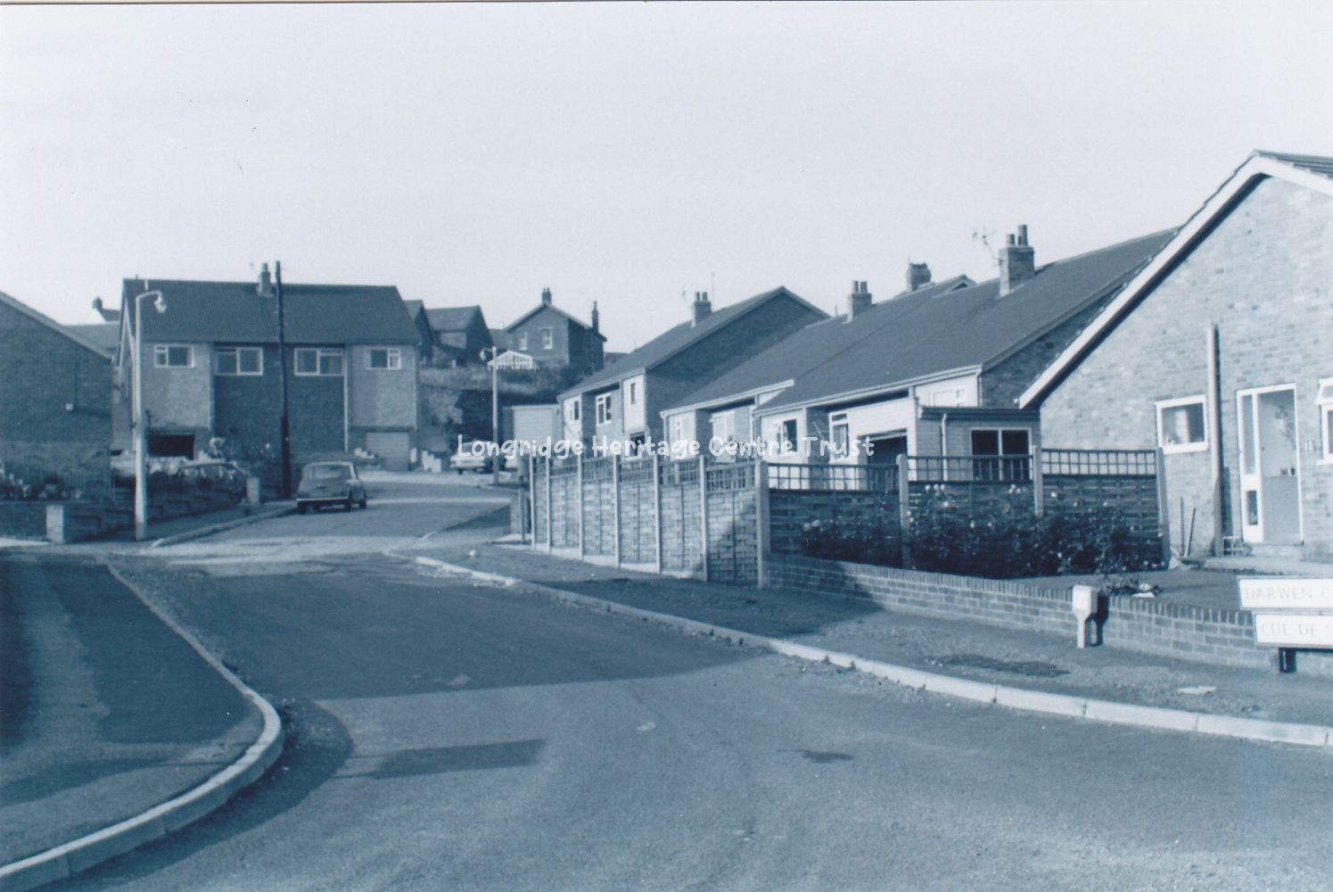
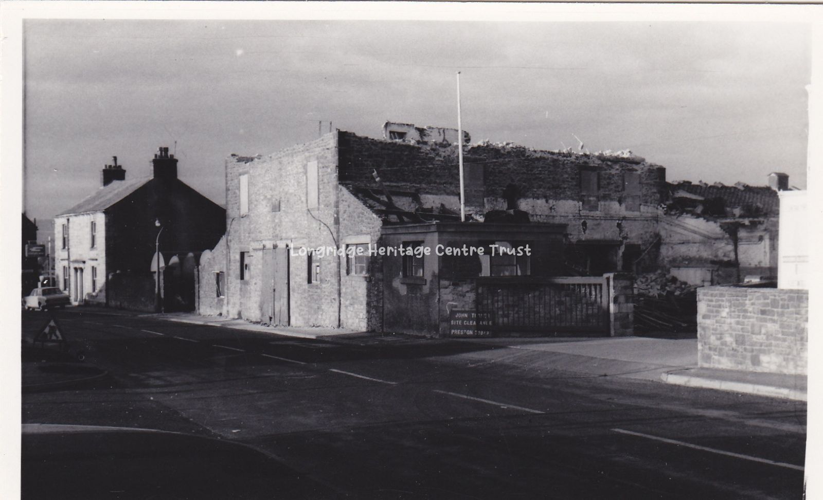
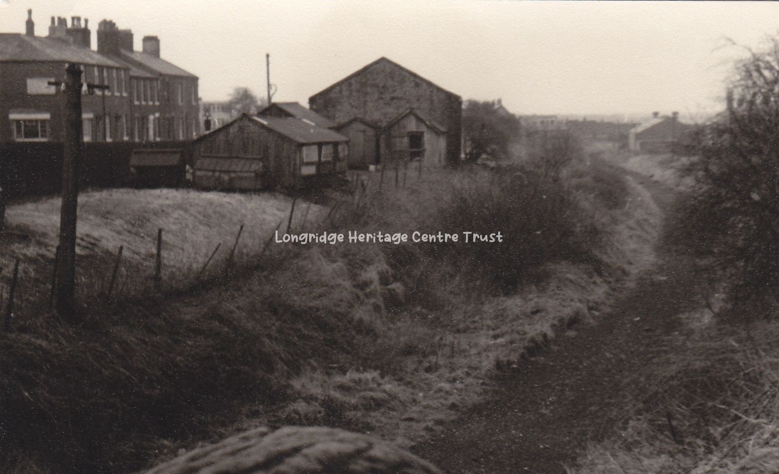
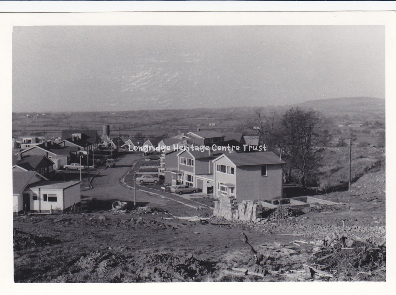
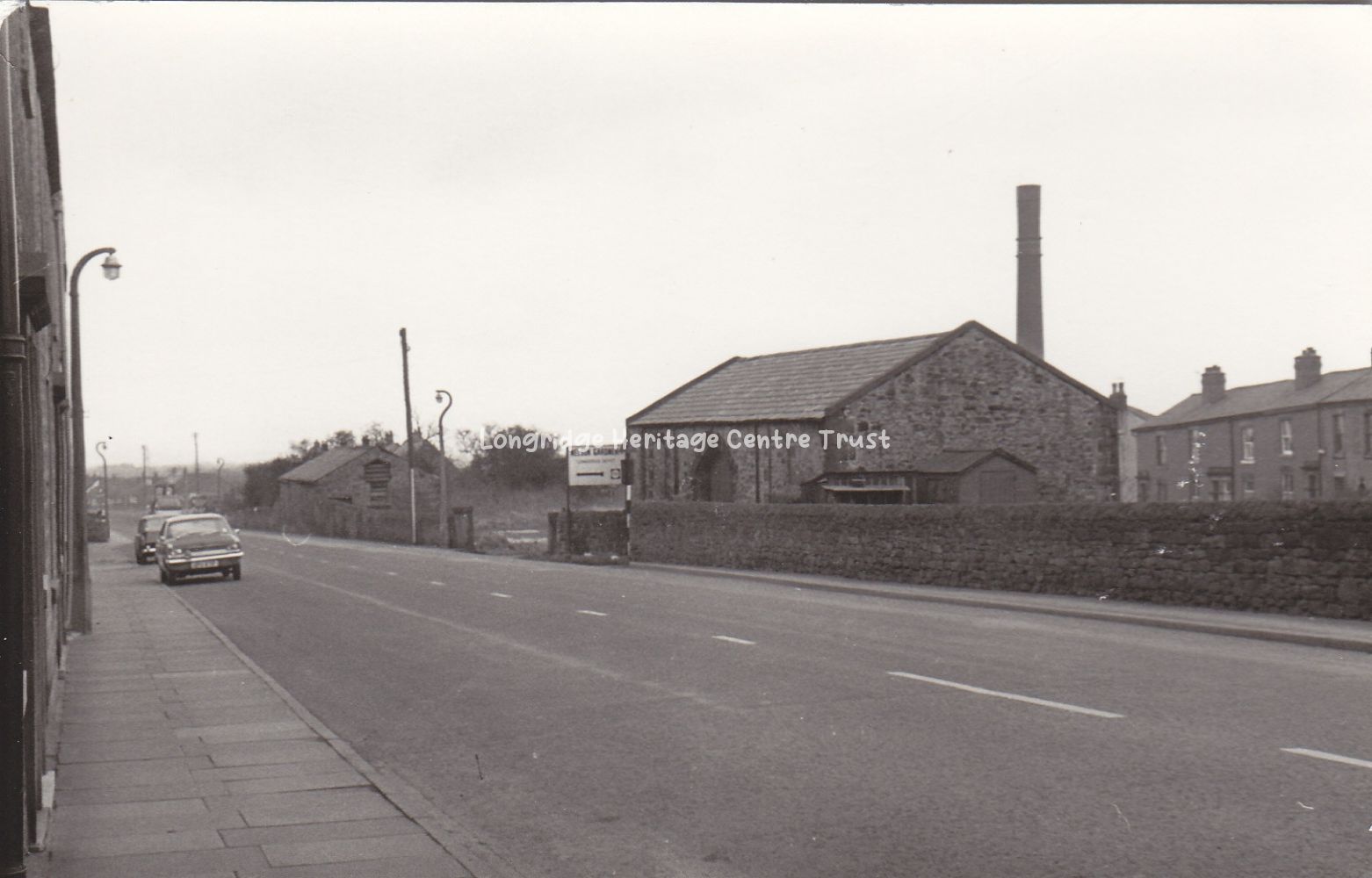
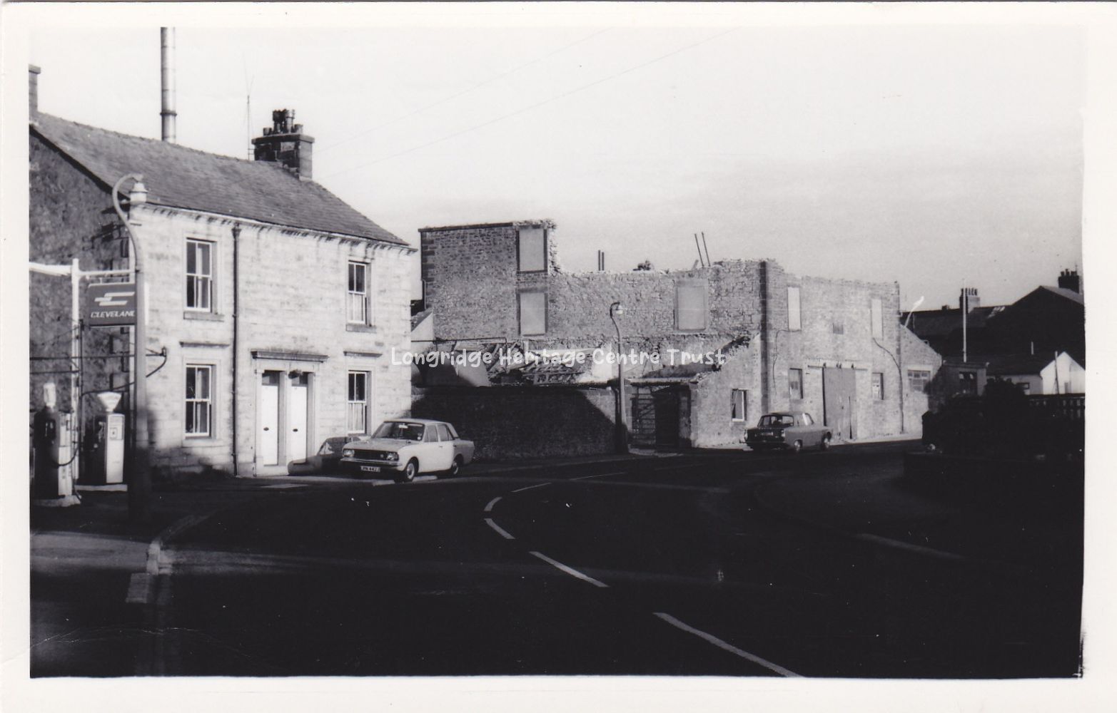
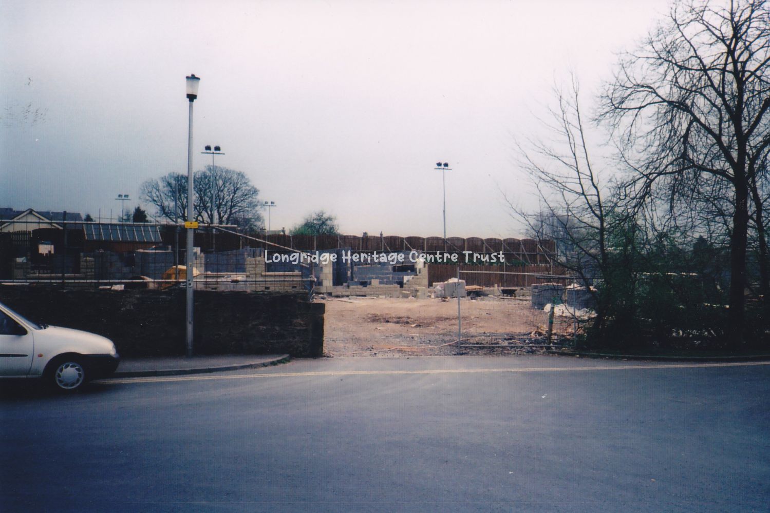
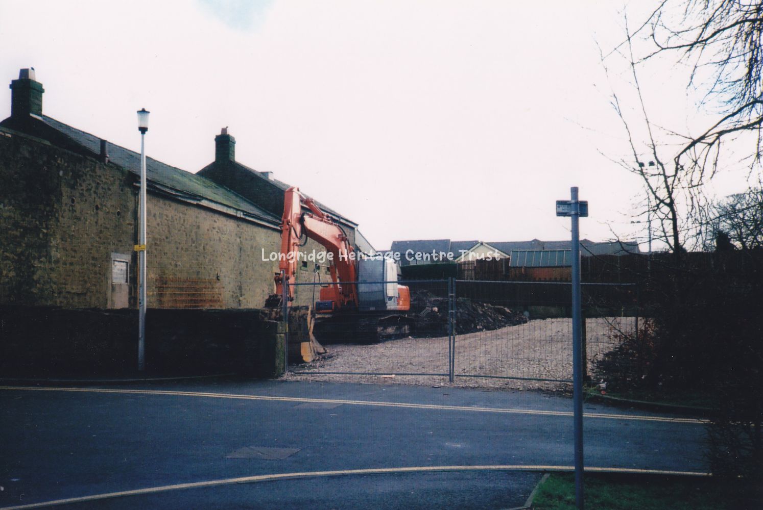
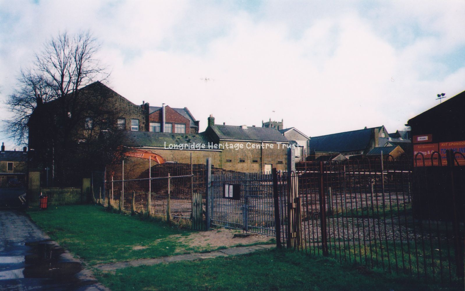
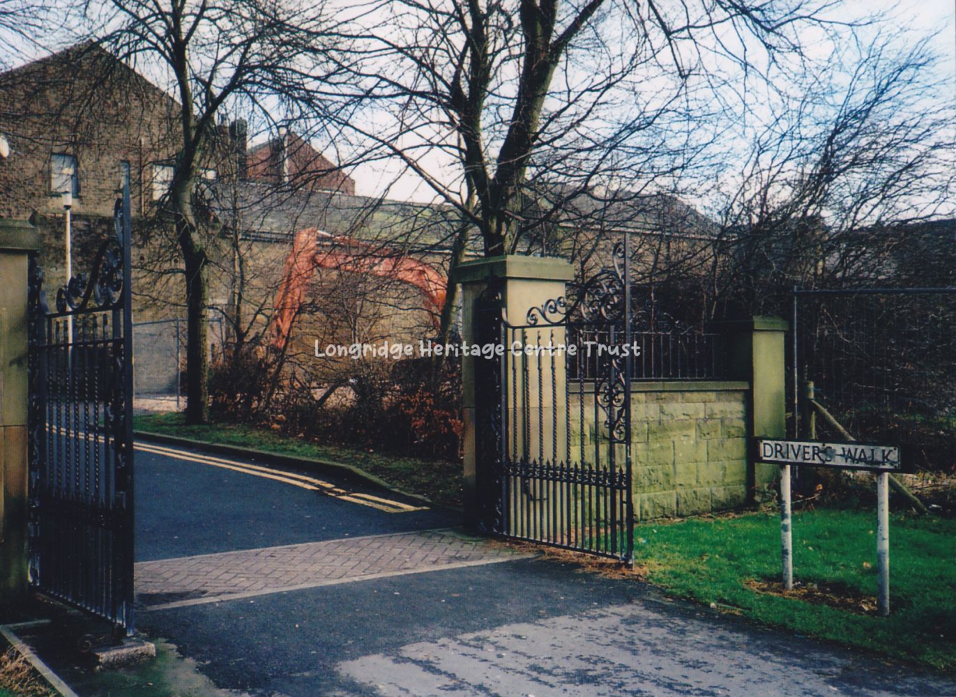
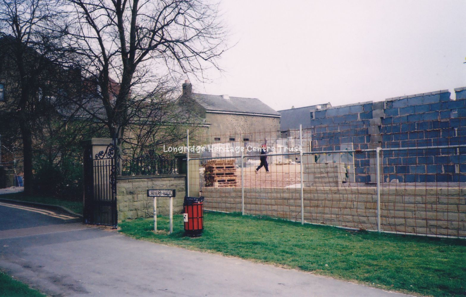
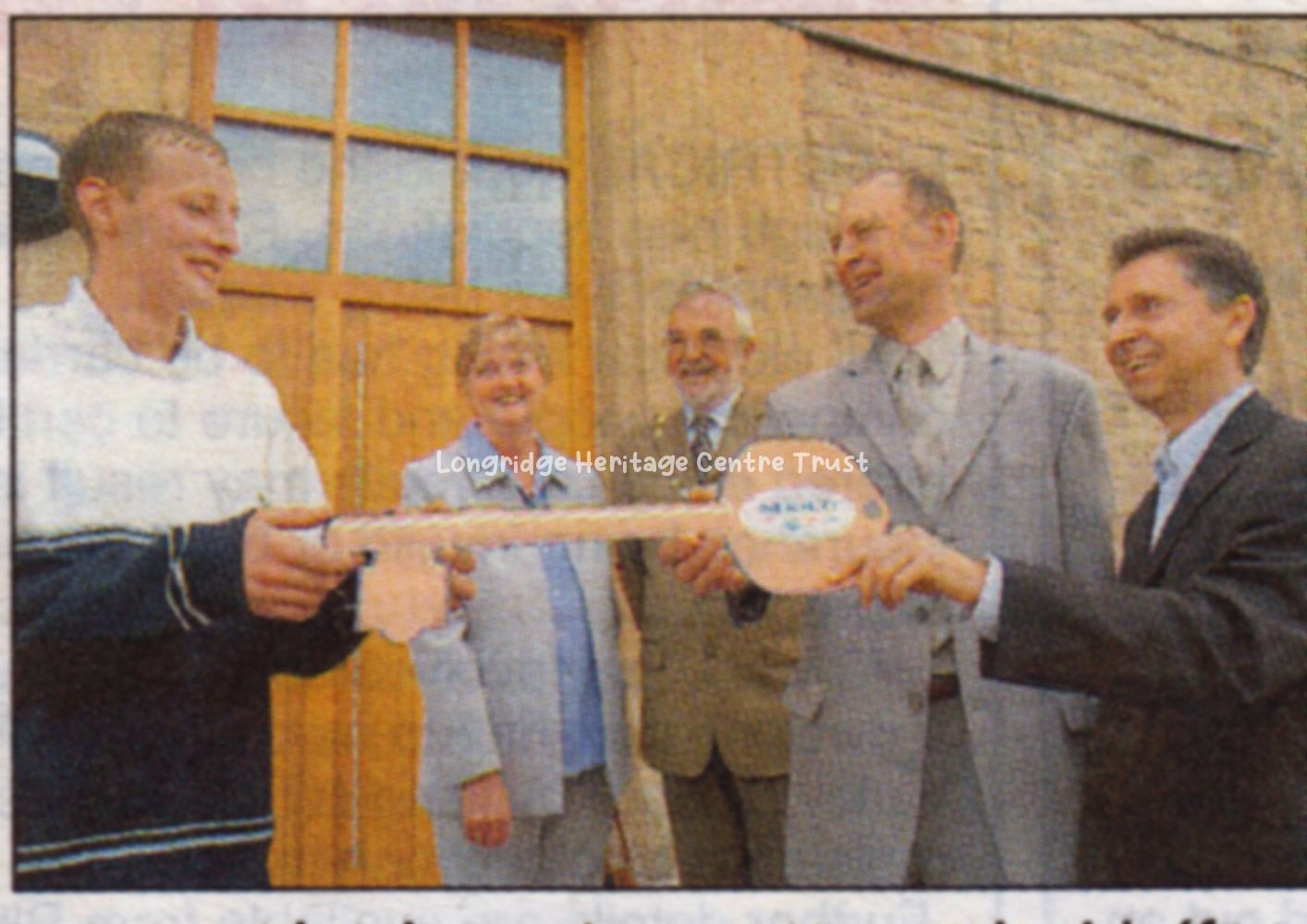
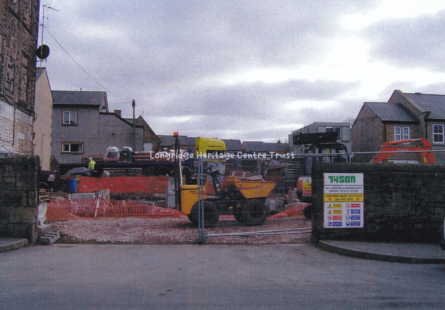
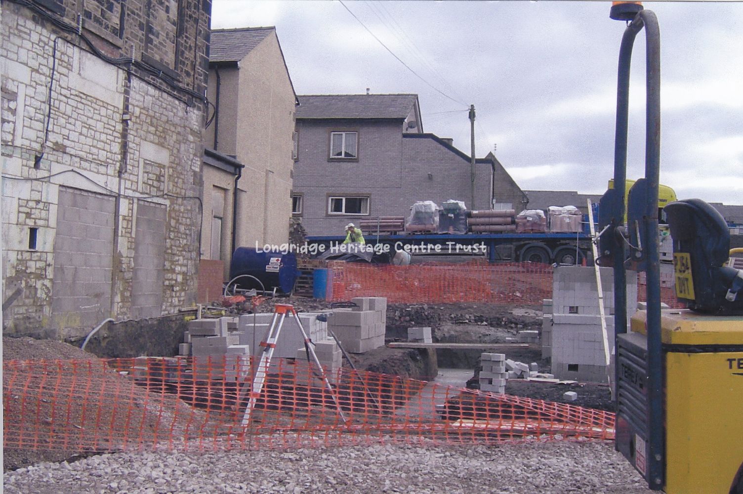
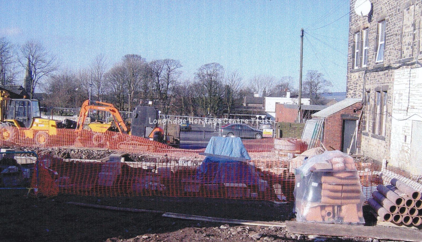
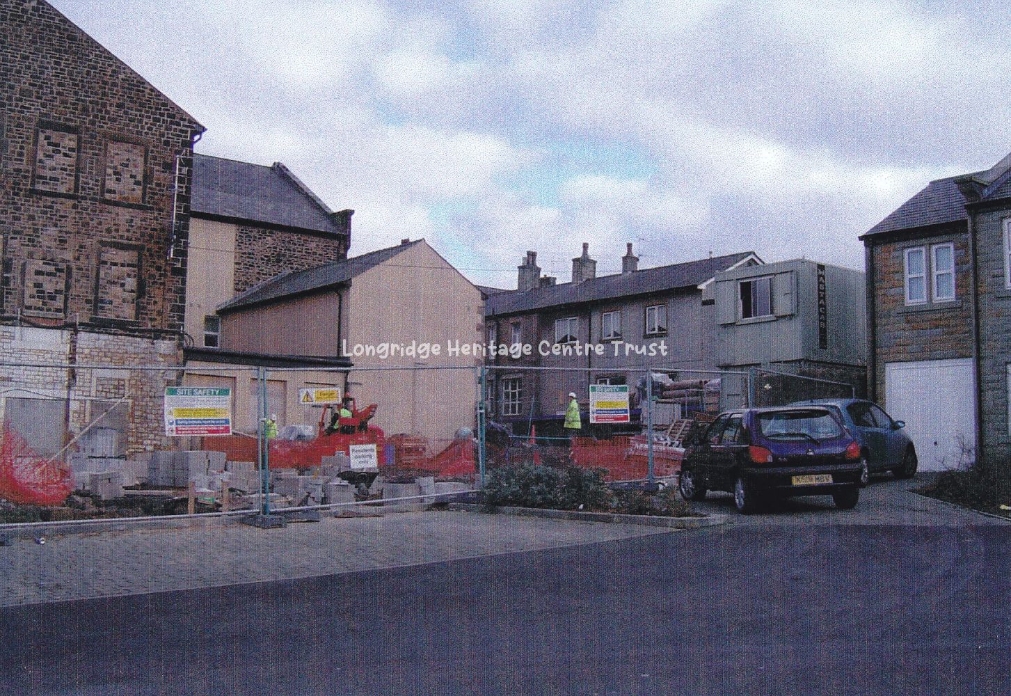
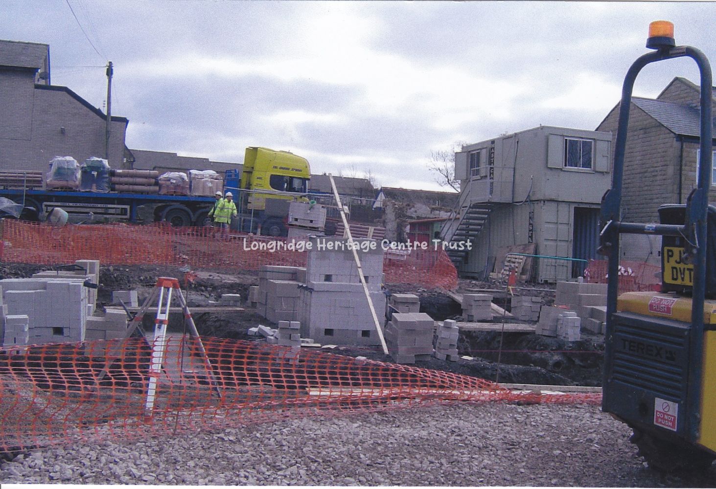
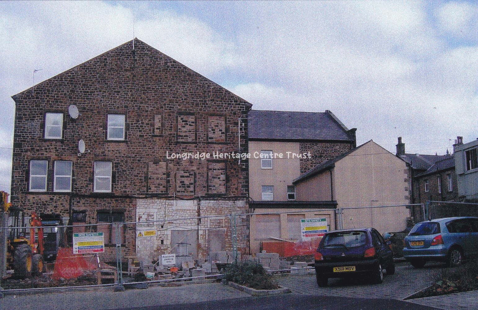
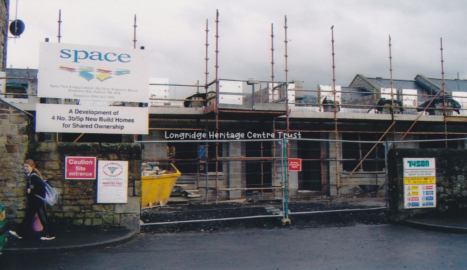
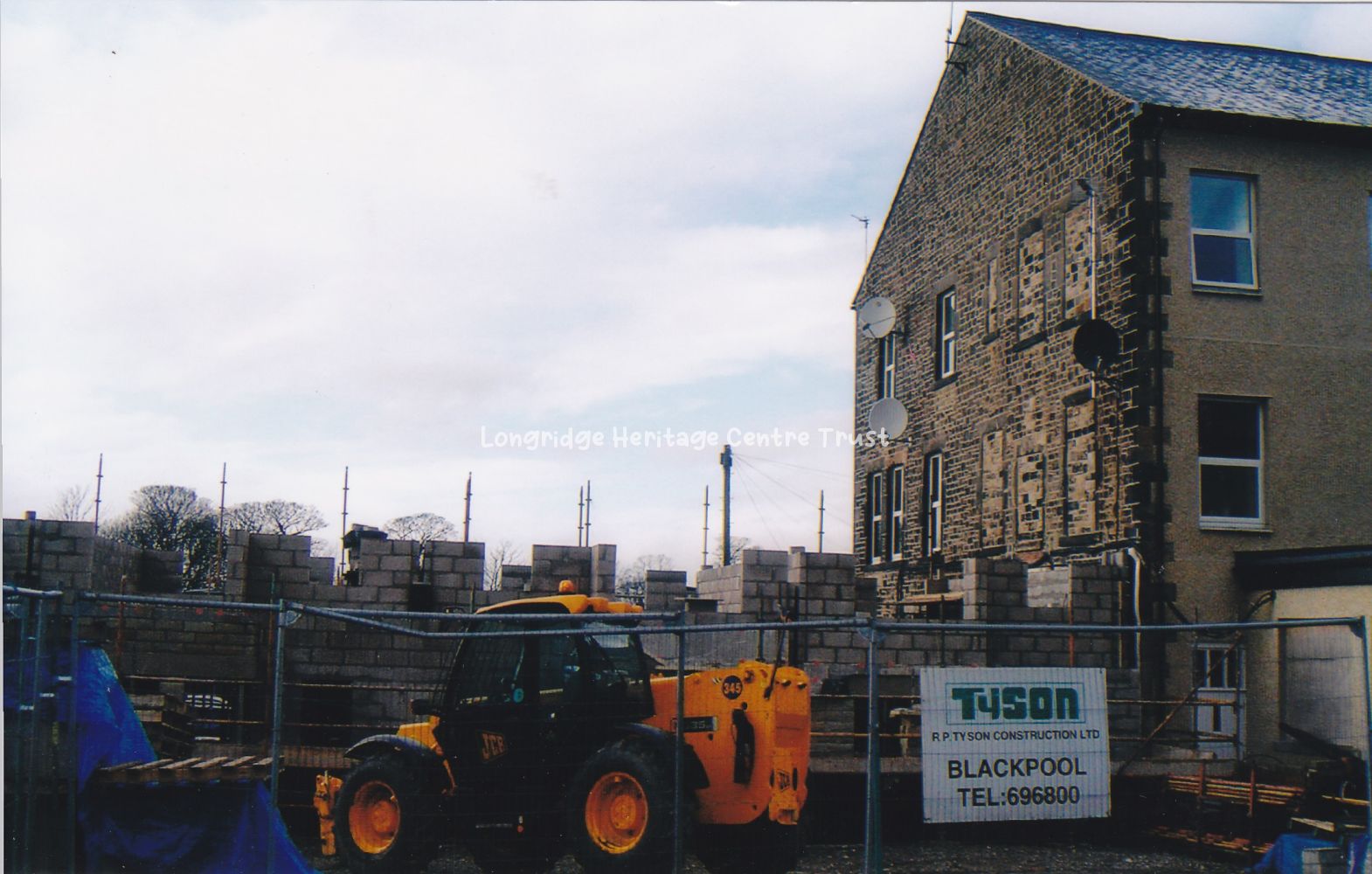
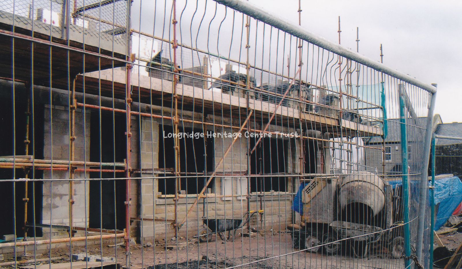
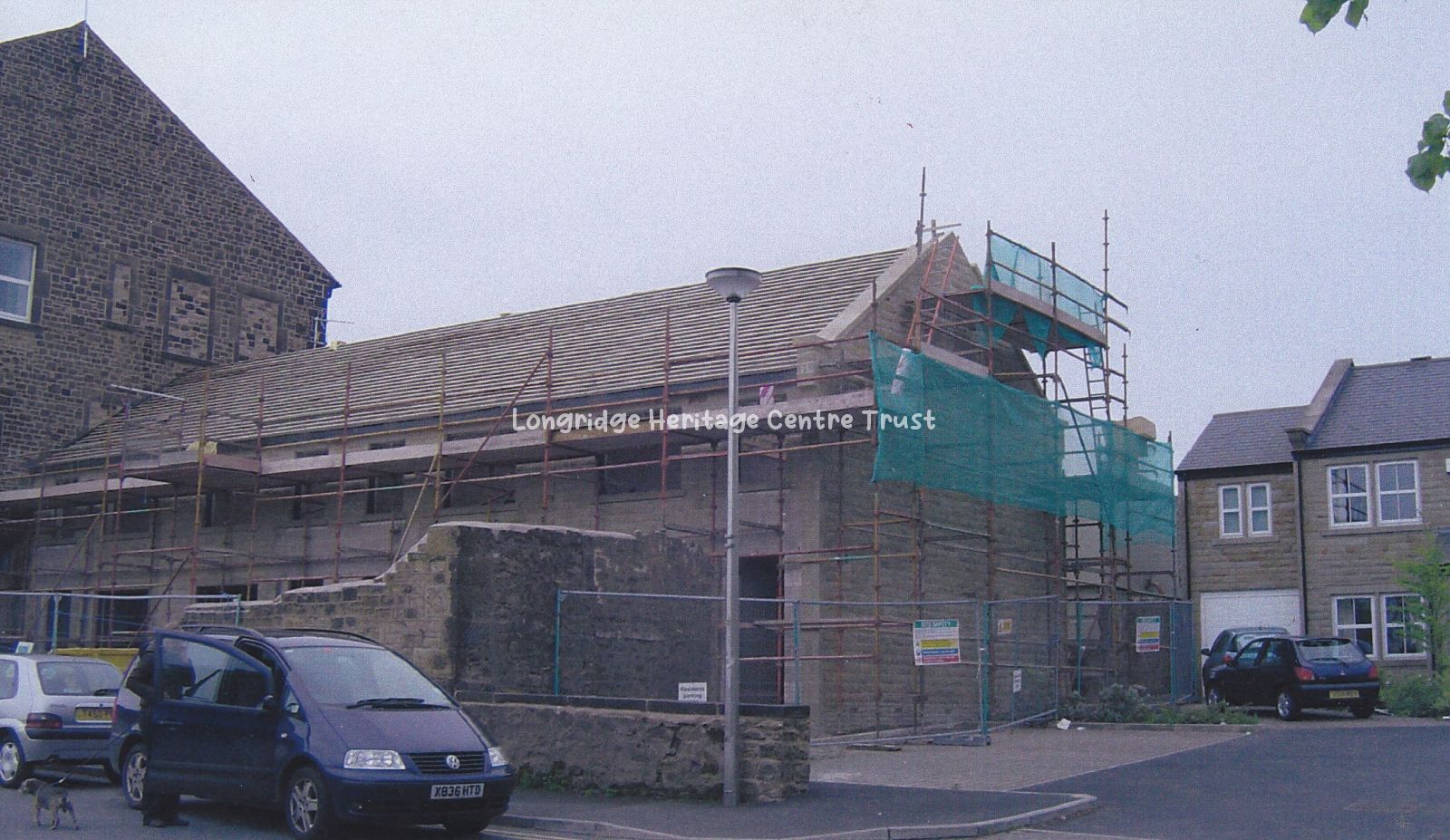
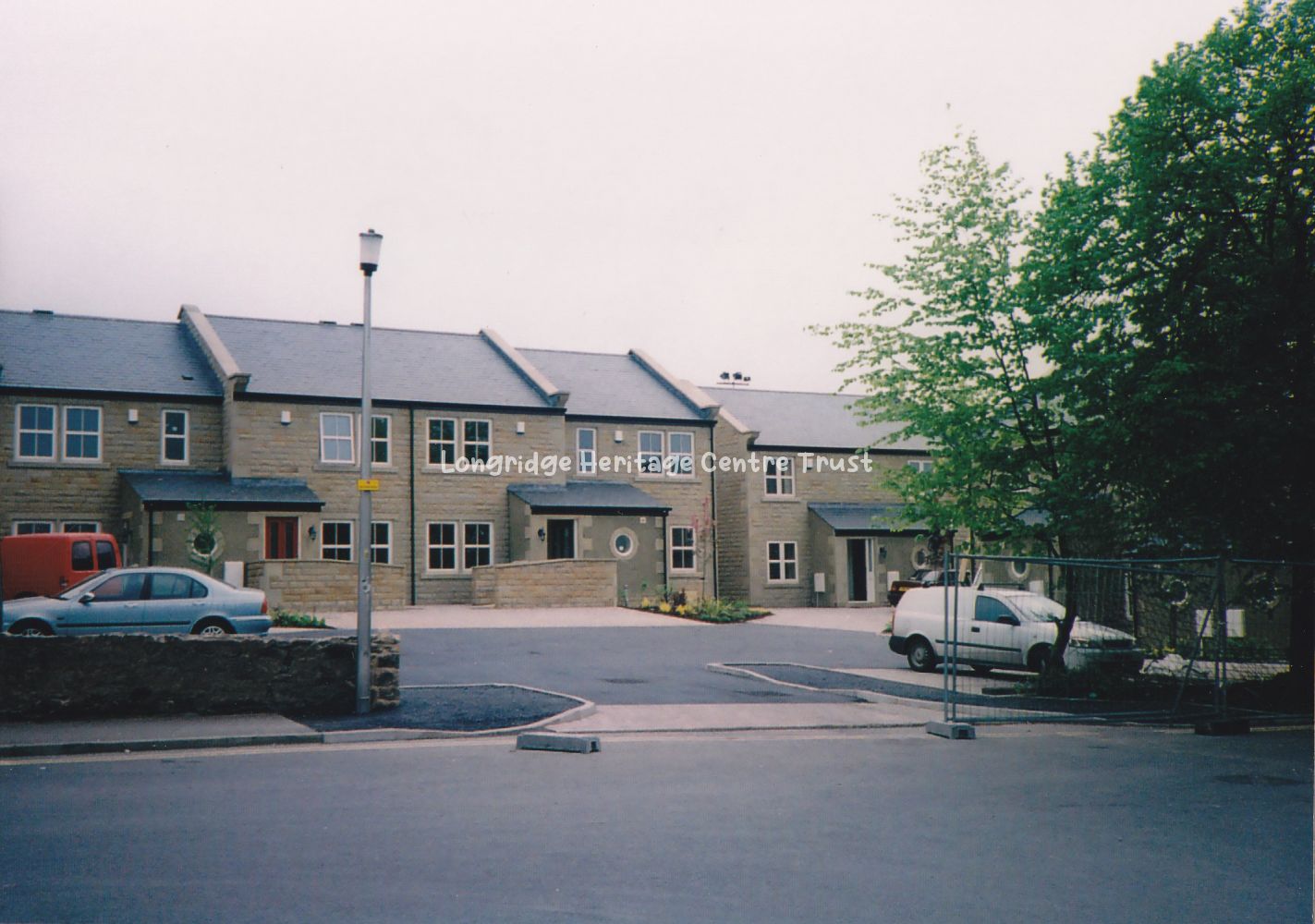
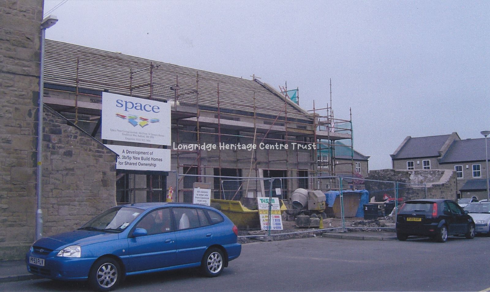
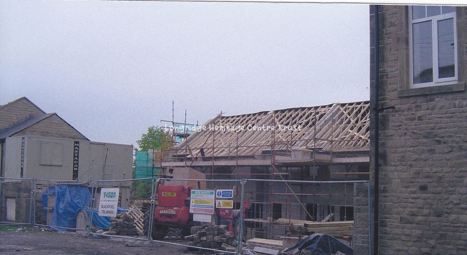
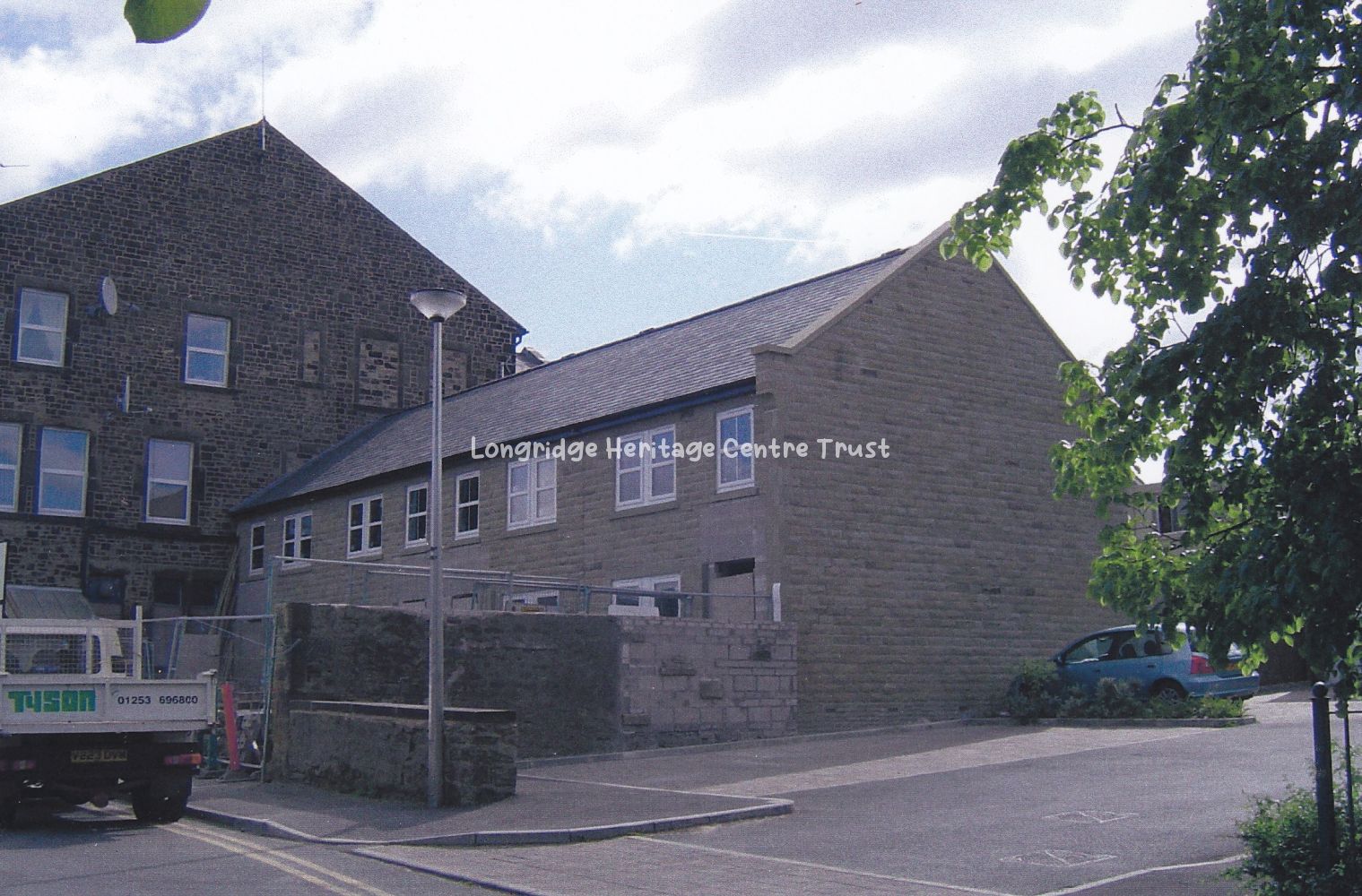
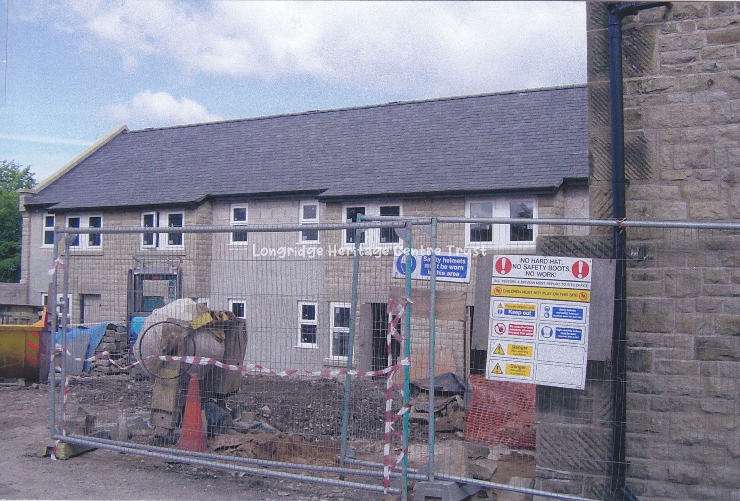
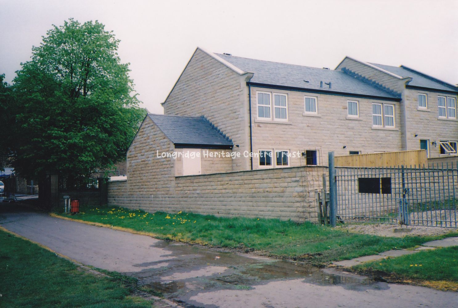
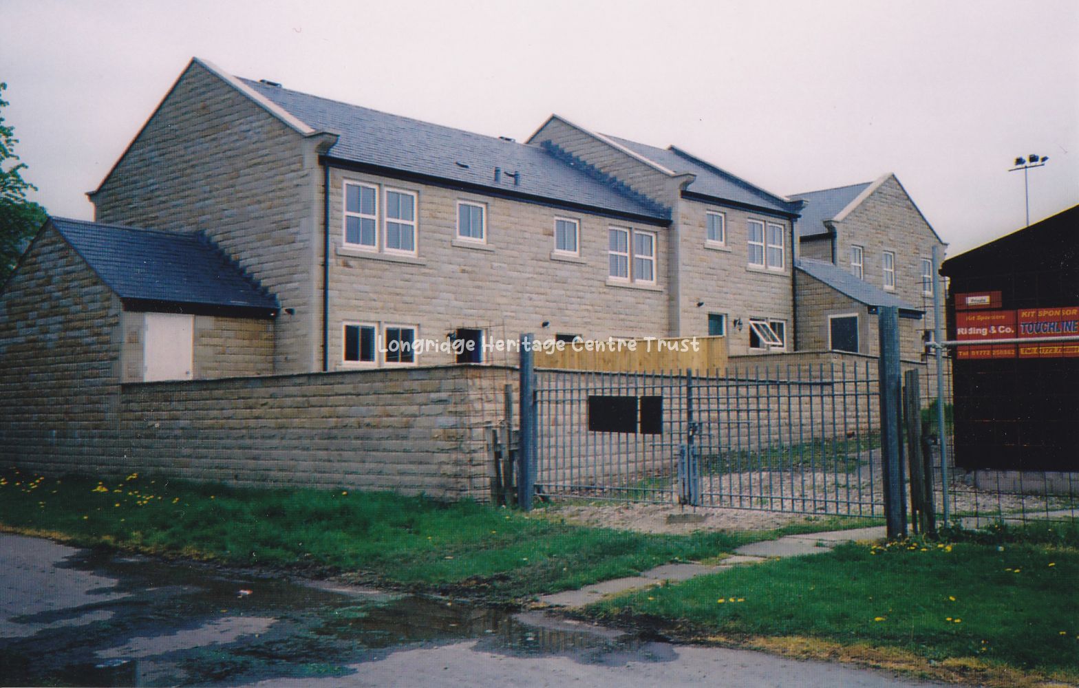
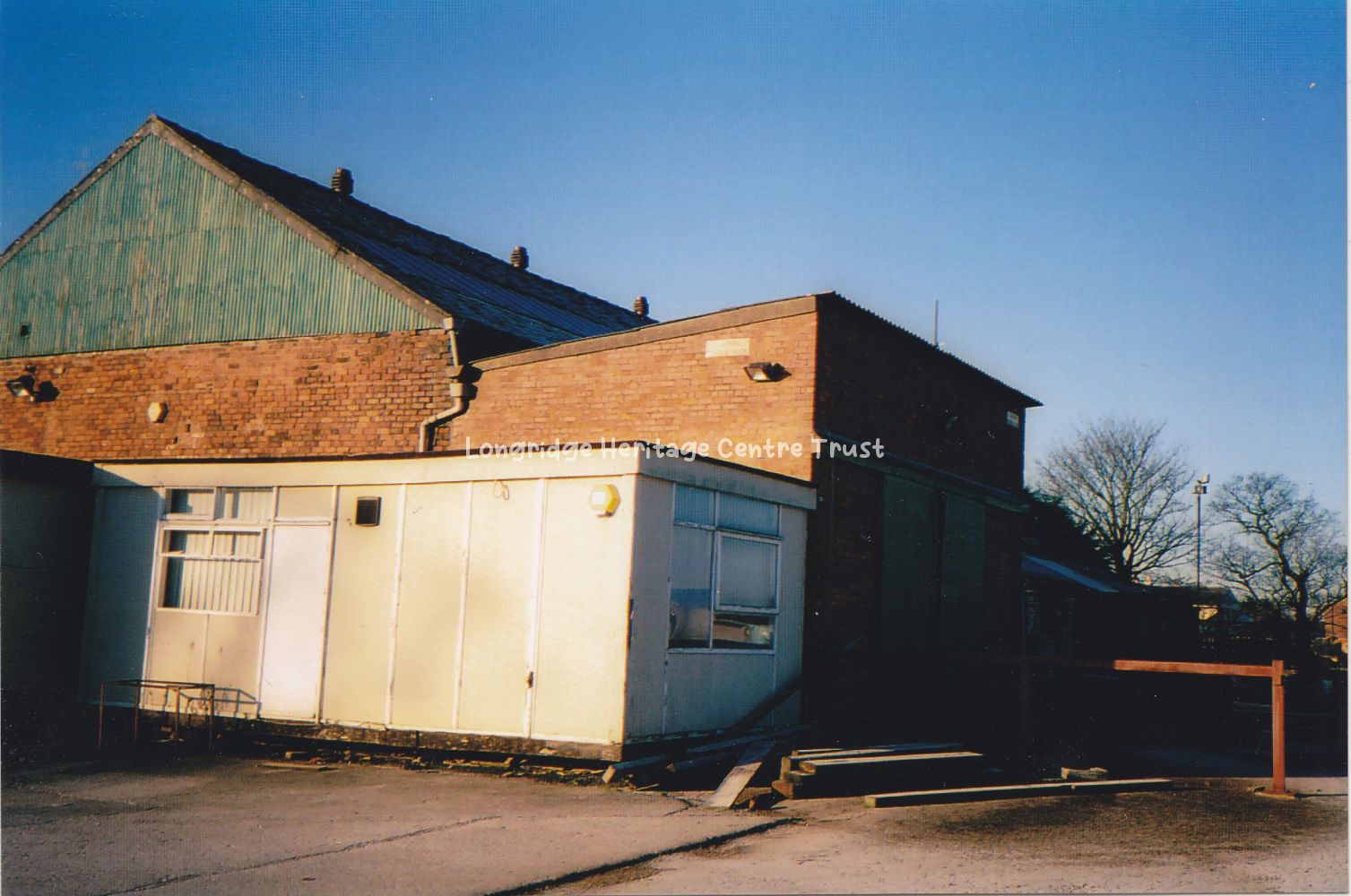
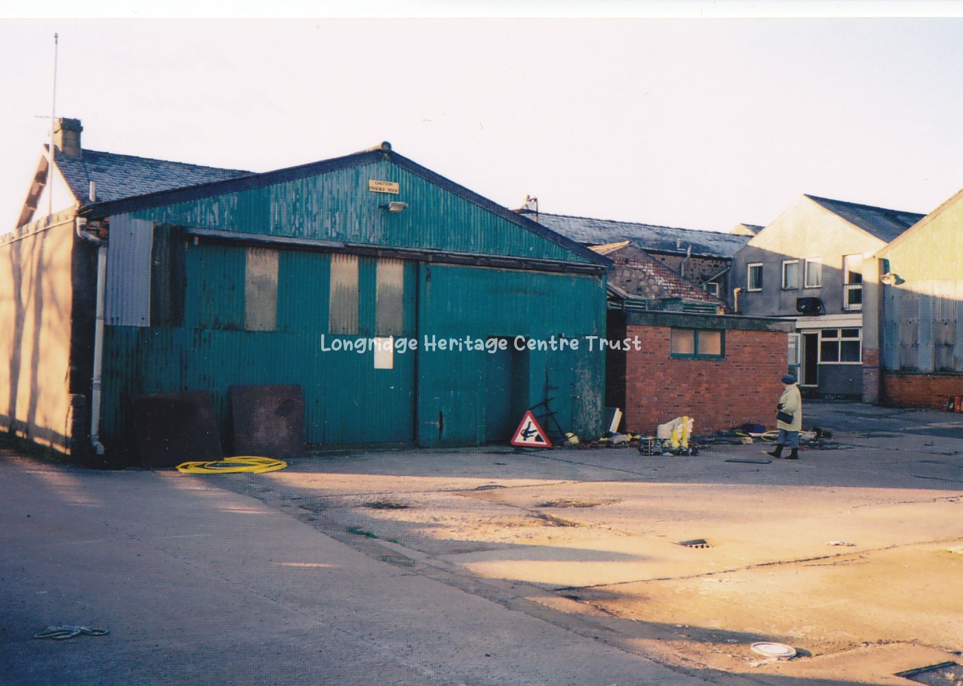
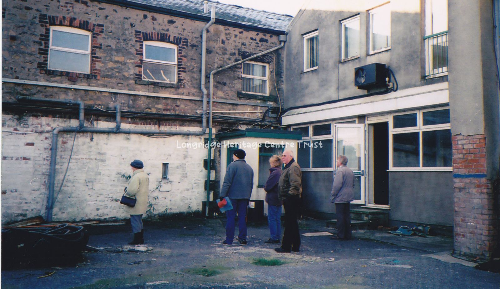
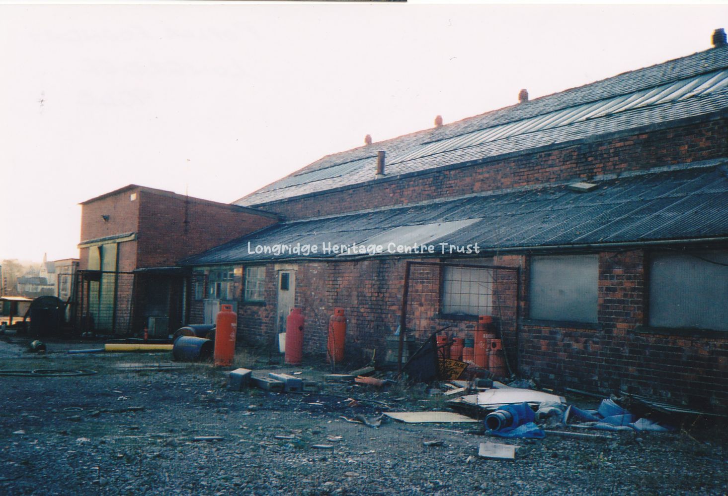
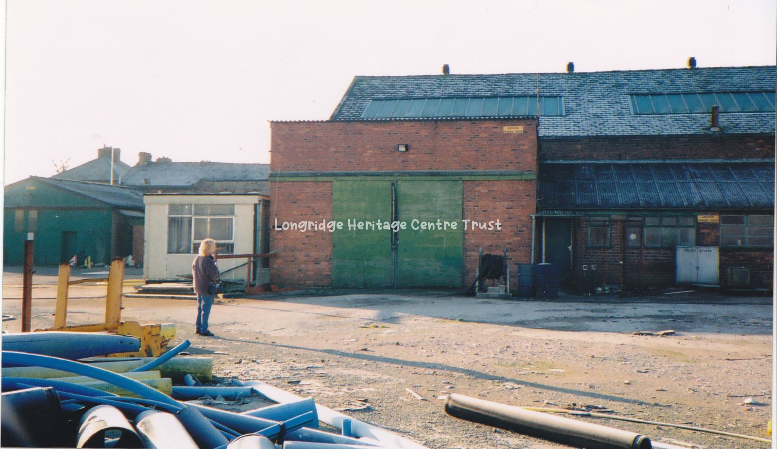
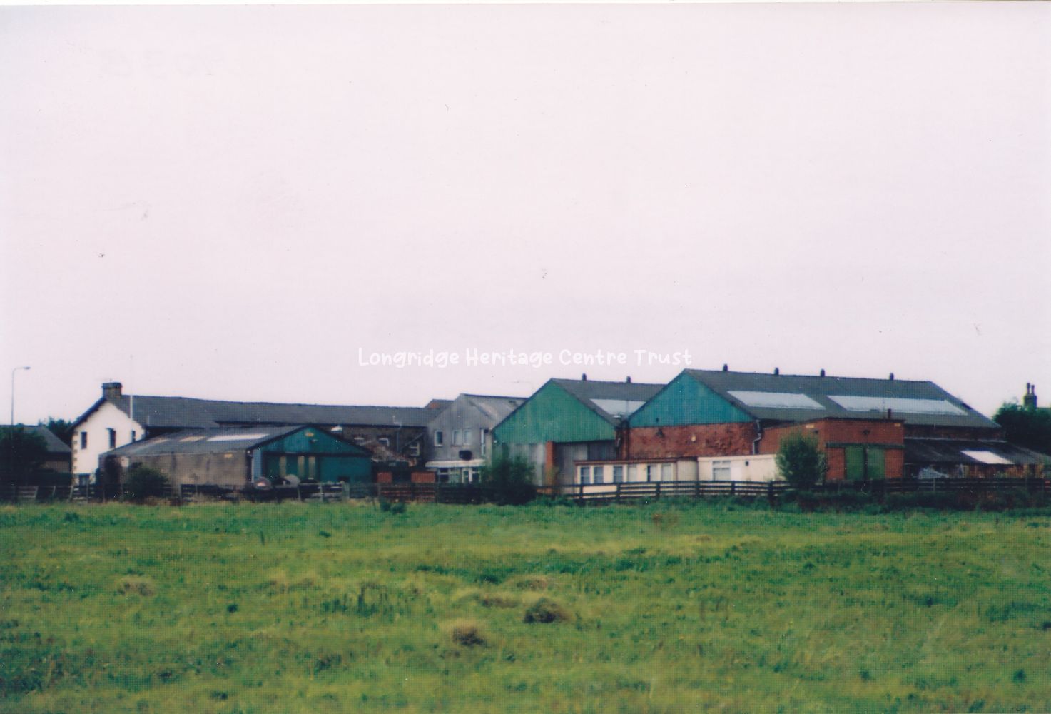
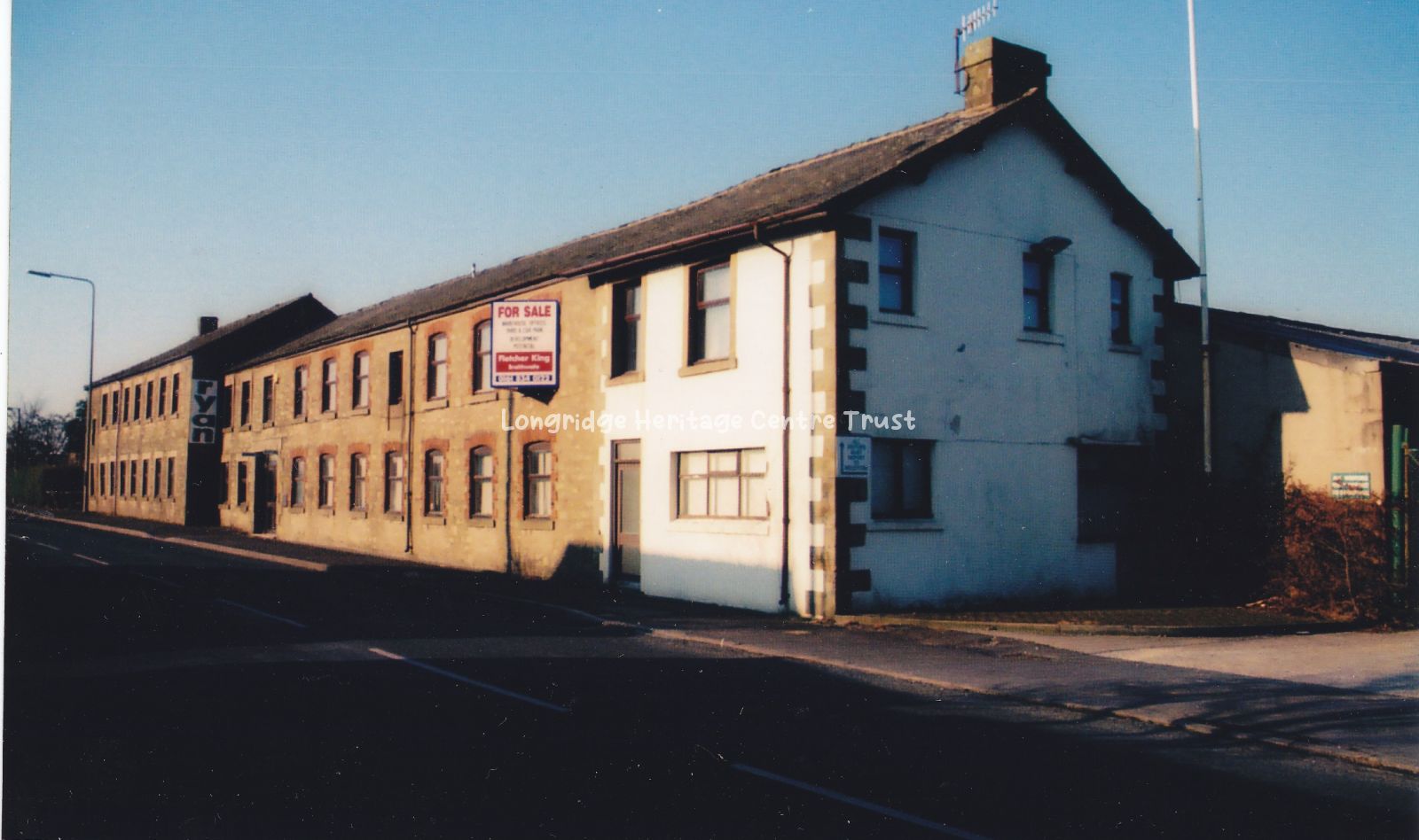
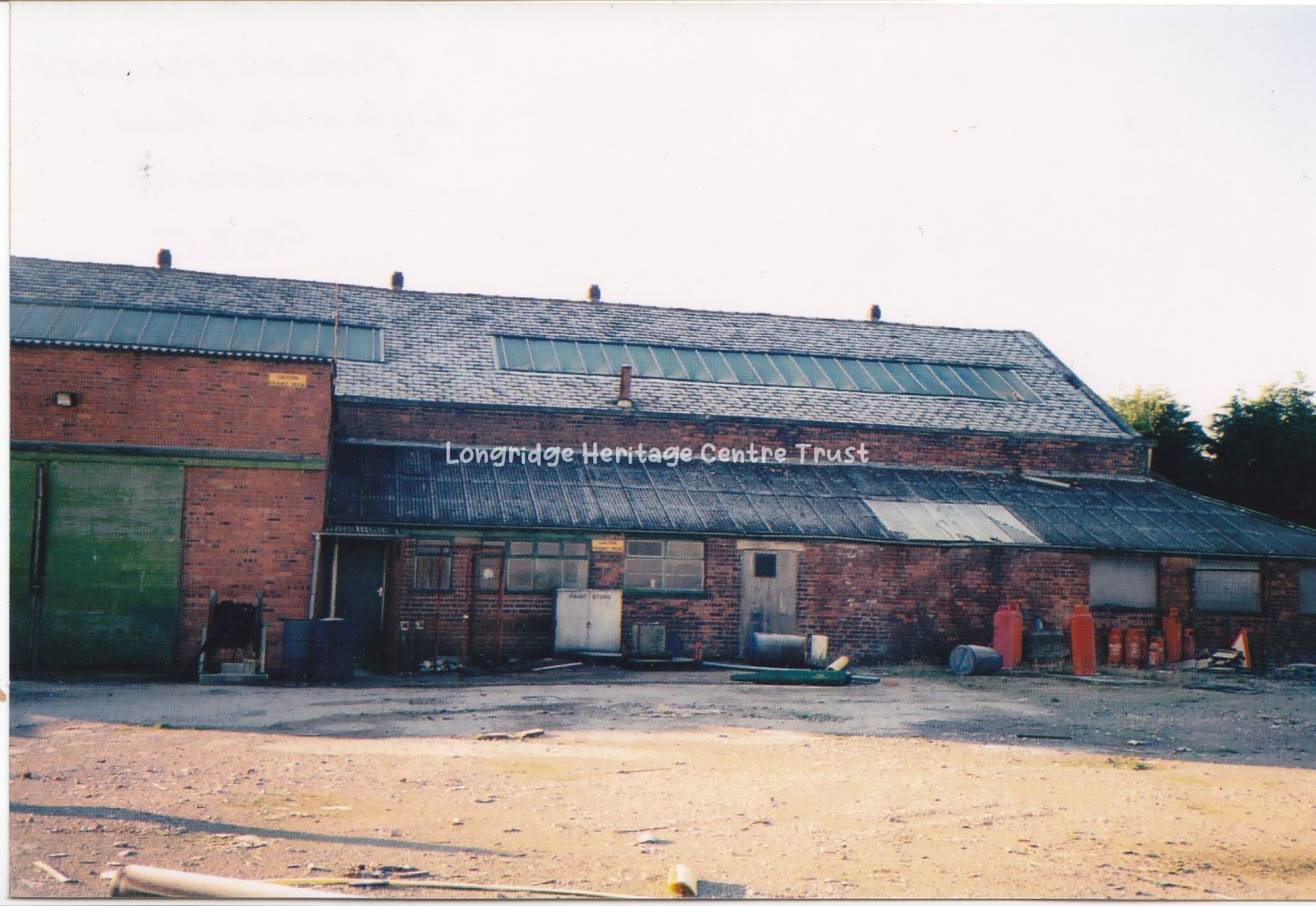
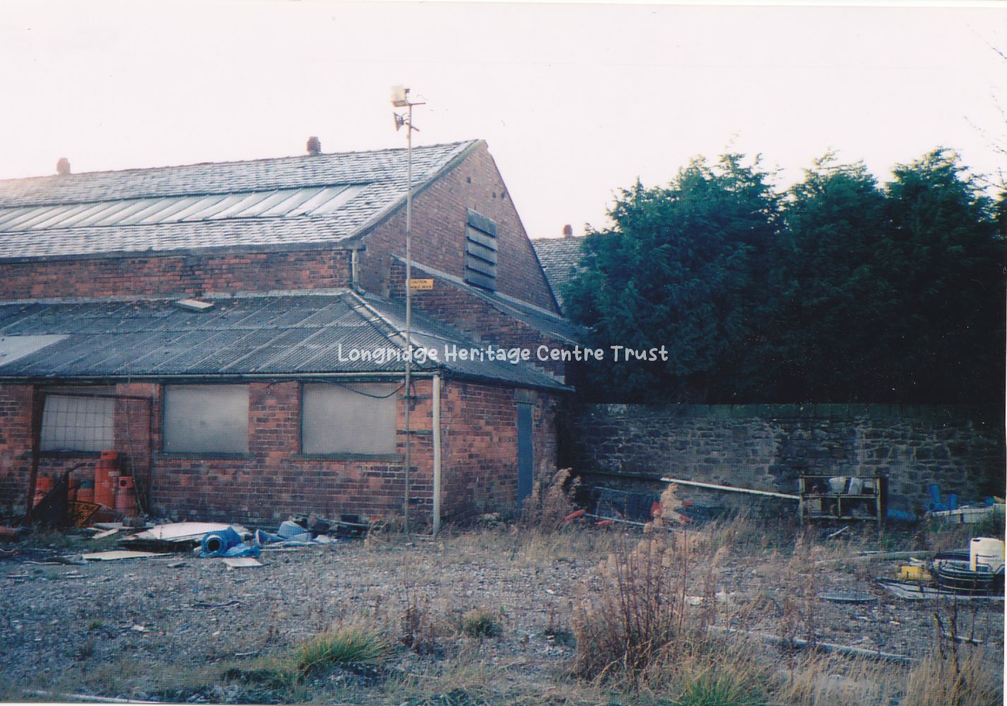
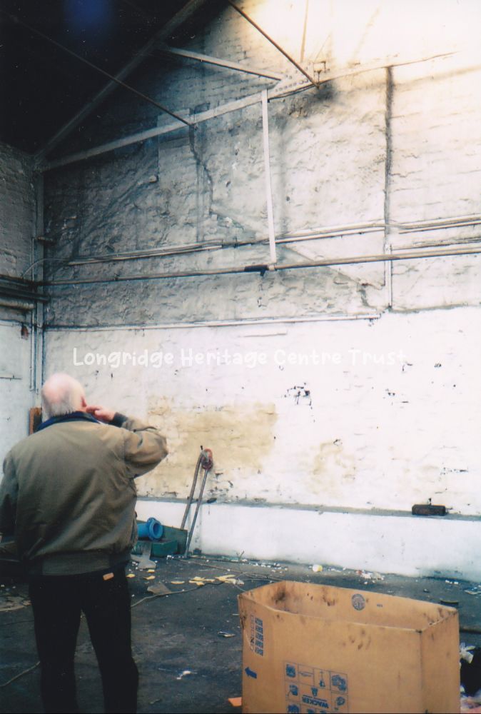
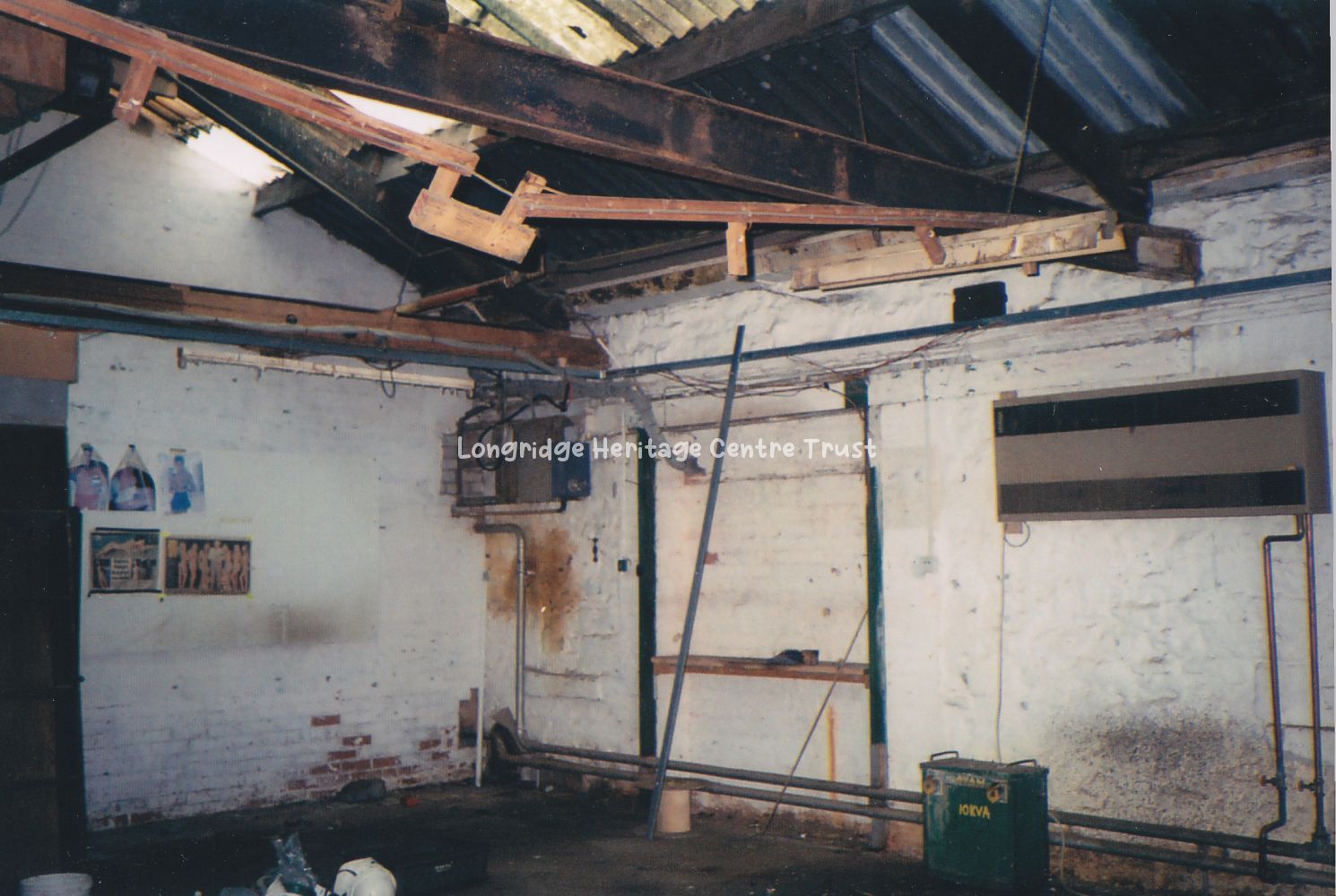
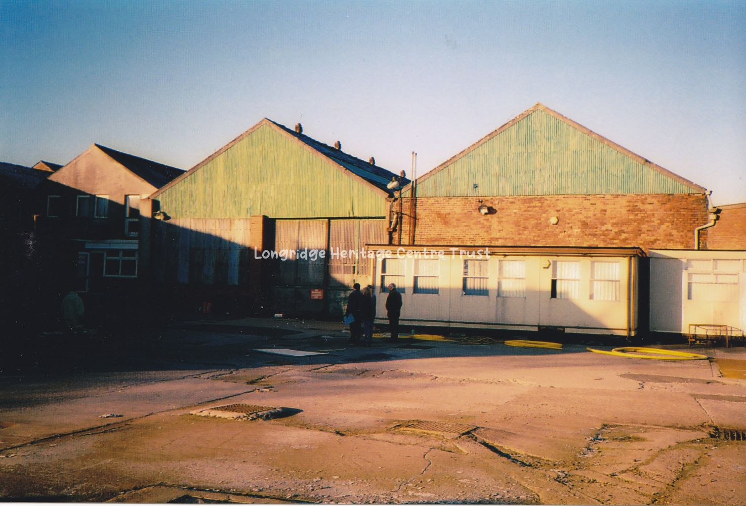
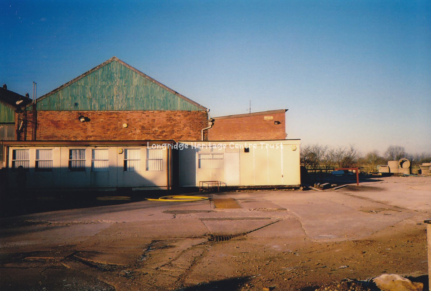
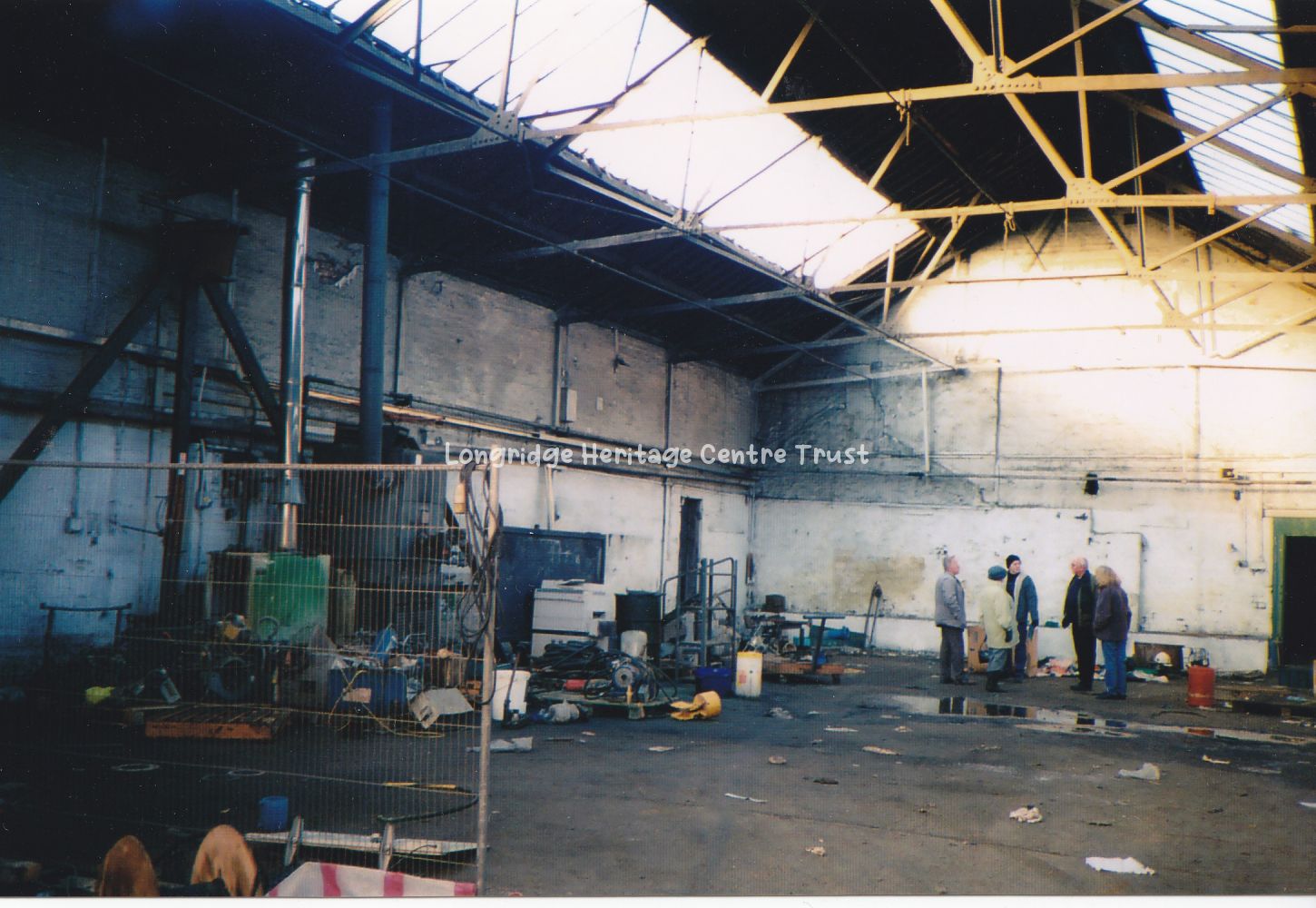
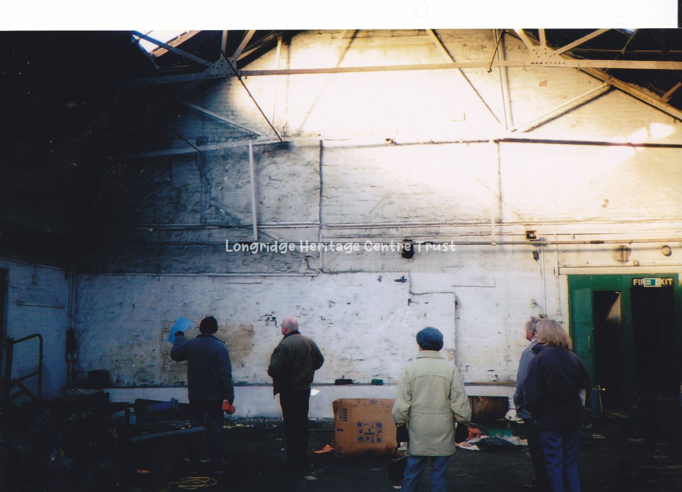
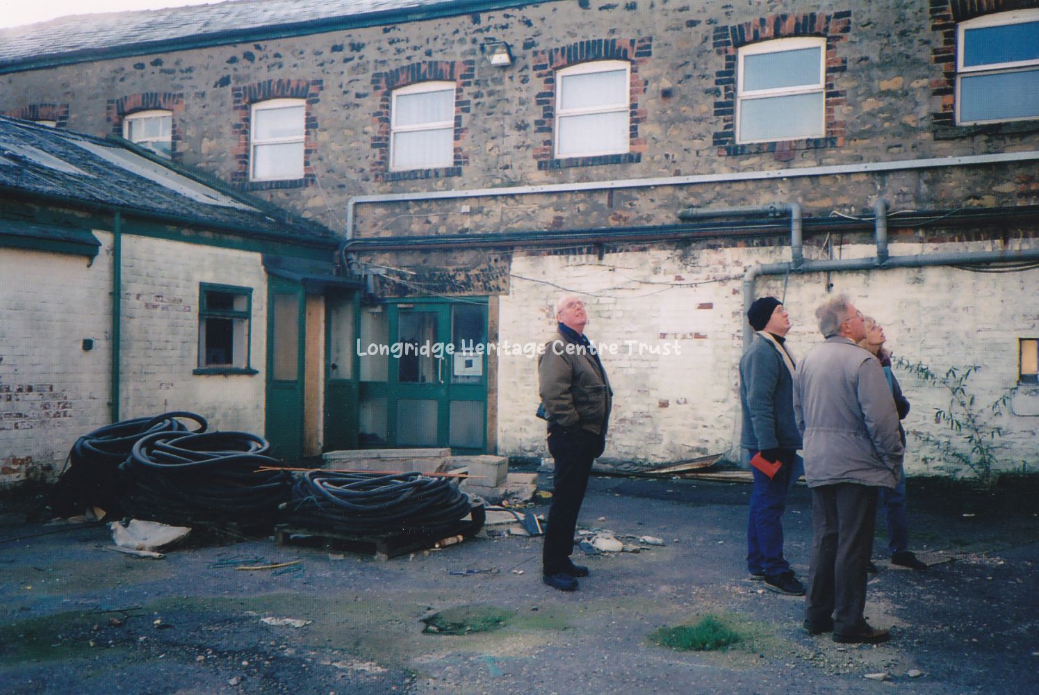
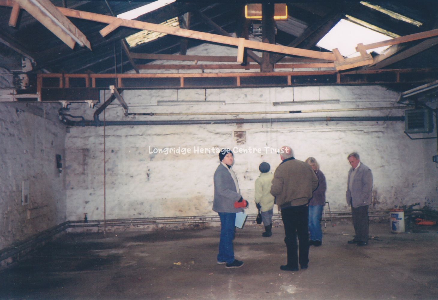
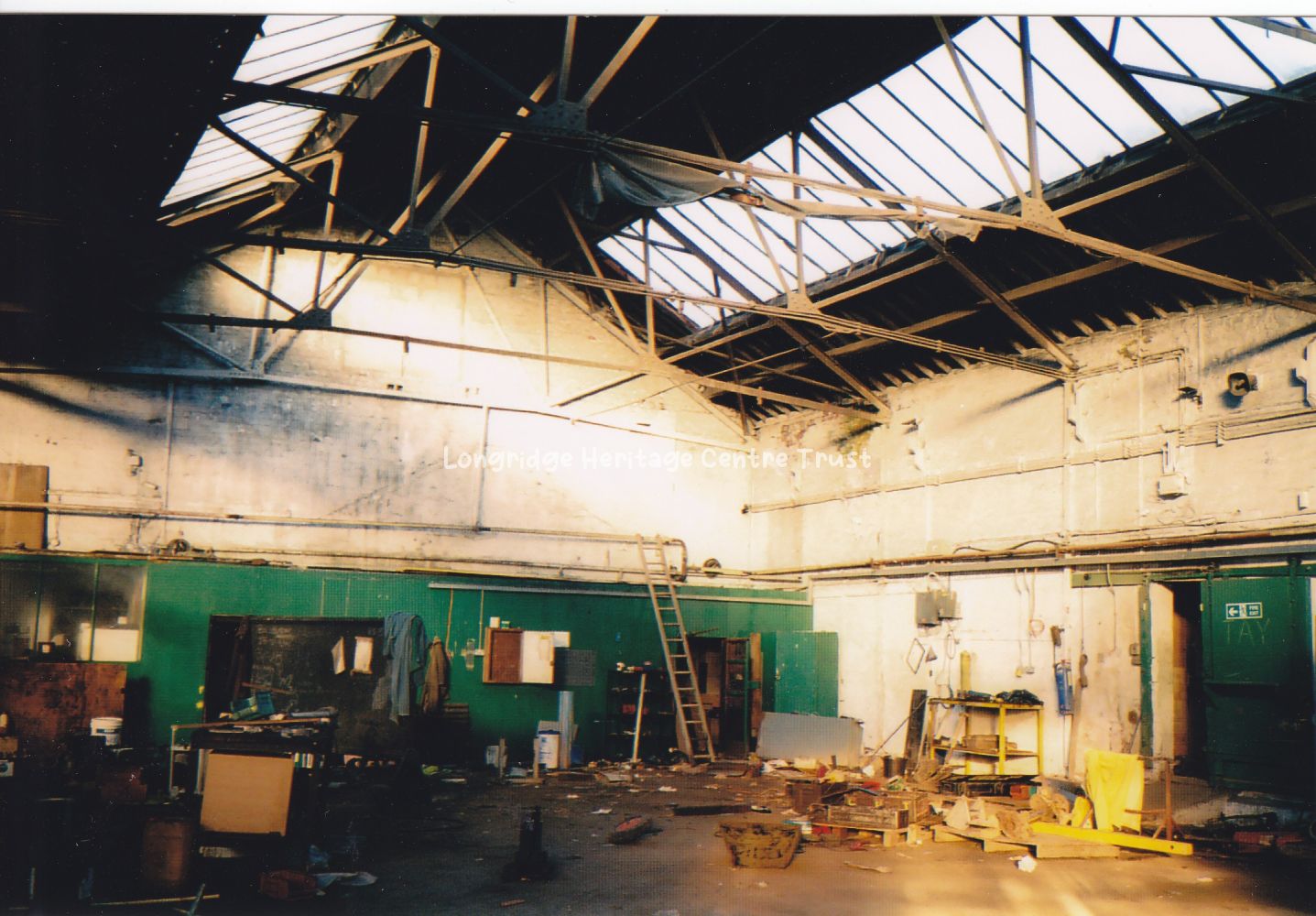
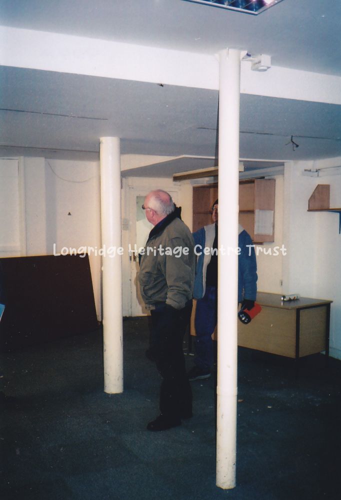
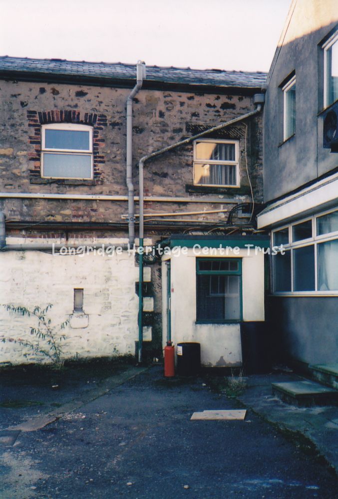
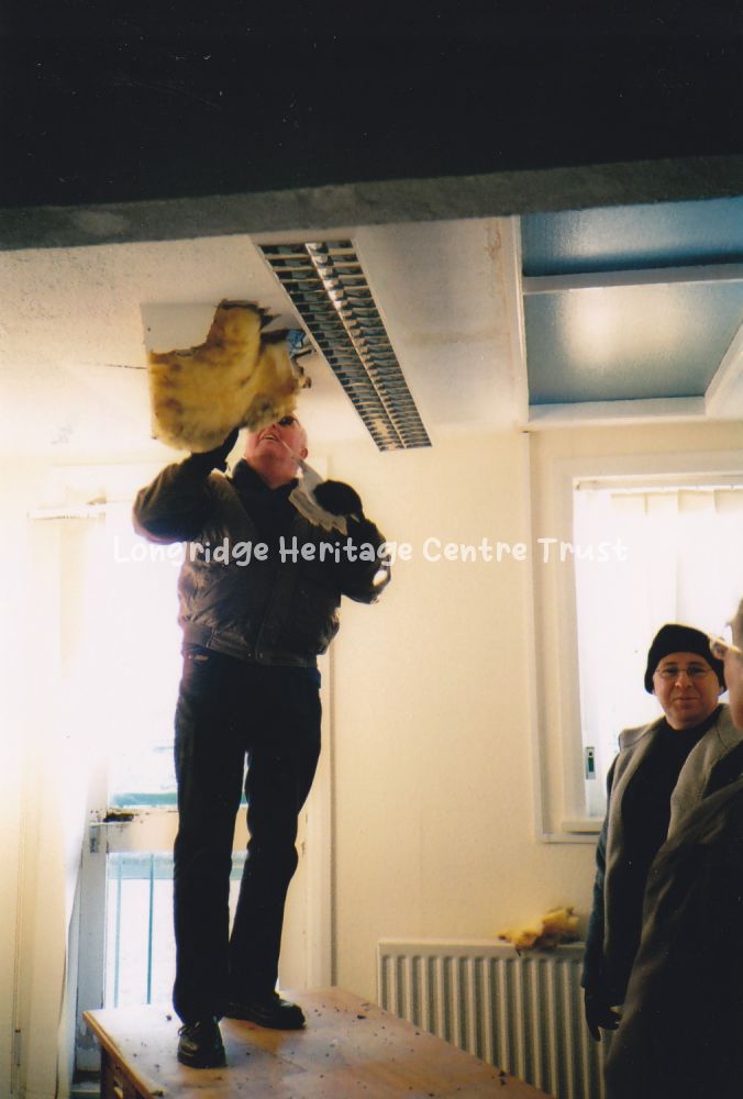
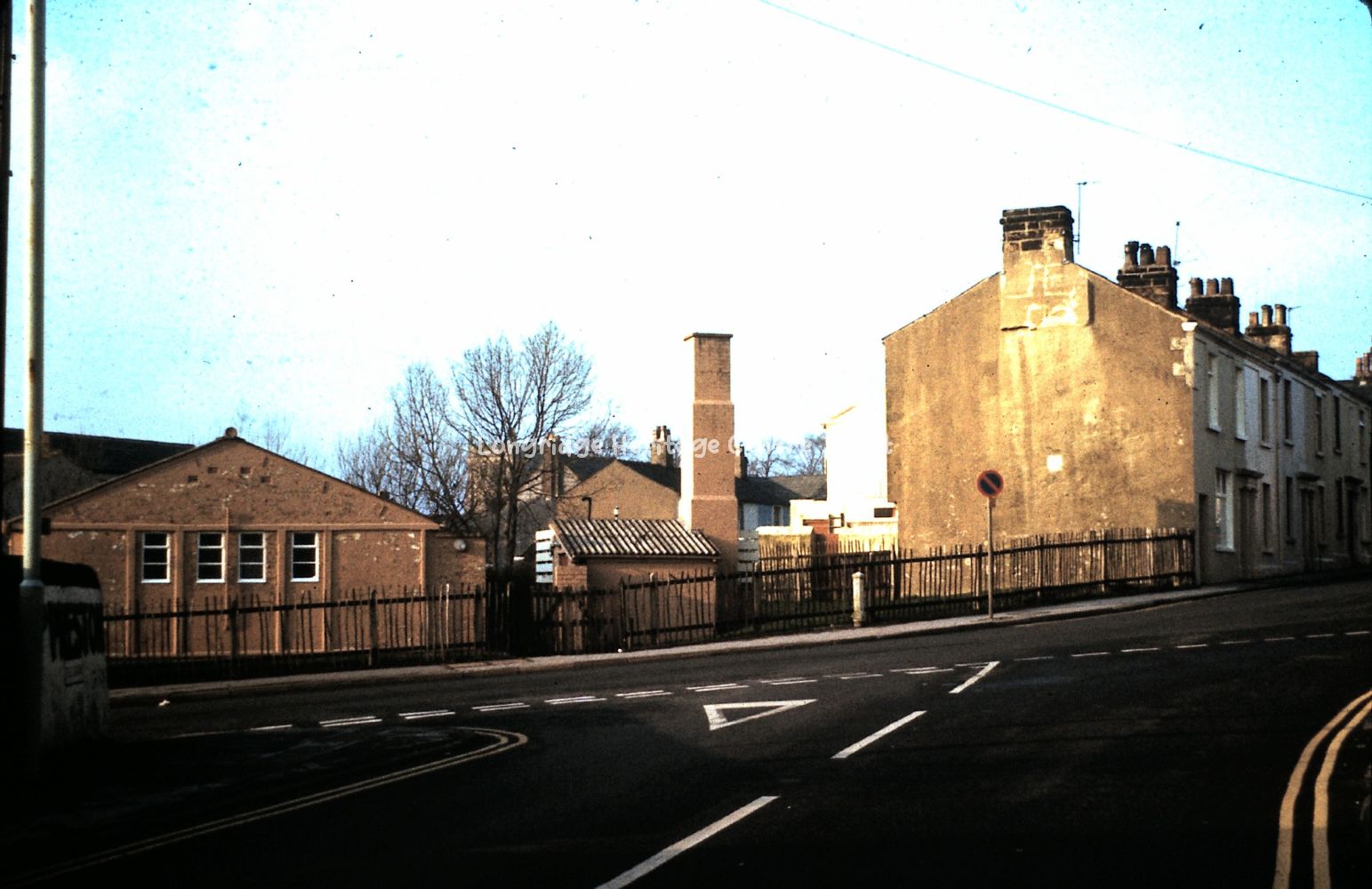
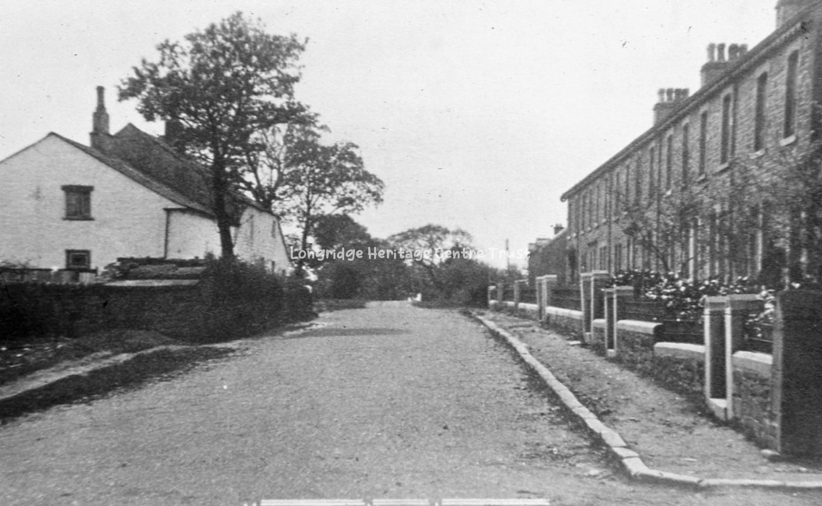
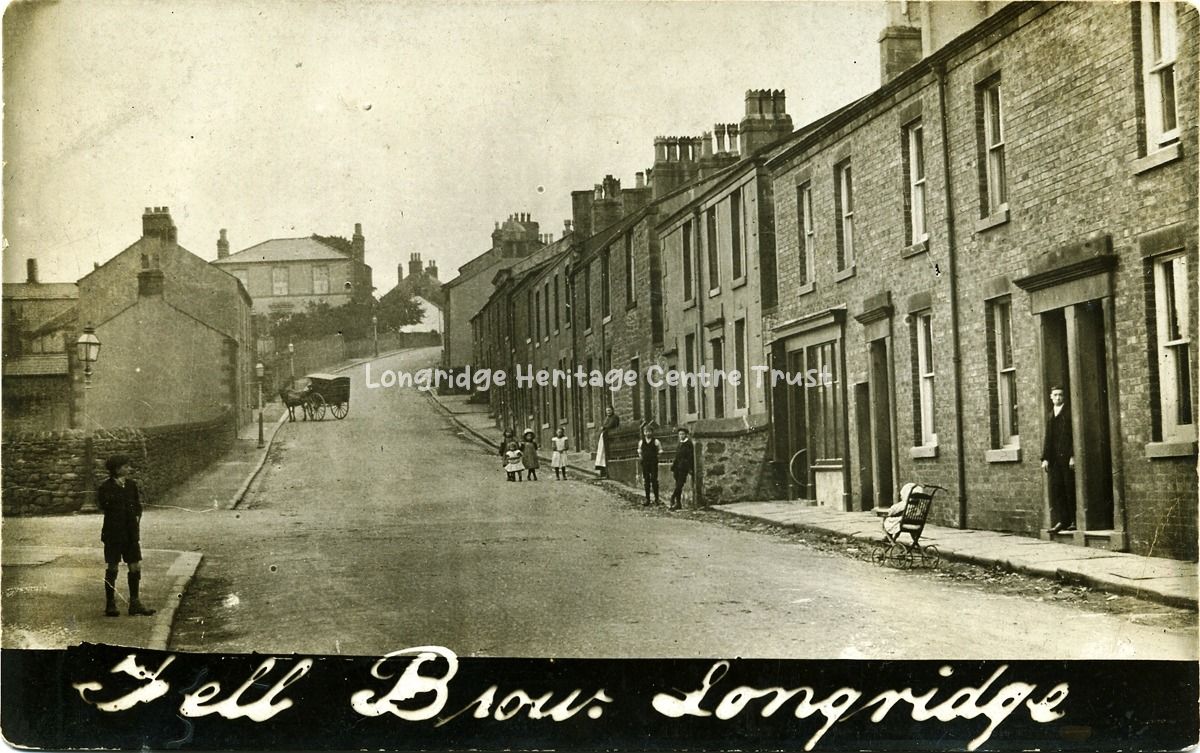
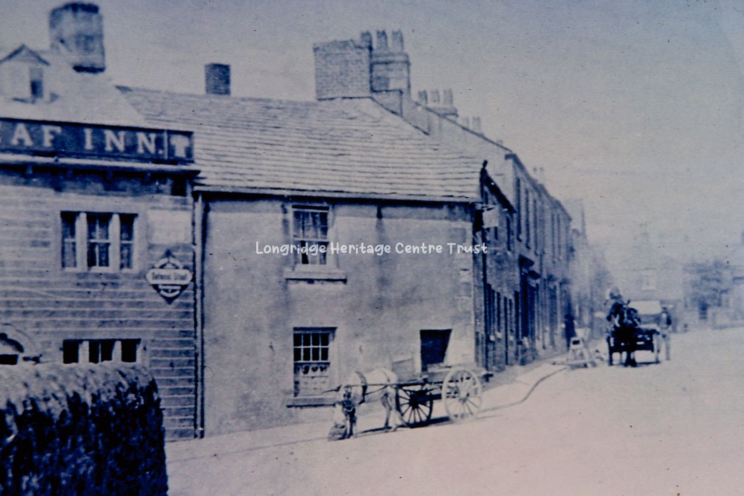
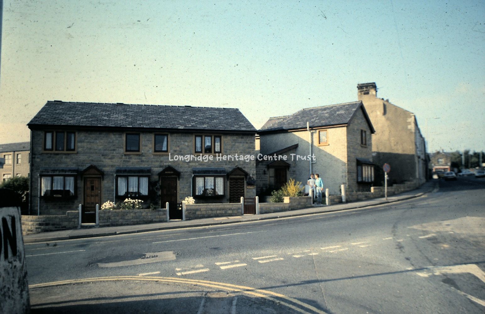
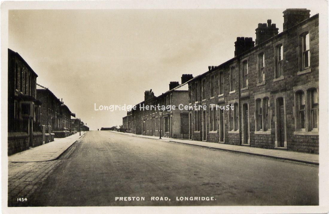
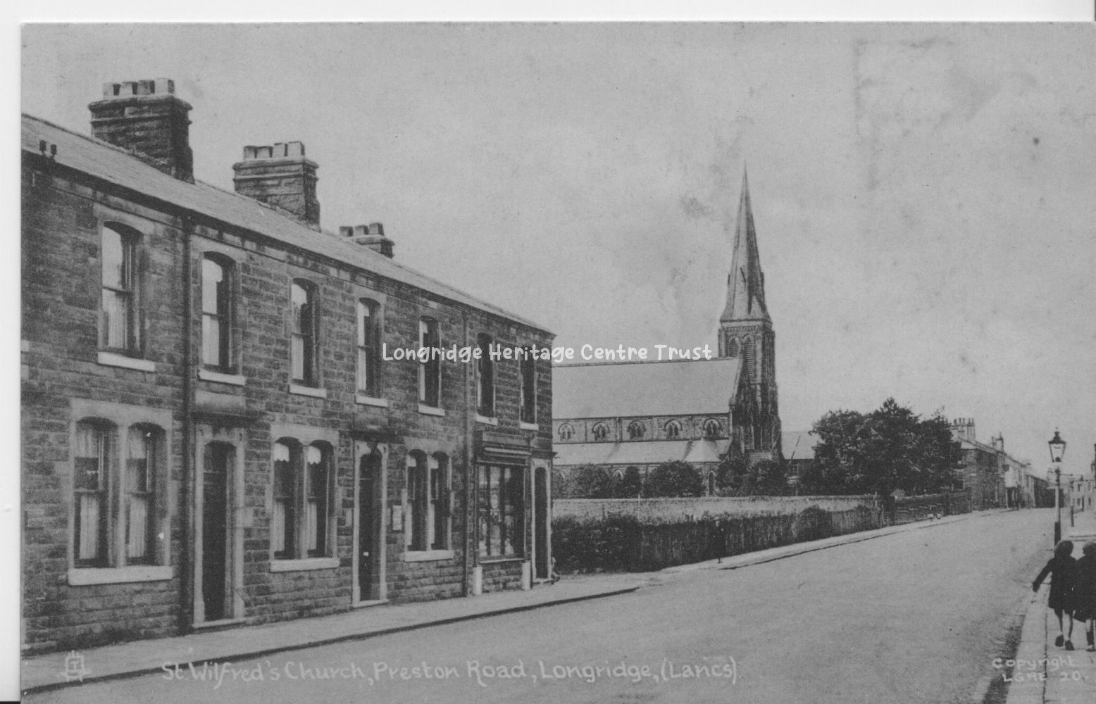
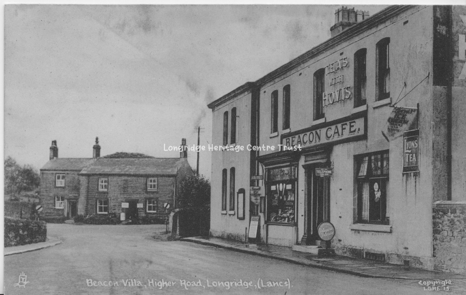
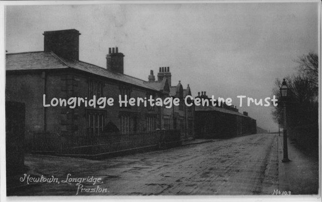
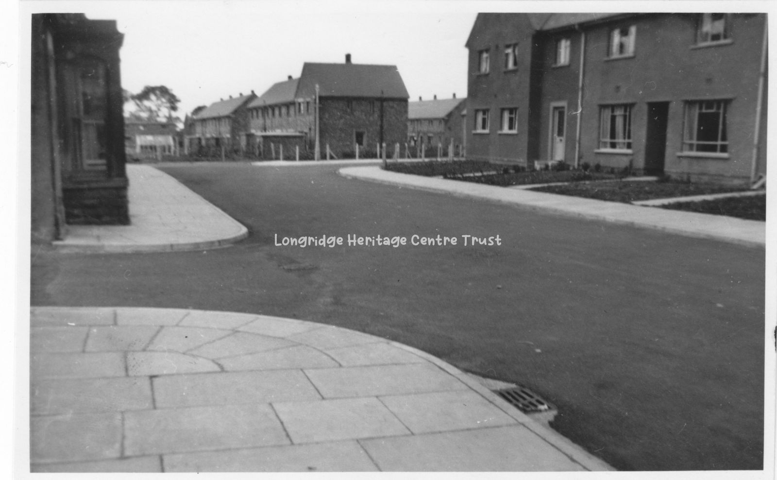
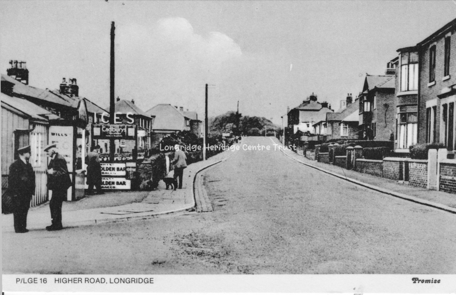
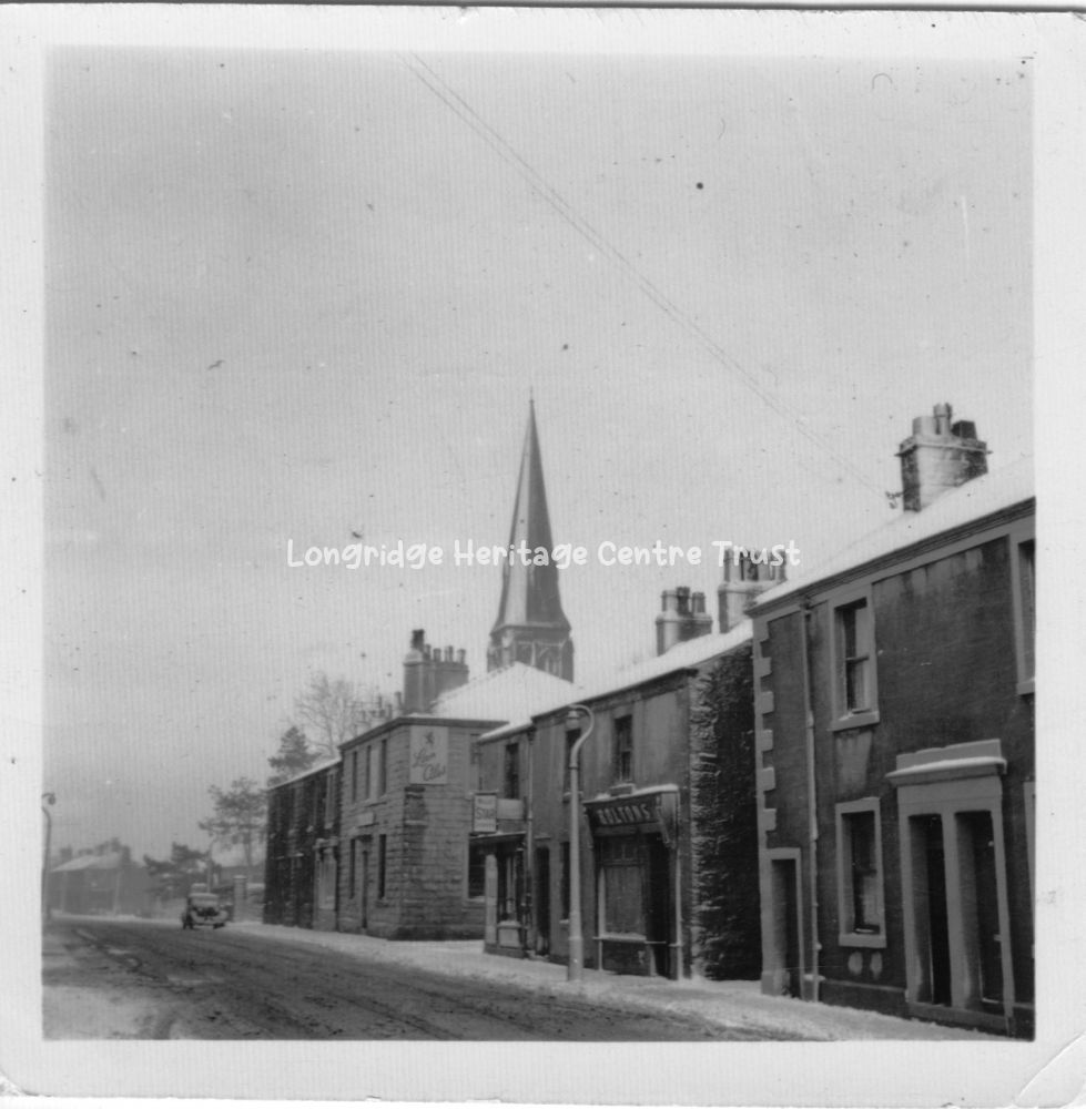
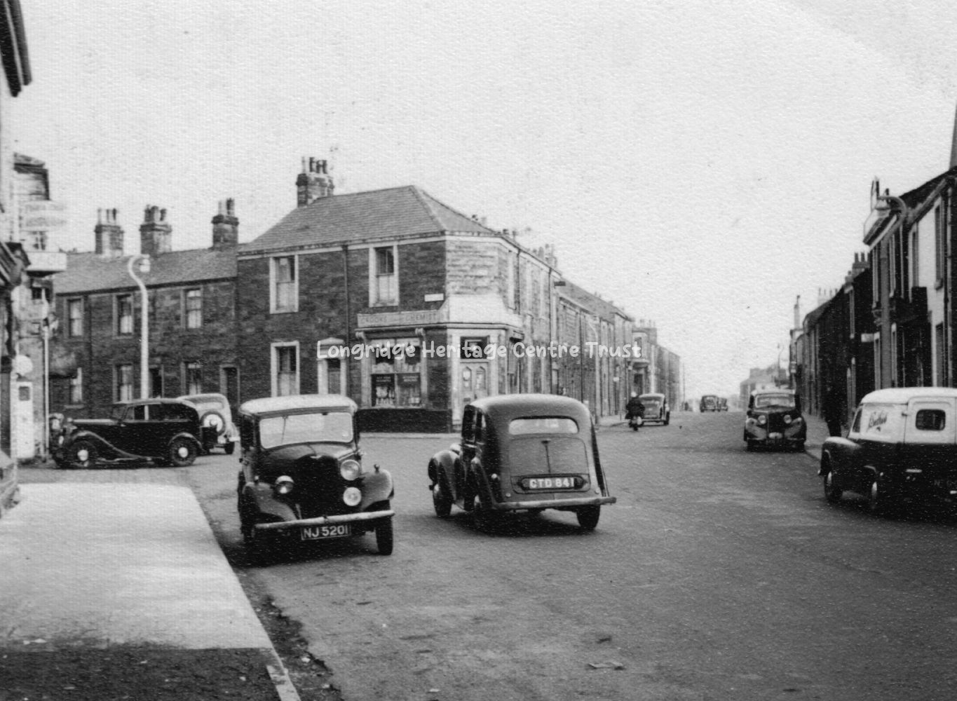
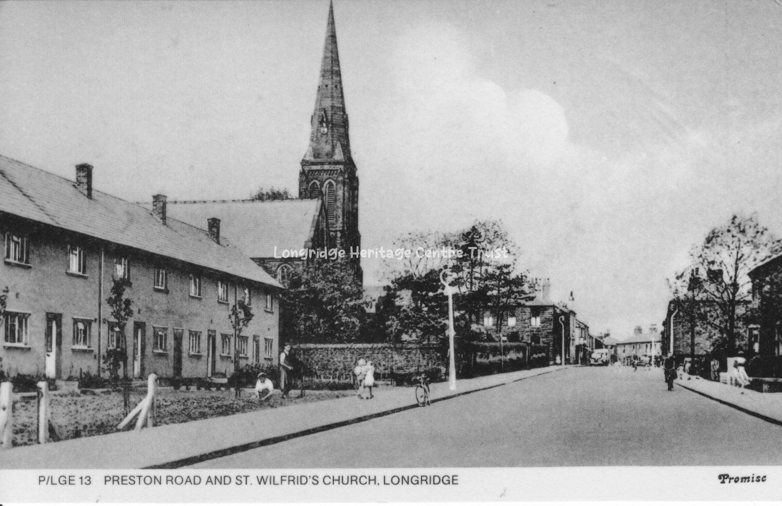
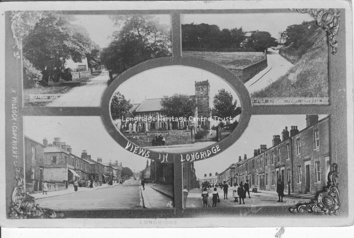
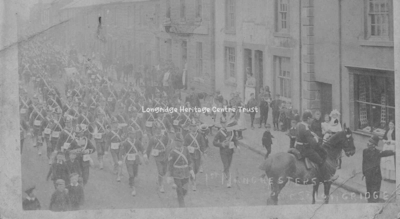
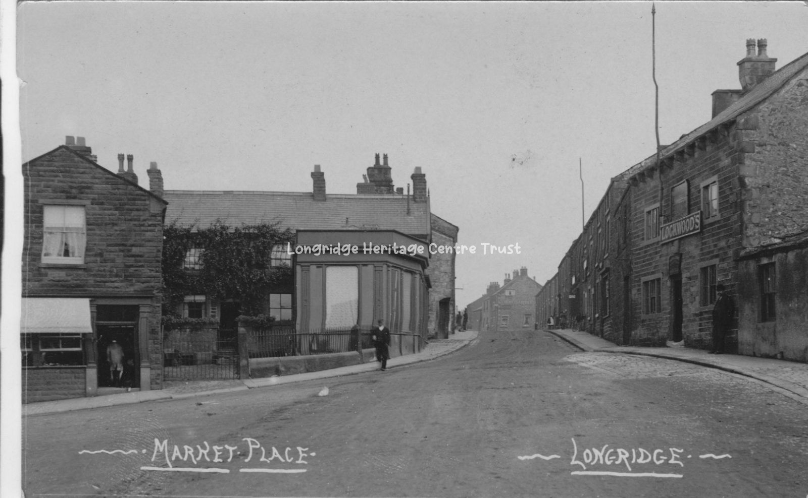
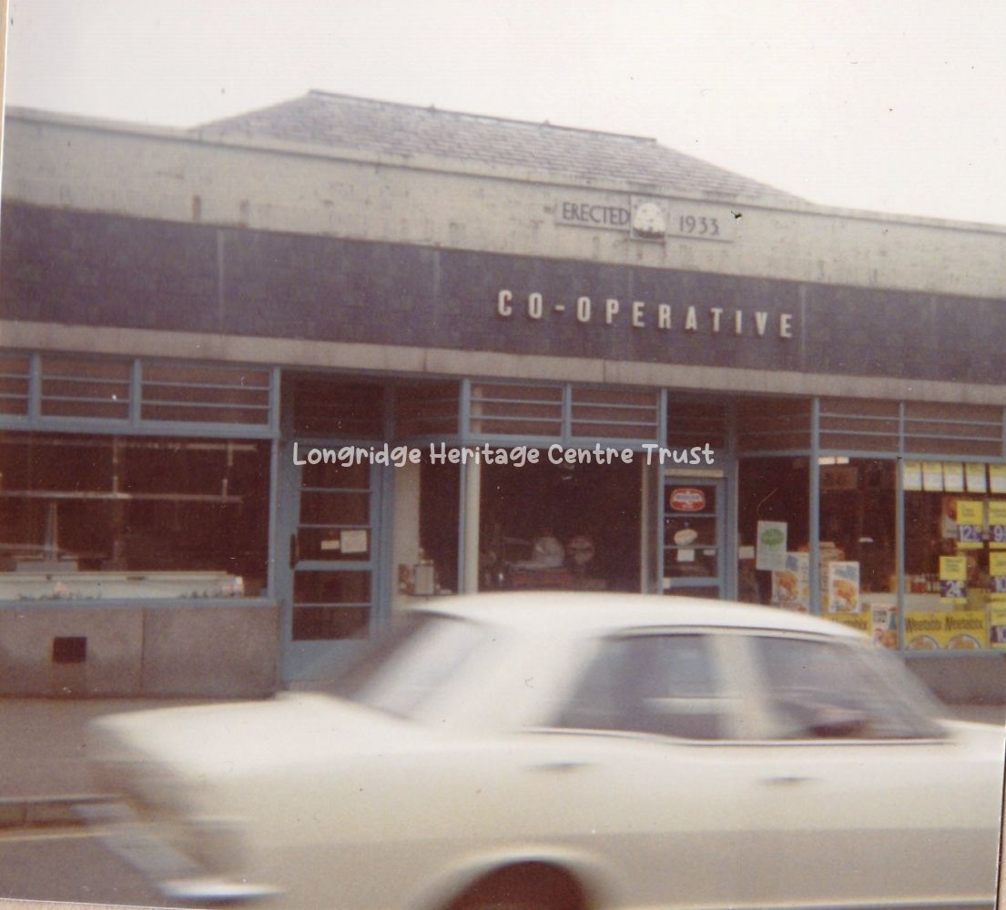
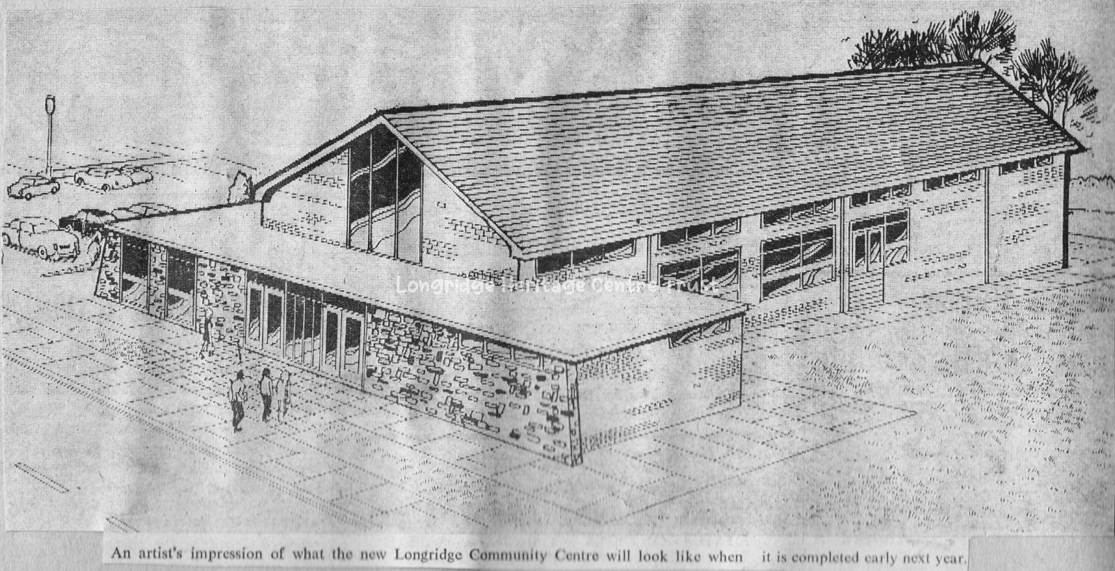
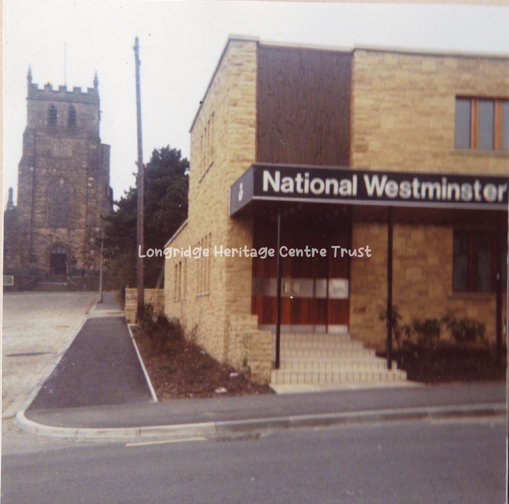
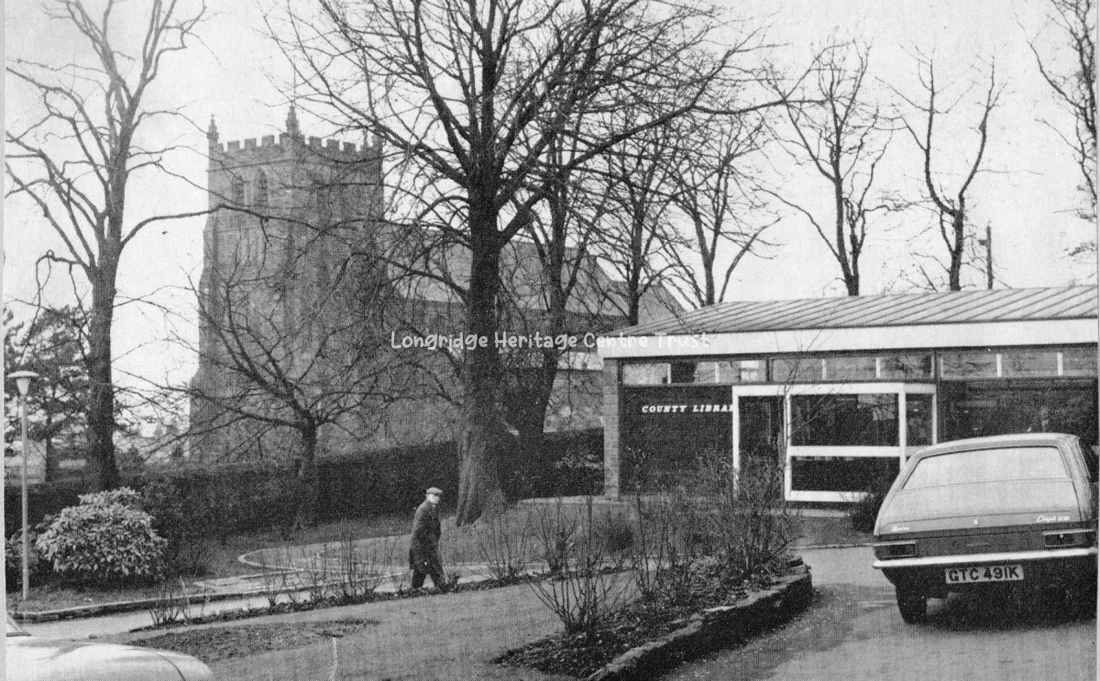
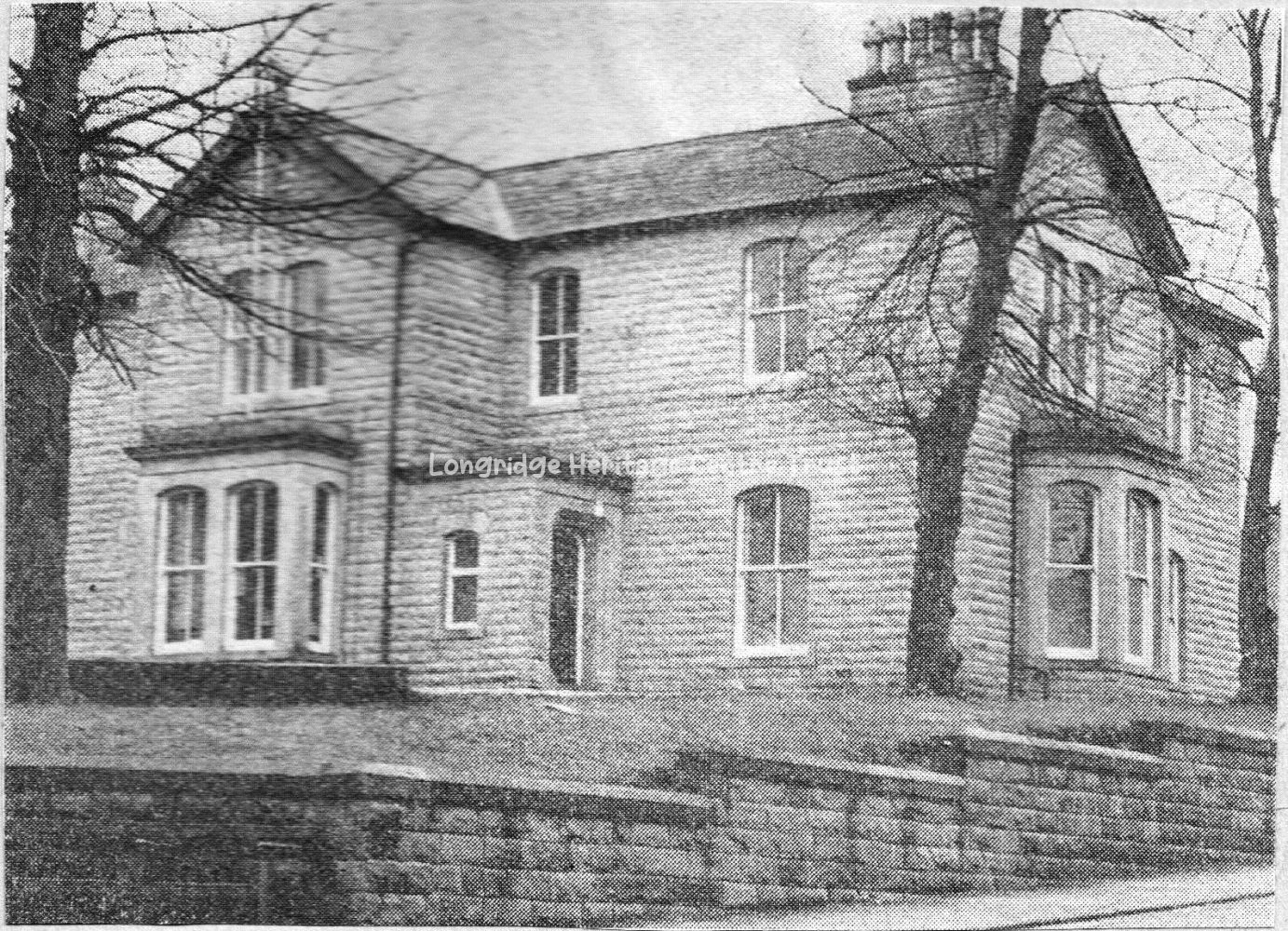
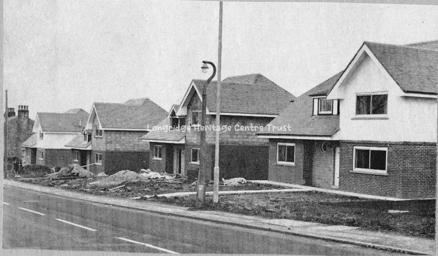
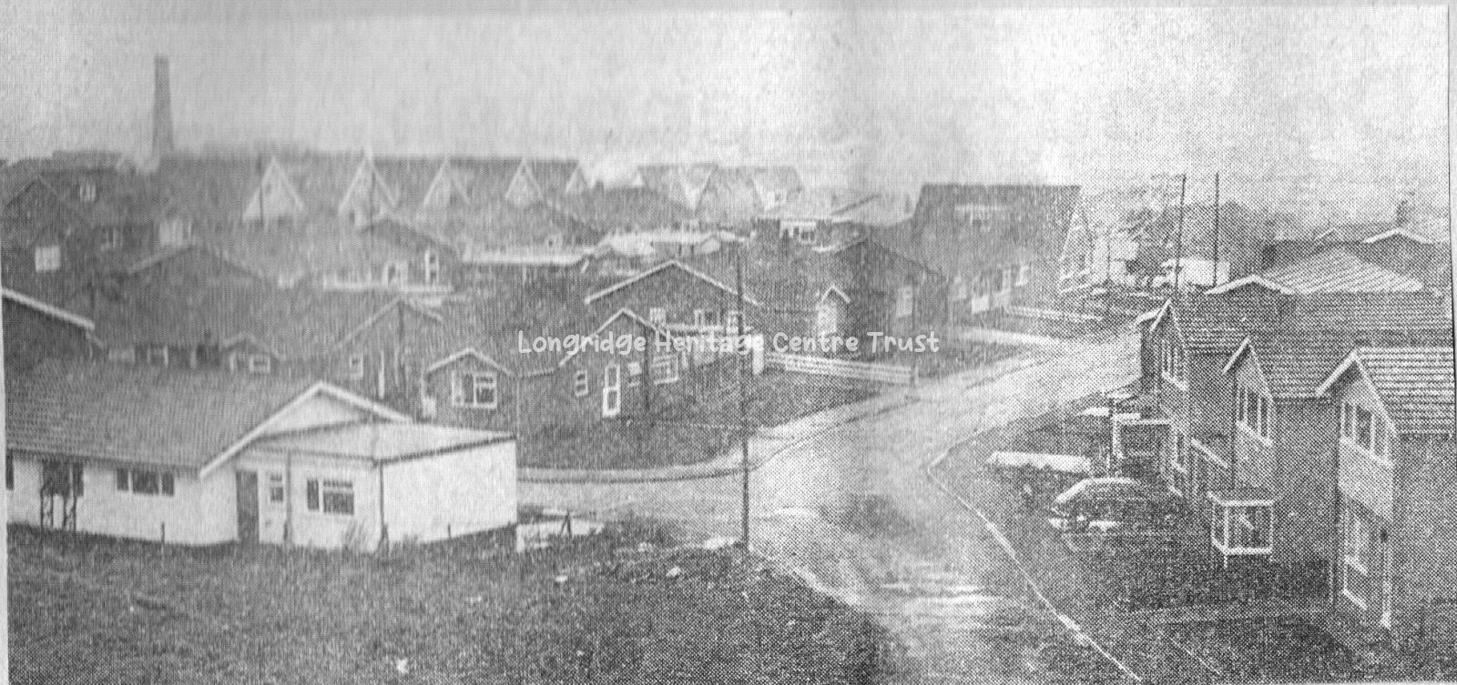
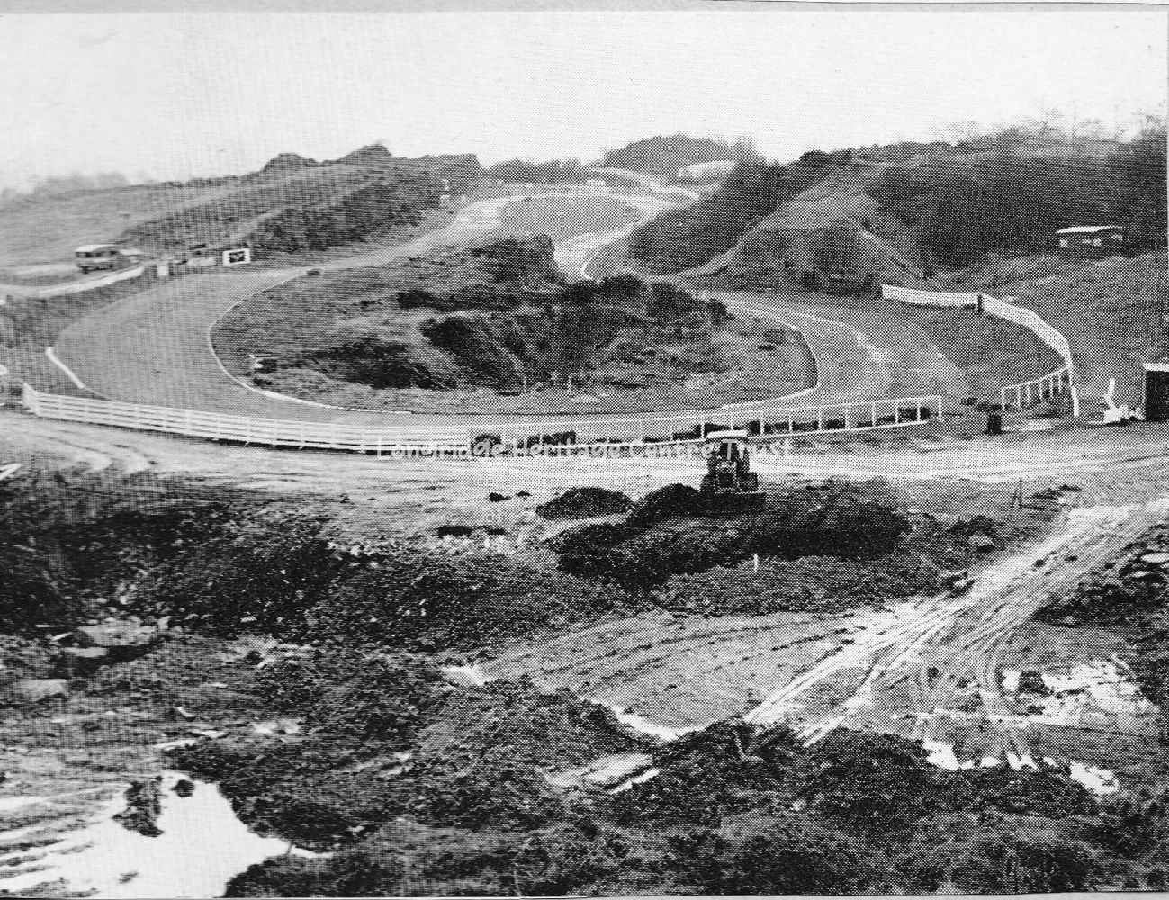
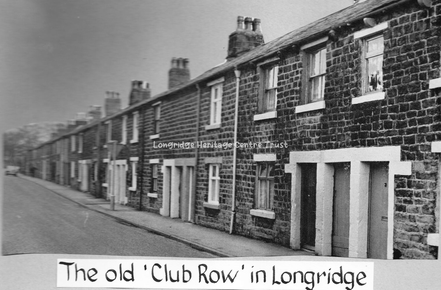
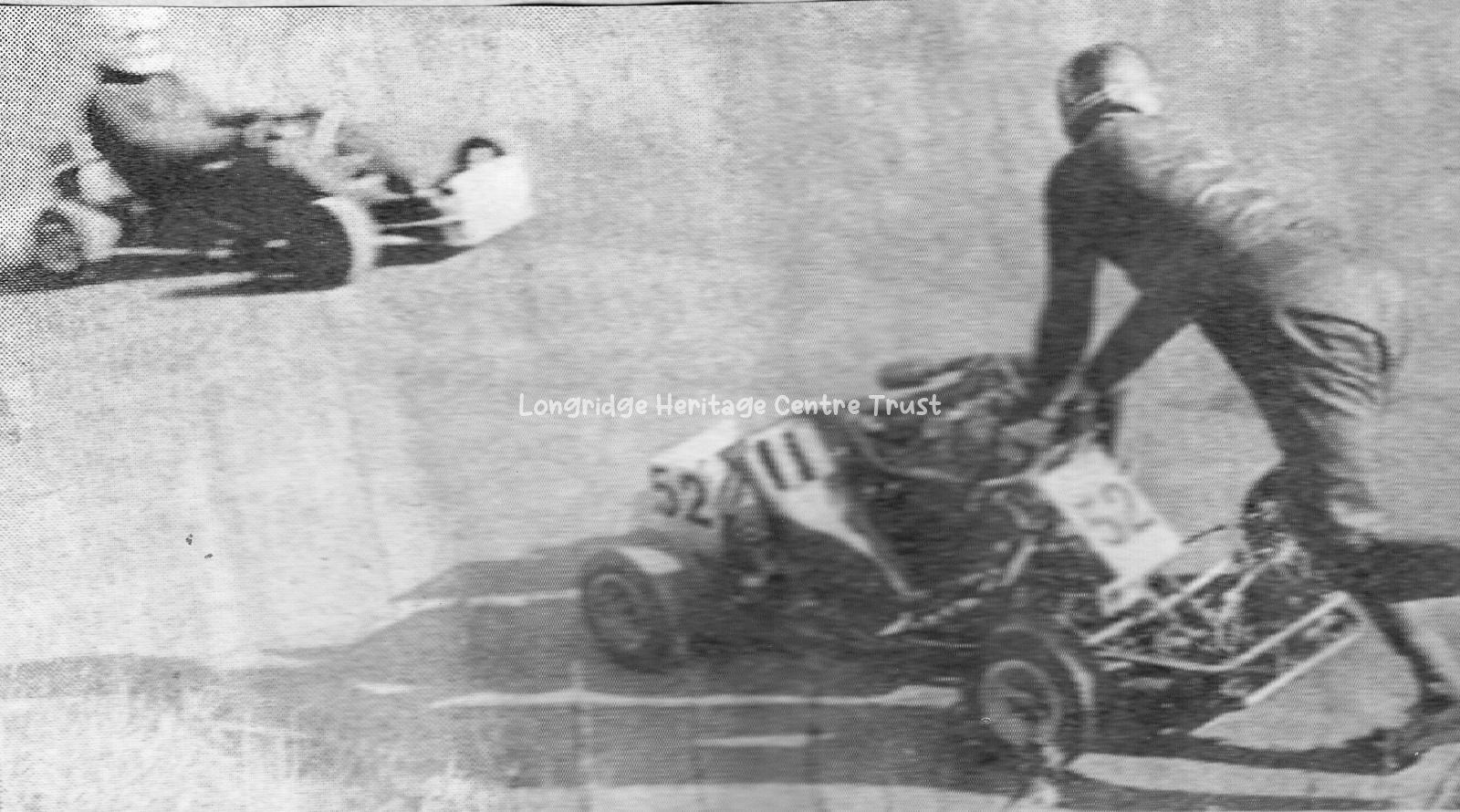
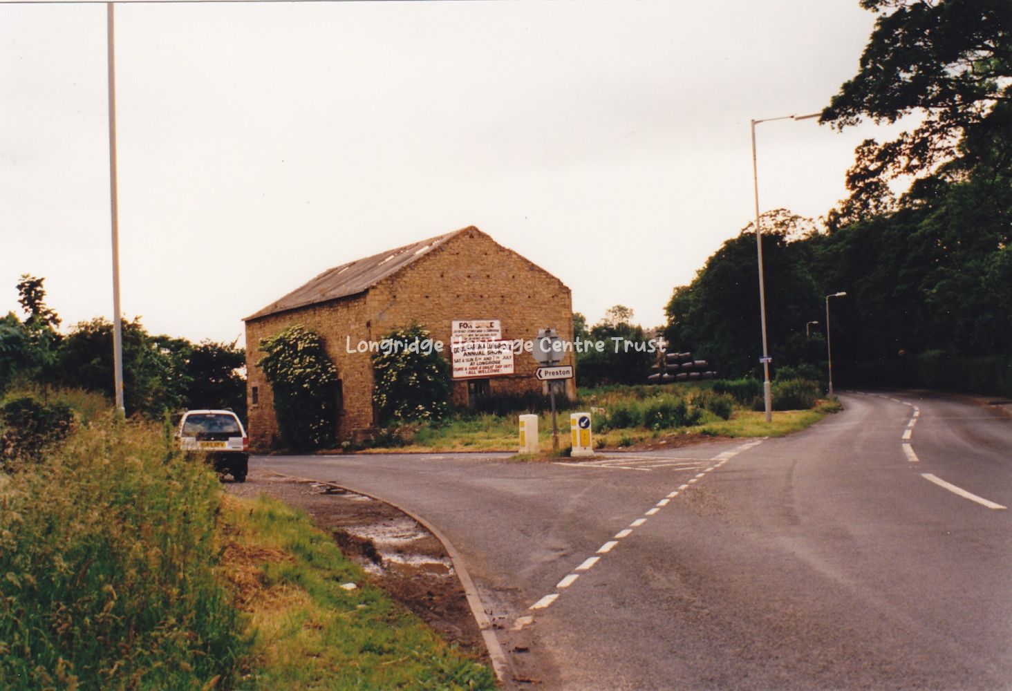
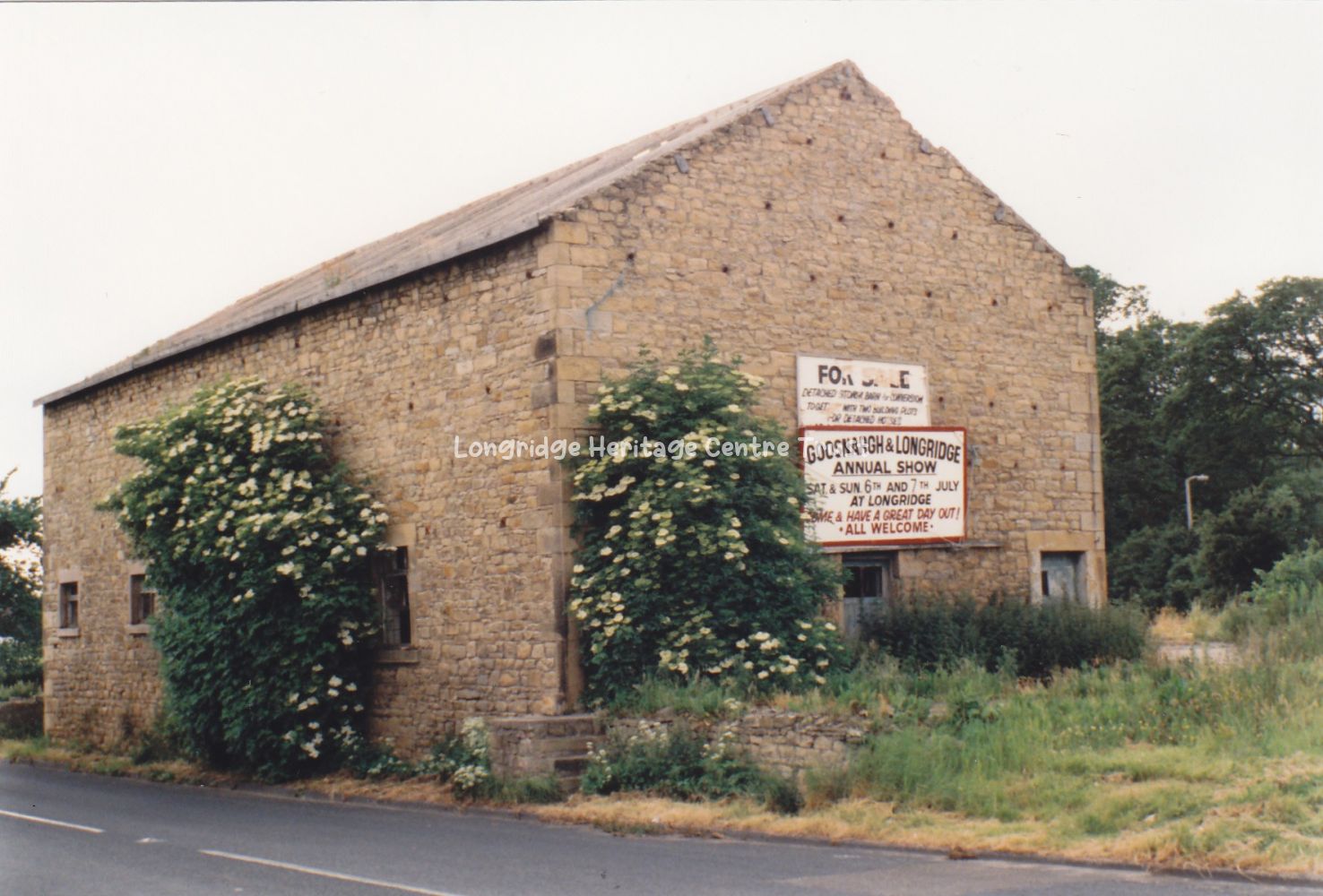
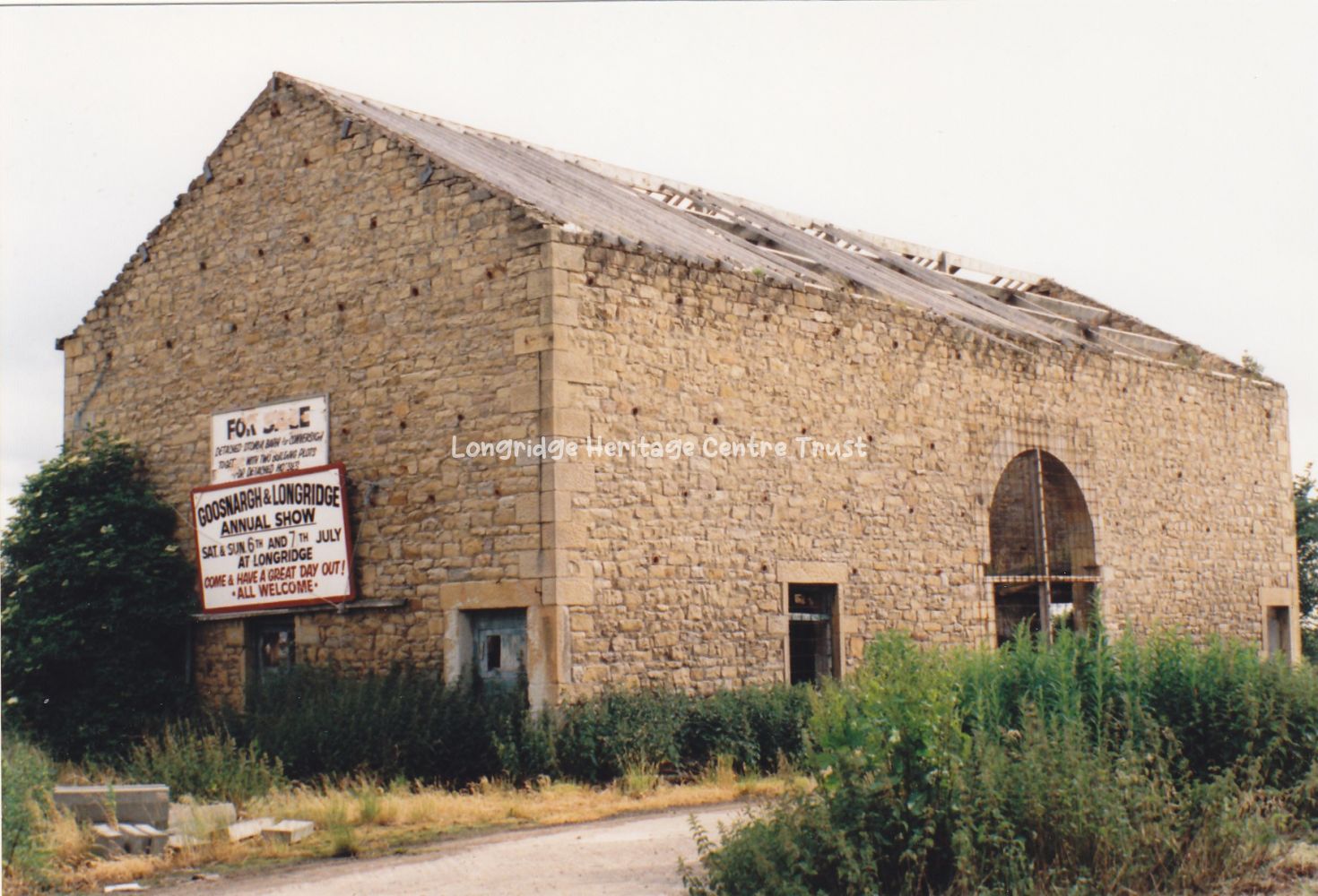
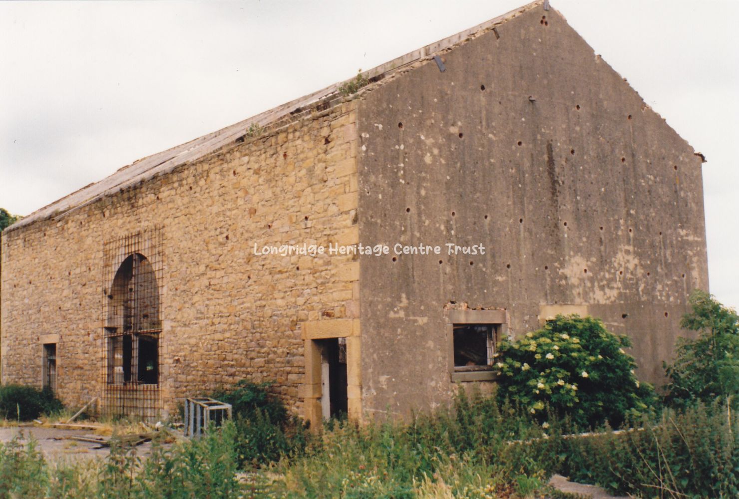
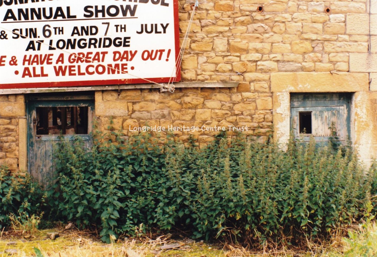
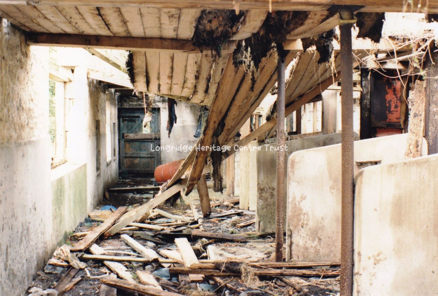
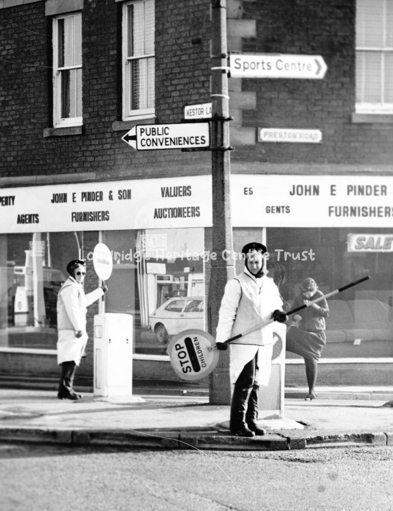
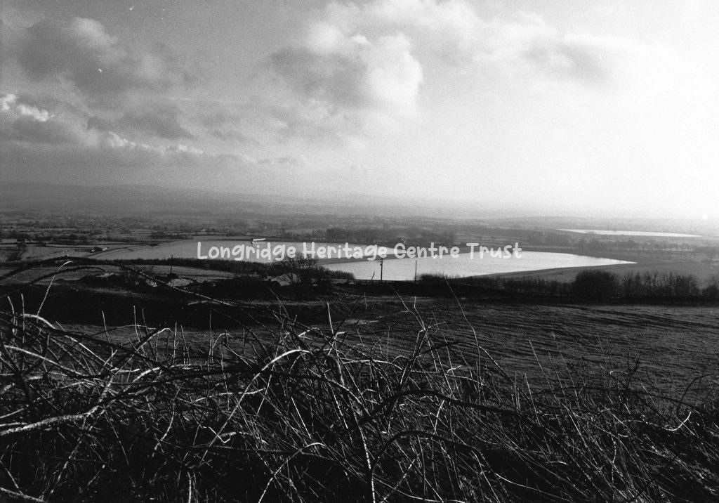
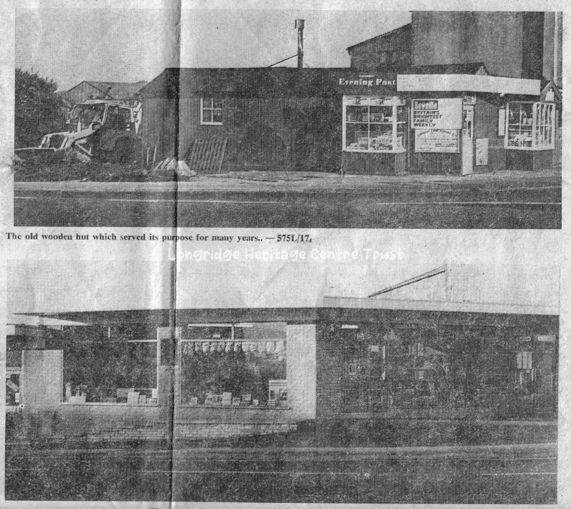
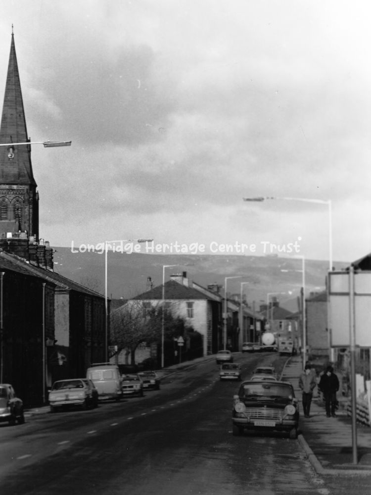
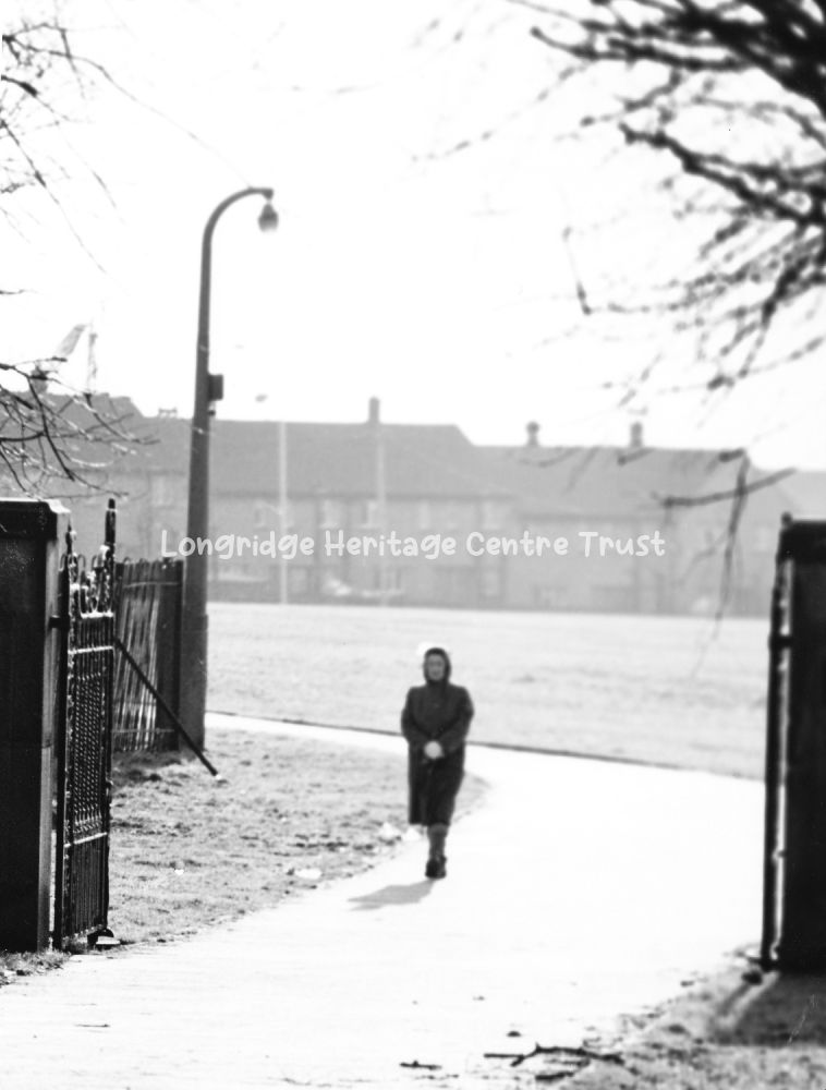
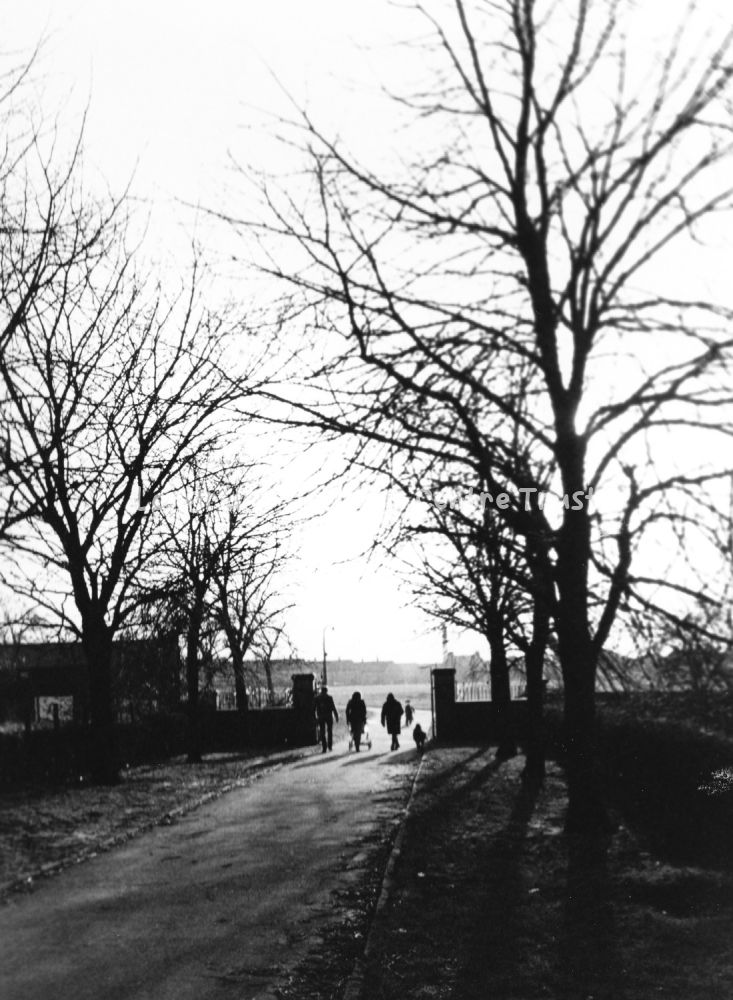
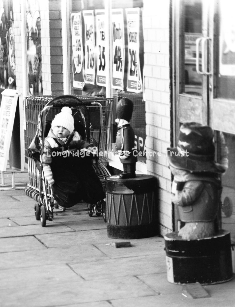
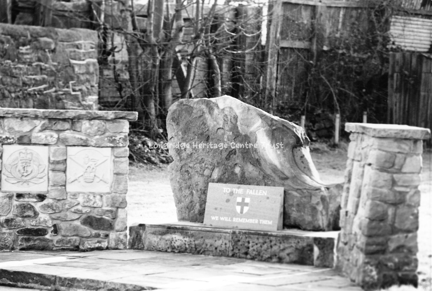
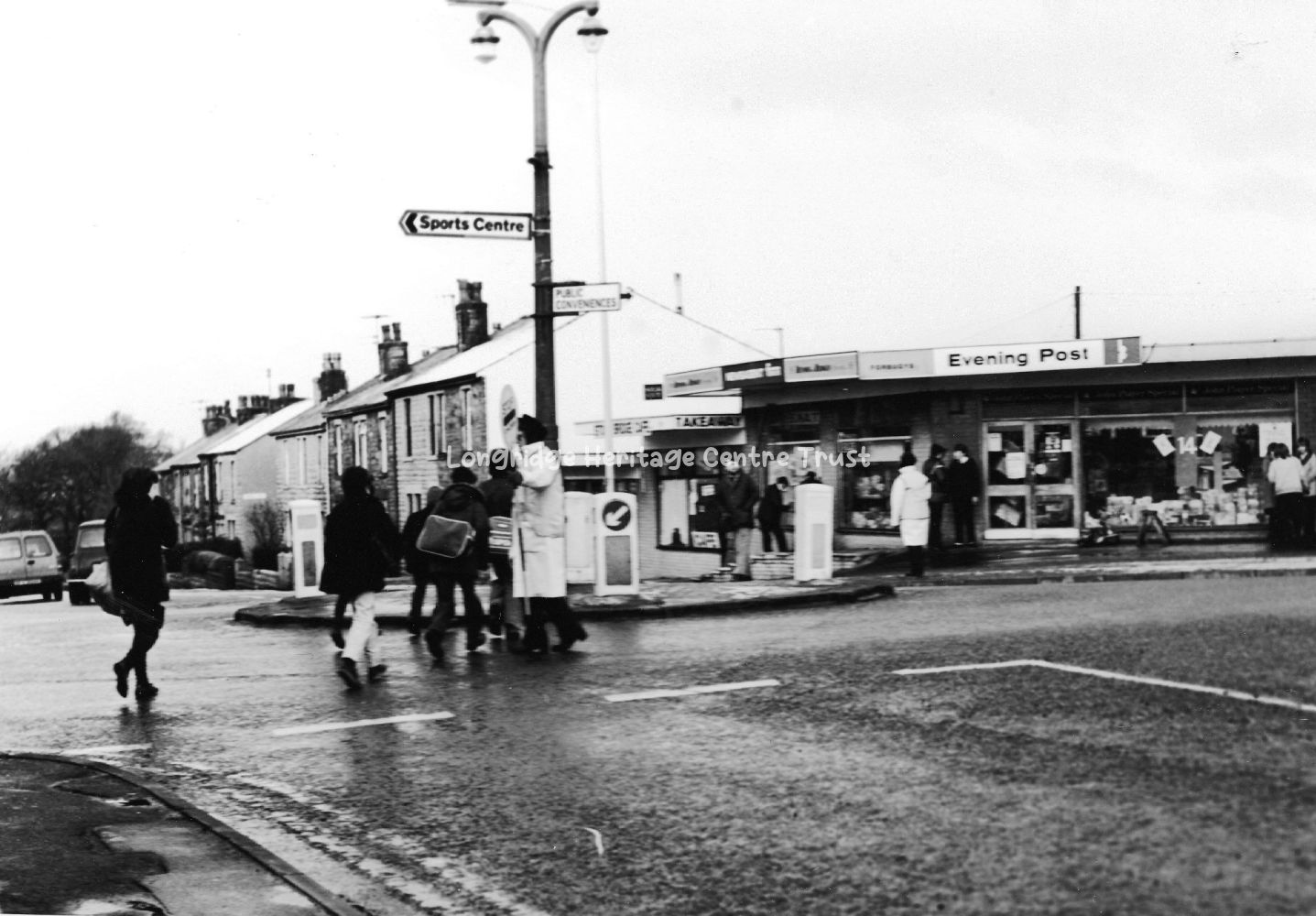
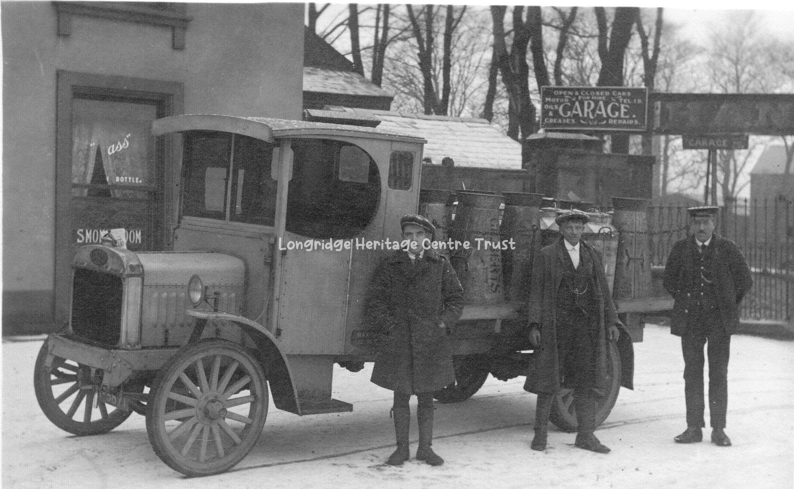
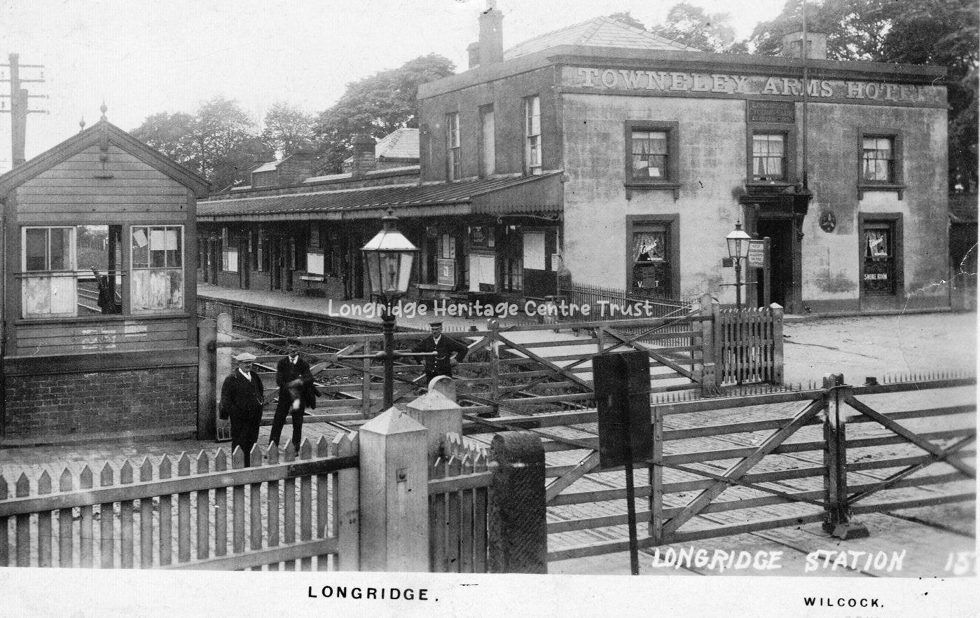
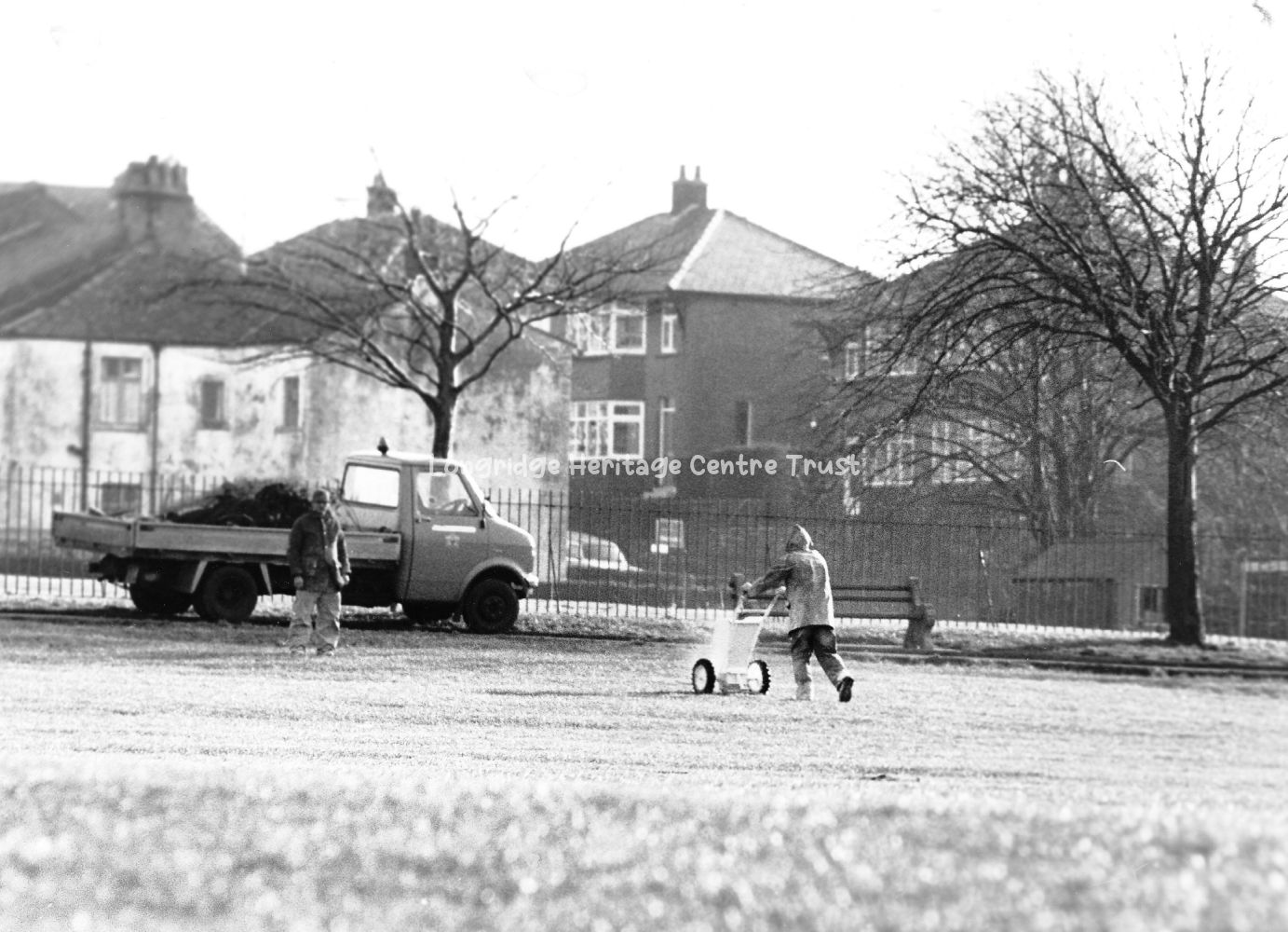
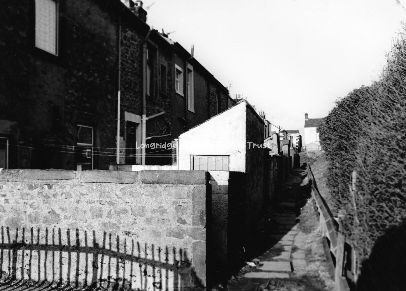
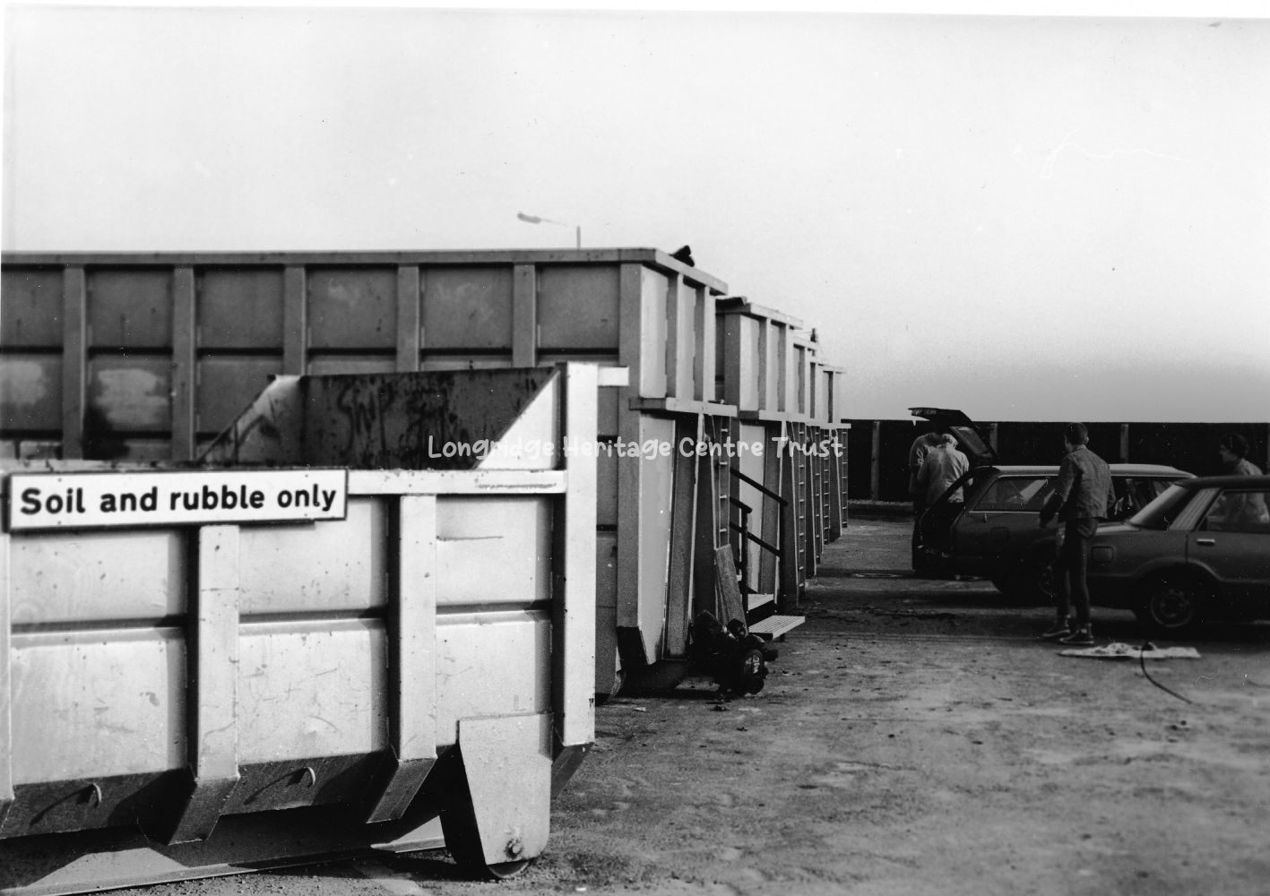
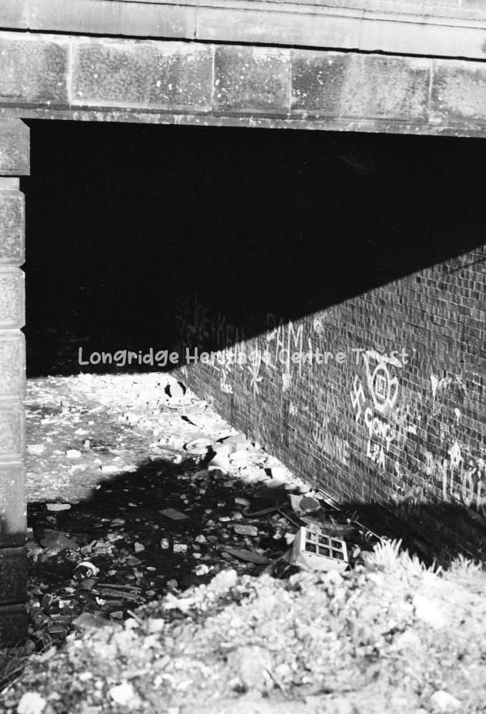
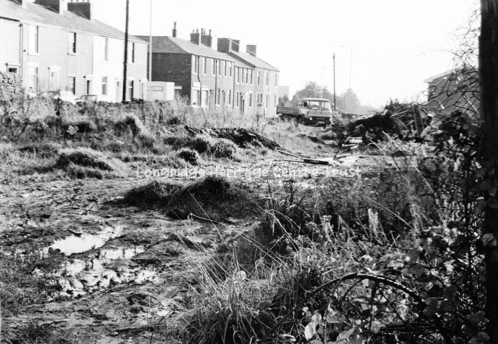
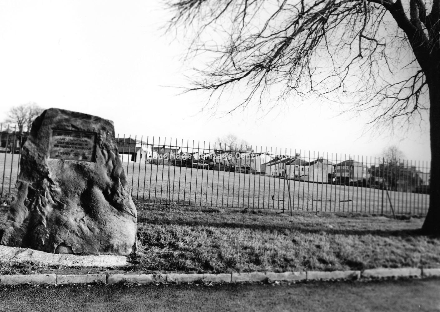
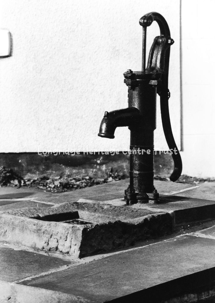
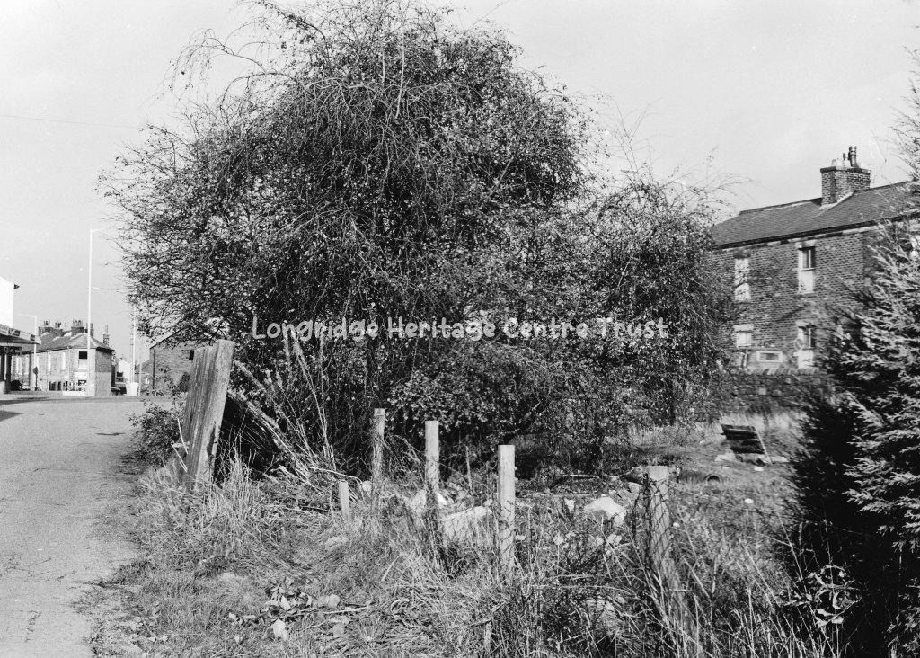
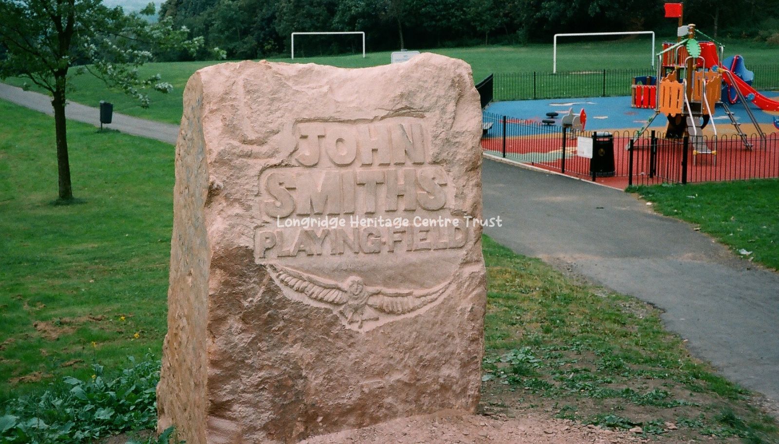
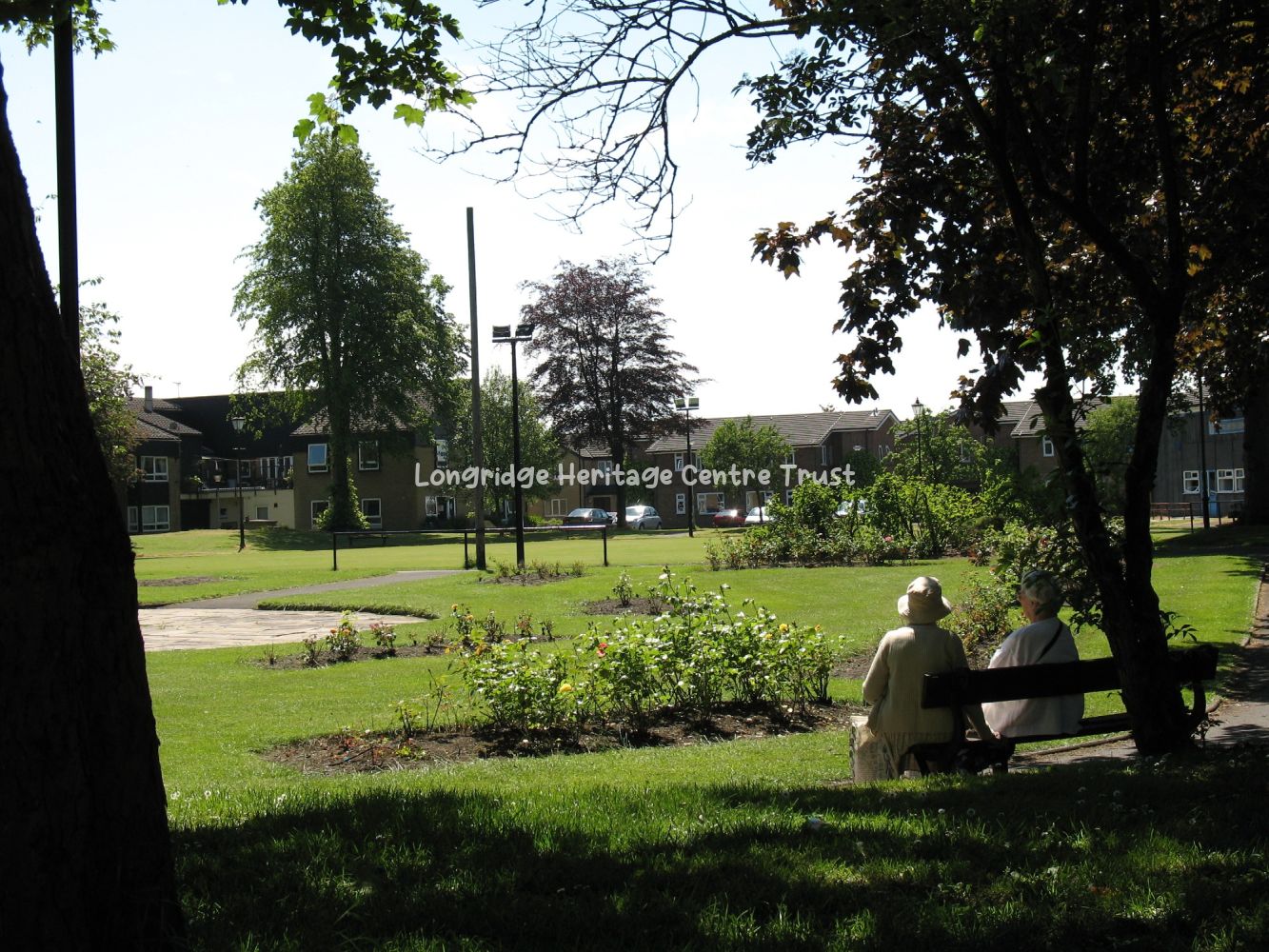
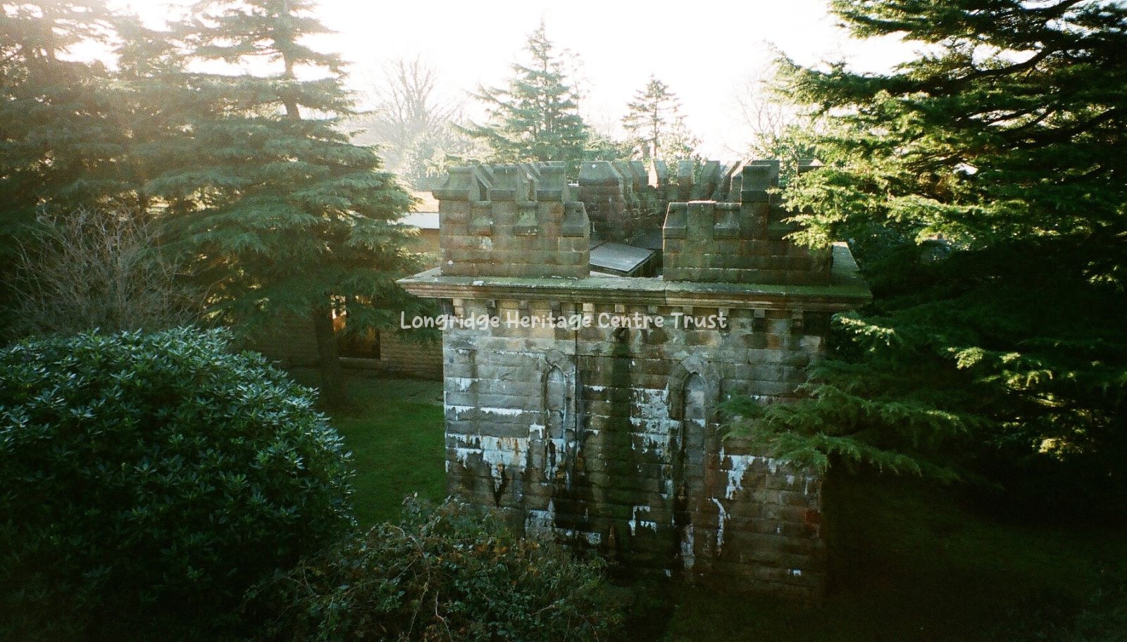
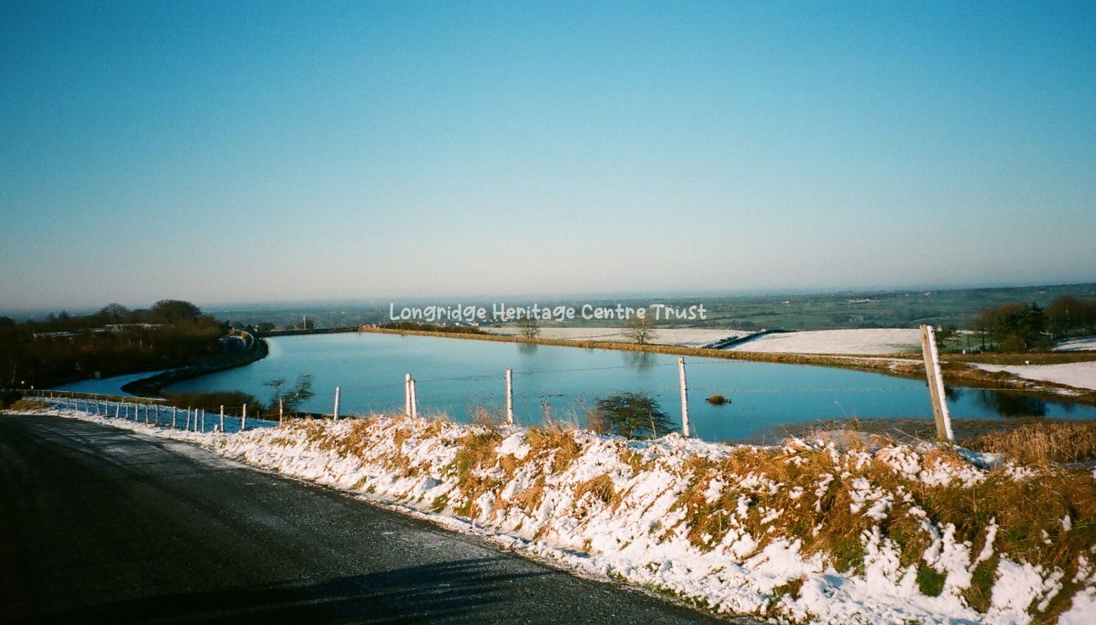
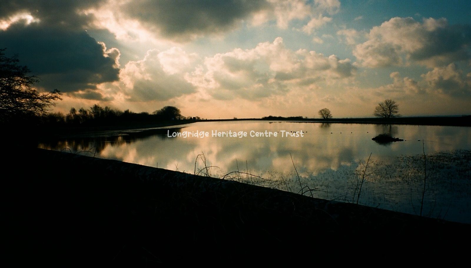
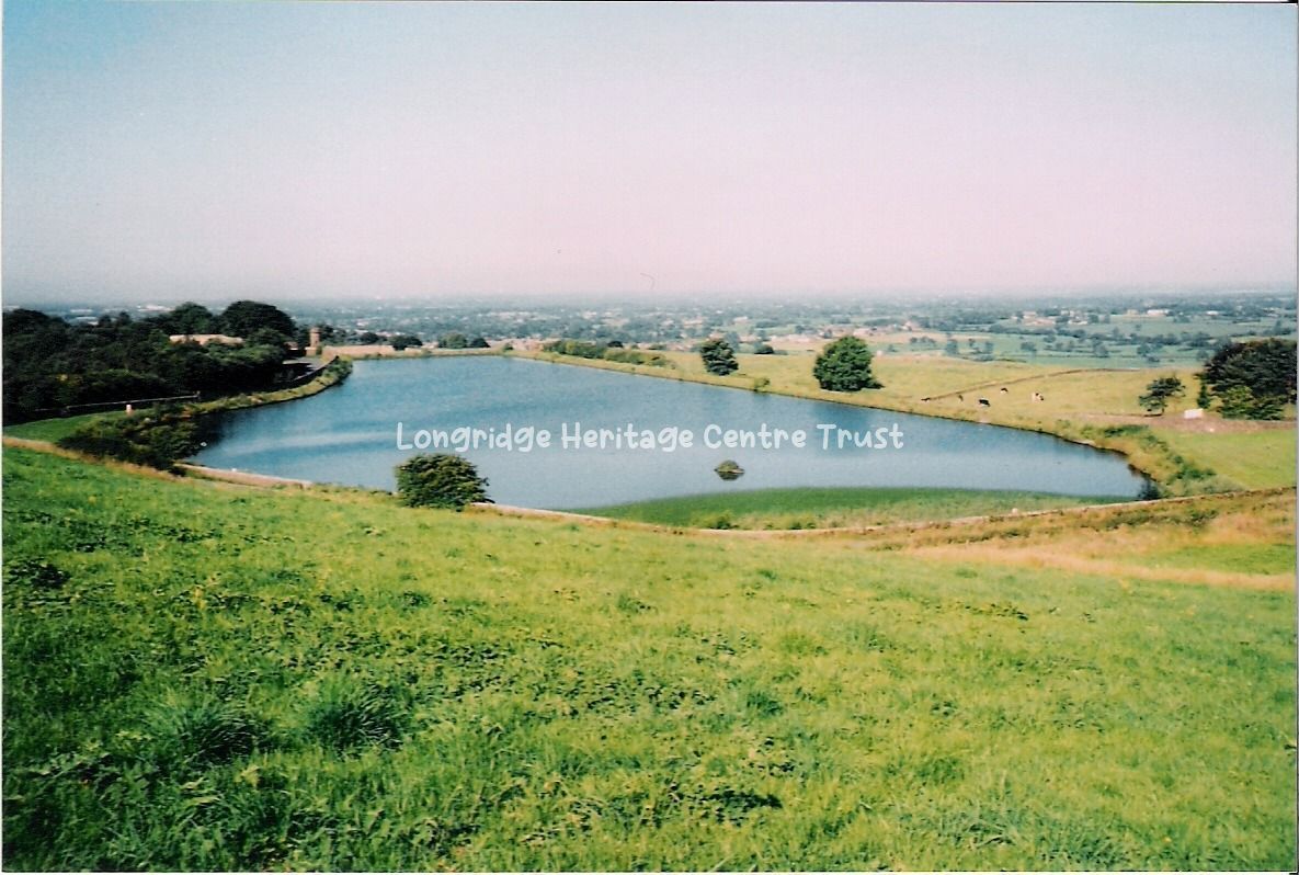
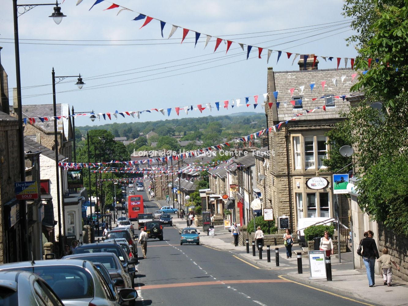
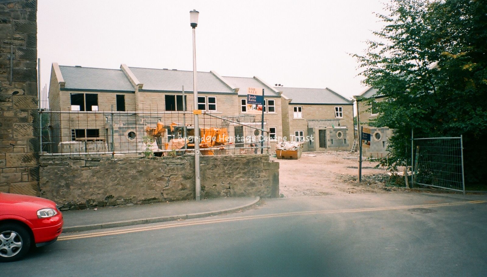
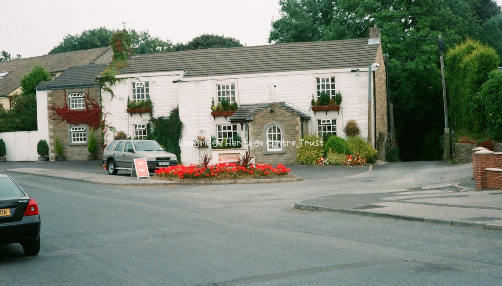
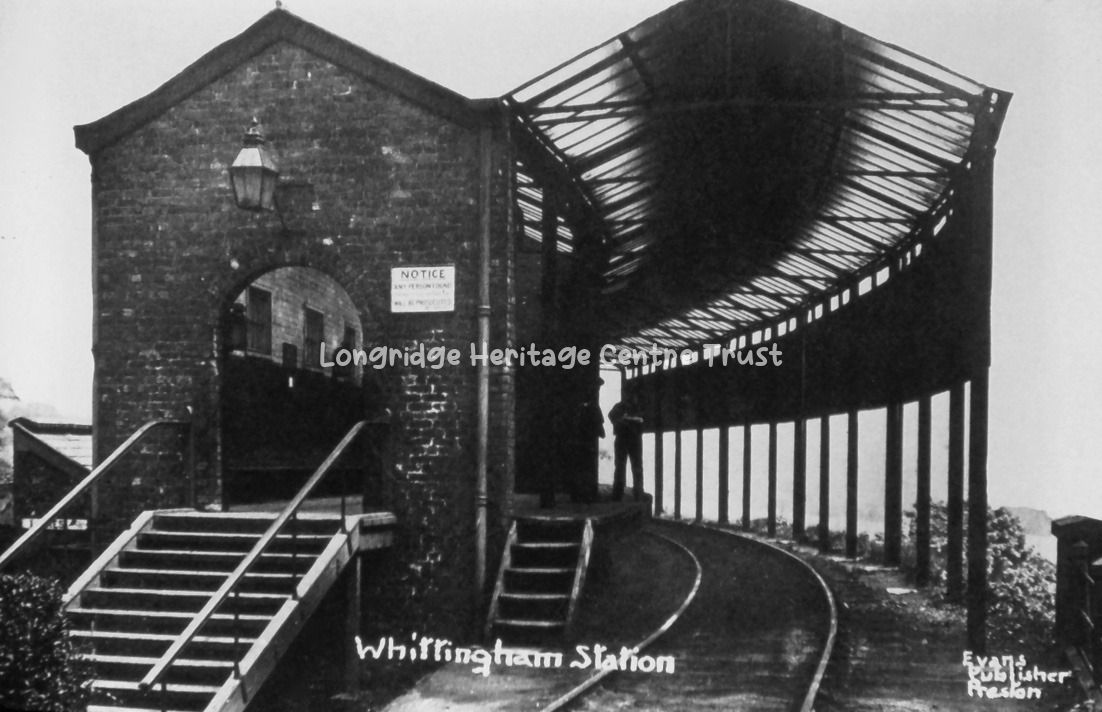
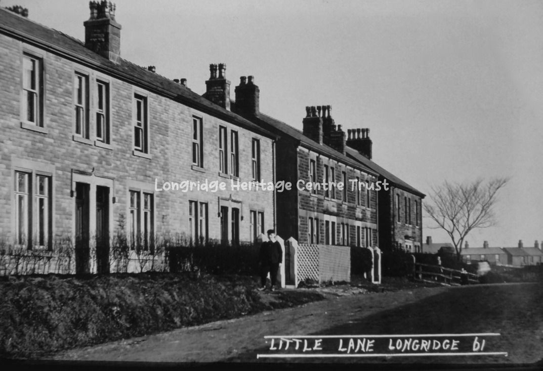
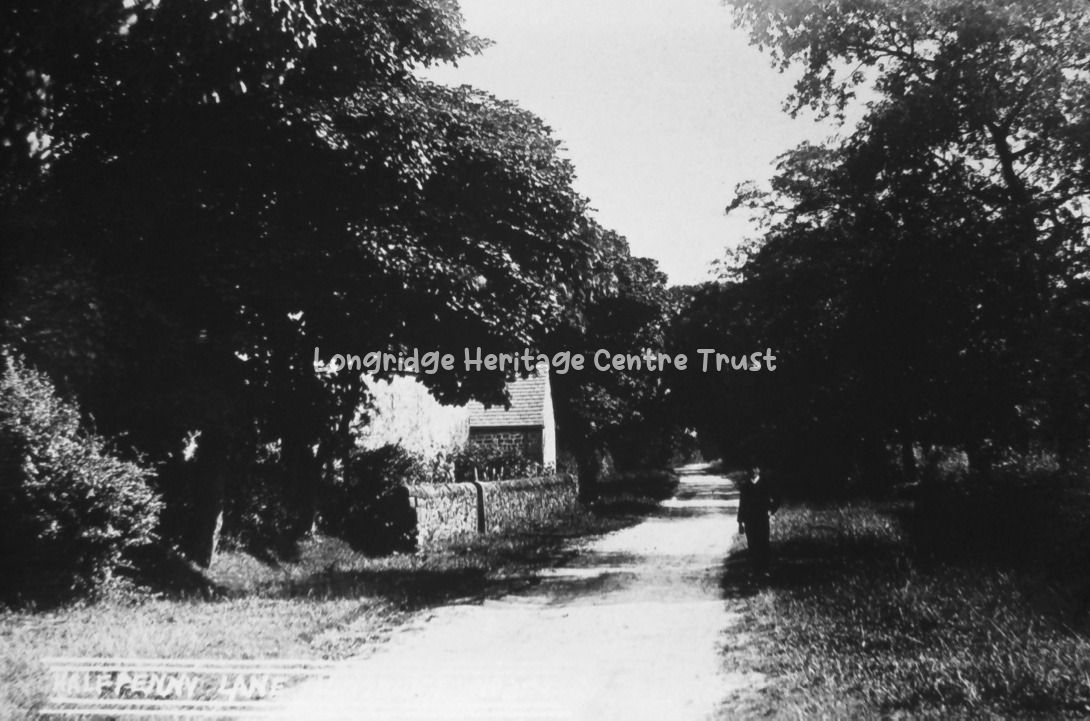
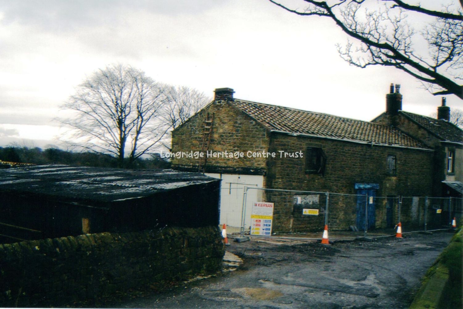
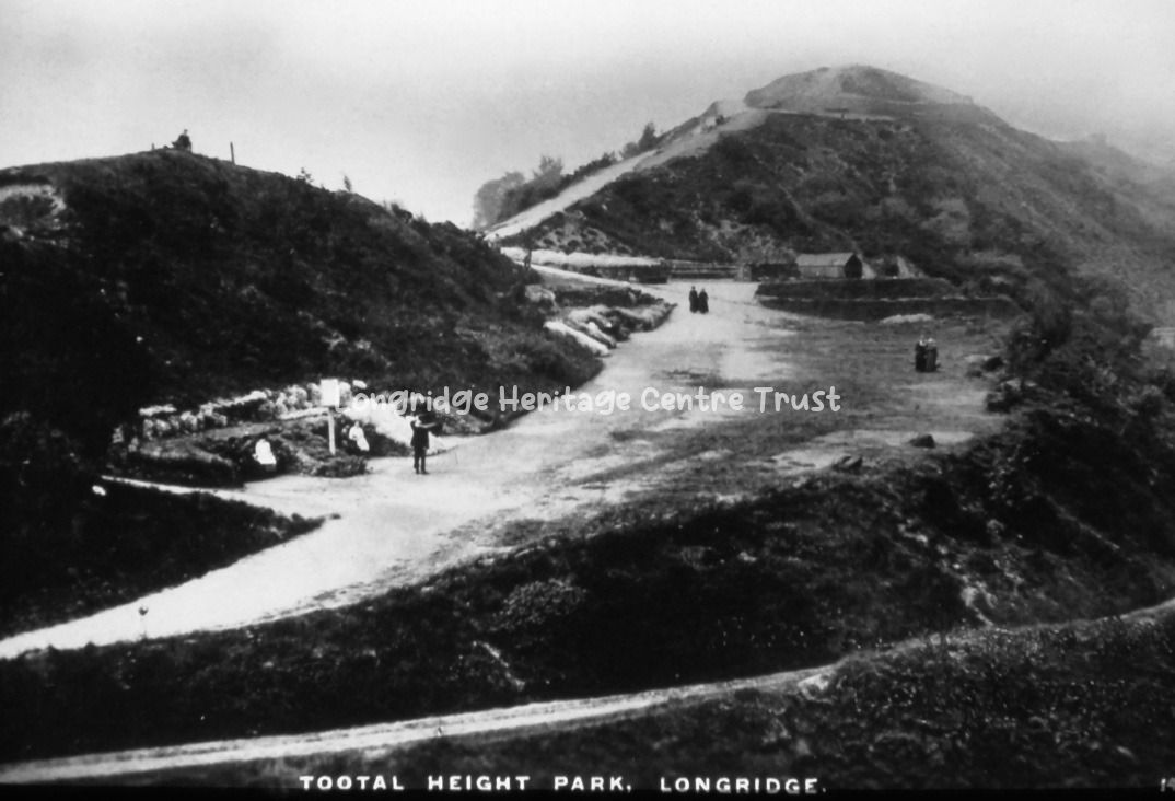
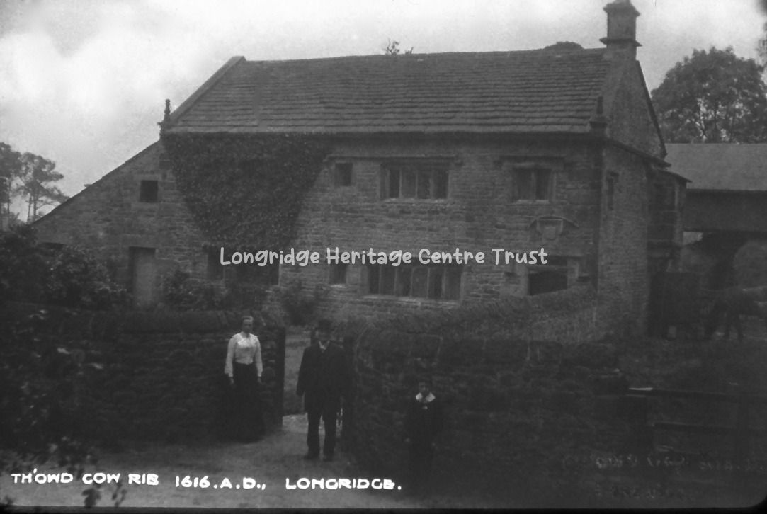
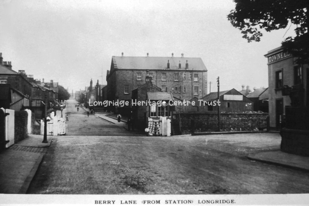
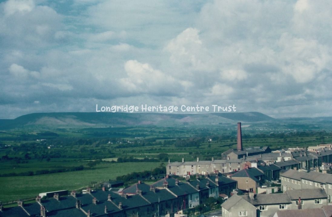
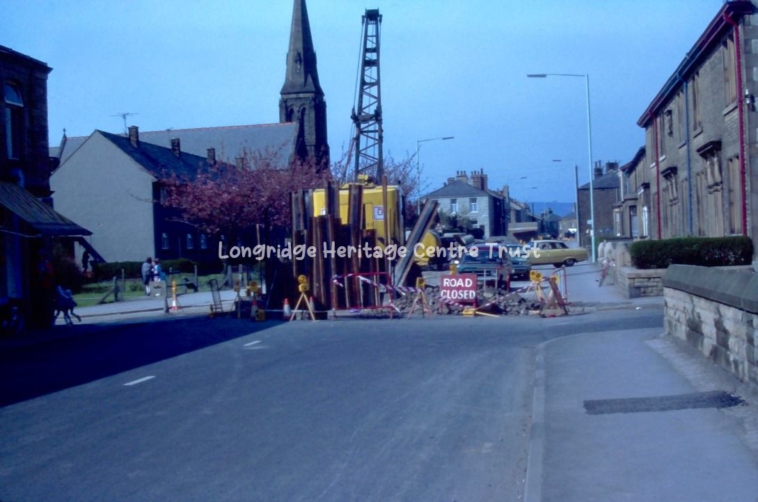
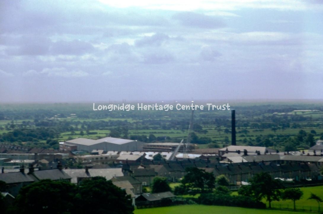
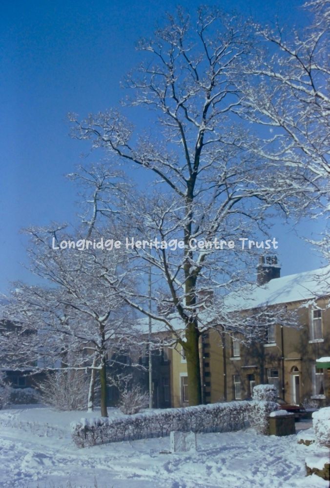
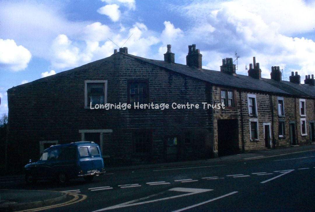
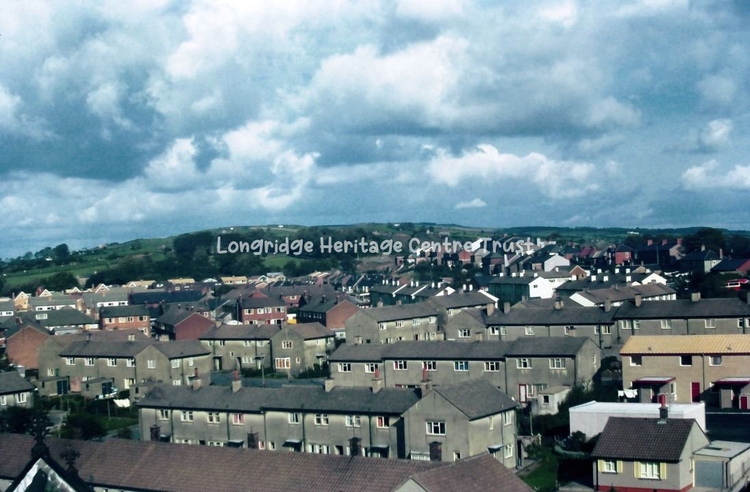
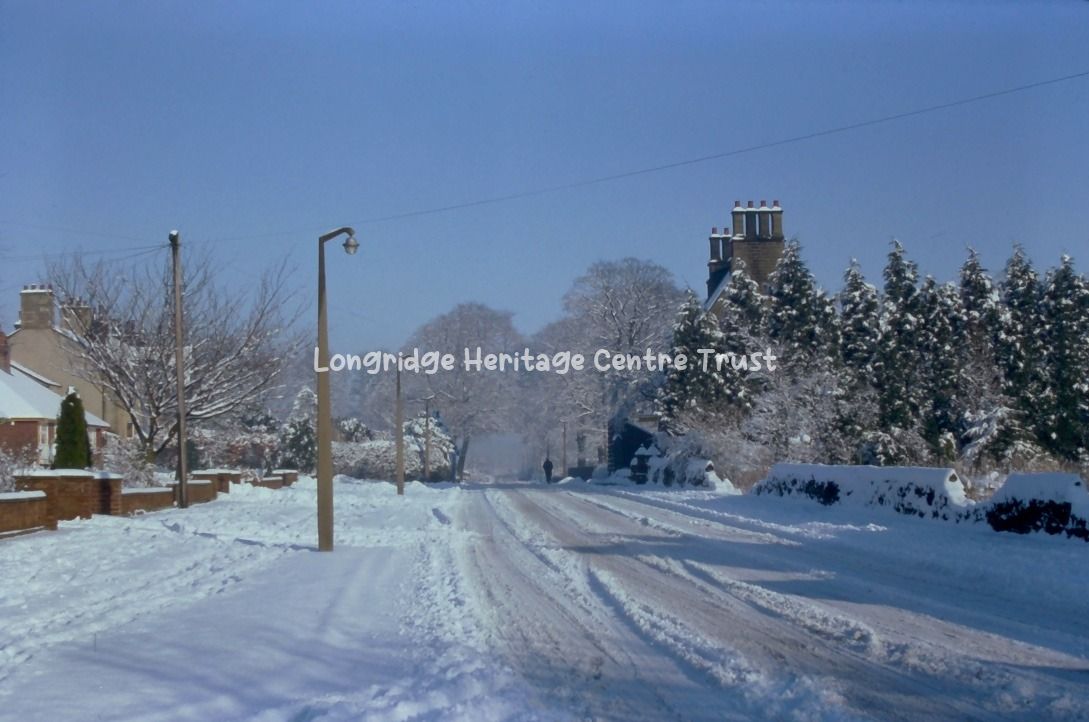
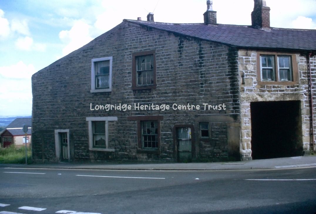
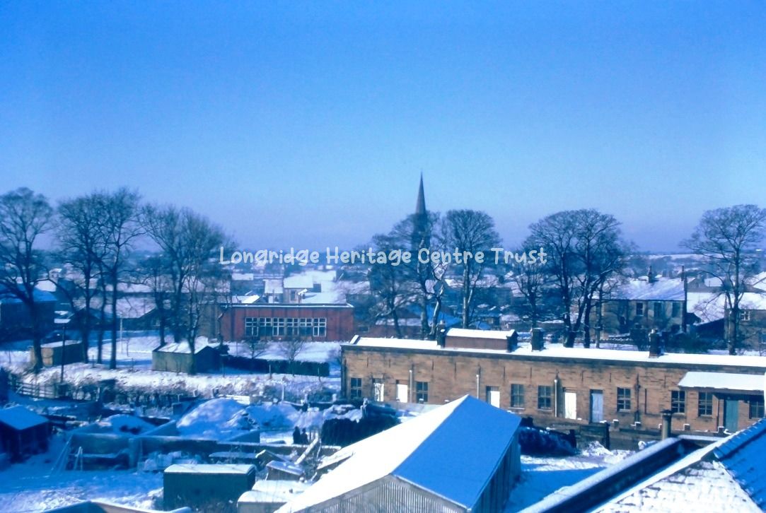
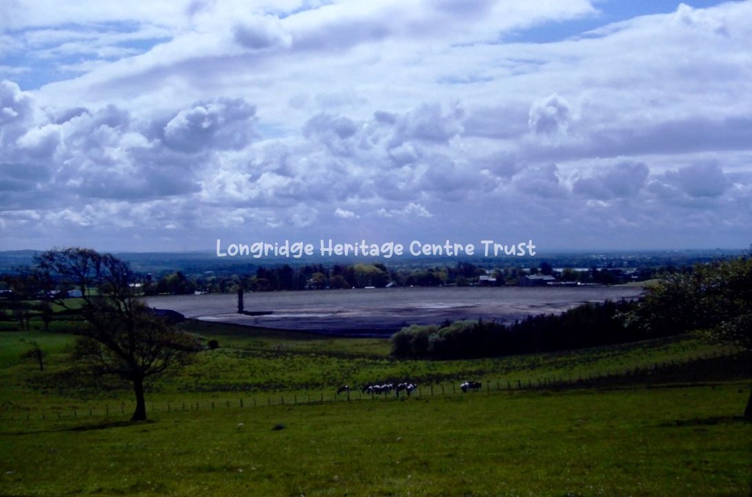
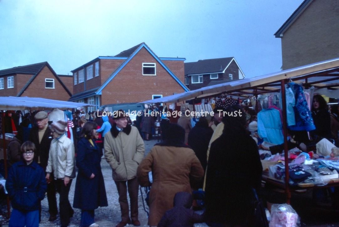
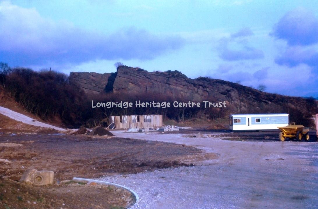
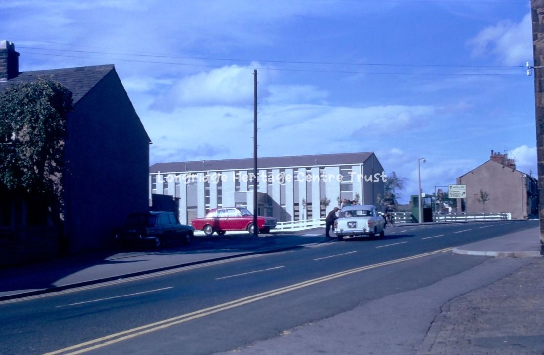
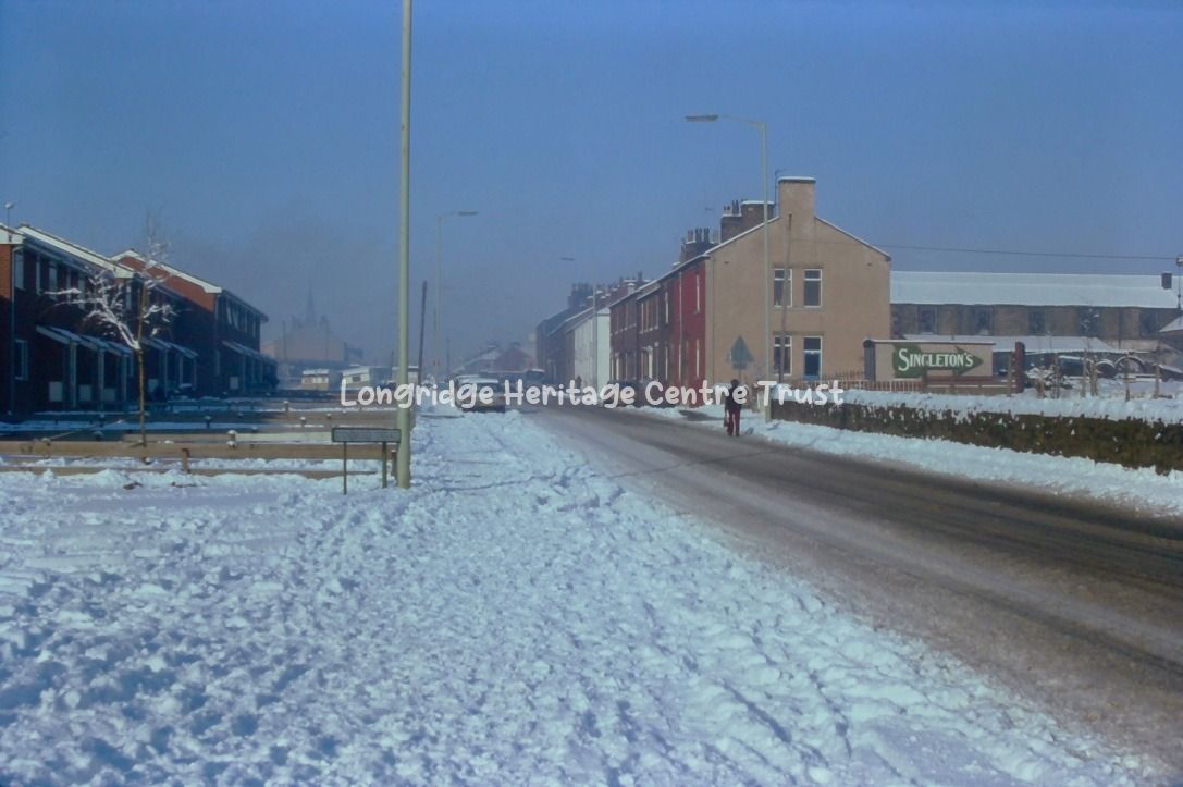
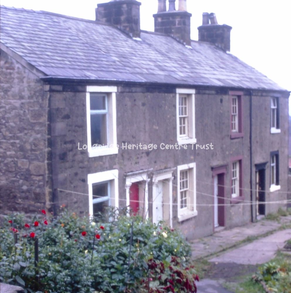
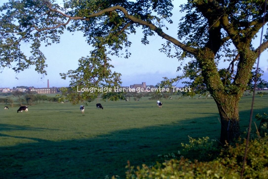
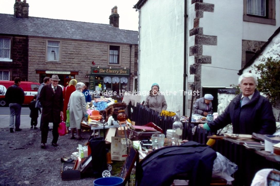
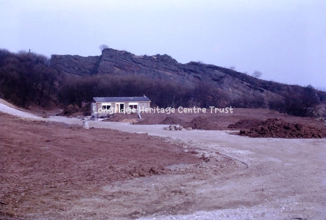
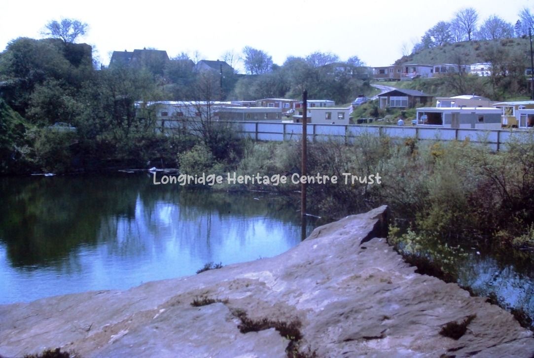
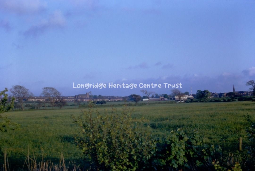
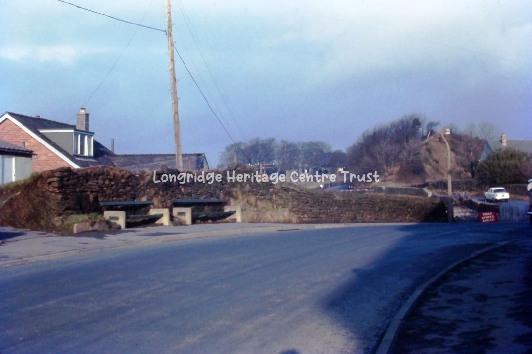
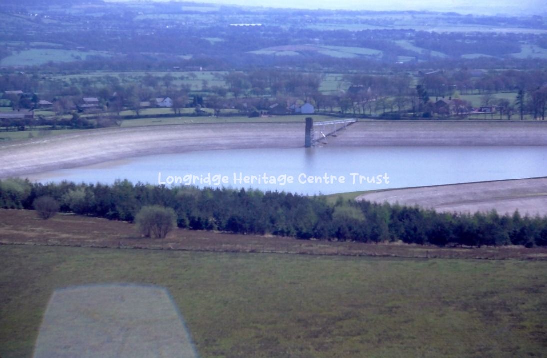
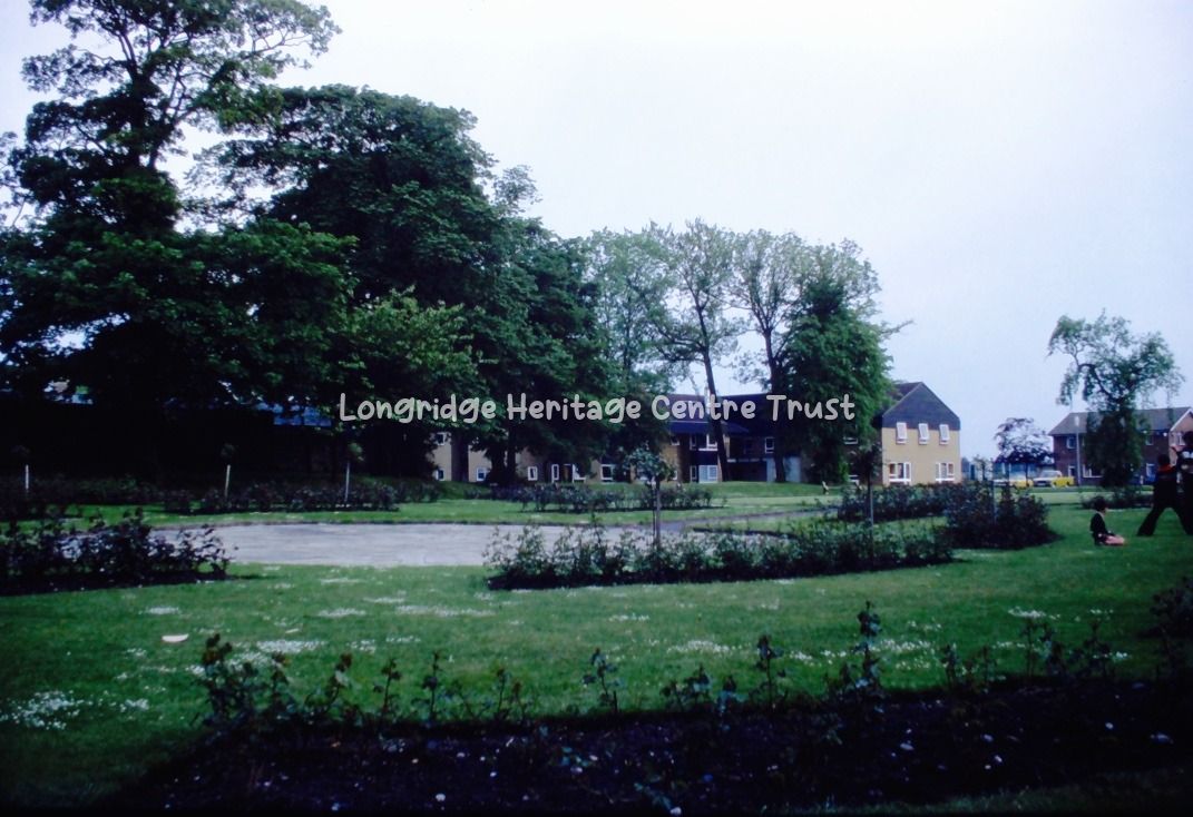
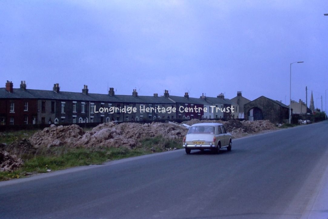
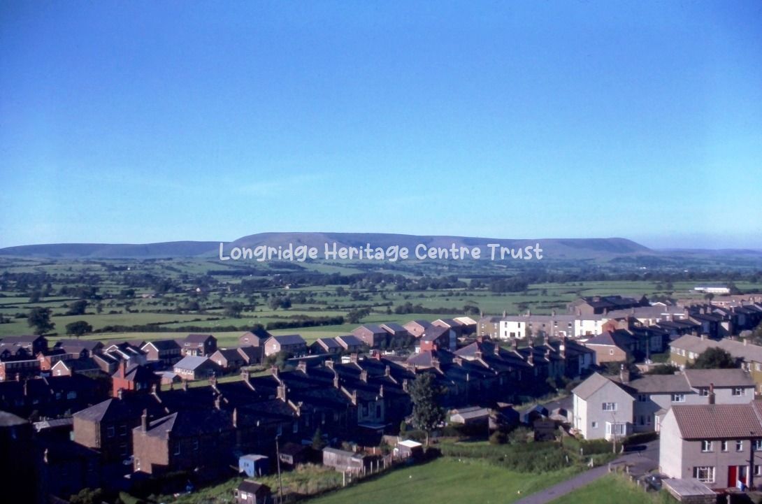
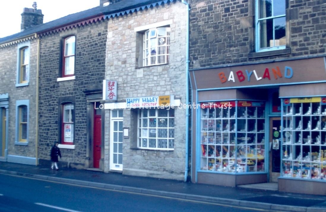
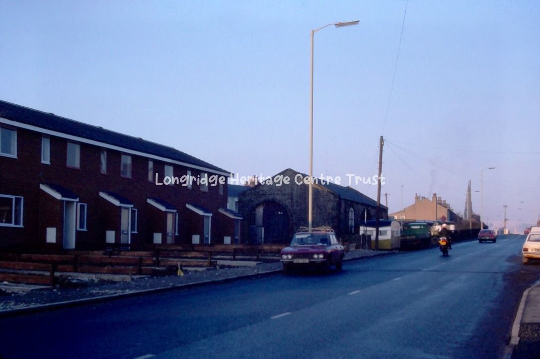
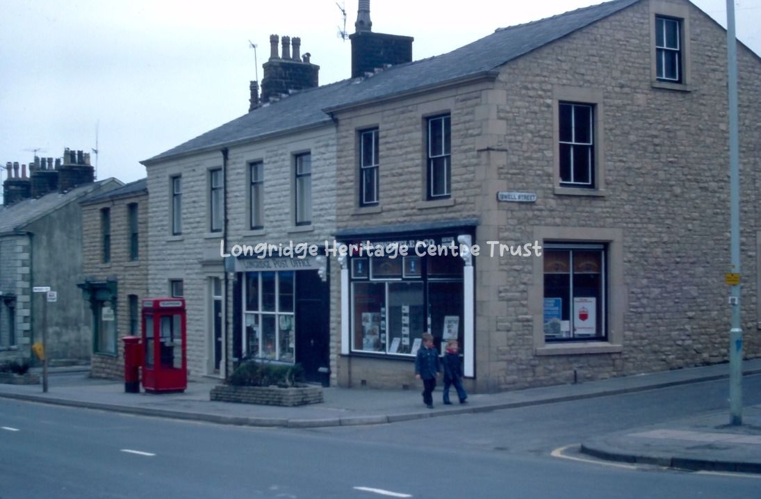
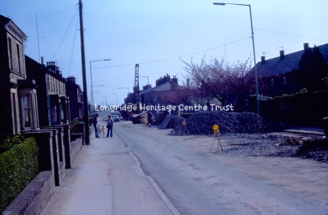
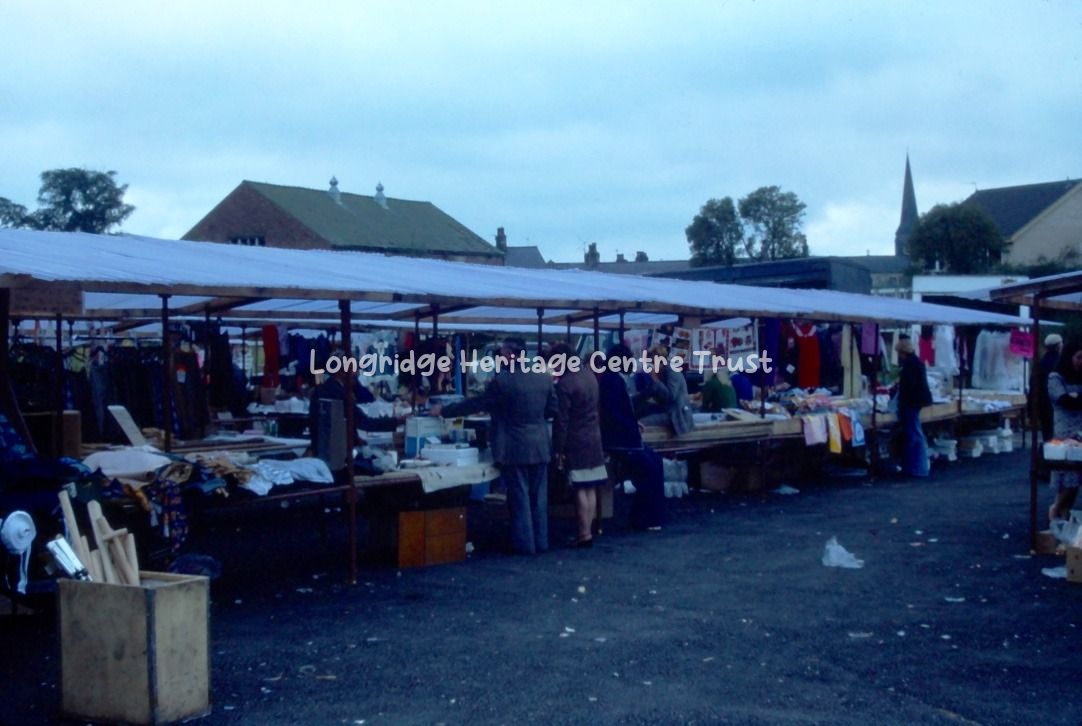
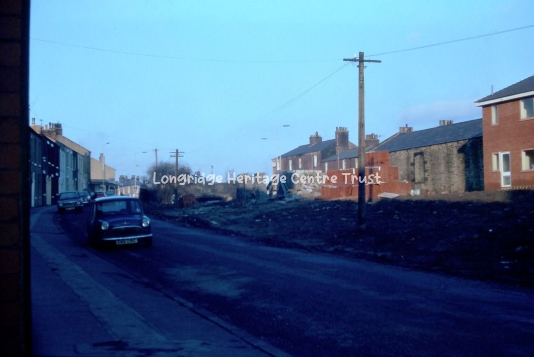
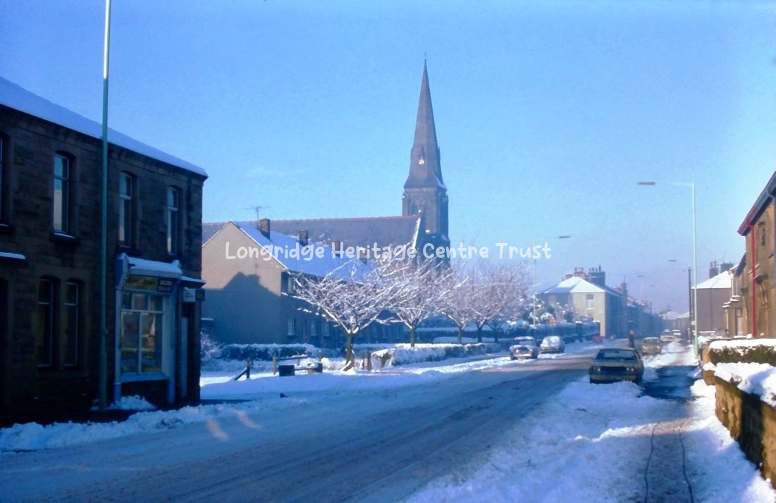
• Home
  • Heritage & Visitor Centre
      • Back
      • About Us
      • Objectives
      • Volunteers
  • Meeting Room
      • Back
      • Meeting Room Calendar
      • Meeting Room Hire
  • Longridge Archive
      • Back
      • Longridge Aerial Views
      • Lonridge Berry Lane
      • Longridge Churches
      • Longridge Co-op
      • Longridge Cotton Mills
      • Longridge Events
      • Longridge Pubs & Clubs
      • Longridge Quarries
      • Longridge Railway
      • Longridge Schools
      • Longridge Shops
      • Longridge Sport & Recreation
      • Longridge Townscape
      • Surrounding Villages
      • Unclassified
  • Get in Touch
  • Monthly Magazine

Longridge Townscape

  • 101a Berry Lane A view looking uphill   1900
    101a 101a
    101a
    101a Berry Lane A view looking uphill   1900
  • 101b Berry Lane A view looking downhill   1950
    101b 101b
    101b
    101b Berry Lane A view looking downhill   1950
  • 101c Berry Lane Band of the Territorials at the top of the hill Unknown
    101c 101c
    101c
    101c Berry Lane Band of the Territorials at the top of the hill Unknown
  • 102a Berry Lane A chuch procession at the end of Mersey Street Unknown
    102a 102a
    102a
    102a Berry Lane A chuch procession at the end of Mersey Street Unknown
  • 102b Berry Lane A church procession going passing 'The Limes' Unknown
    102b 102b
    102b
    102b Berry Lane A church procession going passing 'The Limes' Unknown
  • 102c Berry Lane Club day procession with a horse drawn wagon Unknown
    102c 102c
    102c
    102c Berry Lane Club day procession with a horse drawn wagon Unknown
  • 103a Berry Lane A view looking downhill from Chapel Street 1930
    103a 103a
    103a
    103a Berry Lane A view looking downhill from Chapel Street 1930
  • 103b Berry Lane A church procession passing Cramp Oaks Mill Unknown
    103b 103b
    103b
    103b Berry Lane A church procession passing Cramp Oaks Mill Unknown
  • 103c Berry Lane A view looking downhill from Dunderdale Street 1930
    103c 103c
    103c
    103c Berry Lane A view looking downhill from Dunderdale Street 1930
  • 104a Berry Lane A procession passing Towneley Road Unknown
    104a 104a
    104a
    104a Berry Lane A procession passing Towneley Road Unknown
  • 104b Berry Lane A view looking downhill from 'The Limes' 1950
    104b 104b
    104b
    104b Berry Lane A view looking downhill from 'The Limes' 1950
  • 104c Berry Lane View of Berry Lane from near Market Place Unknown
    104c 104c
    104c
    104c Berry Lane View of Berry Lane from near Market Place Unknown
  • 105a Berry Lane A view of the site now occupied by the Co-op supermarket Unknown
    105a 105a
    105a
    105a Berry Lane A view of the site now occupied by the Co-op supermarket Unknown
  • 105b Berry Lane A view looking downhill from 'The Limes' Unknown
    105b 105b
    105b
    105b Berry Lane A view looking downhill from 'The Limes' Unknown
  • 105c Berry Lane Club day procession passing the end of Towneley Road Unknown
    105c 105c
    105c
    105c Berry Lane Club day procession passing the end of Towneley Road Unknown
  • 106a Berry Lane A view downhill including the congregational church 1940
    106a 106a
    106a
    106a Berry Lane A view downhill including the congregational church 1940
  • 106b Berry Lane A view uphill from Cramp Oaks Mill Unknown
    106b 106b
    106b
    106b Berry Lane A view uphill from Cramp Oaks Mill Unknown
  • 106c Berry Lane A view uphill from Severn Street showing the Co-op Unknown
    106c 106c
    106c
    106c Berry Lane A view uphill from Severn Street showing the Co-op Unknown
  • 107a Berry Lane A view to the right looking downhill from the Durham Ox 1934
    107a 107a
    107a
    107a Berry Lane A view to the right looking downhill from the Durham Ox 1934
  • 107b Berry Lane A view uphill from Humber Street 1900
    107b 107b
    107b
    107b Berry Lane A view uphill from Humber Street 1900
  • 107c Berry Lane A view downhill of Bank's coal office and the level crossing 1934
    107c 107c
    107c
    107c Berry Lane A view downhill of Bank's coal office and the level crossing 1934
  • 110a Berry Lane A view uphill showing the level crossing Unknown
    110a 110a
    110a
    110a Berry Lane A view uphill showing the level crossing Unknown
  • 110b Dog Inn PH With two open top buses outside on Market Place Unknown
    110b 110b
    110b
    110b Dog Inn PH With two open top buses outside on Market Place Unknown
  • 112b Higher Road A view from the White Bull PH towards Tootle Heights Unknown
    112b 112b
    112b
    112b Higher Road A view from the White Bull PH towards Tootle Heights Unknown
  • 113b Higher Road A view from the White Bull PH towards Tootle Heights 1930
    113b 113b
    113b
    113b Higher Road A view from the White Bull PH towards Tootle Heights 1930
  • 114b Higher Road Procession Unknown
    114b 114b
    114b
    114b Higher Road Procession Unknown
  • 115a Cut Thorn Cottages On Higher Road near Green Lane junction Unknown
    115a 115a
    115a
    115a Cut Thorn Cottages On Higher Road near Green Lane junction Unknown
  • 115b Cut Thorn Cottages On Higher Road near Green Lane junction Unknown
    115b 115b
    115b
    115b Cut Thorn Cottages On Higher Road near Green Lane junction Unknown
  • 115c Beacon Villa Located on Higher Road 1920
    115c 115c
    115c
    115c Beacon Villa Located on Higher Road 1920
  • 128a Dog Inn PH Two double decker buses outside on Market Place 1920
    128a 128a
    128a
    128a Dog Inn PH Two double decker buses outside on Market Place 1920
  • 127b Dog Inn PH On Market Place 1920
    127b 127b
    127b
    127b Dog Inn PH On Market Place 1920
  • 135b Inglewhite Road View from the Alston Arms PH looking towards Longridge Unknown
    135b 135b
    135b
    135b Inglewhite Road View from the Alston Arms PH looking towards Longridge Unknown
  • 135c Crumpax Avenue View with the farm in the background Unknown
    135c 135c
    135c
    135c Crumpax Avenue View with the farm in the background Unknown
  • 136a Halfpenny Lane Looking from Inglewhite Road Unknown
    136a 136a
    136a
    136a Halfpenny Lane Looking from Inglewhite Road Unknown
  • 136b Halfpenny Lane Th'owd Rib Farm Unknown
    136b 136b
    136b
    136b Halfpenny Lane Th'owd Rib Farm Unknown
  • 136c Halfpenny Lane Th'owd Rib Farm Unknown
    136c 136c
    136c
    136c Halfpenny Lane Th'owd Rib Farm Unknown
  • 137a Halfpenny Lane Th'owd Rib Farm Unknown
    137a 137a
    137a
    137a Halfpenny Lane Th'owd Rib Farm Unknown
  • 137b Halfpenny Lane Looking towards Whittingham Road Unknown
    137b 137b
    137b
    137b Halfpenny Lane Looking towards Whittingham Road Unknown
  • 137c Halfpenny Lane No further details Unknown
    137c 137c
    137c
    137c Halfpenny Lane No further details Unknown
  • 138a Halfpenny Lane No further details Unknown
    138a 138a
    138a
    138a Halfpenny Lane No further details Unknown
  • 138b Halfpenny Lane Th'owd Rib Farm with Th'owd Loo Unknown
    138b 138b
    138b
    138b Halfpenny Lane Th'owd Rib Farm with Th'owd Loo Unknown
  • 138c Halfpenny Lane No further details Unknown
    138c 138c
    138c
    138c Halfpenny Lane No further details Unknown
  • 139a Halfpenny Lane Th'owd Rib Farm showing the old rib over the door Unknown
    139a 139a
    139a
    139a Halfpenny Lane Th'owd Rib Farm showing the old rib over the door Unknown
  • 139b Halfpenny Lane No further details Unknown
    139b 139b
    139b
    139b Halfpenny Lane No further details Unknown
  • 135a Berry Lane A view of the junction of Berry Lane and Inglewhite Road Unknown
    135a 135a
    135a
    135a Berry Lane A view of the junction of Berry Lane and Inglewhite Road Unknown
  • 113a Higher Road Showing the White Bull PH and open top double deck bus 1919
    113a 113a
    113a
    113a Higher Road Showing the White Bull PH and open top double deck bus 1919
  • 113c Higher Road Showing Club Row cottages 1970
    113c 113c
    113c
    113c Higher Road Showing Club Row cottages 1970
  • 114a Higher Road A church procession going to Tootle Height 1930
    114a 114a
    114a
    114a Higher Road A church procession going to Tootle Height 1930
  • 114c Higher Road Looking towards Tootle Height from Green Lane 1920
    114c 114c
    114c
    114c Higher Road Looking towards Tootle Height from Green Lane 1920
  • 116a Higher Road A view towards Quarry Cottages and Tootle Height Unknown
    116a 116a
    116a
    116a Higher Road A view towards Quarry Cottages and Tootle Height Unknown
  • 116b Higher Road Quarry cottages in deep snow 1911
    116b 116b
    116b
    116b Higher Road Quarry cottages in deep snow 1911
  • 568a King Street Health Centre Not known
    568a 568a
    568a
    568a King Street Health Centre Not known
  • 568b King Street Health Centre Not known
    568b 568b
    568b
    568b King Street Health Centre Not known
  • 569c King Street Health Centre Not known
    569c 569c
    569c
    569c King Street Health Centre Not known
  • 569b King Street Health Centre Not known
    569b 569b
    569b
    569b King Street Health Centre Not known
  • 569a King Street Health Centre Not known
    569a 569a
    569a
    569a King Street Health Centre Not known
  • 570a King Street Health Centre, photo of inside Not known
    570a 570a
    570a
    570a King Street Health Centre, photo of inside Not known
  • 570b King Street Health Centre, photo of inside Not known
    570b 570b
    570b
    570b King Street Health Centre, photo of inside Not known
  • 570c King Street Health Centre, photo of inside Not known
    570c 570c
    570c
    570c King Street Health Centre, photo of inside Not known
  • 538c Drill Hall, Little Lane View of Unknown
    538c 538c
    538c
    538c Drill Hall, Little Lane View of Unknown
  • 538a Drill Hall, Little Lane View of Unknown
    538a 538a
    538a
    538a Drill Hall, Little Lane View of Unknown
  • 538b Drill Hall, Little Lane View of Unknown
    538b 538b
    538b
    538b Drill Hall, Little Lane View of Unknown
  • 500a Derby Road Looking towards Inglewhite Road Unknown
    500a 500a
    500a
    500a Derby Road Looking towards Inglewhite Road Unknown
  • 501a King Street Discovery of an old well 2006
    501a3 501a3
    501a3
    501a King Street Discovery of an old well 2006
  • 501b King Street Discovery of an old well 2006
    501b 501b
    501b
    501b King Street Discovery of an old well 2006
  • 502a King Street Discovery of an old well 2006
    502a96 502a96
    502a96
    502a King Street Discovery of an old well 2006
  • 502b King Street Discovery of an old well 2006
    502b12 502b12
    502b12
    502b King Street Discovery of an old well 2006
  • 505a Tootle Height View looking down High Street Unknown
    505a 505a
    505a
    505a Tootle Height View looking down High Street Unknown
  • 505b Tootle Height View looking from Beacon Cafe Unknown
    505b 505b
    505b
    505b Tootle Height View looking from Beacon Cafe Unknown
  • 508a Tootle Height A group of visitors Unknown
    508a 508a
    508a
    508a Tootle Height A group of visitors Unknown
  • 508b Tootle Height View from Grandstand Unknown
    508b 508b
    508b
    508b Tootle Height View from Grandstand Unknown
  • 509x Tootle Height View from Higher Road Unknown
    509x 509x
    509x
    509x Tootle Height View from Higher Road Unknown
  • 510x Berry Lane VE Day celebration at the Limes. Some named Unknown
    510x 510x
    510x
    510x Berry Lane VE Day celebration at the Limes. Some named Unknown
  • 526a Club Row Higher Road Unknown
    526a 526a
    526a
    526a Club Row Higher Road Unknown
  • 533b Higher Road Beacon Cafe 1913
    533b 533b
    533b
    533b Higher Road Beacon Cafe 1913
  • 515b Inglewhite Road View of Unknown
    515b 515b
    515b
    515b Inglewhite Road View of Unknown
  • 522a Views of Longridge Christmas Card Unknown
    522a 522a
    522a
    522a Views of Longridge Christmas Card Unknown
  • 519a Crumpax Avenue View of avenue 1905
    519a 519a
    519a
    519a Crumpax Avenue View of avenue 1905
  • 543a Tootle Height View from near Rock Cottagfe Unknown
    543a 543a
    543a
    543a Tootle Height View from near Rock Cottagfe Unknown
  • 539b Whittingham Road View of from near W & J Ridings garage Unknown
    539b 539b
    539b
    539b Whittingham Road View of from near W & J Ridings garage Unknown
  • 554a Market Place View of 1970
    554a 554a
    554a
    554a Market Place View of 1970
  • 555c Fisher's Square View of 1970
    555c 555c
    555c
    555c Fisher's Square View of 1970
  • 555b Market Place And part of King Street 1972
    555b 555b
    555b
    555b Market Place And part of King Street 1972
  • 554b Market Place View of 1970
    554b 554b
    554b
    554b Market Place View of 1970
  • 554c Market Place View of 1970
    554c 554c
    554c
    554c Market Place View of 1970
  • 555a Market Place View incuding Crook's Chemist, DogInn, BCH 1971
    555a 555a
    555a
    555a Market Place View incuding Crook's Chemist, DogInn, BCH 1971
  • 556a King Street South East side 1970
    556a 556a
    556a
    556a King Street South East side 1970
  • 557c Higher Road Views of 1968
    557c 557c
    557c
    557c Higher Road Views of 1968
  • 557b Higher Road Cottage Cafe 1968
    557b 557b
    557b
    557b Higher Road Cottage Cafe 1968
  • 556c Club Row Higher Road 1970
    556c 556c
    556c
    556c Club Row Higher Road 1970
  • 556b Dilworth Lane View of 1970
    556b 556b
    556b
    556b Dilworth Lane View of 1970
  • 557a Higher Road Views of 1968
    557a 557a
    557a
    557a Higher Road Views of 1968
  • 559b Higher Road View of enterance to caravan site 1972
    559b 559b
    559b
    559b Higher Road View of enterance to caravan site 1972
  • 560b Inglewhite Road View of foundry 1970
    560b 560b
    560b
    560b Inglewhite Road View of foundry 1970
  • 560c Inglewhite Road MMB Dairy formerly Bone Mill 1970
    560c 560c
    560c
    560c Inglewhite Road MMB Dairy formerly Bone Mill 1970
  • 561a Stone Bridge View of 1972
    561a 561a
    561a
    561a Stone Bridge View of 1972
  • 562b Market Place And part of King Street 1970
    562b 562b
    562b
    562b Market Place And part of King Street 1970
  • 563a Drill Hall, Little Lane Enlargement of 563c Unknown
    563a 563a
    563a
    563a Drill Hall, Little Lane Enlargement of 563c Unknown
  • 563b Dilworth Brow View of trough at junction with Lower Lane Unknown
    563b 563b
    563b
    563b Dilworth Brow View of trough at junction with Lower Lane Unknown
  • 564b Shay Lane Building Co-op Distribution Centre 1970
    564b 564b
    564b
    564b Shay Lane Building Co-op Distribution Centre 1970
  • 564c Preston Road View of New Town 1970
    564c 564c
    564c
    564c Preston Road View of New Town 1970
  • 565b Walton Fold, Alston No 1 reservoir View from church tower 1970
    565b 565b
    565b
    565b Walton Fold, Alston No 1 reservoir View from church tower 1970
  • 567b Fleming Square View of Not known
    567b 567b
    567b
    567b Fleming Square View of Not known
  • 571a King Street Health Centre, photo of inside Not known
    571a 571a
    571a
    571a King Street Health Centre, photo of inside Not known
  • 572a King Street Health Centre, photo of inside Not known
    572a 572a
    572a
    572a King Street Health Centre, photo of inside Not known
  • 572c King Street Health Centre, photo of inside Not known
    572c 572c
    572c
    572c King Street Health Centre, photo of inside Not known
  • 572b King Street Health Centre, photo of inside Not known
    572b 572b
    572b
    572b King Street Health Centre, photo of inside Not known
  • 571c King Street Health Centre, photo of inside Not known
    571c 571c
    571c
    571c King Street Health Centre, photo of inside Not known
  • 571b King Street Health Centre, photo of inside Not known
    571b 571b
    571b
    571b King Street Health Centre, photo of inside Not known
  • 573a King Street Health Centre, photo of inside Not known
    573a 573a
    573a
    573a King Street Health Centre, photo of inside Not known
  • 573b King Street Health Centre, photo of inside Not known
    573b 573b
    573b
    573b King Street Health Centre, photo of inside Not known
  • 573c King Street Health Centre, photo of inside Not known
    573c 573c
    573c
    573c King Street Health Centre, photo of inside Not known
  • 574a King Street Health Centre, demolition Not known
    574a 574a
    574a
    574a King Street Health Centre, demolition Not known
  • 574b King Street Health Centre, demolition Not known
    574b 574b
    574b
    574b King Street Health Centre, demolition Not known
  • 574c King Street Health Centre, demolition Not known
    574c 574c
    574c
    574c King Street Health Centre, demolition Not known
  • 575a King Street Building of Kings Court Not known
    575a 575a
    575a
    575a King Street Building of Kings Court Not known
  • 575b King Street Building of Kings Court Not known
    575b 575b
    575b
    575b King Street Building of Kings Court Not known
  • 575c King Street Building of Kings Court Not known
    575c 575c
    575c
    575c King Street Building of Kings Court Not known
  • 576a King Street Building of Kings Court Not known
    576a 576a
    576a
    576a King Street Building of Kings Court Not known
  • 576b King Street Building of Kings Court Not known
    576b 576b
    576b
    576b King Street Building of Kings Court Not known
  • 576c King Street Building of Kings Court Not known
    576c 576c
    576c
    576c King Street Building of Kings Court Not known
  • 577a King Street Building of Kings Court Not known
    577a 577a
    577a
    577a King Street Building of Kings Court Not known
  • 577b King Street Building of Kings Court Not known
    577b 577b
    577b
    577b King Street Building of Kings Court Not known
  • 577c King Street Building of Kings Court Not known
    577c 577c
    577c
    577c King Street Building of Kings Court Not known
  • 578a Berry Lane Medical Centre Photo from the Old Co-op 2003
    578a 578a
    578a
    578a Berry Lane Medical Centre Photo from the Old Co-op 2003
  • 578b Community Hospital St Wilfreds Terrace 2000
    578b 578b
    578b
    578b Community Hospital St Wilfreds Terrace 2000
  • 579a Community Hospital Photgraphs of building site Not known
    579a 579a
    579a
    579a Community Hospital Photgraphs of building site Not known
  • 579b Community Hospital Photgraphs of building site Not known
    579b 579b
    579b
    579b Community Hospital Photgraphs of building site Not known
  • 579c Community Hospital Photgraphs of building site Not known
    579c 579c
    579c
    579c Community Hospital Photgraphs of building site Not known
  • 580a Community Hospital Photgraphs of building site Not known
    580a 580a
    580a
    580a Community Hospital Photgraphs of building site Not known
  • 580b Community Hospital Photgraphs of building site Not known
    580b 580b
    580b
    580b Community Hospital Photgraphs of building site Not known
  • 580c Community Hospital Photgraphs of building site Not known
    580c 580c
    580c
    580c Community Hospital Photgraphs of building site Not known
  • 584b Derby Road "Pioneer Terrace 1898" Unknown
    584b 584b
    584b
    584b Derby Road "Pioneer Terrace 1898" Unknown
  • 584c Rock Cottage Higher Road. The Jump family Unknown
    584c 584c
    584c
    584c Rock Cottage Higher Road. The Jump family Unknown
  • 589a Ruston Steam Navy At work on Alston No 3 reservoir 1922
    589a 589a
    589a
    589a Ruston Steam Navy At work on Alston No 3 reservoir 1922
  • 560a Longridge by night From the top of St Pauls tower 1970
    560a 560a
    560a
    560a Longridge by night From the top of St Pauls tower 1970
  • 117a Higher Road A procession about to enter Tootle Height Park 1918
    117a 117a
    117a
    117a Higher Road A procession about to enter Tootle Height Park 1918
  • 116c Well Brow Farm With cottages off Higher Road 1911
    116c 116c
    116c
    116c Well Brow Farm With cottages off Higher Road 1911
  • 117b Tootle Height Park Peace thanksgiving service 1918
    117b 117b
    117b
    117b Tootle Height Park Peace thanksgiving service 1918
  • 117c Tootle Height Park A view from Beacon Villa Unknown
    117c 117c
    117c
    117c Tootle Height Park A view from Beacon Villa Unknown
  • 118b Tootle Height Park A view looking down Higher Road 1900
    118b 118b
    118b
    118b Tootle Height Park A view looking down Higher Road 1900
  • 119a Tootle Height Park Gardens 1930
    119a 119a
    119a
    119a Tootle Height Park Gardens 1930
  • 122a Rock Cottage Showing Dilworth Water Works Unknown
    122a 122a
    122a
    122a Rock Cottage Showing Dilworth Water Works Unknown
  • 122c Tootle Height Park A murky view towards the summit Unknown Townscape
    122c 122c
    122c
    122c Tootle Height Park A murky view towards the summit Unknown Townscape
  • 126a Whittingham Road Looking towards Whittingham from near Lee Street Unknown
    126a 126a
    126a
    126a Whittingham Road Looking towards Whittingham from near Lee Street Unknown
  • 126b Stone Bridge A horse drawn mill trip about to depart 1902
    126b 126b
    126b
    126b Stone Bridge A horse drawn mill trip about to depart 1902
  • 126c Little Lane A view looking towards Kestor Lane Unknown
    126c 126c
    126c
    126c Little Lane A view looking towards Kestor Lane Unknown
  • 127c Sharley Fold Farm In Dixon Road Unknown
    127c 127c
    127c
    127c Sharley Fold Farm In Dixon Road Unknown
  • 125a Kestor Lane Looking downhill from the corner with Fell Brow 1950
    125a 125a
    125a
    125a Kestor Lane Looking downhill from the corner with Fell Brow 1950
  • 129a Preston Road Looking from Stone Bridge towards Chipping Unknown
    129a 129a
    129a
    129a Preston Road Looking from Stone Bridge towards Chipping Unknown
  • 129c Preston Road Looking towards Chipping fron near Alexandra Road Unknown
    129c 129c
    129c
    129c Preston Road Looking towards Chipping fron near Alexandra Road Unknown
  • 130a Preston Road Showing St Wilfrids Church from near Alexandra Road 1950
    130a 130a
    130a
    130a Preston Road Showing St Wilfrids Church from near Alexandra Road 1950
  • 130b Preston Road Church procession outside St Wilfrids Church Unknown
    130b 130b
    130b
    130b Preston Road Church procession outside St Wilfrids Church Unknown
  • 132a Pitt Street Name plate that was removed from 82 Derby Road 1997
    132a 132a
    132a
    132a Pitt Street Name plate that was removed from 82 Derby Road 1997
  • 140a Lee Street Martha Lawson and Jimmy Lightfoot 1930
    140a 140a
    140a
    140a Lee Street Martha Lawson and Jimmy Lightfoot 1930
  • 146a Fell Brow Reproduced from an old drawing Unknown
    146a 146a
    146a
    146a Fell Brow Reproduced from an old drawing Unknown
  • 151a Lower Lane A view towards Clitheroe from near Prospect House 1945
    151a 151a
    151a
    151a Lower Lane A view towards Clitheroe from near Prospect House 1945
  • 151c Lower Lane View from near the Old Vicarage Unknown
    151c 151c
    151c
    151c Lower Lane View from near the Old Vicarage Unknown
  • 152a Lower Lane Mother Green's cottage and the parish church 1907
    152a 152a
    152a
    152a Lower Lane Mother Green's cottage and the parish church 1907
  • 152b Lower Lane The Vicarage 1907
    152b 152b
    152b
    152b Lower Lane The Vicarage 1907
  • 164c Drill Hall The former drill hall was located on Little Lane Unknown
    164c 164c
    164c
    164c Drill Hall The former drill hall was located on Little Lane Unknown
  • 168c Whittingham Road Looking towards Whittingham from Gleadale House Unknown
    168c 168c
    168c
    168c Whittingham Road Looking towards Whittingham from Gleadale House Unknown
  • 172a Postcard With multi views of Longridge 1905
    172a 172a
    172a
    172a Postcard With multi views of Longridge 1905
  • 172b Postcard With multi views of Longridge 1915
    172b 172b
    172b
    172b Postcard With multi views of Longridge 1915
  • 172c Postcard With multi views of Longridge Unknown
    172c 172c
    172c
    172c Postcard With multi views of Longridge Unknown
  • 112a Stone Sleeper Blocks Used as edging to cattle dock Unknown
    112a 112a
    112a
    112a Stone Sleeper Blocks Used as edging to cattle dock Unknown
  • 149b Silver Street Mill House Farm Unknown
    149b 149b
    149b
    149b Silver Street Mill House Farm Unknown
  • 201a Lower Lane A view from the parish church tower Unknown
    201a 201a
    201a
    201a Lower Lane A view from the parish church tower Unknown
  • 201b Calfcote Lane Chapel House Farm Unknown
    201b 201b
    201b
    201b Calfcote Lane Chapel House Farm Unknown
  • 203b Preston Road Looking towards Inglewhite and showing St Wilfrid's Church 1964
    203b 203b
    203b
    203b Preston Road Looking towards Inglewhite and showing St Wilfrid's Church 1964
  • 205a Dilworth Lane & Corner of King Street A view of 1970
    205a 205a
    205a
    205a Dilworth Lane & Corner of King Street A view of 1970
  • 206a Fisher's Square Off Market Place 1970
    206a 206a
    206a
    206a Fisher's Square Off Market Place 1970
  • 208b Higher Road looking towards Cut Thorn Row & Tootle Heights 1920
    208b 208b
    208b
    208b Higher Road looking towards Cut Thorn Row & Tootle Heights 1920
  • 208c Rock Cottage Looking from Tootle Height Unknown
    208c 208c
    208c
    208c Rock Cottage Looking from Tootle Height Unknown
  • 209a Market Place Looking from the B.C.H. Stores towards the library 1950
    209a 209a
    209a
    209a Market Place Looking from the B.C.H. Stores towards the library 1950
  • 209c Market Place The B.C.H. Stores, No. 17 1934
    209c 209c
    209c
    209c Market Place The B.C.H. Stores, No. 17 1934
  • 213c Fell Brow Another uphill view from the end of Little Lane Unknown
    213c 213c
    213c
    213c Fell Brow Another uphill view from the end of Little Lane Unknown
  • 213b Fell Brow Looking down hill from where the Masons Arms once traded Unknown
    213b 213b
    213b
    213b Fell Brow Looking down hill from where the Masons Arms once traded Unknown
  • 213a Fell Brow Looking up hill from the end of Little Lane Unknown
    213a 213a
    213a
    213a Fell Brow Looking up hill from the end of Little Lane Unknown
  • 211c Market Place No. 17 during building work 1985
    211c 211c
    211c
    211c Market Place No. 17 during building work 1985
  • 211a Market Place No. 17 during building work 1985
    211a 211a
    211a
    211a Market Place No. 17 during building work 1985
  • 210a Market Place No. 17 during building work 1985
    210a 210a
    210a
    210a Market Place No. 17 during building work 1985
  • 210b Market Place No. 17 during building work 1985
    210b 210b
    210b
    210b Market Place No. 17 during building work 1985
  • 211b Market Place No. 17 during building work 1985
    211b 211b
    211b
    211b Market Place No. 17 during building work 1985
  • 215a St Paul's Church A view from the church tower of Irwell Street and Towneley 1969
    215a 215a
    215a
    215a St Paul's Church A view from the church tower of Irwell Street and Towneley 1969
  • 216b St Paul's Church A view from the tower towards Victoria Mill 1969
    216b 216b
    216b
    216b St Paul's Church A view from the tower towards Victoria Mill 1969
  • 217c Chatburn Road Dick Gorrnell and his Carriers Wagon 1940s
    217c 217c
    217c
    217c Chatburn Road Dick Gorrnell and his Carriers Wagon 1940s
  • 218a Chapel Hill View Showing the Parish Church and Houghtons Unknown
    218a 218a
    218a
    218a Chapel Hill View Showing the Parish Church and Houghtons Unknown
  • 218b Chapel Brow Happy Alley View towards Parish Church 1914
    218b 218b
    218b
    218b Chapel Brow Happy Alley View towards Parish Church 1914
  • 219c Lower Lane Looking towards the fountain from near Prospect House 1939
    219c 219c
    219c
    219c Lower Lane Looking towards the fountain from near Prospect House 1939
  • 221b Multi view of Longridge Multi View of Longridge 1915
    221b 221b
    221b
    221b Multi view of Longridge Multi View of Longridge 1915
  • 221c Multi view of Longridge Multi View of Longridge Unknown
    221c 221c
    221c
    221c Multi view of Longridge Multi View of Longridge Unknown
  • 227b St Paul's Church A view from the tower over Parlick Avenue and Bleasdale Court 1969
    227b 227b
    227b
    227b St Paul's Church A view from the tower over Parlick Avenue and Bleasdale Court 1969
  • 228b Parish church A view from the tower looking up Fell Brow 1969
    228b 228b
    228b
    228b Parish church A view from the tower looking up Fell Brow 1969
  • 229a Kestor Lane a view up towards Market Place from near Little Lane c 1910
    229a 229a
    229a
    229a Kestor Lane a view up towards Market Place from near Little Lane c 1910
  • 253b Inglewhite Road demolition of the Old Mill cum Dairy 1969
    253b 253b
    253b
    253b Inglewhite Road demolition of the Old Mill cum Dairy 1969
  • 258c Higher Road Beacon Café & Quarry Cottages 1930s or 40s
    258c 258c
    258c
    258c Higher Road Beacon Café & Quarry Cottages 1930s or 40s
  • 259a Birk's Brow Looking towards Parleck Unknown
    259a 259a
    259a
    259a Birk's Brow Looking towards Parleck Unknown
  • 260a Hollin Hall Farm in the Tan Yard Unknown
    260a 260a
    260a
    260a Hollin Hall Farm in the Tan Yard Unknown
  • 260b Hollin Hall Cottages in the Tan Yard Unknown
    260b 260b
    260b
    260b Hollin Hall Cottages in the Tan Yard Unknown
  • 260c Tan Yard Hollin Hall Farm and cottages Unknown
    260c 260c
    260c
    260c Tan Yard Hollin Hall Farm and cottages Unknown
  • 264b Pitt Street (Inglewhite Road) Looking towards the bone mill Unknown
    264b 264b
    264b
    264b Pitt Street (Inglewhite Road) Looking towards the bone mill Unknown
  • 264b Pitt Street (Inglewhite Road) Looking towards the bone mill Unknown
    266a 266a
    266a
    264b Pitt Street (Inglewhite Road) Looking towards the bone mill Unknown
  • 270a Higher Road A view from Tootle Height 1918
    270a 270a
    270a
    270a Higher Road A view from Tootle Height 1918
  • 271b Halfpenny Lane looking from Inglewhite Road, Jubilee Terr' on right Unknown
    271b 271b
    271b
    271b Halfpenny Lane looking from Inglewhite Road, Jubilee Terr' on right Unknown
  • 272a Multi view postcard of Longridge   1980 Townscape
    272a 272a
    272a
    272a Multi view postcard of Longridge   1980 Townscape
  • 272b Derby Road Looking from Stone Bridge to Inglewhite Road 1980
    272b 272b
    272b
    272b Derby Road Looking from Stone Bridge to Inglewhite Road 1980
  • 274a Inglewhite Road looking towards the Alston Arms & Inglewhite Unknown
    274a 274a
    274a
    274a Inglewhite Road looking towards the Alston Arms & Inglewhite Unknown
  • 276c Higher Road "Cottage Café" 1950s or 60s
    276c 276c
    276c
    276c Higher Road "Cottage Café" 1950s or 60s
  • 277a Radcliffe Farm   Unknown
    277a 277a
    277a
    277a Radcliffe Farm   Unknown
  • 277b Preston Docks Preston Docks Unknown
    277b 277b
    277b
    277b Preston Docks Preston Docks Unknown
  • 277c Higher Road "Beacon Villa" and Quarry Cottages 1913
    277c 277c
    277c
    277c Higher Road "Beacon Villa" and Quarry Cottages 1913
  • 279a Higher Road "Crown Hotel" & Quarry Cottages Unknown
    279a 279a
    279a
    279a Higher Road "Crown Hotel" & Quarry Cottages Unknown
  • 280a Calfcote Lane Mr and Mrs Walker of Chapel House Farm C1930
    280a 280a
    280a
    280a Calfcote Lane Mr and Mrs Walker of Chapel House Farm C1930
  • 317a Pitt Street (Derby Road) Looking from Stone Bridge towards St Wilfrids 1912
    317a 317a
    317a
    317a Pitt Street (Derby Road) Looking from Stone Bridge towards St Wilfrids 1912
  • 303b Stone Bridge Showing the Co-op on the corner of Kestor Lane and Silver Street Unknown
    303b 303b
    303b
    303b Stone Bridge Showing the Co-op on the corner of Kestor Lane and Silver Street Unknown
  • 314x LUDC New offices in the Limes. Official opening & Councillors 1948
    314b 314b
    314b
    314x LUDC New offices in the Limes. Official opening & Councillors 1948
  • 309a Hight Street (Higher Road) Church procession passing the White Bull Unknown
    309a 309a
    309a
    309a Hight Street (Higher Road) Church procession passing the White Bull Unknown
  • 317b Pitt Street (Derby Road) St Wilfrids tower & extension under construction 1907
    317b 317b
    317b
    317b Pitt Street (Derby Road) St Wilfrids tower & extension under construction 1907
  • 319x Longridge Area Postcard showing multi views of Longridge 1928
    319 319
    319
    319x Longridge Area Postcard showing multi views of Longridge 1928
  • 322x Ariel View Market Place, Berry Lane, Dog Inn area looking North West 1970
    322 322
    322
    322x Ariel View Market Place, Berry Lane, Dog Inn area looking North West 1970
  • 324a Woodville House Coachman waiting to take the Smith family to church 1910
    324a 324a
    324a
    324a Woodville House Coachman waiting to take the Smith family to church 1910
  • 324b Broomhill House Tanyard 1960
    324b 324b
    324b
    324b Broomhill House Tanyard 1960
  • 324c Higher Road Top of Green Lane with Harry Clegg & Cut Thorn cottages 1950
    324c 324c
    324c
    324c Higher Road Top of Green Lane with Harry Clegg & Cut Thorn cottages 1950
  • 325a Kestor Lane Remembrance Day parade 1960
    325a 325a
    325a
    325a Kestor Lane Remembrance Day parade 1960
  • 327b White Bull View of High Street (Higher Road) Unknown
    327b 327b
    327b
    327b White Bull View of High Street (Higher Road) Unknown
  • 333b Dilworth House Farm At junction of Lower Lane and Dilworth Lane Unknown
    333b 333b
    333b
    333b Dilworth House Farm At junction of Lower Lane and Dilworth Lane Unknown
  • 330a Warwick Street View of Proctors Corn Mill after a fire 1935
    330a 330a
    330a
    330a Warwick Street View of Proctors Corn Mill after a fire 1935
  • 332a Stone Bridge Bonds Garage with a selection of cars 1950
    332a 332a
    332a
    332a Stone Bridge Bonds Garage with a selection of cars 1950
  • 332b Stone Bridge Bonds Garage with Les Bond the owner Unknown
    332b 332b
    332b
    332b Stone Bridge Bonds Garage with Les Bond the owner Unknown
  • 332c Inglewhite Road Wallbanks Belmont Garage late 20s early 30s 1930
    332c 332c
    332c
    332c Inglewhite Road Wallbanks Belmont Garage late 20s early 30s 1930
  • 333c Calfcote Lane Looking down towards Lower Lane during the 1930s 1930
    333c 333c
    333c
    333c Calfcote Lane Looking down towards Lower Lane during the 1930s 1930
  • 371c Dilworth House Gardeners cottage and the coach house Unknown
    371c 371c
    371c
    371c Dilworth House Gardeners cottage and the coach house Unknown
  • 372a Towneley Gardens With Whittles Mill chimney in the background Unknown
    372a 372a
    372a
    372a Towneley Gardens With Whittles Mill chimney in the background Unknown
  • 372b Tootle Height Looking from near Well Brow Farm 1933
    372b 372b
    372b
    372b Tootle Height Looking from near Well Brow Farm 1933
  • 372c Tan Yard Lane Looking from Lower Lane Unknown
    372c 372c
    372c
    372c Tan Yard Lane Looking from Lower Lane Unknown
  • 374a Higher Road View of Rock Cottage Unknown
    374a 374a
    374a
    374a Higher Road View of Rock Cottage Unknown
  • 377b King Street A convoy of horse drawn wagonettes Unknown
    377b 377b
    377b
    377b King Street A convoy of horse drawn wagonettes Unknown
  • 377c King Street Looking towards the White Bull and Higher Road late 1950s or 60s 1950
    377c 377c
    377c
    377c King Street Looking towards the White Bull and Higher Road late 1950s or 60s 1950
  • 378c Tan Yard Lane Also known as "Lovers Walk" 1917
    378c 378c
    378c
    378c Tan Yard Lane Also known as "Lovers Walk" 1917
  • 379a Observers Corps Post Members group in Higher Road 1941
    379a 379a
    379a
    379a Observers Corps Post Members group in Higher Road 1941
  • 380c High Street (Higher Road) Towards Tootle Height from Cut Thorn 1920
    380c 380c
    380c
    380c High Street (Higher Road) Towards Tootle Height from Cut Thorn 1920
  • 408b Berry Lane A view looking uphill from opposite the Co-op 1904
    408b 408b
    408b
    408b Berry Lane A view looking uphill from opposite the Co-op 1904
  • 408a Alston Corn Mill Used by John A Graham &Sons & later by a Mr Bates 1976
    408a 408a
    408a
    408a Alston Corn Mill Used by John A Graham &Sons & later by a Mr Bates 1976
  • 403x Co-op Central Building Enlargement of sketch of the original building 1880
    403 403
    403
    403x Co-op Central Building Enlargement of sketch of the original building 1880
  • 404x Co-op Central Building Berry Lane 1967
    404 404
    404
    404x Co-op Central Building Berry Lane 1967
  • 402d Severn Street 1937 Coronation Party (enlarged) 1937
    402d 402d
    402d
    402d Severn Street 1937 Coronation Party (enlarged) 1937
  • 402c Severn Street 1937 Coronation Party (small) 1937
    402c 402c
    402c
    402c Severn Street 1937 Coronation Party (small) 1937
  • 402b Severn Street 1937 Coronation Party (small) 1937
    402b 402b
    402b
    402b Severn Street 1937 Coronation Party (small) 1937
  • 401b Co-op Central building Presentaion of framed print of original building 1970
    401b 401b
    401b
    401b Co-op Central building Presentaion of framed print of original building 1970
  • 400x Berry Lane Thomas Banks & Co, Coal, Coke & Lime Merchants 1920
    400 400
    400
    400x Berry Lane Thomas Banks & Co, Coal, Coke & Lime Merchants 1920
  • 402a Severn Street 1937 Coronation Party (enlarged) 1937
    402a 402a
    402a
    402a Severn Street 1937 Coronation Party (enlarged) 1937
  • 409b Inglewhite Tea Rooms Inglewhite Tea Rooms 1900
    409b 409b
    409b
    409b Inglewhite Tea Rooms Inglewhite Tea Rooms 1900
  • 419x Aerial View Market Place and Berry Lane looking North West 1969
    419 419
    419
    419x Aerial View Market Place and Berry Lane looking North West 1969
  • 413b Berry Lane A view looking uphill from near the Co-op 1916
    413b 413b
    413b
    413b Berry Lane A view looking uphill from near the Co-op 1916
  • 415b Police Station A group photograph during a visit by Dutch Police officers 1979
    415b 415b
    415b
    415b Police Station A group photograph during a visit by Dutch Police officers 1979
  • 416x Longridge band At Stone Bridge. Victory Parade June 1946 1946
    416 416
    416
    416x Longridge band At Stone Bridge. Victory Parade June 1946 1946
  • 417a Waterworks Tunnel Preston Waterworks Tunnel. Thornley to Spade Mill resevoir 1930
    417a 417a
    417a
    417a Waterworks Tunnel Preston Waterworks Tunnel. Thornley to Spade Mill resevoir 1930
  • 417b Boys Brigade Band Marching down Fell Brow Unknown
    417b 417b
    417b
    417b Boys Brigade Band Marching down Fell Brow Unknown
  • 425a Multi View postcard of Longridge Multi view postcards of Longridge. White Bull, Higher Road, corner of Berry Lane, St Lawrence Church. 1990
    425a 425a
    425a
    425a Multi View postcard of Longridge Multi view postcards of Longridge. White Bull, Higher Road, corner of Berry Lane, St Lawrence Church. 1990
  • 425b Multi View postcard of Longridge Berry Lane, St Pauls Church, Market Place, Towneley Gardens 1990
    425b 425b
    425b
    425b Multi View postcard of Longridge Berry Lane, St Pauls Church, Market Place, Towneley Gardens 1990
  • 426b Mersey Street In deep snow 1940
    426b 426b
    426b
    426b Mersey Street In deep snow 1940
  • 431a Higher Road View towards Tootle Height from opposite the Crown Hotel Unknown
    431a 431a
    431a
    431a Higher Road View towards Tootle Height from opposite the Crown Hotel Unknown
  • 431b Berry Lane Post Card view uphill from near the Co-op 1970
    431b 431b
    431b
    431b Berry Lane Post Card view uphill from near the Co-op 1970
  • 434a Aerial View Belmont Garage showing part of Belmont Foundry Unkown
    434a 434a
    434a
    434a Aerial View Belmont Garage showing part of Belmont Foundry Unkown
  • 434b Belmont Garage Inglewhite Road (Wallbanks) Unknown
    434b 434b
    434b
    434b Belmont Garage Inglewhite Road (Wallbanks) Unknown
  • 434c Belmont Garage Inglewhite Road (Wallbanks) Second view Unknown
    434c 434c
    434c
    434c Belmont Garage Inglewhite Road (Wallbanks) Second view Unknown
  • 466c Berry Lane Mercers at the corner with Inglewhite Road 1955
    466c 466c
    466c
    466c Berry Lane Mercers at the corner with Inglewhite Road 1955
  • 448b Tootle Height Bonfire on Longridge Fell celebrating Queen Victoria Golden Jubilee 1897
    448b 448b
    448b
    448b Tootle Height Bonfire on Longridge Fell celebrating Queen Victoria Golden Jubilee 1897
  • 442x Aerial View Stone Bridge showing Whittle's Mill and Kestor Lane 1950
    442 442
    442
    442x Aerial View Stone Bridge showing Whittle's Mill and Kestor Lane 1950
  • 421a Tootle Height Park View of park Unknown
    421a 421a
    421a
    421a Tootle Height Park View of park Unknown
  • 441x Aerial View Stone Bridge Area 1950
    441 441
    441
    441x Aerial View Stone Bridge Area 1950
  • 465a Inglewhite Road Corner of George Street 1955
    465a 465a
    465a
    465a Inglewhite Road Corner of George Street 1955
  • 465b Davis Street Margaret Turner and Elizabeth Martin 1955
    465b 465b
    465b
    465b Davis Street Margaret Turner and Elizabeth Martin 1955
  • 466b Lune Street Tom and Mollie Pearson in Lune Street 1955
    466b 466b
    466b
    466b Lune Street Tom and Mollie Pearson in Lune Street 1955
  • 479b Palace Cinema Coronation celebrations at the Palace 1953
    479b 479b
    479b
    479b Palace Cinema Coronation celebrations at the Palace 1953
  • 476b Calfcote Lane Calfcote Lane towards Lower Lane 1920
    476b 476b
    476b
    476b Calfcote Lane Calfcote Lane towards Lower Lane 1920
  • 473x The Old Fountain The old fountain at the bottom of Dilworth Lane 1964
    473 473
    473
    473x The Old Fountain The old fountain at the bottom of Dilworth Lane 1964
  • 474a The Old Fountain Sketch of the old fountain by the grand-daughter of Nellie Redmayne 1994
    474a 474a
    474a
    474a The Old Fountain Sketch of the old fountain by the grand-daughter of Nellie Redmayne 1994
  • 474b The Old Fountain Photograph of the old fountain 1970
    474b 474b
    474b
    474b The Old Fountain Photograph of the old fountain 1970
  • 476c Poplar Foundry Foundry on Inglewhite Road 1920
    476c 476c
    476c
    476c Poplar Foundry Foundry on Inglewhite Road 1920
  • 479a Palace Cinema Frontage of Palace Cinema 1999
    479a 479a
    479a
    479a Palace Cinema Frontage of Palace Cinema 1999
  • 484x Longridge Fire Brigade A group photo of the crew and officers 1980
    484 484
    484
    484x Longridge Fire Brigade A group photo of the crew and officers 1980
  • 480b Higher Road View down from Tottle Heights 1925
    480b 480b
    480b
    480b Higher Road View down from Tottle Heights 1925
  • 481a Spade Mill Resevoir Steam locomotive "West Baldwin" and foreman 1910
    481a 481a
    481a
    481a Spade Mill Resevoir Steam locomotive "West Baldwin" and foreman 1910
  • 481b Alston No 1 Resevoir Train load of clay during build 1929
    481b 481b
    481b
    481b Alston No 1 Resevoir Train load of clay during build 1929
  • 481c Alston No 1 Resevoir A Ruston steam navvy digging clay during construction 1929
    481c 481c
    481c
    481c Alston No 1 Resevoir A Ruston steam navvy digging clay during construction 1929
  • 482c Happy Alley Preston Corporation Waterworks timekeepers office 1979
    482c 482c
    482c
    482c Happy Alley Preston Corporation Waterworks timekeepers office 1979
  • 483a Lower College Farm 'Baggin break'' during hey time 1929
    483a 483a
    483a
    483a Lower College Farm 'Baggin break'' during hey time 1929
  • 486b Longridge Fire Brigade Showing John Buxton, Ricky Pheonix, Geoff Parker 1967
    486b 486b
    486b
    486b Longridge Fire Brigade Showing John Buxton, Ricky Pheonix, Geoff Parker 1967
  • 485b Longridge Fire Brigade Showing engines at the opening 1967
    485b 485b
    485b
    485b Longridge Fire Brigade Showing engines at the opening 1967
  • 485a Longridge Fire Brigade Showing K Moore, David Dewhurst, Roy Eccles, Bernard Thornton 1967
    485a 485a
    485a
    485a Longridge Fire Brigade Showing K Moore, David Dewhurst, Roy Eccles, Bernard Thornton 1967
  • 486a Longridge Fire Brigade Showing Steve Dewhurst, Jan Ceslick 1967
    486a 486a
    486a
    486a Longridge Fire Brigade Showing Steve Dewhurst, Jan Ceslick 1967
  • 486c Longridge Fire Brigade Showing Tony Gee, Steve Dewhurst, John Buxton, Lawrence Pye, Dave Green, Roy Eccles 1967
    486c 486c
    486c
    486c Longridge Fire Brigade Showing Tony Gee, Steve Dewhurst, John Buxton, Lawrence Pye, Dave Green, Roy Eccles 1967
  • 487a Fire At Arnitz Belting in Shay Lane Fire At Arnitz Belting in Shay Lane 1984
    487a 487a
    487a
    487a Fire At Arnitz Belting in Shay Lane Fire At Arnitz Belting in Shay Lane 1984
  • 487b Fire At Arnitz Belting in Shay Lane Fire At Arnitz Belting in Shay Lane 1984
    487b 487b
    487b
    487b Fire At Arnitz Belting in Shay Lane Fire At Arnitz Belting in Shay Lane 1984
  • 488x Longridge Fire Brigade A group photo to celebrate the retirement of four crew 1996
    488 488
    488
    488x Longridge Fire Brigade A group photo to celebrate the retirement of four crew 1996
  • 497a Ribchester Road Now Dilworth Lane 1913
    497a 497a
    497a
    497a Ribchester Road Now Dilworth Lane 1913
  • 491a Derby Road Construction of Ashley Parade 1905
    491a 491a
    491a
    491a Derby Road Construction of Ashley Parade 1905
  • 490c Market Place J Myerscough's shop at the corner of Berry Lane. 14 Market Place 1927
    490c 490c
    490c
    490c Market Place J Myerscough's shop at the corner of Berry Lane. 14 Market Place 1927
  • 491c Whittingham Road Looking towards Whittingham near Lee Street 1900
    491c 491c
    491c
    491c Whittingham Road Looking towards Whittingham near Lee Street 1900
  • 492b Higher Road (High Street) Broomhill Farm in the late 19th Century 1900
    492b 492b
    492b
    492b Higher Road (High Street) Broomhill Farm in the late 19th Century 1900
  • 495a Higher Road Waterworks near Rock Cottage 1915
    495a 495a
    495a
    495a Higher Road Waterworks near Rock Cottage 1915
  • 496x Aerial View View of Longridge looking west 1930
    496 496
    496
    496x Aerial View View of Longridge looking west 1930
  • 497a Ribchester Road Now Dilworth Lane 1913
    497c 497c
    497c
    497a Ribchester Road Now Dilworth Lane 1913
  • 610a Barclay Road Off Berry Lane, leading to the 'rec' 1970
    610a 610a
    610a
    610a Barclay Road Off Berry Lane, leading to the 'rec' 1970
  • 604c Dunderdale Street Between Nos 17 & 19 Berry Lane 1970
    604c 604c
    604c
    604c Dunderdale Street Between Nos 17 & 19 Berry Lane 1970
  • 605c Brewery Street A general view 1970
    605c 605c
    605c
    605c Brewery Street A general view 1970
  • 606a Brewery Street Nos 1 - 4 1970
    606a 606a
    606a
    606a Brewery Street Nos 1 - 4 1970
  • 608a Dunderdale Street Nos 1 - 5 1970
    608a 608a
    608a
    608a Dunderdale Street Nos 1 - 5 1970
  • 608b Chapel Street Longridge From Berry Lane 1970
    608b 608b
    608b
    608b Chapel Street Longridge From Berry Lane 1970
  • 613c Sharples Court Looking back towrads Berry Lane 1970
    613c 613c
    613c
    613c Sharples Court Looking back towrads Berry Lane 1970
  • 611a Towneley Road Looking from Berry Lane 1970
    611a 611a
    611a
    611a Towneley Road Looking from Berry Lane 1970
  • 611b Towneley Road The old fire station & Civil Cefence HQ 1970
    611b 611b
    611b
    611b Towneley Road The old fire station & Civil Cefence HQ 1970
  • 611c Towneley Road British Legion Club & Townwlwy House 1970
    611c 611c
    611c
    611c Towneley Road British Legion Club & Townwlwy House 1970
  • 612a Towneley Road No's 4 & 6 1970
    612a 612a
    612a
    612a Towneley Road No's 4 & 6 1970
  • 612b Towneley Road View from British Legion Club 1970
    612b 612b
    612b
    612b Towneley Road View from British Legion Club 1970
  • 612c Towneley Road Looking towards footpath to Fleet Steet 1970
    612c 612c
    612c
    612c Towneley Road Looking towards footpath to Fleet Steet 1970
  • 613a Stanley Street No's 1 to 3 off Berry Lane 1970
    613a 613a
    613a
    613a Stanley Street No's 1 to 3 off Berry Lane 1970
  • 613b Sharples Court Off Berry Lane 1970
    613b 613b
    613b
    613b Sharples Court Off Berry Lane 1970
  • 620c Severn Street Top end showing Cunliffes Calorgas Store 1970
    620c 620c
    620c
    620c Severn Street Top end showing Cunliffes Calorgas Store 1970
  • 620a Severn Street From Berry Lane 1970
    620a 620a
    620a
    620a Severn Street From Berry Lane 1970
  • 619a Mersey Street From Berry Lane 1970
    619a 619a
    619a
    619a Mersey Street From Berry Lane 1970
  • 618b Irwell Street Guide and Scout Huts 1970
    618b 618b
    618b
    618b Irwell Street Guide and Scout Huts 1970
  • 617c Irwell Street Off Berry Lane 1970
    617c 617c
    617c
    617c Irwell Street Off Berry Lane 1970
  • 615c Hodder Street off Berry Lane Between TSB and district bank 1970
    615c 615c
    615c
    615c Hodder Street off Berry Lane Between TSB and district bank 1970
  • 616c Church Street The Congregational Manse 1970
    616c 616c
    616c
    616c Church Street The Congregational Manse 1970
  • 619b Lune Street Off Mersey Street 1970
    619b 619b
    619b
    619b Lune Street Off Mersey Street 1970
  • 620b Severn Street Looking towards Berry Lane 1970
    620b 620b
    620b
    620b Severn Street Looking towards Berry Lane 1970
  • 628a Gas Street Off Derby Road 1970
    628a 628a
    628a
    628a Gas Street Off Derby Road 1970
  • 622a Humber Street Beacon Cresent 1970
    622a 622a
    622a
    622a Humber Street Beacon Cresent 1970
  • 621b Humber Street From Berry Lane 1970
    621b 621b
    621b
    621b Humber Street From Berry Lane 1970
  • 621c Humber Street Looking towards Berry Lane 1970
    621c 621c
    621c
    621c Humber Street Looking towards Berry Lane 1970
  • 622b Humber Street Number 40 1970
    622b 622b
    622b
    622b Humber Street Number 40 1970
  • 622c Humber Street Numbers 22-26 looking towards Lune Street 1970
    622c 622c
    622c
    622c Humber Street Numbers 22-26 looking towards Lune Street 1970
  • 629a Derby Road From Inglewhite Road towards Stonebridge 1970
    629a 629a
    629a
    629a Derby Road From Inglewhite Road towards Stonebridge 1970
  • 629b Derby Road Towards Inglewhite Road from St Wilfrid's 1970
    629b 629b
    629b
    629b Derby Road Towards Inglewhite Road from St Wilfrid's 1970
  • 629c Derby Road Towards Stonebridge from St Wilfrid's 1970
    629c 629c
    629c
    629c Derby Road Towards Stonebridge from St Wilfrid's 1970
  • 630c Gas Street Off Derby Road 1970
    630c 630c
    630c
    630c Gas Street Off Derby Road 1970
  • 630b Warwick Street View from Derby Road 1970
    630b 630b
    630b
    630b Warwick Street View from Derby Road 1970
  • 630a Derby Road Looking north from near Blackpool Road 1970
    630a 630a
    630a
    630a Derby Road Looking north from near Blackpool Road 1970
  • 631a Gas Street Off Derby Road 1970
    631a 631a
    631a
    631a Gas Street Off Derby Road 1970
  • 631c Ashton Street Off Derby Road 1970
    631c 631c
    631c
    631c Ashton Street Off Derby Road 1970
  • 632a Ashton Street Looking back towards Derby Road 1970
    632a 632a
    632a
    632a Ashton Street Looking back towards Derby Road 1970
  • 632b St Wilfrid's Terrace View of from Derby Road 1970
    632b 632b
    632b
    632b St Wilfrid's Terrace View of from Derby Road 1970
  • 632c St Wilfrid's Terrace Looking towards Derby Road 1970
    632c 632c
    632c
    632c St Wilfrid's Terrace Looking towards Derby Road 1970
  • 633a St Wilfrid's R C School View of St Wilfrid's RC School 1970
    633a 633a
    633a
    633a St Wilfrid's R C School View of St Wilfrid's RC School 1970
  • 633b Alexandra Road From Derby Road 1970
    633b 633b
    633b
    633b Alexandra Road From Derby Road 1970
  • 633c Queen's Drive From Alexandra Road 1970s
    633c 633c
    633c
    633c Queen's Drive From Alexandra Road 1970s
  • 634a Queen's Drive Windsor Avenue 1970s
    634a 634a
    634a
    634a Queen's Drive Windsor Avenue 1970s
  • 634b Windsor Avenue View from Victoria Street 1970
    634b 634b
    634b
    634b Windsor Avenue View from Victoria Street 1970
  • 634c Windsor Avenue View looking North 1970
    634c 634c
    634c
    634c Windsor Avenue View looking North 1970
  • 635b Regent Street From Derby Road 1970s
    635b 635b
    635b
    635b Regent Street From Derby Road 1970s
  • 635a Charles Grove Off Windsor Avenue 1970
    635a 635a
    635a
    635a Charles Grove Off Windsor Avenue 1970
  • 635c Fleet Street From Derby Road 1970
    635c 635c
    635c
    635c Fleet Street From Derby Road 1970
  • 636a Victoria Street View from Derby Road 1970
    636a</